

Kea is one of the strongest hiking islands in the Cyclades, and that can surprise travellers who know it mainly as the quick ferry escape from Athens. Its old stone paths connect ancient city-states, farms, springs, chapels, oak woodland and the coast. Walking here is not an activity added on top of the island; it is one of the best ways to understand how Kea was organised before modern roads.
Visit Greece currently describes twelve routes and more than 80 km of walking connections, while the Municipality of Kea has also promoted a signed cultural-interest trail network. Distances and route classifications can vary between mapping sources, so I treat official maps and current local information as more important than a single total-kilometre number.
What makes hiking on Kea different
Many paths follow kalderimia, old stone-paved routes that once connected the island’s settlements and ancient cities. You are therefore walking through a cultural landscape rather than on purpose-built recreational tracks. Dry-stone walls, springs, chapels and terraces matter as much as the final viewpoint.
Kea also has oak woodland, which gives parts of the interior a greener character than the stereotypical bare Cycladic island. In spring, flowers and fresh growth can make the routes especially rewarding; in midsummer, the same paths become much hotter and more exposed.
Ioulida to the Lion and toward Otzias
One of the easiest ways to start is from Ioulida toward the Lion of Kea. The official Visit Greece route description continues in the direction of Otzias and measures about 5.1 km for that section. Even if you only walk to the Lion and back, it gives you a useful introduction to trail surfaces and the island’s terrain.
If continuing farther, solve return transport before setting out. A route that looks straightforward on a map can become awkward if you finish at the coast late in the day and discover there is no convenient bus at that hour.
Ioulida to Karthaia: the big cultural hike
Visit Greece highlights a roughly 11.8 km route from Ioulida through Messaria and Agios Symeon toward Karthaia. This is a serious day compared with a village stroll. It combines interior landscapes with one of the island’s most important archaeological destinations.
Do not use the quoted distance as your only planning metric. Heat, elevation, uneven stone and the logistics of returning from Karthaia matter just as much. For many visitors, a shorter Karthaia approach from a southern trailhead is the more realistic option.
Korissia, Agia Irini and Vourkari
The port-to-Vourkari side is useful for an easier walking day. Visit Greece lists a Korissia–Agia Irini–Vourkari route of about 3.5 km. It combines harbour scenery with a less demanding distance and works well for travellers who want activity without committing to a remote mountain route.
Because this area is more developed, you can pair the walk with a swim at Gialiskari, lunch, or an evening in Vourkari. It is also a good first-day choice before deciding whether your group is ready for longer trails.
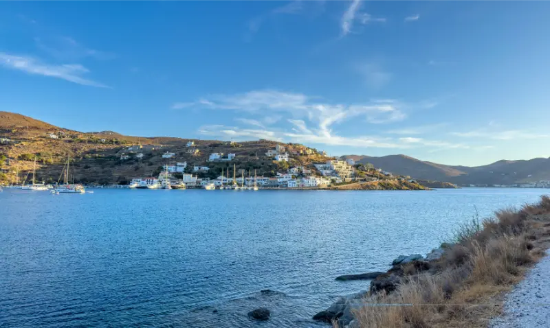
Karthaia routes
Several traditional paths reach Ancient Karthaia. The Municipality of Kea identifies four approaches and notes that the shortest, route 6 from Stavroudaki, is roughly 1.9 km for the descent. The archaeological site and two beaches make this one of the island’s signature walking experiences.
The return ascent is the part that catches people out. Start early, carry water for both directions and leave the beach with daylight to spare. If conditions are too hot, postpone the hike or use a boat rather than forcing the plan.
How to choose a route by season
| Season | Best approach | Main concern |
|---|---|---|
| March–May | Longer interior and archaeological routes | Weather changes, some seasonal services limited |
| June | Early starts with swimming finish | Rising heat |
| July–August | Shorter routes at dawn or late day | Heat, strong sun and fire restrictions |
| September–October | Longer walks plus warm sea | Shorter daylight later in autumn |
| Winter | Local low-level walks when weather is stable | Rain, wind and reduced transport/services |
Footwear, navigation and water
Use closed shoes with real grip. Historic paving can be polished, broken or covered with loose gravel. Download the route before leaving, carry a power bank and take a screenshot of key junctions. Signage helps, but it should not be your only navigation plan on a remote route.
Water is the non-negotiable item. Even if an old spring appears on a map, do not depend on it being available or safe to drink. In warm weather, start with more water than a city walk of the same distance would require.
Transport for point-to-point hikes
A rental car is useful for reaching trailheads, but it can also trap you into returning to the same place. For linear hikes, taxis, buses and a second vehicle can solve the problem. Arrange this in advance rather than improvising after the hike.
If you are staying in Ioulida without a car, you still have useful walking options from the town itself. This is one reason Ioulida is such a good hiking base: the trail network begins from a place where you can also eat and stay.
When a guide is worth paying for
A certified local guide makes sense for longer routes, archaeology-focused walks, complicated logistics or visitors who do not regularly hike in exposed Mediterranean terrain. The value is not only navigation; it is interpretation of the ancient road system, farming landscape and archaeological context.
Independent walking is reasonable on well-understood routes in good conditions. The key is matching the route to your actual experience rather than to the best photo you saw online.
Where to stay and how to book
Ioulida is the strongest base for walkers because several routes connect naturally with the capital and you can return to restaurants without another long drive. Korissia works better if ferry convenience is the priority. For repeated Karthaia hikes or south-coast walking, a base around Pisses or Koundouros can reduce road time.
For live availability and current rates, compare places to stay in Kea on Booking.com. I recommend checking the exact pin on the map before paying: on Kea, two properties described with the same village name can be separated by steep roads, long walks or a stretch that is much easier with a car.
Official resources to check before your trip
Start with Visit Greece’s hiking routes on Kea and cross-check local maps on the Municipality of Kea trail page.
Opening hours, ferry times, bus routes and beach services can change by season. Recheck them close to your travel date rather than treating an old timetable or a social-media post as permanent.
Tours and activities
Kea has a smaller organised-tour market than Santorini or Mykonos, so availability is often seasonal. The widget below is useful for checking whether guided hikes, sailing, diving or other bookable experiences are operating on your dates. Verify meeting points and cancellation terms before paying.
Continue planning your Kea trip
- Kea Travel Guide: Ioulida, Beaches, Hiking and a 5-Day Tzia Itinerary
- Kea Diving Guide: Britannic, Burdigala, Patris Wrecks and Responsible Diving
- Kea Food and Wine Guide: Loza, Paspalas, Local Cheese, Honey, Acorns and Mavroudi
- Kea Without a Car: Buses, Taxis, Walking, Beaches and the Best Base
- Where to Stay in Kea: Ioulida, Korissia, Vourkari, Otzias, Pisses or Koundouros?
- How to Get to Kea from Athens: Lavrio Ferries, 2026 Schedules and Island Hopping
- Ioulida Kea Guide: Lion of Kea, Castle, Alleys, Museums and Where to Stay
How I would fit this into a first Kea itinerary
For a first stay of four or five nights, I would not make Kea hiking guide the only purpose of the trip. Kea works best when one day is built around Ioulida and the historic interior, one around the coast, one around a substantial walk or archaeological experience, and at least one remains flexible for wind and weather. That structure lets you use this guide in context rather than forcing every attraction into consecutive hours. If you are arriving from Athens on a Friday and leaving Sunday, cut the plan further: choose one village experience, one beach area and one signature activity. The island is close enough to return to, so there is little value in turning a short break into a race.
Kea also changes character between weekdays and summer weekends. Its proximity to Attica means Friday-evening and Sunday-return traffic can feel much busier than a midweek stay. If accommodation prices, restaurant reservations or ferry availability look tight, consider shifting the same itinerary by a day or travelling in June or September. Shoulder-season travel is particularly attractive for walking because the sun is less punishing and you can spend more of the day outdoors instead of organizing everything around midday heat.
Keep one practical rule throughout the trip: verify the next day’s transport and opening information the evening before. Ferry operators, local buses, museums, restaurants and boat activities can all change seasonally. Ten minutes of checking is more useful than relying on a screenshot saved months earlier. It also gives you permission to change plans when the wind or temperature makes another part of the island more appealing.
Small practical details that make the trip easier
Another detail worth planning is the difference between map distance and real travel time. Kea’s roads are not long, but bends, village traffic, beach approaches and parking can slow a day considerably. Avoid stacking reservations back to back. Leaving thirty or forty minutes of slack between a beach, a museum, dinner or a ferry transfer makes the trip feel calmer and gives you room to stop when a viewpoint or village turns out to be more interesting than expected.