Author: Jessica

  • Ios Travel Guide: Beyond the Nightlife – Beaches, Chora, Hiking and a 4-Day Itinerary

    Ios Travel Guide: Beyond the Nightlife – Beaches, Chora, Hiking and a 4-Day Itinerary

    Ios is often reduced to one description: a party island. Nightlife is certainly part of its identity, especially in July and August, but that label hides why the island works for a much wider range of travellers. Chora is one of the prettiest hill towns in the Cyclades, Mylopotas has a long sandy beach, Manganari feels remote and expansive, and the interior holds old paths, chapels and archaeological sites that receive far fewer visitors than the bars.

    Ios lies between well-known Cycladic neighbours, making it easy to combine with Santorini, Naxos or Paros when ferry schedules align. If you are planning a multi-island route, read my Greece ferries and transport guide before booking hotels in a rigid sequence.

    Chora: white lanes, churches and sunset views

    Chora climbs above the port in a maze of whitewashed houses, blue-domed churches, stairways and small squares. During the day, the lanes can feel almost sleepy; at night they become the centre of the island’s dining and nightlife. The contrast is part of the appeal.

    Walk without a strict route. Climb toward the hilltop churches for sunset, look for the old windmills and the open-air Odysseas Elytis Theatre, then return through the lanes as restaurants begin to fill. Photographers should also explore early in the morning when the streets are quiet.

    Mylopotas: the easiest beach base

    Mylopotas is the island’s best-known beach and one of the most practical places to stay if swimming is the priority. The long sandy bay has restaurants, accommodation and seasonal transport back to Chora. Parts of the beach are organized while other sections feel more open.

    It works especially well for younger travellers, couples and families who want a simple beach day without a car. During peak summer, music and beach-club activity can become lively, so choose the exact end of the bay carefully if quiet nights matter.

    Manganari: the beach worth travelling for

    Manganari lies on the southern side of Ios and feels much farther from the social energy of Chora. The bays are broad, the water is clear and the setting is one of the strongest reasons to explore beyond the port-Chora-Mylopotas triangle. Seasonal buses, excursions or a rental vehicle may be used depending on current services.

    Make it a full beach day rather than a rushed photo stop. Bring sun protection and check return transport in advance, especially outside July and August.

    Other beaches and coves

    Agia Theodoti on the eastern side is quieter than Mylopotas and appeals to travellers who prefer open space. Gialos near the port is convenient on arrival or departure days. Valmas can be reached on foot from the port area and feels more secluded despite its relative proximity.

    Wind direction matters in the Cyclades. If one beach is uncomfortable, another side of the island can feel completely different. Ask locally rather than assuming your original plan is the only option.

    Ios has real hiking potential

    Official Visit Greece information highlights a network of old footpaths across the island. Routes connect Chora with Skarkos, Agia Theodoti, coastal areas and hilltop chapels. The landscapes are classic Cyclades: dry-stone walls, low vegetation, terraces and wide Aegean views.

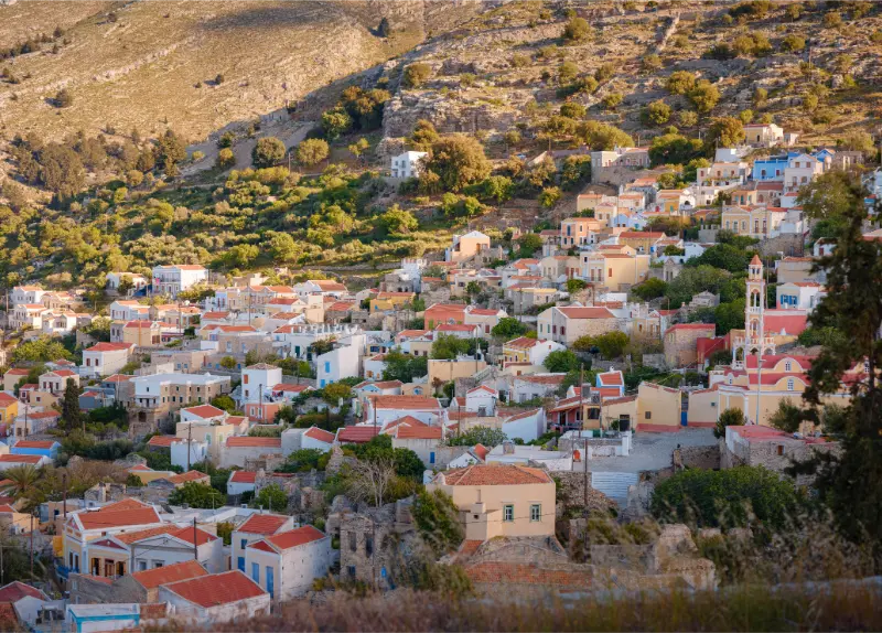
    Ios Island Chora Cyclades Greece

    Spring and September are particularly good for walking. In midsummer, leave very early, carry water and avoid exposed routes during the hottest hours. Hiking shoes are preferable to beach sandals once you leave the paved lanes.

    Skarkos and the prehistoric side of Ios

    Skarkos, near Chora, preserves an important Early Cycladic settlement. It is a useful counterpoint to the island’s modern party reputation and shows that Ios has a much deeper historical story. Pairing the site with a walk from Chora creates a half-day that feels completely different from the beach circuit.

    Opening arrangements can be seasonal, so check current information before building the day around a specific time.

    Where to stay on Ios

    **Chora** is best for nightlife, restaurants and atmosphere. You can walk home after dinner and enjoy the lanes at different times of day. The trade-off is noise on certain streets during peak season.

    **Mylopotas** suits beach-focused travellers who want easy swimming and still plan to visit Chora in the evening. **Ormos**, around the port, is practical for ferry connections and often calmer than Chora. Visitors with a car may also choose quieter accommodation elsewhere, but make sure the road access and parking fit your plans.

    Getting around

    Seasonal buses connect the port, Chora and Mylopotas, with additional routes depending on time of year. Taxis and rental vehicles add flexibility for Manganari and remote beaches. I would not rent a car automatically for the whole stay; first decide how many days you actually plan to leave the main corridor.

    Scooters and ATVs are popular on Greek islands, but road safety matters. Choose a vehicle only if you are licensed, experienced and properly insured, and always use the required protective equipment.

    Nightlife without making it the whole trip

    Ios nightlife is concentrated in Chora, where small bars fill narrow lanes and larger venues continue late. If that is your main reason for coming, stay close enough to walk rather than relying on late-night transport. If you want quiet, choose accommodation outside the core and read recent noise reviews carefully.

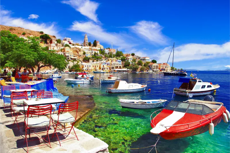
    Chora Capoluogo Of Island Of Ios In Archipelago Of Cyclades In Greece

    The island is easier to appreciate when you alternate nightlife with slower days. A late night followed by an early Manganari departure is not always a realistic combination.

    Food and simple island routines

    Ios has the full range from quick souvlaki and bakeries to contemporary Greek restaurants. One of the pleasures of a smaller Cycladic island is keeping meals simple: breakfast in Chora, long lunch after the beach, then a later dinner once the heat drops.

    Try local cheeses and dishes when they appear on menus, but do not build your whole food plan around social-media “must eat” lists. The strongest meals are often the ones that fit the day naturally.

    A four-day Ios itinerary

    Day 1: arrival and Chora

    Settle in, explore the port area and climb to Chora in the late afternoon. Walk the lanes, windmills and hilltop churches, then stay for dinner. If nightlife interests you, make this the evening to sample it without pressure to stay out until sunrise.

    Day 2: Mylopotas

    Spend the day at Mylopotas. Swim, have lunch by the beach and keep the afternoon slow. Return to Chora for sunset and a relaxed evening.

    Day 3: Manganari

    Use the seasonal bus, transfer or rental vehicle to reach Manganari. Treat it as a full day. On the way back, stop at a viewpoint if transport allows.

    Day 4: history and walking

    Visit Skarkos or follow one of the island’s marked paths in the morning. Have lunch in Chora and leave enough buffer for your ferry. If you have a fifth day, add Agia Theodoti or a boat excursion.

    Ios for couples

    Ios can be romantic outside the peak party context. Sunset above Chora, a quiet beach day and dinner on a small terrace provide a very different experience from the nightclub image. June and September are especially attractive for couples who want warm weather with a calmer rhythm.

    Ios for families

    Families should choose accommodation carefully. Mylopotas can be convenient for beach access, while Chora’s central nightlife streets may not suit early bedtimes in high season. Older children may enjoy water sports and boat trips, but heat and steep lanes require pacing.
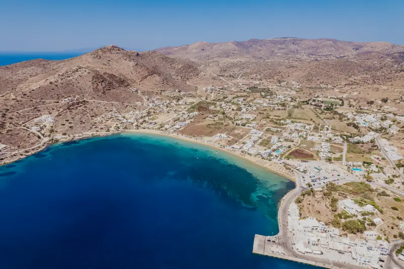
    Aerial View Beach Resort Town Nea Chora Ios Island Greece

    For a family-first island with more extensive shallow beaches, compare Naxos or Kos once that fits your wider route.

    Best time to visit

    June provides warm weather and a lively atmosphere before the absolute peak. July and August bring the most nightlife, strongest demand and highest accommodation prices. September is excellent for warm sea temperatures and a more relaxed pace. Spring is best for walkers, though some seasonal tourist services may be limited.

    Island hopping from Ios

    Ios combines naturally with Santorini because of geography, while Naxos and Paros can also fit well depending on the ferry schedule. Never assume a route operates daily simply because two islands look close on a map. Search actual sailings for your travel dates before making non-refundable hotel reservations.

    Read my guides to Santorini, Naxos and Paros when building the sequence.

    Common mistakes

    • Assuming the whole island is only for partying.
    • Booking Chora accommodation without checking noise reviews.
    • Underestimating summer heat on exposed hiking routes.
    • Planning Manganari without checking the return transport.
    • Booking island-hopping hotels before confirming ferry schedules.

    Frequently asked questions

    How many days do you need on Ios?

    Three nights give you Chora and two beach days; four or five nights are better if you want hiking and a quieter pace.

    Is Ios only for young travellers?

    No. The nightlife reputation is real, but beaches, walking routes and the traditional town appeal to couples, families and independent travellers as well.

    Do you need a car?

    Not necessarily. Chora, the port and Mylopotas are well suited to a car-free stay. A vehicle adds flexibility for remote beaches and inland exploration.

    Is Ios cheaper than Santorini or Mykonos?

    It can be, but high-season prices still rise significantly. Book early and compare exact location, not just room price.

    Why Ios deserves a broader reputation

    The best version of Ios is balanced: one evening in lively Chora, one long day on Mylopotas, one journey to Manganari and one walk into the quieter landscape. Do that and the island stops feeling like a party stereotype and starts feeling like a complete Cycladic destination.
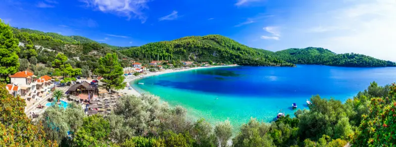
  • Skopelos Travel Guide: Beaches, Mamma Mia Locations and a 4-Day Itinerary

    Skopelos Travel Guide: Beaches, Mamma Mia Locations and a 4-Day Itinerary

    Skopelos is greener and quieter than the stereotypical white-and-blue Cycladic island. Pine forests run toward clear water, traditional houses climb above harbours, and the island feels connected to the wooded landscape of the northern Aegean rather than to the dry scenery of Mykonos or Santorini. It became internationally famous through Mamma Mia!, but the film locations are only one small part of the experience.

    There is no commercial airport on Skopelos, so arrival is by sea. Many travellers fly to Skiathos and continue by ferry, which makes the two islands natural partners. Read my Skiathos travel guide if you are considering a two-island Sporades trip.

    Why choose Skopelos?

    Choose Skopelos if you want beaches plus a strong sense of landscape and village life. Visit Greece describes it as the largest island of the Sporades and highlights the combination of pine forests, emerald water, traditional architecture and the chapel of Ai Giannis at Kastri.

    It is generally less nightlife-focused than Skiathos. Evenings revolve around harbour walks, tavernas and small bars rather than large clubs. That makes Skopelos particularly appealing to couples, families and travellers who want a slower island rhythm.

    Skopelos Town

    Skopelos Town is one of the best bases because ferry arrival, restaurants, shops and old lanes are all close together. White houses with tiled roofs rise on the hillside, and the town rewards wandering without a fixed list.

    Walk uphill away from the waterfront in the cooler morning or evening. The higher lanes reveal churches, courtyards and views over the harbour. Comfortable shoes are useful because stairs and slopes are part of daily movement here.

    Glossa and Loutraki

    Glossa sits high above the northwest coast and feels different from the main town. Loutraki below serves as a port for some ferry connections. Staying in this area can be convenient if you prefer village atmosphere and western beaches.

    Because ferry arrival ports can vary by route and operator, confirm whether your ticket lands at Skopelos Town or Loutraki before booking accommodation transfers.

    Glossa Skopelos Greece

    Best beaches

    Popular beaches include Panormos, Milia and Kastani, each with a different balance of services, scenery and crowd levels. Pine-covered slopes behind clear water are a recurring Skopelos image and one of the island’s strongest reasons to visit.

    Beach choice should follow wind and your location. Instead of crossing the island every day to chase a ranked list, ask locally which coast is calmer and choose one beach where you can actually stay long enough to relax.

    Mamma Mia locations

    The most famous filming landmark is the chapel of Agios Ioannis at Kastri, perched dramatically above the sea. Reaching the chapel involves climbing many steps, so visit early or later in the day rather than in peak heat.

    Kastani Beach is another location associated with the film. Fans will recognise the scenery, but the island has its own identity beyond the movie. Treat the locations as a fun layer, not the only reason to explore Skopelos.

    View Kastani Beach Skopelos Island Greece

    Local food and crafts

    Skopelos is known for its twisted cheese pie and other Sporadic dishes. Look for local produce, honey and seafood rather than eating only generic tourist menus on the waterfront.

    The island also has a long craft tradition. Visit Greece highlights contemporary ceramic workshops that continue local techniques. A pottery or craft visit is a useful change of pace on a windy day when the beach is less appealing.

    Getting around

    Buses connect major settlements and popular beaches in season, making a car unnecessary for a simple trip. A rental vehicle gives more flexibility for remote viewpoints and the Ai Giannis area, but roads can be winding.

    Scooters are common, yet I recommend them only to experienced riders with the correct licence and protective equipment. Island roads are not automatically safe because traffic volume is low.

    Where to stay

    Skopelos Town is the easiest all-round base for first-time visitors, especially without a car. Panormos suits travellers who want to be near the beach, while Glossa offers village atmosphere and convenient access to the northwest.

    For four nights, I would usually stay in one base. Changing hotels on a small island consumes more time than it saves unless you specifically want two very different experiences.

    A four-day itinerary

    Day 1: Arrive, settle into Skopelos Town and spend the evening exploring the lanes and waterfront.

    Day 2: Beach day at Panormos, Milia or Kastani, with a relaxed taverna lunch and no rushed sightseeing.

    Day 3: Explore Glossa and visit Agios Ioannis at Kastri early or late in the day. Stop at a quieter beach on the return.

    Day 4: Choose a boat trip, hiking, a craft workshop or a second beach day depending on weather, then enjoy one final evening in town.

    Combining Skopelos and Skiathos

    A week in the Sporades can split naturally between Skiathos and Skopelos. Skiathos provides the airport, a compact lively town and many accessible beaches; Skopelos feels greener, more spread out and quieter.

    Do not plan a same-day international flight immediately after a ferry from Skopelos unless you have a generous buffer. Sea conditions can change ferry schedules, and one delayed crossing can create an expensive chain reaction.

    Best time to visit

    June and September are my favourite balance of warm water, open services and lower crowd pressure. July and August bring the widest range of ferries and beach services but also higher demand.

    May and October can be beautiful for walking and village life, yet some seasonal businesses may be closed and sea conditions can be less predictable. Build flexibility into ferry days.

    Frequently asked questions

    Does Skopelos have an airport?

    No commercial airport. Many visitors fly to Skiathos and continue by ferry, while other ferry routes connect from mainland ports depending on season.

    Is Skopelos only for Mamma Mia fans?

    No. The film locations are enjoyable, but the island’s strongest qualities are its forests, beaches, traditional towns, food and slower pace.

    How many days do I need?

    Four days gives a strong first visit. Five to seven days is better if you want several beach days and no pressure to move during windy weather.

    Is Skopelos good without a car?

    Yes if you stay in Skopelos Town and use seasonal buses for major beaches. A vehicle adds flexibility for remote corners but is not essential for everyone.

    Skopelos in bad weather

    Island itineraries need a backup plan because wind or rough seas can change beach and boat days. In Skopelos Town, use poor weather for churches, cafes, shopping and local craft workshops. A slow lunch and a pottery visit can become a memorable day rather than a consolation prize.

    If roads are wet, drive conservatively on bends and shaded sections. Do not force a remote beach itinerary simply because it was written in your plan weeks earlier. The island’s villages and food culture give you enough alternatives to remain flexible.

    Sporades Skopelos Loutraki

    Ferry disruption is the bigger practical issue. If you have an international flight from Skiathos or the mainland, build a buffer rather than travelling from Skopelos on the last possible connection. One extra night near your departure airport is often cheaper than a missed flight.

    Additional practical notes

    If you rent a car, ask whether it can be collected at your arrival port and returned at a different port if your ferry leaves from elsewhere. Not every local company offers one-way island returns.

    For hiking, start early and carry water even on wooded routes. Pine shade helps, but humidity and climbs can make short distances feel harder than expected.

    A slower island rhythm

    Skopelos is a good place to stop scheduling every hour. Choose one geographic zone each day, especially if you have a car. A beach morning can become a village lunch and a sunset stop without crossing the island repeatedly. This reduces fuel use, parking stress and the feeling that you are constantly leaving places just as you begin to enjoy them.

    The island’s green landscape is also worth seeing away from the road. Short walks around settlements or marked routes reveal old chapels, orchards and forest that are invisible from a beach itinerary. Start early, carry water and ask locally about trail condition, especially after rain or periods of high fire risk.

    If Mamma Mia is important to your trip, choose one dedicated half-day for the film locations and then let the rest of the holiday be about Skopelos itself. Fans often find that the chapel, coastline and villages are more memorable when they are not trying to recreate every scene.

    Finally, keep at least one flexible day. Wind can make one beach unpleasant while another coast is calm, and ferry excursions may shift. A flexible day turns weather from a problem into a reason to discover a different part of the island.

    One final tip: check which port your ferry uses on both arrival and departure, then save the accommodation transfer number offline. Skopelos has more than one practical arrival point, and knowing the exact port avoids the surprisingly common mistake of waiting for a taxi or host at the wrong side of the island.

    More guides to continue planning

    Continue with Skopelos Chora; Agios Ioannis Kastri for more detailed planning.

    Explore more Skopelos guides

    Glossa and Loutraki Skopelos Guide: Village Views, Port, Beaches and Where to Stay | Panormos, Milia and Kastani Skopelos Guide: Three West-Coast Beaches Compared | Best Beaches in Skopelos: Stafylos, Velanio, Panormos, Milia, Kastani and More | Mamma Mia Locations in Skopelos: Kastani, Agios Ioannis Kastri and a Film-Fan Itinerary | Skopelos Hiking Guide: Pine Forests, Monasteries, Coastal Walks and Safety | Skopelos Boat Trips Guide: Coastline Cruises, Alonissos Marine Park and Sea Caves | Skopelos Without a Car: Buses, Taxis, Ferries, Walking and the Best Bases | Where to Stay in Skopelos: Chora, Panormos, Glossa, Loutraki or Neo Klima? | Skopelos with Kids: Family Beaches, Easy Villages, Boat Trips and Practical Tips | Skopelos Food Guide: Cheese Pie, Plums, Honey, Goat Cheese and What to Eat

  • Acrocorinth Guide: Fortress Walls, Views and How to Combine It with Ancient Corinth

    Acrocorinth Guide: Fortress Walls, Views and How to Combine It with Ancient Corinth

    Acrocorinth is the vast fortified hill that rises above Ancient Corinth, and it changes the way a visit to the Corinth area feels. The archaeological city below explains the commercial and religious importance of Corinth; the fortress above explains why this position mattered strategically for so many centuries. At roughly 575 metres above sea level, the citadel commands the isthmus and broad views across the surrounding countryside.

    I would not treat Acrocorinth as an optional photo stop after the ruins. It deserves its own walking time, sturdy shoes and enough water. Use it together with my Ancient Corinth and Corinth Canal guide and the wider Peloponnese road trip to build a day that feels coherent rather than rushed.

    Why this place deserves its own stop

    Acrocorinth is one of the most impressive fortified landscapes in Greece because its history is layered rather than frozen in one period. Ancient, Byzantine, Frankish, Venetian and Ottoman phases all left traces. Gates, walls, churches, cisterns, towers and later religious buildings sit inside a defensive system that used the steep rock itself as part of the fortification.

    The second reason to come is perspective. From the lower archaeological site you look up at the mountain; from Acrocorinth you understand the geography that made Corinth powerful. The Gulf of Corinth, the isthmus and the inland plains become part of the historical story instead of abstract names in a guidebook.

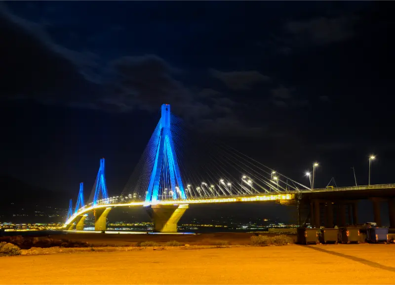
    Rio Antirio Cablestayed Bridge Across Gulf Corinth Greece Night With Lighting

    What to see and do

    The three-gate approach

    The ascent through the successive defensive gates is one of the strongest parts of the visit. The path is uneven and steep in places, but it immediately shows how attackers were forced through a controlled sequence rather than a single entrance. Pause between gates and look back: the view opens quickly, and the changing wall construction hints at centuries of repair and reuse.

    The fortification circuit

    Acrocorinth’s walls run around a large, irregular plateau rather than a compact castle courtyard. You will not see everything in ten minutes. Walk selectively, focusing on the most legible sections and viewpoints rather than trying to trace every wall. The landscape is exposed, so the same route can feel very different in spring, high summer or strong wind.

    The Frankish tower

    The prominent Frankish tower on the higher ground is an obvious visual anchor. Reaching it requires more walking, but it helps explain how the citadel was adapted in the medieval period. The reward is not only the structure itself but a wider panorama over the Corinthian landscape.

    Religious layers inside the fortress

    Ruins of churches and later Ottoman structures show that Acrocorinth was not simply a military shell. Communities lived and worshipped within the walls. Looking for these layers makes the site more meaningful than a simple “castle hike”.

    Water and survival on the hill

    A fortress of this size needed reliable water. Historic springs and cisterns were essential to making prolonged occupation possible. Their presence is a reminder that commanding views alone do not sustain a citadel; water storage, food and internal circulation mattered just as much as walls.

    The views over the isthmus

    The panoramic view is the easiest way to understand why Corinth controlled movement between mainland Greece and the Peloponnese. On a clear day, the contrast between sea, plain and mountain makes the strategic geography obvious even to visitors with little interest in military history.

    A realistic way to plan the visit

    For most travellers, the best sequence is Ancient Corinth first and Acrocorinth second. The museum and ruins below provide the historical framework; the drive uphill then gives that history a physical setting. Starting very early can also work in reverse if summer heat is the main concern.

    Allow a proper break between the two sites. Eat or drink something near Ancient Corinth, refill water and use facilities before driving up. Acrocorinth is the part of the day where heat and footwear matter most.

    Do not add too many extra stops. The Corinth Canal is easy to include, but a full Nafplio sightseeing afternoon after both Ancient Corinth and Acrocorinth makes the day unnecessarily dense.

    How to get there and move around

    A rental car is the simplest way to combine the lower archaeological site and Acrocorinth. The road climbs to parking near the fortress entrance. Travellers arriving in Corinth by public transport can use a taxi, but should arrange the return rather than assume one will be waiting at the top.

    If you are driving from Athens, the Corinth area is an efficient first stop on a Peloponnese trip. If you are based in Nafplio, it works well as a half- or full-day excursion. Avoid leaving luggage visible in the car while visiting.

    How much time do you need?

    Budget around 1.5 to 2 hours for Acrocorinth if you want to walk beyond the first gates, and another 1.5 to 2 hours for Ancient Corinth and its museum. Add driving, a meal and the canal, and the experience naturally fills most of a day.

    Best time to visit

    Spring and autumn are especially pleasant because the exposed hill is easier to walk and the landscape can be greener. Summer is possible, but early morning is much more comfortable than midday.

    In winter, check weather and site conditions. Wet stone and strong wind can make the upper paths less enjoyable, even when temperatures are mild.

    Food, breaks and the pace of the day

    There are places to eat around Ancient Corinth, making the lower site the sensible place for lunch or coffee. Do not rely on finding shade or refreshments once you are walking inside the fortress.

    A slow lunch after the climb is more useful than squeezing in another distant attraction. The Peloponnese works best when major archaeological visits are separated by real breaks.

    Families, mobility and practical comfort

    This is not a smooth, level monument. Expect stone, slopes and uneven ground. Visitors with limited mobility can still appreciate parts of the approach and views, but the deeper circuit is physically demanding.

    For children, the gates and “castle” atmosphere can be engaging, but keep them close near walls and exposed edges. In hot weather, shorten the route rather than forcing the complete circuit.

    What to combine with it

    Pair it with Ancient Corinth and a brief stop at the Corinth Canal. That is the most natural historical and geographical combination.

    If continuing south, spend the night in Nafplio rather than returning to Athens. It sets up easy visits to Mycenae and Epidaurus on the following day.

    Common mistakes to avoid

    • Arriving at midday in July or August with little water
    • Wearing smooth sandals on steep polished stone
    • Trying to see every corner of the fortress in under an hour
    • Assuming public transport reaches the fortress entrance
    • Combining it with too many major archaeological sites on the same day

    Frequently asked questions

    Is Acrocorinth the same as Ancient Corinth?

    No. Ancient Corinth is the archaeological city on the plain; Acrocorinth is the fortified acropolis on the mountain above it. They are separate sites and should be planned as two parts of the same day.

    Is Acrocorinth worth visiting if I am not interested in history?

    Yes if you enjoy dramatic landscapes and viewpoints. The climb through the gates and the panorama are memorable even without detailed historical knowledge.

    Can I walk up from Ancient Corinth?

    It is possible in principle, but the climb is steep and adds substantial effort. Most visitors drive or use a taxi to the fortress entrance and save their energy for walking inside.

    How difficult is the walking?

    Moderate for a reasonably fit traveller, but the combination of steep sections, uneven stone and summer heat can make it feel harder. Supportive shoes make a noticeable difference.

    Should I visit before or after Ancient Corinth?

    Ancient Corinth first is best for historical context. In very hot weather, however, doing Acrocorinth early and the lower site later can be more comfortable.

    Final advice

    Acrocorinth is one of those places that becomes more impressive the longer you give it. Do not rush through the gates for a photograph and leave. Walk far enough to feel the scale of the citadel, look back over the isthmus, and then connect that view with the city below. That combination is what makes Corinth one of the strongest historical stops in the Peloponnese.

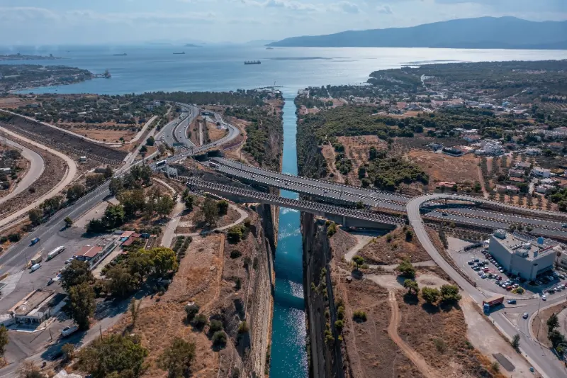
    Aerial View Deep Narrow Corinth Channel With Blue Water Cut Through Rock Korinthos Greece View 2

    A few details that make the day better

    A strong itinerary is not built only around opening hours. Leave a margin for parking, slow roads, heat, photographs and an unplanned coffee. In the Peloponnese, travel times can look short on a map but feel longer once mountain bends, village traffic and archaeological walking are added. Build the day around one major experience and one secondary stop rather than trying to collect every nearby place.

    Carry water, sun protection and a light layer in the car even when the forecast looks simple. Archaeological sites can be exposed, caves can be cool, coastal forts can be windy and mountain towns can change temperature quickly. These small preparations matter more than adding another attraction to the schedule.

    For current prices, opening hours and access rules, use the official site or local authority close to the travel date. Greece is gradually changing ticketing, restoration schedules and visitor routes at many sites, and a detail copied from an older article can be the difference between a smooth day and a wasted drive.

    For more ideas in northern Peloponnese, continue with Corinth city, Isthmia.

    Aerial View Deep Narrow Corinth Channel With Blue Water Cut Through Rock Korinthos Greece
  • Where to Stay in Symi: Gialos, Chorio, Pedi or Nimborio? Best Areas Compared

    Where to Stay in Symi: Gialos, Chorio, Pedi or Nimborio? Best Areas Compared

    Choosing where to stay on Symi matters more than the island’s small size suggests. Gialos and Chorio are physically close but separated by a steep vertical climb; Pedi offers a calm bay on the other side of the ridge; Nimborio feels quiet even though it is not far from the main harbour. The best area depends on how you want to move every day.

    For a first visit of two or three nights, Gialos is the safest all-round choice. For a longer stay, the quieter alternatives become more attractive. Before booking, ignore straight-line distance and ask two practical questions: how many steps are there from road or quay to the room, and how will I reach an early ferry with luggage?

    Gialos: best for first-time visitors and ferry convenience

    Gialos gives you the classic harbour view, the widest dining choice and the easiest access to ferries, taxis and many beach boats. You can arrive and start exploring immediately. This makes it ideal for short stays, island-hopping itineraries and travellers who do not want to organise transfers.

    The drawback is activity. Excursion boats can make midday busy, and some harbour-front rooms hear restaurants, scooters or ferries. Ask for a quieter room if you are a light sleeper, and check the exact number of steps even when a property is marketed as port-side.

    Chorio: best for atmosphere and views

    Chorio sits above the harbour and feels more residential. Staying among the old lanes gives you Symi’s architecture after most day visitors have returned to Gialos. Balconies can have exceptional views, and evening walks feel intimate.

    The price of that atmosphere is vertical movement. The Kali Strata has around 500 steps, and not every property has easy road access. Chorio suits fit travellers and couples who enjoy walking; it can be difficult with heavy luggage, pushchairs or limited mobility.

    Pedi: best for a quieter sea-level base

    Pedi offers a sheltered bay, local swimming and bus access through Chorio to Gialos. It is calmer than the main port and works especially well for families or couples who want to start the day near the water. Access toward Agios Nikolaos adds another beach option.

    You sacrifice some restaurant and shopping choice. If you like late dinners in Gialos, plan around the bus timetable or budget for taxis. Confirm how close the accommodation really is to the beach and bus stop.

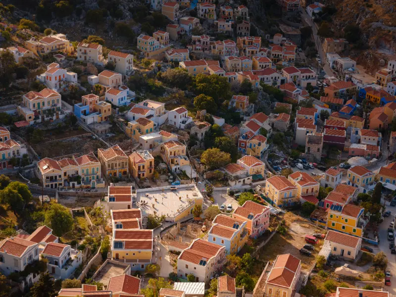
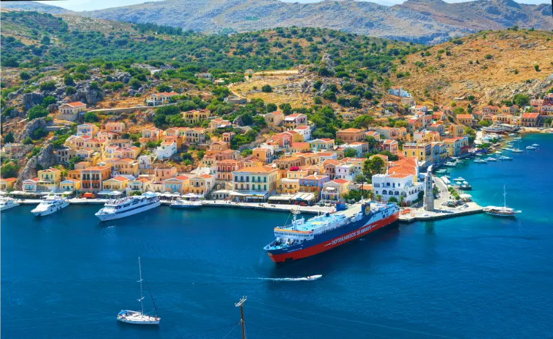
    Symi Island Greece Islands From Rhodos Aegean Sea

    Nimborio: best for genuine quiet

    Nimborio is the choice for travellers who are happy with a smaller range of services in exchange for a peaceful beach setting. It is close enough to the main settlement for occasional visits but feels removed from the ferry traffic.

    This area works best with self-catering facilities or a clear understanding of what restaurants are open during your dates. Transport for early departures should be arranged rather than improvised.

    Best area for a car-free holiday

    Gialos wins for pure convenience because almost every transport mode begins or passes through the harbour. Pedi is the strongest alternative thanks to the municipal bus corridor and local beach. Chorio also works without a car but demands more walking.

    If you intend to rely heavily on beach boats, stay near Gialos. If your main aim is swimming in a calm bay and you are willing to commute for dinner, choose Pedi.

    Best area for couples

    Couples who want restaurants and evening harbour walks will enjoy Gialos, while Chorio feels more romantic if views and quiet lanes matter more than convenience. Pedi suits couples seeking a slower beach stay without being isolated.

    For an anniversary or special trip, pay for the feature you will actually use: a good terrace, road-level access, a quiet room or immediate waterfront location. A theoretical sea view is not worth much if you never want to climb to it.

    Best area for families

    Pedi can be particularly practical because of the bay, calmer atmosphere and easier beach rhythm. Gialos works well for families who value ferries, shops and short logistics. Nimborio can be excellent for repeat visitors who are comfortable with fewer services.

    Chorio can still work with older children who enjoy steps, but parents with pushchairs should investigate access in detail. Symi’s vertical geography is more important than hotel star category when travelling with small children.

    Best area for one night versus one week

    For one night, choose Gialos unless there is a compelling reason not to. Moving luggage uphill or across the island steals too much of a very short stay. For a week, Pedi or Nimborio becomes much more attractive because repeated quiet mornings are part of the holiday.

    A split stay is usually unnecessary on such a small island. Instead, choose one base and use buses, taxis and boats. Changing accommodation often creates more packing than benefit.

    Getting there and getting around

    The Municipality of Symi lists buses on the Gialos–Chorio–Pedi route and between Symi and Panormitis, plus taxis and rentals. That means accommodation choice can be based on atmosphere rather than a need to drive everywhere. However, very early or late transfers may still require a taxi.

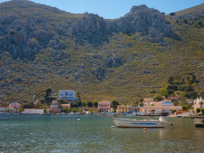
    Symi Island Greece Symi Island View Greece

    Always send your accommodation your ferry arrival time. Some hosts can advise on the best drop-off point, especially in Chorio where a road approach may save many steps.

    Best time to go

    In July and August, harbour convenience is valuable because services run actively, but quiet-room choice becomes more important. June and September are ideal for staying in Pedi or Chorio because walking is easier and the sea remains inviting.

    In May or October, verify restaurants, buses and boat services before choosing the quietest area. A shoulder-season retreat is wonderful when you deliberately want peace; it is frustrating when you expected high-season convenience.

    Where to stay

    If you are undecided, choose Gialos for 2–3 nights, Pedi for 4–7 nights focused on swimming, Chorio for architecture and views, and Nimborio for deliberate quiet. These are guidelines rather than rankings; the right room in the “wrong” area can still be better than a poor room in the theoretically ideal one.

    Filter accommodation by access, terrace, air-conditioning, breakfast and cancellation terms before chasing small price differences. On Symi, a small nightly saving can disappear quickly if you need extra taxis every day.

    Food, water and useful stops

    Gialos has the broadest dining and shopping choice. Chorio has atmospheric options but fewer practical shops. Pedi and Nimborio suit travellers happy with a smaller local selection. If self-catering, confirm where the nearest market actually is and whether you are willing to carry groceries uphill.

    A realistic way to plan the day

    • Short first visit: Gialos for maximum convenience, with day trips to Chorio, Pedi and one boat-access beach.
    • Relaxed beach stay: Pedi, using the bus for Gialos and Chorio and boats or walks for nearby coves.
    • Architecture-focused stay: Chorio, choosing accommodation with road or luggage access that suits you.
    • Quiet repeat visit: Nimborio, after confirming seasonal food and transport options.

    Mistakes to avoid

    • Choosing by map distance without checking elevation.
    • Booking a sea-view room that requires more steps than you can comfortably manage.
    • Staying in a remote area for one night and losing time to transfers.
    • Assuming late-night buses run simply because daytime service exists.
    • Booking shoulder-season accommodation without checking nearby restaurants and shops.
    • Paying for a harbour location when your real priority is quiet sleep.

    More Symi guides

    Gialos Symi Guide: Harbour, Neoclassical Houses, Nos Beach, Food and Where to Stay; Chorio and Kali Strata Symi Guide: Old Town, Castle, Museum, Views and Sunset; Pedi Symi Guide: Bay, Beach, Agios Nikolaos, Boats and Where to Stay; Nimborio Symi Guide: Beach, Coastal Walks, Swimming and a Quiet Stay; Best Beaches in Symi: Nos, Agios Nikolaos, Nanou, Marathounda and Agios Georgios; Symi Boat Trips Guide: Nanou, Agios Georgios, Sesklia, Nimos and Agia Marina; Symi Day Trip from Rhodes: Ferries, Gialos, Panormitis and a Realistic One-Day Plan; Symi Without a Car: Buses, Taxi Boats, Taxis, Walking and the Best Bases; Where to Stay in Symi: Gialos, Chorio, Pedi or Nimborio? Best Areas Compared; Symi Food Guide: Symi Shrimp, Seafood, Akoumia, Tavernas and What to Eat; Symi Travel Guide; Symi Hiking and Panormitis Guide.

    Frequently asked questions

    What is the best area to stay in Symi for first-time visitors?

    Gialos is usually the easiest because ferries, restaurants and transport are concentrated there.

    Symi Greece

    Where should families stay on Symi?

    Pedi and Gialos are practical choices. Pedi is calmer and beach-oriented; Gialos has the easiest logistics.

    Is Chorio too far from the harbour?

    No in distance, but the vertical climb matters. Kali Strata has about 500 steps, while road transport can reduce the effort.

    Can I stay in Nimborio without a car?

    Yes, but taxis, walking and seasonal boat connections require more planning than in Gialos or Pedi.

    Official information to check before you go

    For the layout and character of the island see Visit Greece: Symi. For current buses, taxis and rentals check the Municipality of Symi transport page; for beach access use Visit Greece: Beaches of Symi.

    Final planning advice

    There is no universally best base on Symi because the island’s four main visitor areas solve different problems. Gialos removes transport stress, Chorio gives atmosphere, Pedi balances beach life with access, and Nimborio prioritises quiet. Choose the daily routine you want first, then book the room that supports it.

  • Patmos Hiking Guide: Chora, Kastelli, Vagia, Psili Ammos and Practical Tips

    Patmos Hiking Guide: Chora, Kastelli, Vagia, Psili Ammos and Practical Tips

    Patmos is better for walking than many visitors expect. Its small scale, old footpaths and rugged coastline create routes that connect the port, Chora, chapels, archaeological viewpoints and beaches. Visit Greece describes an extensive network of old paths that once linked settlements, fields and religious sites, with routes ranging from the classic Skala–Chora climb to a five-hour Vagia circuit.

    This is not high-mountain trekking, but summer heat, exposed rock and limited shade can turn a modest route into a serious outing. The best hiking season is spring and autumn; in July and August, start early, carry more water than you think you need and keep the middle of the day for swimming or museums.

    Four walks to know before you arrive

    RouteApproximate characterBest for
    Skala–Chora–Skala40 min up, 30 min down according to Visit GreeceFirst-time walkers and heritage
    Kastelli circuitArchaeological hill and views over Skala baysShort scenic outing
    Vagia circular routeAbout 5 hours, Mediterranean vegetation and covesLonger hiking day
    Psili Ammos approachTrail to remote south-coast beachHike-and-swim day

    Skala to Chora via the Cave of the Apocalypse

    This is the route I would recommend to almost every active first-time visitor. The historic climb links Skala with Chora and passes the Cave of the Apocalypse. Visit Greece gives an approximate ascent of 40 minutes and descent of 30 minutes, before sightseeing stops.

    Start early enough that the cave and monastery are still inside their morning visiting window. The walk becomes far more demanding if you begin after a late breakfast under strong sun. Take water and wear shoes with grip because old stone can be smooth.

    Kastelli circuit

    Kastelli provides one of the easiest ways to add archaeology and panorama to a stay in Skala. Visit Greece describes fortification remains and views over the bays of Skala, Merikas and Chochlakas, with distant islands visible in clear weather.

    Use this route in the morning or late afternoon. It is a short outing, but there is no reason to turn it into a heat challenge. Pair it with lunch and a nearby swim rather than stacking it after a long boat trip.

    Vagia circular route

    The Vagia circuit is the more substantial walk highlighted by Visit Greece, taking about five hours and passing Mediterranean vegetation, chapels, coves and clear-water beaches. This is the route where footwear, water and route-finding matter most.

    Do not assume that “five hours” includes long swimming stops or lunch. Build margin for heat and navigation, tell someone your plan and check current path condition locally. If conditions are poor, switch to a shorter north-coast beach day instead of forcing the route.

    Hiking to Psili Ammos

    The municipality describes Psili Ammos as reachable by sea or scenic trails, making it a classic hike-and-swim objective. The attraction is obvious: you earn a remote beach rather than stepping off a bus. The risk is equally obvious: after a long swim and lunch in the sun, you still need to hike back unless you have confirmed a boat.

    Carry enough water for both directions, use sun protection and avoid flip-flops. The Patmos beach guide explains how Psili Ammos fits among easier swimming options.

    What to carry

    • 1.5–2 litres of water per person for longer summer routes, more in extreme heat.
    • Supportive shoes with grip rather than smooth sandals.
    • Hat, sunscreen and a light long-sleeve layer.
    • Offline map or downloaded route information.
    • Small first-aid kit and any essential medication.
    • Swimwear and compact towel for routes that finish at a beach.
    • A charged phone and enough battery for navigation.

    Heat, wind and fire risk

    Wind can make Patmos feel cooler while sun exposure remains intense. Start before the island heats up, especially on south-facing or exposed routes. During periods of high fire risk, access to natural areas can be restricted; respect local instructions even if your route app says the trail is open.

    A strong meltemi can also affect boat plans. If your hiking day depends on a boat pickup, confirm the operation that morning and have a walking return plan that is realistic for your fitness.

    Walking without a car

    Patmos is well suited to combining buses with one-way walks. The 2026 timetable links Skala with Chora, Grikos and Kampos, giving you several ways to avoid retracing a route. For example, bus to Kampos, walk toward Vagia, then return from the same corridor.

    Check the last bus before you start walking, not after you reach the beach. The Patmos Without a Car guide gives the transport framework behind these combinations.

    Guided hiking and active experiences

    A guide is useful for longer circuits if you want local knowledge of path condition, chapels and landscape. Before booking, ask about total walking time, elevation, shade, water supply and whether transport back is included.

    Official sources and what to recheck

    For current destination information, use Visit Greece – Patmos and the 2026 Municipality of Patmos visitor brochure. Bus schedules are seasonal, so verify them on Patmos Bus shortly before travelling. The key route descriptions come from Visit Greece’s walking trails on Patmos page.

    Continue planning your Patmos trip

    Start with the main Patmos travel guide, then use specialist pages according to the trip you are building. Useful next reads are Skala; Chora; Monastery of Saint John; Cave of the Apocalypse; Grikos and Petra. Keeping the guides connected helps you plan one coherent holiday rather than treating every sight as a separate day trip.

    Frequently asked questions

    Is Patmos good for hiking?

    Yes. The island has old paths linking Skala, Chora, archaeological viewpoints, chapels and beaches.

    What is the easiest classic walk?

    The Skala–Chora route is the best first walk, with about 40 minutes uphill and 30 minutes downhill before stops.

    What is the longest route mentioned by Visit Greece?

    The Vagia circular route is described as a roughly five-hour walk.

    Can I hike to Psili Ammos?

    Yes, but carry water and plan the return before setting out.

    When is the best hiking season?

    Spring and autumn are most comfortable. Summer hikes should start very early and avoid peak heat.

    Final planning advice

    Build Patmos walking around temperature and transport, not ambition. One heritage walk, one scenic circuit and one beach trail are enough for most holidays. Leave room to stop at a chapel, swim in a quiet bay or turn back when the wind and heat change the day.

    Patmos Greece View 2

    Navigation and trail markings

    Do not rely on one app as if digital mapping were authoritative. Download an offline map, look for local waymarks and ask about recent path condition, especially after winter weather. On quiet trails, turn around early if the route becomes unclear rather than trying to force a shortcut across scrub or private land.

    Hike-and-swim logistics

    A swim is a perfect reward after walking, but wet feet and fatigue can make the return harder. Dry off, eat something and give yourself recovery time before starting back. If you carry sandals for the beach, keep proper shoes for the trail rather than hiking in footwear chosen only for the water.

    Practical packing checklist

    For a Patmos day out, carry water, sun protection, supportive shoes, a light layer for wind, swimwear when relevant, modest clothing for sacred sites, a charged phone and a small amount of cash. Keep ferry and bus information saved offline. The island is compact, but small practical choices make the difference between a relaxed day and repeatedly returning to your room for something you forgot.

    Patmos Greece

    Seasonal planning

    May, June, September and early October are especially comfortable for mixed sightseeing and walking, while July and August offer the strongest holiday atmosphere but require earlier starts and more attention to heat. Outside peak season, verify ferry frequency, buses, restaurant openings and beach services rather than assuming the summer pattern applies. Religious sites remain important throughout the year, but their schedules can change around services and feast days.

    Common planning mistakes to avoid

    The most common mistake on Patmos is trying to fit a cultural morning, remote beach, long lunch and sunset outing into one day simply because the island is small. Distances are short, but heat, bus timing, sacred-site opening windows and ferry traffic slow the rhythm. Choose one activity that has a fixed time, one flexible activity and one good meal. Keep a backup plan for wind or transport changes, and never make the final bus or an uncertain boat the only way to reach a ferry departure.

    A second mistake is treating every famous place as compulsory. Patmos is strongest when you have enough time to notice the relationship between Chora, the monastery, the port and the coast. If energy is low, replace a distant stop with an easy swim or an evening walk. A trip that leaves room for weather and mood will usually feel more complete than one that technically checks every box.

    Keep the final hour of the day deliberately unscheduled. On Patmos, a quiet coffee, an unexpected church service, a swim near your base or a slower sunset walk often becomes more memorable than another rushed stop.

    Patmos
  • Tolo Travel Guide: Psili Ammos, Ancient Asine, Boat Trips and Where to Stay

    Tolo Travel Guide: Psili Ammos, Ancient Asine, Boat Trips and Where to Stay

    Tolo is one of the easiest beach bases in Argolis for travellers who want to combine swimming with some of Greece’s most important archaeological sites. The village curves around a sheltered bay south-east of Nafplio, with hotels, apartments and tavernas close to the water and the long Psili Ammos beach forming the centre of summer life. It is far more resort-oriented than Nafplio, but that is exactly why it works for families and travellers who want a beach-first holiday without giving up Mycenae or Epidaurus.

    Visit Peloponnese describes Tolo as an amphitheatrically built seaside settlement overlooking the small islands of Romvi, Koronisi and Daskalio. The official regional guide also emphasises water sports, excursion boats, nearby Ancient Asine and easy access to beaches such as Plaka Drepano, Vivari, Kondyli and Kandia. The result is a useful base where you can keep most evenings simple and reserve the car for day trips.

    Why this Argolis stop belongs in your itinerary

    Tolo is best for families, beach-focused couples and first-time Peloponnese visitors who want a straightforward holiday setup. You can walk from many hotels to the beach and dinner, yet Nafplio is close enough for an evening out and major archaeological sites are realistic day trips. The compromise is summer density: in July and August the waterfront can feel busy, parking is tight and the most central stretches are not for travellers seeking remote, silent beaches.

    Quick planning summary

    • Best all-round seasons: April to June and September to October for archaeology, walking and comfortable road trips.
    • July and August: excellent for beach time, but visit exposed archaeological sites early and expect heavier traffic around Nafplio and Tolo.
    • Transport: a car gives the most flexibility across Argolis; central Nafplio, Argos, Tolo and Palaia Epidavros are walkable once you arrive.
    • Heat strategy: put stone sites and hilltop castles in the morning, keep the middle of the day for lunch, museums or swimming.
    • Always recheck: archaeological opening hours, museum closures, KTEL timetables, boat excursions, festival schedules and wildfire restrictions close to your trip.

    What to see and do

    Psili Ammos beach

    Psili Ammos is the main beach experience and the practical reason many people choose Tolo. The long sandy stretch has organised sections, water sports, cafés and accommodation close behind it. Families appreciate the easy logistics, though summer weekends can be crowded. Walk the beach before choosing your favourite section: the character changes from busier hotel frontage to quieter edges, and wind or boat activity can affect conditions from one part of the bay to another.

    Build some margin into the visit. Distances in Argolis are short, but parking, heat, meal times and the temptation to stop at viewpoints make realistic days slower than a map suggests. One major site plus one beach, town or food experience usually feels better than four rapid stops.

    Tolo waterfront and village lanes

    Tolo does not have a formal old town, but the waterfront, small streets and hillside accommodation create a pleasant evening routine. Restaurants focus heavily on fish and familiar Greek dishes, while bars and cafés are more active in high season. If you stay uphill, check the gradient before booking; sea views can be excellent, but the walk back from dinner may be steeper than the map suggests.

    Build some margin into the visit. Distances in Argolis are short, but parking, heat, meal times and the temptation to stop at viewpoints make realistic days slower than a map suggests. One major site plus one beach, town or food experience usually feels better than four rapid stops.

    Romvi, Koronisi and Daskalio

    The small islets in Tolo Bay give the water its distinctive view. Visit Peloponnese notes that the uninhabited islands have small coves and can be reached by small boat, canoe or pedal craft when conditions are suitable. Do not treat them as a casual swim target unless you understand currents and boat traffic. For most visitors, a rental boat or organised outing is the safer and more enjoyable way to explore the bay.

    Build some margin into the visit. Distances in Argolis are short, but parking, heat, meal times and the temptation to stop at viewpoints make realistic days slower than a map suggests. One major site plus one beach, town or food experience usually feels better than four rapid stops.

    Ancient Asine

    Ancient Asine lies close enough to combine archaeology and swimming in one outing. The coastal site has a long history and is linked to Homeric tradition; below it, Kastraki beach provides clear water and an easy cooling-off stop. Go early, wear shoes with grip and allow time to read the site rather than simply walking to the viewpoint. It is one of the best low-effort cultural excursions from Tolo.

    Build some margin into the visit. Distances in Argolis are short, but parking, heat, meal times and the temptation to stop at viewpoints make realistic days slower than a map suggests. One major site plus one beach, town or food experience usually feels better than four rapid stops.

    Boat trips to Hydra and Spetses

    Seasonal excursion boats often connect Tolo with Hydra, Spetses or coastal swimming stops. These trips are convenient because they avoid driving back toward a larger port, but they are day cruises rather than substitutes for staying on the islands. Check the exact itinerary, sea conditions, time ashore and cancellation policy. A cruise with only a short stop on Hydra can feel rushed if your main goal is to explore the town slowly.

    Build some margin into the visit. Distances in Argolis are short, but parking, heat, meal times and the temptation to stop at viewpoints make realistic days slower than a map suggests. One major site plus one beach, town or food experience usually feels better than four rapid stops.

    Nafplio evenings

    Nafplio is close enough for dinner, sunset or a walk through the old town. This pairing is one of Tolo’s biggest strengths: sleep by the beach, then use Nafplio for architecture and atmosphere. In peak season, leave extra time for parking and consider going later in the afternoon rather than during the busiest midday hours. Do not drive after a long dinner if you have been drinking; use a taxi when appropriate.

    Build some margin into the visit. Distances in Argolis are short, but parking, heat, meal times and the temptation to stop at viewpoints make realistic days slower than a map suggests. One major site plus one beach, town or food experience usually feels better than four rapid stops.

    Epidaurus and Mycenae day trips

    Tolo is strategically placed between the Argolic Gulf beaches and the famous inland sites. Ancient Epidaurus, Mycenae, Tiryns and Argos are all realistic excursions, but avoid scheduling two major archaeological sites and a long beach afternoon on the same day. One significant cultural visit before lunch followed by swimming is usually the best rhythm for a summer stay.

    Build some margin into the visit. Distances in Argolis are short, but parking, heat, meal times and the temptation to stop at viewpoints make realistic days slower than a map suggests. One major site plus one beach, town or food experience usually feels better than four rapid stops.

    A realistic itinerary

    • Day 1: settle in, explore Psili Ammos and walk the waterfront at sunset.
    • Day 2: visit Ancient Asine in the morning, swim at Kastraki or Plaka Drepano, then have dinner in Tolo.
    • Day 3: take a day trip to Mycenae or Epidaurus, returning for a late swim.
    • Day 4: choose a boat excursion or spend the afternoon and evening in Nafplio.

    Treat the itinerary as a framework rather than a timetable. If the sea is rough, switch a boat or snorkelling plan for archaeology. If a site is unusually hot or crowded, shorten it and return another morning. Argolis is compact enough that flexibility rarely costs much driving.

    Where to stay

    Stay directly behind Psili Ammos if beach access is your priority and you do not mind summer activity. The central waterfront is best for walking to dinner. Hillside rooms can offer much better views and quieter nights but require steeper walks or a car. Travellers with toddlers, mobility concerns or heavy beach gear should prioritise flat access over panorama when choosing accommodation.

    Before booking, zoom into the map and read recent comments about parking, road noise, stairs and walking access. In Nafplio and hillside Tolo especially, a property that looks central can involve steep lanes or restricted vehicle access. On the coast, “sea view” does not always mean “walkable beach.”

    For accommodation, compare current options on Booking.com. Use map view rather than sorting only by review score, because location changes the experience substantially in Argolis.

    Getting there and getting around

    Tolo is reached by road from Nafplio and is served by local/regional buses in season, though timetables should be checked close to travel. A car is useful for archaeology and quieter beaches but not necessary for a simple beach holiday. Parking becomes difficult in the busiest summer weeks, so once you find a legal space, walk for local errands rather than moving the car repeatedly.

    Tolo Near Nafplio Argorida Peloponnese Greece Aerial Drone Panoramic View Village Sea

    From Athens, most road trips reach Argolis through Corinth. Public transport is possible for the main towns, but connections between beaches, small archaeological sites and villages are much less convenient. If you rent a car, park legally and avoid blocking narrow residential streets, beach access or emergency routes.

    Best time to visit

    Spring is outstanding for wildflowers, green landscapes and archaeology without extreme heat. June and September are the best compromise if you want warm sea temperatures and cultural sightseeing. July and August are ideal for a beach-first trip but require early starts. October can remain pleasant on the coast, while winter is better for city breaks, food and archaeology than for relying on resort services.

    Wind and local exposure matter more than the regional forecast suggests. A calm morning in Nafplio can coincide with choppier conditions on another part of the Argolic Gulf. Check the day’s weather and marine conditions before committing to boat trips, long swims or exposed ridge walks.

    Food and local products

    Seafood is the obvious strength: grilled fish, octopus, calamari and small fish are common, alongside Greek salads, grilled meats and family-friendly dishes. Waterfront tables are convenient, but walk one street back as well. For wine, ask for bottles from Nemea rather than defaulting to generic house wine; Argolis sits close to one of Greece’s most important red-wine regions.

    Across Argolis, look for citrus from the Argive plain, local olive oil, seasonal vegetables, cheeses, grilled meats and fish on the coast. Nemea’s Agiorgitiko adds a strong wine identity. The best way to eat locally is to match the meal to the landscape: seafood by the gulf, market produce in Argos and wine-focused dishes inland.

    Travelling with children

    Tolo is one of the simplest family bases in Argolis because the beach, food and accommodation are concentrated in a small area. Choose a section of Psili Ammos with the water depth and facilities that suit your children, carry shade protection and avoid scheduling a long archaeological excursion every day. A short Ancient Asine visit or Nafplio evening is often enough culture between beach days.

    Tolo Argolida Peloponnese Greece

    Family days work best when the difficult element comes first. Do the fortress, archaeological site or hike in the morning, then reward everyone with lunch and a swim. Carry water and hats, and do not underestimate how tiring reflective stone, cobbles and uneven paths become in summer.

    Costs and practical details

    Argolis can be relatively good value because beaches, town walks and many viewpoints cost little or nothing. Budget separately for state archaeological tickets, museums, boat trips, organised water sports and wine tastings. Keep some cash for small tavernas, kiosks and seasonal businesses, although cards are widely accepted in larger towns.

    How this guide fits the wider region

    Continue planning with Ancient Asine and Drepano; Nafplio guide; Best beaches near Nafplio; Epidaurus guide. These pages form one connected Argolis cluster, so you can move between archaeology, coast, towns and food without repeating the same planning work.

    Common mistakes

    • Booking a steep hillside property without checking the walk to the beach.
    • Driving into central Tolo for every small errand in August.
    • Assuming every boat excursion provides enough time on Hydra or Spetses.
    • Trying to visit Mycenae and Epidaurus on the same hot summer day.
    • Ignoring nearby Plaka Drepano and Ancient Asine because the main beach is convenient.

    Frequently asked questions

    How many days should I spend in Argolis?

    Three days are enough for Nafplio, Mycenae and Epidaurus at a brisk pace. Five to seven days are much better if you also want beaches, Argos, Tiryns, wine country and the eastern coast without constant driving.

    Do I need a car?

    Not for a simple Nafplio stay, but a car dramatically improves access to archaeological sites, Tolo, Drepano, coastal villages, Nemea wineries and the eastern Argolis peninsula.

    Can I visit Argolis as a day trip from Athens?

    Yes for one major objective such as Mycenae plus Nafplio or Epidaurus, but a day trip cannot reproduce the slower combination of archaeology, evenings and beach time that makes the region special.

    Is Argolis suitable outside summer?

    Yes. Spring and autumn are arguably better for archaeology and walking. Winter suits Nafplio, Argos and historical sites, although beach resorts and boat services become much quieter.

    What should I verify shortly before travelling?

    Check archaeological opening hours, museum operating days, current bus or ferry timetables, boat excursions, performance schedules, trail conditions and any wildfire-related access restrictions.

    Useful official source

    For information that can change, check Visit Peloponnese – Tolo and confirm current access, opening hours or local conditions close to your travel date.

    Final advice

    Argolis is at its best when you use its compact geography to slow down rather than accelerate. Visit a major site early, eat a proper lunch, spend time by the sea or in a town, and keep evenings simple. That rhythm produces a richer trip than racing from monument to monument simply because everything appears close on the map.

  • Aegina Without a Car: Buses, Taxis, Ferries and the Best Car-Free Bases

    Aegina Without a Car: Buses, Taxis, Ferries and the Best Car-Free Bases

    Aegina is one of the better Greek islands for a short car-free trip because the main port places you immediately in the largest town and several important sights are connected by bus or taxi. The island is still large enough that you cannot walk everywhere, so success depends on choosing a good base and building each day around one transport corridor.

    The best car-free strategy is not to reproduce a road trip. Stay in Aegina Town if you want maximum flexibility, or choose Agia Marina if your priority is beach time plus the Temple of Aphaia. Use buses for predictable journeys, taxis for time-sensitive connections and walking for the compact town or village centres.

    Quick planning summary

    QuestionPractical answer
    Best forTravellers who want an easy Saronic-island trip combining culture, food and sea
    Ideal paceOne major sight or area plus one beach/meal rather than an island-wide checklist
    TransportFerry from Piraeus; buses, taxis and rentals on the island
    Best seasonsLate spring, summer and early autumn; cultural trips work year-round

    Aegina Town is the easiest car-free base

    The main port gives you ferries, taxis, buses, restaurants, Kolona and quick-access beaches in one place. This reduces the number of days when you must coordinate transport before breakfast. It is particularly strong for a two- or three-night stay and for travellers taking an early ferry back to Piraeus.

    The compromise is beach quality. You can swim nearby, but the island’s more classic beaches require a bus or taxi. For many travellers that is a good trade: transport convenience at night, beach excursions by day.

    Agia Marina for a beach-first stay

    Agia Marina works if you want to walk to a proper beach and keep Aphaia close. Seasonal bus connections make it possible to reach Aegina Town, but you should check the timetable before booking accommodation. In shoulder season, a resort that looks perfect online can feel isolated if transport and restaurants have reduced hours.

    A two-base trip is usually unnecessary. Stay in Agia Marina only if your daily routine genuinely centres on swimming; otherwise, visit it from the main town.

    Using buses intelligently

    Bus routes connect major settlements and attractions, but Greek-island timetables are seasonal. Photograph the current timetable at the station or use the operator’s latest online information rather than relying on a travel blog from several years ago. Ask which side of the road the return stop uses before leaving the bus.

    Plan the farthest journey first and keep the afternoon flexible. If you miss a return bus from a beach, your choices may be a long wait or a taxi. Carry cash as backup even when card payment is common in Greece.

    When a taxi is worth the money

    Taxis are most valuable for Aphaia, Agios Nektarios/Paleochora combinations, early ferry connections and evenings in Perdika. You do not need to use them all day. One carefully chosen taxi can save enough waiting time to make the whole car-free plan work.

    Ask for the approximate fare and arrange pickup before setting out to a quieter location. Save the number of a local taxi service or ask your accommodation to book for you. During busy weekends, demand can be high.

    Walking and cycling

    Aegina Town is excellent on foot, and Perdika, Agia Marina and Souvala are compact once you arrive. Inter-village walking is a different matter: heat, traffic and limited roadside space can make road walking unpleasant. Do not assume that a short map distance equals a comfortable pedestrian route.

    Cycling can be enjoyable for experienced riders, but summer heat and road traffic matter. If you rent an e-bike, ask about battery range, helmet, lock, roadside support and whether the route to your chosen beach is suitable.

    Three easy car-free day plans

    Day one: Aegina Town, Kolona, market and Avra/Kolona swim. Day two: bus or taxi to Aphaia, then Agia Marina. Day three: bus/taxi south toward Marathonas and Perdika, with a Moni boat only if departures line up. This structure covers culture, beach and village atmosphere without constant backtracking.

    If you have only two days, drop whichever experience matters least. Aegina works precisely because you can have a satisfying short trip without seeing every settlement.

    What to pack for a short island stay

    Bring sun protection, water, shoes with grip for archaeological sites and a modest clothing layer for monasteries. A small dry bag is useful for Moni or beach days. If you are travelling on a fast ferry, keep medication and valuables in a small personal bag rather than buried in large luggage.

    Do not overpack beach equipment if you are using buses. Aegina is easy precisely when you stay mobile. Buy heavy water locally and keep one refillable bottle with you for cultural sites.

    Responsible travel on a busy island near Athens

    Aegina’s proximity to Athens means visitor pressure can be concentrated on weekends and holidays. Use bins, reduce single-use plastics, respect archaeological barriers and avoid parking in ways that block village roads. On beaches without services, take everything you brought back out with you.

    Support local producers by checking provenance, especially for pistachios. In churches and monasteries, remember that worship takes priority over sightseeing. On boats and around wildlife, follow operator guidance and never feed animals for photographs.

    Useful Aegina guides to read next

    Continue planning with Aegina with Kids: Family Beaches, Easy Sightseeing and Practical Tips, Where to Stay in Aegina: Town, Agia Marina, Souvala or Perdika?, Aegina Food Guide: Pistachios, Seafood, Local Products and What to Try, Aegina Town and Kolona Guide: Waterfront, Archaeology, Markets and Where to Stay, Temple of Aphaia and Agia Marina Aegina Guide: Archaeology, Beach and Practical Tips.

    Frequently asked questions

    Can I visit Aegina without renting a car?

    Yes. Aegina Town is particularly easy, and buses/taxis can reach the main attractions.

    What is the best base without a car?

    Aegina Town for overall flexibility; Agia Marina for a beach-first holiday.

    Can buses reach the Temple of Aphaia?

    Services operate on the island, but exact routing and frequency are seasonal, so check the current timetable.

    Can I walk from Aegina Town to Perdika?

    It is not the kind of walk I recommend in summer traffic; use a bus, taxi or vehicle.

    Is a taxi necessary?

    Not every day, but one or two strategic rides can make a short car-free stay much easier.

    Check before you go

    For destination context, use Visit Greece. Confirm bus times locally or through the current operator timetable because seasonal frequencies change.

    Final planning advice

    Aegina rewards realistic planning more than aggressive sightseeing. Keep your transport simple, leave a buffer before ferries and choose one or two experiences that match the day’s weather. The island’s great advantage is that history, sea and food are close enough to combine without turning the trip into a race.

    If this is your first Saronic-island trip, use Aegina as an easy introduction rather than trying to prove how much you can cover. A slower lunch, one archaeological site and one swim often create a stronger memory than five short stops. Save something for the next visit; the island is close enough to Athens that returning is realistic.

    One more practical detail

    Budget planning should include island transport, not only ferry and hotel prices. A cheap room far from the places you want to visit can create repeated taxi costs, while a slightly more expensive central base may reduce daily spending. Compare the full trip pattern before deciding what counts as good value.

    Extra planning note

    If you are combining Aegina with Athens, keep the arrival or departure day deliberately light. Ferry travel is usually easy, but port transfers, luggage and weather can still add friction. One waterfront walk and dinner on arrival is often a better start than trying to squeeze in a major site before closing time.

    View From Deck Ferry Sail Greece Greek Island Aegina

    Extra planning note

    One detail I would confirm locally for this specific plan is the day’s transport and opening pattern. Aegina is close to Athens, which makes spontaneous travel tempting, but ferry arrivals, bus departures and seasonal businesses do not all follow the same rhythm. Saving screenshots of the latest timetable and one taxi contact can prevent a small delay from changing the whole day.

    Extra planning note

    For photography and comfort, early morning and late afternoon are usually more rewarding than the middle of a summer day. The island’s pale stone, pine-covered hills and harbour light can look flat at noon but much richer when the sun is lower. This also gives you a natural reason to reserve midday for lunch or swimming rather than another exposed walk.

    Yachts Boats Harbour Waterfront Aegina Town Sunset Aegina Island Greece

    Extra planning note

    Budget planning should include island transport, not only ferry and hotel prices. A cheap room far from the places you want to visit can create repeated taxi costs, while a slightly more expensive central base may reduce daily spending. Compare the full trip pattern before deciding what counts as good value.

    Extra planning note

    If you are combining Aegina with Athens, keep the arrival or departure day deliberately light. Ferry travel is usually easy, but port transfers, luggage and weather can still add friction. One waterfront walk and dinner on arrival is often a better start than trying to squeeze in a major site before closing time.

    Extra planning note

    One detail I would confirm locally for this specific plan is the day’s transport and opening pattern. Aegina is close to Athens, which makes spontaneous travel tempting, but ferry arrivals, bus departures and seasonal businesses do not all follow the same rhythm. Saving screenshots of the latest timetable and one taxi contact can prevent a small delay from changing the whole day.

  • Best Beaches in Ithaca: Filiatro, Gidaki, Dexa, Afales, Skinos and Hidden Coves

    Best Beaches in Ithaca: Filiatro, Gidaki, Dexa, Afales, Skinos and Hidden Coves

    Ithaca’s beaches are not about long resort promenades or kilometres of sand. The island is at its best when a road or footpath suddenly ends above a small pebble cove, trees reach almost to the water and the sea shifts from transparent green to deep Ionian blue. That intimacy is also why beach planning matters: parking is limited, shade changes through the day, some coves are boat-access oriented and a famous beach can be less enjoyable than a quiet one five kilometres away.

    Filiatro: the easiest all-round choice near Vathy

    Filiatro is one of the safest recommendations for a first beach day because it is close to Vathy, attractive and comparatively straightforward to reach. White pebbles and clear water are backed by trees that can provide shade, though natural shade is never guaranteed for every visitor. In high season, arrive earlier if you want a comfortable parking spot and a good place to settle.

    The beach works well for families when the sea is calm, but pebbles can make water shoes useful. Bring drinking water even when seasonal facilities are operating; small-island services can change.

    Dexa: easy, calm and historically evocative

    Dexa is another convenient option near Vathy. The official tourism material links the area with the Homeric harbour of Phorcys, adding a literary layer to an otherwise simple swim. You do not need to resolve the archaeology to enjoy the setting: treat the Homeric association as part of Ithaca’s cultural landscape, not as a reason to turn the beach into a checklist.

    Dexa is useful on arrival or departure day because it requires less commitment than the northern coves. It is also a good fallback when you do not want to spend an hour driving for a beach.

    Gidaki: turquoise water and a sense of arrival

    Gidaki is often described as one of Ithaca’s most beautiful beaches. Many visitors reach it by boat from Vathy, which turns the journey into part of the day. There is also a walking approach, but hikers should confirm the current route and avoid attempting it in midday heat without proper footwear and water.

    Boat arrivals create waves of visitors, so the atmosphere can change by hour. If you care more about quiet than convenience, ask about early departures or combine Gidaki with a second cove rather than staying through the busiest period.

    Skinos and Sarakiniko: close to Vathy but quieter in feel

    Skinos sits in a sheltered green cove and rewards travellers who want a smaller-scale swimming stop. Sarakiniko has clear water and a more open rocky setting. Access conditions and parking can vary, so do not assume that “near Vathy” means urban-beach infrastructure.

    These are good beaches to use flexibly. If Filiatro is crowded, move rather than deciding the beach day has failed. Ithaca’s strength is the number of small alternatives within a short drive.

    Afales: dramatic north-coast scenery

    Afales Bay is one of the island’s most dramatic coastal areas, with steep slopes and deep water. Individual coves within the bay can be reached in different ways, and some are far more practical by boat. Treat it as an area to explore rather than one simple road-access beach.

    North-coast exposure means conditions can differ from Vathy on the same day. Ask locally about wind and sea state before committing to a boat plan or a remote path. If the water looks rough, choose a sheltered eastern or southern cove.

    Platia Ammos and remote coves

    Platia Ammos is known for pale pebbles and dramatic cliffs. Access is more demanding than the easy beaches near Vathy, with sea access often being the practical choice. The official tourism page notes access by steps or sea, but route conditions can change, so verify the current land approach before setting out.

    Remote beaches are rewarding precisely because they lack urban convenience. Carry water, sun protection and footwear, and take rubbish back with you. Do not rely on phone reception or a beach bar.

    Polis Bay and northern swimming

    Polis Bay near Stavros is easy to combine with the north-village route. It has archaeological associations as well as practical beach appeal, making it a good choice for travellers who want culture and swimming in the same day. Frikes and Kioni also have smaller swimming spots and coves nearby rather than one dominant resort beach.

    Which Ithaca beach is best for you?

    NeedGood starting choice
    Easy from VathyFiliatro or Dexa
    Boat-trip experienceGidaki
    Sheltered small coveSkinos
    Wild northern sceneryAfales area
    Village + beach dayPolis Bay
    Remote dramatic settingPlatia Ammos with current access checked

    Gidaki Beach Island Ithaki Ithaca Ionian Sea Mediterranean Sea Greece

    Beach safety and practical details

    Ithaca’s clear water can create false confidence. Depth increases quickly at some pebble beaches, boats use many bays and wind can change the surface. Keep children within reach, use visible swim zones where provided and never assume yesterday’s calm conditions will repeat.

    Pebbles become hot and uncomfortable in strong sun. Water shoes help with entry, while a lightweight shade solution is useful where trees are limited. Avoid tying hammocks or equipment to fragile vegetation. On boat-access beaches, know the exact pickup time and operator before the boat leaves.

    A three-day beach strategy

    1. Day 1: stay close to Vathy with Filiatro plus Dexa or Skinos.
    2. Day 2: book a boat or water taxi for Gidaki and another cove if conditions allow.
    3. Day 3: explore the north, combining Polis Bay or Afales with Stavros, Frikes or Kioni.

    When to go

    June and September offer warm water with fewer peak-season parking problems. July and August bring the widest range of services but also stronger demand. May can be beautiful for walking and quiet beaches, though sea temperatures are cooler. In October, choose accommodation and meals carefully because seasonal businesses start reducing hours.

    Booking accommodation and activities

    For accommodation, compare places to stay in Ithaca on Booking.com. Check the exact village rather than booking from the island name alone: Vathy, Kioni, Frikes and the northern villages create very different daily logistics.

    For organised activities and excursions, use the widget below as a starting point. Availability on Ithaca is seasonal and inventory can be limited, so verify the meeting point, cancellation terms and whether transfers are included before paying.

    Official resources to recheck before you go

    For an official destination overview, use Visit Greece’s Ithaca page. It describes Vathy, the fishing villages, pebbled coves and the island’s walking character, and it is a useful starting point before checking local conditions.

    For beaches, the official Visit Greece beaches of Ithaca page covers Filiatro, Dexa, Gidaki, Platia Ammos, Afales, Sarakiniko and Skinos. For local notices, municipal services and seasonal announcements, check the Municipality of Ithaca.

    More Ithaca guides for planning the same trip

    Continue with Vathy Ithaca Guide · Kioni and Frikes Ithaca Guide · North Ithaca Villages Guide · Best Beaches in Ithaca · Ithaca Hiking and Odysseus Sites Guide · Ithaca Boat Trips Guide · Ithaca Without a Car · Where to Stay in Ithaca · Ithaca with Kids · How to Get to Ithaca. Start with the Ithaca Travel Guide if you need the island overview before choosing detailed day plans.

    Choosing by wind instead of reputation

    The best beach on a given day is often the one protected from that day’s wind. Ask your host, a boat captain or a taverna owner which side is calmer. This local question is more useful than a permanent ranking. If the north is exposed, stay around Vathy; if the east is calm, Gidaki or Skinos may be ideal.

    Beach Of Gidaki On Ithaca Island In Greece

    Keep two options in mind each morning. Flexibility also reduces the urge to drive aggressively because you are “late” for a beach that has no appointment.

    Leave remote coves as you found them

    Small coves have limited waste collection and fragile vegetation. Carry a reusable bag for rubbish, avoid taking stones as souvenirs and do not build cairns or move natural material for photographs. If you use reef-safe products, remember that the simplest environmental improvement is still using shade and clothing so you need less sunscreen in the water.

    Anchoring can damage seagrass meadows. If you rent a boat, use established moorings where available and follow the operator’s instructions on where anchoring is permitted.

    Practical timing by season

    In May and early June, walking and village exploration are easier in cooler temperatures, but the sea is cooler and some seasonal services run less frequently. July and August bring the fullest transport and restaurant choice, along with stronger heat, parking pressure and demand for taxis and boats. September is often the best compromise for warm water and calmer roads, while October requires more careful checking of ferry frequencies and business opening days.

    Whatever the month, plan the following day with the actual wind and temperature forecast rather than using a fixed itinerary written weeks earlier. Ithaca is compact enough that changing from a north-coast beach to a Vathy day, or from hiking to a museum and long lunch, rarely ruins the trip. Flexibility is one of the island’s greatest advantages.

    Common planning mistakes

    The most common mistake is treating short distances as short journeys. Roads are narrow and winding, parking takes time and a spontaneous swim can easily add an hour. Do not schedule every meal, beach and village. Choose one main purpose for the day and let secondary stops remain optional.

    Another mistake is relying on a single old timetable or map review. Ferries, local buses, excursion boats and seasonal businesses change. Confirm anything time-critical close to travel and keep departure day simple. Finally, avoid judging the island only by famous names: a quiet unnamed cove or ordinary village square can be more memorable than a hurried checklist stop.

  • Athens to the Greek Islands: Piraeus, Rafina or Lavrio Port?

    Athens to the Greek Islands: Piraeus, Rafina or Lavrio Port?

    Athens has three ferry ports that matter to most island travellers: Piraeus, Rafina and Lavrio. Choosing the wrong one can add hours of transfer time; choosing the right one can make the start of an island trip feel almost effortless. The best port depends on your island, your airport or hotel location and the actual sailing schedule on your date.

    Landscape Piraeus Athens Greece Scenic View Peace Friendship Stadium

    Piraeus has the widest network, Rafina can be excellent for parts of the Cyclades, and Lavrio is strategically useful for islands such as Kea and Kythnos. None is universally “best.”

    Why this matters when planning a trip to Greece

    Good planning here reduces friction across the entire trip. The benefit is not only saving money or time; it is avoiding the small stressful decisions that accumulate when you are already tired, carrying luggage or trying to catch transport.

    I prefer to solve these issues before departure, then keep the holiday itself simple. A few screenshots, saved phone numbers and clear rules for yourself are usually enough.

    Piraeus: the biggest choice of routes

    Piraeus is the main ferry hub for Athens and serves a huge range of islands. Its strength is choice; its weakness is scale. Gates can be far apart, so “arrive at Piraeus” is not enough information. Check the exact gate, terminal area and walking distance before travel day.

    Ferry Boat Loading Unloading Seaport Piraeus Near Athens Greece

    My Piraeus Port Guide goes deeper into the layout and airport connections.

    Rafina: useful for the northern Cyclades

    Rafina can be a smart choice for islands such as Andros, Tinos and Mykonos depending on the seasonal timetable. It is also relatively convenient from Athens International Airport, which can save time if you are connecting directly to a ferry rather than staying in central Athens first.

    Always compare the complete door-to-door journey rather than only the ferry duration.

    Lavrio: smaller but strategically useful

    Lavrio is especially useful for Kea and Kythnos and can serve other routes seasonally. It is farther from central Athens, so the transfer needs more planning, but the port itself is smaller and can feel easier once you arrive.

    Combine a Lavrio departure with my Lavrio guide if you are considering Cape Sounion or the southeastern Attica coast.

    How to choose the right port

    Start with the ferry route, then compare departure time, transfer cost, hotel location and buffer before sailing. A slightly longer ferry from a convenient port can be easier than a faster sailing that requires a stressful cross-city transfer.

    If your trip involves several islands, use the Greek island hopping guide together with current operator schedules.

    Airport arrival plus same-day ferry: when it works

    A same-day flight-to-ferry connection can work, but only when the timetable has meaningful margin. Add immigration or baggage collection, traffic, port navigation and boarding cutoff time. If the final ferry of the day is the only option, the financial saving of avoiding one hotel night may not justify the risk.

    When possible, I prefer either an early flight arrival with a later ferry or one night in Athens before a complicated island sequence.

    A practical way to use this advice

    Before departure, write down the three or four rules from this guide that actually apply to your itinerary. You do not need to memorise everything. A traveller using only Athens and Santorini will face different practical decisions from someone driving across Epirus or taking five ferries through the Cyclades.

    Recheck anything that can change close to departure: timetables, opening hours, weather alerts, operator policies and prices. Evergreen travel advice is useful only when it is paired with current operational information.

    Common mistakes to avoid

    • Assuming a rule that worked on one island automatically applies everywhere in Greece.
    • Building connections with no time buffer for weather, traffic or queues.
    • Relying on one payment method, one copy of a document or one transport option.
    • Using an old screenshot for a price, timetable or opening hour that may have changed.
    • Trying to save a small amount of money at the cost of a much more stressful travel day.

    The recurring lesson is to protect the parts of the trip that are hard to replace: flights home, special accommodation, health, mobility and major reservations. Smaller details can stay flexible.

    Frequently asked questions

    Which Athens port is best for the Cyclades?

    It depends on the island and date. Piraeus has the broadest network; Rafina is particularly useful for some northern Cyclades routes; Lavrio serves selected routes including Kea and Kythnos.

    Piraeus Port Athens Greece

    Which port is closest to Athens airport?

    Rafina is often the most convenient of the three from the airport, but transfer time depends on traffic and the transport option.

    How early should I arrive?

    Follow the ferry operator’s instructions and add extra time in summer, especially at large Piraeus gates or when carrying a vehicle.

    Can I switch ports if a ferry is cancelled?

    Only if another suitable sailing exists. Do not assume tickets transfer automatically between operators or ports.

    Final thoughts

    The best practical travel advice is the advice that disappears into the background once the trip begins. Set up a sensible system before departure, then spend your energy on Greece rather than on avoidable logistics.

    Use official sources for anything time-sensitive, keep one backup plan and allow enough margin that a small delay or change does not control the whole day.

    A realistic decision checklist

    Before you finalise the trip, run this issue through a short checklist: what is the official source, what can change with weather or season, what happens if the first plan fails, and which part of the day is genuinely time-critical? This sounds simple, but it prevents a large percentage of travel stress. Greece is easiest when fixed commitments are few and well protected, while meals, beaches, neighbourhood walks and scenic stops stay flexible.

    I also save key confirmations offline. Mobile data is generally easy to obtain, but ferry terminals, mountain roads, underground stations and crowded events are exactly the places where you do not want a booking reference to depend on a weak signal. A screenshot of the hotel address, transport ticket and essential contact number takes seconds and can save much more time later.

    Finally, remember that a successful Greece itinerary does not need to optimise every euro or every minute. Paying slightly more for the simpler transfer, choosing the hotel with easier access, or leaving an empty afternoon can produce a better holiday than the mathematically cheapest or busiest plan. Practical travel decisions should protect your energy as well as your budget.

    How I would plan this in a real itinerary

    On a real trip, I would not treat Athens ferry ports as a separate research project. I would connect it to the days where it can actually cause a problem: arrival day, ferry day, a long road trip, a museum-heavy day or the final connection home. This keeps preparation proportional. The aim is to identify the moments where a small mistake has a large consequence, then leave the rest of the holiday flexible. Greece rewards that balance because many of the best experiences — a village lunch, an uncrowded beach, a sunset walk — do not need minute-by-minute planning.

    For each fixed day I keep a Plan A and one simple Plan B. If a ferry is disrupted, I know which operator page to check. If a site is closed, I have a nearby museum, neighbourhood or beach. If heat makes a walk unreasonable, I move it to early morning. If a payment card fails, I have another card and some cash. This is not over-planning; it is creating enough redundancy that one ordinary travel problem does not become the story of the whole trip.

    What to verify 48 hours before

    Two days before any important transfer or booked attraction, I check the current official information again. In Greece, ferry gates, sailing times, museum hours, weather restrictions and road access can change with season or operational needs. I compare the official operator or attraction page with my booking confirmation and save the latest details offline. For a family or group, I also make sure everyone knows the meeting point rather than keeping all information on one person’s phone.

    I also check the practical environment around the plan: expected temperature, wind, walking distance, luggage, parking and the time needed to eat. These details are often more important than the headline journey time. A 45-minute ferry connection may be easy with hand luggage and difficult with a rental car; a one-kilometre old-town walk can feel very different at noon in August than at 8:00 in May.

    How to make the advice work for families and groups

    Groups should plan for the least flexible requirement, not the fastest traveller. A child who needs a meal, a grandparent who prefers fewer stairs, or a friend with motion sickness can change which transfer is genuinely best. Build those needs into the decision from the start rather than trying to solve them at the port, airport or attraction entrance. The result is usually better for everyone because it creates more margin and fewer rushed arguments.

    When travelling as a couple, I still split responsibilities. One person can keep transport documents while the other stores accommodation details and emergency numbers. Both should know the essential route. That way a lost phone, dead battery or separated queue does not stop the trip. Small organisational choices like this are more useful than carrying pages of generic travel tips.

    A note on changing plans

    Changing a plan is not a failed itinerary. Wind, heat, strikes, local events and personal energy can all make yesterday’s perfect idea less sensible today. If you have protected the expensive and time-critical parts of the trip, most other pieces can move. Greece has enough alternatives that a cancelled boat day can become a village drive, a hot archaeological afternoon can become a museum visit, and a rainy morning can become a long lunch followed by a coastal walk when conditions improve.

    The practical skill is knowing what must be rebooked immediately and what can simply be replaced. Transport home, scarce accommodation and timed tickets deserve quick action. An ordinary beach, viewpoint or restaurant usually does not. Keeping that hierarchy clear makes travel decisions faster and calmer.

  • Symi Boat Trips Guide: Nanou, Agios Georgios, Sesklia, Nimos and Agia Marina

    Symi Boat Trips Guide: Nanou, Agios Georgios, Sesklia, Nimos and Agia Marina

    On Symi, a boat is not only an excursion; it is one of the most useful ways to understand the island. Roads reach parts of the coast, but steep cliffs and narrow coves make the sea the natural route to beaches such as Nanou and Agios Georgios. Nearby islets including Nimos, Sesklia and Agia Marina add another layer to the day.

    Visit Greece specifically recommends sea excursions around Symi and describes Nimos as a wildlife sanctuary, Sesklia for clear water and springs, and Agia Marina for glass-like sea. The practical challenge is choosing between a simple beach taxi, a shared multi-stop excursion and a private boat. The best option depends on whether you value flexibility, price or the number of stops.

    Symi Island Greece Islands From Rhodos Aegean Sea

    Taxi boat or full excursion: choose by your real priority

    A taxi boat is ideal when you want to spend most of the day at one beach. You travel out, agree or confirm the pickup time and avoid a timetable packed with short stops. This works particularly well for Nanou or another serviced cove where you are happy to swim, read and have lunch.

    A full excursion is better when the coastline itself is the attraction. You may see cliffs, remote bays and islets that are difficult to appreciate from land. Read the itinerary carefully: two tours with the same duration can offer very different swimming time.

    Nanou: a classic beach-taxi day

    Nanou combines dramatic enclosing slopes, clear water, large pebbles and enough space to feel away from the town. It is one of the easiest introductions to a boat-access Symi beach because you can make the cove the main destination rather than treating it as a quick photo stop.

    Ask about current facilities before departure and still carry water. Confirm the last pickup. If you are prone to seasickness, sit where fresh air is good and consider whether afternoon wind might make the return bumpier.

    Agios Georgios: go for the approach as much as the beach

    The vertical limestone wall behind Agios Georgios Dysalonas is the reason the cove stands out. Visit Greece gives a height of about 350 metres. Approaching by sea reveals the scale gradually, which is far more impressive than seeing another photograph online.

    Because the setting is exposed and natural, listen to the skipper’s instructions about where the boat can land or anchor. Do not wander beneath unstable cliffs or assume every part of the shore is safe. Water, shade and return arrangements matter more than beach facilities.

    Agia Marina: clear-water stop close to the main island

    Agia Marina is often included in swimming itineraries because of the clarity of the water and the small-island atmosphere. It can work as one stop on a multi-cove day rather than a full-day destination. Conditions and access arrangements vary with the boat you choose.

    If your priority is snorkelling, ask the operator whether enough time is allowed to get in the water rather than simply photograph the bay. Bring your own mask if fit matters to you; shared gear availability should never be assumed.

    Sesklia: a quieter islet experience

    Visit Greece highlights Sesklia among the offshore excursions and mentions clear water and natural springs. It is a good example of why a boat day on Symi is about more than beaches: the sense of leaving the inhabited coast is part of the experience.

    Respect archaeological and environmental restrictions on the islets. Do not remove shells, stones or plants, and follow the skipper’s guidance about where landing is permitted. Pack all rubbish back to the boat.

    Nimos: treat a wildlife sanctuary carefully

    Nimos is described by Visit Greece as a wildlife sanctuary. That means the goal is not to turn every cove into a party stop. Keep music low, avoid disturbing animals and follow any landing restrictions. The island’s value is precisely that it feels less developed.

    Photographers should bring a longer lens rather than moving close to wildlife. A responsible excursion protects the quiet character that visitors came to experience in the first place.

    Private boat rental: freedom comes with responsibility

    The Municipality of Symi lists rental-boat operators, but a private boat is not automatically the best choice for everyone. Experience, licence requirements, insurance, fuel policy, weather knowledge and mooring rules all matter. If you are not confident, hire a skipper or join an organised trip.

    Even experienced boaters should ask about local hazards and restricted areas. The cliffs that make Symi beautiful also create wind effects and limited landing points. Do not copy another boat’s route simply because it appears easy.

    Traditional Greece Series Symi Island Dodecanese

    Plan for sun, water and motion

    A full day on the water produces more sun exposure than many people expect because light reflects from the sea. Use high-SPF sunscreen, a hat that will not blow away and a shirt or rash vest for long periods. Drink water before you feel thirsty.

    If you get seasick, take preventive measures early rather than waiting until the boat is moving. Sit facing forward with fresh air and avoid a very heavy breakfast. Children need shade, snacks and a realistic amount of swimming time rather than an adult sightseeing schedule.

    Getting there and getting around

    Gialos is the main place to compare boat options, while Pedi can also be useful for nearby beach access. Go to the departure point early enough to identify the correct boat; several vessels may leave around similar times. Keep the operator’s contact details and ask whether payment must be cash or card.

    Weather can change the itinerary or cancel a trip. Do not book a non-refundable plan for the same afternoon that depends on the boat returning at an exact minute. Leave a buffer before ferries, restaurant reservations or airport connections.

    Best time to go

    June through September offers the most reliable boat-trip season, with July and August providing the largest choice but also stronger heat and more demand. June and September are often ideal if you want warm swimming without peak crowds.

    Morning departures can be calmer on many days, though local wind patterns matter more than a generic rule. Ask operators what conditions are expected and be willing to shift the boat day if the forecast is poor.

    Where to stay

    Gialos is the most convenient base if boat trips are a major part of your holiday because you can compare departures and reach the quay easily. Pedi is attractive for a quieter stay with access to nearby coves. Chorio requires more transport down to the sea but compensates with atmosphere.

    If you are taking an early excursion, staying near the departure point the previous night removes unnecessary stress. Check exact meeting points because “Symi harbour” can still cover a long waterfront walk.

    Food, water and useful stops

    Some excursions include food, a barbecue or drinks; others include nothing. Read the inclusions rather than guessing from the price. Carry your own water and a snack even when lunch is promised, especially with children or dietary restrictions. Never count on finding a taverna at every remote stop.

    A realistic way to plan the day

    • Simple beach taxi: choose one cove such as Nanou, confirm the final pickup and spend most of the day swimming and relaxing.
    • Scenic shared excursion: prioritise a route with Agios Georgios plus two or three meaningful swim stops rather than the longest possible list.
    • Islet day: choose an itinerary including Agia Marina, Sesklia or Nimos if offshore scenery interests you more than staying on one beach.
    • Private boat: use only if experience, licensing and local conditions are appropriate; otherwise hire a skipper.

    Mistakes to avoid

    • Booking a tour because it has the most stops without checking actual swimming time.
    • Failing to confirm the final return on a beach-taxi service.
    • Assuming lunch, snorkelling gear or shade are included.
    • Scheduling an important ferry too close to a boat-trip return.
    • Renting a boat without understanding local licence and insurance requirements.
    • Disturbing wildlife or ignoring landing restrictions on protected or archaeological islets.

    More Symi guides

    Gialos Symi Guide: Harbour, Neoclassical Houses, Nos Beach, Food and Where to Stay; Chorio and Kali Strata Symi Guide: Old Town, Castle, Museum, Views and Sunset; Pedi Symi Guide: Bay, Beach, Agios Nikolaos, Boats and Where to Stay; Nimborio Symi Guide: Beach, Coastal Walks, Swimming and a Quiet Stay; Best Beaches in Symi: Nos, Agios Nikolaos, Nanou, Marathounda and Agios Georgios; Symi Boat Trips Guide: Nanou, Agios Georgios, Sesklia, Nimos and Agia Marina; Symi Day Trip from Rhodes: Ferries, Gialos, Panormitis and a Realistic One-Day Plan; Symi Without a Car: Buses, Taxi Boats, Taxis, Walking and the Best Bases; Where to Stay in Symi: Gialos, Chorio, Pedi or Nimborio? Best Areas Compared; Symi Food Guide: Symi Shrimp, Seafood, Akoumia, Tavernas and What to Eat; Symi Travel Guide; Symi Hiking and Panormitis Guide.

    Frequently asked questions

    What is the difference between a taxi boat and an excursion boat?

    A taxi boat usually takes you to one beach and collects you later. An excursion boat follows a multi-stop route and keeps the group on a timetable.

    Which boat-access beach is most dramatic?

    Agios Georgios Dysalonas is the standout for cliff scenery, while Nanou is a classic option for spending a longer beach day.

    Can I visit Nimos and Sesklia?

    Boat excursions may include them depending on season, permissions and conditions. Follow environmental and archaeological restrictions.

    Should I book Symi boat trips in advance?

    In peak summer, booking popular excursions ahead can be sensible. In shoulder season, confirm that the route is actually operating before organising the rest of the day around it.

    View Ano Symi Greece

    Official information to check before you go

    For beach and islet descriptions see Visit Greece: Beaches of Symi. For rental-boat contacts and other local transport information use the Municipality of Symi transport page. For wider planning consult Visit Greece: Symi.

    Final planning advice

    A good Symi boat day is not measured by how many coves you tick off. Decide whether you want one long beach stop, dramatic coastline or offshore islets, then choose the boat that gives enough time for that experience. Confirm return times, protect yourself from the sun and let the skipper adjust the plan when sea conditions demand it.