

Sifnos is one of the Cycladic islands where walking can shape the whole holiday rather than fill one spare morning. The old path network linked villages, farms, mines, churches, towers and beaches long before modern roads. Today the municipality describes roughly 200 km of historic paths and 19 officially marked routes, while Visit Greece refers to more than 100 km of signposted trails. The two figures are not contradictory: the broader traditional network is larger than the actively waymarked visitor routes.
The result is a rare island where you can build days around footpaths and still finish with a swim or excellent dinner. This guide focuses on route types, seasons, difficulty, transport logistics and safety rather than pretending every visitor should climb the highest summit.
Sifnos hiking at a glance
| Official marked routes | 19 |
| Broader historic path network | About 200 km according to the municipality |
| Best seasons | Spring and autumn |
| Highest classic objective | Profitis Ilias Apsilos, 682 m |
| Best easy introduction | Central villages: Apollonia–Artemonas and nearby settlements |
Why the trail network is special
These were working paths, not routes invented for tourism. Along them you encounter dry-stone walls, dovecotes, wells, farm buildings, threshing floors, old mining remains, chapels and ancient towers. The walking therefore tells you how the island functioned before roads, and that context is as important as the sea views.
Some paths are paved with stone or marble; others are rough dirt tracks. Signage is generally strong on the marked network, with route numbers and information, but a phone map and offline backup remain sensible.
Best time to hike
The municipality recommends spring and autumn, when temperatures are milder and vegetation is at its best. That is the period I would choose for a walking-first trip. Summer hiking is possible, but the strategy changes: start early, choose shorter routes, carry more water and avoid committing to exposed climbs during the hottest hours.
Wind can cool you deceptively while sun exposure remains intense. Hat, sunscreen and water are essential even when the air feels comfortable.
Easy village walking: Apollonia to Artemonas
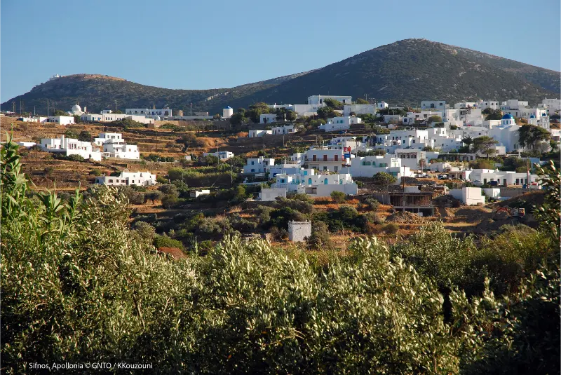
The linked central settlements are the best introduction because you can walk through lived-in villages rather than isolated terrain. Combine Apollonia, Pano Petali, Agios Loukas and Artemonas depending on your route and energy. You get architecture, bakeries, churches and frequent chances to stop.
This is also the easiest option when weather is uncertain: you are never far from roads, cafés or a bus connection. Use the Apollonia and Artemonas guide for the village details.
Artemonas to Kastro
The historic connection from the central villages toward Kastro is one of the island’s most atmospheric combinations. It lets you approach the old capital gradually and makes the fortified settlement feel connected to the landscape rather than isolated at the end of a car ride.
Finish with the Kastro guide and check the current bus schedule if you plan to walk only one direction. A one-way hike plus bus or taxi return can be smarter than forcing a hot round trip.
Faros to Chrysopigi
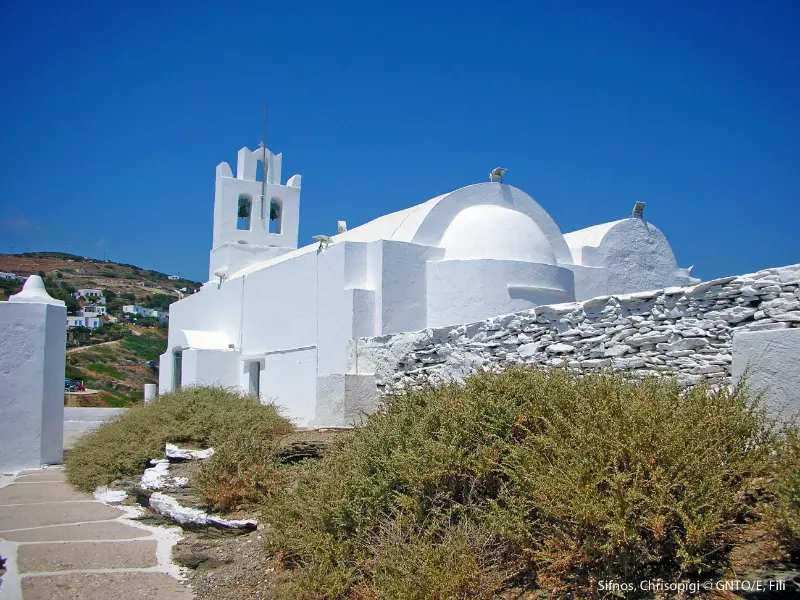
For an easy coastal walk, Faros–Glyfo–Apokofto–Chrysopigi is hard to beat. The route is paved for much of the coastal section and gives immediate access to swimming. It is ideal for travellers who want scenery and movement without a full mountain day.
The walk is described in detail in Faros and Chrysopigi. Even here, midday heat and slippery rock around swimming spots require judgement.
Profitis Ilias Apsilos
Profitis Ilias Apsilos is the island’s highest peak at about 682 m and one of the classic objectives for experienced walkers. The ascent is longer, more exposed and more serious than a village stroll. Views can be extensive, but the route should not be attempted simply because the summit number sounds modest.
Start early, carry substantial water and turn back if heat, wind or navigation becomes uncomfortable. Outside the main walking seasons, ask locally about path condition before committing.
Agios Andreas and ancient landscape
Routes around the central and southern island can connect with the ancient acropolis of Agios Andreas, where archaeology and panoramic views reinforce each other. Check site opening information separately if your plan depends on entering the archaeological area; the trail itself and the staffed site do not necessarily share the same schedule.
Fikiada from Platis Gialos or Vathi
Fikiada is a rewarding beach objective because it is reached by path or sea. Approaching on foot makes the swim feel earned, but it also means you must carry what you need and retain enough energy for the return. The route is better in mild weather than during a hot, windless afternoon.
Pair it with the Sifnos beaches guide to understand which nearby alternatives are easier if conditions change.
Navigation and official maps
Use the official Sifnos Trails resources rather than relying only on crowd-sourced tracks. Download the route before leaving mobile coverage and note junction numbers or landmarks. A paper hiking map is still useful because it gives a complete view of how routes connect.
The municipality links to its official paths information, which also points visitors toward the dedicated Sifnos Trails network.
Safety checklist
- Start early in hot weather and avoid exposed midday climbs.
- Carry more water than you expect to drink; fountains are not guaranteed to be running.
- Wear shoes with grip rather than smooth beach sandals.
- Download offline maps and tell someone your route on longer hikes.
- Close gates and respect livestock, farms, churches and private property.
- Do not enter abandoned mines or unstable ruins.
- Check wind, fire-risk restrictions and local advice before remote routes.
Using buses for one-way hikes
Sifnos becomes much easier for walkers when you combine paths with buses. Seasonal routes connect central villages with Kamares, Kastro, Faros, Platis Gialos, Vathi and northern settlements at varying frequencies. Build one-way walks around the current timetable and always keep enough time for a taxi fallback if the final bus is missed.

Tours and activities
If you want a guided walk, food experience, boat trip or another organised activity, compare what is available for your exact dates. On a small Cycladic island the choice can change by season, so check the meeting point, duration, language, cancellation terms and whether transport is included before booking.
Frequently asked questions
How many marked hiking routes are there?
The municipality lists 19 officially marked routes within a much larger historic path network.
How long is the Sifnos path network?
The municipality describes roughly 200 km of historic paths, while Visit Greece refers to more than 100 km of signposted trails.
When is the best time to hike?
Spring and autumn are the best seasons for comfortable temperatures and vegetation.
What is the highest hiking objective?
Profitis Ilias Apsilos rises to about 682 m and is a classic but more demanding route.
Can I hike without a car?
Yes. Central accommodation plus seasonal buses works well for several one-way routes.
Are the trails suitable for beginners?
Some village and coastal routes are easy; summit and remote routes require better fitness, navigation and heat management.
Final practical advice
Choose one hike that matches the weather, not the most famous route on your saved list. Sifnos rewards consistency: a short village path one day, a coastal route the next and a longer mountain walk in cool conditions can reveal more of the island than driving between viewpoints.
Planning details that are easy to overlook
Build each day around geography rather than a list of saved pins. Sifnos is compact, but repeated returns through the central road network can still waste time. Group central villages together, south-coast beaches together and Kastro with the eastern side. This leaves more time for meals and swimming, which are not empty gaps in a Sifnos itinerary but part of the experience.
In July and August, heat changes the order of the day. Walk early, swim through the hottest hours and return to villages in late afternoon. In May, June, September and October, longer daytime walks become more realistic, but ferry and bus frequency may be lower. Always verify the transport that operates on your exact dates before making a non-refundable plan around it.
Carry a refillable bottle, sun protection and shoes with grip even on days that are not labelled “hiking”. Stone lanes can be polished, coastal paths can be dusty and a five-minute viewpoint detour can become uncomfortable in smooth sandals. A light layer is useful for wind on evening terraces and ferry decks.
For churches and monasteries, dress respectfully and avoid entering during services simply to take photographs. For pottery workshops, ask before photographing artisans at work. For beaches, leave stones, plants and shells where they are and take rubbish back to a serviced settlement if there are no bins.
Finally, keep one flexible half-day in the itinerary. Wind, a changed bus timetable, a festival or a restaurant recommendation may give you a better plan than the one you made months earlier. Sifnos rewards travellers who organise the essentials but leave enough room for the island to change the schedule.
A realistic pace for the day
Avoid planning Sifnos as a sequence of ten-minute stops. Roads are short, but parking, bus waits, stone lanes, meals and beach access all add time. A realistic day normally has one main village or walk, one swim and one unhurried meal. This rhythm also makes it easier to adapt when wind changes the beach choice or when a small museum has different seasonal hours than expected.
If you are combining this area with another part of the island, choose the nearest logical neighbour rather than crossing Sifnos repeatedly. Keep Kastro with the eastern side, Faros and Chrysopigi with the south-east, Platis Gialos with the south and Kamares with ferry-day logistics. This simple approach reduces unnecessary transfers and creates more time for the experiences that make the island distinctive.
Leave a Reply