
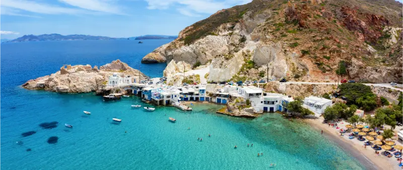
Firopotamos and Mandrakia are two of the small coastal settlements that make Milos feel more intimate than its famous beaches suggest. Both have syrmata—traditional boat-storage buildings built directly beside the water—but the villages have different moods. Firopotamos combines a tiny beach and whitewashed church with a compact bay, while Mandrakia feels more like a pocket-sized fishing harbour carved into volcanic rock.
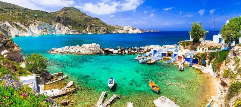
These are not places where you need a long checklist. Their value is scale: a short walk, the colour of the boat doors, reflections on calm water and the relationship between houses and sea. I would visit as part of a scenic half-day rather than driving across the island for one photo. Pair them with Sarakiniko, Plaka or Klima depending on wind and your route.
For the bigger picture, start with my Milos Travel Guide. Milos is easiest to enjoy when each day follows geography and wind rather than a rigid checklist, so this article focuses only on the details that matter for this particular stop.
Quick planning facts
- Firopotamos and Mandrakia are small coastal settlements in northern/western Milos.
- Both feature forms of syrmata associated with boat storage at the water’s edge.
- Parking is limited and village roads are narrow.
- These are living settlements, not dedicated tourist attractions.
- Wind direction strongly affects whether the small bays feel calm or exposed.
Why this place is worth adding to a Milos itinerary
Milos rewards travellers who separate sightseeing from beach time. A morning archaeological visit, a slow village evening or one carefully chosen cove usually works better than trying to fit four corners of the island into the same day. Roads are not long in absolute distance, but parking, wind, heat and narrow approaches can make a packed schedule feel much more demanding than it looks on a map.
The other reason to plan selectively is that Milos changes character from coast to coast. The north can be dramatically exposed when the meltemi blows, while the south may be calmer; a village can feel almost empty at midday and crowded at sunset; a tiny harbour that looks like a ten-minute stop can become the place where you want to sit for an hour. Use the weather and your own energy as planning tools.
What to see and what to pay attention to
Firopotamos bay
The combination of a small beach, church and colourful waterfront gives Firopotamos a compact postcard quality. It is best when you have time to sit rather than simply photograph.
Mandrakia harbour
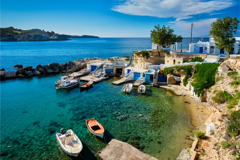
Mandrakia is smaller and more harbour-focused. The boat doors and volcanic rock create strong compositions for photography, especially in softer light.
Traditional maritime architecture
The syrmata make sense only when you remember their function: fishermen needed to protect boats from sea and weather while keeping them immediately accessible.
Low-key swimming
Firopotamos can work for a swim when conditions are calm, but neither village should replace a dedicated beach day if swimming is your priority.
Respectful photography
Stay on public routes, avoid blocking doorways and do not treat private terraces as viewpoints. Drones may also disturb residents and are subject to flight rules.
A realistic way to structure the visit
Start with whichever village is most sheltered that day, spend forty-five minutes to an hour and continue to the second. Add Sarakiniko only if wind conditions suit the north coast; otherwise move inland to Plaka or Tripiti. This keeps the day flexible rather than forcing exposed coast in poor conditions.
I would keep at least one flexible block in every two days on Milos. Wind can cancel or reroute boat trips, parking can become difficult at famous beaches, and you may simply discover that one place deserves more time than expected. A flexible afternoon lets you swap a north-coast stop for the south, move a sunset village to another day or take a longer lunch without breaking the entire itinerary.
Getting there and transport
A car or scooter is easiest. The final roads and parking areas are small, so large vehicles require patience. If spaces are full, do not create your own parking spot on a turning area or access lane.
If transport is a major concern, also use my Greece ferry guide for inter-island planning and the Greek island-hopping guide if Milos is part of a longer Cyclades route. Ferry times, local bus frequency and excursion departures are seasonal, so always verify the current timetable rather than relying on a screenshot from an older trip.
Who this is best for
These villages are excellent for photographers, couples and travellers who enjoy small-scale architecture. They are less useful for visitors looking for extensive shops, facilities or organised beach services.
Best time of day and season
June and September are often excellent for balancing warm sea temperatures with slightly less pressure than peak August, while May and October can be very rewarding for walking and villages if your priority is not guaranteed beach weather. In July and August, start exposed walks and archaeological sites early, keep midday for swimming or shade, and approach sunset hotspots with extra parking time. Outside the main season, confirm restaurants, buses and visitor sites before building a day around them.
Wind matters as much as temperature. Milos is an Aegean island, and the same beach can look completely different on two consecutive days. Check a reliable marine forecast, ask locally and move to a more sheltered coast when needed. This is especially important for cliff-backed coves and boat excursions, where rough sea or falling material can create genuine safety issues.
Parking, roads and practical comfort
Do not underestimate short island drives. The main roads are manageable, but final approaches to fishing villages and beaches can be narrow, dusty or crowded. Park legally even if it means walking farther, never block turning space, and avoid taking a rental vehicle onto tracks your contract excludes. Carry water, sun protection and secure footwear in the car so a spontaneous stop does not become uncomfortable.
If you travel without a car, base selection becomes more important. Adamas gives the strongest transport flexibility, while Pollonia is convenient for Kimolos and north-east Milos. Taxis are useful for sunset evenings when parking pressure is high, but availability can tighten in summer, so arrange important rides in advance rather than assuming a car will appear immediately.
Food, water and a slower rhythm
One of the easiest ways to improve a Milos itinerary is to stop treating meals as interruptions. Villages such as Plaka, Pollonia and Adamas are more enjoyable when you sit down before you are exhausted. Carry water to beaches and archaeological sites, but use lunch or an early dinner as a deliberate rest period. Local dishes, cheeses, pies and seafood can vary by restaurant and season, so ask what is genuinely available rather than ordering only from a pre-made online list.
Photography without making the trip miserable
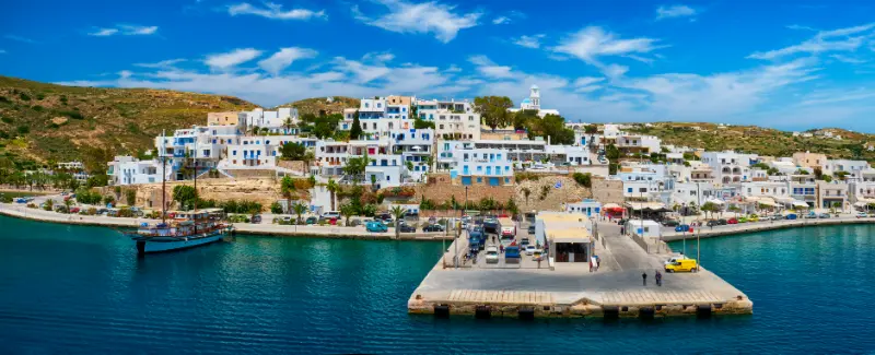
The island photographs beautifully because volcanic rock, white villages and blue water create strong contrast, but the best light often comes with the biggest crowds. Arrive early or stay later instead of fighting for the same viewpoint. Never cross barriers, climb unstable cliffs or enter private terraces for a marginally better angle. At fishing villages, remember that coloured doors and waterfront steps may belong to somebody’s home or working space.
Common mistakes to avoid
- Planning the island as if every famous beach must be visited regardless of wind.
- Arriving at sunset hotspots at the last minute and expecting easy parking.
- Wearing flip-flops for archaeological paths, steep village steps or difficult beach access.
- Treating small fishing settlements as photo sets instead of residential places.
- Booking a critical onward ferry immediately after a weather-sensitive boat excursion.
- Trying to combine the far west, north coast and south coast in one rushed day.
What to combine nearby
Depending on your route, useful related guides include Sarakiniko Beach guide, Kleftiko boat trip guide, Kimolos Travel Guide. The goal is not to do all of them together, but to group stops by geography and weather so you spend more time experiencing Milos and less time driving back and forth.
Current information and official sources
For details that can change—opening hours, admission, access restrictions or local notices—check the official source used for this guide shortly before your visit. Milos is a living island, not a static attraction, and weather or operational changes can matter more than what any travel article said months earlier.
Frequently asked questions
Which is better, Firopotamos or Mandrakia?
Firopotamos is better for combining a swim with village scenery; Mandrakia is more compact and harbour-focused.
How much time do you need?
Around one hour per village is plenty for most travellers.
Can you combine them with Sarakiniko?
Yes, geographically it makes sense, but only if wind and sea conditions are comfortable.
Are the houses private?
Many are private or used as accommodation, so respect doors, terraces and residents.
Is parking easy?
It can be limited in high season. Arrive early or be prepared to walk from a legal space.
Final thoughts
Firopotamos and Mandrakia Guide works best when you give it a clear role in the day instead of squeezing it between unrelated stops. Build around one main experience, leave room for weather and parking changes, and keep the pace slow enough to notice why Milos feels different from the other Cyclades.
That approach also keeps the site more useful for future trips: one day can be geology and beaches, another archaeology and villages, another a boat trip, and another Kimolos or the quieter north-east. Milos does not need to be conquered in a checklist. It rewards travellers who let the island’s wind, landscape and small settlements shape the route.