

Kythira is much better for hiking than many first-time visitors expect. Signed routes connect villages, castles, ravines, coastlines and old agricultural landscapes, giving you a way to understand the island beyond beaches. The challenge is not extreme altitude but heat, rough ground and the temptation to underestimate time.
Visit Greece describes the Kythera Trails network as dozens of routes of varying difficulty. I would choose one or two routes that match the rest of the holiday instead of turning every sightseeing day into a hike.
Quick planning summary
| Question | Practical answer |
|---|---|
| Best for | Kythira Hiking travellers and first-time visitors |
| Car needed? | Very useful for broad island exploration; selected bases can work without one |
| Best timing | Morning and late afternoon for walking; beach or shade around midday in summer |
| What to verify | Seasonal hours, road access, wind and local transport close to the travel date |
Five routes that show the range of Kythira
The official destination material highlights several representative routes: M1 Chora and its Port at about two hours; M31 Pirate Raid around Paleochora at roughly 4.5 hours; M41 Valley of the Watermills at about 2.5 hours; M12 Round of Kapsali around two hours; and longer routes such as M11 Origins and M49 Nature in Contrasts at around five hours.

These times are useful for scale, not promises. Heat, photography, navigation and fitness change actual duration. Always use current trail information and allow a buffer if your day includes a ferry, cave opening or dinner reservation.
M1 Chora–Kapsali: best first walk
M1 connects the capital with its harbour and is a natural first route because you can combine it with the castle, churches and a swim. The official trail description lists Chora, the castle, churches of Mesa Vourgo, a British stone bridge and Kapsali among the features. It gives more context than simply driving between the two places.
In summer, walk early or later in the afternoon and think about the return climb before committing. If you plan to finish with dinner in Kapsali, arrange your return transport rather than discovering after dark that the uphill walk feels much longer.
M31 and Paleochora: history plus exposure
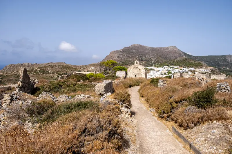
The longer ‘Pirate Raid’ route around Paleochora links historical ruins with a more rugged landscape, including the Kakia Lagada gorge area. This is not the walk I would choose for a casual midday outing. It suits experienced walkers who have water, proper footwear and enough time to deal with route-finding or heat.
Paleochora is evocative even without completing the entire route. If conditions are poor, shorten the day and focus on the historic site rather than forcing a long circuit.
M41 Valley of the Watermills
M41 is one of Kythira’s most distinctive walks because it follows the Mylopotamos water landscape. The route features Fonissa/Neraida waterfall, historic watermills, channels and stone bridges. Shaded sections can feel cooler than exposed coastal paths, but wet stone creates a different hazard.
Do not assume the gorge is easy simply because there is water and vegetation. The path becomes more demanding farther down. Turn around when the route stops being comfortable for your group.
Longer rural routes and cycling
Visit Greece also mentions routes through forgotten rural landscapes and contrasting natural zones. These longer paths are ideal outside the hottest summer weeks, when you can actually enjoy olive groves, old settlements and open ridges rather than simply managing heat.
Kythira also supports cycling and mountain-bike exploration, but road gradients and traffic awareness still matter. A route that looks gentle on a map can become demanding under sun and wind. For both walking and cycling, start with conservative distance estimates.
Hiking safety and wildfire awareness
Carry more water than you think you need, wear shoes with grip, protect yourself from sun and keep an offline route. Tell someone where you are going if the trail is remote. Avoid entering caves, ruins or military-looking structures that are not officially open.
During periods of high fire danger, local authorities can restrict access to natural areas. That is not an inconvenience to work around; it is a safety measure. Check current notices and be ready to switch to a village walk or beach day.
How Kythira changes the way you plan a Greek-island day
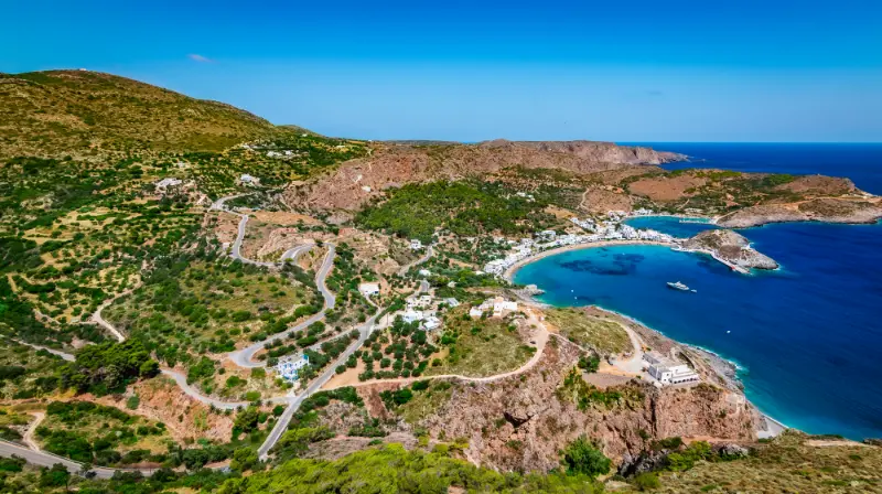
Kythira is not a compact resort island where every attraction sits around one bay. Villages, beaches and historical sites are spread across a rugged landscape, so the best days normally focus on one side of the island rather than crossing from north to south several times. I plan mornings around one anchor place, add a nearby beach or village, and leave dinner close to wherever the afternoon naturally ends.
The island also rewards flexibility. Wind can change which beach feels comfortable, a waterfall can be less dramatic after a dry period, and seasonal businesses do not all keep the same hours outside the busiest weeks. Treat the itinerary as a framework, not a contract. One unhurried village, one swim and one meaningful cultural stop often produce a better day than a long checklist.
Driving, parking and realistic travel time
Even when map distances look short, allow extra time for bends, village streets, parking and short walks from the road. Kythira is manageable by car, but it is not an island where I would schedule activities back-to-back. In popular places such as Chora, Kapsali, Kaladi or Mylopotamos, arriving earlier also makes parking and photography noticeably easier.
If you rent a car, choose a vehicle you are comfortable using on narrow roads and never assume that every road to a remote beach has the same surface. Ask locally about the final approach before committing to an isolated cove, especially after unusual weather. For no-car travel, build the holiday around a strong base and use taxis or seasonal public transport selectively rather than trying to imitate a full road trip.
Best season and daily rhythm
Late spring and early autumn are especially attractive if walking, villages and archaeology matter as much as swimming. July and August deliver the warmest sea and the widest choice of seasonal services, but they also require earlier starts, more careful parking and a serious approach to shade and hydration. September is often a useful compromise for travellers who want warm water without the same daytime intensity.
In summer, I keep exposed walks, castles and viewpoints for morning or late afternoon. Midday is better for a shaded lunch, a protected beach or a long break. Kythira’s most memorable places are often atmospheric rather than monumental, so giving them time is part of the experience rather than wasted schedule space.
Food, water and what to carry
Kythira is known for products such as thyme honey, local rusks and the aromatic Fatourada liqueur, but the practical food rule is simpler: eat where the day already takes you. A lunch in Mylopotamos, a waterfront meal in Kapsali or Avlemonas, and a village dinner in the north all make more sense than driving across the island for one saved restaurant pin.
For remote beaches and trails, carry water, sun protection and at least a small snack. Some coves have seasonal facilities while others have none. I also keep swim shoes, a light shoulder cover for churches and monasteries, and an offline map on my phone. Small preparations matter more here than on an island built around organised beaches.
Accessibility and slower travel
Historic settlements, castle approaches, waterfall paths and rocky coves can involve steps or uneven ground. Travellers with limited mobility should ask accommodation hosts very specific questions about stairs, parking distance and the route to the nearest restaurant or beach. A beautiful room can be inconvenient if every outing begins with a steep climb.
Slow travel works exceptionally well on Kythira. Staying longer in one area reduces driving and makes room for repeat swims, village cafés and weather changes. If you have only three nights, do less. With a week, divide the island into south, east, west/inland and north rather than changing hotels repeatedly.
Common mistakes to avoid
The most common mistake is underestimating how spread out the island feels. The second is treating every beach recommendation as suitable in every wind direction. Other avoidable errors include wearing sandals on rough trails, arriving at a cave or museum without checking seasonal hours, and assuming a waterfall will look identical in late August and after spring rain.
I would also avoid booking accommodation solely on a low map price. Location affects almost every day on Kythira. A base with dinner, a swim and a useful road connection nearby can save enough driving and taxi time to be worth a slightly higher room rate.
How this fits into a complete Kythira trip
Use this guide as one part of a regional plan. The existing Kythira Travel Guide gives the island-wide overview, while the dedicated guides below let you plan the areas and travel styles in more detail. I would normally combine one cultural or walking focus with one beach area each day rather than criss-crossing the island.
Continue planning with Chora and Kapsali Kythira Guide: Castle, Twin Bays, Chytra and Where to Stay; Avlemonas and Paleopolis Kythira Guide: Coves, History, Beaches and Where to Stay; Agia Pelagia Kythira Guide: Beaches, North Coast, Food and Where to Stay; Mylopotamos Kythira Guide: Kato Chora, Watermills, Waterfall and Village Life; Kythira Waterfalls and Caves Guide: Fonissa, Watermills and Agia Sophia; Best Beaches in Kythira: 15 Beaches for Families, Snorkelling and Wild Scenery; Kythira Hiking Guide: Best Kythera Trails, Gorges, Villages and Safety; Kythira Without a Car: Taxis, Buses, Transfers and the Best Bases; Kythira with Kids: Family Beaches, Easy Days and Practical Tips; Where to Stay in Kythira: Chora, Kapsali, Avlemonas, Agia Pelagia or Mylopotamos?.
Kythira Hiking Guide FAQ
What is the best first hike in Kythira?
M1 between Chora and Kapsali is a strong introduction because it combines history, views and practical endpoints.
How long is the watermill route?
Visit Greece describes M41 Valley of the Watermills at about 2.5 hours.
Can I hike in July and August?
Yes, but start very early or late and avoid long exposed routes during peak heat.
Do I need hiking boots?
Good trail shoes with grip are adequate for many routes; rougher routes justify more supportive footwear.
Are routes well signed?
Kythira has a recognised trail network, but always carry current route information and an offline map.
Useful official information
For route planning I check Visit Greece – Outdoor Activities on Kythira and current Kythera Trails information. Trail status and access can change after weather or maintenance.
Opening times, local road conditions, public transport, boat trips and seasonal businesses can change. Recheck anything time-sensitive shortly before you use it, especially outside July and August or after unusual weather.
Leave a Reply