

Karpathos is one of the strongest hiking islands in the Dodecanese because the landscape is genuinely mountainous rather than gently rolling. The municipality describes a network of about 60 mapped trails, concentrated especially in the north, while Mount Lastos rises to about 1,215 m. Hiking here can mean pine forest, exposed ridges, old cobbled paths, remote beaches and villages in the same day.
This article complements the Karpathos Travel Guide rather than repeating it. Karpathos is long, mountainous and more spread out than its map can suggest, so the useful question is not simply what is beautiful, but what fits together in one realistic day. I also link to the Olympos Karpathos Guide where the northern traditions need more detail.
Quick planning summary
- The municipality describes roughly 60 mapped hiking trails, many in the northern half of the island.
- Official route examples range from an easy one-hour Spoa–Mesochori walk to a demanding 7.5-hour Avlona–Tristomo–Vananda–Diafani route.
- Mount Lastos reaches about 1,215 m and is the highest mountain in the Dodecanese according to municipal information.
- Saria adds gorge and archaeological scenery but requires boat logistics.
- Heat, wind, limited shade and sparse water sources make preparation essential.
- Spring and autumn are the easiest seasons for longer routes; summer hiking should start very early.
| Planning point | Practical approach |
|---|---|
| Base | Choose the area that matches your main priority instead of changing hotels every night. |
| Transport | A car gives the widest freedom; buses, taxis and summer boats work best with a narrower plan. |
| Wind | Use daily wind and sea conditions to decide between exposed and sheltered coasts. |
| Pace | Two or three well-chosen stops usually work better than a long checklist. |
Why Karpathos is a serious hiking destination
Karpathos has steep terrain, long north-south distances and historic paths that linked villages long before the modern road network. The official trail page highlights pine forests, sea views, churches, springs and routes that end at beaches or caves.

Treat the island like a small mountain destination, not a beach resort with a few casual walks. Route length, ascent, heat and transport back to the starting point matter.
A short coastal walk and a seven-hour mountain traverse belong to completely different categories even if both appear on the same trail map.
Kato Lastos to Spoa
The municipality lists Kato Lastos–Spoa as an easy route taking roughly 3 hours and 10 minutes, combining mountain and sea scenery. It is a strong introduction for travellers who want a substantial walk without committing to the longest northern traverses.
Start early and confirm the practical return transport before setting out. A point-to-point hike is only easy if you know how you will get back.
The route also gives context to the island’s central mountain spine, which is easy to underestimate from the coast.
Spoa to Mesochori
Spoa–Mesochori is listed as an easy route of about one hour, with pine and sea scenery. This makes it useful for travellers who want a village-to-village experience without a full-day expedition.
Combine it with a village visit and meal rather than treating the walk as the only objective. If using public transport or a taxi, confirm pickup arrangements first.
Short routes are still exposed to heat; carry water and sun protection even when the distance looks modest.
Avlona, Vananda and Diafani
The northern routes around Avlona and Diafani are among the island’s most distinctive. The municipality lists Avlona–Vananda–Diafani at around 4.5 hours and the longer Avlona–Tristomo–Vananda–Diafani at roughly 7.5 hours, described as relatively difficult.
These are not casual flip-flop walks. Take proper footwear, navigation, more water than you expect to need and a firm plan for transport at the finish.
The reward is a remote landscape where mountain paths, pine, sea and old settlements feel far removed from resort Karpathos.
Olympos and the northern paths
Many traditional paths begin around Olympos, where isolation preserved both culture and the old walking network. A hike can extend the village visit into surrounding agricultural landscapes and remote coast.
Use the dedicated Olympos guide for village etiquette and cultural context. On trail days, start before tour groups arrive and avoid assuming that every path from the village is clearly signed.
Offline mapping is valuable because mobile coverage can be inconsistent in rugged terrain.
Saria island hiking
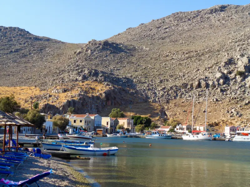
Saria, immediately north of Karpathos, is part of the protected northern area and combines a gorge, archaeological remains and remote coves. Access is normally by boat from Diafani or organised excursions.
Because transport depends on sea conditions, Saria hiking should never be the only plan for a fixed day. Confirm how much walking time the boat schedule actually allows and whether a guide is included.
Carry all essentials and follow conservation rules carefully; the landscape is more sensitive than a serviced beach excursion.
Achata cave and shorter adventure walks
Municipal trail information mentions a route toward a cave with stalactites above Achata, passing churches and springs. This kind of walk can be a good alternative to a full mountain traverse.
Caves add hazards beyond ordinary hiking: loose rock, darkness and uncertain footing. Do not enter deep or technically difficult sections without local guidance and appropriate equipment.
A hike ending with a swim is appealing, but keep dry footwear and enough water for the return.
Heat, water and equipment
The municipality specifically recommends water, snacks or fruit, a hat, glasses, walking stick and suitable shoes. In practice, summer hikers should also carry sunscreen, offline navigation and a charged phone or power bank.
Start earlier than feels necessary. A route that is pleasant at 07:00 can become exhausting by midday, especially when there is no shade.
Tell someone where you are going on remote routes and avoid hiking alone if your navigation or heat tolerance is uncertain.
Transport for point-to-point hikes
The hardest part of a Karpathos hike can be logistics. Buses serve villages, taxis are available and boats reach Diafani and Saria seasonally, but these systems do not always align perfectly with trail times.
Plan the return before leaving the start. A taxi booked in advance can be worth the cost for a long traverse, while a circular route is safer when transport information is uncertain.
Do not rely on hitchhiking as the only way back from a remote trailhead.
Best season and route selection
April, May, late September and October are usually easier for longer walking than the hottest part of summer, though exact weather varies. Winter can bring wind, rain and limited tourist services.
Choose routes by total time, elevation and exposure rather than distance alone. A short steep path can be harder than a longer village road.
Build at least one rest or beach day after the longest hike, especially if you are also driving mountain roads.
Tours and activities
Availability changes through the season, especially for boat trips and outdoor activities. Compare departure points, cancellation terms and the exact beaches or villages included before booking. The widget below is useful for seeing what is actually running for your dates rather than assuming that every summer excursion operates every day.
Useful official sources
- Municipality: trail tourism
- Municipality: island identity and Lastos
- Municipality: Diafani and Saria
- Visit Greece: Karpathos
Continue planning Karpathos
For the rest of the island, continue with these dedicated guides: Pigadia Karpathos Guide: Harbour, Beach, Museum, Food and Where to Stay; Arkasa and Finiki Karpathos Guide: Paleokastro, Beaches, Sunset and Where to Stay; Lefkos and Mesochori Karpathos Guide: Beaches, Village Walks, Sokastro and Where to Stay; Karpathos Mountain Villages Guide: Aperi, Othos, Volada, Pyles and Menetes; Apella, Kyra Panagia and Achata Karpathos Guide: Access, Swimming and Boat Trips; Best Beaches in Karpathos: 15 Beaches for Families, Snorkelling, Wind and Scenery; Karpathos Hiking Guide: Best Trails, Lastos, Olympos, Diafani and Saria; Karpathos Windsurfing Guide: Afiartis, Chicken Bay, Wind, Lessons and Where to Stay; Karpathos Without a Car: Buses, Boats, Taxis and the Best Bases; Where to Stay in Karpathos: Pigadia, Ammoopi, Arkasa, Lefkos or Diafani?. The two existing cornerstone articles remain the Karpathos Travel Guide and the Olympos Karpathos Guide.
Frequently asked questions
How many hiking trails are there in Karpathos?
The municipality describes a network of about 60 mapped trails, particularly strong in the northern part of the island.
What is the highest mountain in Karpathos?
Municipal information gives Mount Lastos at about 1,215 m, making it the highest mountain in the Dodecanese.
Can I hike in July and August?
Yes, but long routes should start very early and require serious heat management. Spring and autumn are more comfortable for sustained hiking.
Do I need a guide?
Not for every signed route, but a guide is valuable for remote northern trails, Saria, complex navigation or anyone without mountain experience.
Final planning advice
Karpathos rewards travellers who leave room for the island to set the pace. Distances, mountain roads, wind and boat conditions can change the value of a plan from one day to the next. A flexible itinerary makes it easier to move a beach day, stay longer in a village or choose a sheltered coast when the Aegean is rough.
For a first trip, I would prioritise one strong base, one mountain-village day, one east-coast beach day, one west-coast day and at least one experience that reflects the island’s character beyond the sea. That might be a hike, a windsurf lesson, a slow meal in a fishing village or an overnight in the north. The result feels much more like Karpathos than racing from viewpoint to viewpoint.
Leave a Reply