

Ithaca is one of the Ionian islands where walking is not an add-on but a way of understanding the landscape. Before roads linked every settlement, stone paths connected villages, farms, churches and bays across steep terrain. The Municipality has promoted a network of roughly 110 kilometres under the Ithaca Trails project, with routes across both the northern and southern parts of the island. That makes Ithaca unusually rewarding for travellers who want more than beaches.
The first rule: separate literary Ithaca from archaeological certainty
The island’s identity is inseparable from Homer’s Odyssey, and many places are associated with Odysseus, Penelope, the palace, the Cave of the Nymphs or ancient harbours. Some associations are traditional, some are linked to archaeological discoveries and some remain debated. A good hiking guide should preserve that complexity rather than presenting every signposted name as a proven location from the poem.
Use the Homeric story as a lens through which to experience the terrain: the difficult ridges, hidden coves, caves and lines of sight help explain why the island has inspired identification and interpretation for centuries. For archaeological claims, rely on museum material and official site information.
The municipal trail network
The Ithaca Trails initiative describes a network of about 110 km, almost evenly distributed between north and south and connected into a larger circular concept. Actual route conditions depend on maintenance, vegetation, weather and recent use. Download maps before the trip and ask locally which sections are clear.
Trail colour or numbering systems can be less obvious on the ground than on a website. Carry an offline map and do not continue blindly at an ambiguous junction just because a GPS line appears to cross private-looking land.
Walking around Anogi and the central ridge
Anogi is an excellent hiking base because it sits high in the island’s interior. Routes descend toward Kioni and connect with the central spine, offering views that reveal how narrow Ithaca is between east and west coasts. The village itself, with its old church and standing stones in the surrounding landscape, deserves time before or after the walk.
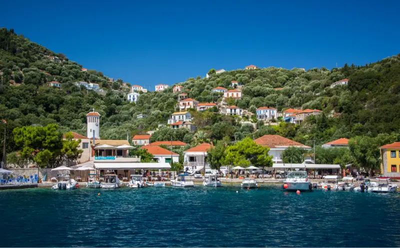
Descending from a high village can feel easy at the start but creates the challenge of climbing back. If you plan a point-to-point route, arrange transport in advance rather than assuming a taxi will be waiting at the finish.
Exogi, Stavros and northern archaeology
Exogi and Stavros sit within the island’s strongest concentration of Homeric associations. Paths and minor roads link high viewpoints, archaeological areas and the coast at Polis Bay. This makes the north ideal for a mixed hiking-and-history day.
The so-called School of Homer near Agios Athanasios has attracted archaeological interest and public attention. Interpretations connecting structures and finds with an Odyssean palace are not a simple settled fact. Visit with respect for the archaeology and read current official information rather than repeating the most dramatic claim as certainty.
South Ithaca: Vathy, Perachori and coastal routes
The south offers routes above Vathy, around Perachori and toward viewpoints over the great harbour. These walks can be easier to fit around a Vathy stay because you do not need a long transfer north. Some routes pass agricultural terraces, chapels and old paths that reveal a quieter working landscape behind the capital.
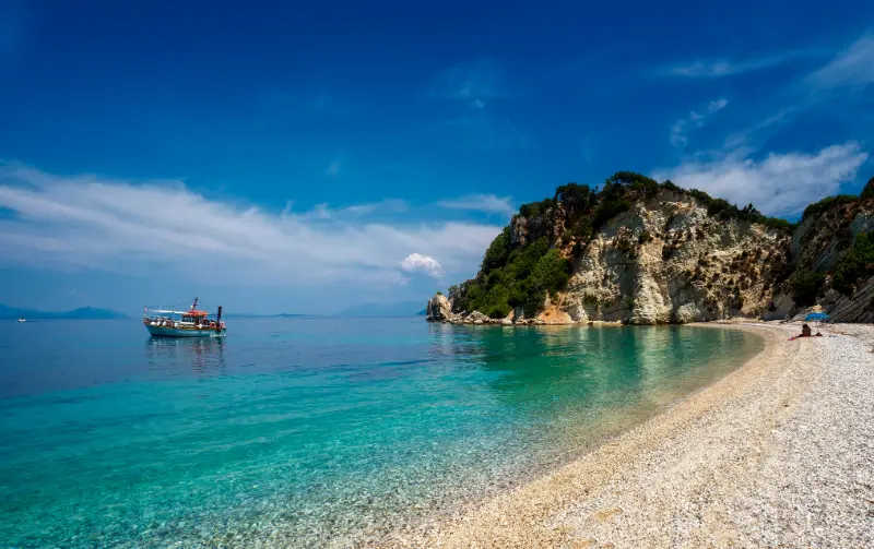
If you want to combine hiking with a beach, choose one destination rather than planning three. A morning walk followed by Filiatro, Dexa or Sarakiniko is more realistic than crossing the island after a long hike.
Heat is the main summer risk
Ithaca’s trails can be brutally hot in July and August. Start around sunrise for longer routes, carry more water than you think you need and avoid exposed ridges in the middle of the day. Shade visible on a map may not exist where vegetation has changed.
Do not depend on springs unless a reliable current source confirms they are flowing and potable. Carry electrolytes or salty food on long days and know the signs of heat exhaustion: headache, nausea, dizziness and unusual weakness are reasons to stop, cool down and reassess.
Footwear, navigation and what to carry
- Hiking shoes or trail shoes with reliable grip.
- Offline map plus a backup battery.
- At least 1.5–2 litres of water for a substantial summer hike, often more depending on heat and duration.
- Sun hat, sunscreen and light long sleeves for exposure.
- Small first-aid kit, blister care and personal medication.
- Snacks and enough energy reserve for an unexpected detour.
- A headlamp for long routes even if you plan to finish before sunset.
Walking with children
Choose short village paths, waterfront walks and easy shaded sections rather than committing the family to an exposed ridge. Children who enjoy hiking can handle more, but the limiting factor is often heat rather than distance. Make the destination tangible: a church square, a beach or lunch in Kioni works better than “we are walking for three hours because the route is famous.”
A two-day hiking plan
- Day 1 north: start early near Stavros or Exogi, walk a selected marked route, add Polis Bay and finish with food in Frikes or Kioni.
- Day 2 central/south: choose Anogi or a route above Vathy, then spend the afternoon swimming close to your base.
- Keep one extra morning flexible in case wind, heat or trail conditions make your preferred route unsuitable.
Respecting land and heritage
Stay on established paths, close gates behind you, do not move archaeological stones and avoid entering ruined structures that look unstable. Wildfire risk is serious in Greek summers; never light fires and follow any official restrictions on access during extreme fire-weather conditions.
The most responsible way to experience Homeric Ithaca is not to “collect” alleged locations but to walk slowly enough to understand the terrain that made the island a powerful literary symbol.
Booking accommodation and activities
For accommodation, compare places to stay in Ithaca on Booking.com. Check the exact village rather than booking from the island name alone: Vathy, Kioni, Frikes and the northern villages create very different daily logistics.

For organised activities and excursions, use the widget below as a starting point. Availability on Ithaca is seasonal and inventory can be limited, so verify the meeting point, cancellation terms and whether transfers are included before paying.
Official resources to recheck before you go
For an official destination overview, use Visit Greece’s Ithaca page. It describes Vathy, the fishing villages, pebbled coves and the island’s walking character, and it is a useful starting point before checking local conditions.
For beaches, the official Visit Greece beaches of Ithaca page covers Filiatro, Dexa, Gidaki, Platia Ammos, Afales, Sarakiniko and Skinos. For local notices, municipal services and seasonal announcements, check the Municipality of Ithaca.
The Municipality announced the Ithaca Trails tourism network as approximately 110 km of routes. Check the current route page or local advice before departure because maintenance and access can change.
More Ithaca guides for planning the same trip
Continue with Vathy Ithaca Guide · Kioni and Frikes Ithaca Guide · North Ithaca Villages Guide · Best Beaches in Ithaca · Ithaca Hiking and Odysseus Sites Guide · Ithaca Boat Trips Guide · Ithaca Without a Car · Where to Stay in Ithaca · Ithaca with Kids · How to Get to Ithaca. Start with the Ithaca Travel Guide if you need the island overview before choosing detailed day plans.
Wildfire restrictions and summer access
During periods of very high fire danger, Greek authorities can restrict access to forests or nature areas. Check local announcements before an exposed summer hike. Even without a formal closure, strong wind and extreme heat are reasons to shorten the route.
Never smoke on dry trails, never light a stove or fire, and do not park a hot vehicle over dry grass. Wildfire prevention is part of hiking safety, not a separate concern.
After the hike
Plan the recovery before you start. Leave clean water in the car, know where you can eat and avoid driving immediately after a long exposed route if you are dizzy or exhausted. A swim can feel wonderful, but cool down gradually and do not jump into deep water while overheated.
Log any confusing junctions or damaged signs with a local tourism contact if there is a clear reporting route. Good trail networks remain useful because walkers communicate problems rather than creating unofficial shortcuts.
Practical timing by season
In May and early June, walking and village exploration are easier in cooler temperatures, but the sea is cooler and some seasonal services run less frequently. July and August bring the fullest transport and restaurant choice, along with stronger heat, parking pressure and demand for taxis and boats. September is often the best compromise for warm water and calmer roads, while October requires more careful checking of ferry frequencies and business opening days.
Whatever the month, plan the following day with the actual wind and temperature forecast rather than using a fixed itinerary written weeks earlier. Ithaca is compact enough that changing from a north-coast beach to a Vathy day, or from hiking to a museum and long lunch, rarely ruins the trip. Flexibility is one of the island’s greatest advantages.
Common planning mistakes
The most common mistake is treating short distances as short journeys. Roads are narrow and winding, parking takes time and a spontaneous swim can easily add an hour. Do not schedule every meal, beach and village. Choose one main purpose for the day and let secondary stops remain optional.
Another mistake is relying on a single old timetable or map review. Ferries, local buses, excursion boats and seasonal businesses change. Confirm anything time-critical close to travel and keep departure day simple. Finally, avoid judging the island only by famous names: a quiet unnamed cove or ordinary village square can be more memorable than a hurried checklist stop.