Author: Jessica

  • Best Beaches in Zakynthos: 12 Beaches for Families, Snorkelling, Turtles and Scenery

    Best Beaches in Zakynthos: 12 Beaches for Families, Snorkelling, Turtles and Scenery

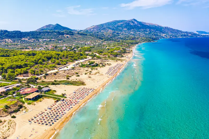
    Choosing the best beaches in Zakynthos is less about ranking beauty and more about matching each coast to the way you travel. The south has long sandy beaches and protected turtle nesting areas, the east has convenient resort beaches, the north-east offers clear-water coves, and the west is dominated by deep rocky inlets. A family with toddlers needs a different beach from a strong swimmer carrying a snorkel.

    This guide is designed as a decision tool. I would pick one or two beaches per day and let weather decide the final choice. Wind, swell, parking pressure and turtle-protection rules can change the experience more than a photograph taken on a perfect morning.

    For the wider island picture, keep the Zakynthos travel guide open alongside this page. The Zakynthos Town and Bochali guide is useful for evenings and cultural stops, while the Keri Caves and Mizithres guide covers one of the best south-west coast boat areas in more detail.

    Best Zakynthos beaches by travel style

    Travel styleGood starting points
    Families and easy sandKalamaki, Laganas outside the nightlife core, Tsilivi, Alykes, Banana Beach.
    Turtle-protection experienceGerakas, Dafni and the wider Laganas Bay nesting coast.
    Snorkelling and clear waterMakris Gialos, Porto Limnionas, Porto Roxa.
    Unusual sceneryXigia sulphur cove and the Navagio viewpoint rather than beach access in 2026.
    Facilities and full beach dayBanana Beach, Tsilivi, Agios Nikolaos (Vasilikos), Alykes.

    1. Gerakas: best for protected natural scenery

    Gerakas combines a broad sandy setting with the ecological importance of a turtle nesting beach. Go early, follow the ranger instructions and stay in the permitted visitor area. It is not a place for loud beach games or spreading equipment across the upper sand.

    Read the Vasilikos guide for how to combine Gerakas with the rest of the peninsula.

    2. Kalamaki: easiest protected beach for families

    Kalamaki is convenient because you can pair a sandy beach with accommodation and restaurants without a complicated drive. The nesting rules remain important, so the beach is not open for unrestricted night use.

    Families should check sea conditions and keep children’s digging close to the waterline, filling holes before leaving.

    3. Laganas: long sand plus resort convenience

    Laganas has a long sandy shoreline and enormous visitor infrastructure. The central resort is best known for nightlife, but daytime beach use can still work for people who stay outside the busiest strip. The bay is protected for turtles, so conservation rules apply.

    Use the Laganas and Kalamaki guide to decide which base suits you.

    4. Banana Beach: best for facilities

    If your priority is sunbeds, food, watersports and an easy all-day setup, Banana Beach is one of the most straightforward choices. It is more commercial than Gerakas and that is exactly why some families and groups prefer it.

    In peak summer, arrive earlier for easier parking and a better choice of places.

    5. Tsilivi: best resort balance

    Tsilivi works well when you want a beach day without planning. Restaurants, accommodation and services are close, and the area is easy to combine with Zakynthos Town. It lacks the raw drama of the west coast but wins on convenience.

    This is a useful “rest day” beach between more ambitious road trips.

    6. Alykes and Alykanas: relaxed north-east sand

    These neighbouring areas are strong choices for a calmer resort beach with good access toward the northern part of the island. They work particularly well if you are staying locally and want to mix beach days with a Blue Caves excursion.

    The Alykes/Alykanas/Tsilivi comparison covers accommodation trade-offs.

    7. Xigia: best for something unusual

    Xigia is memorable because mineral-rich spring water can create a sulphur smell and milky patches in the turquoise cove. It is small, with limited space and a descent from the road, so I prefer it as a morning stop rather than a full-day beach.
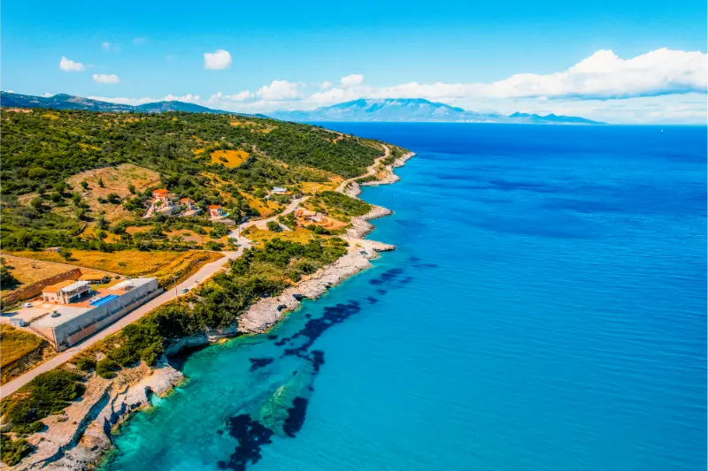
    Xigia Beach Zakynthos Island Greece Views Azure Sea Water Nature With Cliffs

    Go to the Xigia and Makris Gialos guide for exact planning.

    8. Makris Gialos: best for easy snorkelling

    Rocky edges and clear water make Makris Gialos more interesting for snorkelling than a featureless sandy resort beach. It is also easy to combine with Xigia and northern boat departures.

    On rough days, visibility and entry comfort can deteriorate, so keep another beach option in mind.

    9. Porto Limnionas: best for strong swimmers

    Porto Limnionas is not a conventional beach at all. It is a deep limestone inlet with rock/platform access and very clear water when calm. Strong swimmers and snorkellers often love it, while toddlers and non-swimmers may prefer to enjoy the view from land.

    See the west-coast coves guide before driving there.

    10. Porto Roxa: best for a slow west-coast afternoon

    Porto Roxa offers another rocky-water experience and can be especially attractive later in the day. Check the sea before swimming and plan the return drive before darkness if you are not comfortable on winding roads at night.

    It pairs naturally with Porto Limnionas rather than with distant south-coast beaches.

    11. Dafni: best for a secluded protected setting

    Dafni sits inside the protected marine-park landscape and feels removed from the main resort belt. Road access and regulations can change, so check locally before setting out and follow all conservation signs once there.

    This is a beach to visit slowly, not a quick photo stop.

    12. Agios Nikolaos Vasilikos: best for active beach time

    Agios Nikolaos on the Vasilikos peninsula combines organised facilities with an energetic summer atmosphere. It can suit mixed groups who want swimming, food and activities in one place.

    Be careful in navigation apps because Zakynthos also has a northern Agios Nikolaos harbour.

    What about Navagio in 2026?

    Navagio belongs on a scenery list, but not on a 2026 swimming-beach list. Landing and swimming in the bay are prohibited through 31 October under the current restrictions. You can still see the cove from the official viewpoint and from boats respecting the safety zone.

    Read the Navagio 2026 guide before booking any “Shipwreck Beach” excursion.
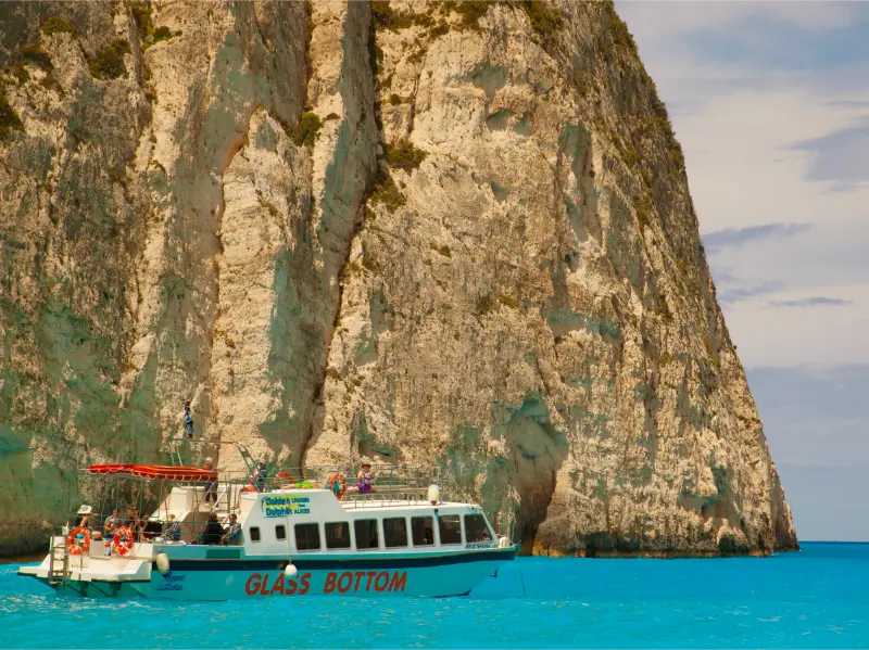
    View Navagio Shipwreck Beach Zakynthos Greece Navagio Beach Attraction Tourists Visiting Island Zakynthos

    How to choose the beach each morning

    Look at wind direction and sea state, then consider driving time, parking and the needs of your group. A famous west-coast inlet is a poor choice for a non-swimmer on a choppy day. A simple sandy beach five minutes from the hotel can be the best decision after a long boat excursion.

    I would keep at least two unscheduled beach days in a week-long holiday so you can respond to weather instead of fighting it.

    Tours and bookable experiences

    If you prefer to organise transport and timing in advance, compare current small-group and boat experiences below. Check the exact departure point, cancellation rules, accessibility, shade and swim-stop details before paying, because routes can change with weather and local restrictions.

    Beach safety basics

    Zakynthos beaches do not all have the same lifeguard coverage, entry depth or boat traffic. Assess the water when you arrive, supervise children directly and use flotation as a support rather than a substitute for swimming skill. On rocky coasts, watch the way other swimmers enter and exit before committing to the water.

    Leave-no-trace habits

    Carry reusable water, remove all litter and never leave cigarette ends in the sand. On protected turtle beaches, flatten children’s holes and sand structures before leaving. At small rocky coves, pack out everything you brought because there may be no bins. These simple habits matter more than any “eco” slogan in a travel brochure.

    One final practical planning rule

    For this part of Zakynthos, I would also keep one simple rule: do not let the distance on the map dictate the pace of the day. Summer traffic, narrow village roads, parking, heat and sea conditions can easily add time. Check the weather and any protected-area restrictions in the morning, save important meeting points offline, and keep a second beach or village in mind in case the first stop is crowded or the sea is rough. If you are travelling with children, older relatives or anyone with limited mobility, make the access route part of the decision—not an afterthought. A slightly less famous place that everyone can reach comfortably is usually a better holiday experience than forcing a difficult stop because it appeared on a “must-see” list.

    Frequently asked questions

    Which Zakynthos beach is best for families?

    Kalamaki, Tsilivi, Alykes and organised Vasilikos beaches are strong starting points. Choose based on sea conditions and your exact accommodation.

    Sunrise View From Beach Coastline Greece Zakynthos Alykes Ionian Sea

    Which beach is best for snorkelling?

    Makris Gialos and the west-coast inlets such as Porto Limnionas can be excellent when the sea is calm.

    Can you swim at Navagio in 2026?

    No. Swimming and landing in the bay are prohibited through 31 October 2026 under the current safety restrictions.

    Which beaches have turtle nests?

    Protected nesting occurs around Laganas Bay and beaches such as Gerakas/Dafni. Follow current marine-park signs and ranger instructions.

    Do I need water shoes?

    They are useful for rocky and pebbly beaches, especially Xigia, Makris Gialos and west-coast coves, but less important on long sandy resort beaches.

    Final thoughts

    The best Zakynthos beach changes with your travel style and with the weather. Use the south for easy sand and turtle landscapes, the east for convenience, the north-east for clear coves and the west for deep-water drama. If you choose by conditions rather than by a rigid ranking, you will have better swimming days and spend less time driving.
  • Amorgos Travel Guide: Hozoviotissa, Hiking, Beaches and a 5-Day Itinerary

    Amorgos Travel Guide: Hozoviotissa, Hiking, Beaches and a 5-Day Itinerary

    Amorgos is long, mountainous and dramatic, with a sense of distance that makes it feel more remote than many better-known Cyclades islands. The famous Hozoviotissa Monastery clings to a cliff above the Aegean, but the island is not a one-sight destination. Chora, Aegiali, Katapola, mountain villages and a network of historic paths can easily fill five or six days.

    This is an island for travellers who enjoy landscapes and walking as much as beaches. Official tourism information describes marked routes crossing the island, including the demanding Palia Strata, which links Chora with Aegiali via the monastery. If that sounds appealing, Amorgos may suit you better than a resort-oriented island. Compare it with my Folegandros guide and Naxos guide.

    Choosing between Katapola, Chora and Aegiali

    Katapola is one of the main ferry ports and a practical base with restaurants and transport connections. Aegiali, in the north, has the island’s largest sandy beach and a more obvious holiday atmosphere. Chora sits inland at altitude and is, for me, the most beautiful evening base if you value architecture and quiet lanes over immediate beach access.

    Because Amorgos is elongated, your choice matters more than on a compact island. Staying only in one far end can create unnecessary driving. For a five- or six-night trip, consider splitting the stay between central/southern Amorgos and Aegiali if you want to hike and explore widely.
    Hozoviotissa Monastery

    The Monastery of Panagia Hozoviotissa is the island’s defining landmark, built against a sheer cliff face above the sea. Reaching it involves steps and exposure to sun, so visit early and carry water. Dress modestly because this is an active religious site, not only a viewpoint.

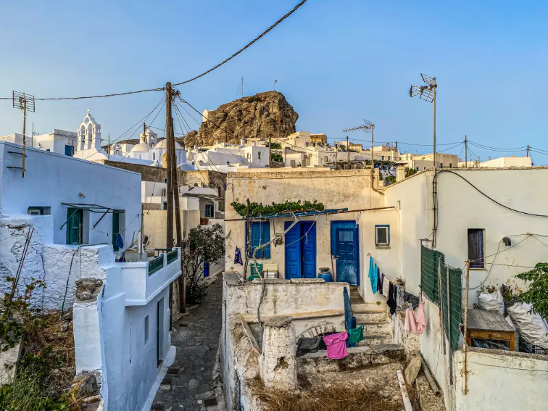
    Pedestrian Street Greek Chora Village Built Around Large Rock Amorgos Island Aegean Sea Cyclades Greece

    The setting is extraordinary, but the visit becomes more meaningful when you approach it as part of Amorgos’s religious and cultural history rather than as a photo stop. Continue to nearby Agia Anna only if conditions are comfortable; the coast here is rocky and the sea can be rough.

    Chora after sunset

    Amorgos Chora is a maze of white houses, chapels, small squares and lanes beneath windmills. It is especially attractive in the late afternoon when the heat drops. Rather than rushing through with a camera, sit for coffee or dinner and let the town change from daylight to evening.

    Parking is outside the historic core, and that is part of the appeal. Wear shoes suitable for stone paving. If you are staying elsewhere, check the final bus or taxi plan before settling into a long dinner.

    Hiking and the old paths

    Amorgos is one of the best Cyclades choices for strong walkers. Official tourism information describes routes such as the 11.5-kilometre Palia Strata, the 10-kilometre Itonia route and shorter village paths around Aegiali. These are real mountain walks, not paved promenades.

    Summer heat, strong wind and limited shade can make even moderate distances demanding. Start early, carry plenty of water and tell someone your route if you are walking alone. Spring and October are far more comfortable for hikers than the peak of August.

    Best beaches and swimming spots

    Aegiali is the easiest sandy beach with services. Agia Anna is famous for rocky coves and clear water beneath the monastery landscape. Mouros has dramatic rocks and access by a descending path. Kalotaritissa, toward the southwest, offers a sheltered bay and seasonal boat access to Gramvousa islet.

    The island’s beaches are often smaller and less immediately accessible than those on Naxos or Paros. That is part of Amorgos’s character. If your ideal holiday needs a wide sandy beach directly outside the hotel, choose your base carefully.

    The Olympia shipwreck and southern Amorgos

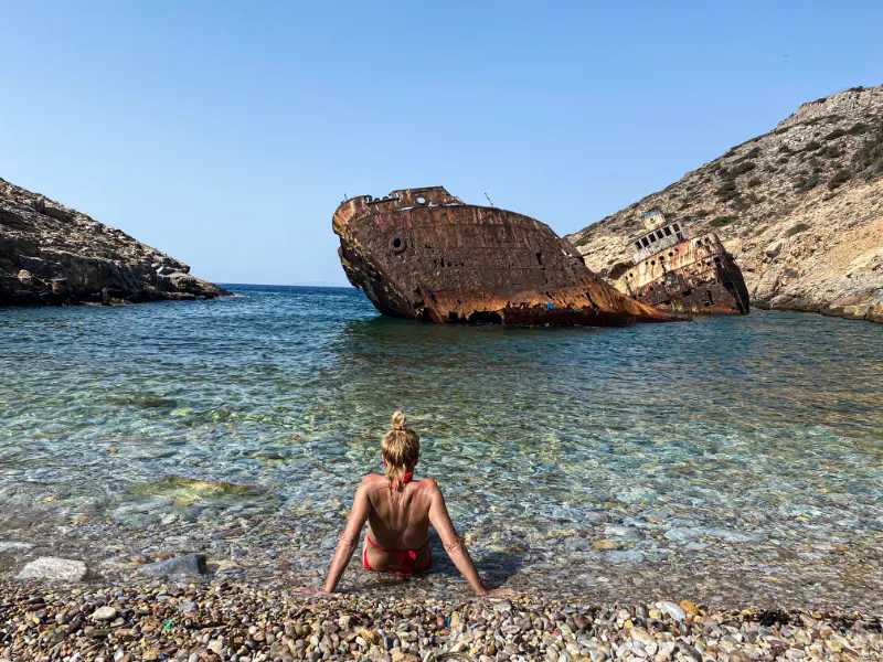
    The shipwreck in Liveros Bay has become a popular photography stop, but I would not plan an entire day around it. Combine it with the southern coast and Kalotaritissa so the drive has a broader purpose.

    Roads are scenic but slower than map distances suggest. Build in extra time for viewpoints and oncoming traffic. The south feels sparse and exposed, which is precisely why it is memorable.

    Aerial Drone View Shipwreck Olympia Boat Amorgos Island Coastal Rocky Area People Beach Cyclades Greece

    Getting around Amorgos

    Buses connect the main ports, Chora and major villages, but schedules determine how much you can combine in one day. A rental car gives more flexibility for beaches and trailheads. If you are not comfortable on mountain roads, buses and taxis may produce a more relaxed trip.

    Pay close attention to which port your ferry uses. Amorgos has ferry activity at both Katapola and Aegiali, and assuming the wrong one can create a stressful transfer on departure day.

    Katapola Island Of Amorgos Cyclades Aegean Greece

    A five-day Amorgos itinerary

    Day one: arrive and explore your base. Day two: visit Hozoviotissa early, walk in Chora and swim at a nearby coast if conditions allow. Day three: explore Aegiali and the villages of Lagada or Tholaria. Day four: hike a section of the island’s path network. Day five: drive or bus south toward Kalotaritissa and the shipwreck area.

    With seven days, add a second hike and a genuinely empty beach day. Amorgos rewards staying longer because the distances and walking make rushed sightseeing inefficient.

    When to visit

    June and September balance swimming weather with less punishing hiking temperatures. July and August are warmer and busier, and the meltemi can affect both beaches and ferries. May and October are attractive for walkers, although sea temperatures and seasonal services vary.

    Always leave some flexibility around ferry days. The Aegean is not a theme park ride running on your personal schedule, and wind can change plans.

    Who should choose Amorgos

    Amorgos is excellent for hikers, couples, photographers and repeat Greece visitors looking for a stronger landscape experience. It can work for families, but the steep terrain and beach access require more planning with very young children.

    If you want continuous nightlife, easy resort beaches and minimal walking, another island may fit better. Amorgos is at its best when you enjoy the effort required to reach things.

    Frequently asked questions

    How many days do I need in Amorgos?

    Five days is a good minimum. Six or seven days is better if hiking is a major part of the trip.

    Which port should I use?

    Both Katapola and Aegiali can receive ferries. Check the exact port on your booking and arrange accommodation transfers accordingly.

    Is Amorgos good without a car?

    Yes if you plan around buses and stay near a main settlement, but a car gives much more freedom for remote beaches and trailheads.

    Is the Hozoviotissa Monastery difficult to reach?

    There are many steps and little shade, so it can be tiring in hot weather. Visit early, wear suitable shoes and dress respectfully.

    Planning Amorgos in practice

    The biggest planning mistake on Amorgos is underestimating travel time between north and south. The island is narrow but long, and roads follow mountain terrain. Group each day geographically. If you are exploring Aegiali villages, stay in the north instead of adding a southern beach just because it looks close on a map.

    Hiking days need a weather check for both heat and wind. A strong meltemi can make exposed ridges exhausting even when temperature looks reasonable. Start with more water than a city walk would require and protect your head and neck from sun.

    Because ferry arrivals can be late or use either main port, confirm your accommodation transfer in writing. Save the host’s telephone number offline. This is particularly useful if the ferry schedule changes after you have already left the previous island.

    Amorgos rewards a light schedule. One monastery visit, one swim and a long village evening can be a complete day. Trying to match a ten-item sightseeing list from a larger island usually creates unnecessary driving and misses the quality that makes Amorgos special.

    If you suffer from motion sickness, prepare for winding roads and ferry approaches before travel. Choosing seats with a horizon view, eating lightly and carrying your usual remedy can make remote-island logistics far easier.

    Travel days also deserve their own space in the itinerary. Leave time for breakfast, packing, transfers and delays instead of counting a ferry or drive as invisible time. This simple adjustment makes the entire Greece trip feel calmer and more realistic.

    If you suffer from motion sickness, prepare for winding roads and ferry approaches before travel. Choosing seats with a horizon view, eating lightly and carrying your usual remedy can make remote-island logistics far easier.

    Travel days also deserve their own space in the itinerary. Leave time for breakfast, packing, transfers and delays instead of counting a ferry or drive as invisible time. This simple adjustment makes the entire Greece trip feel calmer and more realistic.

    If you suffer from motion sickness, prepare for winding roads and ferry approaches before travel. Choosing seats with a horizon view, eating lightly and carrying your usual remedy can make remote-island logistics far easier.

    If you suffer from motion sickness, prepare for winding roads and ferry approaches before travel. Choosing seats with a horizon view, eating lightly and carrying your usual remedy can make remote-island logistics far easier.

    If you suffer from motion sickness, prepare for winding roads and ferry approaches before travel. Choosing seats with a horizon view, eating lightly and carrying your usual remedy can make remote-island logistics far easier.

  • Lefkada 7-Day Itinerary: West Coast Beaches, Villages, Nydri, Vasiliki and Meganisi

    Lefkada 7-Day Itinerary: West Coast Beaches, Villages, Nydri, Vasiliki and Meganisi

    Seven days is enough to experience Lefkada properly if you stop trying to put a famous beach, village, boat tour and sunset into every day. The island works best in geographic clusters: north and town, west coast, mountain interior, Nydri and the east, the south around Vasiliki, plus one island or boat day. A spare weather option is not wasted time; it is what protects the best beach days from wind and swell.

    Lefkada Coast Vasiliki Town Greece Ionian Sea View From Up

    This itinerary expands the shorter plan in the main Lefkada guide and uses the newer destination guides for detail. It assumes a rental car for most days, but the structure can be adapted using the no-car guide if you base in Lefkada Town and Nydri.

    Quick planning snapshot

    Ideal trip length7 nights
    Best transportCar for flexibility; buses/boats can cover a simplified version
    Best structureOne major area per day
    Boat dayMeganisi or a multi-stop Ionian cruise
    Weather bufferKeep Day 6 or 7 flexible

    Do not attach fixed weekdays to the beach days before seeing the forecast. Reserve accommodation and any essential tour, but move the exposed west-coast days if the sea is rough.

    Day 1: Lefkada Town, lagoon and an easy first evening

    Use arrival day for the capital rather than immediately driving to Porto Katsiki. Walk the old streets, waterfront and lagoon area, organise groceries or rental-car details and have an early dinner. If you arrive with daylight, a nearby beach can add a short swim without turning the first day into a race.

    Day 2: Agios Nikitas, Mylos and Kathisma

    Start early in Agios Nikitas, then choose Mylos if access and sea conditions are comfortable. Use Kathisma for a later organised beach stop or sunset. If the west coast is rough, swap this entire day with the mountain-village route instead of forcing the plan.

    Day 3: Karya, Eglouvi and inland Lefkada

    Spend the morning in Karya and Eglouvi, have a proper mountain lunch and continue to the high plateau only if weather and road conditions are good. Finish at an east-coast beach or return to your base for a relaxed evening. This is deliberately a lower-swimming day so the itinerary has variety.

    Day 4: Nydri and Meganisi

    Use Nydri as the departure point for Meganisi. Choose a scheduled ferry if you want independent village time, or a cruise if your priority is coastline and swimming stops. Return to Nydri for dinner and avoid adding another long drive after a full boat day.

    Day 5: Vasiliki, south coast and Cape Lefkatas

    Explore Vasiliki in the morning, choose Agiofili or another south-coast swim according to conditions, then drive toward Cape Lefkatas later in the day. If you want Porto Katsiki too, start much earlier and be realistic about stairs, parking and the return drive.

    Day 6: Porto Katsiki, Egremni or your best-weather beach

    This is the headline-beach day, but choose the exact beach after checking sea state and access. Porto Katsiki is the classic option; Egremni requires more effort. Stay long enough to enjoy one place rather than spending the day moving between car parks.

    Beach Of Port Katsiki On Ionian Sea Lefkada Island Greece With View On Water Blue Of Sea And On Nature With Cave Of Cliffs

    Day 7: south-east coast or weather catch-up

    Use the final day for Mikros Gialos and Sivota, or repeat the best beach you missed because of weather. A flexible last day is especially valuable on Lefkada because exposed beach conditions can shift during the week.

    How to plan the visit without wasting half the day

    If you are flying through Aktion/Preveza Airport, avoid scheduling the longest south-coast road trip on departure day. Return toward Lefkada Town the night before an early flight if that reduces stress. If you arrive by car from mainland Greece, the road bridge means there is no ferry check-in to build into arrival.

    Fuel up before remote west and south-west drives, carry water and download offline maps. Book a vehicle with enough luggage space but do not oversize it unnecessarily; smaller cars are easier on narrow village and beach approach roads.

    When to go and how weather changes the experience

    June and September are ideal for this itinerary because the sea is warm and the roads are less pressured than in August. In July and August, start earlier, reserve key accommodation and accept that parking can slow the schedule.

    In shoulder season, boat services and beach businesses may be reduced. Keep the structure but verify Meganisi connections and seasonal restaurants close to travel.

    Who this plan works best for

    This route suits first-time visitors who want beaches plus villages and one boat day. Families should shorten driving days and choose easier beaches; couples can add longer dinners and sunset stops; active travellers can add hiking or water sports in Vasiliki.

    A realistic way to fit it into your Lefkada trip

    A two-base version works especially well: spend the first three or four nights in Lefkada Town/Nydri, then move to Agios Nikitas or Vasiliki. That cuts repeated drives while keeping the island’s variety.

    Landscape City Vasiliki With Its Turquoise Sea Island Lefkada Greece

    A one-base version is simpler if you dislike packing. Nydri gives the best boat access; Lefkada Town gives the best transport; Agios Nikitas gives the strongest west-coast atmosphere but longer drives to the south-east.

    Common mistakes to avoid

    • Fixing the west-coast beach days before seeing the weather.
    • Doing Meganisi and a long south-coast drive on the same day.
    • Moving hotels every two nights.
    • Saving all famous beaches for the final day.
    • Treating driving times as if Lefkada were flat.

    A good itinerary is not one that survives unchanged; it is one that can be rearranged without losing the trip. Keep the mountain and south-east days as natural substitutes for rough west-coast weather.

    Tours and activities around Lefkada

    Boat trips, sailing days and guided activities can be useful when you want to see coves or nearby islands without building the entire day around driving and parking. Availability changes through the season, so compare the exact departure point, duration and cancellation conditions before booking.

    Frequently asked questions

    Is seven days enough for Lefkada?

    Yes. A week lets you see the major coasts, mountain villages, Nydri and one nearby island without rushing if you group days geographically.

    Should I rent a car for the whole week?

    For this exact itinerary, a car is very useful. A simplified version is possible by bus and boat from Lefkada Town or Nydri.

    Can I add Kefalonia or Ithaca?

    You can, but a one-week Lefkada trip becomes more fragmented. Meganisi is the easier nearby island add-on; save a larger Ionian island-hop for a longer trip.

    Which day should I visit Porto Katsiki?

    Whichever day has the best combination of sea conditions, road comfort and your energy. Do not force it onto a fixed date simply because it appears as Day 6 here.

    Continue planning your Lefkada trip

    Start with the main Lefkada travel guide if you are still choosing your base and trip length. For the island’s most famous west-coast scenery, use the Porto Katsiki and Egremni guide. The Lefkada Town guide, Nydri guide and Vasiliki guide help you compare very different bases rather than booking only by hotel price. Use Karya and Eglouvi, Meganisi, Cape Lefkatas and Sivota and Mikros Gialos as the detailed day guides.

    Final practical advice

    The strongest seven-day Lefkada trip alternates demanding and easy days. After a long west-coast beach, give yourself a village, harbour or boat day rather than another two-hour drive.

    Keep one day flexible until the forecast is clear. That single decision improves the odds that Porto Katsiki, Egremni or Mylos appears at its best instead of on the roughest day of your holiday.

    Extra planning notes for a smoother day

    For a longer stay, remember that Lefkada 7 day itinerary should be one part of a broader Lefkada plan rather than the only objective. Build in time for meals, parking, short walks and weather changes. Distances on the island are manageable, but the roads frequently bend around mountains and bays, so a schedule that looks sparse on a flat map can already be full in practice. Travelling earlier in the morning usually improves parking, temperatures and photography, while late afternoon is better for slower village walks and harbour dinners. If a beach or boat day is uncomfortable because of wind, switch to an inland village, the capital or a sheltered bay instead of forcing the original plan. This flexible approach is especially useful in July and August, when traffic and heat magnify every small delay. Keep drinking water in the car, download the route before leaving your accommodation, and confirm seasonal transport or boat information close to the day of travel.

    Extra planning notes for a smoother day

    For a longer stay, remember that Lefkada 7 day itinerary should be one part of a broader Lefkada plan rather than the only objective. Build in time for meals, parking, short walks and weather changes. Distances on the island are manageable, but the roads frequently bend around mountains and bays, so a schedule that looks sparse on a flat map can already be full in practice. Travelling earlier in the morning usually improves parking, temperatures and photography, while late afternoon is better for slower village walks and harbour dinners. If a beach or boat day is uncomfortable because of wind, switch to an inland village, the capital or a sheltered bay instead of forcing the original plan. This flexible approach is especially useful in July and August, when traffic and heat magnify every small delay. Keep drinking water in the car, download the route before leaving your accommodation, and confirm seasonal transport or boat information close to the day of travel.

  • Parga Travel Guide: Castle, Beaches, Paxos Trips and a 4-Day Plan

    Parga Travel Guide: Castle, Beaches, Paxos Trips and a 4-Day Plan

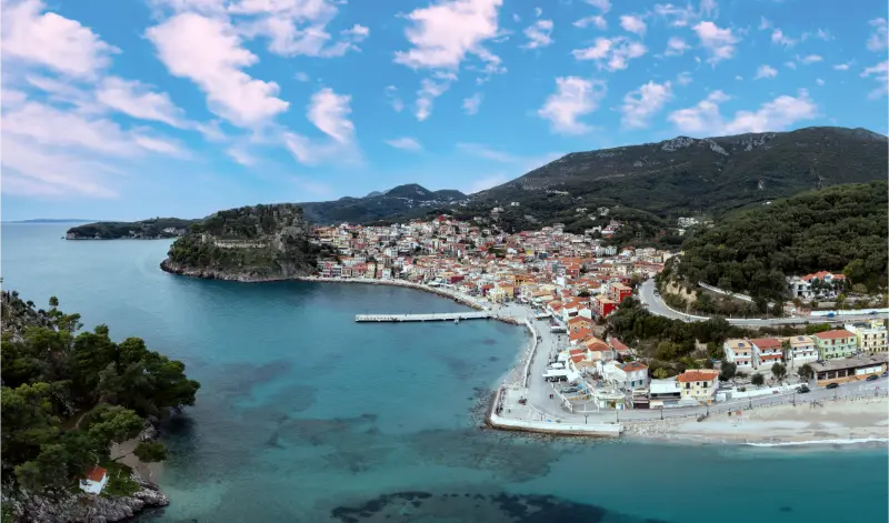
    Parga looks like an island town but sits on the mainland coast of Epirus. Colourful houses climb a hillside above a small harbour, a castle crowns the headland and beaches curve away on both sides. That combination makes Parga especially useful for travellers who want Ionian scenery without depending on a ferry for every movement.

    The town can be busy in summer, but the setting is genuinely beautiful and the mainland location opens up excellent day trips. You can spend one day on Valtos Beach, another on a boat to Paxos and Antipaxos, and still drive inland toward Ioannina or Zagori. Parga works best when you combine sea time with at least one exploration day.

    Where to stay in Parga

    The old town and harbour are ideal if you want to walk to restaurants and enjoy evenings without a car. The trade-off is stairs, limited parking and noise in the busiest weeks. Valtos gives you easier beach access and a little more space while remaining within walking distance of the castle area.

    Lichnos and other nearby coastal areas suit travellers who prefer a quieter resort base and do not mind using a car or taxi for evenings. Before booking, look carefully at elevation. A property that appears close to the waterfront may involve a steep climb.

    Parga Castle

    The castle occupies the headland between the town and Valtos Beach, creating one of the best viewpoints in the area. The site reflects centuries of strategic competition on the Ionian coast, with Venetian influence strongly associated with its present form.

    Visit early or late to avoid the hottest climb. The surrounding lanes and viewpoints are as enjoyable as the ruins themselves, so allow time to wander rather than treating the castle as a quick photo stop.

    Valtos Beach

    Valtos is the main large beach beside Parga and is easy to combine with the castle. It has organised sections, water activities and enough space that different parts of the beach feel slightly different.

    You can walk from town over or around the headland, use a water taxi when operating, or drive. If you are staying centrally, walking or boat access usually removes the parking problem.

    Lichnos and other beaches

    Lichnos lies farther south and has a broad bay with clear water and facilities. Sarakiniko, farther northwest, is another popular excursion. Small coves around the coast can be reached by boat or road depending on location.

    Do not plan a beach-hopping marathon. Parga is at its best when you choose one beach and stay long enough to swim, eat and relax. Check wind and sea conditions before paying for a boat transfer.

    Boat trips to Paxos and Antipaxos

    Day cruises from Parga commonly visit the Ionian islands of Paxos and Antipaxos, often including sea caves and swimming stops. They are popular for good reason, but itinerary quality depends on boat size, weather and how much time is spent in each port.

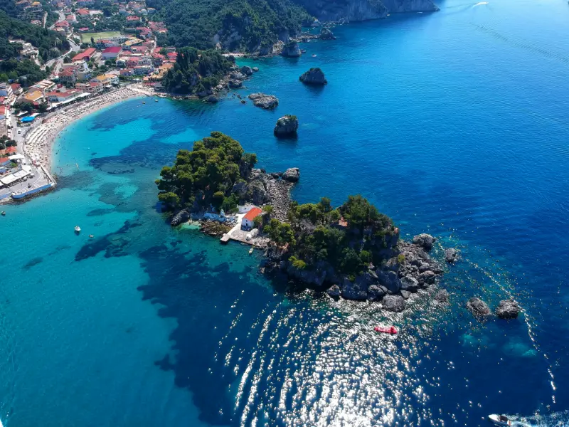
    Parga Epirus Greece Aerial Drone View Waterfront Ionian City Coastal Road Transparent Sea

    Read the actual route before booking. A long list of stops can mean very little time ashore. If Paxos is a major priority, consider staying there separately rather than seeing it only from a crowded day boat.

    Old town and evenings

    Parga’s narrow lanes rise behind the waterfront and fill with shops, restaurants and bars. The harbour is busiest after sunset, when visitors return from beaches. Walk uphill for quieter terraces and better views.

    The town is romantic but also practical, with supermarkets, pharmacies and tour operators. This makes it easy for families and independent travellers who do not want an isolated resort.

    Parking and driving

    The historic centre is not designed for large volumes of cars. Public parking areas exist, but spaces can fill in peak periods. If you arrive by rental car, choose accommodation with clear parking instructions and avoid trying to improvise in narrow lanes.

    A car is useful for Lichnos, Sarakiniko and inland trips, but you do not need it for every day if you stay centrally. Park once and enjoy walking whenever possible.

    A four-day Parga itinerary

    Day one: settle in, explore the old town and walk up to the castle near sunset. Day two: spend most of the day at Valtos Beach. Day three: take a boat excursion to Paxos and Antipaxos if sea conditions are good. Day four: choose Lichnos, Sarakiniko or an inland excursion depending on your interests.

    With a week, add a night or two in Ioannina or Zagori rather than filling every Parga day with another boat trip. The coast and mountains complement each other beautifully.

    Best time to visit

    June and September are excellent for warm sea and somewhat lighter crowds. July and August are lively, hot and busy, with the widest choice of excursions. May and October can be attractive but boat services are more weather-dependent.

    Because Parga is on the mainland, it can also form part of a spring road trip when island ferry schedules are less convenient. Swimming may be cooler, but sightseeing and driving are pleasant.

    Who Parga suits

    Parga is excellent for couples and families who want a pretty walkable town with easy beaches and lots of restaurants. It also suits road trippers who want to combine the Ionian coast with inland Epirus.

    If you are looking for total isolation, the central harbour will feel too busy in high season. Stay outside town or visit in shoulder season for a quieter version of the experience.

    Small Island Across Parga Greece

    Frequently asked questions

    How many days do I need in Parga?

    Four days is enough for the town, castle, two beach experiences and a boat trip. A week works well if you want slower beach days.

    Is Parga on an island?

    No. Parga is on the mainland coast of Epirus, although its colourful harbour and Ionian setting often feel island-like.

    Do I need a car?

    Not for a short central stay. A car becomes useful for farther beaches and inland day trips.

    Can I visit Paxos from Parga?

    Yes. Seasonal boat excursions commonly operate to Paxos and Antipaxos, subject to weather and operator schedules.

    Planning Parga in practice

    Peak-summer Parga is easier if you accept that the historic centre belongs to pedestrians. Arrive, park where your accommodation recommends and leave the car alone. Trying to move it for every meal or beach can waste more time than walking or using a water taxi.

    For boat excursions, compare vessel size and itinerary rather than shopping only by price. A smaller boat may feel more personal but react more to rough sea; a larger boat can be comfortable yet crowded. Ask how much actual time is spent on Paxos and at swimming stops.

    If you are combining Parga with the mountains, pack for two climates. Beach days may be hot and humid, while evenings in Zagori can feel cool. A light jacket and proper walking shoes make the transition much easier.

    Parga can also be used as a rest stop after a mainland road trip. If you have already driven through archaeological sites and mountain villages, schedule one full day with no excursion at all. A slow morning, Valtos swim and dinner by the water may be the most restorative part of the itinerary.

    Families should check beach access and hotel stairs carefully. Parga can be easy with children when based near Valtos or the waterfront, but a steep hillside property can make every outing feel unnecessarily complicated.

    Travel days also deserve their own space in the itinerary. Leave time for breakfast, packing, transfers and delays instead of counting a ferry or drive as invisible time. This simple adjustment makes the entire Greece trip feel calmer and more realistic.

    Parga Epirus Greece

    Families should check beach access and hotel stairs carefully. Parga can be easy with children when based near Valtos or the waterfront, but a steep hillside property can make every outing feel unnecessarily complicated.

    Travel days also deserve their own space in the itinerary. Leave time for breakfast, packing, transfers and delays instead of counting a ferry or drive as invisible time. This simple adjustment makes the entire Greece trip feel calmer and more realistic.

    Families should check beach access and hotel stairs carefully. Parga can be easy with children when based near Valtos or the waterfront, but a steep hillside property can make every outing feel unnecessarily complicated.

    Travel days also deserve their own space in the itinerary. Leave time for breakfast, packing, transfers and delays instead of counting a ferry or drive as invisible time. This simple adjustment makes the entire Greece trip feel calmer and more realistic.

    Families should check beach access and hotel stairs carefully. Parga can be easy with children when based near Valtos or the waterfront, but a steep hillside property can make every outing feel unnecessarily complicated.

    Travel days also deserve their own space in the itinerary. Leave time for breakfast, packing, transfers and delays instead of counting a ferry or drive as invisible time. This simple adjustment makes the entire Greece trip feel calmer and more realistic.

    Families should check beach access and hotel stairs carefully. Parga can be easy with children when based near Valtos or the waterfront, but a steep hillside property can make every outing feel unnecessarily complicated.

    \n

    For more coastal Epirus beyond Parga, continue with the Acheron River guide and our Syvota guide.

    \n

    For a quieter river-and-sea day nearby, use our Ammoudia and Acheron estuary guide.

    If you want a long sandy beach base outside town, compare Parga with our Vrachos and Loutsa beach guide.

    Continue planning with our new Epirus guides: where to stay in Parga, Parga with kids, best beaches in Epirus.

  • Ikaria Hiking Guide: Halari Gorge, Randi Forest, Waterfalls and Mountain Trails

    Ikaria Hiking Guide: Halari Gorge, Randi Forest, Waterfalls and Mountain Trails

    Ikaria is one of the strongest hiking islands in the eastern Aegean because its interior is far greener and wetter than the stereotypical dry Greek-island landscape. Trails pass through pine forests, ravines, streams, old terraces, stone bridges and high villages before dropping to beaches. The terrain is also demanding: summer heat, sudden exposure, poor phone signal and route maintenance can turn a pleasant walk into a serious problem if you treat it like a seaside stroll.

    Halari Gorge and the Nas-Raches area

    The Halari landscape near Nas and Raches is the island’s best-known walking zone. Paths follow wooded ravines, watercourses and old routes between mountain villages and the coast. Depending on season, you may encounter pools, small waterfalls, stone bridges and dense vegetation that feels very different from Ikaria’s exposed ridges.

    Do not assume every online GPS track is current. Winter storms, vegetation, landslides and local maintenance can change a route. Ask accommodation hosts or local walking groups about conditions and turn back when a trail becomes unclear instead of pushing through private land or unstable ground.

    Randi Forest and ancient trees

    The Randi Forest is one of Ikaria’s distinctive natural areas, known for old oak woodland and a landscape that has survived in pockets despite centuries of human use and grazing. It deserves a slow, low-impact visit rather than being treated as a backdrop for off-road driving.
    Fire risk is the central summer concern. Follow any access restrictions, never smoke on dry trails and do not park a hot vehicle over dry grass. On extreme fire-weather days, choose a village, museum or beach plan instead of insisting on a forest hike.

    Waterfalls and seasonal water

    Ikaria’s official tourism material highlights waterfalls, streams and small lakes, but water levels change dramatically with season. A waterfall shown as powerful in a spring photograph may be reduced to a trickle in August. That does not make the walk worthless; it simply changes the experience.

    Never jump into an unfamiliar pool. Depth, submerged rock and water quality vary, and flash runoff can alter a basin. If locals advise against swimming, take that seriously.

    Village-to-village walking

    Some of the most satisfying hikes connect settlements rather than chasing a single attraction. Raches, Nas, Karavostamo and surrounding villages are linked by old paths and minor roads that reveal how people moved before the modern road network. These routes also make it easier to finish with food, water or a taxi rather than ending in an isolated valley.

    Point-to-point walks require transport planning. Do not assume a bus or taxi will appear at the finish. Arrange a pickup, use two vehicles or choose a loop when possible.

    South and central Ikaria

    The south has excellent walking too, including routes above Agios Kirykos, around Perdiki and through the central mountain villages. The scenery can be more exposed, with broad views over the Ikarian Sea and dramatic transitions from scrub to wooded valleys.

    Perdiki is specifically noted in official tourism material for trails through a lush canyon. Use local route information because signage and maintenance can differ from heavily marketed European trail networks.

    Heat, wind and timing

    In July and August, start substantial hikes near sunrise and aim to be off exposed sections before midday. Strong wind can reduce the feeling of heat while increasing dehydration, so drink on schedule rather than waiting to feel thirsty. Carry more water than a map distance alone suggests because climbing and rough surfaces slow progress.

    May, June, late September and October are usually more comfortable for longer walks. Winter brings water and green landscapes but also storms, slippery ground and fewer visitor services.

    What to carry

    • Trail shoes or hiking shoes with reliable grip.
    • Offline map plus a backup battery or second navigation method.
    • At least 1.5–2 litres of water for a substantial warm-weather walk, often more.
    • Sun hat, sunscreen and light long sleeves.
    • Snacks with salt and carbohydrates.
    • Small first-aid kit, blister care and personal medication.
    • Headlamp for any route where delays could push you toward dusk.
    • A lightweight layer because wind and high villages can feel cooler than the beach.

    Walking with children

    Choose short village paths, forest sections with clear exits and routes that end at a beach or café. Children often cope well with distance but poorly with repetitive exposure and heat. Make the objective tangible and stop before everyone is exhausted.

    Avoid rough gorge sections with scrambling unless the child has relevant experience and the route is known to be suitable. Online descriptions such as “easy” are subjective and often written by experienced hikers.

    Navigation and rescue reality

    Phone reception can be inconsistent in ravines and remote western areas. Tell someone your route, expected return time and vehicle location. Save emergency numbers offline and carry identification. If weather, fire restrictions or route uncertainty change the risk, turn around early.

    Using a certified local guide is sensible for ambitious routes, unfamiliar gorge terrain or travellers who want natural and cultural interpretation rather than simply following a GPX line.

    A three-walk plan

    1. Walk 1: a shorter Raches or Halari route early in the trip to understand local terrain.
    2. Walk 2: a village-to-village route with a planned taxi or car pickup.
    3. Walk 3: a central or southern trail chosen according to heat, wind and current maintenance reports.

    Booking accommodation and activities

    For accommodation, compare places to stay in Ikaria on Booking.com. Always check the exact village and road access before booking. A property described simply as “Ikaria” can be an hour or more from the beach, port or village you expect to use most.

    Turquoise Mesakti Beach Bay With Analipsi Chapel Ikaria Island Greece Sunlight

    For organised activities and excursions, use the widget below as a starting point. Ikaria has a smaller organised-tour market than Santorini, Rhodes or Crete, so availability can be seasonal. Verify the meeting point, transfer arrangements and cancellation terms before paying.

    Official resources to recheck before you go

    For a broad official destination overview, use Visit Ikaria and the Municipality of Ikaria. Both are useful for checking local notices, villages, beaches, museums and seasonal information close to your trip.

    For village geography, the official Visit Ikaria village directory is especially useful because Ikaria is not organised around one resort strip: the island has many scattered settlements and travel times are longer than the map first suggests.

    Visit Greece’s official Ikaria hiking page highlights Halari gorge, Randi Forest, waterfalls and paths connecting Nas, Raches and other villages. Use it as inspiration, then verify route condition locally.

    Continue planning your Ikaria trip

    Trail etiquette around farms

    Old paths can pass beside grazing land, gardens and houses. Close gates, keep dogs under control and never harvest fruit or herbs without permission. A trail being public does not make the surrounding land public.

    Goats and dogs can appear unexpectedly. Slow down, give animals space and avoid running directly toward livestock guardian dogs.

    After rain

    Rain can transform dry paths into slippery rock and can raise water levels in gorges. Check the forecast for the whole catchment, not only the village where you start.

    If a stream crossing looks stronger than expected, turn around. A hike is optional; a flooded crossing is not a test of commitment.

    Planning by season

    May and early June favour walking, green landscapes and quieter villages, but some seasonal beach businesses operate shorter hours. July and August bring the widest choice of accommodation, food and festival activity along with stronger heat, wind, traffic and booking pressure. September often offers the best balance of warm sea, active villages and easier roads. October can be rewarding for slow travel, but ferry frequency and seasonal restaurants require more checking.

    Whatever the month, build each day around the actual wind and temperature. Ikaria is large enough that a fixed itinerary can create unnecessary driving when the north coast is rough or the mountains are hot. Keeping one flexible half-day is more useful than adding another attraction to a crowded schedule.

    Common planning mistakes

    The most common mistake is treating map distance as travel time. Mountain bends, village traffic, ferry arrivals and spontaneous stops slow every journey. Choose one main part of the island per day and resist adding a distant beach simply because it appears only thirty kilometres away.

    Another mistake is relying on a single old timetable or social-media post. Ferries, buses, museum hours and festival confirmations change. Recheck anything time-critical close to travel and ask locally when conditions matter more than a published schedule.

    How to keep the day realistic

    Ikaria works best when you choose one main purpose for each day and let secondary stops remain optional. A beach day can include one village and dinner; a hiking day can finish with a swim; a port day can include a museum and nearby meal. Trying to combine the north coast, Raches, Therma and a sunset stop in one circuit creates more road time than experience.

    Mesakti Sandy Beach Calm Turquoise Bay Ikaria Island Greece Swimmers Hillside Homes

    Leave enough time to stop when a bakery, viewpoint or village square looks inviting. The island rewards curiosity more than speed. If the wind, heat or ferry schedule changes, shorten the plan rather than moving every stop later into the evening. That flexibility is one of the simplest ways to make an Ikaria trip feel genuinely relaxed.

  • Ano Syros Guide: Medieval Lanes, Saint George, Rebetiko and Sunset

    Ano Syros Guide: Medieval Lanes, Saint George, Rebetiko and Sunset

    Ano Syros rises above Ermoupoli in a dense maze of steps, passages, arches and small squares. The settlement developed long before the neoclassical port below and retains a strong Catholic identity, with Saint George Cathedral crowning the hill. Visiting both towns on the same day is one of the best ways to understand how different historical layers coexist on a small island.

    This is a place to explore on foot. Cars do not solve the steepest part of the visit, and navigation apps are less useful than simply following the lanes uphill and allowing time for wrong turns. The reward is a sequence of framed views over Ermoupoli, the port and surrounding islands rather than one single “must-see” viewpoint.

    Ano Syros is also linked to rebetiko musician Markos Vamvakaris, whose life and music give the neighbourhood a cultural identity beyond architecture. Come for the lanes and sunset, but stay long enough to notice churches, courtyards, workshops and the sound of everyday village life.

    At a glance

    Best forHistory, walking, views, rebetiko, atmosphere
    Allow2–4 hours; longer with dinner
    TerrainSteep steps and stone lanes
    Best timeLate afternoon into evening
    Combine withErmoupoli and Vaporia

    Understanding the hill town

    Ano Syros was developed as a fortified medieval settlement, and its form still makes defensive sense: narrow lanes twist around the hill, houses press close together and passages open unpredictably. Rather than looking for a perfectly linear route, think of the visit as a slow spiral upward toward Saint George Cathedral.

    The settlement’s Catholic heritage is one of its defining features. Syros has long had both Catholic and Orthodox communities, and this mixture is visible in churches, festivals and local identity. Respect active places of worship and avoid entering during private ceremonies simply to photograph interiors.

    Saint George Cathedral

    Saint George, often called San Tzortzis locally, occupies the highest point and is the natural destination of the climb. The terrace and surrounding lanes provide broad views toward Ermoupoli and the sea. Even if the interior is closed, reaching the upper part of the settlement gives the walk a satisfying structure.

    Dress with church visits in mind and carry water because there are long stretches of steps with limited shade. The final climb feels more demanding in mid-afternoon heat than the distance suggests, so the late afternoon is ideal when summer temperatures are high.

    Markos Vamvakaris and rebetiko

    Markos Vamvakaris, born in Ano Syros in 1905, became one of the foundational figures of rebetiko. The small museum dedicated to him and references around the neighbourhood are a useful entry point into a musical tradition associated with urban working-class life, migration and the bouzouki.

    Even travellers who know little about Greek music can get more from the visit by listening to a few Vamvakaris recordings beforehand. The connection turns the village from a beautiful backdrop into a place associated with a specific voice and social history. Check local opening information for the museum because small cultural sites can keep seasonal hours.

    The best way to walk the lanes

    Start from the lower entrance and resist the temptation to follow only the widest path. Small alleys reveal arches, staircases, cats sleeping in shade, tiny shops and glimpses of Ermoupoli below. Keep moving generally uphill, then choose a different sequence of lanes on the descent.

    Photography is easiest when the sun drops lower and façades lose the harsh midday contrast. Do not block narrow passages for posed photos; these are residential streets. If you have mobility limitations, understand that the essential character of Ano Syros involves many steps and uneven surfaces, and plan your route accordingly.

    Sunset and evening atmosphere

    Ano Syros is a good sunset choice because the climb can end with a meal or drink rather than another transfer. Exact sunset visibility depends on the lane and season, but the wider appeal is watching Ermoupoli change colour as lights appear below. Give yourself time to choose a viewpoint rather than arriving five minutes before sunset.

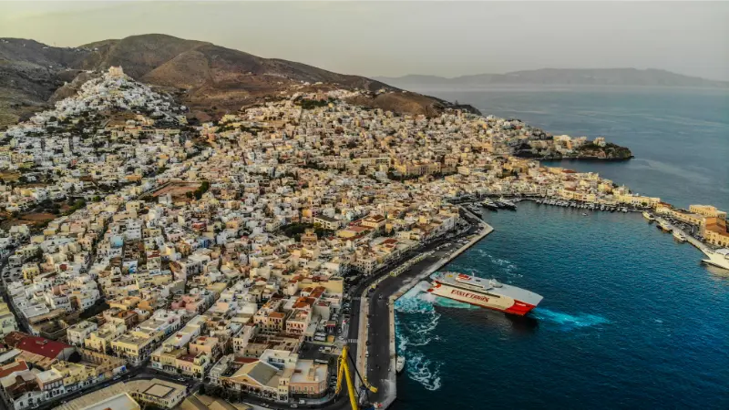
    Syros Island Hermoupolis Cityscape Panorama Aerial Drone View Greece Cyclades

    After dark the lanes become quieter and more atmospheric, but steps can be harder to judge. A phone torch is useful and shoes with grip are sensible. If you are not comfortable descending on foot, arrange a taxi connection from an accessible point rather than assuming one can reach every doorway.

    Food and an unhurried dinner

    Ano Syros works well for a dinner built around local products: Syros cheeses, louza, sausages, capers and simple plates to share. Restaurants in the hill town may have limited terraces and can fill on busy evenings, so reserve if you specifically want sunset views in peak season.

    Do not rush down to Ermoupoli immediately after the last photograph. Sitting in a small square after day visitors leave is part of the experience. If you are staying in the port, check your return route before ordering another round, especially if you rely on a taxi rather than walking.

    Combining Ano Syros with Ermoupoli

    The two towns are visually and historically complementary. Start in neoclassical Ermoupoli with Miaouli Square, the Archaeological Museum or Apollo Theatre, break for lunch, then climb to Ano Syros later. This avoids doing the steepest walk in the hottest part of the day.

    If you prefer to separate them, use one morning for museums and one late afternoon for Ano Syros. Travellers staying only two nights should still resist trying to add a distant beach between the two halves; the transition from port to hill is already a complete cultural day.

    How much time to allow

    Two to four hours works for the hill town alone; add dinner and sunset and it easily becomes a half-day experience. Syros is compact on a map, but steep streets, beach stops and meal times make a rushed schedule less enjoyable than it looks. Build the day around two or three meaningful anchors rather than a list of ten pins. That gives you room for a swim, a museum that takes longer than expected, or a bus connection that is less frequent outside the busiest summer weeks.

    If you are visiting on a day trip, identify the one experience that matters most and protect time for the return to the port. If you are staying several nights, group places by coast: Ermoupoli and Ano Syros together, Galissas with the south-west, and Kini with the west. This simple geographic approach cuts backtracking and gives every stop a more relaxed rhythm.

    Getting around and transport reality

    Taxis and local access roads can reduce the initial climb, but the core lanes are pedestrian and involve many steps. The public bus network is useful for the main settlements and beaches, but timetables are seasonal. Check the official KTEL Syros schedule shortly before travelling rather than planning from an old screenshot. Taxis are valuable for early ferries, late dinners and combinations that do not line up neatly with buses.

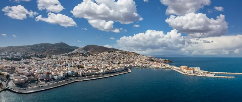
    Panoramic View Ermoupolis City Syros Island With Ferries Cruise Liners Greece

    A rental car gives more flexibility for remote coves and village combinations, but it is not automatically the best choice in Ermoupoli. Central streets can be steep, narrow and busy, and parking may be some distance from your accommodation. Travellers who stay centrally can often combine walking, buses and an occasional taxi and avoid driving every day.

    Best time of day

    Late afternoon is ideal in warm months because the climb is cooler and you can remain for sunset and dinner. In July and August, the middle of the day can feel much hotter on stone streets and exposed beaches than the air temperature suggests. Use morning for uphill walking, museums or uncrowded swimming, keep lunch unhurried, and save sunset-facing beaches or waterfront walks for later.

    Wind matters as much as temperature in the Cyclades. A beach that looks perfect in a photograph may feel very different on a strong northerly day. Keep at least one flexible beach afternoon and ask locally which coast is calmer that day; this is more useful than locking every swim into the itinerary weeks in advance.

    What to bring

    Wear shoes with grip, carry water and keep a small light for the descent after dark. Add a refillable bottle, strong sun protection, a light layer for evening wind and offline maps. Shoes with grip are much more useful than smooth sandals in Ano Syros, on polished marble steps and on rough paths to quieter coves.

    For beaches, pack a small dry bag or waterproof pouch for phones and ferry tickets. For churches and cultural sites, carry something that lets you dress respectfully without returning to your room. Families should add water shoes when children dislike pebbles and a compact shade solution for beaches with limited natural cover.

    Costs and reservations

    Walking the settlement is free; budget mainly for museum visits if open, food, drinks and possibly a taxi. Accommodation prices rise sharply around popular summer weekends, so lodging and ferry tickets deserve priority. Ordinary beach days and village walks do not need to be over-planned, and leaving some free time makes it easier to react to wind, heat and local events.

    For paid museums and attractions, confirm opening hours on the official site on the day before your visit. Small Cycladic museums sometimes close one weekday or change seasonal hours. For restaurants with a specific sunset table in mind, reserving ahead is sensible in July and August; otherwise, eating a little earlier or later usually provides more flexibility.

    How this fits into a wider Syros trip

    Start with the Syros Travel Guide for the island overview, then use Vaporia & Asteria, Galissas & Kini, Posidonia & Agathopes, Syros Food Guide, Best Beaches in Syros for the parts of the trip that need more detail. Linking the guides by geography and travel style makes it easier to plan realistic days instead of zig-zagging across the island.

    Tours and activities

    If you want a guided experience, boat trip or organised activity, compare what is available for your exact dates. Check the meeting point, cancellation terms, language, duration and what is included before booking; on an island, wind can also affect marine activities.

    Common mistakes to avoid

    • Starting the steep walk at the hottest hour.
    • Expecting a completely step-free route.
    • Visiting only for a sunset photo and missing the cultural context.
    • Blocking residential lanes for photographs.
    • Assuming a taxi can stop beside every accommodation or restaurant.

    Frequently asked questions

    How long does Ano Syros take?

    Allow at least two hours, and three to four if you want the museum, churches, photos and a relaxed meal.

    Can you walk from Ermoupoli?

    Yes if you are comfortable with a sustained uphill climb and many steps; a taxi can shorten the approach.

    What is Ano Syros known for?

    Its medieval hill-town form, Catholic heritage, Saint George Cathedral and connection with rebetiko musician Markos Vamvakaris.

    Is it good for sunset?

    Yes, especially when paired with dinner, although the exact view depends on the street and season.

    Is it suitable with a stroller?

    The many steps make a stroller impractical for much of the historic core.

    Final practical advice

    Treat Ano Syros as a living hill town, not just a viewpoint above Ermoupoli. Climb slowly, listen to some Vamvakaris before you go, step into the churches respectfully and stay into the evening if your schedule allows. The contrast with the grand port below is one of the clearest reasons to spend more than a beach weekend on Syros.

  • Evia with Kids: Family Beaches, Easy Sights, Road Trips and Practical Tips

    Evia with Kids: Family Beaches, Easy Sights, Road Trips and Practical Tips

    Evia can be one of the easiest Greek islands for a family road trip because you can drive across the bridges at Chalkida without coordinating a ferry on arrival. That flexibility matters with children: snacks, naps, luggage and unexpected stops are simpler when the car remains part of the trip. The challenge is the island’s size. Trying to “see Evia” from one base creates long days that are not especially child-friendly.

    I would plan a family trip around two compact regions rather than a giant loop. Central Evia plus the north works well, as does central Evia plus Karystos in the south. Choose beaches for access and sea conditions rather than fame, and leave enough free time for the days when everyone prefers the pool or a second swim.

    Best family bases

    Eretria is a practical all-round base because it combines a walkable waterfront, archaeology, beaches and proximity to Chalkida. Edipsos works for a north-Evia stay, while Karystos gives families a useful southern town with services and beaches.

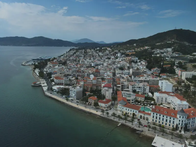
    Edipsos Evia Greece

    Remote villas can be wonderful if you want privacy, but check driving time to a supermarket, pharmacy and evening restaurants. A spectacular view loses some appeal when every forgotten item requires a 30-minute mountain drive.

    Chalkida with children

    The Euripus Strait gives Chalkida an unusual natural phenomenon that children can actually watch rather than simply read about. The waterfront is easy for an evening walk, and cafés make breaks simple.

    Karababa Castle adds views and a little history, but summer heat can make exposed climbs unpleasant. Use mornings for sightseeing and late afternoon for the waterfront.

    Eretria archaeology without overload

    Ancient Eretria can introduce children to archaeology without the scale and crowds of the Acropolis. Keep the visit short, use the museum for context and turn the rest of the day into beach time.

    Bring hats and water. Archaeological sites often have uneven ground, so a lightweight stroller may be less useful than expected; check access needs if travelling with a toddler.

    Edipsos and thermal water

    Edipsos is interesting because hot mineral water reaches the coast in places, but thermal water is not automatically appropriate for young children or for long immersion. Temperatures vary and spa facilities may have age or health rules.

    Waterfront Spa Resort Town Loutra Edipsou Island Evia Greece

    Treat the thermal element as something to investigate responsibly rather than a guaranteed children’s activity. Ask the facility, follow local signage and keep ordinary sea swimming as the main family plan.

    Choosing family beaches

    For younger children, prioritise shelter, easy entry, nearby shade and a short walk from the car. Gulf-facing beaches may be calmer on many days than the open Aegean side, though conditions always change.

    Bring water shoes for pebbles and check wind before driving to exposed beaches such as Chiliadou or long east-coast shores. If the sea looks rough, change plans without hesitation.

    Chiliadou Beach Evia Greece

    Road-trip rhythm with kids

    Limit major drives to one per day and combine them with a clear reward: a beach, boat trip, castle or lunch stop. Schedule around naps where possible and avoid adding a “quick” mountain detour late in the afternoon.

    The best family itinerary is rarely the one with the most places. Two bases, several flexible beach days and one or two memorable excursions will usually feel richer than a daily packing-and-driving routine.

    How much time should you allow?

    For Evia with kids, I would allow at least a full day if you are visiting from another part of Evia, and longer when the area itself is your base. Evia’s distances are deceptive because many roads cross mountains or follow indented coastlines. A schedule that looks efficient in kilometres can become rushed once you add parking, lunch, swimming and photo stops.

    If you have only one day, choose two priorities and leave the rest for another trip. With two or three days, you can add a slower beach afternoon, a local dinner and one inland or cultural excursion. That extra time is usually what turns an Evia visit from a driving exercise into an actual holiday.

    Best time to visit

    Late spring and early autumn are excellent for road trips because temperatures are usually more comfortable for walking and driving. July and August bring the warmest sea and the widest range of seasonal beach services, but also stronger sun, busier weekends and higher fire risk in dry landscapes.

    For hiking or exposed archaeological sites, start early even outside peak summer. For beach days, check wind as well as temperature: the Aegean coast can be rough while the gulf side is comfortable, or vice versa. In winter, Evia remains accessible by road, but seasonal accommodation, boat trips and beach businesses may close.

    Getting around this part of Evia

    A rental car is the most useful tool for exploring Evia beyond the main towns. Public buses connect important settlements, but they are not designed around a visitor trying to combine remote beaches, trailheads and villages in one day. Taxis work well for specific transfers but become expensive as a substitute for a car over long distances.

    Download offline maps before crossing the mountains, keep fuel above half a tank on remote drives and avoid planning unfamiliar rural roads after dark. If you are renting in Athens, check the company’s rules before taking the vehicle on any ferry route. Road conditions and temporary closures should be verified locally after severe weather or during periods of high fire danger.

    Where to stay and booking strategy

    For live availability, compare accommodation across Evia on Booking.com. On this island, the map pin matters as much as the hotel rating. A property advertised under a well-known town name may be several kilometres away on a hillside or rural coast.

    Before paying, check parking, road access, walking distance to dinner and whether air conditioning is included. If you are building a road trip, choose accommodation that shortens the next day’s drive instead of returning to the same base purely out of habit. Two well-chosen bases usually beat one central-looking base for a week.

    Eating well without overplanning

    Evia rewards simple meals: grilled fish on the coast, meat and pies in mountain villages, salads, local cheese, honey, figs and olive-oil-based dishes. Ask what is fresh and regional rather than ordering only the same famous Greek dishes at every stop.

    For restaurants that matter to you, book ahead on summer weekends. Otherwise, keep some flexibility and eat where the day naturally ends. Long evening drives on mountain roads are rarely worth it just to reach a restaurant with a slightly higher online score.

    Common planning mistakes

    • Treating North Evia, central Evia and South Evia as if they were one compact resort area.
    • Ignoring wind and sea conditions when choosing an Aegean-facing beach.
    • Scheduling a remote beach, a mountain hike and a long transfer on the same day.
    • Following an old boat or bus timetable without checking the current season.
    • Underestimating summer heat, fire restrictions and the lack of shade at exposed sites.
    • Booking accommodation without checking its exact road access and parking situation.

    A simple one-day plan

    Start early and make the main purpose of the day Evia with kids. Use the coolest morning hours for walking, archaeology or driving to a viewpoint. Break for a long lunch rather than adding another distant attraction, then use the afternoon for a swim, an easy town walk or a short coastal stop.

    Keep the last hour flexible. If the weather is good, stay for sunset or another swim. If wind rises or everyone is tired, return to your base before dark. This flexibility is especially valuable in Evia, where the best days often come from doing less driving than you originally planned.

    Useful official information

    For destination background, start with Visit Greece. For mountain routes around Steni, the official tourism site also publishes descriptions of the marked trail network and the Stropones Gorge. Always recheck opening hours, local transport, ferry departures and seasonal boat trips close to your travel date.

    Weather and fire-risk information are particularly important for mountain and forest areas. If a road, trail or beach access is officially closed, do not bypass barriers because an older map suggests a route continues.

    Tours and activities

    Organised experiences on Evia are more seasonal than on Santorini or Mykonos. The widget below is useful for checking whether boat trips, outdoor activities, food experiences or transfers are available on your dates. Verify meeting points and cancellation terms before paying.

    Continue planning your Evia trip

    Final advice

    Evia with Kids works best when it is treated as part of Evia rather than an isolated attraction. Build the day around realistic road times, weather and one or two strong experiences. The island’s advantage is variety: when wind, heat or energy levels change, you can often switch from beach to village, mountain to waterfront, or archaeology to a long lunch without wasting the day.

    The most useful habit is to check tomorrow’s conditions each evening. Ten minutes spent confirming weather, transport and opening information can save hours of unnecessary driving. Leave room to change your mind, because Evia is large enough to reward a second trip rather than a first trip overloaded with every possible stop.

  • Where to Stay in Tilos: Livadia, Megalo Chorio, Eristos or Agios Antonios?

    Where to Stay in Tilos: Livadia, Megalo Chorio, Eristos or Agios Antonios?

    Choosing where to stay on Tilos is less about finding the island’s single ‘best’ village and more about deciding how much transport you want in your day. Livadia is the practical hub, Megalo Chorio offers a traditional inland setting, Eristos puts the main sandy beach close at hand, and Agios Antonios is for travellers who actively want isolation. Because the island is small, every choice can work, but the wrong base can create unnecessary bus and taxi planning.

    Use this article together with my Tilos travel guide. Tilos is small, but the combination of limited public transport, summer heat, rough walking terrain and seasonal services means that good timing matters more than raw distance.

    Why this deserves its own place in a Tilos itinerary

    Tilos is one of the quieter islands of the Dodecanese, and its strongest experiences are distributed rather than concentrated in one resort zone. Livadia provides the port and daily services, Megalo Chorio carries much of the historic identity, Eristos opens onto a fertile valley and sandy bay, and the western road leads toward older harbours, beaches and the monastery. The result is an island that rewards one focused objective per half-day instead of constant movement.

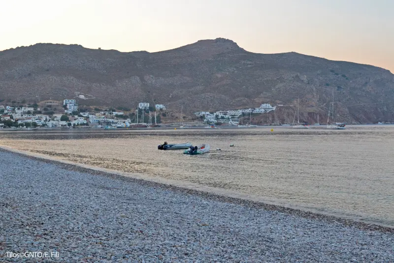
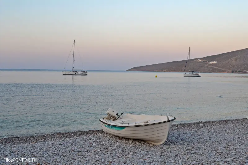
    Tilos

    The municipality also promotes the island for its ecological character, birdlife, flora, medieval remains and the fossil record of dwarf elephants. That diversity is why staying several nights produces a much richer experience than stepping off a ferry, seeing one attraction and leaving again.

    Livadia: best for first visits, no-car trips and short stays

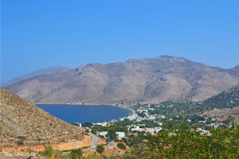
    Livadia is where ferries arrive and where the widest mix of accommodation, restaurants, shops and transport services is concentrated. The village beach begins beside the settlement, so you can swim without organising a day trip. For three or four nights, especially without a car, this convenience is difficult to beat.

    The trade-off is that Livadia feels more functional and active than the inland villages. You see ferry arrivals, port movement and more visitors. If you dream of opening your door onto complete rural silence, choose elsewhere. Within Livadia, however, small differences matter: the port end is best for luggage, the central waterfront for dining, and slightly elevated streets for views and quieter nights.

    Megalo Chorio: best for traditional atmosphere and west-side access

    Megalo Chorio sits below the castle and above Eristos Valley. It is a strong base for travellers who want village architecture, archaeology and easier access to the west side of Tilos. Evenings can feel quieter and more local than the port, and the landscape around the village is one of the island’s most distinctive settings.

    You give up immediate ferry and beach convenience. Restaurants are fewer and an early departure may require a taxi or carefully timed bus. A car makes Megalo Chorio much easier, but it is not mandatory if you are comfortable planning around public transport. Check whether your room is near the road or reached by steps.

    Eristos: best for a slow sandy-beach holiday

    Eristos is the island’s main sandy beach and a compelling choice if your ideal holiday is built around swimming, reading and long, low-key days. The fertile valley behind the shore makes the setting feel different from the dry hills elsewhere. Staying nearby can also reduce the need to carry beach gear on the bus every day.

    The compromise is service density. Livadia has more restaurants, shops and transport choices, and ferry logistics are simpler there. Eristos works best for travellers who are happy eating locally, preparing some meals themselves or using a vehicle. Outside peak summer, verify which businesses near the beach will be operating during your exact dates.

    Agios Antonios and the west: best for maximum quiet

    Agios Antonios is a small former harbour with a fishing-port feel and access toward Plaka and Agios Panteleimon. It is the choice for travellers who genuinely want to wake up away from the island’s main activity. The west side can feel spacious and beautifully detached from ferry schedules.

    That detachment is also the disadvantage. Accommodation and dining choice is limited, and spontaneous transport is harder. Do not book here simply because a room looks picturesque online. Make sure you understand how you will reach groceries, dinner, the port and the rest of the island, particularly if you are not renting a car.

    How to choose by travel style

    Without a car, choose Livadia. With young children, Livadia is usually easiest, while Eristos appeals if sand is the top priority and transport is arranged. Couples seeking a traditional setting may prefer Megalo Chorio. Hikers benefit from Livadia for the Lethra trail and from Megalo Chorio for the castle and west side. Travellers staying only two nights should avoid wasting time on repeated transfers and stay near the port.

    For a week, splitting the stay can make sense only if you want two genuinely different experiences, such as four nights in Livadia and three near Eristos or Megalo Chorio. The island is small enough that moving hotels is not necessary for sightseeing. Do not split simply because the map shows multiple villages; packing and check-in time can cost more than a bus ride.

    Getting around for this experience

    Livadia is the transport hub. The municipal bus has connected Livadia with Megalo Chorio, Eristos and Agios Antonios, but published timetables can change by season and year. Check the current schedule on arrival instead of planning around an old screenshot. Taxis are valuable for the monastery, sunset returns, luggage and ferry-critical journeys.

    A rental car or scooter adds flexibility for the west side and remote road-access beaches, but it is not essential for a short trip based in Livadia. If you rent, confirm fuel arrangements, parking and insurance, and do not take a standard vehicle onto rough tracks simply because an online map shows a route.

    Where to stay

    For most readers, the simplest recommendation is Livadia first, then Megalo Chorio if atmosphere matters more than convenience. Eristos is a specialist choice for beach-centred stays, and Agios Antonios suits experienced independent travellers seeking quiet. Always check the final walk from road to accommodation, air conditioning or fan arrangements, kitchen facilities if important, and transport for arrival and departure.

    A realistic way to plan the day

    • Choose Livadia for stays of three nights or fewer.
    • Choose Megalo Chorio if you have four or more nights and enjoy inland village life.
    • Choose Eristos when the beach is the main purpose of the trip.
    • Choose Agios Antonios only after confirming transport and food logistics.
    • Avoid changing hotels unless a week-long trip genuinely benefits from two different atmospheres.

    Treat this sequence as a framework, not a rigid timetable. Wind, ferry arrivals, bus changes, heat and seasonal opening hours can alter the best order. Tilos is small enough that a flexible plan usually works better than trying to force every stop into a pre-written schedule.

    Tilos

    Best time for this part of Tilos

    May, June, September and early October are especially comfortable for travellers who want walking, villages and beach time in the same trip. July and August bring the most dependable summer atmosphere and the greatest chance that seasonal businesses are open, but they also require stricter heat management. Spring is excellent for flowers and greener landscapes; autumn can still be warm while feeling calmer.

    Outside the main summer season, verify ferries, buses, restaurants and museum access before building a tight itinerary. A place being marked on a map does not guarantee that visitor services operate daily in every month.

    What to pack

    • Shoes with grip for stone lanes, castle paths and rough trails.
    • A refillable water bottle plus extra water for remote beaches or walks.
    • High-SPF sunscreen, sunglasses and a secure sun hat.
    • Water shoes if you prefer easier entry on pebbly beaches.
    • Offline maps, a charged phone and a small power bank.
    • A light layer for breezy ferry crossings and evenings.

    Common mistakes to avoid

    • Choosing only by sea view without checking stairs or road access.
    • Assuming every village has the same restaurant and shop choice.
    • Booking the west side without a plan for the ferry port.
    • Splitting a short stay between multiple bases.
    • Ignoring seasonal closures near beaches outside high summer.

    More Tilos guides

    Livadia Tilos Guide: Port, Beach, Waterfront, Food and Where to Stay; Megalo Chorio Tilos Guide: Castle, Dwarf Elephant Museum, Eristos Views and Where to Stay; Mikro Chorio Tilos Guide: Abandoned Village, Sunset, History and How to Visit; Charkadio Cave and Tilos Dwarf Elephants Guide: Fossils, Museum and Visiting Tips; Agios Panteleimon and West Tilos Guide: Monastery, Agios Antonios, Plaka and Scenic Stops; Best Beaches in Tilos: Eristos, Livadia, Plaka, Lethra, Skafi, Tholos and Quiet Coves; Tilos Hiking Guide: Best Trails, Castle, Lethra, Mikro Chorio and Safety; Tilos Without a Car: Buses, Walking, Taxis, Boats and the Best Base; Tilos with Kids: Family Beaches, Easy Villages, Dwarf Elephants and Practical Tips; Where to Stay in Tilos: Livadia, Megalo Chorio, Eristos or Agios Antonios?; Tilos Travel Guide.

    Frequently asked questions

    What is the best area for a first visit to Tilos?

    Livadia is the easiest because it combines the ferry port, beach, restaurants, shops and public transport.

    Where should couples stay?

    Livadia works for convenience; Megalo Chorio is better for a quieter traditional-village atmosphere.

    Where should families stay?

    Livadia is usually simplest. Eristos is attractive if a sandy beach matters most and you have suitable transport.

    Is it worth staying in Agios Antonios?

    Yes for travellers seeking maximum quiet, but only if you are comfortable with fewer services and more transport planning.

    Official information to check before you go

    For current village, trail, beach and local-transport information, check the Municipality of Tilos. For wider destination information, see the official Visit Greece page for Tilos. Ferry, bus and seasonal business details should always be confirmed for your exact dates.

    Final planning advice

    Tilos works best when you leave space in the itinerary. Choose a village, beach, walk or cultural site as the main purpose of each half-day, keep the hottest hours lighter, and use local transport strategically instead of trying to cover the entire island continuously. That slower structure is not a compromise; it is the travel style that lets Tilos make sense.

    Tilos
  • Koufonisia Travel Guide: Chora, Pori, Italida, Fanos and Kato Koufonisi

    Koufonisia Travel Guide: Chora, Pori, Italida, Fanos and Kato Koufonisi

    Koufonisia are the best-known members of the Small Cyclades, and that popularity changes the experience. Ano Koufonisi combines tiny-island distances with a surprisingly polished summer tourism scene: sandy beaches, restaurants, boutique rooms and paths that let you walk from Chora toward one swimming stop after another. Kato Koufonisi, separated by a narrow stretch of sea, remains far less developed and is normally experienced by boat. Visit Greece notes that Pano and Kato Koufonisi lie only about 200 metres apart at their closest point, yet they feel very different once you step ashore.

    Quick planning table

    Main villageChora
    Signature beachPori
    Best forSandy beaches, walking, lively slow travel
    Ideal first stay3–5 nights
    Car essential?No

    Chora and the port

    The ferry arrives below Chora, where whitewashed lanes, the church of Agios Georgios, bakeries, restaurants and accommodation cluster within easy walking distance. The scale is immediately reassuring: you can arrive as a foot passenger, walk to many rooms and be eating beside the sea without arranging a car. Chora is also where the island’s evening energy concentrates.

    Stay close to Chora if you want restaurant choice and simple ferry logistics. If you book farther east toward the beaches, check the exact walking route and luggage transfer. Distances are short, but midday sun and rolling bags over uneven surfaces can make a ‘ten-minute walk’ feel much longer.

    The east-coast beach walk

    The classic Koufonisia day is a walk east from Chora through a sequence of beaches and coves. Finikas, Fanos and Italida are the best-known sandy stops before Pori. Because the island is compact and relatively flat, you can decide in real time how far to continue rather than committing to one beach by car.

    This flexibility is also the solution to crowds. If the first famous beach feels busy, keep walking and reassess. Carry water and sun protection, because even easy walking becomes tiring in July heat. Beach facilities and boat shuttles are seasonal, so do not leave all logistics to the last departure of the day.

    Pori and the sea caves

    Pori is the beach that often becomes the visual shorthand for Koufonisia: a broad, pale sandy bay with clear turquoise water. Nearby geological formations and sea caves add interest to the coastal walk, but conditions around rocks depend heavily on swell and wind. Never treat a social-media photo taken in flat water as proof that a cave or rocky inlet is safe on your day.

    Arrive early if photography or a quieter swim matters. If the wind is pushing directly into the bay, ask about alternatives rather than forcing the plan. The island is small enough to change beaches without losing the day.

    Kato Koufonisi

    Kato Koufonisi is largely uninhabited and reached by seasonal local boats from Ano Koufonisi. The experience is deliberately simple: swim, walk, eat where seasonal options are open and return later in the day. It is not an island where you should expect the same infrastructure as Chora.

    Confirm the return schedule before wandering away from the landing point, and carry water even if a taverna is expected to open. Wind can affect boat operations. Kato Koufonisi is most enjoyable when treated as a flexible day excursion rather than an obligation squeezed between two ferry connections.

    Walking and cycling

    Visit Greece describes Koufonisia as ideal for walking and cycling because of their small size. A bicycle can reduce the effort of repeated beach runs, but walkers see the coastline at a better pace and avoid worrying about where to leave equipment. Either way, the island rewards travellers who pack light and do not build their holiday around a vehicle.

    Koufonisia From Greece

    Use footwear that handles hot surfaces and rougher coastal sections; sandals are fine for Chora but not every rocky path. If you cycle, ride conservatively around pedestrians and do not assume every lane is designed for speed. The best feature of Koufonisia is compactness, not the ability to rush.

    Food and festivals

    Fresh seafood is central to the island’s identity, and Visit Greece highlights local celebrations including Agios Georgios, the Fisherman’s Festival and the Virgin Mary festival. In peak summer, Chora has enough restaurants to support several nights of eating differently, from simple grilled fish and seafood pasta to more modern Cycladic cooking.

    Ask the price of fish or lobster sold by weight, and book only the meals that genuinely matter to you. One of the pleasures of Koufonisia is deciding late whether to stay at the beach for sunset or return to Chora, so avoid turning every evening into a reservation deadline.

    Where to stay and who should come

    Chora is the default first-choice base because ferries, food and services are close. East-coast accommodation can be excellent for beach-first travellers who do not mind walking into town. Couples and friends who want relaxed evenings will find more going on here than on the other Small Cyclades, while families benefit from sandy beaches and short distances.

    The trade-off is popularity. August can feel far removed from the image of an empty island. For a quieter version, come in June or September. Compare accommodation in Koufonisia on Booking.com.

    Practical planning: season, wind and daily rhythm

    For these islands, season changes the trip more than distance. June usually brings warm swimming weather and a calmer accommodation market, while July and August bring the fullest restaurant schedules, more visitors and stronger booking pressure. September is excellent for sea temperatures and a slower rhythm, but ferry frequency can begin to thin later in the month. Outside the core season, never assume every taverna, beach service or local transport option is operating simply because it appears on a summer map.

    The meltemi deserves respect. Strong northerly winds can change which beach is comfortable, delay ferries and make a simple boat excursion inappropriate. I prefer to decide each next day’s beach or sea activity the evening before using both a weather forecast and local advice. Keep hiking as an alternative on moderate days, but in high summer move strenuous walks to early morning and protect the middle of the day for shade, lunch or a short swim close to your base.

    Budget and booking strategy

    The Small Cyclades are not automatically cheap. Ferry tickets may be modest on local hops, but the small supply of rooms can push accommodation prices up in August. Restaurant prices also reflect island logistics and the cost of bringing supplies by sea. Save money by travelling in June or September, staying several nights rather than moving daily, and choosing a room with a fridge for breakfast and water. Spend on location: a well-placed room can remove repeated taxi or transfer costs.

    Compare current accommodation on Booking.com. Check the exact map position, recent comments about stairs or transfers, cancellation terms and whether the property is open for your dates before booking.

    How I would use this guide in a real itinerary

    For a first trip, I would use Koufonisia travel guide as one part of a wider day rather than as a checklist to complete. Start with the activity or place that depends most on cool temperatures, calm water or opening hours, then leave the afternoon flexible. On these islands, a short distance can still take time because you stop for a swim, wait for a local boat or decide that lunch is worth extending. Building that margin into the plan is not wasted time; it is what keeps a small-island holiday from feeling like a city-break timetable.

    Greece Small Cyclades Islands Aerial Drone Panoramic View Koufonisia Islands

    If you are combining islands, protect arrival and departure days. After a ferry, use the first hours to learn the village, buy water, photograph the current transport timetable and ask your host about wind-exposed beaches. Before departure, stay close to the port and avoid a remote hike or boat trip that leaves no recovery time. This simple structure gives you four or five genuinely useful full days from a week-long holiday instead of losing the best parts of the trip to unnecessary transfers and tight connections.

    Official and current information

    Use Visit Greece for destination background and the Municipality of Naxos and Small Cyclades maps and guides for local planning material. For ferry logistics, the municipality also publishes practical access guidance. For date-specific 2026 sailings, cross-check Ferryhopper and the published Small Cyclades Lines / Express Skopelitis timetable, then confirm your exact departure close to travel.

    Tours and activities

    Boat trips and organised activities are highly seasonal in the Small Cyclades. Always check the departure point, return time, cancellation policy, minimum passenger requirements and weather conditions before paying.

    Continue planning the Small Cyclades

    Small Cyclades Travel Guide: Donousa, Koufonisia, Schinoussa and Iraklia Compared | Donousa Travel Guide: Stavros, Kedros, Kalotaritissa, Hiking and Where to Stay | Schinoussa Travel Guide: Chora, Mersini, Beaches, Food and Where to Stay | Iraklia Travel Guide: Agios Georgios, Panagia, Agios Ioannis Cave and Beaches | Best Beaches in the Small Cyclades: Pori, Italida, Kedros, Livadi, Tsigouri and More | Small Cyclades Island Hopping Guide: Naxos, Donousa, Koufonisia, Schinoussa and Iraklia | Small Cyclades Without a Car: Walking, Local Transport, Boats and the Best Bases | Where to Stay in the Small Cyclades: Donousa, Koufonisia, Schinoussa or Iraklia? | How to Get to the Small Cyclades in 2026: Ferries from Piraeus, Naxos and Amorgos | Naxos Travel Guide | Amorgos Travel Guide | Greek Island Hopping Guide

    FAQ

    How many days do you need in Koufonisia?

    Three nights is enough for a first taste, while four or five let you enjoy the beaches and Kato Koufonisi without rushing.

    Do you need a car on Ano Koufonisi?

    No. Walking and cycling are practical, and seasonal local boats can supplement them.

    Which are the best-known beaches?

    Finikas, Fanos, Italida and Pori form the classic east-coast sequence.

    Is Kato Koufonisi worth visiting?

    Yes if you enjoy simple, lightly developed island days. Confirm seasonal boat times and return options before setting off.

    Final practical advice

    The Small Cyclades are easiest to enjoy when you leave margin. Do not schedule a long hike, remote beach, boat trip and ferry transfer on the same day. Keep one main goal, check wind and transport, and let meals and swims expand when they are going well. The islands are small enough that you will see a great deal without forcing the pace, and that is exactly why they make such a strong contrast to busier Cycladic destinations.

  • Meteora Travel Guide: Monasteries, Hiking, Where to Stay and How Many Days You Need

    Meteora Travel Guide: Monasteries, Hiking, Where to Stay and How Many Days You Need

    Meteora is one of the places in mainland Greece that feels dramatically different from the islands. Huge rock pillars rise from the Thessalian plain, and monasteries sit on top of them in locations that seem almost impossible. The landscape is beautiful from the road, but the experience becomes much richer when you combine monastery visits with a walk, a sunset viewpoint and time in the villages below.

    Panoramic Aerial View City Kalabaka Near Monasteries Tops Stone Pillars Meteora Accommodation Greece

    Official Greek tourism information describes Meteora as a UNESCO World Heritage site and notes that six historic monasteries remain active and open to visitors under their own schedules. That detail is important: you should not assume every monastery is open every day. Build the itinerary around current opening information, then use the rest of the time for hiking and viewpoints rather than trying to force a fixed checklist.

    Kalambaka or Kastraki: where to stay

    Kalambaka, also written Kalabaka, is the larger town and the most practical base if you arrive by public transport. It has more shops, restaurants and everyday services. Kastraki is smaller and sits closer to the rocks, so it often feels more atmospheric and gives you quicker access to walking routes and some monastery roads.

    For a first visit I would choose based on transport rather than chasing a supposedly perfect view. If you have a car, both bases are easy. Without one, check where your bus, transfer or tour starts and choose accommodation that avoids unnecessary taxi journeys. The distances look short on a map, but hills and summer heat can make walking with luggage unpleasant.

    How many days do you need in Meteora?

    A day trip can show you the landscape and several monasteries, but it compresses the experience. One night is much better because it allows a sunset or early-morning view when the tour buses are less dominant. Two nights are ideal for travellers who want to hike, photograph the rocks or visit monasteries at a relaxed pace.

    If your Greece trip is only a week and focuses on Athens plus an island, Meteora requires a real trade-off. On a ten- or fourteen-day trip it fits much more naturally. See my 7-, 10- and 14-day Greece itineraries before adding it simply because it looks close on a map.

    Understanding the monasteries

    Meteora developed as an important Orthodox monastic centre over centuries. Monks and hermits sought isolation in caves and on the inaccessible rock towers, and the monasteries that survive today preserve religious art, architecture and living traditions. They are not theme-park attractions, so clothing rules, quiet behaviour and respect for worship matter.

    The six active monasteries most visitors plan around are Great Meteoron, Varlaam, Roussanou, St Nicholas Anapafsas, Holy Trinity and St Stephen. Individual opening days and hours can change, particularly around religious observances. Check official or locally confirmed information shortly before your trip instead of copying an old timetable from a blog.

    Meteora Monasteries Greece Monastery Holy Trinity

    What to wear inside the monasteries

    Dress standards are part of visiting a religious site. Shoulders and knees should be covered, and some monasteries provide wrap garments when needed. I prefer to arrive already dressed appropriately because it is simpler and more respectful. In warm weather, light breathable trousers or a long skirt and a modest top work well.

    Good walking shoes are essential even if you drive between monasteries. There are stairs, uneven paths and viewpoints where stable footwear makes a big difference. Bring water, but remember that this is not a wilderness area where you can leave bottles or snack packaging behind.

    The best way to move around Meteora

    A rental car gives the most freedom for sunrise, sunset and monastery timing. The road loops through the rock formations and connects the main access points. Parking can still become busy, so a car does not eliminate waiting or walking. Drive carefully because cyclists, pedestrians and tour vehicles share narrow stretches.

    Without a car, organised tours, taxis and walking are all realistic options. A small-group tour can be especially useful on a short stay because local guides understand the opening patterns and can reduce wasted time. If your wider trip uses public transport, read my guide to getting around Greece before booking connections.

    Hiking is not just an extra activity

    Walking between or beneath the rocks changes the scale of Meteora. From the road, the formations are spectacular; on foot, you notice caves, forest, old paths and the way the monasteries appear and disappear above you. You do not need to be an advanced hiker to enjoy the area, but route length and elevation vary.

    Young Woman Green Dress Hat Enjoying Nature Mountains Near Meteora Monasteries Greece Meteora Sandstone Rock Formations Meteora Area

    For independent hiking, use an up-to-date trail map or a reliable GPS route and start earlier in hot weather. A guided hike is worthwhile if you want historical context, lesser-known viewpoints or reassurance about navigation. Never climb restricted rock faces or enter monastic or archaeological areas outside permitted access.

    Sunset and photography

    Sunset is one reason to stay overnight. Several roadside viewpoints look west across the rocks, and the landscape becomes softer as the light drops. The popular overlooks can fill up, so arrive before the final minutes and park only where it is safe and legal. Do not stand in the road for a photograph.

    Morning can be even better for travellers who dislike crowds. Mist and changing light sometimes create a completely different mood from sunset. Photography enthusiasts should consider two nights so weather does not determine the entire trip.

    A realistic two-day Meteora itinerary

    Day 1: arrival, first monasteries and sunset

    Arrive by late morning if possible, leave luggage at your hotel and have a simple lunch. Visit two monasteries whose schedules work that day rather than chasing all six. Stop at several viewpoints, return to rest, then head out for sunset. Eat in Kalambaka or Kastraki and keep the evening easy.

    Day 2: hike and remaining highlights

    Start with a morning hike or guided walking route. Afterward, visit one or two monasteries you did not see on day one. Have lunch, collect your luggage and continue to the next destination with a generous transport buffer. This plan leaves room for weather, closures and the fact that stairs take time.

    Meteora with children

    Meteora can be memorable for children because the landscape is immediately dramatic. The challenge is the combination of stairs, driving stops and quiet indoor spaces. Plan fewer monasteries, choose one short walk and make viewpoints the main event. Older children often enjoy the story of how people once accessed remote monasteries using ropes, ladders and nets.

    In summer, avoid pushing family hikes into the hottest hours. A shaded rest in Kastraki can be more valuable than one extra monastery. The aim is for children to remember the extraordinary rocks, not an endless sequence of stairs.

    Meteora as part of a mainland road trip

    Meteora combines well with Delphi or northern Greece, but the driving distances require honest planning. A route that looks compact on a country map may involve mountain roads and several hours behind the wheel. If you want to include both Meteora and Delphi, treat the drive as a travel day with scenic stops rather than as dead time between attractions.

    For a larger mainland circuit, Thessaloniki can also work well before or after Meteora. My Thessaloniki guide is designed to connect with this route.

    When to visit Meteora

    Spring and autumn are particularly attractive for walking because temperatures are often more comfortable and the landscape can be greener than in high summer. Summer has long daylight and fits naturally into most Greece holidays, but exposed walks can be hot. Winter is quieter and atmospheric, although shorter days and weather require more flexibility.

    There is no single perfect month. Choose based on your wider Greece itinerary, then adjust the daily schedule to the season. The rocks are impressive in very different conditions.

    Common mistakes to avoid

    • Assuming all six monasteries open on the same days and hours.
    • Trying to visit every monastery in a few rushed hours.
    • Dressing for a beach day instead of a religious site and walking terrain.
    • Driving from Athens and back in one day without considering fatigue.
    • Treating sunset viewpoints as parking areas rather than shared public spaces.
    • Skipping the walking trails completely when you have enough time.

    Frequently asked questions

    Is Meteora worth visiting without a car?

    Yes. Public transport can get you to the area, and local tours, taxis and walking cover the final sightseeing. A car is convenient, not essential. The key is to match accommodation and tour departure points to your transport plan.

    Can I see Meteora in one day from Athens?

    It is possible through long day tours, but the travel time is significant and the experience is compressed. I would stay at least one night whenever the overall itinerary allows it.

    How many monasteries should I visit?

    For most first-time visitors, two to four monasteries across a one- or two-day stay provide plenty of variety. More is not automatically better because the landscape, paths and viewpoints are equally important parts of Meteora.

    Is Meteora suitable for a summer trip?

    Yes, but start outdoor activities early, carry water and keep strenuous walking away from the hottest hours. Monastery dress rules still apply even when temperatures are high.

    Why Meteora deserves more than a photo stop

    Meteora works because nature, history and living religious tradition occupy the same landscape. You can admire it quickly, but the place becomes more memorable when you slow down enough to notice how the rocks change with every viewpoint and how the monasteries relate to the terrain. Give it a night if you can, and it can become one of the strongest experiences in a trip that also includes Athens and the islands.