Author: Jessica

  • Evia Hiking and Outdoor Guide: Dirfys, Mount Ochi, Dimosari, Manikia and Mountain Safety

    Evia Hiking and Outdoor Guide: Dirfys, Mount Ochi, Dimosari, Manikia and Mountain Safety

    Evia is one of Greece’s strongest islands for travellers who want mountains as much as sea. Visit Greece identifies Mount Dirfys as the island’s highest peak and highlights the outdoor landscapes around Mount Ochi, Dimosari Gorge, Manikia and the forested interior. The range of activities is unusual: serious mountain hiking, gorge walking, climbing, forest roads and remote beach approaches can all fit into one trip.
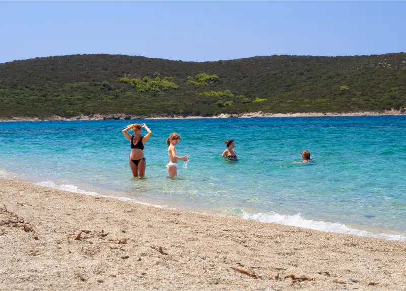
    Beach Greek Island Evia Euboea Greece

    That variety also creates risk. Summer heat, wildfire restrictions, rapidly changing mountain weather and rough roads mean Evia should not be approached as a collection of social-media viewpoints. The right route depends on season, fitness, daylight and current local conditions.

    Quick planning summary

    • Region: Evia (Euboea), Central Greece.
    • Best for: independent travellers combining coast, villages, archaeology and nature.
    • Transport: a car gives the most flexibility; verify current ferries and buses if travelling without one.
    • Before leaving: check weather, wildfire risk, site opening, road access and sea conditions where relevant.
    • Pacing: Evia is much larger and more mountainous than it looks on a simple map.

    Dirfys and the central mountains

    Mount Dirfys dominates central Evia and rises to 1,743 metres according to Visit Greece. The Steni side is the classic access area, with forest and mountain terrain that can feel completely different from the coast only a short drive away.

    High-elevation weather changes quickly. Carry an extra layer, water and navigation even when Chalkida is hot and clear, and do not push onto exposed ridges when cloud, strong wind or thunderstorms build.

    Mount Ochi and South Evia

    Mount Ochi combines upland hiking with the archaeological mystery of the Dragon Houses and the wild geography above Karystos. Routes vary from moderate walks to demanding mountain days, and heat exposure can be severe outside the forested sections.

    Use Karystos as a practical base, start early and confirm current trail information locally. If the summit or remote Drakospita route is beyond your experience, shorter foothill walks still deliver excellent scenery.

    Dimosari Gorge

    Dimosari is one of South Evia’s signature landscapes, descending from the Ochi massif toward the Aegean. The gorge should be treated as a real mountain route, not a beach stroll. Direction, transport logistics and water availability need planning before you begin.

    After storms or wildfire events, conditions can change. Check current local guidance and never assume an old GPS track proves a bridge, path or road is passable today.

    Manikia climbing area

    Manikia has developed into an internationally known climbing destination near Kymi. Sport climbing requires its own equipment, technique and route knowledge; first-time visitors should use current guide information and, where appropriate, qualified local instruction rather than copying a route grade from an outdated post.

    Climbers should also respect seasonal closures, private access and parking rules. The long-term future of climbing areas depends heavily on good relations with villages and landowners.

    Setta, forest walks and softer adventures

    Not every outdoor day needs a summit. Setta offers fir forest, short walks, cool summer temperatures and a mountain-village base, making it ideal for families or travellers who want nature without technical terrain.

    Combine a short forest walk with a village meal and keep rough-road routes optional. This kind of low-intensity day is valuable between harder hikes.

    Remote beaches as outdoor objectives

    Thapsa, Tsilaro, Chiliadou and other remote beaches can involve long approaches, rough tracks or steep terrain. The access itself should be treated with the same planning mindset as a hike: water, footwear, daylight, vehicle suitability and a backup plan.

    Do not let the promise of turquoise water push you beyond your vehicle or fitness limits. There are excellent easier-access beaches elsewhere on Evia.

    Wildfire, heat and emergency planning

    Greek summer fire danger can lead to restrictions on forests and mountain roads. Check Civil Protection alerts and local municipal announcements, avoid smoking or flames in dry vegetation and never enter a closed area because an app still shows the route.

    Tell someone where you are going, carry a power bank and offline map, and set a turnaround time. Emergency response is slower in remote gorges and mountain roads than in resort areas.

    Mountain and outdoor safety

    Download an offline map, carry more water than you expect to need and set a turnaround time. High ground on Evia can be windy, cloudy or cold even when the coast is hot, and summer hiking also requires daily wildfire-risk awareness.

    Do not assume a forestry or unpaved road is suitable for an ordinary rental car. Erosion, gates and contract restrictions can turn an apparent shortcut into the wrong choice.

    Best time to visit

    Spring and autumn are generally the easiest seasons for walking and nature, while summer requires heat and wildfire precautions. Winter can be rewarding but brings short daylight, wet ground and colder conditions at elevation.

    After heavy rain, storms or major wind events, allow trails and rural roads time to recover. Postponing a walk is better than improvising around damage or closures.

    Food, water and breaks

    Evia is large enough that you should not assume a restaurant or petrol station appears exactly when you need one. Carry water, keep fuel above reserve and use larger towns as dependable service anchors.

    Local meals can include grilled goat or lamb, seafood, cheeses, honey, figs, vegetables and pies. Choose places that are clearly open and active, and ask directly about ingredients if you have allergies or dietary restrictions.

    Where to stay nearby

    Choose accommodation according to the next morning’s route, not only the nightly rate. Evia’s driving times are long enough that the right base can save several hours across a multi-day trip.

    Useful internal planning links

    Continue planning with our Manikia Climbing.

    Continue planning with our Karystos and Dimosari Gorge.

    Continue planning with our Dragon Houses of Mount Ochi.

    Continue planning with our Setta.

    Official information

    For details that may change, consult Visit Greece – Evia shortly before travel. Current archaeological, municipal, emergency, ferry or site-management instructions take priority over old reviews and cached map information.

    Frequently asked questions

    What is the highest mountain in Evia?

    Mount Dirfys, at 1,743 metres according to Visit Greece.

    Is Evia good for beginner hikers?

    Yes, if you choose village and forest walks rather than exposed peaks or long gorges.
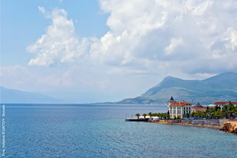
    Evia Aidipsos

    Do I need a guide for Manikia?

    Experienced climbers may use current route resources, but beginners should use qualified instruction and appropriate equipment.

    When is hiking best?

    Spring and autumn are generally easiest; summer requires very early starts, heat management and wildfire awareness.

    Can I rely on online GPS tracks?

    Use them as one tool, not proof of current access. Storms, gates, fires and road damage can change routes.

    Final advice

    Evia rewards outdoor travellers who plan conservatively. Choose routes for the season, respect closures and give the mountains the same attention you would give an alpine destination; the island’s landscapes are beautiful precisely because they are real terrain, not theme-park attractions.

    Extra planning notes

    Tell someone your intended route when heading into remote mountain terrain and keep enough battery for navigation and emergency calls. A power bank is useful, but it does not replace a route that matches your fitness, vehicle and remaining daylight.

    If cloud closes in or the road becomes uncertain, turn back while the decision is still easy. Evia’s mountains rise abruptly from the coast, and conditions can be dramatically different from the harbour where the day began.

    Before setting out, save the key address, accommodation contact and one official source offline. Evia has long mountain sections where a weak signal or missed junction can waste more time than expected. A simple offline note makes it easier to adapt without stress.

    Keep at least forty-five minutes of unscheduled time in the day. Parking, a longer meal, changing sea conditions or a cultural stop that deserves more attention can all absorb that margin. The buffer is especially valuable on Evia because distances are often slower than they look.
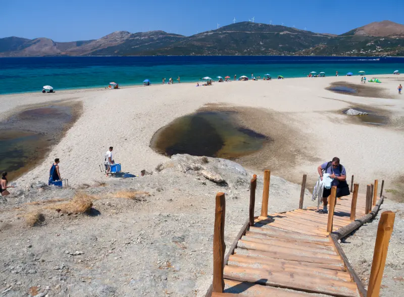
    Grand Sandy Beach Aegean Sea With Holidaymakers Tourists Greek Island Evia Greece

    Do not judge a destination only by how many formal attractions it contains. Some of the strongest Evia experiences are the transition between forest and sea, a village square before dinner, a quiet harbour or a landscape that helps the archaeology make sense. Leave enough time for those unscheduled moments.

    If you are continuing to another part of Evia the next day, check the route before dinner rather than in the morning. This gives you time to identify fuel stops, ferry constraints or mountain sections that might change the sensible departure time.

    For families and mixed-age groups, plan one comfortable place to sit during the middle of the day. A shaded square, waterfront café or museum break can matter more than one extra viewpoint, especially in summer.

    Carry both a card and a modest amount of cash. Larger towns are straightforward, but a small seasonal business, monastery donation point or rural café may not fit the payment assumptions of a city trip. The same principle applies to fuel: do not wait for the warning light before heading into the interior.

    When photographing villages, beaches and religious places, avoid turning residents into scenery. Ask before taking close portraits, keep drones away unless all current rules allow them, and never block a doorway or road for a photograph.

    \n

    More Evia practical guides: Evia Without a Car, Best Time to Visit Evia, Where to Stay in Chalkida, Chalkida with Kids, Where to Stay in Edipsos, Edipsos Thermal Springs Guide, Where to Stay in Eretria, Where to Stay in Karystos, Evia in 3 Days, Solo Travel in Evia.

    \n
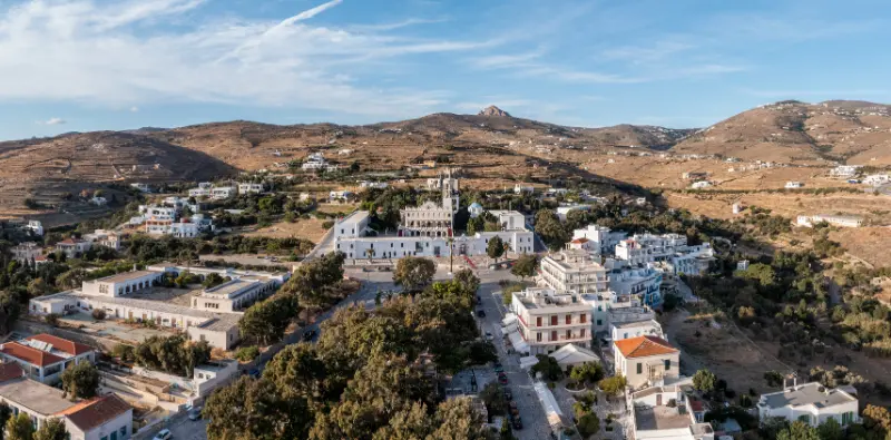
  • Tinos Chora Guide: Panagia Evangelistria, Waterfront, Food and Where to Stay

    Tinos Chora Guide: Panagia Evangelistria, Waterfront, Food and Where to Stay

    Tinos Chora is more than the ferry port you pass through on the way to the island’s villages. It is the practical centre of a Tinos trip, the home of Panagia Evangelistria, the easiest place for buses, and the island’s strongest choice if you want restaurants and evening walks without driving every night. The town feels busiest around ferry arrivals and major religious dates, but a few streets away from the port it becomes a mix of marble details, small squares, bakeries, galleries and residential lanes.

    For first-time visitors, the useful question is not whether Chora is the prettiest place on Tinos; villages such as Pyrgos, Kardiani and Volax have more distinctive landscapes. The question is whether Chora makes your holiday easier. If you are staying only a few nights, arriving without a car, travelling with children or planning day trips by bus, the answer is often yes. This guide explains how to use the town well without spending the entire trip there.

    Tinos Kardiani Village

    At a glance

    BaseBest forMain trade-off
    Central ChoraNo-car trips, restaurants, first visitsBusy around ferries and feast days
    Agios Fokas sideBeach access, couples, familiesLonger walk to church and port
    Kionia sideSunset, quieter stay, beachLess convenient for evening town walks
    Outside townParking, villas, privacyCar or taxi more useful

    Start with Panagia Evangelistria

    The Church of Panagia Evangelistria rises above Chora at the top of Megalocharis Avenue and is the island’s defining pilgrimage site. Visit with enough time to understand that this is an active place of worship, not simply a monument. Dress respectfully, keep voices low, avoid blocking worshippers for photographs and be particularly considerate during services or major feast days. The icon associated with the shrine was discovered in 1823 after visions attributed to the nun Pelagia, and the site became closely connected with modern Greek religious and national history.

    Walk down Megalocharis Avenue slowly

    The broad route between the church and the waterfront is part of the experience. Shops selling candles, religious objects and local products reflect the pilgrimage economy that shaped modern Chora. Parallel lanes are often more enjoyable for a relaxed walk because they reveal cafés, old houses and smaller businesses without the same movement of organised groups. If a ferry has just arrived, give the main street twenty minutes and explore sideways rather than assuming the town is always crowded.

    The old harbour and waterfront

    The waterfront is where Chora becomes a holiday town rather than a pilgrimage centre. Ferries, excursion boats, cafés and evening promenades give it constant movement. The best time is usually early morning before the heat builds or after sunset when the traffic eases. Keep in mind that the island has more than one port area and ferry operations can change berths; on departure day confirm exactly where your vessel leaves instead of relying on where you arrived.

    Where to eat in Chora

    Chora gives you the widest choice of food on the island, which is useful when a group has different priorities. Look beyond the most obvious waterfront tables and try small streets where menus focus on Cycladic ingredients, local cheeses, capers, artichokes, sausages and seasonal vegetables. Tinos has a serious food identity, so it is worth mixing one carefully chosen dinner with simpler bakery breakfasts and casual lunches. Reservations help at popular restaurants in August and on pilgrimage weekends.

    Beaches you can reach from town

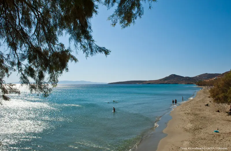
    Agios Fokas is the obvious beach extension of Chora: long, close to town and practical for a swim without turning the day into an expedition. Kionia lies in the opposite direction and combines a beach stay with access to the Sanctuary of Poseidon and Amphitrite area. Neither should replace a day exploring the wilder north or west coast, but both are valuable when you have half a day, arrive late, or want a low-logistics beach after sightseeing.

    Tinos Kionia Beach Greece

    Shopping for local products

    Use Chora for products you can carry home rather than generic souvenirs. Ask about Tinian cheeses, cured meats, capers, sun-dried tomatoes, thyme honey and local spirits, and check airline rules before buying liquids. For marble pieces or decorative objects, prefer shops that can explain who made the item and where. The island’s craft tradition is important enough that buying directly from makers or reputable workshops adds more meaning than choosing mass-produced Cycladic décor.

    Where to stay in Chora

    Stay near the centre if you want to walk to dinner, the church and the bus terminal. Stay toward Agios Fokas for easier beach access and a quieter resort feel, but check the exact distance back to the centre in the evening. Travellers with a rental car should verify parking before booking because a charming room in a narrow lane may be inconvenient with luggage. Light sleepers should also ask about ferry-road noise if the property faces a main approach to the port.

    A realistic first day

    If your ferry arrives before lunch, do not immediately drive across the island. Check in, walk the waterfront, eat something simple, visit Panagia Evangelistria later in the afternoon when appropriate, and finish with dinner in town. This gives you time to understand the geography, buy water and supplies, and confirm bus or rental-car details. The next morning you can start a village day with much less friction.

    How this fits into a wider Tinos trip

    Use this page together with Tinos travel guide, Pyrgos and Panormos Tinos Guide, Volax Tinos Guide, Kardiani and Isternia Tinos Guide, Panagia Evangelistria Tinos Guide, Best Beaches in Tinos. Keeping related places and practical topics connected makes it easier to build days by geography instead of repeatedly crossing the island.

    Village Of Isternia Island Of Tinos Greece

    How to plan around wind and summer heat

    Tinos is famously exposed to Aegean wind, and the same breeze that makes a terrace comfortable can make a north-facing beach rough or an exposed ridge unpleasant. Check the day’s conditions before committing to a remote beach, boat outing or long hike. In July and August, use early morning for villages, churches and walking, reserve the hottest hours for lunch or swimming, and return to sightseeing later in the afternoon. A flexible itinerary is a practical advantage, not a failure to plan.

    Driving realistically on Tinos

    Distances on the map look short, but roads between villages are winding and often narrow. Add time for oncoming traffic, photo stops and finding sensible parking outside historic lanes. Do not follow a navigation app blindly onto a rough shortcut simply because it saves three minutes. If you are uncomfortable with steep bends, base in Chora and use buses, taxis or organised excursions for selected days rather than turning every transfer into stress.

    Food and daily rhythm

    Tinos is a destination where lunch can be part of the sightseeing rather than a break from it. Build time for village squares, bakeries, local cheeses, capers, artichokes, sausages and seasonal dishes instead of planning every meal at the waterfront. Opening patterns outside peak summer can be irregular in small villages, so carry water and a snack even when you expect to find a taverna. In August, reserve famous restaurants but leave ordinary meals spontaneous.

    Booking and time-sensitive information

    Ferry times, bus schedules, museum hours and road access can change. Recheck anything that would cause a serious problem if wrong: the last bus, the final ferry of the day, a museum you are crossing the island to visit, or access to a remote beach after strong weather. Save confirmations offline and keep enough margin before departure. Tinos rewards slow planning; it punishes itineraries where one ten-minute delay breaks the rest of the day.

    Official shrine information

    For feast-day programmes, religious announcements and the shrine’s own account of its history, consult the official Panagia Tinou website. The sanctuary is an active religious institution, so on-site instructions always take priority over travel-blog advice.

    Tours and activities

    A guided village day, food experience or private transfer can be useful when it reduces transport friction or adds local interpretation. Compare the actual time spent at each stop, pickup location, group size and cancellation policy rather than choosing the itinerary with the longest list of villages.

    Common planning mistakes

    • Treating Chora only as a ferry terminal.
    • Visiting the church as if it were a photo attraction rather than an active shrine.
    • Booking a room without checking port-road noise or parking.
    • Spending every beach day near town and missing the island’s more distinctive coast.
    • Assuming the berth used on arrival will automatically be the departure point.

    Frequently asked questions

    Is Tinos Chora worth staying in?

    Yes, especially for first-time visitors, short stays and travellers without a car. It has the best transport connections and evening choice.

    Can you walk to a beach from Chora?

    Agios Fokas is the easiest beach area to combine with town, while Kionia is also close enough for a short transfer.

    How long do you need in Chora?

    One focused day covers the church and town, but several nights make sense if you are using Chora as a base for island excursions.

    Is Chora good for families?

    Yes. Choose a quieter street or the Agios Fokas side if early nights matter.

    Do you need a car in Chora?

    No for the town itself. A car becomes useful for flexible village and remote-beach days.

    Final practical advice

    Tinos is most rewarding when you leave space between the famous stops. One village, one meaningful cultural visit and one swim often make a better day than six pins on a map. Choose a base that suits your transport style, group nearby experiences, check wind and heat each morning, and verify time-sensitive information shortly before you travel. The island’s villages, food and walking routes are not filler between beaches; together they are the reason Tinos feels different from many other Cycladic destinations.

  • Amorgos Hiking Guide: Palia Strata, Melania, Mount Krikelos and Trail Planning

    Amorgos Hiking Guide: Palia Strata, Melania, Mount Krikelos and Trail Planning

    Amorgos is one of the Cyclades where hiking is not an extra activity added to a beach holiday; it is one of the best ways to understand the island. Old mule paths connect ports, mountain villages, monasteries, archaeological sites and high ridges. The walking network ranges from short one-hour circuits to exposed half-day routes where wind, heat and loose stone matter.

    Visit Greece highlights the 11.5 km Palia Strata, the 10 km Itonia route, the Melania village trail and the climb toward 821 m Mount Krikelos. The municipal trail pages provide additional route detail and classify several paths by difficulty. Distances are useful, but elevation, sun exposure and return transport determine how hard the day feels.

    At a glance

    Classic long routePalia Strata
    Best village walkMelania
    Easy Chora–Katapola linkFotodotis
    Historical south routeItonia
    High-point hikePan / Krikelos
    Easy Katapola circuitEvangelistria

    Palia Strata: Chora to the north

    The Old Strata is Amorgos’s signature long walk, leaving Chora, passing Hozoviotissa and continuing across rugged terrain toward the northern settlements. Visit Greece describes an 11.5 km route of around four hours, while the municipal page gives roughly 4–5 hours and labels it hard.

    The difference is a reminder that timings are estimates. Photo stops, monastery access, heat and your exact endpoint can add substantial time. Start early and make sure you know how you will return from Aegiali/Langada or wherever you finish.

    Melania: Aegiali, Langada and Tholaria

    The Melania route is one of the best introductions to Amorgos walking because it links living villages with old paths and archaeological interest. The municipal route gives about 7.6 km and approximately two hours for the full Aegiali–Langada–Tholaria circuit, with shorter sections possible.

    You pass near windmills, Panagia Epanochoriani and the Ancient Aegiali area. Food and water are easier to find than on remote routes, which makes Melania a good first hike before committing to the high ridges.

    Monastery Of Panagìa Hozovitissa Amorgos

    Fotodotis: Chora to Katapola

    Fotodotis is the practical one-hour link from Chora toward Katapola/Xylokeratidi. It is useful when you want a real walk without dedicating most of the day to a trail.

    Because the route descends toward the harbour, many travellers prefer to walk down and return by bus. Reversing the direction turns it into more of a climb, which can be worthwhile in cooler weather.

    Itonia and the south

    Itonia crosses the less-visited southern part of Amorgos through areas associated with ancient Arkesini and traditional settlements. Visit Greece describes about 10 km and around three hours, while the municipal guide classifies it as a medium route.

    This is a good choice for travellers interested in archaeology and rural landscapes rather than the famous east-coast cliffs. Transport at the endpoints can be less frequent, so confirm buses or arrange a taxi before setting out.

    Pan route and Mount Krikelos

    The high-point route from Langada toward Agios Ioannis Theologos, Stavros and Krikelos is the serious hiking day in the north. Visit Greece lists the Pan route at about 6.5 km and Mount Krikelos at 821 m; the municipality describes it as hard.

    Wind is a major factor on the ridge. A forecast that looks pleasant at sea level can feel very different on exposed ground. Turn around if visibility, gusts or heat make progress uncomfortable; reaching the highest point is never worth losing your safety margin.

    Valsamitis and Katapola circuits

    The Valsamitis route links Katapola with Agios Georgios Valsamitis and Ancient Minoa in an easier circuit of around two hours according to the municipal network. It combines culture with walking without the exposure of the major ridge routes.

    The Evangelistria circuit from Xylokeratidi is even shorter—about 3.7 km and one hour—and is an excellent arrival-day or shoulder-season walk.

    Gear and summer heat

    Wear shoes with tread; ankle support helps on loose stone. Carry more water than you think you need, plus a hat, sun protection and a light wind layer. There may be no shade for long stretches.

    In July and August, begin early. If you cannot start before the strongest heat, choose a shorter village route and save the exposed ridge for another day or another season.

    Using buses for one-way hikes

    Public buses can make linear hikes much more useful, but only if the current schedule fits. The timetable changes seasonally and the operator advises travellers to check for route changes on arrival.

    Do not assume you can finish a remote trail at sunset and find a bus. Note the last realistic connection before you leave, carry taxi numbers, and be willing to shorten the route if timing slips.

    Which route should you choose?

    For a first easy walk choose Evangelistria or Fotodotis. For villages choose Melania. For the classic Amorgos experience choose Palia Strata in suitable conditions. For a strenuous mountain day choose the Pan/Krikelos route. For archaeology and a quieter south, consider Itonia.

    This progression lets you test how your body handles Amorgos terrain before choosing the hardest option.

    Tours and experiences

    Organised activities on Amorgos are more limited than on Santorini or Mykonos, which is part of the island’s appeal. When a guided hike, boat trip or cultural tour fits the plan, compare the exact meeting point, duration, cancellation conditions and whether transport is included before booking.

    Frequently asked questions

    What is the best hike in Amorgos?

    Palia Strata is the classic long route, but Melania is a better first hike for many visitors because it connects villages and is easier to shorten.

    Can I hike Amorgos in July or August?

    Yes, but start early, carry plenty of water and avoid exposed routes during the hottest hours or extreme wind.

    Are the trails well marked?

    Several official routes are marked, but markings can fade and junctions can be confusing. Carry an offline map and route file where possible.

    Do I need hiking boots?

    Trail shoes or light boots with good grip are much safer than smooth sandals. Ankle support helps on loose stone.

    Can I use buses for one-way hikes?

    Often yes in season, but verify the exact timetable and final connection on your travel date.

    Is Mount Krikelos difficult?

    The high route is exposed and classified as hard by the municipal trail network. Wind, heat and elevation make it a serious outing.

    Planning details that make a real difference

    Amorgos looks compact on a map, but a hiking-focused stay on Amorgos works best when you respect the island’s long, mountainous shape. Roads bend around ridges, buses are seasonal and several beaches or trailheads still require walking. Build the day around one part of the island instead of repeatedly crossing from north to south.

    Getting To Amorgos Greece

    In July and August, start exposed walks early and treat the middle of the day as swimming, lunch or shade time. The Meltemi can make the air feel cooler than it is, so do not use wind as a substitute for sun protection. In May, June, September and early October, walking is often more comfortable, but transport and boat services may run less frequently than at peak summer.

    Keep water, a hat and shoes with reliable grip in your day bag even when the plan does not sound like a hike. Many rewarding places on Amorgos are reached by stone steps, rough paths or steep village lanes. For remote beaches, assume there may be no shade, shower, shop or mobile signal exactly where you need it.

    Finally, leave some flexibility. Strong wind can change boat trips and beach conditions, a bus timetable can be revised, and a village festival may be a better evening than the restaurant reservation you planned months earlier. Organise the essential logistics, then allow the island to change the order of the day.

    Continue planning Amorgos

    For the rest of the island, continue with Chora Amorgos Guide; Katapola Amorgos Guide; Aegiali, Langada and Tholaria Guide; Hozoviotissa Monastery Guide; Agia Anna and Mouros Beaches Guide; Best Beaches in Amorgos; Amorgos Without a Car. These guides are designed to work together, so you can move from a general idea to the practical details of transport, beaches, walking and where to base yourself.

    Useful official resources

    For current destination information use Amorgos Municipality tourism guide. For public buses check the Amorgos Bus Company timetable page, which explicitly advises travellers to confirm route changes on arrival. For walking and beach overviews, Visit Greece hiking information and Visit Greece beaches of Amorgos are useful starting points. Recheck opening hours, buses and boat departures shortly before travel.

    Final practical advice

    The most important rule is simple: do not choose a trail only because the photos are beautiful. Match the route to temperature, wind, your footwear and the bus connection at the finish. On Amorgos, good logistics are part of good hiking.

    How I would fit this into a first Amorgos trip

    For a first visit, I would avoid using this subject as an isolated checklist. Build it into a route that gives Chora, Katapola and the north enough time to feel different. A five- to seven-night stay can include one dedicated hiking day, two flexible swimming days, one cultural day around Hozoviotissa and Chora, and an evening in both a port and a mountain village. This balance is more revealing than trying to collect every beach and viewpoint in one loop.

    Chiesa Of San Giorgio In City Of Katapola On Island Of Amorgos Cyclades Greece

    Ferry times should shape the first and last day. If you arrive in Katapola, keep the first evening local instead of immediately crossing the island. If you arrive in Aegiali, enjoy the north first. The same logic applies on departure: sleep where the morning connection is easiest when the ferry is early, rather than creating a stressful taxi transfer simply to spend one final night in a prettier village.

    Amorgos also rewards seasonal thinking. May and early June suit walking and flowers but the sea may feel cool; July and August bring the broadest visitor services plus stronger heat and wind; September often combines warm water with better hiking temperatures, although bus and boat frequencies can begin to ease. October can be beautiful for independent travellers who accept a quieter island and fewer daily connections.

    Budget for occasional taxis even if you plan to use buses. One well-timed taxi can protect a hiking plan, solve an early ferry connection or let you eat in another village after the last convenient bus. That is usually better value than renting a car for an entire week if you only need private transport twice.

  • Lassi and Makris Gialos Kefalonia Guide: Beaches, Argostoli Access and Where to Stay

    Lassi and Makris Gialos Kefalonia Guide: Beaches, Argostoli Access and Where to Stay

    Lassi is one of the easiest places in Kefalonia for a beach-first holiday without giving up quick access to Argostoli. The resort stretches along the coast just south of the capital and is best known for Makris Gialos and Platis Gialos, two of the island’s most convenient organised beaches. It is not the place I would choose for a remote-village experience, but it works extremely well when simplicity matters: airport access is short, restaurants are close, and several beaches can be reached without committing to a full island road trip.

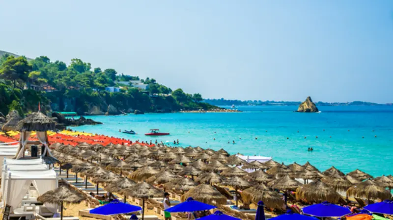
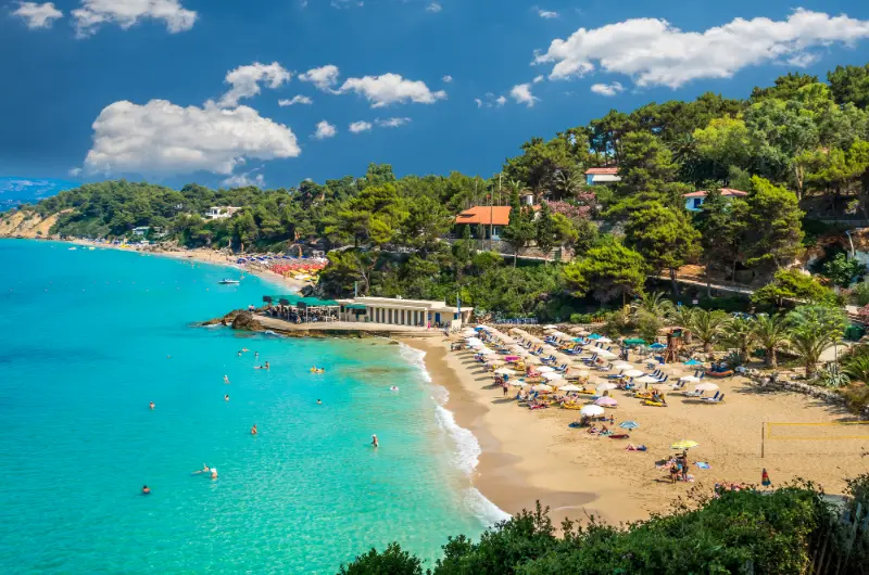
    Pleasure White Boat Crystal Clear Blue Sea Water Platis Gialos Makris Gialos Beach Kefalonia Island Near Lassi Argostoli Greece

    The useful question is not whether Lassi is ‘authentic enough’. It is whether its layout matches the trip you want. Families, first-time visitors and travellers staying only a few nights often benefit from the easy logistics, while people looking for dramatic villages and quiet coves may prefer to split the stay with the north or east coast. Use the broader Kefalonia travel guide for the island overview and the Argostoli guide for evenings, shopping and the waterfront.

    Lassi and Makris Gialos Kefalonia Guide at a glance

    QuestionPractical answer
    Best forEasy beach holiday, first visits, families and short stays
    Main beachesMakris Gialos, Platis Gialos and smaller coves along the Lassi coast
    Car essential?No for a simple Lassi/Argostoli stay; useful for island exploration
    Good pairingArgostoli, airport area, south-coast beaches and day trips north
    Main trade-offConvenient and lively rather than secluded

    Why Lassi works as a base

    Kefalonia is larger than many visitors expect, so a base that reduces everyday driving has real value. In Lassi you can build slow days around the beach and still reach Argostoli quickly for the market, waterfront, museums, restaurants and evening atmosphere. That makes it especially practical after a late flight or before an early departure.

    The compromise is that Lassi feels like a developed resort strip rather than a compact historic village. I would choose it for convenience, not because it offers the island’s most atmospheric architecture. If you want both, spend time in Lassi and deliberately schedule trips to Assos, Fiskardo, Sami or inland villages.

    Makris Gialos: what to expect

    Makris Gialos is the beach most visitors associate with Lassi. It combines clear Ionian water with a broad shore and organised facilities, so the day is easy to manage even if you did not bring chairs, shade or a packed lunch. In peak summer, that convenience also makes it popular; arriving earlier gives you more choice and cooler conditions.

    The beach is better treated as a full beach day than a quick photo stop. Swim, take a long break in the shade, and avoid turning the middle of the day into a race between attractions. If you are travelling with children, check the sea on arrival rather than assuming conditions will always be gentle.

    Platis Gialos and smaller nearby coves

    Platis Gialos sits close enough to pair naturally with Makris Gialos, yet it can feel like a separate beach day because the shape of the bay and crowd pattern differ. Smaller coves around Lassi are useful when you want a shorter swim before dinner or when the main beaches feel busy.

    Platis Gialos And Makris Gialos Beach Kefalonia Island Greece

    One advantage of staying locally is that you can react to conditions. If wind, cloud or crowd levels are not ideal in the morning, go into Argostoli and return later rather than driving across the island in search of a perfect forecast. That flexibility is one of Lassi’s strongest practical benefits.

    How to combine Lassi with Argostoli

    Do not plan Argostoli as a rushed evening after an exhausting island circuit. It deserves its own half day or evening. Walk the waterfront and De Bosset Bridge area, browse the centre and allow time for dinner without worrying about a long drive back. The Argostoli guide covers the city in much more detail.

    If you are not renting a car, Lassi is one of the more manageable resort choices because local buses connect it with Argostoli during the main season. Frequencies change, so check the current KTEL Kefalonia local timetable rather than relying on an old screenshot.

    Argostoli The Capital Of Kefalonia Island In Greece

    Who should stay here—and who should not

    Choose Lassi if your priority is beach time with straightforward logistics, you want to be near the airport, or you prefer having restaurants and services close to the accommodation. It is also a sensible first base before moving to Fiskardo, Assos or Sami.

    Look elsewhere if your ideal evening means a tiny harbour, a mountain village or near-total quiet. Agia Efimia, Assos and Fiskardo have a stronger small-settlement identity, while Skala provides a larger resort environment on the opposite side of the island.

    When to go and how the season changes the experience

    For Lassi and Makris Gialos Kefalonia, June and September are usually the easiest months to balance warm swimming conditions with less pressure on roads, parking and restaurants. July and August bring the widest range of seasonal services, boat trips and nightlife, but they also bring the strongest heat and the most competition for parking. May and October can be rewarding for walking and quieter travel, yet weather and seasonal opening hours become less predictable.

    Do not plan the entire trip from average temperature charts. Wind direction, recent weather and sea state can change the best beach for a particular day. Keep one or two flexible days and move the most weather-sensitive boat or west-coast plan when conditions look best.

    Driving, roads and parking

    Kefalonia rewards a car, but the driving is slower than the map suggests. Mountain roads, village streets, bends and summer traffic all add time. Build margin into every estimate, especially when you have a ferry, boat departure or restaurant reservation. Avoid stopping on blind corners for photographs and use formal viewpoints or safe pull-outs instead.

    Parking is usually the hidden problem at famous places. Arriving before the middle of the day can make Myrtos, Assos, Fiskardo and other popular stops much easier. If you dislike driving on steep roads, choose a base that reduces the number of cross-island days rather than forcing yourself through a seven-day road-trip schedule.

    Buses and car-free planning

    KTEL Kefalonias publishes seasonal local routes linking Argostoli with the airport, Lassi, Sami, Fiskardo, Myrtos and other destinations. Frequencies change through the season, sometimes substantially. Use buses for the routes they serve well and accept that a taxi, boat excursion or one-day car rental may be the sensible tool for places outside the main network.

    Before travelling, check the official KTEL Kefalonia local timetable. Do not rely on a blog timetable copied months earlier. For a full strategy, see my Kefalonia without a car guide.

    Food, water and the rhythm of the day

    A good Kefalonia day has space for lunch. Long coastal drives and beach parking feel much easier when you are not trying to fit six attractions around them. Keep water in the car, especially for remote beaches and hiking, and do not assume every scenic cove has a taverna or kiosk.

    Robola wine is one of the island’s best-known local products, while meat pies, seafood and simple grilled dishes appear widely. If wine tasting is part of the day, designate the driver or use a transfer; winding island roads are not the place to combine driving with alcohol.

    How to connect this guide with the rest of Kefalonia

    Start with the Kefalonia travel guide if this is your first visit. The Myrtos Beach guide, Assos guide, Fiskardo guide, Melissani and Drogarati Caves guide and Mount Ainos guide cover the island’s major landscape and sightseeing anchors in more depth. Use those pages to build clusters of nearby stops instead of crossing the island several times in one day.

    If you have seven nights, one base can work for a relaxed holiday but two bases usually reduce driving for travellers who want to see both the north and south. The point of a split stay is not to collect hotels; it is to move once so that several later days become easier.

    Booking experiences and boat trips

    Kefalonia has boat trips, sea kayaking, sailing, cave visits and day excursions, but availability is seasonal and weather-dependent. Compare duration, transport included, boat size, shade and cancellation terms before booking. A shorter high-quality trip can be better than an all-day itinerary with too many stops.

    Common planning mistakes to avoid

    • Trying to combine Myrtos, Assos, Fiskardo, Melissani, Drogarati and a sunset stop in one day.
    • Choosing accommodation only by nightly price without checking how much driving it creates.
    • Assuming every famous beach has sand, shallow water, shade and full facilities.
    • Saving a seasonal bus timetable and assuming it will still apply on different dates.
    • Booking a weather-sensitive boat excursion on the only free day of the trip.
    • Underestimating the sun on remote pebble beaches where natural shade may be limited.

    Frequently asked questions

    Is Lassi good without a car?

    Yes for a beach-focused stay combined with Argostoli, especially in the main season. A car becomes much more useful if you want Myrtos, Assos, Fiskardo, Mount Ainos or several remote beaches.

    Is Makris Gialos suitable for families?

    It is popular with families because facilities make the day easy, but parents should still judge waves, depth and heat on the day rather than treating any beach as automatically safe.

    Can I walk from Lassi to Argostoli?

    Depending on your accommodation, walking can be possible, but summer heat and road conditions make the bus or a taxi more comfortable for many travellers.

    How many nights should I stay in Lassi?

    Three to five nights works well for a short Kefalonia trip; for a week or more, consider splitting the island if you want to explore the north in depth.

    Is Lassi better than Argostoli?

    Neither is universally better. Lassi is easier for beach days; Argostoli is stronger for urban services, evening walks and local transport connections.

    When is Lassi busiest?

    July and August are the busiest months. June and September usually give a better balance of warm sea, open services and less pressure on beaches and parking.

    More Kefalonia in-depth guides

    Continue planning the island with Sami and Antisamos Kefalonia Guide; Skala Kefalonia Guide; Lixouri and Paliki Kefalonia Guide; Agia Efimia Kefalonia Guide; Fteri Beach Kefalonia Guide; Best Beaches in Kefalonia; Kefalonia Without a Car; Kefalonia with Kids; Where to Stay in Kefalonia.

  • Fira Santorini Guide: Caldera Walks, Museums, Nightlife and Practical Tips

    Fira Santorini Guide: Caldera Walks, Museums, Nightlife and Practical Tips

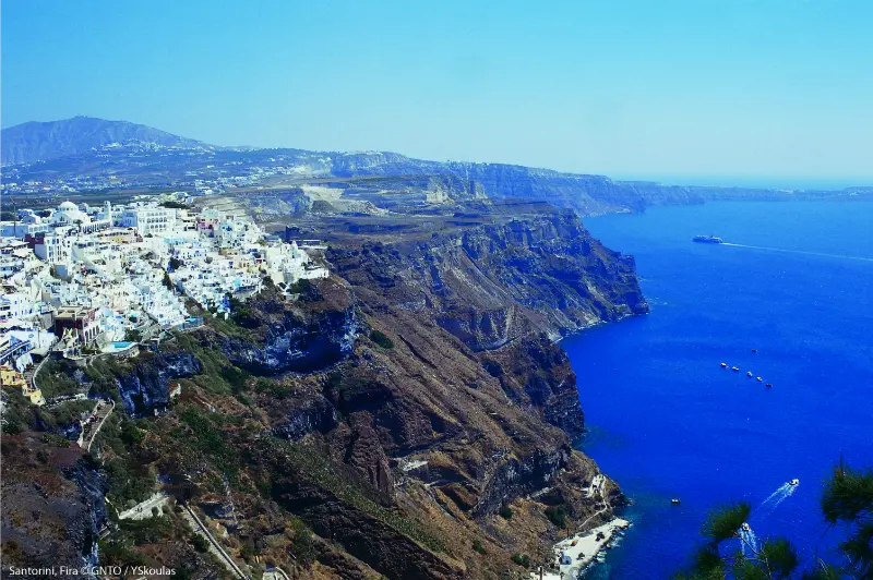
    Fira Santorini Guide is the focus of this guide. Fira is Santorini’s capital and the island’s practical centre. It has caldera views that rival Oia, but it also has the bus hub, museums, shops, nightlife, restaurants at every price level and easy connections to the port and airport. For travellers who want to explore several parts of the island without renting a car, Fira is often the most efficient base.

    Fira deserves more than a transfer stop. Its best moments come from combining the cliff-edge promenade with the Museum of Prehistoric Thera, a walk through Firostefani and Imerovigli, and an evening when the caldera lights up below the town. It is busier and more commercial than some villages, but that energy is part of its strength.

    At a glance

    Best forFirst-time visitors, car-free trips, nightlife and short Santorini stays
    Ideal stay2–3 nights if using Fira as a base
    Main advantageBest public-transport connections on Santorini
    Main challengeCruise-day crowds and steep streets near the caldera

    Why this place deserves time in your Greece itinerary

    A good visit is less about collecting landmarks and more about understanding how the destination works. Fira is Santorini’s capital and the island’s practical centre. It has caldera views that rival Oia, but it also has the bus hub, museums, shops, nightlife, restaurants at every price level and easy connections to the port and airport. For travellers who want to explore several parts of the island without renting a car, Fira is often the most efficient base.

    My planning approach here is simple: build the day around the strongest local experiences, leave breathing room for weather and crowds, and use nearby destinations only when they add something genuinely different. Fira deserves more than a transfer stop. Its best moments come from combining the cliff-edge promenade with the Museum of Prehistoric Thera, a walk through Firostefani and Imerovigli, and an evening when the caldera lights up below the town. It is busier and more commercial than some villages, but that energy is part of its strength.

    Ristorante Affacciato On Caldera At Fira Santorini

    What to see and do

    Caldera promenade

    Walk the cliff edge slowly rather than treating it as a route between restaurants. Views change every few minutes, especially as you approach Firostefani. The volcanic islands, Thirasia and the white villages across the rim make this one of the easiest high-impact walks on Santorini.

    Early morning is peaceful, while late afternoon gives warmer light. On days with many cruise visitors, move one or two streets inland when you need to cross town quickly.

    Museum of Prehistoric Thera

    This museum is the ideal companion to Akrotiri. It displays finds that help explain the Bronze Age settlement, including objects and artworks that give context to what you see at the archaeological site. Visiting the museum before or after Akrotiri makes both experiences more meaningful.

    Allow enough time to read the displays rather than rushing through between buses. For the archaeological site itself, use the Akrotiri guide.

    Firostefani and Imerovigli walk

    The northbound walk from Fira is one of the best low-effort ways to experience the caldera. Firostefani feels like a quieter continuation of the capital, while Imerovigli sits higher and opens broader views. You can walk as far as your energy allows and return by the same route.

    This is also the beginning of the longer trail to Oia. For a full cliff-path day, combine this guide with the Oia guide.

    Cable car and old port

    Fira’s old port sits far below the town. The cable car is the most practical connection for many visitors, while the staircase is long and exposed. Boat excursions may use the old port, so check the exact departure point rather than assuming every cruise leaves from Athinios.

    If you choose to walk the steps, wear shoes with grip and be prepared for heat. The route is functional rather than a must-do attraction.

    Evening in Fira

    Fira has the strongest nightlife scene on Santorini, from wine bars and cocktail terraces to late-night clubs. You do not need to be a party traveller to enjoy the atmosphere; an evening walk after day crowds thin out is one of the most pleasant times to see the town.

    Stay close to the centre if nightlife is important, but choose Firostefani or a side street if you want quieter sleep.

    Where to stay

    Caldera edge

    Best for views and romantic stays, but usually the most expensive and the least convenient with heavy luggage.

    Central Fira

    Best for buses, restaurants and nightlife. It is ideal for a short car-free trip.

    Firostefani

    A calmer choice within walking distance of Fira, with excellent views and less late-night noise.

    When choosing accommodation, look beyond the marketing label and check the exact map position, stairs, parking or transfer access, and walking time to the places you will use most. On Greek islands in particular, two hotels described as being in the same village can offer very different daily experiences because of gradients, pedestrian lanes or spread-out coastal development.

    How to get there and get around

    Most island buses converge on Fira, which is why it works so well without a car. Direct or connecting services link the capital with Oia, Kamari, Perissa, Akrotiri and other areas. Taxis and transfers cover the airport and ferry port. If you rent a car, park outside the narrow central streets and walk the final section.

    For short stays, it is usually better to choose one transport strategy rather than mixing a rental car, taxis and tours every day. If the destination is walkable, keep car days for the places that genuinely need one. If you do rent, photograph the vehicle at collection, understand fuel and insurance conditions, and never assume an attractive coastal track is suitable for a standard rental car.

    A realistic itinerary

    Day 1

    Start with the Museum of Prehistoric Thera, wander the centre, then follow the caldera path through Firostefani toward Imerovigli. Return for sunset and dinner in Fira.

    Day 2

    Use the morning for Akrotiri or a volcanic-beach loop, return to Fira for an afternoon break, then explore the old port area or take a caldera cruise. Finish with bars or a relaxed terrace dinner.

    Rooftop Terrace With Sunbeds Overlooking Hillside Architecture Fira Santorini Greece

    Day 3

    With an extra day, hike toward Oia or use the bus to explore Oia early and return after sunset. Staying in Fira makes this easy without moving hotels.

    Best time to visit

    Fira functions for a longer season than many resort areas because it is the island capital. Spring and autumn are especially comfortable for walking. In July and August, schedule museums and shaded breaks around the hottest hours and expect heavy pedestrian traffic when cruise passengers are ashore.

    Weather is only one part of timing. Ferry frequency, boat excursions, seasonal restaurants and opening hours can also change outside the main summer period. In peak season the opposite problem appears: almost everything is operating, but parking, restaurant reservations and popular viewpoints require more patience. Build flexibility into the plan rather than trying to optimise every hour.

    Food and evenings

    The town has the widest range of dining on Santorini. Caldera-view tables charge a premium for location, while streets a few minutes inland often offer better value. Try local tomatoes, fava, capers and white eggplant when available, and consider a winery visit elsewhere on the island for a deeper introduction to Santorini’s volcanic agriculture.

    A useful rule for a better Greece trip is to separate the places you choose for a view from the places you choose for food. Sometimes they are the same restaurant, but not always. Walk one or two streets away from the most obvious waterfront or viewpoint, read the menu before sitting down, and leave room for a bakery breakfast, a simple taverna lunch and one longer dinner rather than making every meal an event.

    Practical tips for different travellers

    Couples

    Couples can make the destination feel more relaxed by avoiding the most obvious sunset rush and booking one slower evening with no transport after dinner. A room with a view is worthwhile only if you will actually spend time there; otherwise put the budget into location, a boat trip or a special meal.

    Families

    Families should check gradients, shade, beach entry and transfer logistics before booking. A beautiful old-town room can become inconvenient with a stroller, while a resort outside the centre may require repeated taxis. Keep the hottest hours simple and build in a swim, playground or rest period rather than expecting children to follow an adult sightseeing pace.

    Solo travellers

    Solo travellers benefit from walkable bases and public transport, but should still plan the last connection of the day rather than assuming buses or boats run late. Joining a small-group excursion can be useful for remote sights, while self-guided mornings are ideal for photography and museums.

    Road-trip travellers

    If this stop is part of a larger road trip, resist the temptation to check out every morning. Two or three nights in one base often saves more time than it costs because packing, parking and check-in repeatedly can consume the best hours of the day.

    Common mistakes to avoid

    • Using Fira only as a bus station and never walking the caldera promenade.
    • Assuming every boat tour departs from the same port.
    • Booking a central nightlife street when you actually want quiet evenings.
    • Driving into the narrow centre instead of using peripheral parking.
    • Trying to walk the old-port steps at midday without water or proper shoes.

    How to combine it with the rest of Greece

    Fira is the best launch point for the rest of the island. Continue with Oia, Akrotiri and the broader Santorini guide.

    Santorini Fira

    The most efficient itinerary usually moves geographically rather than bouncing back and forth. Check ferry days, driving times and airport locations before fixing hotel dates. On an island trip, one extra night in a well-connected hub is often more valuable than adding another island simply to increase the destination count.

    FAQ

    Is Fira or Oia better to stay in?

    Fira is more practical for transport, restaurants and nightlife; Oia is more atmospheric and romantic. The better choice depends on how much of the island you plan to explore.

    Can I visit Santorini without a car from Fira?

    Yes. Fira is the easiest base for a public-transport trip because many bus routes begin or connect there.

    How many days should I stay in Fira?

    Two to three nights work well for a first trip, especially if Fira is your base for island day trips.

    Is Fira walkable?

    The centre is compact, but there are hills and steps near the caldera. Comfortable shoes matter.

    Is Fira good for nightlife?

    Yes. It has the island’s broadest concentration of bars and late-night venues.

    Final advice

    Plan enough structure to protect the important parts of the trip, but leave room to change the order when weather, crowds or local advice suggest a better option. That flexibility is often what turns a busy Greece itinerary into a trip that actually feels like a holiday.

  • Best Beaches in Santorini: Black Sand, Swimming, Families and Wind

    Best Beaches in Santorini: Black Sand, Swimming, Families and Wind

    Santorini is famous for cliffs and sunsets, not for long Caribbean-style sand, and that is exactly why its beaches deserve a realistic guide. The coast is volcanic: expect black or dark sand, pebbles, dramatic rock formations and water that can become deep quickly in places. Some beaches are highly organised with restaurants and sunbeds; others are better for scenery than for an effortless family swim.

    Beach With Volcanic Mountains Turquoise Water Black Sand Vlychada Beach Santorini Island Greece

    The right beach depends on what you want that day. Perissa and Perivolos are the easiest choices for facilities, Kamari is convenient and lively, Vlychada has the most unusual cliff backdrop, and the Akrotiri coast is about colour and geology. Wind direction matters, so I would not lock every beach day into the itinerary weeks in advance.

    For the wider island picture, keep the Santorini travel guide open alongside this page. The Oia guide, Fira guide, Akrotiri guide, Imerovigli guide and Santorini wine guide cover the main places and experiences in more depth, so you can build a route without repeating the same stops.

    Santorini beaches at a glance

    BeachBest forMain caution
    PerissaFacilities, families, long beach daysDark sand becomes very hot.
    PerivolosBeach clubs, restaurants, longer relaxed staysCan feel commercial in peak season.
    KamariEasy resort base, promenade, airport-side convenienceBusy and developed.
    VlychadaScenery, geology, quieter atmosphereKeep away from eroding cliff bases.
    Red Beach areaDramatic volcanic colourAccess and safety conditions can change; follow local restrictions.
    MonolithosFamilies and a local feelWind and seasonal facilities vary.
    Agios GeorgiosQuieter extension of the Perissa/Perivolos coastFewer services in some stretches.

    Perissa: the easiest all-round beach

    Perissa is the beach I would recommend to first-time visitors who want a straightforward swimming day. The dark shore runs below Mesa Vouno, with restaurants, cafés, sunbed areas and easy access to accommodation. You can spend several hours without needing a car once you arrive. The Kamari and Perissa guide covers where to stay and how to use the area as a base.

    The sand and pebbles can become extremely hot under summer sun. Water shoes are useful for walking between your towel and the sea, particularly for children. Enter the water carefully because depth and seabed conditions vary along the beach.

    Perivolos and Agios Georgios: more space and beach-club energy

    South of Perissa, the coastline continues through Perivolos toward Agios Georgios. Perivolos has many organised venues, making it attractive for travellers who want lunch, drinks and loungers built into the day. Move farther along the coast and the atmosphere can become quieter. This is the area I would use for a full beach day rather than a quick photo stop.

    Kamari: practical and lively

    Kamari is another highly developed black-sand option with a long seafront lined by restaurants and hotels. It works especially well if you stay on the east side of the island and want everything on foot. The beach can be exposed to particular wind and sea conditions, so compare the day’s forecast with south-coast options rather than choosing automatically.

    Vlychada: best for volcanic scenery

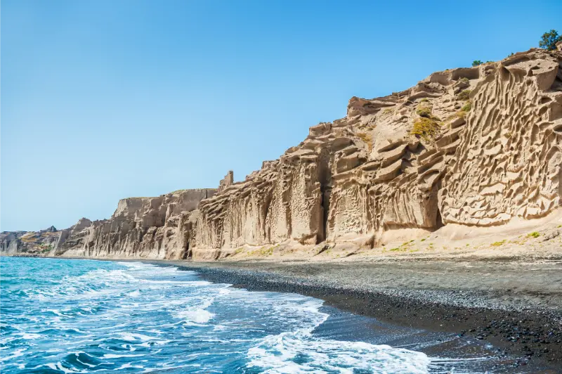
    Vlychada feels completely different because sculpted pale cliffs rise behind the dark shore. Visit for the landscape and combine it with the Vlychada and Tomato Museum guide. The essential safety rule is simple: do not sit directly beneath eroding cliffs or climb them for photographs.

    Red Beach: famous, dramatic and condition-dependent

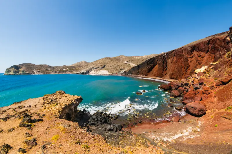
    The red volcanic cliffs near Akrotiri create one of Santorini’s best-known coastal scenes. However, rockfall risk and local access measures have changed over time. I would treat the viewpoint and surrounding landscape as the attraction and follow current barriers, signs and official advice rather than assuming an old online route to the beach is safe or permitted.

    If a boat excursion includes views of Red Beach from the water, that can be a sensible way to appreciate the geology without relying on unstable shore access. The Akrotiri guide explains how to combine the archaeological site with the south coast.

    Monolithos: useful for families

    Monolithos can be a practical family option because parts of the east coast are flatter and less cliff-dominated than the caldera villages. Facilities vary by season, so bring water and shade if you are unsure what will be open. Families should still assess sea conditions on the day; “family-friendly” never means waves and wind can be ignored.

    What about White Beach?

    The name appears frequently in boat itineraries around the Akrotiri coast. Access is typically associated with the sea rather than a convenient road approach, and conditions can vary. If it is a priority, choose a boat trip that clearly states the swimming stops rather than assuming every caldera cruise follows the same route.

    Panoramic View White Beach Akrotiri Santorini Cyclades Greece Blue Sea Blue Sky

    Which beaches are best without a car?

    Perissa and Kamari are among the easiest because KTEL services connect them with Fira during the main season. Vlychada also appears in the official network, but frequency can be lower. Check KTEL Santorini for the current timetable. If you are staying in Oia, expect many beach journeys to involve Fira as a transfer hub.

    Wind matters more than most visitors expect

    Santorini’s compact size can create the illusion that every beach experiences the same conditions. In reality, headlands and orientation matter. A windy day on one coast may be much more comfortable elsewhere. Ask locally, check a marine forecast and keep at least one beach day flexible. Strong wind also affects boat excursions, so do not make a cruise your only possible activity for a particular afternoon.

    Beach shoes, sun and practical comfort

    • Bring water shoes if hot black sand or pebbles bother you.
    • Use more sun protection than you think you need; volcanic beaches offer little natural shade.
    • Do not depend on sunbed umbrellas during the strongest midday sun.
    • Keep valuables simple; a waterproof pouch is useful if everyone wants to swim.
    • Carry a light layer in windy shoulder-season conditions even when Fira feels warm.

    Families: which beach is easiest?

    For families I would usually choose Perissa, parts of Perivolos or Monolithos based on the day’s sea conditions. What matters most is not the beach name but a combination of manageable water entry, nearby food/toilets, shade and easy transport. The Santorini with kids guide builds those beach choices into a slower family itinerary.

    Beach clubs and public space

    Organised sections often rent loungers or tie them to minimum spending, while public access to the shore remains distinct from buying a beach-club package. Prices and policies change quickly. Ask before sitting down and do not assume a social-media post from last year reflects the current minimum spend.

    Boat trips and coastal swimming

    A boat trip is the best way to see sections of the volcanic coast that are awkward from land and to appreciate the caldera cliffs from sea level. Compare boat size, swimming stops, meal inclusions and transfers rather than choosing only by the word “sunset.”

    How to choose a beach each morning

    Look at wind direction, wave conditions, how far you want to travel and whether you need organised facilities. Then pick one beach and stay long enough to enjoy it. The common mistake is spending the hottest part of the day moving between several beaches merely to say you saw them.

    Sunbed costs and beach budgets

    Commercial beach venues set their own policies, and minimum spends can change by season, day and row. Ask the price before occupying a bed and compare the cost with simply buying lunch and using a towel on a public section. A relaxed beach day does not require a premium club package.

    Swimming confidence matters

    Some volcanic beaches deepen quickly and pebbly entries can be awkward for uncertain swimmers. Stay close to shore, supervise children actively and choose calmer organised sections when anyone in the group lacks confidence. Beautiful water is not automatically easy water.

    One final practical planning note

    Before finalising the day, recheck transport, weather and any seasonal opening information for your exact travel date. Santorini changes character dramatically between spring, peak summer and late autumn: buses run at different frequencies, restaurants and beach services may alter their hours, and strong wind can make a plan that looked perfect on paper uncomfortable in practice. Build a little spare time between major stops, carry water, and avoid treating short driving distances as proof that you can fit unlimited sightseeing into one day. The most enjoyable Santorini itineraries leave enough room to stop for a meal, change coast when conditions are better elsewhere, or simply stay longer in a place that turns out to be more interesting than expected.

    Frequently asked questions

    Does Santorini have sandy beaches?

    Yes, but the sand is volcanic and usually dark rather than golden. Pebbles are also common.

    What is the best beach in Santorini for families?

    Perissa, parts of Perivolos and Monolithos are practical starting points, but always check the day’s wind and sea conditions.

    Beach Of Perissa At Santorini Greece

    Can I visit Red Beach safely?

    Access conditions can change because of rockfall risk. Follow current signs and barriers; do not ignore restrictions because an older guide shows a path.

    Which beach is best without a car?

    Perissa and Kamari are among the easiest by public bus from Fira in the main season.

    Are Santorini beaches worth visiting?

    Yes, if you value volcanic landscapes and swimming rather than expecting the long pale-sand beaches of other Greek islands.

    Final thoughts

    Santorini’s beaches make more sense when you stop judging them against islands famous for sand. They are geological beaches: dark, dramatic and closely tied to the volcanic landscape. Use Perissa or Perivolos for convenience, Vlychada for scenery, and the Akrotiri coast for colour. Most importantly, let wind and safety conditions decide the final plan.

  • Anafi Travel Guide: Chora, Beaches, Kalamos, Hiking and a 4-Day Itinerary

    Anafi Travel Guide: Chora, Beaches, Kalamos, Hiking and a 4-Day Itinerary

    A practical first-trip guide to Anafi, covering Chora, Roukounas and Kleisidi beaches, Kalamos, hiking, transport, food and a realistic four-day itinerary.

    This guide is written for independent travellers who want practical detail rather than a checklist. Distances on Anafi are short, but heat, wind and limited transport can make a simple day more demanding than it appears on a map. The best plans leave margin and use Chora as the logistical anchor.

    Quick planning notes

    • Base yourself in Chora for the easiest transport and evening logistics.
    • Check the current ferry and local bus schedule close to travel.
    • Start exposed walks early and carry more water than you expect to drink.
    • Keep one alternative beach or walking plan for windy days.

    Why Anafi feels different from busier Cyclades

    Anafi sits at the quieter end of the Cyclades experience. The island has no airport, nightlife is modest, distances are short but public transport is limited, and many of the most rewarding places are reached on foot. That combination makes it appealing to travellers who value landscape, walking and unhurried beach time more than resort infrastructure. Chora is the only substantial settlement, while the south coast strings together beaches, small coves and trailheads.

    Anafi Island Greece

    the island sits at the quieter end of the Cyclades experience. The island has no airport, nightlife is modest, distances are short but public transport is limited, and many of the most rewarding places are reached on foot. That combination makes it appealing to travellers who value landscape, walking and unhurried beach time more than resort infrastructure. the main village is the only substantial settlement, while the south coast strings together beaches, small coves and trailheads. In practice, the most useful approach is to slow down, confirm the day’s conditions locally and avoid linking too many stops into one itinerary. This creates time for swimming, shade, meals and unexpected delays rather than turning a small island into a race.

    Chora as the natural base

    Chora is built high above the harbour and works as the practical base for most first visits. Whitewashed lanes, churches, old ovens and the remains of the Venetian castle give the village enough character for repeated evening walks. The elevation creates broad sunset views, and staying here keeps restaurants, shops and the main bus connection close at hand. The trade-off is that every beach day begins with a descent or a bus ride.

    the main village is built high above the harbour and works as the practical base for most first visits. Whitewashed lanes, churches, old ovens and the remains of the Venetian castle give the village enough character for repeated evening walks. The elevation creates broad sunset views, and staying here keeps restaurants, shops and the main bus connection close at hand. The trade-off is that every beach day begins with a descent or a bus ride. In practice, the most useful approach is to slow down, confirm the day’s conditions locally and avoid linking too many stops into one itinerary. This creates time for swimming, shade, meals and unexpected delays rather than turning a small island into a race.

    Beaches worth prioritising

    Kleisidi is one of the easiest sandy beaches to reach from the port side, while Roukounas is the best-known long sandy beach and a natural anchor for a full beach day. Katsouni and Flamourou are smaller and quieter alternatives, and Agioi Anargyroi is one of the island’s most photogenic coves. Conditions change with wind, so it is better to keep a shortlist than to decide every swim stop days in advance.

    Kleisidi is one of the easiest sandy beaches to reach from the port side, while Roukounas is the best-known long sandy beach and a natural anchor for a full beach day. Katsouni and Flamourou are smaller and quieter alternatives, and Agioi Anargyroi is one of the island’s most photogenic coves. Conditions change with wind, so it is better to keep a shortlist than to decide every swim stop days in advance. In practice, the most useful approach is to slow down, confirm the day’s conditions locally and avoid linking too many stops into one itinerary. This creates time for swimming, shade, meals and unexpected delays rather than turning a small island into a race.

    Kalamos and the monasteries

    Kalamos is the island’s defining natural landmark, a steep limestone monolith at the southeast end of Anafi. The lower Monastery of Zoodochos Pigi stands above the remains of an ancient sanctuary, while Panagia Kalamiotissa sits high on the rock. The climb is memorable but exposed, and it should be treated as a serious hike rather than a casual viewpoint. Start early, carry enough water and avoid strong wind or extreme heat.

    Anafi Island Greece

    Kalamos is the island’s defining natural landmark, a steep limestone monolith at the southeast end of the island. The lower Monastery of Zoodochos Pigi stands above the remains of an ancient sanctuary, while Panagia Kalamiotissa sits high on the rock. The climb is memorable but exposed, and it should be treated as a serious hike rather than a casual viewpoint. Start early, carry enough water and avoid strong wind or extreme heat. In practice, the most useful approach is to slow down, confirm the day’s conditions locally and avoid linking too many stops into one itinerary. This creates time for swimming, shade, meals and unexpected delays rather than turning a small island into a race.

    A four-day rhythm that works

    Day one can focus on Chora and Kleisidi, day two on Roukounas and nearby coves, day three on Kalamos and the monastery area, and day four on either a longer hike through Kastelli or a slow beach day. This sequence leaves weather flexibility and avoids stacking the two most strenuous walking days together. If ferry timing gives you only three nights, cut one beach circuit rather than rushing the Kalamos hike.

    Day one can focus on the main village and Kleisidi, day two on Roukounas and nearby coves, day three on Kalamos and the monastery area, and day four on either a longer hike through Kastelli or a slow beach day. This sequence leaves weather flexibility and avoids stacking the two most strenuous walking days together. If ferry timing gives you only three nights, cut one beach circuit rather than rushing the Kalamos hike. In practice, the most useful approach is to slow down, confirm the day’s conditions locally and avoid linking too many stops into one itinerary. This creates time for swimming, shade, meals and unexpected delays rather than turning a small island into a race.

    Who will enjoy Anafi most

    Anafi suits independent travellers, hikers, couples, photographers and repeat visitors to Greece who already know the busier Cyclades. Families can also enjoy it, especially with older children comfortable walking, but the island asks for more planning than a full-service beach resort. Anyone expecting frequent buses, large organised beaches or extensive nightlife may prefer another island; Anafi’s strength is precisely its low-key scale.

    the island suits independent travellers, hikers, couples, photographers and repeat visitors to Greece who already know the busier Cyclades. Families can also enjoy it, especially with older children comfortable walking, but the island asks for more planning than a full-service beach resort. Anyone expecting frequent buses, large organised beaches or extensive nightlife may prefer another island; the island’s strength is precisely its low-key scale. In practice, the most useful approach is to slow down, confirm the day’s conditions locally and avoid linking too many stops into one itinerary. This creates time for swimming, shade, meals and unexpected delays rather than turning a small island into a race.

    Planning around wind and heat

    Anafi is exposed to the Aegean, so weather should shape the day rather than sit in the background. In midsummer, schedule exposed walking before 10:00 and again after the strongest heat. Wind can make one coast uncomfortable while another feels manageable. Check the forecast, but also ask locally because residents understand how a particular direction affects Roukounas, Kleisidi and the Kalamos side. Build at least one flexible day into a four- or five-night stay.

    Water, cash and phone coverage

    Carry water before leaving Chora, especially on trails and remote beach days. Card acceptance is common in many businesses, but a modest cash reserve is useful for small purchases or temporary terminal problems. Save ferry tickets, accommodation directions and bus information offline. Mobile service is generally useful around settled areas, yet no hiker should rely on continuous signal as a safety system.

    Responsible travel on a small island

    Anafi’s appeal depends on low-density landscapes, clean beaches and a small resident community. Take rubbish back to Chora when bins are not available, stay on established paths, avoid removing stones or archaeological material and keep noise low around chapels and monasteries. Water and waste systems on small Cycladic islands face heavy summer pressure, so short showers and refillable bottles are practical environmental choices rather than symbolic gestures.

    Booking strategy

    July and August need earlier accommodation booking than the island’s quiet reputation might suggest because room supply is limited. Ferries also deserve attention: a small number of weekly departures can make one missed connection expensive. Reserve the critical pieces first—ferry, room and any must-do excursion—then keep meals and beach choices more spontaneous. Shoulder-season visitors should confirm opening dates because services reduce outside the main summer period.

    What to pack

    Bring closed walking shoes, sandals with reliable grip, a hat that stays on in wind, high-SPF sunscreen, a light long-sleeve layer, refillable water bottle and a small daypack. A headlamp is useful for early or late walks, while a compact first-aid kit helps with blisters and minor scrapes. If you are arriving on an overnight ferry, keep the first morning simple rather than starting a major hike sleep-deprived.

    How long to stay

    Two nights only show the surface of Anafi. Three nights allow Chora, one strong beach day and one major outing, while four or five nights create enough margin for Kalamos, Roukounas and a second hike without racing. Travellers who love walking can easily use a week. The island rewards repetition: the same Chora viewpoint or beach can feel completely different as light and wind change.

    Useful official information

    Municipality of Anafi publishes practical information on trails, sights, churches and beaches. For current ferry times, compare the actual sailing date before travel because frequencies change by season.

    Accommodation and activities

    Compare accommodation on Booking.com. For guided activities and bookable experiences in the wider Cyclades, compare the exact departure island before paying.

    Related Anafi guides

    • Anafi Chora Guide: Castle, Alleys, Churches, Sunset and Where to Stay
    • Best Beaches in Anafi: Roukounas, Kleisidi, Katsouni, Agioi Anargyroi and More
    • Roukounas Beach Anafi Guide: Swimming, Camping Culture, Walking and Practical Tips
    • Kalamos Anafi Hiking Guide: Panagia Kalamiotissa, Zoodochos Pigi and Safety
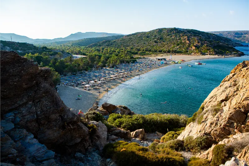
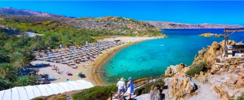
  • Vai Palm Beach Guide: Palm Forest, Swimming, Itanos and East Crete Road Trip Tips

    Vai Palm Beach Guide: Palm Forest, Swimming, Itanos and East Crete Road Trip Tips

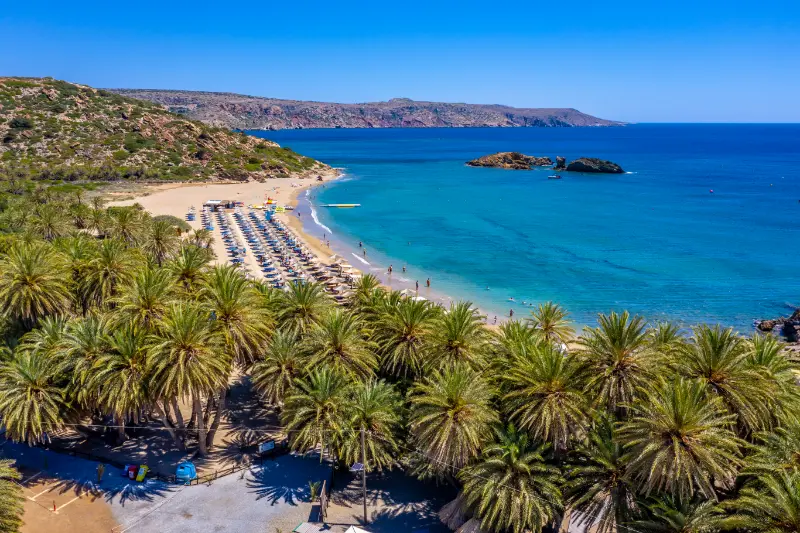
    Vai is one of those places where the landscape is instantly recognisable: a sandy bay backed by a dense grove of native Cretan date palms, Phoenix theophrasti. The combination feels almost tropical, yet it belongs completely to eastern Crete. The mistake is to drive several hours for a quick photograph and leave; Vai works better as the centre of a full east-coast day.

    Base yourself in Sitia if possible. From there, you can combine Vai with Toplou Monastery, the archaeological area of Itanos or Palaikastro without spending most of the day in the car. The palm forest is protected, so treat it as a natural site first and a beach facility second.

    Why this place deserves its own stop

    The strongest reason to come is the landscape itself. The attraction is not only one viewpoint or one activity, but the sequence of terrain, light and local life around it. Build enough margin into the day that you can stop when conditions are good rather than racing to match an overfilled schedule.

    What to see and do

    Arrive before the peak

    Vai becomes much more enjoyable before the main wave of day visitors. Early arrival improves parking, gives you a quieter first swim and makes the palm-backed beach feel like a landscape rather than a crowd scene. If you arrive late, consider staying into the late afternoon after some organised groups have left.

    Respect the palm forest

    The Cretan date palm is native to the region and the forest is the defining feature of Vai. Follow marked access and do not push into protected areas for photographs. The most responsible experience is to enjoy the visual relationship between palms and beach without treating the grove as an unrestricted picnic zone.

    Use the viewpoint

    A short climb to the established viewpoint gives the classic perspective over the curve of the beach and the palm forest. It is more useful than wandering randomly behind the beach because you see the scale and shape of the landscape. Do it before the hottest part of the day.

    Add Itanos

    The ancient site and beaches at Itanos are close enough to make an excellent second stop. The contrast is strong: at Vai the palm forest dominates; at Itanos, archaeology, rocky coastline and quieter coves change the mood. This is one of the easiest ways to make the long drive east feel worthwhile.

    Keep Toplou or Palaikastro as alternatives

    Toplou Monastery adds history and culture, while Palaikastro and Chiona add archaeology and a more local beach atmosphere. Do not attempt every stop. Choose one secondary place based on weather and energy, and let Vai remain the main beach experience.

    A realistic plan

    Part of the dayPlan
    08:30Arrive at Vai, swim and walk the beach
    10:30Viewpoint before peak heat
    12:00Leave for lunch or a second stop
    AfternoonItanos, Toplou or Palaikastro
    EveningReturn to Sitia for dinner

    Use this as a framework rather than a timetable. Crete rewards flexibility: parking can take longer than expected, mountain roads slow down, a good lunch becomes part of the day, and heat can change the order of activities. The best itinerary is the one that leaves enough margin to enjoy the main experience rather than simply arriving at every planned pin on a map.

    How to get there and move around

    Vai is in far eastern Crete, so driving time is the main planning issue. From Sitia it is a manageable excursion; from Agios Nikolaos it becomes a much longer day. Parking and facilities are available around the beach area in season, but conditions and charges can change. Bring water even if you plan to use beach services, and do not leave valuables visible in the car.

    Beach Of Vai Come Finikodasos Crete Island In Greece

    Respect seasonal conditions

    Natural sites in Crete change with weather, heat, wind and water levels. A route that is comfortable in spring can be much more demanding in August. Check local conditions, start earlier than you think you need to, and never treat a gorge or remote beach as an urban attraction with guaranteed services every few minutes. Water, suitable shoes and a realistic turn-around time matter more than squeezing another stop into the same day.

    Build a flexible backup plan

    Wind, road works, heat or a temporary access restriction can change the day. Keep one nearby alternative in mind instead of driving across the island to rescue the schedule. This is one of the simplest ways to make a Crete road trip feel relaxed: organise each day around one geographic area and choose two or three compatible options within it.

    Best time to visit

    Late May, June and September give the best balance of warm water and lighter pressure. July and August are busiest, so arrive early. Outside the main season the beach can feel wonderfully quiet, but services may be limited and wind can change swimming conditions quickly.

    For any outdoor or archaeological visit, check the same-day forecast and the official operating information. Crete can have very local conditions: wind on one coast, heat in an inland valley and cloud over the mountains at the same time. Planning by region and keeping one backup option nearby is more effective than relying on a rigid island-wide schedule.

    Food and local rhythm

    For a better food day, I prefer lunch away from the busiest beach zone, either around Palaikastro or back in Sitia. That gives you more choice and makes the beach time feel less commercial. Carry a reusable bottle and avoid leaving food waste near the protected palm area.

    One of my favourite planning rules in Crete is to protect lunch. Do not schedule every meal as a 20-minute gap between attractions. A proper stop gives you shade, hydration and a chance to ask local staff about road, wind or beach conditions. It also makes the day feel like a trip through Crete rather than a sequence of parking lots.

    How to combine it with nearby places

    Use Sitia as the natural base. If you have several nights in the east, keep Zakros for a separate day because both places deserve unhurried time.

    If your route already includes two long drives, resist adding a third distant highlight simply because it is famous. Crete is large enough that geographic discipline improves almost every itinerary. A day focused on one corner of the island usually produces more time walking, swimming or eating and less time looking through a windscreen.

    Where to stay

    For most travellers this works best as a day trip from an established base rather than a one-night hotel change. Choose accommodation based on the wider region and your next day, not only this single attraction. If an early start matters, staying within 30–45 minutes can dramatically improve the experience and reduce the temptation to rush.

    Photography and timing

    The most flattering light is usually early or late, but photography should not dictate unsafe timing. On exposed roads, gorges and archaeological sites, practical considerations come first. Carry a phone or camera securely, avoid stepping backward near drops or uneven stones, and take a moment to look without a screen. The best photographs often come after you have understood the shape of the place.

    Common mistakes to avoid

    • Driving from western Crete only for a two-hour beach stop
    • Arriving at midday in August and expecting easy parking
    • Entering protected palm areas for photographs
    • Trying to combine Vai and Zakros in a rushed half-day
    • Ignoring wind and sea conditions because the water looks calm in photos
    • Leaving the area without seeing another east-Crete stop such as Itanos

    Official information

    For current access, opening hours, tickets or regional information, check Visit Greece – Sitia Geopark shortly before the trip. I use official pages for variable details because older travel articles can remain online long after rules have changed.

    Frequently asked questions

    Is Vai worth the drive?

    Yes if you are already staying in eastern Crete. From Chania or Rethymno, the drive is too long for a simple beach day.

    Beach Of Vai At Crete Greece

    Is the palm forest natural?

    Yes. The grove is formed by the native Cretan date palm, Phoenix theophrasti, and is a protected natural feature.

    Can I visit Itanos on the same day?

    Yes. Itanos is close and makes one of the best complementary stops.

    Are there facilities at Vai?

    There are seasonal beach facilities, but availability and prices can change. Bring basic supplies anyway.

    How long should I stay?

    Three to five hours is comfortable for swimming, the viewpoint and a relaxed beach visit before adding one nearby stop.

    Final advice

    Build this stop around one clear reason for going, then let the surrounding area add depth. That approach keeps the day realistic and usually creates better memories than a checklist. In Crete, distance, heat and road shape matter as much as the number of attractions on a map.

    For the wider picture, continue with Sitia Travel Guide, Kato Zakros Guide, Crete Travel Guide. These guides make it easier to connect this stop to the rest of the island without unnecessary backtracking.

  • Spinalonga Travel Guide: Boat Trip, Fortress History and How to Visit from Crete

    Spinalonga Travel Guide: Boat Trip, Fortress History and How to Visit from Crete

    Spinalonga is a small island with an unusually dense history. Venetian fortifications, Ottoman-period settlement remains and the twentieth-century leprosy colony occupy the same compact space, while the surrounding water and dry Cretan landscape make the island visually striking before you even step ashore.

    It is one of the most worthwhile cultural excursions in eastern Crete and adds a completely different historical layer to my broader Crete Travel Guide and Crete Road Trip.

    Why this place deserves more than a quick photo

    Many visitors know Spinalonga mainly from books or television references to the leprosy colony, but the island’s fortifications and earlier settlement history are equally important. Understanding all three periods prevents the visit from becoming a single tragic story disconnected from the physical place.

    The island is also manageable in a few hours, which makes it easy to combine with Elounda, Plaka or Agios Nikolaos. The main constraint is transport by boat, so the day should be planned around sailing schedules rather than a rental-car clock.

    A short history before you visit

    Venetian authorities fortified Spinalonga because of its strategic position controlling access to the Gulf of Elounda. The defensive works remain among the most visible features of the island.

    After political control changed, Spinalonga also developed an Ottoman-period settlement. In the twentieth century, the island became associated with the isolation and treatment of people with leprosy, a chapter that lasted for decades and left buildings and powerful personal histories.

    Spinalonga’s modern heritage significance continues to receive formal cultural attention in Greece. For current destination context and boat information, use official regional or Greek tourism sources close to your travel date because access is seasonal and weather-dependent.

    What to see: the essential highlights

    • Venetian fortifications: walls, gates and elevated defensive positions explain why this small island mattered strategically.
    • Main settlement streets: surviving structures make it possible to imagine daily life beyond the military architecture.
    • Leprosy-colony buildings: emotionally important remains that should be approached with respect rather than as a dark-tourism spectacle.
    • Views toward Plaka and Elounda: the short sea distance emphasises both connection and historical isolation.
    • Perimeter walking route: a compact way to understand the whole island if weather and access allow.
    • Interpretive exhibits: current displays and signs add essential context to buildings that might otherwise seem anonymous.

    The route I would follow

    Most visitors have a fixed amount of time between boat arrival and departure, so orient yourself immediately and avoid spending the first half hour only around the landing area.

    1. Confirm the return boat time as soon as you disembark.
    2. Enter through the fortifications and read the introductory historical material.
    3. Follow the settlement route, paying attention to buildings from different periods.
    4. Visit the areas connected with the leprosy colony slowly and respectfully.
    5. Continue along the perimeter or higher paths if time and heat allow.
    6. Return to the landing point with a comfortable margin for the boat.

    If your boat allows only a short stop, focus on the main historical route instead of attempting every wall and viewpoint. The interpretation matters more than covering every metre.

    How much time do you need?

    Around two hours on the island works for many visitors, though longer gives you more time to read and walk the perimeter. Boat excursion formats vary, so check how much actual island time is included before booking.

    Do not compare excursions only by price or total duration; a long cruise with swimming stops may give less archaeological time than a short direct boat from a nearby port.

    How to get there

    Boats commonly operate from Elounda and Plaka, with other excursions available from the wider Agios Nikolaos area. Plaka is physically closest and can provide a very short crossing, while Elounda has a broader tourism infrastructure.

    Sailing frequency is seasonal and weather-dependent. Confirm the current return schedule before driving across Crete, particularly outside high season.

    Best time of day and best season

    Spring and early autumn are excellent because the island is exposed and can be hot in summer. In July and August, choose an early sailing if possible and carry water.

    Wind can affect comfort and boat operations. If the forecast is poor, keep the day flexible and verify operator messages before leaving your accommodation.

    Tickets, opening hours and current information

    Boat tickets and archaeological admission may be separate and can change. Check exactly what an excursion includes. Use official cultural information for current site admission and local operators for sailing schedules.

    What to wear and what to bring

    • Water and strong sun protection.
    • Secure walking shoes for stone and uneven paths.
    • A hat that can handle wind on the boat.
    • Offline copy of the return ticket or excursion confirmation.
    • A respectful mindset for the medical and social history of the colony.

    Visiting with children

    Spinalonga can work with older children who are ready for difficult historical themes. Explain the island honestly but age-appropriately, focusing on community, medicine and changing attitudes rather than sensational details.

    For younger children, keep the visit shorter and balance it with a boat ride or beach time around Elounda. The island has limited shade, so heat management is more important than completing the perimeter.

    Accessibility and physical effort

    The island includes uneven stone, slopes and historic surfaces. Some main routes may be easier than upper fortifications, but travellers with mobility needs should ask the boat operator and official site staff about current accessible options.

    Boarding small excursion boats can itself be a mobility challenge. Verify vessel access before buying a ticket rather than only researching the archaeological path.

    Photography without missing the place itself

    Wide images from the walls looking toward the Cretan coast communicate Spinalonga’s isolation and strategic position. Narrow streets are best photographed when you include doorways, shadows and sea glimpses rather than empty façades alone.

    Historic Stone Buildings Narrow Streets Spinalonga Island Crete Greece

    Be sensitive around buildings connected with illness and forced isolation. Spinalonga is historic, but it is also within living family memory and should not be reduced to dramatic photo props.

    What to combine with your visit

    Elounda and Plaka make the easiest same-day combination. A relaxed lunch by the water after the visit provides a useful emotional and physical break.

    On a longer eastern Crete route, continue toward Agios Nikolaos or connect the excursion with the broader Crete road trip. Do not try to add Chania or western Crete on the same day; the island is much larger than first-time visitors expect.

    Traditional Old Houses Doors Spinalonga Island Crete Greece With Mountains

    Where to stay for the easiest visit

    Elounda is ideal for resort comfort and frequent excursion options. Plaka is smaller and atmospheric, while Agios Nikolaos provides a lively town base with more evening choice.

    Choose the base according to the rest of eastern Crete rather than Spinalonga alone; the boat ride is short enough from the main local departure points that changing hotels just for the excursion is unnecessary.

    Common planning mistakes

    • Booking a cruise without checking how much time is actually spent on Spinalonga.
    • Visiting in peak midday heat without water.
    • Focusing only on the leprosy colony and ignoring Venetian/Ottoman layers.
    • Forgetting that boat schedules are weather and season dependent.
    • Treating sensitive historical buildings as a dark-tourism photo set.

    A slower, better way to experience it

    Spinalonga is strongest when you let the layers coexist. Stand on a Venetian wall, look down at later houses and remember that the same small island meant defence, home, exclusion and memory to different people.

    Read names, dates and personal accounts where interpretation is provided. They humanise the twentieth-century history and prevent the settlement from becoming an abstract backdrop.

    Frequently asked questions

    Where do boats to Spinalonga leave from?

    Common departure points include Plaka and Elounda, with wider excursion options from the Agios Nikolaos area. Services vary by season.

    How long do I need on Spinalonga?

    Around two hours is enough for the main route; more time is useful if you enjoy detailed historical interpretation.

    Can I visit independently?

    Yes, by buying transport on a local boat and visiting the site independently, subject to current schedules and admission arrangements.

    Is Spinalonga suitable for children?

    It can be, especially for older children, but the leprosy-colony history should be explained sensitively and the heat needs careful management.

    What is the best base?

    Elounda and Plaka are the most convenient for the crossing; Agios Nikolaos is a good larger-town base nearby.

    Final advice

    Spinalonga is small enough for a half-day yet complex enough to stay in your memory far longer. Its power comes from the collision of military, community and medical history within one dry, beautiful island landscape.

    Choose a boat that gives you enough time ashore, visit early in hot weather and approach the twentieth-century story with respect. It is one of eastern Crete’s most meaningful excursions.

    Choosing between Plaka and Elounda boats

    For many independent travellers, the choice is between a very short crossing from Plaka and a slightly longer excursion from Elounda. Plaka is ideal if your only goal is to maximise time on Spinalonga with minimal boat travel. Elounda offers more restaurants, accommodation and excursion choice, and the crossing can feel more like a small outing in its own right.

    I compare the actual time ashore, not just the departure price. A cheap cruise that includes several swim stops may give less time at the archaeological site than a simple direct boat. Read the itinerary line by line before paying.

    Understanding the leprosy-colony period responsibly

    The twentieth-century history can easily be sensationalised. People sent to Spinalonga built community, worked, formed relationships and experienced changing medical treatment under difficult conditions. The site deserves language that recognises those people as residents and patients rather than turning them into scenery for a “haunted island” story.

    A good eastern Crete day around Spinalonga

    My preferred rhythm is an early boat, two thoughtful hours on the island, then lunch in Plaka or Elounda. In the afternoon, choose one beach or a relaxed walk in Agios Nikolaos rather than another long archaeological visit. The emotional intensity of Spinalonga benefits from a lighter second half of the day.

    Discover Spinalonga Islands Rich History Stunning Views Crete Greece
  • Athens Riviera Guide: Beaches, Cape Vouliagmeni, Glyfada and a Coastal Day Trip

    Athens Riviera Guide: Beaches, Cape Vouliagmeni, Glyfada and a Coastal Day Trip

    The Athens Riviera is the long coastal zone stretching south from the city toward Glyfada, Voula, Vouliagmeni and eventually the Saronic-facing road to Cape Sounion. For travellers who think of Athens only as archaeology, traffic and dense neighbourhoods, the coastline can be a surprise. Within the same trip you can spend the morning in a museum and the afternoon swimming, walking a marina or having dinner beside the sea. The key is choosing one section of coast rather than trying to cover the entire Riviera in a single day.

    If this is your first trip to the area, use this article together with Athens Travel Guide, Cape Sounion Day Trip and Greece with Kids. Those guides cover the wider destination, while this page focuses on the practical decisions that make a visit to Athens Riviera Guide work smoothly.

    Why Athens Riviera Guide is worth your time

    The Riviera is most useful when you want a change of rhythm without adding another island transfer. Glyfada offers shopping and restaurants, Voula is more relaxed, Vouliagmeni combines beaches with a polished resort atmosphere, and the farther southern coast becomes increasingly scenic. Families, couples and travellers with an extra day in Athens can all use the coast differently.

    The strongest trips are usually built around a clear reason for being here rather than a list of every possible attraction. Decide whether your priority is history, landscape, food, swimming, photography or walking. Once that is clear, the rest of the itinerary becomes easier: you can choose the right time of day, avoid unnecessary transfers and leave enough space for the experience that brought you here in the first place.

    Main highlights

    • Glyfada for dining, shopping and easy urban access
    • Voula for a quieter coastal base
    • Vouliagmeni for beaches and a resort atmosphere
    • coastal marinas and sunset walks
    • easy combination with Cape Sounion
    • swimming without taking a ferry

    Glyfada for dining, shopping and easy urban access

    Glyfada for dining, shopping and easy urban access is one of the elements that gives Athens Riviera Guide its identity. Do not approach it only as a photo stop. Spend enough time to notice how it connects with the surrounding streets, landscape or historical context. In busy periods, moving even ten minutes away from the obvious focal point often changes the experience completely and gives you a more balanced view of the place.

    Voula for a quieter coastal base

    Voula for a quieter coastal base is one of the elements that gives Athens Riviera Guide its identity. Do not approach it only as a photo stop. Spend enough time to notice how it connects with the surrounding streets, landscape or historical context. In busy periods, moving even ten minutes away from the obvious focal point often changes the experience completely and gives you a more balanced view of the place.

    Vouliagmeni for beaches and a resort atmosphere

    Vouliagmeni for beaches and a resort atmosphere is one of the elements that gives Athens Riviera Guide its identity. Do not approach it only as a photo stop. Spend enough time to notice how it connects with the surrounding streets, landscape or historical context. In busy periods, moving even ten minutes away from the obvious focal point often changes the experience completely and gives you a more balanced view of the place.

    Athens Greece Riviera Asteras Vouliagmeni Panorama Aerial Drone View

    coastal marinas and sunset walks

    coastal marinas and sunset walks is one of the elements that gives Athens Riviera Guide its identity. Do not approach it only as a photo stop. Spend enough time to notice how it connects with the surrounding streets, landscape or historical context. In busy periods, moving even ten minutes away from the obvious focal point often changes the experience completely and gives you a more balanced view of the place.

    Best time to visit

    June and September are excellent because the sea is generally comfortable while the coast is less intense than in peak August. July and August suit beach-focused travellers but traffic and beach demand are higher. In spring and autumn the waterfront remains worthwhile for walking and restaurants even when swimming is not the main goal.

    Time of day matters almost as much as season. Early mornings are best for archaeological sites, exposed walks and popular viewpoints, while late afternoon is usually more pleasant for neighbourhoods, waterfronts and photography. If a visit depends on opening hours, boats, weather or trail conditions, check the official information the evening before rather than relying on an itinerary saved months earlier.

    How to get there and get around

    The tram is useful for the northern Riviera but becomes slow if you are travelling far south. Buses extend beyond the tram network, while taxis or ride-hailing can save time for couples or families. A rental car makes sense if you want to continue toward Cape Sounion, but parking and traffic can remove much of the advantage if your plan is limited to Glyfada or central Vouliagmeni.

    In Greece, transport decisions should be made around the whole day rather than a single attraction. A rental car gives flexibility but can create parking problems in historic centres. Public transport is often excellent for straightforward city routes but less useful for combining several rural stops. Taxis are valuable for short gaps, especially when they save a steep climb or a long wait, but they become expensive when used as a substitute for a properly planned route.

    How much time do you need?

    For Athens Riviera Guide, a focused visit can usually fit into half a day, but the right amount of time depends on how deeply you want to explore. Travellers who enjoy museums, hiking, long lunches or photography should protect a full day or at least avoid scheduling another major attraction immediately afterwards. If you are using the place as part of a wider road trip, one well-planned stop is better than three rushed ones.

    A realistic itinerary

    Leave central Athens after breakfast and head to Vouliagmeni for a swim or coastal walk. Have a long lunch, then move north to Glyfada for cafés and shopping, or continue south if your priority is scenery. For a full coastal day, finish at Cape Sounion near sunset, but keep in mind that this turns a relaxed Riviera outing into a longer road-based excursion.

    Coastal View Athens Riviera From Kavouri With Waves Cityscape Blue Sky Greece

    Build a buffer of at least one hour into the day. That margin absorbs a longer meal, traffic, a museum queue, a change in weather or the discovery of a viewpoint where you simply want to stay. Greece is rarely at its best when every thirty minutes are scheduled. Protect the essential logistics, then allow the day to breathe.

    Where to stay

    You do not necessarily need to sleep beside Athens Riviera Guide. Choose accommodation based on the wider trip. In cities, stay near a metro line or in a neighbourhood you enjoy walking through at night. In mountain and rural areas, staying close to the next morning’s trailhead can be more useful than choosing the prettiest village on a map. On a short trip, convenience usually creates more value than saving a small amount on the nightly rate.

    Food and breaks

    Avoid choosing a restaurant only because it sits beside the most famous landmark. Walk a few streets away, compare menus and look for places where the meal itself can become part of the day. In hot weather, a long lunch during the middle of the afternoon is often smarter than forcing another exposed walk. Carry water even in cities, and never assume a rural viewpoint or archaeological site will have an open café when you need one.

    What to bring

    • comfortable shoes with grip
    • refillable water bottle
    • sun protection and a hat
    • a light layer for wind or cooler evenings
    • offline map or downloaded route
    • charged phone or small power bank
    • a little cash for minor purchases

    Pack for the actual terrain rather than the image you have seen online. Ancient paving can be slippery, mountain trails can be rough, and coastal wind can make a warm day feel much cooler after sunset. Good footwear and water make a bigger difference than carrying extra clothes you will never use.

    Common mistakes to avoid

    • arriving at the same peak hour as every tour group
    • trying to combine too many distant stops
    • ignoring heat, wind or trail conditions
    • assuming old ticket prices or opening hours are still valid
    • forgetting to plan the return journey
    • treating religious, residential or protected areas as photo sets

    The most common mistake at Athens Riviera Guide is overestimating how much fits comfortably into one day. Distances on a map do not show parking, queues, steep streets, museum fatigue or the simple desire to stop for coffee. Prioritise two or three experiences and leave secondary stops optional.

    Is it suitable for families?

    Usually yes, but the day should be adapted to heat, walking distance and attention span. Families often do better with an early start, a clear lunch break and one major attraction rather than a full adult sightseeing schedule. At archaeological sites and viewpoints, uneven surfaces and unprotected drops require active supervision. A shorter successful visit is better than forcing children through every room or path.

    Accessibility and mobility

    Accessibility varies widely. Modern museums and central promenades may have lifts and smoother surfaces, while old towns, mountain paths and archaeological sites can include steps, cobbles and steep gradients. Check the official accessibility information for the specific place you plan to visit. If mobility is limited, taxis can often eliminate the hardest climbs even when the final attraction still requires some walking.

    What to combine with it

    The coast can replace rather than accompany another major Athens attraction. It works especially well after two or three intensive sightseeing days. If you are staying longer, consider one night on the Riviera before an early flight or ferry only if the location genuinely improves your transport plan.

    For more context, continue with Athens Travel Guide, then use Cape Sounion Day Trip and Greece with Kids to build the surrounding itinerary. This keeps Athens Riviera Guide connected to the rest of the trip instead of turning it into an isolated detour.

    Attica Faliro Athens Riviera

    FAQ

    Do I need to book in advance?

    For major museums, organised tours, popular summer activities and time-sensitive transport, advance booking is sensible. For ordinary neighbourhood walks and viewpoints, it is usually unnecessary.

    What is the best time of day?

    Early morning is best for lower temperatures and fewer people. Late afternoon is excellent for atmosphere and photography, provided opening hours and the return journey still work.

    Can I visit without a car?

    In cities, usually yes. Rural attractions and multi-stop mountain days are easier with a car, although organised excursions or taxis can sometimes replace driving.

    Is it worth visiting in the shoulder season?

    Yes. May, June, September and October can be excellent, but seasonal buses, boats and businesses may run less frequently outside peak summer.

    Should I trust prices and timetables from older articles?

    No. Tickets, opening hours, access rules and transport schedules change. Recheck official or local information shortly before your visit.

    Final advice

    Treat Athens Riviera Guide as an experience rather than a task to complete. Arrive with a clear plan for the essential logistics, then give yourself enough time to notice the details that make the place distinctive. That balance between preparation and flexibility is what turns a technically correct itinerary into a trip that actually feels like Greece.

    More Attica guides for your trip

    Continue with Lake Vouliagmeni; Lavrio for more detailed planning.

    For more ideas around Attica, see our Anavyssos and Palaia Fokaia guide.