Author: Jessica

  • Metsovo Travel Guide: Stone Mansions, Cheese, Wine and a 3-Day Pindus Mountain Stay

    Metsovo Travel Guide: Stone Mansions, Cheese, Wine and a 3-Day Pindus Mountain Stay

    Metsovo Travel Guide is a useful way to experience a mountain town on the Pindus slopes with a strong Vlach cultural identity, substantial museums and food traditions, and enough life to justify more than a lunch stop on the motorway. This guide is designed for travellers who want more than a list of sights: it explains how to sequence the day, where driving or walking time is often underestimated, and which details matter when you are actually on the ground in Epirus.

    For wider context, start with the Zagori Travel Guide and the Ioannina Travel Guide. If hiking is central to your trip, also use the Hiking in Greece guide. Those pages cover the broader region; this article stays focused on the practical choices that make this specific stop work smoothly.
    Ioannina Metsovo Anilio

    Quick planning facts

    • The regional tourism authority places Metsovo at roughly 1,160 metres above sea level.
    • Metsovo is known for stone mansions, woodcarving, textiles, wine and cheese.
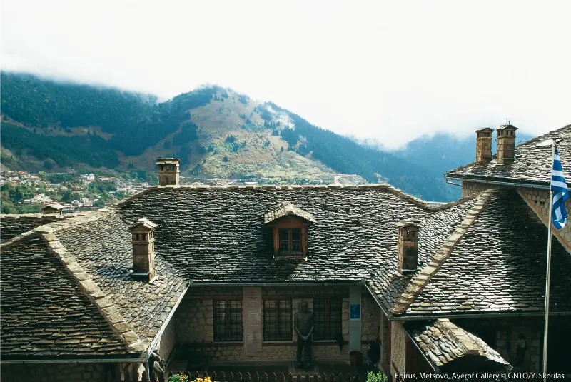
    • The Averoff Gallery and Tositsa Mansion are among the town’s major cultural stops.
    • Aoos Springs Lake and the Northern Pindus landscape expand the trip beyond the town centre.
    • Winter can bring snow and ice, while summer evenings are often cooler than the lowlands.

    Why this place deserves its own stop

    The main reason to include this stop is that it reveals a different layer of Epirus from the famous headline sights. A mountain town on the pindus slopes with a strong vlach cultural identity, substantial museums and food traditions, and enough life to justify more than a lunch stop on the motorway. The experience becomes much richer when you leave enough time for walking, food and the changing mountain light instead of treating the place as a roadside photograph.

    Zagori and the wider Pindus reward slow travel. Roads twist around valleys, parking in old settlements is limited, and weather can change the order of the day. I therefore plan by geographic clusters: one village group, one outdoor objective and one relaxed meal. That structure leaves room for an unexpected viewpoint, a local recommendation or a trail that takes longer than the sign suggests.

    Central Metsovo

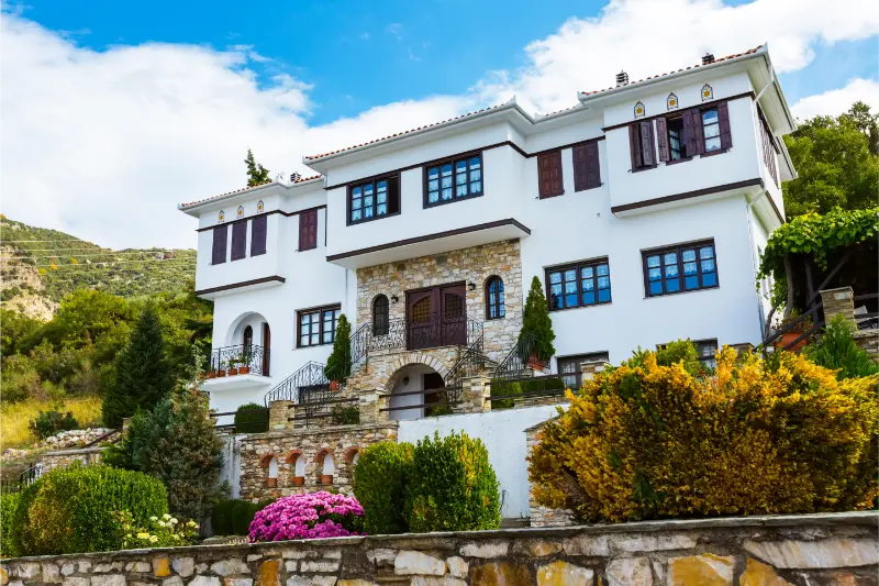
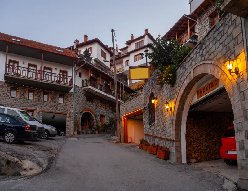
    The centre is compact but steep. Start around the main square and walk rather than repeatedly moving the car. Traditional houses, shops, churches and views open from side streets, and the town feels more coherent when explored on foot. Because Metsovo is a real regional centre rather than a preserved museum village, mornings and evenings reveal local rhythms that day-trippers often miss.

    My approach here is to allow more time than the minimum. Even when the main sight takes less than an hour, the surrounding paths, views and village atmosphere are what make the stop memorable. If weather closes in, shorten the outdoor section rather than compensating by driving faster to the next place.

    Museums and benefactors

    Metsovo’s modern identity is closely tied to benefactor families such as Averoff and Tositsa. The museums and gallery provide context for the wealth, education and cultural exchange that shaped the town. Even travellers who usually skip museums should consider at least one, because the architecture and collections explain why Metsovo looks and feels different from smaller Pindus villages.
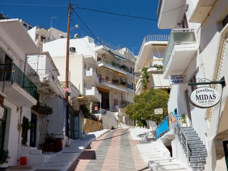
    Streets Houses Traditional Architecture Mountain Village Metsovo Greece

    My approach here is to allow more time than the minimum. Even when the main sight takes less than an hour, the surrounding paths, views and village atmosphere are what make the stop memorable. If weather closes in, shorten the outdoor section rather than compensating by driving faster to the next place.

    Cheese and wine

    Food is not a side note here. Metsovone and other local cheeses, mountain meats and regional wines reflect a long production tradition. Visit Greece notes that a dairy school founded in 1958 helped combine local livestock traditions with techniques brought from Italy. Tasting works best when treated as part of the destination rather than a shopping exercise.

    My approach here is to allow more time than the minimum. Even when the main sight takes less than an hour, the surrounding paths, views and village atmosphere are what make the stop memorable. If weather closes in, shorten the outdoor section rather than compensating by driving faster to the next place.

    Aoos Springs and mountain scenery

    The artificial Aoos Springs Lake and nearby highlands provide an easy way to add landscape to a cultural stay. Road conditions and visibility change sharply with season. In fine weather, the open plateau feels completely different from Metsovo’s dense townscape; in winter, snow can make the same excursion unsuitable without proper preparation.

    My approach here is to allow more time than the minimum. Even when the main sight takes less than an hour, the surrounding paths, views and village atmosphere are what make the stop memorable. If weather closes in, shorten the outdoor section rather than compensating by driving faster to the next place.

    How I would plan the visit

    I would spend the first afternoon entirely in Metsovo, the second day on museums, food and a winery or local producer, and the third on Aoos Lake or another mountain excursion. This rhythm makes the town a destination rather than a motorway stop. It also leaves flexibility for bad weather, which is valuable in the Pindus.

    The key is to preserve a margin. In mountain Greece, a 30-minute delay can come from roadworks, livestock, a photo stop, a slow lunch or simply a narrow road behind another vehicle. Building slack into the itinerary means you can enjoy those moments rather than treating them as problems. I also avoid scheduling a long transfer immediately after the main hike or outdoor activity.

    Where to stay

    Stay within walking distance of the centre if you want to enjoy dinner without moving the car. Parking can be awkward in the steep core, so accommodation with clear parking instructions is a real advantage. In winter, ask about road access and heating; in summer, prioritise a quiet room because the central streets can remain lively into the evening.

    For booking, I pay more attention to parking instructions, heating, breakfast timing and road access than to a long amenities list. Historic villages often have pedestrian lanes and accommodation entrances that are not obvious from a map. A message to the property before arrival can save a stressful search with luggage on steep stone streets.

    Getting around and driving

    A car gives the greatest flexibility in this part of Epirus, but driving style matters. Mountain roads can be narrow, with blind bends, occasional animals and limited shoulders. Keep fuel comfortably above empty, download an offline map, and avoid relying on optimistic map-app journey times. After dark, familiarity with the route matters more than the number of kilometres.

    If you prefer not to drive, organised excursions, taxis and local transfers can cover some major sights, but they are not a complete substitute for a car when you want several small villages. For point-to-point hikes, pre-arranged transport is often more important than getting to the trailhead itself. Confirm the pickup plan before setting out.

    Food and local rhythm

    Metsovo rewards travellers who eat locally: smoked Metsovone, other mountain cheeses, pies, meats and wine are more meaningful here than a generic tourist menu. A tasting at a producer can be useful, but do not overload one day with multiple rich meals. The altitude and cool evenings make a leisurely dinner particularly enjoyable.

    Opening patterns are seasonal. A village that feels busy on an autumn weekend can be extremely quiet on a weekday outside peak periods. I do not assume that a café, petrol station or taverna shown online will be open at a precise hour. Carrying water and a small snack gives you the freedom to keep the day relaxed.

    Best time to visit

    Late spring and early autumn are excellent for most road trips and walking because temperatures are usually more comfortable than midsummer. Summer offers long daylight, but exposed paths can still be hot. Autumn colours are particularly attractive around the Pindus. Winter creates a completely different atmosphere, with snow possible at altitude and a much greater need to check tyres, chains, forecasts and road conditions.

    There is no single best month for every traveller. Hikers should prioritise stable conditions; photographers may prefer changing weather; families often value long daylight and simpler roads. Whatever the season, recent local information is more important than a fixed annual rule when mountains, rivers or snow are involved.

    Travelling with children

    Families can enjoy the compact centre, museums and short nature excursions, but steep streets can tire small children. In winter, snow adds fun but also practical complications. Choose one cultural stop and one outdoor stop per day rather than packing in a long list. Aoos Lake can be a good family drive in stable weather.

    A useful family rule in Zagori is one major objective per day. Children often enjoy the bridges, water, village squares and short paths more than a long checklist of viewpoints. Build in warm food, toilet stops and time to play. If a route has exposure, fast water or loose stone, adult supervision matters more than the route’s reputation for being easy.

    Photography without turning the trip into a photo shoot

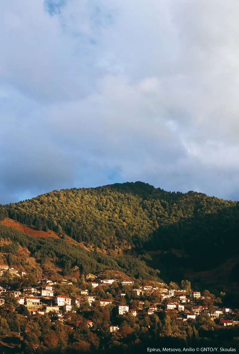
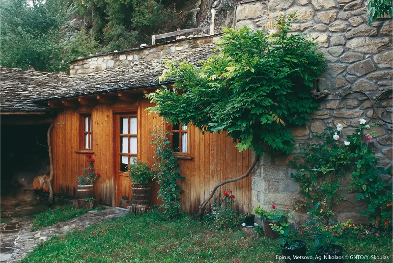
    Stone houses, tiled roofs, mountain backdrops and winter snow make Metsovo highly photogenic. Step away from the main square for quieter compositions. Early morning produces cleaner streets and soft light; after snowfall, prioritise safe footing over chasing viewpoints. Drones may be restricted, so check current rules before flying.

    The best images often come when you stop looking for a single iconic frame. Stone walls, slate roofs, old paths, water and cloud layers tell the story of the region. Use safe pull-offs, never block a road or doorway, and remember that monasteries, churches and homes may have photography restrictions or deserve privacy even when no sign is posted.

    Responsible travel in the UNESCO landscape

    This part of Epirus is not a theme park: villages are lived-in communities and many trails cross a protected mountain landscape. Park only where you do not block residents or emergency access, keep noise low in village lanes, carry your rubbish out, and stay on established paths when the ground is fragile. In summer, fire restrictions can change quickly; in winter, snow and ice can turn an easy-looking road or path into a serious problem. Local advice on the day is more valuable than an old blog post when conditions are changing.

    UNESCO describes Zagori as a cultural landscape in which villages, stone bridges, paths, staircases, sacred forests and mountain terrain form one connected system. That is a useful way to travel here too: support local businesses, walk respectfully through settlements and avoid reducing the region to a collection of viewpoints. The character visitors come to see depends on villages remaining viable places to live.

    Common mistakes to avoid

    • Using Metsovo only as a motorway lunch stop.
    • Driving into narrow central streets without checking parking.
    • Ignoring museums and the town’s benefactor history.
    • Underestimating winter road conditions.
    • Trying too many heavy food tastings in one afternoon.

    Most mistakes come from trying to make the day more efficient than the landscape allows. The cure is simple: fewer stops, earlier starts for outdoor activities, a clear parking plan and a willingness to change the route when weather or fatigue says so. In Epirus, a slower day often produces more memorable travel than a longer checklist.

    Official information and useful context

    For current destination information, consult the Epirus for All Seasons guide to Metsovo. For the wider heritage context, UNESCO’s Zagori Cultural Landscape page explains why the villages, stone infrastructure and surrounding landscape are protected as one cultural system. Recheck opening hours, trail conditions and activity schedules close to your travel date.

    Frequently asked questions

    How many days do you need in Metsovo?

    Two nights are ideal for the town plus one nature or food-focused excursion. One night still works if you are linking Ioannina with Meteora or northern Greece.
    Ioannina Metsovo Ag Nikolaos

    Is Metsovo worth visiting in summer?

    Yes. The mountain setting is cooler than many lowland destinations, and summer works well for walking, food and Aoos Lake excursions.

    What food should you try?

    Local cheeses including Metsovone, pies, mountain meats and regional wines are central to the experience. Choose producers and tavernas that emphasise local ingredients.

    Do you need a car?

    You can explore the town itself on foot, but a car is very useful for Aoos Lake and wider Pindus excursions.

    Is Metsovo good in winter?

    It is one of Greece’s classic winter mountain destinations, but snow and ice mean you should check road conditions, tyres or chains and weather before driving.

    Final thoughts

    Metsovo Travel Guide works best when it is given enough time to feel like part of a mountain journey rather than another pin on a map. Keep the day realistic, connect it with nearby villages instead of distant attractions, and let food, weather and walking pace shape the itinerary. That approach is exactly what makes Epirus different from a fast island-hopping schedule.

    For a quiet high-mountain excursion, use our Aoos Springs Lake guide.

  • Stoupa Travel Guide: Beaches, Kalogria, Zorba History, Lefktron Castle and Where to Stay

    Stoupa Travel Guide: Beaches, Kalogria, Zorba History, Lefktron Castle and Where to Stay

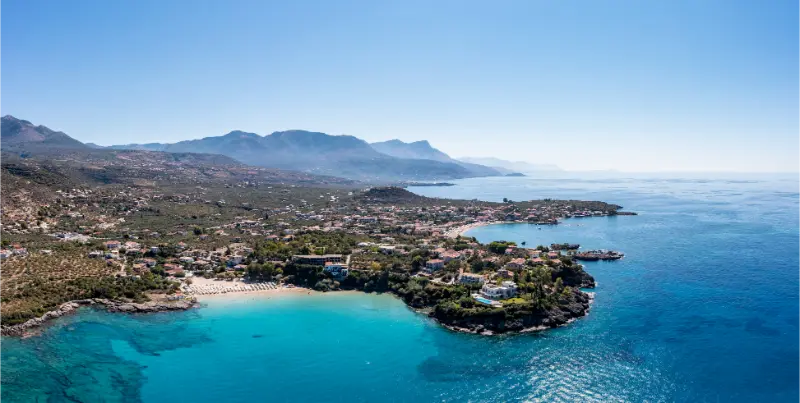
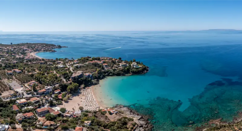
    Stoupa is one of the easiest places in Messinian Mani to turn into a relaxed beach base without losing the region’s history and mountain character. The village sits on the coast with Mount Taygetos rising behind it, about 45 kilometres from Kalamata, and combines two famous sandy bays with tavernas, accommodation and straightforward access to nearby Mani villages.

    What makes Stoupa more interesting than a generic seaside resort is the contrast between the holiday atmosphere and the stories around it: Nikos Kazantzakis, Giorgos Zorbas, the Prastova lignite mine, ancient Leuktron and the Frankish castle of Lefktron. I would stay at least two nights if you want beach time and one or two excursions rather than using Stoupa only as a swimming stop.

    Quick planning summary

    • About 45 km from Kalamata
    • Best for sandy beaches plus easy Mani day trips
    • Kalogria and Stoupa beaches are both walkable from the resort area
    • Two to four nights work well for a relaxed stay

    Stoupa Beach: the practical village beach

    Stoupa Beach is the easiest choice when you want a swim without driving. The sand, clear water and concentration of cafés, tavernas and accommodation make it especially convenient for families or travellers who prefer to walk between breakfast, beach and dinner. The beach can become busy in July and August, so mornings and late afternoons are more pleasant if you value space.

    Do not choose accommodation only because it is listed as “Stoupa”. Check the exact map position. Some properties sit on the slopes or on roads where the walk back from the waterfront is steeper than expected. If being able to leave the car parked is important, prioritise the central village and verify parking before booking.

    Kalogria Beach: famous water and a literary connection

    Kalogria lies immediately north of Stoupa and is one of the best-known beaches in Messinia. It is sandy, organised in season and generally more of a destination beach than a hidden cove. The water can look almost pool-like on calm days, which explains the beach’s popularity, but peak-season demand means arriving early is sensible.

    Kalogria is also associated with Kazantzakis, who lived in the area while involved in the nearby mining venture. The regional tourism authority identifies it as his favourite local beach. That literary connection is worth knowing before you arrive because it turns a famous swimming spot into part of the cultural landscape behind Zorba the Greek.

    Kazantzakis, Giorgos Zorbas and the Prastova mine

    In 1917 Nikos Kazantzakis came to the Stoupa area after acquiring mining rights at Prastova. Giorgos Zorbas worked there as a foreman and later became the real-life inspiration for the character Alexis Zorbas. The mining business did not succeed, but the relationship and the experience became far more important culturally than economically.

    I would treat this story as context rather than search for a polished “Zorba attraction”. The value is in understanding why this quiet corner of Mani became tied to one of the most internationally recognised Greek literary characters. Read a short account before walking the coast and the landscape feels less like a resort strip and more like a place with a layered twentieth-century story.

    Lefktron Castle and the older history of the area

    East of Stoupa, near Lefktro, are the remains of a small Frankish castle built in the thirteenth century on a site connected with ancient Leuktron. Visit Peloponnese dates the castle to around 1250, during the rule of William II of Villehardouin. The remains are modest compared with Methoni or Mystras, so expectations matter.

    This is a useful short excursion for travellers who enjoy combining archaeology and landscape. Wear proper shoes, avoid climbing unstable masonry and remember that the hill has a much longer history than the surviving medieval walls. Finds from the wider area are represented in the Archaeological Museum of Messenia in Kalamata.

    Walking, cycling and nearby coastal villages

    Stoupa works well without a major sightseeing agenda. The flatter coastal section is popular for walking and cycling, and the Municipality of West Mani has promoted cycling from Stoupa toward Agios Nikolaos, Agios Dimitrios and Trachila. Conditions and route surfaces vary, so check the current path before treating it as a dedicated protected cycleway for the entire distance.

    Greece Peloponnese Stoupa Seaside Village Sandy Beach Aerial View Mani Messenia

    A good low-stress day is Stoupa in the morning, Kalogria for a swim, then Agios Nikolaos for a late lunch or evening walk. If you have a car, Kardamyli adds Old Kardamyli and a different beach character without requiring a long regional transfer.

    Food and evenings in Stoupa

    Stoupa has far more restaurant choice than the smaller villages farther south. Look for Messinian olive oil, lalagia, local cheese such as sfela, seasonal vegetables and simple grilled meat or fish. In high summer the most obvious waterfront tables fill quickly; walking one or two streets back can produce a quieter meal.

    The village becomes livelier after sunset, but it is not a large nightlife destination. That balance is part of the appeal for couples and families. If you want a very quiet fishing-village evening, Agios Nikolaos is the better contrast; if you want a broader urban selection, Kalamata offers a completely different experience.

    How long to stay and where Stoupa fits in a Mani trip

    Two nights are enough for a first visit built around beaches and one excursion. Three or four nights make sense if you want Stoupa to be your base for Kardamyli, Agios Nikolaos, coastal walks and a slower beach rhythm. It is also a logical first or last Mani stop when arriving from Kalamata.

    If your trip continues into Laconian Mani, do not commute all the way to Areopoli, Gerolimenas or Cape Tainaron every day. Move accommodation south instead. The Mani Peninsula road trip works better when the peninsula is divided into two bases rather than treated as a single long day trip.

    Best time to visit

    For most of Messinia, May, June, September and early October give the best balance of warm weather, comfortable sightseeing and functioning seasonal services. July and August are ideal for beach-focused travel but bring stronger heat and heavier demand. Archaeological sites, gorges and hill towns are much easier early in the day during midsummer.

    Winter can be excellent for Kalamata, archaeology, food and quiet road trips, but some beach businesses, boat excursions and smaller visitor services operate on reduced schedules. Nature sites such as gorges require extra caution after heavy rain. Always let the actual forecast and local conditions override a fixed itinerary.

    Getting there and getting around

    Kalamata is the main transport hub for Messinia, with road connections to Athens and the rest of the Peloponnese. A car gives the greatest flexibility for beaches, archaeological sites and small villages because regional attractions are spread widely and public transport is not designed around a tourist circuit.

    If you travel without a car, build the trip around one or two walkable bases and use intercity buses, local taxis or organised excursions selectively. Confirm the return journey before leaving for a remote site, and download maps for rural areas where signal can be inconsistent.

    How much time to allow

    Messinia rewards slower planning. Distances may look short, but castle walks, parking, mountain bends, beach stops and long meals add time. I prefer one major attraction plus one lighter stop in the same geographic area rather than crossing the region several times in a single day.

    For a broader regional trip, five to seven nights let you combine Kalamata, archaeology, Navarino/Pylos, one castle coast and either Messinian Mani or Trifylia without changing hotel every night. Shorter trips should choose one side of the region and accept that the rest belongs to a future visit.

    Where to stay

    Choose the base that matches the next morning rather than the most famous town name. Kalamata works for flights, museums and central/eastern Messinia; Pylos or Gialova suit Navarino and Voidokilia; Finikounda works for the south-west coast; Stoupa or Kardamyli are best for Messinian Mani; Kyparissia or Marathopoli reduce driving in Trifylia.

    Check current accommodation options

    Useful internal guides

    Continue planning with Agios Nikolaos (Selinitsa) Messinia Guide, Kardamyli travel guide, Mani Peninsula road trip, Kalamata and Messinia travel guide and Best Beaches in Messinia.

    Practical mistakes to avoid

    • Trying to combine attractions on opposite sides of Messinia because the straight-line distance looks short.
    • Trusting old museum hours, ticket prices, boat timetables or seasonal opening information without checking again.
    • Underestimating heat and sun exposure at archaeological sites, castles and beaches with little natural shade.
    • Parking in narrow village streets or on protected dune and wetland areas instead of using appropriate spaces.
    • Assuming every beach, gorge or archaeological site has water, toilets, lifeguards or staffed facilities.
    • Leaving a boat trip or weather-dependent activity as the only plan for the day without a realistic backup.

    Responsible travel

    Messinia combines active agricultural land, archaeological sites, wetlands, beaches, fishing villages and mountain landscapes. Stay on marked routes, never move archaeological material, protect dunes and nesting or wetland habitat, and treat working harbours and farms as workplaces rather than attractions staged for visitors.

    Spending locally is one of the simplest ways to improve the trip: buy from bakeries and producers, eat in village tavernas, use locally based guides when you need one and choose accommodation that keeps you close to the places you plan to explore.

    Frequently asked questions

    Is Stoupa worth staying in?

    Yes. It is one of the most convenient beach bases in Messinian Mani, especially if you want restaurants and sandy beaches within walking distance.

    Which is better, Stoupa Beach or Kalogria?

    Stoupa Beach is more integrated with the village; Kalogria is the more famous destination beach. Visit both because they are very close.

    What is the connection between Stoupa and Zorba the Greek?

    Kazantzakis held mining rights at nearby Prastova, where Giorgos Zorbas worked. Zorbas later inspired the central character in Kazantzakis’s novel.

    Can I visit Stoupa without a car?

    Yes for the village and beaches. A car or taxi becomes more useful for wider Mani exploration and mountain villages.

    Useful official and specialist sources

    For current details and deeper background, use Visit Peloponnese – Stoupa, Visit Peloponnese – Beaches in Messinian Mani.

    Greece Peloponnese Stoupa Seaside Village Sandy Beach Aerial View Mani Messenia

    For details that can change, I check an official source again shortly before travel. Museum and archaeological-site hours, seasonal boat trips, road access, water conditions and organised-beach services can all change after publication. Useful starting points are Visit Peloponnese – Messinia, Ephorate of Antiquities of Messenia and Hellenic Heritage.

    Final advice

    The strongest Messinia itineraries are regional rather than frantic. Build each day around one landscape — Kalamata and the plain, Navarino and the west coast, Trifylia, the castle coast or Messinian Mani — and let meals, swims and small discoveries fill the gaps instead of turning the journey into a checklist.

    That approach also makes the information in this guide more useful: opening hours and famous sights matter, but the quality of the trip is determined by how realistically you connect them.

  • Kos Cycling Guide: Best Bike Routes, Rentals, Safety and Family Rides

    Kos Cycling Guide: Best Bike Routes, Rentals, Safety and Family Rides

    Kos is one of the few Greek islands where a bicycle can be a real transport tool rather than only a holiday activity. The flat land around Kos Town, dedicated cycle infrastructure in urban and coastal areas and a strong rental market make short rides part of daily life for many visitors. At the same time, the island also has mountain-bike and mixed-surface routes for travellers who want something more demanding.

    The key is to separate “Kos is good for cycling” from “every road on Kos is safe for every cyclist.” Traffic, wind, heat, road surface and lighting still matter. This guide focuses on realistic rides that add to a holiday instead of turning it into an endurance challenge.

    The easiest riding: Kos Town and the waterfront

    Start with the capital. Waterfront cycle lanes allow you to understand local riding conditions before committing to a longer route. A gentle ride north toward Lambi or along the eastern coast can be combined with breakfast, a swim and sightseeing. This is the kind of cycling that works even for travellers who have not trained for a sports holiday.

    City paths still require attention at junctions, driveways and pedestrian crossings. Ride at a speed that lets you stop quickly and remember that holiday areas include people who may step into a lane without looking.

    Kos Town to Tigaki: a classic flat excursion

    The official Tigaki page specifically recommends a scenic bike approach from the Lambi/Faros area using flatter back roads. For reasonably fit adults, riding to Tigaki for a beach day can remove the need for a taxi and turns the journey itself into part of the experience.

    Beach Of Tigaki Or Tigkaki On Coast Northern Of Island Of Kos Greece

    Start early, particularly in summer, and do not make the return ride dependent on finishing after several alcoholic drinks at lunch. Wind direction can also transform an easy outward ride into a tiring return. Ask a local rental shop about the day’s conditions before setting off.

    Alykes and the north-coast nature ride

    Tigaki and Marmari work well with a bicycle because the wetland and beach areas give you several reasons to stop. Alykes salt lake is protected and particularly interesting during migratory seasons. Keep to suitable tracks and roads; a bike should reduce disturbance, not become an excuse to ride into sensitive habitat.

    This route is best in cooler parts of the day. It can be flat yet still tiring under strong sun and headwind. Carry more water than an urban ride would normally require.

    Official mixed and mountain routes

    The Municipality of Kos publishes dedicated cycling routes. One described route runs for about 12.7 km through forest toward the abandoned settlement of Haihoutes and on toward Asomatos and Zia, introducing climbing, dirt surfaces and a completely different side of the island.

    Treat those routes as off-road or mixed-surface outings rather than casual beach cycling. Use a suitable bike, carry basic repair equipment and download navigation before leaving a reliable signal. If you rent an e-bike, confirm battery range for the climbing and whether the rental agreement permits rough tracks.

    Choosing a rental bike

    Fit matters more than colour or price. Ask the shop to adjust saddle height, test brakes and gears, and provide a lock, lights and helmet. For children, insist on the correct bike size and do not accept an oversized frame because “they will manage.”

    Photograph the bike at collection just as you would a rental car, especially if it already has scratches. Confirm what happens after a puncture and whether roadside assistance is included for longer rentals.

    Cycling in summer heat

    July and August require conservative timing. Ride early, stop before the hottest period and resume later if needed. A flat 15 km ride can still become exhausting when the temperature is high and there is no shade. Sunscreen does not replace hydration.

    If the day is exceptionally hot or windy, use the bus and save the ride for another morning. Good cycling travel includes knowing when not to cycle.

    Families on bikes

    Kos can be excellent for cycling families when the route is chosen around protected lanes and quiet roads. Keep the first ride short and repeat a safe section before adding distance. Children who are confident at home can still be distracted by unfamiliar traffic, heat and beach excitement.

    Dodecanese Kos Kamari

    For very young children, ask reputable rental businesses about appropriate seats or trailers and confirm that the route actually suits that equipment. Avoid improvising child transport on a bike not designed for it.

    Bike plus bus or taxi: useful backup

    Before relying on a bus to rescue a tired rider, confirm whether that specific service can carry bicycles; do not assume it will. A taxi able to transport a bike may also require advance arrangement. The safest plan is to choose a distance everyone can ride both ways unless you have confirmed a backup.

    How cycling in Kos fits into a wider Kos trip

    Use this guide together with the main Kos travel guide, Kos Town guide and Asklepieion guide. The newer in-depth pages on Tigaki and Marmari, Kefalos and Kamari, Kardamena, Zia and Mount Dikeos, Therma, cycling, the best beaches, Kos without a car, Kos with kids and where to stay in Kos make it easier to build a trip around one area instead of crossing the island repeatedly.

    Kardamena Kos Greece

    Cycling is best used for Kos Town, the flatter north/east coast and selected official inland routes matched to your fitness. The most useful rule is to group places geographically. Kos is compact compared with many Greek islands, but a holiday still feels much better when a beach, village and archaeological stop naturally belong to the same side of the island.

    Getting around and checking transport

    Use buses and taxis as complements, not assumptions. Confirm bicycle carriage before depending on public transport, and use a car or organised transfer for distant days when cycling would add risk rather than enjoyment.

    Kos Town is the strongest base for travellers who want to use a bicycle frequently because rental choice and cycle infrastructure are concentrated there. Public transport is useful, but seasonal frequency matters. The official KTEL Kos general routes page currently lists services for Kefalos, Kardamena, Marmari, Zia, Antimachia, Tigaki, Pyli and Mastichari. KTEL also announced timetable changes taking effect from 29 June 2026, so always open the live timetable again shortly before the day you travel rather than saving an old screenshot.

    Booking excursions and activities

    Boat trips, island excursions and guided experiences are highly seasonal on Kos. Before booking, compare the actual time spent at each stop, whether transfers are included, the size of the boat or group, shade, swimming opportunities and cancellation conditions. Do not choose an excursion simply because it has the longest list of stops.

    Mistakes that make the day harder

    • Believing the entire island has separated bike lanes.
    • Starting a long ride at midday in peak summer.
    • Renting a poorly fitted bike because it is cheaper.
    • Riding after a long lunch with alcohol.
    • Taking children onto fast roads because the destination itself is family-friendly.

    Frequently asked questions

    Is Kos really good for cycling?

    Yes. It has extensive flat areas, urban/coastal cycle infrastructure and official recreational routes, which is unusual for a Greek island.

    Can you cycle from Kos Town to Tigaki?

    Yes, it is a popular ride for fit visitors, and the official island guide recommends a flatter back-road approach. Heat and wind should determine whether it is sensible on a particular day.

    Do you need a mountain bike?

    Not for waterfront and resort riding. A mountain or trekking bike is more appropriate for official forest, dirt and climbing routes.

    Is cycling suitable for children?

    It can be when you stay on protected or quiet routes and use correctly sized equipment. Avoid treating busy roads as family routes.

    Should you rent a bike for the whole holiday?

    Only if you will use it regularly. Many visitors are better with a one- or two-day rental plus buses or a car for distant parts of the island.

    Final planning advice

    Kos is at its best when you leave some space between the headline attractions. The island is easy enough to explore that there is little benefit in forcing four distant stops into one day. Pick one anchor experience, add one or two nearby places, and keep time for a swim, a long lunch or an evening walk. That slower structure usually produces a better holiday and makes delays, wind or summer heat much easier to handle.

    How to plan around wind and summer heat

    Wind and heat should be treated as planning variables, not annoyances that have ruined the schedule. Kos has enough coastline and enough non-beach alternatives that you can move a swimming day, shorten an exposed walk or swap a western drive for a museum and town afternoon. Check conditions each morning, especially before a boat trip, long cycle ride or remote-beach drive.

    In July and August, schedule archaeological sites, village walks and cycling early. Keep the middle of the day for swimming, shade or a long lunch, then use late afternoon for another short outing. This is more comfortable and usually produces better photographs than forcing outdoor sightseeing under the harshest sun.

    How much should you plan in advance?

    Reserve the things with real capacity constraints—specific hotels, popular boat excursions and important airport transfers—then leave ordinary beach days flexible. A rigid seven-day schedule is vulnerable to one windy day; a flexible plan can move the boat trip and still protect the experiences that matter most.

    Keep addresses, bus information and booking confirmations available offline. Mobile coverage is generally good in populated areas, but a dead battery or weak signal is a poor reason to miss the last bus. For driving days, download an offline map and verify that navigation is not sending a standard rental car onto an unnecessary rough track.

  • Ammouliani Island Guide: Beaches, Drenia Islets and a 3-Day Halkidiki Escape

    Ammouliani Island Guide: Beaches, Drenia Islets and a 3-Day Halkidiki Escape

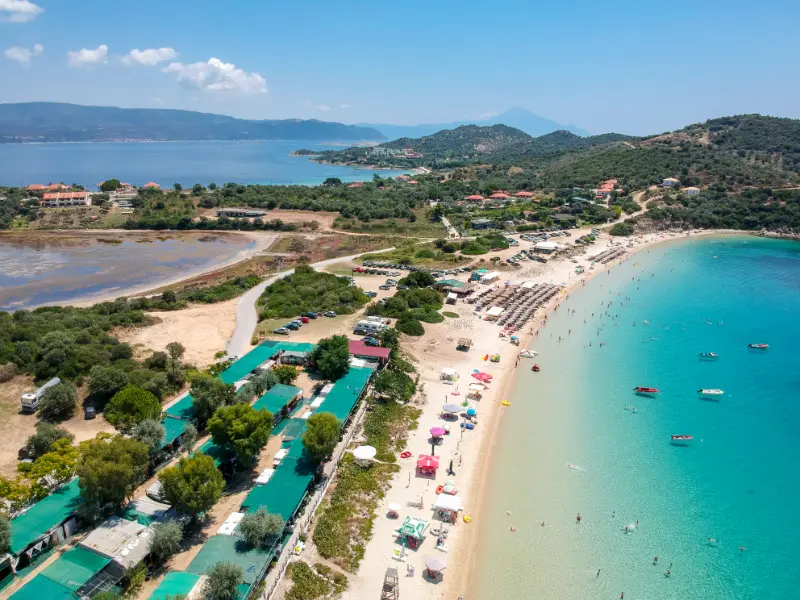
    Ammouliani is the small island surprise of Halkidiki: close enough to reach by a short ferry from Tripiti, but different enough from the mainland peninsulas to justify its own stay. The official Halkidiki tourism site describes it as the only inhabited island of Central Macedonia and notes its turquoise beaches, fishing tradition and compact main village above the port.

    The island is small enough that many people visit for a day, but I think two or three nights work better. After the last day-trippers leave, the village settles into an easy evening rhythm and the next morning begins without a ferry queue. Add a boat day among the nearby Drenia islets and the trip becomes a genuine island break rather than a side excursion.

    Why it is worth adding to your itinerary

    The value is variety without extreme distances. You can combine one excellent swim, one village and one scenic drive in the same day without turning the itinerary into a race. The key is choosing fewer stops and giving the landscape time to change around you.

    What to see and do

    Swim at Alykes

    Alykes is the beach most visitors hear about first, with pale sand and clear water. Go early in high season, then stay rather than immediately moving on. The best use of Ammouliani is not ticking beaches off a list; it is having enough time to swim twice, eat slowly and return to the water when the light softens.

    Beach Ammouliani Island Chalkidiki Greece

    Explore Ammouliani village

    The main village rises gently above the port with tiled roofs, small streets and everyday services. Walk after dinner when ferry traffic has eased. The Folklore Museum adds context about the Asia Minor refugees who settled the island in the 1920s and brought maritime traditions that remain part of local identity.

    Take a Drenia islets boat day

    The Drenia group lies just off Ammouliani and is one of the most appealing reasons to add a boat day. Join an organised trip or rent a small boat only after a proper safety briefing. Wind, fuel range and local navigation matter; a licence-free rental is not the same as a risk-free activity.

    Try a quieter beach

    Karagatsi, Megali Ammos and other small coves give the island different moods. Choose based on wind and road access that day. Some beaches are more organised, others feel more natural. One quiet afternoon is a better counterpoint to Alykes than trying to visit every named bay before sunset.

    Eat seafood close to the source

    Ammouliani has a strong fishing tradition, and the local tourism authorities emphasise fresh fish and seafood. Ask what is actually fresh rather than assuming every item arrived that morning. Simplicity is the advantage: grilled fish, salad, vegetables and a table near the village make a better island evening than an elaborate schedule.

    A realistic itinerary

    Part of the dayPlan
    Day 1Ferry from Tripiti, village walk and nearby swim
    Day 2Alykes and a slow full beach day
    Day 3Drenia boat trip or quieter beaches before returning

    Use this as a framework rather than a strict timetable. Northern Greece rewards flexibility: traffic, wind, mountain weather, ferry operations and opening hours can change the rhythm of a day. Protect the main experience and treat secondary stops as optional. That produces a better trip than racing to every pin saved on a map.

    How to get there and move around

    Ferries run between Tripiti and Ammouliani, and official local tourism information describes the crossing as very short—roughly 10 to 15 minutes depending on service. Timetables and vehicle fares change, so check current information rather than relying on an old blog. You can bring a car, but for a short stay consider whether you really need it. The village is compact; a vehicle is most useful for beach-hopping.

    Beach Ammouliani Island Chalkidiki Greece

    How to plan the driving

    Northern Greece often looks compact on a map, but coastal roads, village streets and summer traffic can slow a day dramatically. Choose one side of a peninsula for the morning and another for late afternoon instead of zigzagging between famous beaches. Download an offline map, keep fuel above half a tank on long loops, and treat scenic pull-offs as optional rather than mandatory stops.

    Beach-day rhythm

    A strong beach day is not necessarily the one with the most beaches. Arrive early at the place you care about most, swim while the water and parking are calmer, take a long lunch or shaded break, then move once in late afternoon. That rhythm usually produces more time in the sea and less time queuing behind rental cars.

    Best time to visit

    June and September are excellent. July and August have the fullest services and warm sea but also the greatest pressure on ferries and popular beaches. May and early October can be peaceful, though boat excursions and beach facilities may be more limited.

    Check the same-day weather and any official operating information shortly before you leave. Northern Greece can combine coastal heat, mountain cloud and strong wind within the same regional itinerary. Planning by conditions rather than by a rigid spreadsheet is one of the easiest ways to improve the trip.

    Food and local rhythm

    Seafood is central to the island’s identity. Balance fish meals with simple Greek staples—salads, vegetables, pies and grilled dishes—so every lunch does not become expensive or heavy. The best evenings are usually the ones where you walk back to your room after dinner instead of driving.

    Do not compress every meal into the smallest possible gap between attractions. A long lunch or early dinner is also a planning tool: it gives you shade, hydration and time to decide whether the next stop still makes sense. This matters even more on driving, hiking and boat days.

    How to combine it with nearby places

    Use Ouranoupoli as the mainland partner to Ammouliani, especially if you also want a Mount Athos cruise. The two destinations are close enough to combine without wasting a day in transit.

    When building a longer route, group places by geography. A northern-Greece itinerary becomes tiring when each day starts with a two-hour transfer in the opposite direction. Two or three nights per base usually produces more walking, swimming and local evenings than changing hotels every day.

    Where to stay

    Choose accommodation according to the part of the day you value most. If evenings on foot matter, stay near the village or waterfront centre. If road-trip access and parking matter more, a property on the edge can be the smarter choice. Read parking details carefully: “parking nearby” is not the same as a guaranteed private space.

    Practical planning notes

    Download an offline map before leaving the main city or resort area. Mobile coverage is generally good but can weaken in mountains, wetlands and isolated coastal stretches. Save the official destination name and your accommodation pin, and carry a charging cable or power bank on days with heavy navigation and photography.

    Carry water, sun protection and a light layer even when the forecast looks simple. Coastal wind can cool a boat quickly, while archaeological parks and wetland roads can be completely exposed. In hiking areas, replace casual footwear with shoes that have reliable grip. Small preparation choices make a bigger difference than adding another attraction.

    If you are travelling with children or older relatives, judge difficulty by heat, surfaces and standing time rather than kilometres. A short archaeological site under strong sun can feel harder than a longer shaded walk. Build in benches, café stops and permission to skip the final viewpoint.

    Common mistakes to avoid

    • Visiting only for two rushed hours
    • Arriving at the ferry without checking the current vehicle rules
    • Renting a boat without taking the safety briefing seriously
    • Trying to visit every beach in one day
    • Expecting nightlife on the scale of Kassandra
    • Driving after dinner when staying in the walkable village would be easier

    Official information

    For current opening hours, tickets, access rules or regional information, check Halkidiki Tourism – Ammouliani and Official Ammouliani tourism site shortly before the trip. I prefer official sources for variable details because transport timetables, admission prices and seasonal operations can change after older travel articles were published.

    Frequently asked questions

    How long is the ferry to Ammouliani?

    Official local tourism sources describe the Tripiti crossing as roughly 10–15 minutes. Check the current timetable before travel.

    Do I need a car on the island?

    Not for the village itself. A car or scooter is useful for reaching multiple beaches, but a short stay can work with transfers and organised boat trips.

    How many nights should I stay?

    Two nights is enough for a relaxed taste; three gives you a full beach day plus Drenia or another boat outing.

    Is Ammouliani good for families?

    Yes, especially for families who prefer a compact island and beach-focused days. Choose swimming areas according to conditions and children’s ability.

    Can I visit as a day trip?

    Absolutely, but an overnight stay gives you quieter mornings and evenings after many mainland visitors leave.

    Final advice

    Build the day around one clear reason for coming, then let the surrounding region add depth. Northern Greece is especially rewarding when you leave margin for a good meal, a change in weather or a place you did not expect to enjoy. The goal is not maximum coverage; it is a route that still feels enjoyable on the final day.

    For the wider picture, continue with Ouranoupoli Guide, Mount Athos Cruise Guide, Sithonia Guide. These guides connect this stop to the rest of the region without unnecessary backtracking.

    For deeper planning, continue with Vourvourou, Best beaches.

  • Mount Parnitha Guide: Hiking, Bafi Refuge, Tatoi and Nature Near Athens

    Mount Parnitha Guide: Hiking, Bafi Refuge, Tatoi and Nature Near Athens

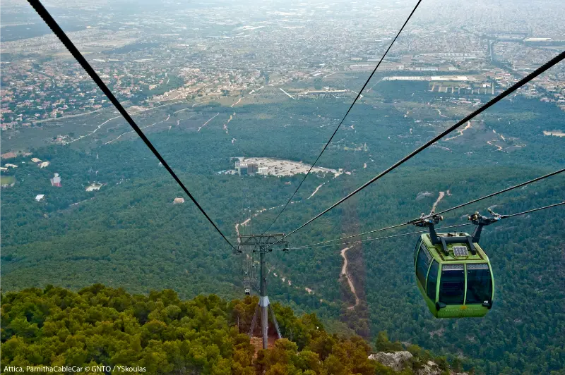
    Mount Parnitha is the largest mountain escape immediately associated with Athens and feels far more remote than its distance from the capital suggests. Forest roads, hiking trails, refuges and high viewpoints create a genuine mountain day, while the lower slopes connect with the former royal estate at Tatoi and the northern edge of the urban basin.

    Visit Greece describes Parnitha as the highest mountain in Attica, around 30 kilometres northwest of Athens, with a large national park. Compared with the shorter walks in the Hymettus guide, Parnitha deserves more time and more serious weather planning.

    Why this trip is worth your time

    The scale is the main attraction. You can spend a full day walking without feeling that the city is just around the corner. The forest and elevation create cooler conditions than central Athens, but they also bring real mountain variables such as fog, snow in winter, wind and difficult orientation.

    Parnitha also suits different travel styles. Strong hikers can plan longer routes, families can choose shorter forest walks near accessible points, and cyclists use the mountain roads and trails. The important thing is matching the route to the group rather than treating “Parnitha” as one single hike.

    At a glance

    Best forHiking, mountain biking, refuges, cooler summer mornings and nature near Athens
    Time neededHalf day for a short walk; full day for hiking
    Best baseAthens
    TransportCar/taxi is easiest; route-specific public transport is limited
    Best pairingTatoi, northern Athens or a dedicated outdoor day

    What to see and do

    Do not arrive without a route. Parnitha is a mountain area, not a single attraction with one entrance gate.

    • Choose a marked trail appropriate to your fitness and the season.
    • Use Bafi or another refuge area as a practical orientation point when relevant to your route.
    • Look for forest views rather than chasing wildlife at close range.
    • Consider Tatoi as a separate lower-altitude cultural/nature stop.
    • Check fire restrictions, snow and road conditions before leaving Athens.

    A national park on the edge of a metropolis

    Parnitha has long been a natural counterweight to Athens. Its forests, springs and high ground made it valuable well before modern recreation, while today the national park protects habitats within reach of a metropolitan region of millions of people.

    The mountain has also suffered major fires, which are part of its modern environmental history. Regeneration, burned landscapes and protected forest now coexist, making visitor behaviour particularly important in dry months.

    Bafi Refuge, trails and choosing the right level

    Bafi Refuge is one of the best-known reference points for hikers, but do not assume every trip has to start or finish there. Parnitha contains multiple trailheads and route combinations. Decide first whether you want a family walk, moderate hike or full-day route, then choose access.

    For navigation, carry an offline map and a charged phone, but also know your turnaround time. Forest tracks can intersect repeatedly, and cloud can erase the city views people use as informal orientation.

    A practical route that works

    For a first visit, a moderate forest route is more useful than a heroic distance target.

    1. Check Civil Protection fire-risk and mountain weather information.
    2. Drive or transfer to the chosen trailhead early.
    3. Walk a marked route toward a refuge or viewpoint.
    4. Take a real break before the return rather than extending the route impulsively.
    5. Leave the mountain with daylight to spare, especially in winter.

    If snow, ice, extreme heat or fire restrictions complicate the route, change the plan. Being close to Athens does not remove mountain risk.

    Getting there from Athens

    Parnitha lies northwest of Athens. Visit Greece notes access from areas such as Menidi, Sfendali and Avlona for different outdoor routes. A car offers the most flexibility because trailheads are dispersed.

    Taxi access can work for popular points, but arrange the return in advance; mobile coverage and taxi availability should not be assumed deep into a hiking day.

    Getting around once you arrive

    Once on the mountain, walking or cycling is the point. Road access varies and temporary closures are possible.

    If you add Tatoi, treat it as a separate segment with its own access and restoration status. Do not assume every historic building or estate section is open to visitors.

    Best time to visit

    Autumn and spring are excellent for hiking. Winter can bring snow and icy roads, which make the mountain beautiful but require different equipment and driving confidence.

    Summer mornings can be cooler than Athens, but wildfire danger is the decisive factor. High-risk days may bring access bans, and those restrictions should be treated as non-negotiable.

    Where to stay or whether to return to Athens

    Stay in Athens. Parnitha is a day-trip mountain for most visitors.

    An overnight near the northern suburbs is useful only if the mountain is part of a larger road trip or specialist hiking plan.

    Food, breaks and local rhythm

    Carry sufficient water and food for your route. A refuge can be useful, but never design a hike around the assumption that a specific facility will be open.

    Pack out every item you bring in. Mountain picnic areas near cities often suffer most from casual litter because visitors assume someone else will collect it.

    How to combine this with a wider Greece itinerary

    Compare Parnitha with Hymettus: Parnitha is the better choice for a full outdoor day, while Hymettus is easier to combine with city sightseeing.

    Attica Parnitha Cable Car

    If your Greece trip is heavily urban, this is also a useful counterpoint to the Athens guide before moving on to islands or archaeological road trips.

    Mistakes to avoid

    • Starting without checking fire-risk restrictions.
    • Treating the mountain as one simple signposted loop.
    • Depending on a refuge for all water and food.
    • Continuing after the planned turnaround time because Athens looks close.

    Parnitha’s biggest planning trap is familiarity: it feels safe because it is beside Athens. Respect it as a mountain and the visit becomes far more enjoyable.

    Practical planning for 2026

    Visit Greece identifies Parnitha as the highest mountain in Attica and highlights mountain-bike routes toward areas such as Bafi and Flambouri refuges. Conditions change seasonally, so use local mountain and Civil Protection information for the day of travel.

    Background: Visit Greece – Athens in Action.

    Responsible travel and safety

    Never smoke or light fires in the forest. Follow seasonal restrictions and report smoke or fire immediately through emergency services.

    Do not approach deer or other wildlife for photos. Keep food secured and leave animals with enough distance to move naturally.

    FAQ

    How far is Mount Parnitha from Athens?

    Visit Greece places it about 30 km northwest of Athens, though driving time depends on the trailhead and traffic.

    Attica Parnitha Mountain Mola

    Is Parnitha suitable for beginners?

    Yes, if you choose a short marked route. The mountain also has much longer and more demanding options.

    Can I visit Parnitha in winter?

    Yes, but snow and ice can require appropriate equipment and driving experience.

    Attica Parnitha Snow

    What is Bafi Refuge?

    It is one of the best-known mountain refuges on Parnitha and a common reference point for hiking routes.

    Is Parnitha safe in summer?

    It can be, but wildfire risk and heat must be checked on the day. Access restrictions may apply.

    Final thoughts

    Parnitha is the outdoor day that makes Athens feel geographically complete. The capital is not only a city facing the sea; it is also surrounded by mountains capable of delivering a real forest hike within the same trip.

    Choose a realistic route, check safety conditions and finish before tiredness or darkness complicates the return. Done well, Parnitha feels like a separate destination rather than an urban park.

    Extra planning notes

    Before committing to Mount Parnitha Guide, compare the real transfer sequence for your date rather than judging the trip by straight-line distance. Attica traffic changes quickly, archaeological and museum schedules can be seasonal, and coastal or mountain plans are sensitive to weather. I prefer to protect one flexible hour in the day so a delayed bus, longer museum visit or slower lunch does not turn the return to Athens into a race.

    For summer visits, move the most exposed activity to the first part of the day, carry water and treat official heat or fire restrictions as part of the itinerary. In cooler months, the opposite issue is shorter daylight and earlier closing times. These small adjustments matter more than adding one extra attraction, especially when the goal is to experience Attica rather than collect map pins.

    A slower version of the day

    If the itinerary still feels crowded, remove the least important stop rather than shortening every visit. The best day trips from Athens usually have one clear anchor, one supporting stop and enough unscheduled time for food, weather and traffic. That structure also makes the trip more resilient when seasonal opening hours or transport changes do not match the plan you made months earlier.

    Before you set out

    A final check the evening before makes this kind of excursion much easier: confirm opening hours, weather, road or trail restrictions, the return route and the amount of daylight available. Keep offline directions on your phone and tell someone your planned route when the day includes mountain paths. If conditions are worse than expected, shorten the outing rather than forcing the original plan.

    For more ideas around Attica, see our Tatoi Estate guide.
    For more ideas around Attica, see our Phyle Fortress guide.

  • Sithonia Halkidiki Guide: Beaches, Vourvourou, Sarti and a 5-Day Road Trip

    Sithonia Halkidiki Guide: Beaches, Vourvourou, Sarti and a 5-Day Road Trip

    Sithonia is the middle peninsula of Halkidiki and the part I would choose when the trip is mainly about beaches, pine-backed coves and a road journey that still feels scenic between stops. It has busy resort towns, but it is less defined by one central nightlife hub than Kassandra. The pleasure is in moving slowly between bays, villages and viewpoints rather than staying in one beach bar all week.

    The official Halkidiki tourism route around Sithonia links Nikiti, Neos Marmaras, Porto Koufo, Sarti, Vourvourou and Ormos Panagias, with side roads leading to smaller beaches and the mountain village of Parthenonas. That makes the peninsula ideal for four to six days by car. Use my broader Halkidiki Travel Guide for the big picture; this guide is for planning Sithonia in detail.

    Why it is worth adding to your itinerary

    The value is variety without extreme distances. You can combine one excellent swim, one village and one scenic drive in the same day without turning the itinerary into a race. The key is choosing fewer stops and giving the landscape time to change around you.

    What to see and do

    Start in Nikiti

    Nikiti works well as a first base because it combines an old village, a long seafront and easy road access to both sides of the peninsula. Spend one evening in the historic upper village rather than seeing only the waterfront. The contrast between stone houses uphill and modern summer life below is a useful introduction to Sithonia.

    Explore Vourvourou and its island-studded bay

    Vourvourou is about water more than town sightseeing. The bay faces a small archipelago and is known for shallow turquoise areas, boat outings and views toward Diaporos. If you rent a small boat, follow the operator’s safety briefing carefully and do not treat the islands as a race to collect beaches; leave time for swimming in one or two protected coves.

    Give Sarti a full beach day

    Sarti has one of Sithonia’s most useful combinations of long beach, services and views across the sea toward Mount Athos on clear days. It becomes busy in summer, so arrive early if parking matters. The village also works as a base for the southeast coast, where several coves can be reached without crossing the entire peninsula.

    Stop at Porto Koufo

    Porto Koufo is a deep natural harbour near the southern tip of Sithonia. It feels very different from open beaches: hills shelter the water and fishing boats shape the atmosphere. I like it as a lunch stop between western and eastern Sithonia, especially on a road-trip day when another exposed beach would feel repetitive.

    Climb to Parthenonas

    Parthenonas sits above Neos Marmaras and gives the trip a mountain-village pause. Go in late afternoon when the heat eases and the light improves. The stone architecture and views create a useful counterpoint to the coast, and the road up makes much more sense if you are already staying near Neos Marmaras rather than driving across Sithonia just for one photograph.

    A realistic itinerary

    Part of the dayPlan
    Day 1Nikiti old village, seafront and nearby beach
    Day 2Vourvourou and a boat or relaxed bay day
    Day 3Neos Marmaras, Parthenonas and west-coast sunset
    Day 4Porto Koufo, Toroni and the southern loop
    Day 5Sarti and east-coast beach time

    Use this as a framework rather than a strict timetable. Northern Greece rewards flexibility: traffic, wind, mountain weather, ferry operations and opening hours can change the rhythm of a day. Protect the main experience and treat secondary stops as optional. That produces a better trip than racing to every pin saved on a map.

    How to get there and move around

    A car is the simplest way to experience Sithonia because the best trip is a sequence of beaches and villages rather than one compact resort. The official peninsula route shows how the coast road loops through Nikiti, Neos Marmaras, Porto Koufo, Sarti, Vourvourou and Ormos Panagias. Distances are manageable, but do not underestimate summer congestion or narrow access roads to small coves. Park only where legal and never block emergency or local access.

    How to plan the driving

    Northern Greece often looks compact on a map, but coastal roads, village streets and summer traffic can slow a day dramatically. Choose one side of a peninsula for the morning and another for late afternoon instead of zigzagging between famous beaches. Download an offline map, keep fuel above half a tank on long loops, and treat scenic pull-offs as optional rather than mandatory stops.

    Beach-day rhythm

    A strong beach day is not necessarily the one with the most beaches. Arrive early at the place you care about most, swim while the water and parking are calmer, take a long lunch or shaded break, then move once in late afternoon. That rhythm usually produces more time in the sea and less time queuing behind rental cars.

    Best time to visit

    Late May to June and September are the sweet spots for warm water, long days and less pressure on parking. July and August offer the liveliest atmosphere but also the most traffic and competition for popular beaches. April and October can be excellent for road trips and walking, although swimming conditions and seasonal businesses are less predictable.

    Check the same-day weather and any official operating information shortly before you leave. Northern Greece can combine coastal heat, mountain cloud and strong wind within the same regional itinerary. Planning by conditions rather than by a rigid spreadsheet is one of the easiest ways to improve the trip.

    Food and local rhythm

    Build meals around seafood, grilled fish, salads, local cheese, vegetables and simple tavern cooking rather than chasing a famous venue across the peninsula. Porto Koufo is especially natural for a fish lunch, while Nikiti and Neos Marmaras give you more choice in the evening. One good rule is to eat close to the day’s final stop instead of adding an unnecessary night drive.

    Do not compress every meal into the smallest possible gap between attractions. A long lunch or early dinner is also a planning tool: it gives you shade, hydration and time to decide whether the next stop still makes sense. This matters even more on driving, hiking and boat days.

    How to combine it with nearby places

    Pair Sithonia with Kassandra if you want more nightlife and resort infrastructure, or with Ouranoupoli and Ammouliani for a quieter eastern-Halkidiki finish.

    Sithonia Coastline Near Lagonisi Beach Chalkidiki Greece View 2

    When building a longer route, group places by geography. A northern-Greece itinerary becomes tiring when each day starts with a two-hour transfer in the opposite direction. Two or three nights per base usually produces more walking, swimming and local evenings than changing hotels every day.

    Where to stay

    Choose accommodation according to the part of the day you value most. If evenings on foot matter, stay near the village or waterfront centre. If road-trip access and parking matter more, a property on the edge can be the smarter choice. Read parking details carefully: “parking nearby” is not the same as a guaranteed private space.

    Practical planning notes

    Download an offline map before leaving the main city or resort area. Mobile coverage is generally good but can weaken in mountains, wetlands and isolated coastal stretches. Save the official destination name and your accommodation pin, and carry a charging cable or power bank on days with heavy navigation and photography.

    Carry water, sun protection and a light layer even when the forecast looks simple. Coastal wind can cool a boat quickly, while archaeological parks and wetland roads can be completely exposed. In hiking areas, replace casual footwear with shoes that have reliable grip. Small preparation choices make a bigger difference than adding another attraction.

    If you are travelling with children or older relatives, judge difficulty by heat, surfaces and standing time rather than kilometres. A short archaeological site under strong sun can feel harder than a longer shaded walk. Build in benches, café stops and permission to skip the final viewpoint.

    Common mistakes to avoid

    • Changing beaches every hour instead of enjoying one properly
    • Crossing the peninsula repeatedly in peak traffic
    • Leaving Vourvourou boat planning until the busiest part of the day
    • Ignoring villages because the beaches are the headline
    • Parking on narrow access roads
    • Trying to combine Sithonia and Kassandra in one rushed day

    Official information

    For current opening hours, tickets, access rules or regional information, check Halkidiki Tourism – Sithonia road route shortly before the trip. I prefer official sources for variable details because transport timetables, admission prices and seasonal operations can change after older travel articles were published.

    Sithonia Coastline Near Lagonisi Beach Chalkidiki Greece

    Frequently asked questions

    How many days do I need in Sithonia?

    Four days is workable, but five or six gives you time for both coasts without turning every day into a drive.

    Is Sithonia better than Kassandra?

    They suit different trips. Sithonia is stronger for scenic beach-hopping and a road-trip feel, while Kassandra has denser resort infrastructure and nightlife.

    Do I need a car?

    A car gives you far more flexibility for beaches and villages. Without one, choose a base with the services you need and plan fewer day trips.

    Where should I base myself?

    Nikiti is practical for a first visit; Neos Marmaras works well for the west; Sarti or Vourvourou suit travellers focused on the east coast.

    Panoramic View Seascape With Bay View From Vourvourou Greece

    Is five days too long?

    No. With beaches, villages, a boat day and the southern loop, five days is a comfortable rather than excessive stay.

    Final advice

    Build the day around one clear reason for coming, then let the surrounding region add depth. Northern Greece is especially rewarding when you leave margin for a good meal, a change in weather or a place you did not expect to enjoy. The goal is not maximum coverage; it is a route that still feels enjoyable on the final day.

    For the wider picture, continue with Halkidiki Travel Guide, Kassandra Guide, Ouranoupoli Guide. These guides connect this stop to the rest of the region without unnecessary backtracking.

  • Lake Vouliagmeni Guide: Thermal Water, Tickets, Swimming and Athens Riviera Tips

    Lake Vouliagmeni Guide: Thermal Water, Tickets, Swimming and Athens Riviera Tips

    Lake Vouliagmeni is the easiest place near Athens to turn a sightseeing-heavy city break into a genuine recovery day. The lake sits beside the Athens Riviera in a dramatic limestone setting and is operated as an organised swimming and wellness venue rather than a wild public lake. That distinction matters when planning cost, opening hours and what you can bring inside.

    I would use the lake as a half-day within the wider Athens Riviera, not as a replacement for exploring the coast. A morning or late-afternoon swim followed by Vouliagmeni, Kavouri or a coastal dinner creates a much more balanced day.

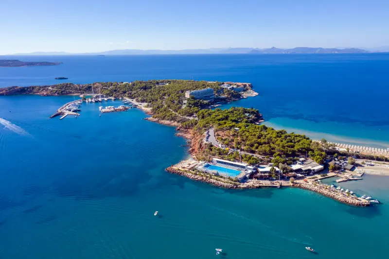
    Athens Greece Riviera Asteras Vouliagmeni Panorama Aerial Drone View

    Why this trip is worth your time

    The appeal is simple: naturally warm water, a protected setting and easy access from Athens. You do not need a ferry or resort stay to have a swim day, and the lake can work outside the peak beach season when the sea feels less inviting.

    It is also a useful option for travellers who want comfort rather than adventure. Facilities, food service and controlled access make the experience easier for many families and couples, although it is more expensive and structured than simply going to a public beach.

    At a glance

    Best forSwimming, wellness, couples, families and relaxed Riviera days
    Time needed2–4 hours at the lake; half or full day with the coast
    Best baseAthens or Vouliagmeni
    TransportTaxi, car or public transport via the Riviera
    Best pairingVouliagmeni, Kavouri, Glyfada or Cape Sounion

    What to see and do

    There is no sightseeing checklist here. The goal is to swim, relax and enjoy the setting without turning a restorative stop into another over-programmed attraction.

    • Swim in the lake’s naturally warm water within the organised facility.
    • Arrive with enough time to enjoy the setting rather than using the lake as a one-hour photo stop.
    • Combine the lake with a coastal walk or meal in Vouliagmeni.
    • Check seasonal opening times and reservation rules before travelling.
    • Use the day as a break between heavy museum and archaeology days in Athens.

    A geological setting, not a conventional beach club

    Lake Vouliagmeni occupies a natural basin connected with underground geological processes and thermal water. Its unusual setting is the reason the experience feels different from the nearby Saronic coast, even though the sea is only a short distance away.

    Today the lake is managed as a commercial wellness and swimming venue, so visitors should plan it more like an attraction than an open natural beach. Entry rules, food policies, operating hours and prices are controlled by the operator and can change seasonally.

    What a visit actually feels like

    Most travellers spend their time swimming, sitting by the water and using the on-site facilities. If you expect a large wild lake with hiking trails around it, the experience may feel more organised than imagined. If you expect a calm thermal-swimming setting close to Athens, it can be exactly right.

    The water and rock setting are the attraction, so there is little value in rushing. Choose a time when you can stay long enough to swim, dry off, have a drink and leave without immediately racing to another reservation.

    A practical route that works

    A simple Riviera day keeps the lake in proportion.

    1. Travel from central Athens after breakfast or arrive near opening.
    2. Spend two to three hours swimming and relaxing.
    3. Walk or transfer into Vouliagmeni for lunch.
    4. Continue along the Riviera to Kavouri or Glyfada if you want more coast.
    5. Return to Athens before late-night transport becomes the main concern.

    If you are driving toward Cape Sounion, the lake can be the first stop, but do not combine a long swim with too many beaches before a sunset temple visit.

    Getting there from Athens

    Lake Vouliagmeni is on the southern coast of Attica. Taxi or car is the simplest option from central Athens, especially for two or more travellers carrying swim gear.

    Public transport along the Riviera is possible but can involve a combination of tram/bus routes depending on where you start. Check the current OASA journey planner rather than copying a route from an old blog post.

    Getting around once you arrive

    Inside the facility, movement is simple. Outside, Vouliagmeni is spread along coastal roads, so walking works best for nearby restaurants and seafront sections rather than the entire Riviera.

    If you have a car, parking strategy matters in summer weekends. Arrive early rather than wasting the best part of the day circling busy coastal streets.

    Best time to visit

    The lake can work across much more of the year than an ordinary beach day because of the thermal character of the water, but comfort depends on air temperature, rain and wind.

    Summer is busiest. Spring and autumn are excellent for combining a swim with walking and outdoor dining, while winter opening hours are shorter.

    Where to stay or whether to return to Athens

    Central Athens is fine for a half-day. Stay in Vouliagmeni only if you want the Riviera itself to be a major part of the trip.

    A coastal night works especially well before or after a road trip to Cape Sounion, but it is not necessary for visiting the lake alone.

    Food, breaks and local rhythm

    Outside food and drinks are not permitted according to the lake’s current FAQ, so budget for the on-site snack bar or restaurant if you plan to stay through a meal period.

    Alternatively, time the visit so you leave for lunch in Vouliagmeni, where the wider neighbourhood offers more choice and a stronger sense of the Riviera.

    How to combine this with a wider Greece itinerary

    The easiest combination is the Athens Riviera guide, especially Vouliagmeni and Kavouri.

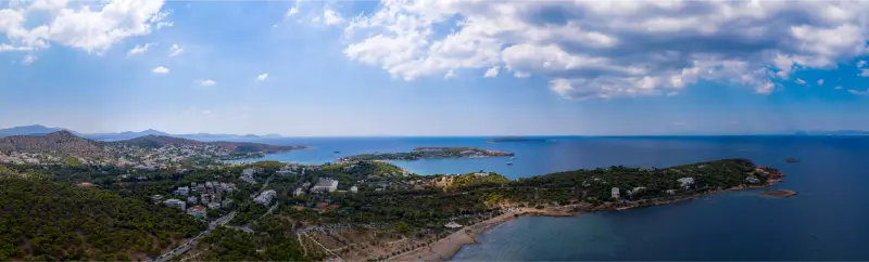
    Athens Greece Panorama Aerial Drone View Vouliagmeni Kavouri

    For a longer coastal day, continue toward the Cape Sounion day trip, but build in a generous time buffer for traffic and sunset arrival.

    Mistakes to avoid

    • Assuming the lake is a free public swimming spot.
    • Arriving without checking seasonal hours or reservation rules.
    • Bringing outside food when current rules prohibit it.
    • Trying to combine the lake, several beaches and Cape Sounion in a rushed half-day.

    The lake is best when it actually functions as downtime. If you reduce it to a quick swim between transfers, you lose the main reason to pay for an organised wellness setting.

    Practical planning for 2026

    The official Lake Vouliagmeni website publishes seasonal hours. For September 16–October 5, 2026, it lists 08:00–19:00; hours shorten later in autumn and winter. The site also notes that same-day reservations are not possible and that admission is ticketed.

    Official information and current price list: Lake Vouliagmeni. Check the current tariff because pricing varies by season and product.

    Responsible travel and safety

    Follow swimming rules and staff instructions. Natural-water settings can have changing depth and underwater features, even when the facility is organised.

    Use reef-safe habits and avoid leaving toiletries, plastic or other waste near the water. Treat the lake as a natural environment first and a wellness venue second.

    FAQ

    Is Lake Vouliagmeni free?

    No. It is an organised, ticketed facility with seasonal pricing.

    Can you swim in Lake Vouliagmeni?

    Yes. Swimming is the main attraction, subject to the facility’s rules and operating hours.

    Do I need to book in advance?

    The official website currently states that same-day reservations are not possible, so advance planning is sensible.

    How long should I stay?

    Two to four hours is a comfortable visit; longer if you want a full relaxation day.

    Can I combine it with Cape Sounion?

    Yes, especially by car, but allow enough time for traffic and do not overfill the day.

    Final thoughts

    Lake Vouliagmeni is not a hidden free lake and it should not be marketed as one. It is a polished, organised way to swim in a remarkable natural setting close to Athens.

    Use it deliberately as a recovery day, check current rules before leaving and combine it with a small part of the Riviera rather than trying to conquer the entire coast at once.

    Extra planning notes

    Before committing to Lake Vouliagmeni Guide, compare the real transfer sequence for your date rather than judging the trip by straight-line distance. Attica traffic changes quickly, archaeological and museum schedules can be seasonal, and coastal or mountain plans are sensitive to weather. I prefer to protect one flexible hour in the day so a delayed bus, longer museum visit or slower lunch does not turn the return to Athens into a race.

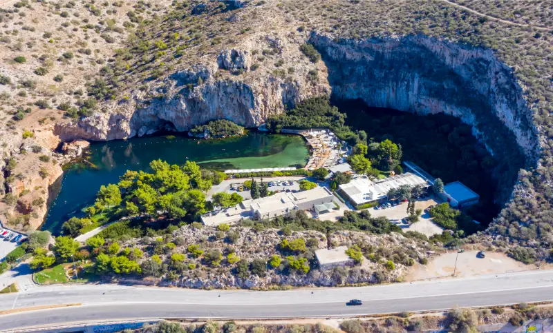
    Vouliagmeni Lake Heath Spa Aerial Drone View Athens Greece

    For summer visits, move the most exposed activity to the first part of the day, carry water and treat official heat or fire restrictions as part of the itinerary. In cooler months, the opposite issue is shorter daylight and earlier closing times. These small adjustments matter more than adding one extra attraction, especially when the goal is to experience Attica rather than collect map pins.

    A slower version of the day

    If the itinerary still feels crowded, remove the least important stop rather than shortening every visit. The best day trips from Athens usually have one clear anchor, one supporting stop and enough unscheduled time for food, weather and traffic. That structure also makes the trip more resilient when seasonal opening hours or transport changes do not match the plan you made months earlier.

    For more ideas around Attica, see our Anavyssos and Palaia Fokaia guide.

  • Tinos Hiking Guide: Best Trails, Villages, Exomvourgo and Practical Tips

    Tinos Hiking Guide: Best Trails, Villages, Exomvourgo and Practical Tips

    Tinos is one of the best Cycladic islands for travellers who want walking to be part of the holiday rather than something added between beach days. Visit Greece describes more than 150 km of old stone roads, cobbled paths and marked trails linking villages, dovecotes, monasteries, valleys and beaches. That network explains the island better than a car alone because you see how settlements were connected before modern roads became the default.

    The challenge is not finding a trail; it is matching the route to the season, wind and transport plan. A path that feels easy in April can be exhausting at 14:00 in August. Some routes finish at beaches or villages with limited buses, so a one-way walk requires more planning than the elevation profile suggests. Start early, carry enough water and use a proper walking map or verified GPX file.

    At a glance

    Route ideaDifficultyBest for
    Pyrgos–PanormosEasy to moderateCulture plus coast
    Volax–KolymbithraModerateGeology plus beach
    Central village loopsEasy to moderateArchitecture, food, flexible days
    ExomvourgoModerate to demandingViews, history
    Volax–Livada areaModerate/demandingWild landscapes, experienced walkers

    Volax to Kolymbithra

    This route is one of the clearest examples of Tinos changing landscape during a walk. You begin among the granite boulders around Volax and descend toward the coast near Kolymbithra. The beach can be a satisfying finish, but transport is the key question: if you do not want to walk back uphill, confirm a bus or taxi before setting off. In summer, start early enough to reach the coast before the strongest heat.

    Volax toward Livada

    The path toward Livada takes you into a wilder, more exposed part of the island. The terrain and final beach environment feel more remote than popular south-coast walks. Carry food, extra water and sun protection, and check whether strong north winds would make the destination uncomfortable. This is a route for travellers who enjoy landscape, not a shortcut to an organised beach.

    Pyrgos to Panormos

    The walk between Pyrgos and Panormos is a gentler introduction to the marble-working landscape. It can be combined with the Museum of Marble Crafts and village lanes, then finished by the harbour. Because the cultural stops are as important as the distance, allow more time than a fitness app predicts. A slow day with museum, walk, lunch and sea is better than treating the route as a race.

    Falatados, Volax and central villages

    Central-island routes connect Falatados, Volax and neighbouring settlements through old agricultural landscapes, dovecotes and dry-stone walls. These walks are excellent when the coast is windy because the objective is the villages rather than swimming. They also give you frequent opportunities to shorten the day if heat builds, provided you know where roads and taxi access intersect the trail.

    Exomvourgo ascent

    The rocky mass of Exomvourgo and the remains of its Venetian fortifications create one of the island’s most dramatic viewpoints. The climb is more exposed and physically demanding than a flat village walk, so choose a cool morning and secure footwear. Strong wind can make the upper sections unpleasant even when the temperature is moderate. Do not approach cliffs or ruined walls simply for a better photograph.

    Triantaros, Dyo Choria and Loutra routes

    The central and eastern village network allows shorter cultural walks that can work well for mixed-ability groups. Routes between villages reveal terraces, springs, churches and old communication paths without committing to an isolated beach finish. These are particularly useful in shoulder season when tavernas may have limited hours: carry a snack even if the map shows a village every few kilometres.

    Tinos Triantaros Village Greece

    Heat and water planning

    Tinos can be very dry in summer and shade is inconsistent. For a half-day walk, start with more water than you expect to drink and know where you can refill rather than assuming every fountain is potable. A hat, sunscreen and a light long-sleeve layer are as important as trail shoes. If the forecast is unusually hot, switch the hike to sunrise or postpone it; no viewpoint is worth heat illness.

    Navigation and trail markings

    Marked routes are improving, but signs can fade, junctions can be confusing and construction or vegetation can change a path. Use a current walking map or downloaded GPX track and keep an offline base map on your phone. Battery management matters: airplane mode can preserve power when you are not actively navigating. Tell someone your route if you are walking alone in a remote area.

    How this fits into a wider Tinos trip

    Use this page together with Tinos travel guide, Tinos Chora Guide, Pyrgos and Panormos Tinos Guide, Volax Tinos Guide, Kardiani and Isternia Tinos Guide, Panagia Evangelistria Tinos Guide. Keeping related places and practical topics connected makes it easier to build days by geography instead of repeatedly crossing the island.

    Tinos Pyrgos Village Greece

    How to plan around wind and summer heat

    Tinos is famously exposed to Aegean wind, and the same breeze that makes a terrace comfortable can make a north-facing beach rough or an exposed ridge unpleasant. Check the day’s conditions before committing to a remote beach, boat outing or long hike. In July and August, use early morning for villages, churches and walking, reserve the hottest hours for lunch or swimming, and return to sightseeing later in the afternoon. A flexible itinerary is a practical advantage, not a failure to plan.

    Driving realistically on Tinos

    Distances on the map look short, but roads between villages are winding and often narrow. Add time for oncoming traffic, photo stops and finding sensible parking outside historic lanes. Do not follow a navigation app blindly onto a rough shortcut simply because it saves three minutes. If you are uncomfortable with steep bends, base in Chora and use buses, taxis or organised excursions for selected days rather than turning every transfer into stress.

    Food and daily rhythm

    Tinos is a destination where lunch can be part of the sightseeing rather than a break from it. Build time for village squares, bakeries, local cheeses, capers, artichokes, sausages and seasonal dishes instead of planning every meal at the waterfront. Opening patterns outside peak summer can be irregular in small villages, so carry water and a snack even when you expect to find a taverna. In August, reserve famous restaurants but leave ordinary meals spontaneous.

    Booking and time-sensitive information

    Ferry times, bus schedules, museum hours and road access can change. Recheck anything that would cause a serious problem if wrong: the last bus, the final ferry of the day, a museum you are crossing the island to visit, or access to a remote beach after strong weather. Save confirmations offline and keep enough margin before departure. Tinos rewards slow planning; it punishes itineraries where one ten-minute delay breaks the rest of the day.

    Official trail context

    Visit Greece describes Tinos as having more than 150 km of stone-paved roads and cobbled paths and highlights routes around Volax, Kolymbithra, Livada, Pyrgos, Panormos and Exomvourgo. Use the Visit Greece hiking overview as background, then pair it with a current local trail map or GPX file for navigation.

    Tours and activities

    A guided village day, food experience or private transfer can be useful when it reduces transport friction or adds local interpretation. Compare the actual time spent at each stop, pickup location, group size and cancellation policy rather than choosing the itinerary with the longest list of villages.

    Common planning mistakes

    • Starting exposed hikes at midday in July or August.
    • Using only Google Maps for old footpaths.
    • Assuming every village has an open café outside high season.
    • Finishing a one-way hike without confirming transport.
    • Underestimating strong wind on ridges and exposed coast.

    Frequently asked questions

    How much hiking does Tinos have?

    Visit Greece describes more than 150 km of paths and old stone routes across the island.

    Cyclades Greece Tinos Greek Island Kardiani Village Aerial View

    What is a good first hike?

    Pyrgos to Panormos or a short central-village route is easier to organise than a remote coast hike.

    Can you hike in August?

    Yes, but start very early, carry plenty of water and avoid exposed midday routes.

    Do you need hiking boots?

    Sturdy trail shoes are sufficient for many routes; rougher paths and Exomvourgo benefit from more support.

    Can you use buses for one-way walks?

    Sometimes, but seasonal frequency means you must confirm the exact return before starting.

    Final practical advice

    Tinos is most rewarding when you leave space between the famous stops. One village, one meaningful cultural visit and one swim often make a better day than six pins on a map. Choose a base that suits your transport style, group nearby experiences, check wind and heat each morning, and verify time-sensitive information shortly before you travel. The island’s villages, food and walking routes are not filler between beaches; together they are the reason Tinos feels different from many other Cycladic destinations.

    Photography without slowing everyone down

    The best photographs on Tinos usually come from side light, village details and wide landscapes rather than stopping a car in an unsafe place. In villages, park first and walk back to the viewpoint. Ask before photographing craftspeople at work and never treat worshippers as part of a travel portrait. Early morning and late afternoon also reduce harsh contrast on white walls and marble while making walking more comfortable.

    What to carry each day

    A small day bag should include water, sun protection, a light layer for wind, offline maps and footwear that can handle stone steps. Add swim shoes if your group dislikes pebbles and a reusable bag for beach rubbish. On hiking days carry significantly more water and a power bank. On church days bring clothing that allows you to enter respectfully without having to return to the hotel.

  • Pelion Hiking Guide: Best Village Trails, Distances, Difficulty and Planning Tips

    Pelion Hiking Guide: Best Village Trails, Distances, Difficulty and Planning Tips

    Pelion is one of the best regions in Greece for travellers who want hiking to be part of a normal holiday rather than an expedition. Old cobbled paths connect villages, orchards, forests and beaches, so a walk can begin with coffee in a mountain square and end by the sea. That variety is more important than summit chasing.

    The official Greek tourism portal publishes several suggested Pelion routes with distances and approximate times. I use those figures below as planning anchors, but trail conditions, weather and personal pace can change the real duration. Always ask locally about current conditions before setting out.

    Quick planning facts

    • Official routes range from easy 3 km walks to demanding 12.9 km forest hikes.
    • Spring and autumn are the most comfortable seasons for most walkers.
    • Plan return transport before starting one-way descents.
    • Use grippy footwear on old stone paths.
    • Split accommodation between west and east Pelion to reduce driving.

    Tsagarada to Damouchari: 3 km / about 1 hour

    This is the classic short east-Pelion walk. Visit Greece lists it as roughly 3 km and one hour, descending from Agia Paraskevi square through forest and cobbled paths toward Damouchari. It is ideal if you want a genuine point-to-point hike without dedicating a full day.

    Pelion Tsagarada

    The main planning issue is the return. One hour downhill does not mean one hour back uphill. Arrange a taxi, use two cars or accept a more demanding climb. Read my Tsagarada and Damouchari guides for the two ends of the route.

    Kala Nera to Milies: 11 km / about 3 hours

    Visit Greece classifies this as a moderately challenging route of about 11 km and three hours, largely following the railway corridor. It links the coast with historic Milies and works particularly well for travellers who enjoy linear walks with a clear destination.

    Plan food and return transport before starting. Depending on the current tourist train schedule, you may be able to combine the hike with rail, but never rely on that connection without checking Hellenic Train the same week.

    Zagora to Chorefto: 3 km / about 1.5 hours

    This easy official route descends from Zagora through orchard country toward Chorefto. It is especially attractive in a trip focused on local food and landscape because the walk passes through the agricultural side of Pelion before ending at the Aegean.

    Pelion Zagora

    Families with walking experience may find it approachable, but remember that downhill paths can still be slippery. If you return uphill, the effort is no longer the same as the official downhill description.

    Ano Lechonia to Agios Georgios Nilias: 4 km / about 2 hours

    The official route is around 4 km and two hours, ascending through olive groves and ravines to Agios Georgios Nilias. This is useful for travellers staying on the western side who want a moderate climb rather than a coastal descent.

    The climb creates heat exposure in warmer months, so start early and carry enough water. A short distance on a map can feel much longer when elevation is continuous.

    Veneto–Flamouri Monastery–Ano Kerasia: 12.9 km / about 5 hours

    Visit Greece lists this as a demanding route of about 12.9 km and five hours through northern Pelion, including forest and the historic Flamouri Monastery. It is a completely different proposition from the short village-to-beach walks.

    Only choose it if your fitness, footwear and navigation preparation match the route. For a long forest day, download maps offline, carry food and water, and confirm current path conditions locally.

    When to hike Pelion

    Spring and autumn are my first choices. Temperatures are generally easier for sustained walking and the forests are at their most interesting. Summer hiking is possible, but start early and avoid exposed climbs in the hottest hours. Winter can be beautiful but brings mud, ice, snow and shorter daylight at higher elevations.

    Weather can differ between the Pagasetic and Aegean sides. Check the actual route, not just a generic Volos forecast. Fog and rain also make polished stone sections much more slippery.

    Footwear, navigation and water

    Use trail shoes or hiking shoes with reliable grip. Old kalderimia are part of Pelion’s charm but become slick when wet. Carry offline mapping even on well-known routes, and do not assume mobile signal will be perfect in ravines or dense forest.

    Water availability should never be assumed from the number of fountains shown online. Carry what you need, especially in summer. A lightweight waterproof layer is useful in shoulder season because mountain weather changes quickly.

    How to design a hiking-based Pelion trip

    Do not stay in one base and drive two hours every morning to a trailhead. Split nights: Portaria/Makrinitsa for west and central Pelion, Milies or Kala Nera for south-west routes, and Tsagarada or Zagora for eastern trails. That turns hiking into part of the day rather than a commute.

    Street View Portaria Village Pelion Greece

    A good five-day active trip could include Makrinitsa/Portaria walks, Kala Nera–Milies, a rest/rail day, Tsagarada–Damouchari and Zagora–Chorefto. Keep one flexible day for weather.

    Trail etiquette and protecting the old kalderimia

    Pelion’s historic cobbled paths are cultural infrastructure as well as hiking routes. Stay on the established trail, avoid cutting switchbacks and do not move stones to create shortcuts. When a path crosses agricultural land or village edges, remember that you are passing through working landscapes rather than a purpose-built hiking park.

    Keep dogs under control around livestock and settlements, carry litter out and avoid loud music. These small choices matter because many Pelion routes remain enjoyable precisely because they still feel connected to village life instead of heavily managed recreation zones.

    When a guide is worth paying for

    For the short official routes, confident walkers with current maps may not need a guide. A guide becomes much more useful on long northern routes, after storms, in poor visibility, or when you want to understand local history and ecology rather than just follow a line. Families and mixed-ability groups also benefit from someone who can adjust the route before fatigue becomes a problem.

    If you book a guide, ask what the route includes, expected elevation, transport at the finish, group size and cancellation policy for bad weather. A well-run walking day should make logistics simpler, not just add another reservation.

    Practical planning checklist

    • Check the mountain forecast as well as the Volos/coastal forecast before driving or hiking.
    • Keep offline directions and your accommodation phone number because mountain roads and village lanes can be confusing after dark.
    • Allow more driving time than the kilometre count suggests; Pelion roads are scenic but winding.
    • Do not overfill the day. One village, one walk and one meal often produces a better Pelion experience than five rushed stops.
    • For the wider region, use my complete Pelion travel guide and Volos travel guide.

    Frequently asked questions

    What is the easiest Pelion hike?

    The official Zagora–Chorefto route is listed as very easy at about 3 km / 1.5 hours, while Tsagarada–Damouchari is also short at about 3 km / 1 hour downhill.

    What is the longest route in this guide?

    The Veneto–Flamouri Monastery–Ano Kerasia route is listed by Visit Greece at about 12.9 km / 5 hours and is described as demanding.

    Do you need a guide?

    Not for every short signed route, but a guide can be valuable for lesser-known paths, poor weather, families or travellers who want local context.

    Can you hike Pelion in summer?

    Yes, but start early, carry water and avoid pushing exposed uphill sections in the hottest part of the day.

    Final thoughts

    Pelion hiking is special because trails connect places you would want to visit anyway. The walk is not separate from the village, meal or beach; it is how you move between them.

    Choose routes that match your pace, solve the return logistics before setting off and leave one flexible day for weather. That is enough to turn a normal Pelion holiday into an active trip without making it feel like a trekking expedition.

    How I would make the day less rushed

    The easiest way to enjoy Pelion hiking guide is to protect one slow block of time. I would avoid booking a timed attraction immediately before or after a mountain drive, and I would not assume that a short road distance means a quick transfer. Pelion travel is shaped by bends, parking, walking surfaces and the temptation to stop for views. Build those realities into the plan instead of treating them as delays.

    I also keep one alternative nearby. If the Aegean is rough, I switch to a village walk. If rain makes stone paths slippery, I use the time for food, architecture or a shorter route. If parking is chaotic, I move on and return later. This flexibility is one of the reasons Pelion is rewarding: mountain, forest, village and sea give you several good versions of the same day.

    What to verify before you leave your hotel

    Before driving, check the weather, road route, parking location and whether your chosen restaurant or attraction is actually open that day. Seasonal businesses may change hours outside peak summer. For hikes, ask whether recent rain, maintenance or fallen trees have affected the path. For beach days, look at wind and sea conditions rather than only air temperature.

    Save your route offline and carry water. In a region of dense forest and winding roads, mobile coverage can vary. These are small preparations, but they keep a pleasant day from becoming an unnecessary logistical problem.

  • Agia Galini Crete Guide: Harbour, Beaches, Messara Day Trips and Where to Stay

    Agia Galini Crete Guide: Harbour, Beaches, Messara Day Trips and Where to Stay

    Agia Galini is a compact resort on the south coast of Rethymno that works best for travellers who want a walkable base, a harbour atmosphere and easy access to the Messara plain. The village is built on a slope above the Libyan Sea, so many lanes involve steps, but the reward is a mix of sea views, tavernas, small hotels and a harbour that still gives the town a sense of place rather than feeling like a purpose-built strip.

    Its strategic advantage is not one single blockbuster sight. It is the ability to split a holiday between beach time and day trips. Matala, Phaistos, Agia Triada and inland villages are all more logical from here than from the north coast. That makes Agia Galini particularly good for a three- to five-night stay if you want to experience southern Crete without changing hotels every day.

    Agia Galini Crete Greece

    Why this place is worth adding to your Crete itinerary

    Choose Agia Galini if you prefer a smaller, walkable seaside town over a large resort and want southern beaches plus archaeology within easy reach. It is more convenient than very remote south-coast villages, yet quieter in character than the major northern cities.

    At a glance

    • Best for: travellers who want a slower, place-specific experience rather than only the classic north-coast highlights.
    • Ideal stay: usually 2–4 nights, depending on hiking, beach time and day trips.
    • Transport: a car gives the most flexibility, but some routes also work with buses and seasonal boats.
    • Best months: May, June, September and early October for a balance of warm weather and easier sightseeing.
    • Peak-summer rule: start exposed walks early and keep a wind or heat backup plan.
    • Planning rule: recheck seasonal transport, archaeological hours and weather shortly before travel.

    What to see and do

    The harbour and waterfront

    Start with the harbour because it explains the town. Cafes and tavernas sit close to the water, excursion boats use the port in season, and evenings are lively without needing a car. The waterfront is also the easiest area if mobility is a concern, since the upper village has steeper lanes and steps.

    Do not rush the harbour and waterfront. The south and west of Crete reward early starts, shade breaks and time to adapt to weather. If conditions are poor, move the activity to another day rather than forcing a plan that looked good on a map.

    Agia Galini Beach

    The main beach lies east of the harbour and is the straightforward choice for a no-driving day. Sections are organised, and the river mouth and coastline make the setting more varied than a simple urban beach. In windy weather, check conditions before swimming because the south coast can change quickly.

    Do not rush agia galini beach. The south and west of Crete reward early starts, shade breaks and time to adapt to weather. If conditions are poor, move the activity to another day rather than forcing a plan that looked good on a map.

    Matala and the south Heraklion coast

    Matala is close enough for an easy half-day or evening visit. Go for the beach, caves and sunset atmosphere, but do not make it the only reason to leave Agia Galini. The quieter beaches and villages between the two bases often become the more memorable part of the drive.

    Do not rush matala and the south heraklion coast. The south and west of Crete reward early starts, shade breaks and time to adapt to weather. If conditions are poor, move the activity to another day rather than forcing a plan that looked good on a map.

    Phaistos and Agia Triada

    The Messara plain contains some of Crete’s most important archaeological landscapes. Phaistos is especially rewarding early in the day before the stone surfaces become hot. Pair it with Agia Triada or a village lunch instead of rushing immediately to another major site.

    Ancient Stone Staircase Ruins Minoan Palace Phaistos Archaeological Site Crete Greece

    Do not rush phaistos and agia triada. The south and west of Crete reward early starts, shade breaks and time to adapt to weather. If conditions are poor, move the activity to another day rather than forcing a plan that looked good on a map.

    Inland villages and food

    The countryside north and east of Agia Galini is useful when the beach is windy or you want a change of pace. Small villages, olive groves and mountain roads add context to the resort. This is also where a meal can feel more local and less tied to waterfront tourism.

    Do not rush inland villages and food. The south and west of Crete reward early starts, shade breaks and time to adapt to weather. If conditions are poor, move the activity to another day rather than forcing a plan that looked good on a map.

    A realistic itinerary

    • Day 1: explore the harbour, upper lanes and main beach; keep the evening for a waterfront dinner.
    • Day 2: visit Phaistos early, add Agia Triada or a Messara village, and return for a swim.
    • Day 3: spend the morning at Matala and Red Beach if conditions suit you, then return via coastal villages.
    • With extra time, drive west toward Triopetra and Agios Pavlos or east toward Zaros and the interior.

    This pace deliberately leaves empty space. Road distances in Crete can be deceptive, and a beach day often becomes more enjoyable when it is not preceded and followed by two major sights. If you have only two nights, keep the first two priorities and remove the rest rather than compressing everything.

    Where to stay

    The lower village near the harbour is easiest if you want a flat walk to dinner and transport. Higher properties can have excellent views and more quiet, but check the exact access because a beautiful terrace can come with many steps. For families or travellers with luggage, proximity to parking matters more than a panoramic photo.

    When comparing rooms, check parking, steps, shade, air conditioning, late check-in and the real walking route to dinner. On steep or roadless parts of southern Crete, a property that looks 300 metres away on a map can involve a much more demanding walk than the distance suggests.

    For current accommodation, compare options on Booking.com. I would use the map view and recent reviews rather than choosing only by headline price.

    Getting there and getting around

    Agia Galini is reached by road from Rethymno, Heraklion or the Messara plain. Seasonal buses can work for a simple resort stay, but a car makes archaeological sites and scattered beaches much easier. If you are relying on buses, build your itinerary around the current timetable rather than assuming late-evening connections exist.

    If you rent a car, photograph the vehicle at pickup, confirm insurance and fuel policy, and avoid choosing the smallest possible transfer window on departure day. Mountain roads, goats, road works, beach traffic and ferry movements can all add time. If you do not drive, build the trip around confirmed services rather than assuming every village has frequent buses.

    Best time to visit

    May and June are excellent for walking, flowers and long daylight. September is one of the best all-round months because the sea is warm and the strongest summer crowds have usually eased. Early October can still be very good, but shorter days and changing weather require more flexibility. July and August offer the most reliable beach weather, yet exposed hikes can become unsafe in the middle of the day.

    Wind matters as much as temperature on the Libyan Sea and open west-facing beaches. A forecast showing strong wind can completely change swimming conditions without making the day a failure. Use that time for villages, museums, food, sheltered coves or an early-evening walk.

    What to eat

    Look for Cretan vegetable dishes, local cheese, grilled meats from the interior and fresh fish when available. The best meal is not necessarily on the front row of the harbour. Walk a little uphill or ask what was cooked that day. South-coast restaurants often do particularly well with simple plates rather than elaborate menus.

    A useful habit is to ask for the day’s cooked dishes before ordering. Cretan food is strongest when it follows season and place: greens in spring, tomatoes and vegetables in summer, local cheese, olive oil, pulses, goat or lamb inland, and fish where there is a working harbour. Save room for fruit, yoghurt, honey or a small sweet instead of turning every meal into a huge checklist.

    Is it good for families?

    Agia Galini can work well with children because it has a beach, restaurants and shops close together. The main practical issue is the slope of the village. A stroller is easier near the waterfront than in the upper lanes. For day trips, one archaeological site plus a beach is usually enough for a family day.

    For family days, alternate one active morning with one simple swim rather than stacking several attractions. Bring more water than you expect to need, use water shoes where the shore is pebbly, and remember that strong wind can make a normally easy beach unsuitable for small children.

    Costs and practical planning

    Accommodation prices vary sharply by month and exact location. Remote south-coast rooms can be good value, but you may spend more on transfers, taxis or a rental car. Beach access itself is often free, while sunbeds, boat trips, archaeological sites and parking can add daily costs. Keep a cash reserve because very small businesses and remote areas may not be as card-friendly as the major cities.

    Do not rely on a single online source for opening hours or transport. Recheck official or operator information a few days before travel, especially for ferries, archaeological sites, protected areas and hiking routes affected by fire risk or extreme weather.

    How to connect this stop with nearby Crete

    Continue planning with Matala guide; Phaistos Palace guide; Triopetra and Agios Pavlos guide; Rethymno travel guide. These guides are designed to work as one internal route rather than as isolated pages.

    Common mistakes

    • Choosing accommodation based only on sea view without checking steps and parking.
    • Visiting Phaistos in the hottest part of the day in July or August.
    • Treating Matala as the only worthwhile excursion from Agia Galini.
    • Assuming excursion-boat schedules are identical every day of the season.
    • Overpacking a three-day stay with long cross-island drives.

    Frequently asked questions

    How many nights should I stay?

    Two nights is enough for a focused visit, but three or four gives you room for weather changes, a beach day and one meaningful excursion without rushing.

    Do I need a rental car?

    Not always, but a car is the easiest option for most south and west Crete itineraries. Roadless villages and ferry routes are the exception, where boats and walking become part of the plan.

    Can I visit in July or August?

    Yes, but start hikes and archaeological visits early, book popular accommodation ahead and keep the middle of the day for shade, lunch or swimming where conditions are safe.

    Is this area suitable without hiking?

    Yes. Every destination in this cluster can be enjoyed through beaches, villages, food and short walks. The longer E4 or gorge routes are optional, not mandatory.

    What should I recheck before departure?

    Current bus and ferry schedules, archaeological opening hours, wind and fire-risk conditions, road access to remote beaches and any protected-area restrictions.

    Useful official source

    For information that can change, use Incredible Crete – Agia Galini and recheck local transport, site access, weather and seasonal services shortly before travel.

    Port Agia Galini Crete Greece

    Final advice

    The strongest trips in southern and western Crete are built around geography and conditions, not around the number of sights completed. Choose a sensible base, start important outdoor activities early, leave room for wind and heat, and allow one meal or swim to last longer than planned. That slower rhythm is usually where this part of Crete becomes memorable.