Author: Jessica

  • Piraeus Port Guide: Ferry Gates, Metro, Airport Connections and Tips

    Piraeus Port Guide: Ferry Gates, Metro, Airport Connections and Tips

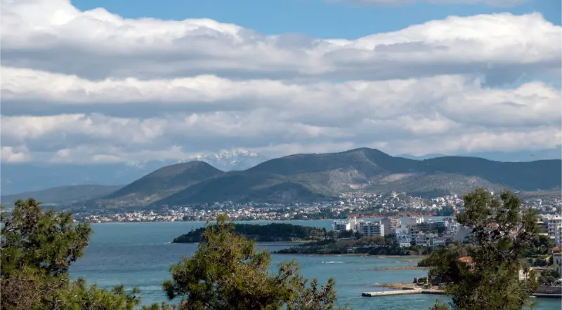
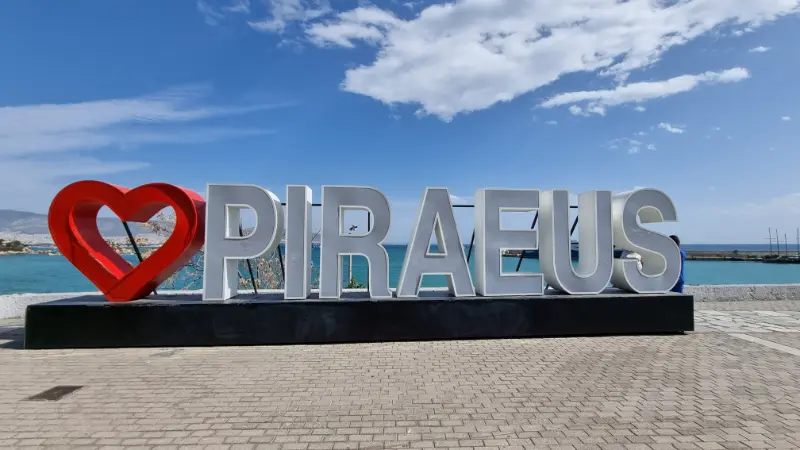
    Piraeus is not one small ferry terminal. It is a large working port with multiple gates, metro and bus connections, cruise facilities and enough distance between some areas that arriving at “Piraeus” is only the first part of the journey. The single most useful habit is to check your ferry’s gate before travel and leave time to reach it.

    If you are coming directly from the airport, read the Athens Airport transport guide as well. If Piraeus is simply the first step in an island-hopping trip, the broader Greece transport guide explains how much buffer I would leave between ferries, flights and other connections.

    Understand the port before you arrive

    Piraeus serves routes to many Aegean islands and Crete, and the passenger port is spread across different gate areas. Your ticket or ferry company information should indicate the departure point. Do not tell a taxi only “Piraeus port” if you already know the gate; give the gate or ferry name as well.

    The Port of Piraeus provides free passenger transport within the port area on designated internal services. Even so, I would rather arrive at the correct side of the port than depend on a last-minute shuttle when boarding is approaching.

    Metro to Piraeus

    Metro Line 3 connects central Athens and the airport with Piraeus, while Line 1 also serves Piraeus from central areas such as Monastiraki. The best line depends on where you start.

    When you exit the station, do not assume the ship is directly opposite. Check the gate and walking route. With large luggage, children or summer heat, a short taxi can be reasonable if the gate is distant.

    Airport to Piraeus

    Athens International Airport currently lists three main public options: Metro Line 3 with an estimated trip of about 60 minutes to Piraeus station, suburban rail at around 65 minutes, and the X96 airport express bus with a longer road journey that is affected by traffic.

    Those times only get you to the Piraeus area. Add the final transfer to your ferry gate, ticket checks and the ferry company’s required boarding time. I would never build an expensive island holiday around a connection with no margin.

    How early should you arrive for a ferry?

    Follow the ferry company’s boarding instructions first. As a general planning habit, I prefer to be in the port area well before boarding rather than arrive at the exact minimum. Vehicle boarding, luggage, children and unfamiliar gates all require extra time.

    If you are collecting tickets, checking a car onto the ferry or travelling in peak summer, add more margin. A coffee near the gate is cheaper than a missed ferry.

    Should you stay overnight in Piraeus?

    Yes when your ferry departs very early, your flight arrives late, or the same-day connection would make you anxious. An overnight in Piraeus can remove the most fragile transfer from the entire itinerary.

    Choose a hotel based on your departure gate or metro access, not simply a “Piraeus” address. The port’s scale means two hotels that look close on a city map may not be equally convenient for your ship.

    Piraeus as more than a transit point

    If you have extra time, the marina areas around Mikrolimano and Pasalimani show a different side of Piraeus from the ferry gates. The Archaeological Museum of Piraeus can also be a useful stop for travellers interested in ancient history.

    I would not sacrifice a full Athens sightseeing day just to tour the port, but arriving the previous afternoon can make an early ferry easier and still give you a pleasant waterfront dinner.

    Piraeus Port Athens Greece

    Travelling with a rental car on the ferry

    Arrive earlier than a foot passenger and follow the ferry company’s instructions for vehicle check-in. Photograph the car before boarding, keep essentials with you and do not leave passports, medication or valuables buried in luggage that becomes inaccessible on the vehicle deck.

    When you arrive on an island, traffic can funnel out of the ferry quickly. Have the next hotel route saved offline before disembarkation rather than trying to configure navigation in the port exit queue.

    Luggage strategy

    Use luggage you can move yourself over uneven pavement and ramps. Large ports are a poor place to discover that one suitcase wheel is broken. Keep documents, medication, phone charger and a light layer in a smaller bag that stays with you.

    On ferries, luggage storage arrangements vary by vessel and ticket type. Follow crew instructions and keep valuables on your person.

    A low-stress ferry morning

    1. Check the ferry status, gate and boarding instructions before leaving the hotel.
    2. Leave with enough time for metro disruption, traffic or a wrong port entrance.
    3. Go directly to the correct gate rather than the generic centre of Piraeus.
    4. Buy water or breakfast only after you are confident you are in the right area.
    5. Board when instructed and keep essential documents and valuables accessible.

    Official information

    For port maps, coastal-terminal information and passenger services, check the Piraeus Port Authority coastal-terminal page. For current Athens public transport and airport fares, use OASA. Ferry schedules should always be confirmed with the operator or booking provider close to travel.

    How I would plan the trip before booking

    For a ferry departure from Piraeus, I would book the trip in this order: decide how many nights you genuinely have, choose a hotel near your specific gate or metro station if you need an overnight, check the transport that controls your arrival and departure, and only then reserve day trips. This order matters because attractive hotel prices can tempt you into a base that creates unnecessary driving, transfers or early-morning stress. A good location often saves more holiday time than a slightly cheaper room.

    The transport question is especially important here: the port is large, so plan the last kilometre as carefully as the Athens-to-Piraeus journey and leave time for internal movement. I would keep the first and final day lighter than the middle of the trip. That leaves space for delayed flights or ferries, heat, wind, children needing a slower morning, or simply discovering a place you want to stay longer.

    Panoramic Of Piraeus And The Port Greece

    For seasonality, Piraeus is busy year-round, with the heaviest island traffic in summer; heat and crowds make extra buffer time even more valuable. I also avoid building a plan in which every day depends on perfect beach weather. A museum, old town, village, food stop or short scenic walk gives the itinerary resilience when conditions change.

    Who will enjoy this destination most?

    a ferry departure from Piraeus works best for travellers who like a mixture of sightseeing and unstructured time rather than rushing between checklist attractions. It rewards mornings that start early, a long lunch or coffee break, and evenings close to the accommodation rather than another long transfer.

    For families, avoid same-morning airport-to-ferry connections when the margin is tight, and keep snacks, documents and a light layer in one easy bag. Couples can make the trip more relaxed by staying somewhere walkable for dinner. Solo travellers generally benefit from central bases and public transport connections. Road-trippers should check parking before choosing accommodation, because a beautiful historic centre can be inconvenient with a car.

    If you are combining this stop with another part of Greece, compare the pacing with the Greek islands comparison guide. One of the biggest mistakes in Greece is treating a short transfer on a map as a short travel day; ferry check-in, port access, parking, waiting time and mountain roads all add invisible hours.

    Small details that make the trip easier

    I keep a small offline map on my phone, carry water in warm months, save the exact accommodation entrance rather than only the property name, and photograph parking or bus-stop information when I arrive. These tiny habits are more useful than a minute-by-minute itinerary.

    Comfortable shoes matter in Greece more often than visitors expect. Polished stone, steps, uneven lanes and archaeological ground are common. Sun protection, a light layer for wind or air-conditioned transport, and a reusable bottle cover most day-to-day needs. At religious sites, modest clothing may be required, so it is useful to carry something that covers shoulders or knees.

    Finally, leave one block of two or three hours completely unscheduled. The most memorable part of a trip is often the bakery you did not plan, a swim that lasts longer than expected, a village square at dusk or a viewpoint found on the way back to the hotel.

    Frequently asked questions

    Is Piraeus Port walkable from the metro?

    Some gates are relatively close and others are not. Always check the exact ferry gate before deciding to walk, particularly with luggage or in summer heat.

    Attica Piraeus Port

    Can I go straight from Athens Airport to Piraeus?

    Yes. Metro Line 3, the suburban railway and X96 airport bus all connect the airport with Piraeus. Add time from the station or bus stop to your specific ferry gate.

    Should I sleep in Athens or Piraeus before an early ferry?

    For a very early departure, Piraeus usually reduces stress. For a later morning or afternoon ferry, central Athens can be more enjoyable if you leave with a generous transport buffer.

    A quick island from Piraeus

    If you want an island escape close to Athens, see the Aegina travel guide. Fast services can make the island practical even for a short stay.

    More practical Greece planning

    Continue with Piraeus, Rafina and Lavrio comparison for more detailed planning.
  • Kea Without a Car: Buses, Taxis, Walking, Beaches and the Best Base

    Kea Without a Car: Buses, Taxis, Walking, Beaches and the Best Base

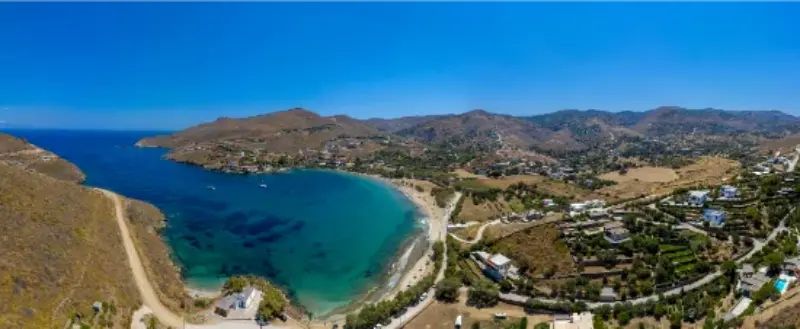
    You can visit Kea without a car, but the trip works best when you design it around the transport network instead of trying to copy a road-trip itinerary. Korissia, Ioulida, Vourkari, Gialiskari and some seasonal beach routes are manageable with buses, taxis and walking. Remote coves, Karthaia trailheads and scattered countryside stays are much harder without your own vehicle.

    The key is to choose the right base. A cheap villa on a hillside can become expensive if every meal and beach requires a taxi. For a car-free trip, location is worth paying for because it replaces transport costs and gives you flexibility when bus times change.

    Best bases without a car

    Korissia is the easiest base for ferry arrivals, flat access and onward buses. Ioulida is the best base for atmosphere, restaurants and walking, provided you can manage hills and steps. Vourkari works for waterfront evenings but may require more careful timing for buses or taxis depending on the season.

    I would avoid remote villa areas unless the property offers reliable transfers. The view may be beautiful, but a car-free holiday should not depend on asking the host for every movement.

    How the bus network helps

    The Municipality of Kea maintains local transport information and summer schedules typically increase service between the port, Ioulida and visitor areas. In summer 2026, the Ioulida–Korissia axis had multiple daily departures, and seasonal services also linked places such as Vourkari, Otzias, Pisses and Koundouros.

    Treat exact times as temporary. Save or photograph the current timetable after you arrive, and check whether the final evening return works before staying for dinner. A bus that gets you to a beach is only useful if there is a realistic bus back.

    Taxis: useful but not unlimited

    Taxis fill the gaps between bus routes, especially for early ferries, dinner transfers and trailheads. Kea does not have the enormous taxi supply of a city, so pre-book important journeys during busy weekends.

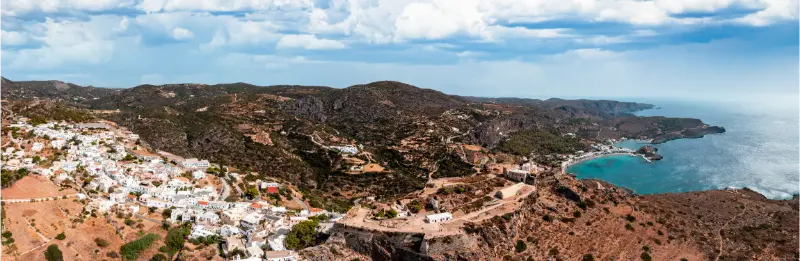
    Kea Island Tzia Greece

    Ask the approximate fare before a long rural trip and agree on pickup arrangements for remote places. Do not assume you can request a car instantly from an isolated beach with weak reception.

    Walking from Ioulida

    Ioulida is unusually rewarding without a car because the Lion of Kea and sections of the historic path network begin from the capital. You can build a meaningful walking day without any road transport beyond the bus from the port.

    Greece Kea Island Aerial Drone View Ioulis Chora

    For longer point-to-point hikes, transport planning returns. If you end at Otzias or another coast, confirm the bus or taxi solution first. The island’s old paths are excellent, but they were not designed around modern return timetables.

    Beaches that are realistic car-free

    Gialiskari is the obvious easy beach because it lies between Korissia and Vourkari. Otzias can work when seasonal buses align. Pisses and Koundouros may also be reachable on summer services, but frequency matters more than distance.

    Spathi, Xyla and remote coves are not where I would build a first car-free trip. You can potentially use taxis or boats, but costs and return logistics reduce spontaneity. Choose the accessible beaches and enjoy them rather than treating the car-free trip as a challenge to reach every pin on the map.

    Can you visit Karthaia without a car?

    Yes, but it requires planning. The site itself is reached on foot or by sea, yet the relevant trailheads may still require a taxi or organised transfer. A guided hike can solve both navigation and transport. Boat access may be another option when weather allows.
    This is exactly the kind of excursion to organise in advance. Do not take a morning bus toward the south and assume the final connection to a remote trailhead will somehow appear.

    When a one-day rental makes sense

    A car-free holiday does not have to mean refusing a vehicle every day. Renting for one carefully planned day can unlock Pisses, Koundouros, remote beaches and rural stops, while you use buses and walking for the rest of the trip.

    This hybrid approach is often cheaper and more relaxed than keeping a rental parked during days spent in Ioulida or Vourkari. Confirm licence and insurance requirements before arrival, especially if you plan to use any unpaved roads.

    Three-day car-free itinerary

    DayPlan
    1Arrive Korissia, settle in, Gialiskari swim, Vourkari evening
    2Bus to Ioulida, Lion of Kea, museum/lanes, dinner in Chora
    3Seasonal bus or taxi to Otzias/Pisses, or guided Karthaia excursion

    With four or five days, add a dedicated walking day and one pre-arranged taxi or rental-car day. This creates variety without spending the whole trip studying transport schedules.

    Car-free mistakes to avoid

    • Booking a remote villa because the nightly rate is lower.
    • Assuming summer bus frequency continues into May, October or winter.
    • Staying for a late dinner without checking the final return.
    • Walking a remote trail without solving the end-point transport.
    • Planning a tight ferry-to-airport connection on separate tickets.
    • Carrying heavy luggage deep into Ioulida without asking about drop-off access.

    Where to stay and how to book

    For the simplest car-free trip, choose Korissia if ferry convenience matters most or Ioulida if evening atmosphere and walking matter most. Vourkari can work well in summer for travellers focused on restaurants and the harbour. Check the exact property location rather than the village name alone.

    For live availability and current rates, compare places to stay in Kea on Booking.com. I recommend checking the exact pin on the map before paying: on Kea, two properties described with the same village name can be separated by steep roads, long walks or a stretch that is much easier with a car.

    Official resources to check before your trip

    Check the Municipality of Kea for current bus and ferry information close to travel. The municipality specifically maintains sections for Kea bus schedules and Lavrio–Kea ferry schedules, but seasonal changes are normal.

    Opening hours, ferry times, bus routes and beach services can change by season. Recheck them close to your travel date rather than treating an old timetable or a social-media post as permanent.

    Tours and activities

    Kea has a smaller organised-tour market than Santorini or Mykonos, so availability is often seasonal. The widget below is useful for checking whether guided hikes, sailing, diving or other bookable experiences are operating on your dates. Verify meeting points and cancellation terms before paying.

    Continue planning your Kea trip

    How I would fit this into a first Kea itinerary

    For a first stay of four or five nights, I would not make Kea without a car the only purpose of the trip. Kea works best when one day is built around Ioulida and the historic interior, one around the coast, one around a substantial walk or archaeological experience, and at least one remains flexible for wind and weather. That structure lets you use this guide in context rather than forcing every attraction into consecutive hours. If you are arriving from Athens on a Friday and leaving Sunday, cut the plan further: choose one village experience, one beach area and one signature activity. The island is close enough to return to, so there is little value in turning a short break into a race.

    Kea also changes character between weekdays and summer weekends. Its proximity to Attica means Friday-evening and Sunday-return traffic can feel much busier than a midweek stay. If accommodation prices, restaurant reservations or ferry availability look tight, consider shifting the same itinerary by a day or travelling in June or September. Shoulder-season travel is particularly attractive for walking because the sun is less punishing and you can spend more of the day outdoors instead of organizing everything around midday heat.

    Keep one practical rule throughout the trip: verify the next day’s transport and opening information the evening before. Ferry operators, local buses, museums, restaurants and boat activities can all change seasonally. Ten minutes of checking is more useful than relying on a screenshot saved months earlier. It also gives you permission to change plans when the wind or temperature makes another part of the island more appealing.

    Small practical details that make the trip easier

    Another detail worth planning is the difference between map distance and real travel time. Kea’s roads are not long, but bends, village traffic, beach approaches and parking can slow a day considerably. Avoid stacking reservations back to back. Leaving thirty or forty minutes of slack between a beach, a museum, dinner or a ferry transfer makes the trip feel calmer and gives you room to stop when a viewpoint or village turns out to be more interesting than expected.

    Carry a small day kit even on short outings: drinking water, sun protection, a light layer for wind, shoes that can handle uneven ground and an offline map. Card payment is common in visitor areas, but having some cash is sensible for small purchases or situations where a terminal or signal is unavailable. None of this requires overpacking; it simply makes remote beaches, trailheads and small villages easier to enjoy without needing to return to the hotel.

  • Mount Athos Cruise Guide: Monasteries from the Sea, Ouranoupoli and Practical Tips

    Mount Athos Cruise Guide: Monasteries from the Sea, Ouranoupoli and Practical Tips

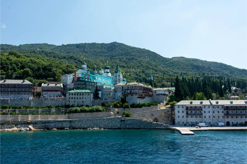
    A Mount Athos cruise is the simplest way for general travellers to understand the scale of the Athos peninsula without entering the monastic state. Boats from Ouranoupoli travel along the western coast, where monasteries appear between forested slopes and the sea. The experience is visual and geographical: you begin to see how isolated the communities are and why maritime access has shaped life here for centuries.

    The official Halkidiki tourism site states that Mount Athos includes 20 monasteries and is a UNESCO World Heritage property, and that sightseeing cruises allow visitors to admire monasteries from the sea. Entry into Mount Athos itself is a separate matter governed by specific religious and administrative rules. This guide focuses only on the public cruise experience and how to plan it respectfully.

    Monastery Mount Athos Halkidiki Greece

    Why it is worth adding to your itinerary

    The experience shows a coastline and cultural landscape that are difficult to understand from the road. It is less about checking monuments off a list and more about seeing distance, isolation and geography from the perspective that has connected communities here for centuries.

    What to see and do

    Understand what the boat can show you

    The western coastline contains several of the most dramatic monastery settings, including complexes that appear to rise directly from steep terrain above the sea. You are viewing them at a distance, so bring binoculars if details matter. The value is the full landscape: monastery, mountain, forest and water in the same frame.

    Listen to the commentary

    On a good cruise, commentary turns distant architecture into a sequence you can understand. Note monastery names only if that interests you; you do not need to memorise everything. I prefer to listen for patterns—how monasteries are positioned, where small harbours sit and how the terrain separates communities.

    Choose your deck position thoughtfully

    Open decks give the clearest views but also the strongest sun and wind. Move rather than guarding one seat for the whole trip. The coastline can be clearer from different sides as the boat turns, and a shaded section is valuable during long stretches between major viewpoints.

    Respect the place you are observing

    Mount Athos is not a themed attraction. It is a living Orthodox monastic community with rules and spiritual significance. Photograph from the boat where permitted, keep commentary volume reasonable and avoid treating restrictions as a curiosity to challenge. Respect makes the experience more meaningful, not less.

    Pair the cruise with Ouranoupoli, not another long drive

    Cruise days are longer than they look because boarding, sailing and sun exposure are tiring. Stay in Ouranoupoli and keep the rest of the day simple: dinner, a swim or an easy waterfront walk. Saving a two-hour road transfer for another day improves the trip immediately.

    A realistic itinerary

    Part of the dayPlan
    Before departureArrive early, confirm boarding point and check sea conditions
    Outbound cruiseUse commentary and binoculars to understand the coast
    Main viewing sectionRotate between shade and open deck; photograph selectively
    ReturnHydrate and rest rather than planning a second major excursion
    EveningDinner and harbour walk in Ouranoupoli

    Use this as a framework rather than a strict timetable. Northern Greece rewards flexibility: traffic, wind, mountain weather, ferry operations and opening hours can change the rhythm of a day. Protect the main experience and treat secondary stops as optional. That produces a better trip than racing to every pin saved on a map.

    How to get there and move around

    Most public sightseeing cruises associated with Mount Athos depart from Ouranoupoli, while other routes may operate from Ormos Panagias. Schedules vary by season and operator, so book from current information and reconfirm close to departure. The official Halkidiki site distinguishes sightseeing cruises from entry to the monastic state. Do not assume a cruise ticket gives any right to disembark inside Mount Athos.

    Choose the cruise for the experience you actually want

    A Mount Athos cruise is about landscape, monasteries seen from the sea and the scale of the peninsula, not close-up access to every complex. Read the route description before booking, check whether commentary is included, and choose a boat size and duration that match your tolerance for sun, wind and time on deck.

    Sea Coast View With Rural Scene Athos Peninsula Halkidiki Greece

    Sea conditions matter

    Even in summer, wind can change comfort and visibility. Bring a light layer, sun protection and water, and keep valuables secure when moving around the deck. If you are prone to seasickness, choose a larger vessel when possible and follow medical advice about prevention before boarding.

    Best time to visit

    Late spring to early autumn offers the broadest cruise season, but wind and sea state matter more than the calendar. A calm September morning may be more comfortable than a hot, windy August afternoon. Leave one flexible day in a longer Halkidiki itinerary if the cruise is important to you.

    Check the same-day weather and any official operating information shortly before you leave. Northern Greece can combine coastal heat, mountain cloud and strong wind within the same regional itinerary. Planning by conditions rather than by a rigid spreadsheet is one of the easiest ways to improve the trip.

    Food and local rhythm

    Eat lightly before sailing if you are sensitive to motion. After the cruise, Ouranoupoli is ideal for a fish or seafood dinner. Hydrate first, especially after several hours on an exposed deck, and avoid turning the evening into another long car journey.

    Do not compress every meal into the smallest possible gap between attractions. A long lunch or early dinner is also a planning tool: it gives you shade, hydration and time to decide whether the next stop still makes sense. This matters even more on driving, hiking and boat days.

    How to combine it with nearby places

    Spend two or three nights in Ouranoupoli and use a separate day for Ammouliani. This creates a balanced eastern-Halkidiki stay with culture, sea and beach time.

    When building a longer route, group places by geography. A northern-Greece itinerary becomes tiring when each day starts with a two-hour transfer in the opposite direction. Two or three nights per base usually produces more walking, swimming and local evenings than changing hotels every day.

    Where to stay

    Stay in Ouranoupoli the night before if your cruise leaves early. Removing a long pre-dawn drive reduces the risk of missing departure and makes the day much calmer. A second night is useful if you want dinner and a relaxed waterfront walk after returning.

    Practical planning notes

    Download an offline map before leaving the main city or resort area. Mobile coverage is generally good but can weaken in mountains, wetlands and isolated coastal stretches. Save the official destination name and your accommodation pin, and carry a charging cable or power bank on days with heavy navigation and photography.

    Carry water, sun protection and a light layer even when the forecast looks simple. Coastal wind can cool a boat quickly, while archaeological parks and wetland roads can be completely exposed. In hiking areas, replace casual footwear with shoes that have reliable grip. Small preparation choices make a bigger difference than adding another attraction.

    If you are travelling with children or older relatives, judge difficulty by heat, surfaces and standing time rather than kilometres. A short archaeological site under strong sun can feel harder than a longer shaded walk. Build in benches, café stops and permission to skip the final viewpoint.

    Common mistakes to avoid

    • Assuming the cruise enters monasteries
    • Booking the tightest possible connection before departure
    • Spending the whole cruise in full sun
    • Forgetting binoculars when architecture is your main interest
    • Treating religious access rules as optional
    • Planning a long cross-Halkidiki drive immediately after returning

    Official information

    For current opening hours, tickets, access rules or regional information, check Halkidiki Tourism – Mount Athos shortly before the trip. I prefer official sources for variable details because transport timetables, admission prices and seasonal operations can change after older travel articles were published.

    Building Details Karyes Holy Mount Athos Greece

    Frequently asked questions

    Can women take a Mount Athos cruise?

    Yes. Public sightseeing cruises offshore are open to general visitors, including women; entry into the monastic state is governed by separate rules.

    Do cruises stop at monasteries?

    Standard sightseeing cruises are designed to view monasteries from the sea, not to provide general tourist entry.

    Where do cruises leave from?

    Ouranoupoli is the main departure point highlighted by the official Halkidiki tourism site; some routes also operate from Ormos Panagias.

    Do I need binoculars?

    They are not essential, but they make distant architectural details much easier to appreciate.

    What if the weather is windy?

    Cruise comfort and schedules can change with sea conditions, so reconfirm with the operator and keep a flexible backup plan.

    Final advice

    Build the day around one clear reason for coming, then let the surrounding region add depth. Northern Greece is especially rewarding when you leave margin for a good meal, a change in weather or a place you did not expect to enjoy. The goal is not maximum coverage; it is a route that still feels enjoyable on the final day.

    For the wider picture, continue with Ouranoupoli Guide, Ammouliani Guide, Halkidiki Travel Guide. These guides connect this stop to the rest of the region without unnecessary backtracking.

  • Chalkida Evia Guide: Evripos Tides, Karababa Castle, Waterfront and a 2-Day Stay

    Chalkida Evia Guide: Evripos Tides, Karababa Castle, Waterfront and a 2-Day Stay

    Chalkida is the easiest introduction to Evia because it sits exactly where the island nearly touches mainland Greece. Bridges make arrival simple, the waterfront feels lively year-round and the Evripos Strait gives the city a natural phenomenon that is genuinely worth pausing to watch.

    Many travellers drive straight through Chalkida on the way north or south, but one night makes an Evia road trip more relaxed and adds an urban counterpoint to beaches and mountains. For the bigger picture, see the Evia travel guide.

    Why this place deserves more than a quick stop

    The city is both gateway and destination. The old sliding bridge, waterfront promenade, seafood culture and Karababa Castle create enough for a short break, while road connections make it practical before continuing elsewhere on Evia.

    Visit Greece describes Chalkida as a favourite short escape from Athens and highlights the Evripos tidal phenomenon, where water direction changes approximately every six hours. The city’s geography makes that movement visible in a way few urban waterfronts can match.

    At a glance

    Best forWeekend breaks, road-trip gateways, waterfront dining and unusual natural phenomena
    Ideal time1–2 days
    Main baseCentral waterfront near the old bridge
    TransportWalk in centre; car or bus for wider Evia
    Pair it withEretria, Edipsos or southern Evia

    What to see and do

    Chalkida is compact enough that a first visit can focus on the strait and historic viewpoints rather than driving between attractions.

    • Watch the current at the Evripos old bridge.
    • Walk both sides of the waterfront at different times of day.
    • Visit Karababa Castle on Kanithos Hill for city views.
    • Eat seafood or meze near the water.
    • Use the city as an overnight transition before an Evia road trip.

    The Evripos “crazy waters”

    The strait is the city’s defining feature. Currents reverse direction in a complex tidal pattern, and the old bridge area is the easiest place to observe the water moving through the narrow channel. Do not worry about memorising an exact reversal time from a blog; the pattern is affected by cycles and local conditions.

    Ask locally or observe the water more than once if the phenomenon is a priority. Even when the reversal itself is not dramatic, the speed and texture of the current make the strait feel very different from a typical harbour.

    Karababa Castle and the city from above

    Karababa Castle sits on Kanithos Hill opposite the central waterfront. The elevated position helps you understand Chalkida’s strategic control of the strait and gives one of the best city panoramas.

    Combine the castle with the waterfront rather than treating it as a separate half-day excursion. Visit in comfortable light, then return to the old bridge for an evening meal and another look at the currents.

    A practical route that works

    A simple walking-and-viewpoint plan is enough for a satisfying first day.

    1. Start at the old bridge and watch the strait.
    2. Walk the waterfront and central streets.
    3. Cross toward Kanithos and visit the castle area.
    4. Return for late lunch or coffee by the water.
    5. See the bridge again after dark when the city atmosphere changes.

    On day two, leave the centre and begin your Evia route rather than adding too many minor urban stops.

    Getting there

    Chalkida is connected to mainland Greece by road bridges and is roughly 79 km from Athens according to Visit Greece. That direct access is one reason Evia feels easier than ferry-dependent islands.

    Rail and bus options can also serve Chalkida depending on schedules. If the city is the start of a larger Evia trip, a rental car becomes more useful after the central stay than during it.

    Getting around

    Central Chalkida is walkable. Leave the car parked when possible because the waterfront experience is much better on foot.

    For wider Evia, driving becomes the practical choice: the island is long, and beach, mountain and spa destinations are spread far apart.

    Where to stay

    Choose the central waterfront for a first stay. You gain easy evening walks, restaurants and access to the bridge without needing to drive.

    If you are only transiting, accommodation with secure parking on the edge of the centre can be more practical than squeezing into the busiest streets.

    Food and local rhythm

    The water is central to Chalkida’s food identity. Seafood, ouzo or tsipouro-style meze and long waterfront meals fit the city better than rushing through a motorway stop.

    Do not assume the restaurant with the closest table to the old bridge is automatically the best. Walk a little, compare menus and choose the atmosphere you want.

    Best time to visit

    Chalkida works year-round better than a small resort island. Spring and autumn are ideal for walking, while summer evenings bring strong waterfront energy.

    Winter can be an attractive option for food and city breaks, especially if your trip focuses on mainland Greece rather than beaches.

    How long do you need?

    One night is enough for the bridge, castle, waterfront and dinner. Two nights give a slower start to an Evia trip.

    Greece Chalkida City Evia Close Up View Port From Castle Building Cloudy Sky

    Do not base an entire week here if your goal is to explore the island; distances to north and south are significant.

    A realistic mini-itinerary

    1. Day 1: old bridge, waterfront walk, Karababa Castle and evening meal by the strait.
    2. Day 2: breakfast, one final bridge stop, then drive toward your chosen Evia region.
    3. Optional: use Chalkida as a weekend base with an Eretria excursion.

    Mistakes to avoid

    • Driving through without stopping at the strait.
    • Expecting the current reversal to happen on a simple fixed hourly timetable.
    • Keeping the car for every central errand.
    • Assuming north and south Evia are short drives from the city.

    Chalkida is best understood as a gateway worth inhabiting for a night, not merely a road junction.

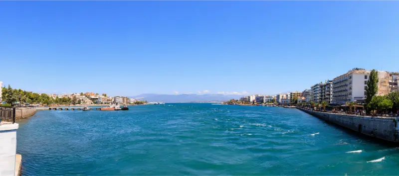
    Greece Panoramic View Chalkida Town

    Responsible travel and practical etiquette

    Walk the centre when practical and use established viewpoints rather than leaning into traffic lanes for bridge photographs. The old bridge area is active urban infrastructure, not a pedestrian-only attraction.

    Support year-round restaurants and local shops if you visit outside summer; this is a real regional city, not a seasonal resort.

    How to combine it with the rest of Greece

    Continue north toward the Loutra Edipsou guide for thermal springs, or south toward Karystos and Dimosari Gorge for a more mountainous road trip.

    The Evia road-trip guide explains why you should normally use more than one base on the island.

    Useful official information

    The official Visit Greece Chalkida page covers the Evripos phenomenon, old bridge, Karababa Castle and road distances.

    FAQ

    Is Chalkida on an island?

    Yes. Chalkida is the capital and main gateway of Evia, which is connected to mainland Greece by bridges.

    What is the Evripos phenomenon?

    Strong tidal currents in the narrow strait change direction in a distinctive cycle, visible around the old bridge.

    Can I visit from Athens in a day?

    Yes, but one overnight gives you the evening waterfront and makes an onward Evia road trip easier.

    Do I need a car?

    Not for central Chalkida. A car is very useful for exploring the rest of Evia.

    How long should I stay?

    One or two days are enough for a first visit.

    Final thoughts

    Chalkida is not the kind of Greek destination that depends on one ancient ruin or famous beach. Its character comes from the moving water, bridges and everyday waterfront life.

    Stop here before racing into Evia. One evening by the strait makes the rest of the island feel like a journey rather than a sequence of long drives.

    Extra planning notes

    Before locking in accommodation, compare the real transfer sequence for your dates rather than relying on a generic map. Greek island and regional travel is often simple once you are there, but seasonal timetables, wind, road conditions and the location of your hotel can change how a day feels. I prefer to leave one part of the itinerary intentionally flexible: a beach can move to another day, a hike can start earlier, and a boat trip can shift when the sea is calmer. This is especially useful in places where the landscape is the attraction, because forcing an activity in poor conditions rarely creates the experience you imagined.

    A second practical rule is to plan around energy as much as distance. A short drive followed by stairs, heat or a long swim may be more tiring than a longer transfer on paper. Build in shade, water, unhurried meals and time to return to your base before dinner. That slower rhythm is not wasted time; it is often what separates a holiday that feels like a sequence of logistics from one that actually feels like Greece.

    Practical pacing for a better trip

    One final detail that improves this trip is to keep the day deliberately under-filled. Leave room for a delayed bus, a longer meal, a change in wind or a viewpoint that deserves more time than expected. In Greece, the most frustrating itineraries are often the ones that look perfectly efficient on paper. A realistic plan has enough slack to move an outdoor activity, return to the hotel for a break or stay longer in a village without creating a chain of missed reservations.

    If you are travelling in the busiest summer weeks, start earlier than you think you need to and avoid making the hottest part of the afternoon your most demanding walking period. Carry water, use sun protection and check local advice for fire risk, trail access and sea conditions. These small choices are more useful than adding another attraction to the schedule, and they make the destination feel more relaxed and personal.

  • Chios Travel Guide: Mastic Villages, Beaches, Kampos and a 7-Day Itinerary

    Chios Travel Guide: Mastic Villages, Beaches, Kampos and a 7-Day Itinerary

    Chios is an island with a remarkably strong identity. In the south, medieval villages are tied to the cultivation of mastic; near the capital, Kampos is filled with old estates and citrus gardens; elsewhere the coastline alternates between pebbled bays and remote coves. The result feels culturally dense and very different from the white-and-blue Cyclades image.

    I would recommend Chios to travellers who like road trips, architecture and food as much as beaches. A week lets you explore the mastic villages properly instead of compressing them into a rushed day tour.

    Why visit Chios?

    The mastic landscape is unique. Villages such as Pyrgi and Mesta preserve fortified forms and decorative traditions, while mastic cultivation continues to shape local products and identity.

    Chios also offers Byzantine heritage, maritime history, citrus estates and a long north-south geography. It feels like an island you discover in layers rather than a destination organised around one famous beach.

    Where to stay

    Most first-time visitors benefit from a car and one or two bases depending on trip length.

    Chios Town

    The practical base for airport, port, museums and evening life. Best for the first or last nights.

    Kampos

    A distinctive area south of town with walled citrus estates and a quieter atmosphere, while remaining close to transport.

    Mesta

    A memorable southern base inside a medieval mastic village, especially good for couples and travellers who value evening atmosphere.

    Northern Chios

    The north is quieter and more mountainous, suitable for repeat visitors who want remote villages and fewer tourism services.

    Best things to do

    Walk through Pyrgi

    Pyrgi is famous for the geometric black-and-white façade decoration known as xysta. Explore beyond the central square to appreciate the village structure.

    Stay late in Mesta

    The fortified lanes are atmospheric after day visitors leave. Evening is the best time to feel the village rather than simply photograph it.

    Explore Kampos

    Old mansions, high stone walls and citrus gardens create a landscape unlike other Greek islands. Respect private property and use organised visits where available.

    Learn about mastic

    Understand how mastic is cultivated and processed in southern Chios. The product appears in sweets, liqueurs, cosmetics and savoury cooking.

    Visit Nea Moni

    This important Byzantine monastery is a major cultural stop. Dress appropriately and check current visitor hours before making the drive.

    Choose a beach day by wind

    Chios has very different beaches around the island. Let wind direction and your route determine the day instead of driving long distances to one famous name.

    Beaches and nature

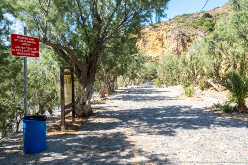
    The coastline is varied, from volcanic-looking pebbles to clear coves and broader beaches. Mavra Volia is especially distinctive for dark pebbles, while other bays are easier for long family beach days.

    Cobblestone Walkway Lined With Tamarisk Trees Near Mavra Volia Beach Chios Island Greece

    The interior contains dry southern mastic country, citrus landscapes and more rugged northern terrain. This environmental variety is one reason a road trip feels worthwhile.

    Food and local character

    Chios is exceptionally strong for food-minded travellers. Mastic is the signature ingredient, but local citrus, cheeses, pasta, seafood, spoon sweets, ouzo and souma also shape the table.

    Do not limit mastic to souvenirs. Try it in different forms and learn how the trees are cultivated; the agricultural process gives the flavour more meaning.

    How to get there

    Chios has an airport close to Chios Town and ferry links to Piraeus and other Aegean destinations. Flights are efficient for a short trip, while ferries can fit a longer North Aegean itinerary.

    As with other eastern Aegean islands, ferry travel can be lengthy. Overnight services may be practical but should be planned around cabin availability and arrival times.

    Getting around

    A rental car is strongly recommended for mastic villages, remote beaches and the north. The road network is extensive but includes winding mountain sections.

    If you stay only in Chios Town, buses and organised trips can cover major highlights, but you lose much of the flexibility that makes the island rewarding.

    How many days do you need?

    Six to seven days is ideal for a first visit. Four days can cover Chios Town, Kampos and the southern villages, but not the whole island comfortably.

    A practical 7-day Chios itinerary

    Day 1 – Chios Town

    Explore the waterfront, market area and museums, keeping the arrival day easy.

    Day 2 – Kampos

    Spend time in the citrus-estate landscape and combine it with a nearby beach.

    Day 3 – Pyrgi and Mavra Volia

    Focus on southern Chios, leaving enough time to walk Pyrgi slowly before swimming.

    Day 4 – Mesta and Olympi

    Explore fortified villages and stay for dinner in the south if possible.

    Day 5 – Nea Moni and central Chios

    Make heritage the priority and add only one or two nearby stops.

    Day 6 – Northern road trip

    Drive north for villages, viewpoints and a quieter coastline.

    Day 7 – Flexible beach and food day

    Repeat your favourite region, buy local products and keep departure logistics simple.

    Best time to visit

    June and September balance warm sea with comfortable sightseeing. July and August are hotter and busier but have the fullest seasonal services.

    Spring is excellent for road trips, flowers and cultural sightseeing. Autumn can be attractive for food and village travel if ferry and hotel schedules work.

    Is it a good choice for families?

    Chios is good for families who enjoy a mix of beaches and cultural stops. Medieval villages feel like open-air mazes and can be engaging for older children.

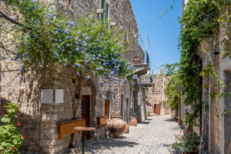
    Stone Arch Gateway Nea Monastery Courtyard Chios Island Greece Open Wooden Door Cobblestone Trees

    Keep drive times realistic and select beaches with simple parking and facilities for younger children.

    Budget and booking tips

    Accommodation prices change sharply with season, location and room type. I prefer to compare a few bases before booking rather than choosing the first hotel that looks inexpensive. A cheaper room far from the places you actually want to see can cost more once transport, parking and lost time are included.

    For ferries, flights, rental cars, boat trips and guided activities, treat schedules and prices as dynamic. Check the operator again shortly before travel, especially outside July and August. Weather can affect sea transport, while seasonal businesses may open later in spring or close earlier in autumn.

    Mistakes to avoid

    Do not try to see every mastic village in one day. Pyrgi and Mesta deserve unhurried time, and the pleasure comes from walking rather than ticking names off a list.

    Do not assume all roads are quick because the island looks manageable on a map. Northern and interior drives can take longer than expected.

    Who Chios suits best

    Chios works best for travellers who are comfortable giving a destination enough time to reveal its character. If your priority is to collect as many islands or regions as possible in a single week, this may feel slower than expected. If instead you enjoy mixing beaches or landscapes with local food, village walks, cultural stops and unplanned pauses, the trip becomes much more rewarding. Couples can build quiet evenings around scenic towns, solo travellers gain flexibility to follow weather and transport conditions, and repeat visitors to Greece will appreciate seeing a side of the country that is less dominated by the most internationally famous stops.

    Nea Monastery Courtyard Chios Island Greece Cypress Trees Stone Walls Quiet Garden Blue Sky

    It is also a strong choice for independent travellers who like making decisions day by day. A rental vehicle can open up more options, but it should not turn the holiday into a driving challenge. Pick one main objective for each day, then add nearby stops only if time and energy allow. That approach keeps the itinerary useful for different ages and budgets and reduces the temptation to race from viewpoint to viewpoint.

    Planning the pace of your trip

    My preferred way to plan this kind of Greece trip is to separate transfer days from sightseeing days. Arrival and departure always take longer than the timetable suggests once luggage, check-in, parking, meals and possible delays are included. Treating those hours as real travel time makes the itinerary far more realistic. On full days, start early for exposed archaeological sites, long drives or hikes, then reserve the hottest part of the afternoon for lunch, swimming or rest.

    Keep at least one half-day flexible. Wind, heat, ferry changes or a beach you unexpectedly love can easily change priorities. A flexible block prevents one cancelled boat trip or poor-weather morning from becoming a problem. It also leaves space for the experiences that are difficult to schedule in advance: a village festival, a recommendation from a hotel owner, a quiet cove discovered on the road or simply the decision to stay longer over lunch.

    How to combine Chios with the rest of Greece

    Chios can pair with Lesvos or Samos when ferry schedules align, but a full week on Chios alone is never wasted.

    If food traditions are a major priority, compare Chios with Sifnos; each expresses local cuisine in a very different way.

    Frequently asked questions

    What is Chios famous for?

    Mastic, medieval villages, citrus estates, Byzantine heritage and a varied coastline.

    How many days?

    Six or seven days is ideal for a first road trip.

    Do I need a car?

    A car is strongly recommended for the villages and beaches beyond Chios Town.

    Where should I stay?

    Chios Town is easiest; adding Mesta or another regional base creates a more immersive trip.

    Is Chios good for beach holidays?

    Yes, but its cultural and culinary experiences are just as important as the beaches.

    Practical final advice

    Build your days around geography rather than a checklist. Group nearby beaches, villages and sights together, leave room for a long lunch or an unexpected swim, and avoid crossing the same area repeatedly. This matters even more on islands and mountain roads, where short distances can take longer than they appear on a map.

    Carry water, sun protection and shoes suitable for uneven ground. Download an offline map before remote drives or hikes, and do not rely on mobile coverage in every cove or mountain village. If a route uses an unpaved road, confirm the conditions locally and check whether your rental agreement permits it.

    Most importantly, allow the destination to feel different from the headline islands. The value of this trip is not in reproducing Santorini or Mykonos somewhere else, but in experiencing its own landscapes, food, architecture and daily rhythm. A slower itinerary usually produces a better trip than adding another island simply because it fits on the map.

    Useful official information

    For destination updates and inspiration, consult the Greek National Tourism Organisation: Visit Greece – Chios. Always recheck transport timetables and seasonal opening details close to your travel dates.

  • Chora Folegandros Guide: Kastro, Panagia, Squares, Sunset and Where to Stay

    Chora Folegandros Guide: Kastro, Panagia, Squares, Sunset and Where to Stay

    Chora is the place that gives Folegandros its strongest visual identity: a white Cycladic settlement arranged around a chain of shaded squares, with the medieval Kastro hanging above a cliff and the zigzag path to Panagia climbing higher still. It is compact enough to explore without a checklist, yet layered enough that a quick evening walk misses a great deal. I would treat Chora as both a place to stay and a place to revisit at different times of day.

    The official visitor portal places the settlement at roughly 200 metres above sea level and notes that vehicles are excluded from the traditional core. That changes the experience immediately. You do not need to watch for traffic in the central lanes, but you do need to think about luggage, stairs and where a taxi or rental car can realistically drop you.

    Best forFirst-time visitors, couples, food, evening atmosphere and car-free stays
    AllowHalf a day for a first visit; 2–4 nights if using Chora as a base
    Key sightsKastro, Pounta, the sequence of squares and Panagia
    TransportLocal bus/taxi to the edge; walk inside the village
    Main trade-offNo beach directly in the old centre

    Start with the squares, not the viewpoints

    Chora is unusual because several small squares flow into one another and each has a different rhythm. In the morning, bakery stops and coffee feel local; by late afternoon the same spaces fill with people returning from beaches; after dark they become the island’s social centre. I would begin without a route and notice how Ntounavides, Kontarini, Piazza and the smaller spaces connect through narrow passages.

    This is also where the island is easiest for a low-effort evening. Restaurants, cafés, bars, shops and basic services sit close together, so you can leave the car parked outside the settlement and spend hours on foot. The advantage is not nightlife in the Mykonos sense; it is that dinner, dessert and a final drink happen naturally within a few minutes’ walk.

    Walk through Kastro slowly

    Kastro is the oldest fortified part of Chora, built into the cliff edge. The attraction is less a single monument than the urban form: compact houses, defensive edges, narrow passages and abrupt glimpses of the sea. Walk respectfully because people still live here. Doorways, courtyards and laundry are part of a residential neighbourhood, not a film set.

    Pounta is the obvious place to feel the height of the settlement. In strong wind, however, the exposed cliff edge can feel very different from the sheltered squares only a minute away. This contrast is useful when planning: if the coast is uncomfortable, Chora can still work for a café, meal or museum-style afternoon.

    Climb to Panagia at the right time

    The Church of Panagia is the largest church on Folegandros and sits above Chora on a conspicuous zigzag path. The official island site describes a walk of about 15 minutes from Pounta Square. The gradient and sun matter more than the distance, so I prefer early morning or the last part of the day instead of climbing in the strongest heat.

    The church incorporates ancient material and the current form dates mainly from rebuilding in the early nineteenth century. Even if you are not travelling for religious history, the terrace and approach make sense as part of a Chora walk. Dress respectfully if entering, keep voices low and do not let sunset photography turn the church into a backdrop only.

    Where to eat and how to use the evening

    Chora is the easiest place on the island to try local cooking without planning a special excursion. Look for matsata pasta, rabbit or rooster sauces when available, local cheese, capers, simple vegetable dishes and seasonal seafood. Ask what is local rather than assuming every “Greek” dish on a menu is specifically Folegandros cuisine.

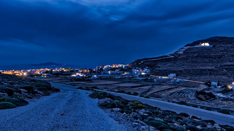
    Folegandros Greece Evening

    The smartest evening plan is flexible: Panagia or Pounta before sunset, dinner after the light softens, then a slow circuit of the squares. If you are staying elsewhere, check the return bus or taxi plan before ordering a final drink. The island is small, but late-night transport is not something I would improvise in peak season.

    Where to stay in Chora

    Stay in Chora if your priorities are atmosphere, dinner choice, easy evenings and a car-free base. It also works for hikers because routes fan toward Ano Meria and different coastal approaches. The compromise is that every proper beach requires a bus, taxi, vehicle, walk or boat connection.

    Before booking, ask exactly how far the room is from the nearest vehicle drop-off. A romantic lane can become less charming with a heavy suitcase and midday heat. If quiet is essential, avoid rooms directly over the busiest evening squares. For a full comparison, use the Where to Stay in Folegandros guide.

    How I would plan a day around Chora

    The easiest way to enjoy Chora is to give it a clear role in the day rather than squeezing it between unrelated stops. Use the cool part of the day for Panagia and Kastro, then let lunch or an afternoon rest separate the walk from the evening. Folegandros is small on a map, but heat, wind, footpaths and waiting for a bus or boat can make short distances feel longer. Build the day around one coast or one walking corridor and keep a second option for changing conditions.

    Buses connect Chora with Karavostasis, Ano Meria and Agali, and ferries are met at the port by local buses according to the official island information. I would avoid making a tight sequence of reservations around transport that is seasonal or weather-dependent. A slower plan is not wasted time here: coffee in a square, a swim that lasts an hour longer than expected, or an early dinner after a hike is part of the reason to choose Folegandros over a larger resort island.

    Port Town Karavostasis Folegandros Greece

    Who this experience suits best

    Chora suits couples, first-time visitors, photographers, walkers and travellers who want dinner and evening life outside the hotel door. It is less suitable for travellers who need a long list of organised attractions every day. Folegandros works best when you are comfortable with simple routines, walking and choosing quality over quantity.

    What to carry

    • Water in a reusable bottle, with extra capacity for remote beaches or trails
    • Sun protection: hat, sunglasses and high-SPF sunscreen
    • Shoes with grip if the plan includes old paths or rocky approaches
    • A light layer for windy evenings or exposed boat rides
    • Offline maps or screenshots of the return route and current transport information
    • Cash as a backup for small seasonal services or boat tickets

    Common mistakes to avoid

    Do not treat Chora as a one-hour photo stop. The squares, Kastro and Panagia feel different in morning light, afternoon shade and after dark. Another common mistake is assuming that a place described as “close” is effortless to reach. On Folegandros, 2–4 km can involve strong sun, exposed paths, steep gradients or a bus that runs only at certain times. Match the day to your actual fitness and the weather, not to the map scale.

    A final mistake is overplanning sunset. The island has beautiful evening light from many places, but racing from a beach to a famous viewpoint can turn a relaxed day into a stressful one. If the day is already working, stay where you are and enjoy the light there.

    Continue planning your Folegandros trip

    Use these guides together rather than as isolated checklists. Start with the main Folegandros Travel Guide and then open the specialist pages that match the way you want to travel: Karavostasis Folegandros Guide; Ano Meria Folegandros Guide; Agali Folegandros Guide; Katergo Beach Folegandros Guide; Livadaki Beach Folegandros Guide; Best Beaches in Folegandros; Folegandros Hiking Guide; Folegandros Without a Car; Where to Stay in Folegandros.

    Useful official sources before you go

    For destination details I cross-check the official Folegandros visitor portal and Visit Greece. Beach boats, local buses, ferry schedules, museum hours and seasonal businesses can change, so verify time-sensitive details shortly before travel. The official Panagia page describes the walk from Pounta Square as about 15 minutes, while the Chora page confirms the vehicle-free traditional core.

    Frequently asked questions

    How many nights should I allow?

    Three to four nights is a strong first stay, while five or six gives more room for hiking and weather changes.

    Do I need a rental car?

    Not necessarily. The bus network links the main settlements, and taxis, boats and walking cover many other trips.

    When is the best time to visit?

    Late spring, June and September balance warm weather with easier walking; July and August are busiest.

    Is this area suitable for families?

    Yes when transport and beach access match the children’s age, but remote coves need more preparation.

    What should I confirm before travelling?

    Check ferry times, current local buses, beach-boat operation and any seasonal museum or business hours.

    Best time to visit and how season changes the plan

    May, June and September are the easiest months for balancing walking, swimming and village time. Paths are more comfortable outside the strongest heat, while most seasonal transport and restaurants are active. July and August bring the fullest island atmosphere and the widest choice of services, but shade is limited and accommodation should be booked earlier. In peak summer I would start any exposed walk before breakfast or immediately after it, then use the hottest hours for a long lunch or rest.

    April and October can be excellent for quiet travel, but do not assume every beach boat, museum or seasonal taverna follows a summer timetable. The sea can also feel cooler and weather changes become more relevant. Winter is a different kind of trip: the island remains inhabited, yet tourism infrastructure and ferry frequency are reduced, so plan it as a local-life visit rather than a conventional beach holiday.

    How to fit this into a first Folegandros itinerary

    For a four-night first trip, I would use Chora as the main base and divide the island by direction. Give one day to the Agali side, one day to Ano Meria and a western-coast walk, and one day to Karavostasis/Katergo or another beach chosen by conditions. Keep arrival and departure days light. This structure avoids crossing the island repeatedly and leaves enough room to change plans if wind affects a beach boat.

    Agali Beach Folegandros Greece

    With six nights, add a second slower beach day, a proper village lunch and one sunset that is not attached to a schedule. The extra time is particularly valuable for walkers because you can avoid doing a long hike in poor conditions simply because it is the only free day. Folegandros is small enough to understand quickly but rewarding enough that one unscheduled afternoon never feels wasted.

  • Gavdos Travel Guide: Sarakiniko, Agios Ioannis, Tripiti, Hiking and Where to Stay

    Gavdos Travel Guide: Sarakiniko, Agios Ioannis, Tripiti, Hiking and Where to Stay

    Gavdos is the kind of destination where logistics are part of the experience. The island lies south of Crete, has limited accommodation and services, and depends on weather-sensitive ferry links. Visitors come for quiet beaches, cedar and juniper landscapes, walking, stars and the feeling of being far from conventional resort life. It rewards preparation more than spontaneity.

    Visit Greece describes Gavdos as the southernmost island of Europe and highlights its simple, nature-focused character. That simplicity should be taken literally. Do not arrive expecting a dense network of ATMs, shops, medical services or late-night transport. Bring what you need, respect protected vegetation and leave enough flexibility for ferry changes.

    Why this place is worth adding to your Crete itinerary

    Choose Gavdos if isolation, walking and unstructured beach days are the goal. It suits independent travellers comfortable with basic services and weather uncertainty. It is not the right choice for a tightly scheduled holiday, luxury expectations or travellers who need rapid access to extensive medical facilities.

    At a glance

    • Best for: travellers who want a slower, place-specific experience rather than only the classic north-coast highlights.
    • Ideal stay: usually 2–4 nights, depending on hiking, beach time and day trips.
    • Transport: a car gives the most flexibility, but some routes also work with buses and seasonal boats.
    • Best months: May, June, September and early October for a balance of warm weather and easier sightseeing.
    • Peak-summer rule: start exposed walks early and keep a wind or heat backup plan.
    • Planning rule: recheck seasonal transport, archaeological hours and weather shortly before travel.

    What to see and do

    Sarakiniko

    Sarakiniko is one of the most accessible and social beach areas on the island and a logical first base for many visitors. The beach is broad, with nearby food and accommodation options compared with more remote parts of Gavdos. Even here, services are limited by mainland standards.

    Sarakiniko Beach Gavdos Island Greece Featuring Turquoise Waters Golden Sand Clear Blue Sky

    Do not rush sarakiniko. The south and west of Crete reward early starts, shade breaks and time to adapt to weather. If conditions are poor, move the activity to another day rather than forcing a plan that looked good on a map.

    Agios Ioannis

    Agios Ioannis is known for dunes and a distinctive coastal forest landscape. This is a fragile environment, not an unlimited camping ground. Follow current local rules, avoid damaging roots and dunes, and keep all waste with you until it can be disposed of properly.

    Do not rush agios ioannis. The south and west of Crete reward early starts, shade breaks and time to adapt to weather. If conditions are poor, move the activity to another day rather than forcing a plan that looked good on a map.

    Cape Tripiti

    Tripiti marks the celebrated southern edge of Europe and is reached through a dry, exposed landscape. The symbolic chair and cape attract visitors, but the walk should be planned around heat and water. Start early, carry more water than you think you need and do not underestimate the return.

    Do not rush cape tripiti. The south and west of Crete reward early starts, shade breaks and time to adapt to weather. If conditions are poor, move the activity to another day rather than forcing a plan that looked good on a map.

    Gavdos georoutes

    Official tourism material promotes georoutes linking beaches, hamlets, geological features and the historic lighthouse. Hiking is one of the best ways to understand Gavdos, but shade is limited and mobile coverage may be inconsistent. Offline maps and a conservative turnaround time are sensible.

    Do not rush gavdos georoutes. The south and west of Crete reward early starts, shade breaks and time to adapt to weather. If conditions are poor, move the activity to another day rather than forcing a plan that looked good on a map.

    The lighthouse and interior

    The historic lighthouse area provides a different view of the island from the beaches. Inland roads and tracks can be quiet and exposed. If you rent or use local transport, verify what is actually operating that season rather than relying on a map icon.

    Do not rush the lighthouse and interior. The south and west of Crete reward early starts, shade breaks and time to adapt to weather. If conditions are poor, move the activity to another day rather than forcing a plan that looked good on a map.

    A realistic itinerary

    • Arrival day: settle near Sarakiniko or your chosen base, buy essential supplies and keep the first evening simple.
    • Day 2: explore Agios Ioannis and nearby walking routes, avoiding dune and root damage.
    • Day 3: make an early start for Cape Tripiti, carrying enough water and sun protection.
    • Day 4: choose a georoute, lighthouse visit or completely unscheduled beach day; build in flexibility for ferry weather.

    This pace deliberately leaves empty space. Road distances in Crete can be deceptive, and a beach day often becomes more enjoyable when it is not preceded and followed by two major sights. If you have only two nights, keep the first two priorities and remove the rest rather than compressing everything.

    Where to stay

    Accommodation is limited, so location matters. Sarakiniko is convenient for first-time visitors who want easier access to food and transport. More remote rooms deliver quiet but can make every meal or transfer harder. Confirm whether the property provides pickup from the port and what happens if your ferry arrival changes.

    When comparing rooms, check parking, steps, shade, air conditioning, late check-in and the real walking route to dinner. On steep or roadless parts of southern Crete, a property that looks 300 metres away on a map can involve a much more demanding walk than the distance suggests.

    For current accommodation, compare options on Booking.com. I would use the map view and recent reviews rather than choosing only by headline price.

    Getting there and getting around

    Gavdos is reached by boat from the south coast of Crete, including services associated with Chora Sfakion and Palaiochora depending on the timetable. Visit Greece notes both access points. Sailing schedules can change with season and weather, so verify the current operator information and never place an inflexible flight immediately after the return ferry.

    If you rent a car, photograph the vehicle at pickup, confirm insurance and fuel policy, and avoid choosing the smallest possible transfer window on departure day. Mountain roads, goats, road works, beach traffic and ferry movements can all add time. If you do not drive, build the trip around confirmed services rather than assuming every village has frequent buses.

    Best time to visit

    May and June are excellent for walking, flowers and long daylight. September is one of the best all-round months because the sea is warm and the strongest summer crowds have usually eased. Early October can still be very good, but shorter days and changing weather require more flexibility. July and August offer the most reliable beach weather, yet exposed hikes can become unsafe in the middle of the day.

    Wind matters as much as temperature on the Libyan Sea and open west-facing beaches. A forecast showing strong wind can completely change swimming conditions without making the day a failure. Use that time for villages, museums, food, sheltered coves or an early-evening walk.

    What to eat

    Expect a small number of tavernas rather than endless choice. Fresh fish, simple local dishes, salads and Cretan ingredients are the natural fit. If you have allergies or a strict diet, carry backup food because a remote island cannot guarantee the range of a city supermarket.

    A useful habit is to ask for the day’s cooked dishes before ordering. Cretan food is strongest when it follows season and place: greens in spring, tomatoes and vegetables in summer, local cheese, olive oil, pulses, goat or lamb inland, and fish where there is a working harbour. Save room for fruit, yoghurt, honey or a small sweet instead of turning every meal into a huge checklist.

    Is it good for families?

    Gavdos can be wonderful for older children who enjoy nature and simple routines. For very young children, the limited services, strong sun and transport uncertainty require more planning. Shade, water and the ability to change plans are more important than trying to reach every famous beach.

    Gavdos Island Crete Greece Aerial Drone Panoramic View Sandy Beach Turquoise Ripple Sea Water

    For family days, alternate one active morning with one simple swim rather than stacking several attractions. Bring more water than you expect to need, use water shoes where the shore is pebbly, and remember that strong wind can make a normally easy beach unsuitable for small children.

    Costs and practical planning

    Accommodation prices vary sharply by month and exact location. Remote south-coast rooms can be good value, but you may spend more on transfers, taxis or a rental car. Beach access itself is often free, while sunbeds, boat trips, archaeological sites and parking can add daily costs. Keep a cash reserve because very small businesses and remote areas may not be as card-friendly as the major cities.

    Do not rely on a single online source for opening hours or transport. Recheck official or operator information a few days before travel, especially for ferries, archaeological sites, protected areas and hiking routes affected by fire risk or extreme weather.

    How to connect this stop with nearby Crete

    Continue planning with Palaiochora guide; Frangokastello and Sfakia guide; Loutro guide; Chania travel guide. These guides are designed to work as one internal route rather than as isolated pages.

    Common mistakes

    • Booking an onward flight too close to the scheduled return ferry.
    • Arriving without enough cash, water capacity or essential medication.
    • Damaging dunes or coastal trees by treating protected nature as campsite furniture.
    • Attempting long walks in the middle of a heatwave.
    • Expecting frequent transport and urban-style services.

    Frequently asked questions

    How many nights should I stay?

    Two nights is enough for a focused visit, but three or four gives you room for weather changes, a beach day and one meaningful excursion without rushing.

    Do I need a rental car?

    Not always, but a car is the easiest option for most south and west Crete itineraries. Roadless villages and ferry routes are the exception, where boats and walking become part of the plan.

    Can I visit in July or August?

    Yes, but start hikes and archaeological visits early, book popular accommodation ahead and keep the middle of the day for shade, lunch or swimming where conditions are safe.

    Is this area suitable without hiking?

    Yes. Every destination in this cluster can be enjoyed through beaches, villages, food and short walks. The longer E4 or gorge routes are optional, not mandatory.

    What should I recheck before departure?

    Current bus and ferry schedules, archaeological opening hours, wind and fire-risk conditions, road access to remote beaches and any protected-area restrictions.

    Useful official source

    For information that can change, use Visit Greece – Gavdos and recheck local transport, site access, weather and seasonal services shortly before travel.

    Final advice

    The strongest trips in southern and western Crete are built around geography and conditions, not around the number of sights completed. Choose a sensible base, start important outdoor activities early, leave room for wind and heat, and allow one meal or swim to last longer than planned. That slower rhythm is usually where this part of Crete becomes memorable.

  • Where to Stay in Skyros: Chora, Magazia, Molos, Linaria or Atsitsa?

    Where to Stay in Skyros: Chora, Magazia, Molos, Linaria or Atsitsa?

    Choosing where to stay in Skyros changes the character of the trip more than choosing between two similar hotels. Chora offers culture and evening atmosphere, Magazia and Molos combine beach access with proximity to town, Linaria is calm and convenient for the ferry, while Atsitsa and rural areas trade convenience for nature. There is no universal best base; the right choice depends on whether you want to walk, drive, swim or simply slow down.

    Streets Town Chora Northern Sporades Skyros Island Greece

    Chora: best for atmosphere and evenings

    Choose Chora if you want to step outside into narrow lanes, cafes, local shops and historic sights. The castle, monastery, museums and Brooke Square are all part of everyday exploration rather than a separate excursion.

    The downside is terrain. Chora is steep, parking can be awkward and reaching the beach means descending toward Magazia. Ask exactly how many steps separate your room from road access if mobility matters.

    Magazia: best balance for a first visit

    Magazia is one of the strongest first-time bases because it sits directly below Chora and beside a long sandy beach. You can swim in the morning, walk up to town later and avoid a car for a significant part of the holiday.

    Beachfront rooms can be busy in high season and the climb to Chora is real. Still, for travellers who want both sea and culture, Magazia often makes the fewest compromises.

    Molos: beach-focused and easier for longer stays

    Molos extends the east-coast accommodation zone north of Magazia. It has more of a relaxed seaside-neighbourhood feel and works well for families or travellers who expect to spend time at the beach every day.

    You are still close to Chora, but the exact distance varies. Check whether you are in easy walking range of restaurants and whether a car is needed for evening plans.

    Linaria: ferry convenience and west-coast sunsets

    Linaria is the island’s main port and an appealing small harbour in its own right. Stay here if you prioritise a quiet waterfront, sailing atmosphere, easy ferry logistics and access to west/south-west beaches.

    You will travel for Chora’s nightlife and museums, so Linaria is less convenient if you want to wander the old town every evening. It is excellent for a final night before an early ferry.

    Atsitsa and the north: for nature and seclusion

    Atsitsa offers pine scenery, clear water and a sense of retreat. It suits repeat visitors, drivers and travellers who genuinely want quiet. The trade-off is distance from major services and from Chora.

    Before booking a remote property, confirm restaurant access, road surface, parking, air conditioning, grocery options and whether mobile signal is reliable enough for your needs.

    Best areas by traveller type

    TravellerBest fit
    First-time visitorMagazia or Chora
    No carChora, Magazia, central Molos
    FamiliesMolos or Magazia
    Couples / atmosphereChora
    Ferry convenienceLinaria
    Nature and seclusionAtsitsa / north
    Road-trip travellerAny base with reliable parking

    If you have five or more nights, splitting the stay between east and west is possible, but Skyros is small enough that most visitors are better with one base and day trips.

    What to check before booking

    • Exact map location and walking gradient.
    • Parking if you rent a car.
    • Distance to a swimmable beach, not simply “sea view.”
    • Air conditioning and shade in summer.
    • Breakfast or grocery access in remote areas.
    • Cancellation terms around ferry or flight disruption.

    My practical choice for different trip lengths

    For two or three nights, stay around Chora/Magazia and keep logistics simple. For four to six nights, Magazia, Molos or Chora still work well if you rent a car for selected days. For a week, Linaria or Atsitsa become more realistic if you deliberately want a quieter rhythm.

    The best hotel deal is not a bargain if it creates two extra taxi rides every day. Compare the total trip, not only the room rate.

    Booking accommodation and activities

    For accommodation, you can compare places to stay in Skyros on Booking.com. Check the map carefully: a property described simply as “Skyros” may be in Chora, Magazia, Molos, Linaria or a much quieter rural area, and those choices create very different holidays.

    If you want to add an organised experience, boat trip or activity, the widget below can be used as a starting point. Availability on smaller Greek islands is seasonal, so compare the meeting point and cancellation terms with your transport plan.

    Useful official resources and a note on changing information

    The Municipality of Skyros publishes visitor information on beaches, nature, sights and local transport. Visit Greece is useful for broad destination information, while ferry schedules should be checked directly with the operator before travel. Bus routes on Skyros are seasonal and can change from month to month, so use any timetable in this guide as a planning clue rather than a promise.

    Opening hours, road conditions, wind, sea state and seasonal services can all change. For archaeological sites, museums, organised beaches and boat trips, verify the current situation shortly before setting out. That is especially important outside July and August, when a place may be open but transport frequency can be much lower than in high summer.

    When to go and how to shape the day

    Late spring and September are especially comfortable for combining beaches, walks and sightseeing because the island is active without the most intense summer heat. July and August offer the widest range of seasonal services, but exposed Chora climbs, archaeological sites and mountain walks are much more pleasant early in the morning or later in the day. Sea temperature and wind matter as much as air temperature, so choose the beach coast after looking at the actual conditions each morning.

    A useful Skyros rhythm is to put the most active part of the day before lunch, keep the hottest hours for a long meal or rest, then return to the beach or Chora in the late afternoon. This is not wasted time: it reduces driving, makes children and walkers happier, and leaves enough energy for the island’s best evenings. Outside high season, daylight, museum hours and restaurant opening days become more important than heat, so confirm key stops the day before.

    View Resort Town Chora Sea Northern Sporades Skyros Island Greece

    For a first visit, four or five nights is a good minimum if you want Chora, two contrasting beach areas and one inland or cultural excursion without rushing. A week lets you react to wind, repeat a favourite beach and include a northern or southern exploration day. With only two nights, stay close to Chora/Magazia and resist the temptation to circle the whole island.

    Practical planning notes for Skyros

    Skyros is compact, but roads, wind and the separation between Chora on the east side and Linaria on the west make daily planning important. Do not estimate travel only from kilometres. A beach day in the north, a cultural morning in Chora and a ferry departure from Linaria can fit into one day on paper but feel rushed in practice. Group sights by coast and keep one flexible day for weather.

    For summer travel, reserve accommodation and any essential vehicle early, but avoid pre-booking every hour. The island’s strongest experiences—choosing the sheltered coast, lingering in a village, changing plans after local advice—depend on flexibility. In shoulder season, verify restaurant, museum and excursion opening days because businesses can reduce schedules before ferry and flight services fully stop.

    If you rent a car, photograph existing damage, check tyre condition and ask specifically about unpaved-road restrictions. If you do not drive, choose Chora/Magazia and budget for occasional taxis. In either case, leave a generous buffer before a ferry or flight and avoid scheduling an international connection too tightly after leaving the island.

    Plan the rest of your Skyros trip

    Skyros works best as a connected itinerary rather than ten separate checklists. Start with the existing Skyros Travel Guide, then use the specialist guides below according to your priorities.

    Skyros Chora Guide: Castle, Monastery, Brooke Square, Museums and Sunset; Best Beaches in Skyros: Magazia, Molos, Atsitsa, Pefkos, Agios Fokas and Kalamitsa; Linaria Skyros Guide: Port, Marina, Beaches, Sunset and Where to Stay; Skyrian Horse Guide: Where to See the Rare Skyros Horse Responsibly; Mount Kochylas Skyros Hiking Guide: Trails, Wildlife, Views and Safety; Palamari and North Skyros Guide: Archaeology, Atsitsa, Pine Forests and Quiet Beaches; Skyros Without a Car: Buses, Taxis, Walking and the Best Base; Where to Stay in Skyros: Chora, Magazia, Molos, Linaria or Atsitsa?; Skyros with Kids: Family Beaches, Horses, Easy Sights and Practical Tips; Skyros Food Guide: Lobster Pasta, Ladopita, Cheese, Honey and What to Eat

    Fragment Castle Ancient Church Island Skyros Greece

    Common mistakes to avoid

    The most common mistake on Skyros is trying to reproduce a large-island road trip on a small-island schedule: too many beach stops, too much driving at midday and not enough time in Chora or at one good swimming place. Another is assuming every road shown on a map is suitable for an ordinary rental car. Ask before taking rough tracks and turn around if conditions deteriorate.

    A second mistake is treating wind as a minor inconvenience. It affects swimming comfort, boat trips, exposed hikes and even where you want to eat by the water. Check the day rather than the week, then choose the coast that fits. Finally, do not save all practical logistics for departure day. Confirm ferry or flight time, transfer and fuel the evening before.

  • Tilos Travel Guide: Livadia, Megalo Chorio, Beaches and a 4-Day Itinerary

    Tilos Travel Guide: Livadia, Megalo Chorio, Beaches and a 4-Day Itinerary

    Tilos is one of the Dodecanese islands I recommend to travellers who want quiet rather than spectacle. It has a small port village, a compact inland capital, broad bays, mountains and an unusually strong environmental identity. The island is not designed around a long list of headline attractions, which is exactly why it works for slow travel.

    Visit Greece describes Tilos as a small ecological marvel with more than four hundred species of flowers and herbs, rare birdlife and a pioneering energy model. It is also known for the remains of dwarf elephants found on the island. Those facts give Tilos an identity beyond beaches, but the practical pleasure is simpler: you can spend several days walking, swimming and eating without needing to chase an itinerary.

    Why this destination is worth adding to your Greece itinerary

    Tilos Travel Guide works best when you give it a clear role in the wider trip. Rather than adding another stop simply because it appears on a ferry map, decide what you want here that a larger island cannot provide: quieter evenings, a particular landscape, a historical layer or a slower few days between more demanding destinations. That decision makes accommodation, transport and trip length much easier to choose.

    Tilos

    For a wider route, connect this guide with Rhodes Travel Guide; Symi Travel Guide; Quiet Greek Islands. I prefer combinations that reduce backtracking, even when that means visiting fewer islands overall.

    Best things to see and do

    Use Livadia as your everyday base

    Livadia is the port and the easiest place for a first stay. The long pebble beach begins almost immediately beside the settlement, while tavernas, rooms and transport are close enough that you can manage without a car. The waterfront is most attractive early in the morning and again after the heat drops.

    Because the village is small, you quickly learn its rhythm. That familiarity is part of Tilos: the holiday becomes less about navigation and more about deciding whether to walk, swim or linger over breakfast.

    Spend time in Megalo Chorio

    Megalo Chorio, the island capital, sits inland beneath the remains of a medieval castle. Its white houses and narrow lanes feel very different from Livadia. Walk slowly, look for shaded corners and climb only as far as heat and footwear make sensible.

    The village is also the best context for the island’s archaeological story. Tilos was home to Europe’s last dwarf elephants, and local displays help explain why a remote island can hold such an unusual natural-history record.

    Swim at Eristos without rushing away

    Eristos is the broad beach most often associated with Tilos. Tamarisk shade, clear water and a spacious shoreline make it suitable for a long beach day rather than a brief stop. Conditions can change with wind, so treat the island’s quieter coves as alternatives rather than promising yourself one perfect beach.

    Tilos

    Bring water and sun protection even when there are seasonal services nearby. Tilos rewards self-sufficient travellers because facilities are intentionally modest compared with larger resort islands.

    Walk and watch the landscape change

    Hiking is one of the best ways to understand Tilos. Old paths connect villages, chapels and coastal areas, and the island’s birdlife adds another reason to move slowly. Start early outside the cooler months and avoid assuming that every route has shade or water.

    A short walk can be as satisfying as a long hike. The aim is not to collect kilometres but to see how quickly the terrain changes from cultivated valley to dry slope, cliff and sea.

    Respect the island’s environmental character

    Tilos has invested heavily in renewable energy and waste reduction, and that environmental identity is more than marketing. Travellers can support it by refilling water where possible, reducing disposable plastic, staying on paths and keeping distance from wildlife.

    Small islands feel the effect of visitor behaviour quickly. A low-impact trip is also usually a better trip: fewer hurried transfers, less driving and more time in the same local businesses.

    How to get there

    Most visitors reach Tilos by ferry, commonly from Rhodes and neighbouring Dodecanese islands. Visit Greece gives roughly two and a half hours from Rhodes on some services, but ferry times depend on vessel and season. I would avoid building a same-day international flight connection around a tight ferry arrival.

    Ferry and flight schedules are seasonal, and even a route that runs frequently in July may be limited in spring or autumn. I therefore book the transport skeleton first—arrival and departure—then fit accommodation around it. Leave a meaningful buffer before an international flight, especially when a ferry or small-island flight is involved.

    Getting around

    If you stay in Livadia, walking plus seasonal buses can cover a surprising amount. A scooter or car helps with beaches and trailheads, but it is not mandatory. On a small island, one or two vehicle-rental days can be more sensible than keeping a car for the entire stay.

    Whatever transport you choose, avoid judging island distances by kilometres alone. Narrow roads, heat, parking, ferry-day traffic and scenic stops make short journeys take longer than expected. A realistic itinerary leaves room for one delay without sacrificing the entire day.

    Where to stay

    Livadia suits first-time visitors, car-free travellers and anyone who wants restaurants close at night. Megalo Chorio is quieter and more atmospheric inland. The choice matters less than on a large island because distances are short, but ferry-day convenience still favours Livadia.

    For a first visit, I usually prefer the base that makes evenings and departure day easiest. A spectacular remote room can be excellent for a longer holiday, but on a three- or four-night stay the hidden cost is often extra driving, taxis or missed flexibility. Check recent accommodation reviews for noise, air-conditioning, stairs and parking rather than looking only at the sea view.

    How many days do you need?

    The itinerary in this guide is designed around 4 days or stages because that is enough time to understand the place without forcing every beach, village and museum into the same afternoon. Travellers who mainly want to swim can stay longer; island hoppers can shorten it, but I would rather remove one activity than compress every day.

    • Day 1: settle in Livadia, swim from the village beach and walk the waterfront in the evening.
    • Day 2: visit Megalo Chorio, explore its lanes and local history, then spend the afternoon at Eristos.
    • Day 3: choose a hiking route or quieter beach, keeping the schedule flexible around heat and wind.
    • Day 4: enjoy a slow morning in Livadia, revisit your favourite swim, then leave generous time for the ferry.

    Best time to visit

    Late May, June and September usually offer the best balance for travellers who want both outdoor time and working tourist services. July and August bring the widest range of connections but also the strongest heat and demand. April, early May and October can be excellent for walking and local atmosphere, though ferry frequency, beach services and restaurant opening patterns become more variable.

    Wind matters as much as temperature in the Aegean. A clear forecast can still produce rough sea conditions or an uncomfortable exposed walk. I check the local marine forecast each morning before committing to boat trips or long coastal routes.

    What to eat

    Meals on Tilos are part of the slow-travel appeal. Look for vegetables, pulses, goat or sheep cheeses, fish when available and simple baked dishes. Small tavernas may change what they serve according to deliveries and season, so flexibility is a better strategy than arriving with a list of dishes that must be available.

    Tilos

    For a better food experience, move at least one meal away from the most obvious harbour tables and ask what is genuinely local or seasonal. I also avoid scheduling dinner too tightly after a long excursion: island transport delays are common enough that a reservation with no flexibility can create unnecessary stress.

    Who this trip suits best

    This destination works especially well for independent travellers who are comfortable with a little uncertainty and do not need constant organised entertainment. Couples and solo travellers can enjoy the slower rhythm, while families should focus on accommodation convenience, beach access and shade. Travellers with mobility limitations should research steps, slopes and boat boarding carefully because picturesque island terrain is not always accessible.

    Practical mistakes to avoid

    • Do not build a same-day ferry connection with no margin for delays.
    • Do not assume every beach has shade, toilets, food or card payment.
    • Do not rent a vehicle before confirming where it can realistically be used and parked.
    • Do not plan long exposed walks in the hottest part of a summer day.
    • Do not treat residents, religious sites or working harbours as scenery for intrusive photography.
    • Do not rely on an old blog post for current ferry times, tickets or archaeological-site hours.

    A note on responsible travel

    Small islands and historic places absorb visitor pressure quickly. Refill water where practical, refuse unnecessary single-use plastic, stay on marked paths, never remove stones or archaeological material, and keep a respectful distance from wildlife. If a beach, trail or monument has a temporary closure, treat it as a safety or conservation decision rather than an obstacle to work around.

    Frequently asked questions

    Is Tilos good for nightlife?

    Not if nightlife means clubs and large bars. Tilos is better for quiet dinners, waterfront drinks and evenings built around conversation rather than entertainment venues.

    Do I need a car?

    No. Livadia works well without one, and seasonal buses help. A vehicle becomes useful if you want to reach remote beaches or several trailheads in limited time.

    Is Tilos suitable for families?

    Yes for families who enjoy quiet beaches and simple days. Families seeking water parks, large resorts or constant organised entertainment may prefer a bigger island.

    When should I visit?

    Late spring and early autumn are excellent for walking and quieter beaches. Summer offers the most services but also stronger heat, so hikes need earlier starts.

    How long should I stay?

    Three to five nights works well. Four days gives enough variety without turning the island into a checklist.

    Check current information before you travel

    For official destination or site updates, check Visit Greece – Tilos. I recommend confirming ferry times, opening hours, trail conditions and any temporary access restrictions again shortly before travel, especially outside the peak summer months.

    Final thoughts

    Tilos Travel Guide is most rewarding when you resist the urge to optimise every hour. Choose a few experiences that explain the place, leave room for weather and local advice, and allow at least one part of the day to remain unplanned. That balance is what turns a technically efficient itinerary into a trip that actually feels like Greece rather than a sequence of transport bookings.

    More Tilos guides

    Livadia Tilos Guide: Port, Beach, Waterfront, Food and Where to Stay; Megalo Chorio Tilos Guide: Castle, Dwarf Elephant Museum, Eristos Views and Where to Stay; Mikro Chorio Tilos Guide: Abandoned Village, Sunset, History and How to Visit; Charkadio Cave and Tilos Dwarf Elephants Guide: Fossils, Museum and Visiting Tips; Agios Panteleimon and West Tilos Guide: Monastery, Agios Antonios, Plaka and Scenic Stops; Best Beaches in Tilos: Eristos, Livadia, Plaka, Lethra, Skafi, Tholos and Quiet Coves; Tilos Hiking Guide: Best Trails, Castle, Lethra, Mikro Chorio and Safety; Tilos Without a Car: Buses, Walking, Taxis, Boats and the Best Base; Tilos with Kids: Family Beaches, Easy Villages, Dwarf Elephants and Practical Tips; Where to Stay in Tilos: Livadia, Megalo Chorio, Eristos or Agios Antonios?.

  • Kythira Travel Guide: Chora, Waterfalls, Beaches and a 6-Day Road Trip

    Kythira Travel Guide: Chora, Waterfalls, Beaches and a 6-Day Road Trip

    Kythira sits between the Peloponnese and Crete and feels slightly outside the usual Ionian-island pattern. Venetian villages, dry hills, green ravines, waterfalls, old watermills, beaches and a serious trail network give it far more variety than a simple beach island.

    I would choose Kythira for a road trip after a route through the Peloponnese or Monemvasia. It rewards travellers who are comfortable driving and changing scenery several times in one day.

    Why visit Kythira?

    The island’s appeal comes from contrasts. Chora and Kapsali have classic whitewashed and Venetian scenery, while Mylopotamos introduces plane trees, running water and stone bridges. Palaiochora feels stark and historic, and the coastline alternates between organised beaches and remote coves.

    Kythira also has one of the more developed hiking identities among the Greek islands. Official information highlights dozens of marked routes, including the Valley of the Watermills and walks around Chora, Kapsali and Palaiochora.

    Kapsali Kythera Greece Aerial Drone Panorama Kythira Twin Bay Coast Harbor Beach Village

    Where to stay

    Chora / Kapsali

    Best for atmosphere, evening walks and first-time visitors who want easy access to the castle and southern beaches.

    Mylopotamos

    A quieter inland base surrounded by vegetation and traditional architecture, useful for walkers and travellers who prefer village life.

    Agia Pelagia

    A practical northern base with a seaside setting and easier access to the north and northeast.

    Best things to do

    Explore Chora and the castle

    Walk the lanes in late afternoon, then climb toward the Venetian castle for wide views over Kapsali and the southern coastline.

    Visit Mylopotamos and the watermills

    The shaded ravine, watermills and waterfall create a landscape that surprises travellers expecting only dry Aegean scenery. Trail conditions can change after winter rains.

    Walk Palaiochora

    The abandoned Byzantine settlement sits dramatically above a gorge and is one of the island’s most atmospheric historical stops. Avoid the strongest midday heat.

    See the Katouni bridge

    The large stone bridge from the period of British rule is an easy architectural stop that fits naturally into a southern driving loop.

    Choose beaches by wind direction

    Kaladi, Fyri Ammos, Diakofti and Melidoni are among the better-known names, but the best beach on a given day often depends on wind, road access and how far you want to walk.

    Kythira Island Greece Aerial View Diakofti Sandy Beach Bridge Turquoise Blue Sea Water

    Hike a marked trail

    The official Kythera Trails network includes routes from roughly two hours to five hours. Choose one appropriate to temperature and fitness rather than automatically picking the longest.

    Food and local products

    Kythira is known for olive-oil rusks, honey, herbs and local sweets. I would use village bakeries and small groceries as part of the trip, especially on driving days when lunch options may be spread out.

    How to get there

    Kythira can be reached by air and by ferry, with sea connections varying according to season and port. Its position makes it possible to combine with the southern Peloponnese, but the exact route should be built around the current timetable.

    Getting around

    A car is the easiest way to experience the island. Roads are generally manageable, but distances feel longer because of bends, village streets and the number of tempting detours. Avoid scheduling the most remote beach and a long hike on the same day.

    A realistic 6-day itinerary

    Day 1 – Chora and Kapsali

    Settle in, explore the castle area and finish by the sea.

    Day 2 – Mylopotamos

    Walk the village, waterfall area and watermill trail.

    Day 3 – Palaiochora and the north

    Visit the historic ruins and continue toward northern villages or beaches.

    View Whitewashed Buildings Ruins Venetian Castle Chora Kythira Island Greece

    Day 4 – Beach day

    Choose the coast according to wind and road conditions rather than locking in one beach months ahead.

    Day 5 – Hiking and villages

    Use a marked trail, then slow down in an inland village.

    Day 6 – Southern loop

    Include Katouni bridge, a final swim and time in Chora without a long checklist.

    How I would plan the trip

    I would build a trip to Kythira around geography rather than a list of attractions. Choose one main area for each day, add only nearby stops, and keep at least one half-day flexible. On a Greek island, the distance on the map rarely tells the full story: narrow roads, parking, ferry schedules, heat and the temptation to stop at an unexpected beach can all stretch a simple transfer.

    Transfer days deserve their own space in the itinerary. A morning ferry, a rental-car pickup or a mountain drive can consume more time than the timetable suggests once luggage, check-in and meals are included. Treating those hours as real travel time is one of the easiest ways to make the holiday feel relaxed rather than rushed.

    Best time to visit

    For a first trip to Kythira, late spring and early autumn are usually the easiest seasons to balance warm weather with a calmer pace. July and August bring the most reliable beach conditions but also the highest demand, stronger midday heat and more pressure on parking and accommodation. In shoulder season, some seasonal services may run less frequently, so transport and opening times should be checked close to the trip.

    If walking, archaeological sites or road trips are central to the plan, I would avoid putting the most exposed activities in the middle of the day. Start early, leave the hottest hours for lunch or swimming, and return to villages and viewpoints later in the afternoon.

    Budget and booking strategy

    Accommodation prices can change dramatically by month and by exact location. I compare the total cost of the stay rather than the room rate alone: a cheaper property can become less attractive if it requires daily taxis, long drives or paid parking. On small islands and in mountain regions, location is often worth more than an extra category of hotel.

    Ferry timetables, domestic flights, rental-car prices and boat excursions are dynamic. I would book the fixed parts of the trip first, then leave weather-dependent activities flexible where possible. Always recheck schedules a few days before travel and again on the day when sea conditions are relevant.

    Practical mistakes to avoid

    The most common mistake in Kythira is trying to see too much in too little time. A better trip usually comes from choosing fewer bases, driving the same roads less often and leaving space for a beach, village or meal that turns out to be better than expected.

    Do not assume every attractive cove has easy access, shade, facilities or reliable phone coverage. Carry water, sun protection and shoes suitable for uneven ground. Download an offline map before remote drives or hikes, and ask locally before taking a rental car onto rough roads that may not be covered by the rental agreement.

    Who this destination suits

    Kythira works especially well for independent travellers who enjoy combining landscapes with local food and small-scale sightseeing. Couples can build days around beaches, sunset walks and slow dinners, while solo travellers gain flexibility to follow weather and transport conditions. Families can also enjoy the destination, but the most comfortable plan usually uses fewer bases and avoids very long transfer days.

    Travellers with limited mobility should check accommodation access carefully. Historic villages can have steep lanes, steps and parking outside the centre, while some beaches require rough paths or stairways. A beautiful location on a map is not always the most practical base for every traveller.

    How to combine it with the rest of Greece

    Kythira works well after Monemvasia or a longer Peloponnese road trip. Travellers continuing south can also compare the island with the very different landscapes in the Crete travel guide.

    Frequently asked questions

    How many days do I need in Kythira?

    For a first visit, four to seven days usually gives enough time to understand the destination without turning every day into a transfer. A shorter stay can work if you focus on one area and accept that you will leave some places for another trip.

    Do I need a car?

    It depends on the destination and your base, but a car is often the easiest way to reach beaches, villages and archaeological sites away from the main town. If you prefer not to drive, choose accommodation around the strongest public-transport hub and build the itinerary around available buses, boats and organised excursions.

    Is it suitable for a first trip to Greece?

    Yes, provided you match the destination to your travel style. It is particularly rewarding for travellers who want to go beyond the most famous Greek islands while still having enough infrastructure for an independent holiday.

    Should I book everything in advance?

    Book the parts that can sell out or determine the structure of the trip, such as peak-season accommodation, flights and important ferry connections. Keep beach days and weather-sensitive excursions more flexible whenever cancellation terms allow.

    What should I pack?

    Bring sun protection, a reusable water bottle, comfortable walking shoes and a light layer for windy evenings or mountain areas. For beach-heavy itineraries, water shoes can be useful on pebbled or rocky shores.

    Final advice

    The best way to experience Kythira is to resist the temptation to turn it into a checklist. Spend enough time in one area to notice the rhythm of the place, eat where the day naturally takes you, and leave room for local recommendations. That slower approach is what makes a second-tier destination in the guidebooks feel like a first-rate travel experience.

    Useful official information

    For destination information and current travel inspiration, consult the Greek National Tourism Organisation: Visit Greece. Transport timetables, seasonal opening hours and excursion schedules should always be checked again close to your travel dates.

    Why Kythira is excellent for walkers

    Kythira is one of the islands where hiking can be a primary reason to travel rather than a backup activity. Routes pass watermills, ravines, ruined settlements, chapels and coastal viewpoints, so each walk has cultural as well as natural interest.

    Official route descriptions include shorter circuits of roughly two hours and demanding routes of four to five hours. Use those times only as a planning baseline: heat, photography, loose terrain and navigation can all increase the real duration.

    More Kythira guides

    Chora and Kapsali Kythira Guide: Castle, Twin Bays, Chytra and Where to Stay; Avlemonas and Paleopolis Kythira Guide: Coves, History, Beaches and Where to Stay; Agia Pelagia Kythira Guide: Beaches, North Coast, Food and Where to Stay; Mylopotamos Kythira Guide: Kato Chora, Watermills, Waterfall and Village Life; Kythira Waterfalls and Caves Guide: Fonissa, Watermills and Agia Sophia; Best Beaches in Kythira: 15 Beaches for Families, Snorkelling and Wild Scenery; Kythira Hiking Guide: Best Kythera Trails, Gorges, Villages and Safety; Kythira Without a Car: Taxis, Buses, Transfers and the Best Bases; Kythira with Kids: Family Beaches, Easy Days and Practical Tips; Where to Stay in Kythira: Chora, Kapsali, Avlemonas, Agia Pelagia or Mylopotamos?.