Author: Jessica

  • Kefalos and Kamari Kos Guide: Agios Stefanos, Beaches, Village and Where to Stay

    Kefalos and Kamari Kos Guide: Agios Stefanos, Beaches, Village and Where to Stay

    Kefalos is the part of Kos I recommend when beach quality matters more than being close to the capital. The old village sits above a broad bay at the southwestern end of the island, while Kamari and the coastal strip provide accommodation, tavernas and access to several of Kos’s most photogenic beaches. It feels different from Kos Town and the north-coast resorts: distances are longer, the landscape opens out, and a car becomes more useful even though buses do serve the area.

    A day trip works, but two or three nights reveal why some travellers prefer to base here. You can swim at Agios Stefanos, explore the village, choose between organised sandy beaches and wilder western coves, and stay for dinner after day-trippers have started the long return east.

    Kefalos village and Kamari are not the same place

    The traditional settlement of Kefalos stands inland and uphill, while Kamari is the port and beach area below. This matters when booking accommodation. A room in the village can offer views and a more local atmosphere, but walking back from the coast in summer heat is not the same as staying a few minutes from the water. Kamari is easier for beach-focused travellers and evening meals by the sea.

    If you have a car, either base works. Without one, compare bus stops and gradients carefully. The official KTEL network includes Kos–Kefalos services, but frequency changes by season and the last useful return for your plans may be much earlier than you expect.

    Agios Stefanos: beach and archaeology in one frame

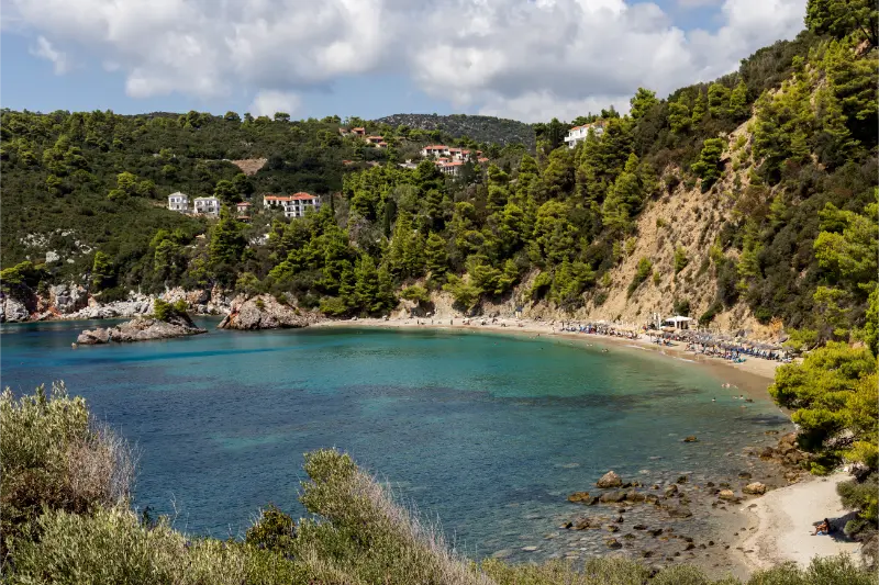
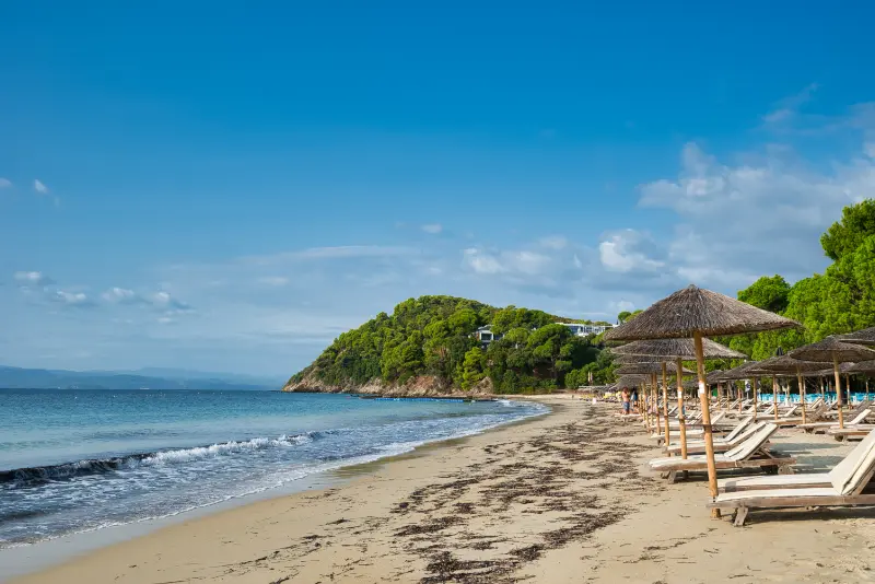
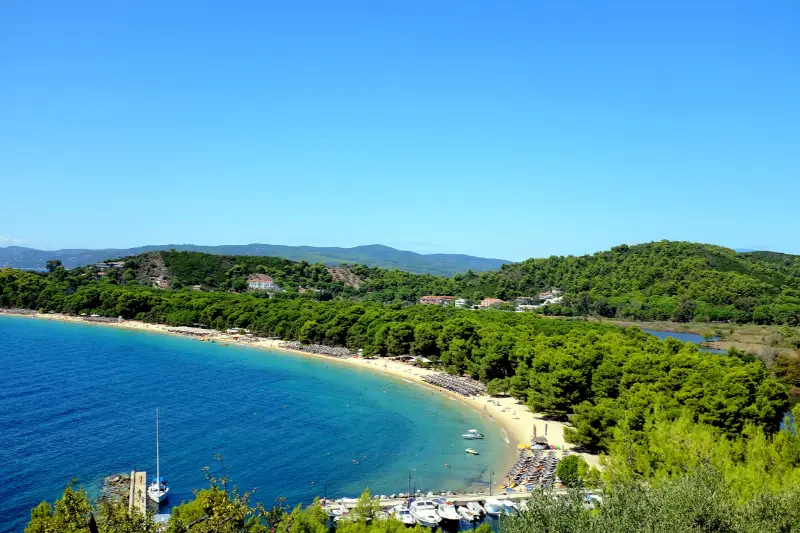
    Agios Stefanos is the signature stop in Kefalos Bay. The official Kos beach guide describes shallow water, sand and the remains of two early-Christian basilicas beside the shore, facing the small islet of Kastri and its white chapel. It is one of those rare places where a proper beach day and a historic site occupy the same landscape.
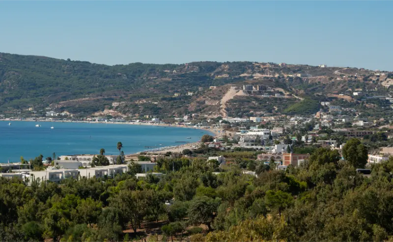
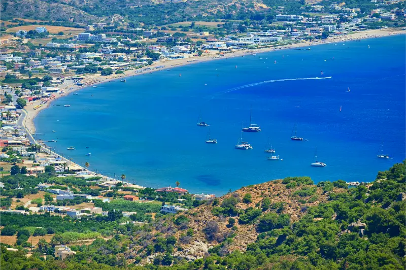
    View Beach Bay Kefalos Kos Greece

    Respect the ruins as archaeology rather than using stones as seats or changing areas. The swim toward Kastri may look short from shore, but open-water conditions, boat traffic and personal fitness matter. If you are not a confident swimmer, enjoy the view from the beach instead of turning a photograph into a challenge.

    Paradise Beach and the central bay

    Paradise Beach is one of the most organised beaches in the area. The official island guide describes sandy shallows, water sports and a gradual entry, making it popular with families. It lies around 35 km from Kos Town. The famous small bubbles that can sometimes be seen rising through the seabed are linked locally to the island’s volcanic setting.

    If you dislike busy organised beaches, use Paradise as one option rather than the automatic choice. Nearby stretches such as Camel, Lagada and other parts of Kefalos Bay can feel different depending on wind and crowd levels. Having a car makes it easy to check two beaches before committing the entire day.

    Western beaches: beautiful, but not automatically easy

    Continue west beyond the main bay and the landscape becomes more exposed. Cavo Paradiso and Agios Theologos appeal to travellers who want a wilder day, but rougher access roads, wind, limited facilities and stronger sea conditions can be part of the experience. These are not the beaches I would promise to a family with a stroller or anyone who dislikes unpaved driving.

    Ask locally about current road condition before heading out. A road that was manageable last season can deteriorate after winter rain or maintenance work. Carry water and do not assume a remote beach bar will be open outside the busiest months.

    A realistic one-day Kefalos plan

    TimePlan
    MorningDrive or bus to Kefalos; walk the village before the heat builds
    Late morningAgios Stefanos for swimming and the basilica ruins
    LunchKamari or a taverna overlooking the bay
    AfternoonParadise, Camel or another nearby beach depending on wind
    EveningDinner in Kefalos/Kamari before returning if transport allows

    The mistake is adding too much. Kefalos is far enough from Kos Town that the day is already a real excursion. Do not combine it with Asklepieion, Zia sunset and Therma unless your objective is simply to spend hours in a vehicle.

    Where to stay in the southwest

    Kamari is easiest for travellers who want to walk to the sea and restaurants. Kefalos village suits people who value views and a traditional settlement atmosphere. Accommodation scattered around the bay can work brilliantly with a car, but verify walking access if you will rely on buses or taxis. A “sea view” property can still be far above the beach.

    For a seven-night Kos holiday, splitting three nights in the southwest and four in Kos Town can work well if you genuinely want two different rhythms. For five nights, I would usually choose one base and avoid losing time to check-in and luggage logistics.

    Best season for Kefalos

    The southwest is rewarding from late spring into autumn, but wind and sea state should shape individual beach choices. June and September balance warm water with less intense midday heat. July and August bring full seasonal services and bus frequency but also the highest demand. Outside high season, confirm that remote beach facilities and boat services are operating.

    How Kefalos and Kamari fits into a wider Kos trip

    Use this guide together with the main Kos travel guide, Kos Town guide and Asklepieion guide. The newer in-depth pages on Tigaki and Marmari, Kefalos and Kamari, Kardamena, Zia and Mount Dikeos, Therma, cycling, the best beaches, Kos without a car, Kos with kids and where to stay in Kos make it easier to build a trip around one area instead of crossing the island repeatedly.

    This part of Kos is best for travellers who put beaches, scenery and a slower evening atmosphere above frequent trips to the capital. The most useful rule is to group places geographically. Kos is compact compared with many Greek islands, but a holiday still feels much better when a beach, village and archaeological stop naturally belong to the same side of the island.

    Getting around and checking transport

    KTEL serves Kefalos from Kos Town, but a rental car gives much more freedom to compare beaches and reach the wilder west. If you use the bus, build the day around the published return times rather than assuming late-evening service.

    Without a car, stay near a useful bus stop in Kamari or the main settlement rather than choosing an isolated hillside property. Public transport is useful, but seasonal frequency matters. The official KTEL Kos general routes page currently lists services for Kefalos, Kardamena, Marmari, Zia, Antimachia, Tigaki, Pyli and Mastichari. KTEL also announced timetable changes taking effect from 29 June 2026, so always open the live timetable again shortly before the day you travel rather than saving an old screenshot.

    Booking excursions and activities

    Boat trips, island excursions and guided experiences are highly seasonal on Kos. Before booking, compare the actual time spent at each stop, whether transfers are included, the size of the boat or group, shade, swimming opportunities and cancellation conditions. Do not choose an excursion simply because it has the longest list of stops.

    Mistakes that make the day harder

    • Calling every southwest beach “Kefalos” and underestimating the distance between them.
    • Swimming toward Kastri without judging wind, fitness and boat traffic.
    • Taking a low-clearance rental car onto a poor track simply because an online map shows a road.
    • Trying to combine Kefalos with Zia, Therma and Kos Town archaeology in one day.
    • Booking an isolated hotel without checking how you will reach dinner.

    Frequently asked questions

    Is Kefalos worth staying in?

    Yes if beaches and a slower south-western base are priorities. It is less convenient than Kos Town for island-wide public transport but better placed for Agios Stefanos and the western beaches.
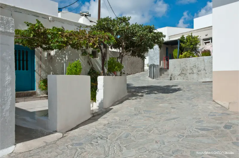
    Dodecanese Kos Kefalos

    Is Agios Stefanos suitable for children?

    The beach has shallow sections and sand, but families should still judge wind and sea conditions on the day and keep children away from fragile archaeological remains.

    Can you visit Kefalos by bus?

    Yes. KTEL lists Kefalos among its regular island routes, but seasonal schedules change, so check the live timetable for your exact date.

    Which is better, Kefalos village or Kamari?

    Kefalos village offers views and a more traditional atmosphere; Kamari is easier for beach access, restaurants and travellers without a car.

    How long should a Kefalos day trip take?

    Give it most of a day. The area is far enough from Kos Town that rushing in for one photograph wastes the journey.

    Final planning advice

    Kos is at its best when you leave some space between the headline attractions. The island is easy enough to explore that there is little benefit in forcing four distant stops into one day. Pick one anchor experience, add one or two nearby places, and keep time for a swim, a long lunch or an evening walk. That slower structure usually produces a better holiday and makes delays, wind or summer heat much easier to handle.

    How to plan around wind and summer heat

    Wind and heat should be treated as planning variables, not annoyances that have ruined the schedule. Kos has enough coastline and enough non-beach alternatives that you can move a swimming day, shorten an exposed walk or swap a western drive for a museum and town afternoon. Check conditions each morning, especially before a boat trip, long cycle ride or remote-beach drive.

    In July and August, schedule archaeological sites, village walks and cycling early. Keep the middle of the day for swimming, shade or a long lunch, then use late afternoon for another short outing. This is more comfortable and usually produces better photographs than forcing outdoor sightseeing under the harshest sun.

    How much should you plan in advance?

    Reserve the things with real capacity constraints—specific hotels, popular boat excursions and important airport transfers—then leave ordinary beach days flexible. A rigid seven-day schedule is vulnerable to one windy day; a flexible plan can move the boat trip and still protect the experiences that matter most.

    Keep addresses, bus information and booking confirmations available offline. Mobile coverage is generally good in populated areas, but a dead battery or weak signal is a poor reason to miss the last bus. For driving days, download an offline map and verify that navigation is not sending a standard rental car onto an unnecessary rough track.

  • Armenistis and Gialiskari Ikaria Guide: Mesakti, Livadi, Nas and Where to Stay

    Armenistis and Gialiskari Ikaria Guide: Mesakti, Livadi, Nas and Where to Stay

    Armenistis and Gialiskari form the most visitor-friendly coastal area on northern Ikaria. This is where many travellers picture themselves before booking: a small seaside village, long sandy beaches at Livadi and Mesakti, sunset drives toward Nas, tavernas within walking distance and the green hills of Raches rising immediately inland. It is also the part of Ikaria where choosing the exact accommodation matters most, because “near Armenistis” can mean a flat walk to the sea or a steep hillside drive.

    Sailboat Calm Turquoise Aegean Sea Water Beneath Armenistis Village Ikaria Island Greece

    Armenistis or Gialiskari: what is the difference?

    Armenistis is the better-known tourism base, with a compact waterfront, accommodation, restaurants and a small bay. Gialiskari sits just east and retains a working fishing-harbour feel around its small port and chapel. In practice the two settlements share the same beach zone and are easy to combine, but they create slightly different evenings.

    Choose Armenistis if you want the densest concentration of visitor services. Choose Gialiskari if you prefer a quieter harbour atmosphere while remaining close to Mesakti and Livadi. Either is far more convenient for north-coast beach days than Agios Kirykos.

    Mesakti: the beach that defines the area

    Mesakti is one of Ikaria’s most famous beaches, with a broad sandy shoreline and enough space to feel open even when summer demand is high. It is popular with families, younger travellers and surfers when conditions produce waves. The important practical point is that the sea can change character quickly: a calm morning does not guarantee a calm afternoon.

    Watch flags, local warnings and the behaviour of the water before letting children swim. Strong surf and currents require more caution than the beach’s soft sand might suggest. On windy days, a sheltered cove elsewhere can be a better choice than insisting on Mesakti because it is famous.

    Livadi: convenient and often calmer in feel

    Livadi lies beside the same north-coast holiday zone and is easy to combine with Armenistis. It has sand, shallow-looking sections and a river-mouth landscape that changes with season and rainfall. Families often appreciate the easier beach-day logistics, but the same rule applies: judge actual sea conditions rather than assuming sandy means safe.

    If your accommodation is between Armenistis and the beaches, walking can work for short distances, but road shoulders are not consistently designed for pedestrians. Ask your host about the safest walking route rather than relying only on map distance.

    Gialiskari and the small harbour

    Gialiskari is worth visiting even if you sleep in Armenistis. The harbour, fishing activity and small Analipsis chapel create one of the most photogenic coastal scenes in northern Ikaria without needing a formal attraction. It is also a useful place to slow down after the beach rather than treating every evening as a drive to another village.

    Armenistis Village Beach Ikaria Island Greece Hillside Houses Blue Aegean Sea Water

    The official tourism site notes that Gialiskari’s feast is associated with August 15. If you stay during that period, expect traffic and parking pressure as well as a much more social atmosphere.

    Nas: sunset, archaeology and the river gorge

    Nas lies a few kilometres west and is one of the north coast’s essential stops. The small beach sits where a river valley meets the sea, near the remains associated with the sanctuary of Artemis. The setting is beautiful at sunset, but the water at Nas can be rough and currents have a serious reputation. Treat it as a scenic place first and a swimming stop only when conditions are clearly suitable.

    Nas also connects naturally with hiking in the Halari area. If you are walking, do not underestimate heat, rough ground and the return climb. For a dedicated route overview, use the Ikaria hiking guide.

    Raches is your inland evening extension

    Christos Raches and the surrounding villages sit above this coast and create a very different atmosphere. Shops and cafés can run on a famously late schedule, and the square becomes lively well into the night during summer. The drive from the coast is not long in kilometres but is winding and should not be combined with alcohol.

    If you want the north-coast beach lifestyle by day and Raches evenings by night, Armenistis is one of the best bases. If you want silence and mountain air, staying in Raches itself may suit you better.

    Restaurants, groceries and daily rhythm

    Armenistis has enough food and shopping options for an easy holiday, but this is not a large resort with every service open all year. In shoulder season, ask which nearby tavernas and shops are operating before booking a remote apartment. In August, do the opposite: reserve important dinners and expect more demand.

    Breakfast by the water, a long beach session, a late lunch and an evening in Raches or Nas is a more realistic rhythm than trying to add Agios Kirykos and Therma on the same day.

    Where to stay in the area

    Properties closest to the waterfront reduce driving but may have less parking and more evening noise. Hillside rooms can provide extraordinary sea views but involve stairs or steep access. Accommodation near Mesakti gives you direct beach convenience but less of a village feel after dark.

    Read recent reviews for road access, parking, air conditioning and walking distance. “Five minutes from the beach” can mean five minutes by car, which is very different from stepping out with a towel.

    A three-day north-coast plan

    1. Day 1: settle into Armenistis or Gialiskari, swim at Livadi and have dinner locally.
    2. Day 2: spend the morning at Mesakti, rest in the afternoon and visit Christos Raches in the evening.
    3. Day 3: hike or explore toward Nas, stay for sunset if sea and road conditions are comfortable, then return without adding a long cross-island drive.

    Booking accommodation and activities

    For accommodation, compare places to stay in Ikaria on Booking.com. Always check the exact village and road access before booking. A property described simply as “Ikaria” can be an hour or more from the beach, port or village you expect to use most.

    For organised activities and excursions, use the widget below as a starting point. Ikaria has a smaller organised-tour market than Santorini, Rhodes or Crete, so availability can be seasonal. Verify the meeting point, transfer arrangements and cancellation terms before paying.

    Official resources to recheck before you go

    For a broad official destination overview, use Visit Ikaria and the Municipality of Ikaria. Both are useful for checking local notices, villages, beaches, museums and seasonal information close to your trip.

    For village geography, the official Visit Ikaria village directory is especially useful because Ikaria is not organised around one resort strip: the island has many scattered settlements and travel times are longer than the map first suggests.

    The official pages for Armenistis and Gialiskari confirm their role as the main north-coast beach area and are useful for local orientation.

    Continue planning your Ikaria trip

    Surf, wind and beach choice

    North-coast waves attract experienced surfers, but swimming and surfing needs are different. Do not assume a beach is safe for children because surfers are enjoying it. When swell builds, choose a sheltered alternative or use the day for Raches and village exploration.

    Ask lifeguards or local businesses about conditions rather than judging only from the shore. Rip currents and shore break are difficult to read from a café terrace.

    Sunset planning at Nas

    Nas sunset can draw cars onto a small road network at the same time. Arrive well before the final light, park without blocking residents and bring a small torch for the walk back from viewpoints or tavernas.

    If you have been drinking with dinner, use a taxi. A beautiful sunset is not improved by a stressful drive on dark mountain roads.

    Planning by season

    May and early June favour walking, green landscapes and quieter villages, but some seasonal beach businesses operate shorter hours. July and August bring the widest choice of accommodation, food and festival activity along with stronger heat, wind, traffic and booking pressure. September often offers the best balance of warm sea, active villages and easier roads. October can be rewarding for slow travel, but ferry frequency and seasonal restaurants require more checking.

    Whatever the month, build each day around the actual wind and temperature. Ikaria is large enough that a fixed itinerary can create unnecessary driving when the north coast is rough or the mountains are hot. Keeping one flexible half-day is more useful than adding another attraction to a crowded schedule.

    Common planning mistakes

    The most common mistake is treating map distance as travel time. Mountain bends, village traffic, ferry arrivals and spontaneous stops slow every journey. Choose one main part of the island per day and resist adding a distant beach simply because it appears only thirty kilometres away.

    Another mistake is relying on a single old timetable or social-media post. Ferries, buses, museum hours and festival confirmations change. Recheck anything time-critical close to travel and ask locally when conditions matter more than a published schedule.

  • Pelion Train Guide 2026: Ano Lechonia to Milies Schedule, Route and Practical Tips

    Pelion Train Guide 2026: Ano Lechonia to Milies Schedule, Route and Practical Tips

    The Pelion Train is one of the rare attractions in Greece where the journey itself is the destination. The narrow-gauge line climbs from Ano Lechonia toward Milies through olive groves, forest, stone bridges and mountain scenery. It is not the fastest way to reach Milies, and that is exactly the point.

    Because the service is seasonal and schedules can change, this is also one Pelion experience that should never be planned from an old blog post. The information below reflects Hellenic Train’s published schedule in September 2026, but verify the official Pelion Train page before travel.

    Quick planning facts

    • Current September 2026 regular service: Saturday–Sunday.
    • Published departures: Ano Lechonia 10:00; Milies 15:00.
    • Journey about 15 km / 90 minutes each way, with a 15-minute Ano Gatzea stop.
    • Verify extra dates and timetable directly with Hellenic Train.
    • Do not assume Interrail covers this tourist railway.

    2026 timetable: what is running now

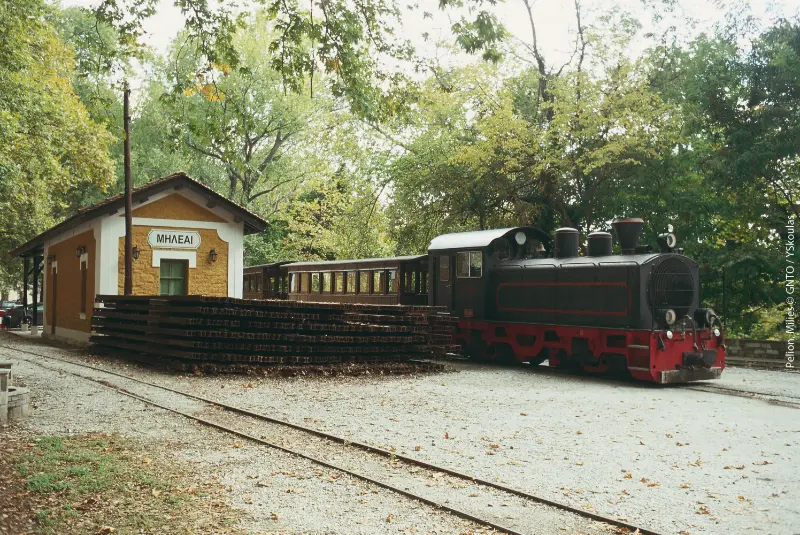
    As of September 2026, Hellenic Train lists the regular service on Saturdays and Sundays. Train 3800 leaves Ano Lechonia at 10:00 and reaches Milies at 11:35. Train 3801 leaves Milies at 15:00 and reaches Ano Lechonia at 16:30. Both directions include a 15-minute stop at Ano Gatzea.

    Hellenic Train has also announced extra Friday services on selected September dates, including 18 and 25 September 2026. These additions show why you should always check the current operator notice rather than assuming that last year’s pattern still applies.

    Route, distance and travel time

    Hellenic Train describes the tourist section as approximately 15 km long and around 90 minutes each way. The line uses a 60 cm gauge, one of the narrowest in the world, and follows infrastructure built in stages between the late 19th and early 20th centuries.

    The scenery changes gradually rather than through one spectacular moment. You pass vegetation, stone works, bridges and views toward the Pagasetic side before arriving below Milies.

    Ano Gatzea and the intermediate stop

    The published timetable includes a 15-minute stop at Ano Gatzea in both directions. Treat it as a short break, not enough time for independent sightseeing. Stay close to the train and follow crew instructions.

    This stop is part of the rhythm of the excursion. The Pelion Train is deliberately slow, and trying to optimise every minute misses the appeal of travelling on a historic mountain railway.

    Pelion Ano Lehonia

    The De Chirico bridge and railway history

    One of the best-known engineering features is the Taxiarchis, or De Chirico, metal bridge near Milies. The line was supervised by Evaristo de Chirico, father of painter Giorgio de Chirico, who was born in Volos. Hellenic Train notes the connection between the railway environment and imagery that later appeared in the artist’s work.

    The line once connected Volos with Pelion communities and contributed to regional development. Tourist operation preserves a small but tangible part of that transport history.

    What to do during the Milies stop

    The current schedule gives several hours between arrival around 11:35 and departure at 15:00. From the station, a traditional cobbled path leads uphill toward Milies. Use the time for a village walk, lunch and one or two key stops rather than attempting a wider road trip.

    My Milies and Vyzitsa guide explains how to make the village part of a longer stay. If you are returning on the same train, watch the clock: missing a historic tourist service is much more complicated than missing a frequent city metro.

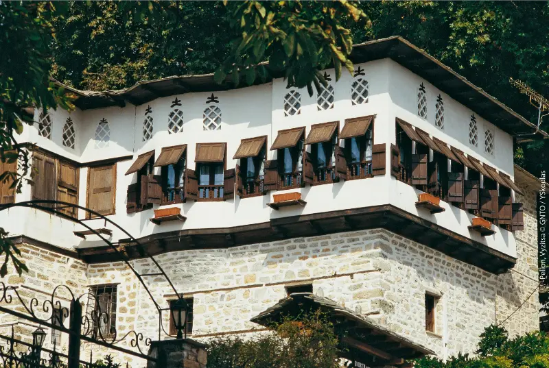
    Pelion Vyzitsa

    Tickets, booking and practical preparation

    Book through official Hellenic Train channels and confirm the operating date before travelling to Ano Lechonia. Tourist services can sell out on popular weekends. Save your booking offline and arrive with enough time to park and find the platform without rushing.

    Interrail/Eurail coverage should not be assumed: Hellenic Train’s current Interrail information explicitly excludes the Ano Lechonia–Milies tourist route. Check the fare and conditions that apply to your own journey.

    How to build the day around the train

    If you are staying in Volos or western Pelion, drive or transfer to Ano Lechonia in the morning, ride to Milies, have lunch and return on the afternoon service. Do not add distant east-Pelion stops on the same day. The timetable already creates a full excursion.

    If you stay in Milies, you can ride the line in the opposite direction only if the schedule works for your plan. Always verify same-day return possibilities instead of assuming symmetric departures.

    Photography and where to sit

    The best views change side repeatedly as the line bends, so there is no single “correct” seat for the entire journey. If photography matters, keep the camera ready but do not spend ninety minutes pressed against a window. Bridges, vegetation and glimpses of the gulf appear quickly, and the atmosphere inside the small train is part of the experience too.

    Be considerate when moving for photographs and follow crew instructions. Historic tourist trains have different space and safety constraints from modern intercity services. If a particular bridge or view matters to you, enjoy it first and photograph second; the train will not stop simply because the angle was not perfect.

    What to do if the train is sold out or not running

    Do not build the entire Pelion trip around one service. If tickets are unavailable, drive to Milies and explore the village, walk part of the railway-aligned trail from Kala Nera, or visit Ano Gatzea independently. You will miss the ride itself, but not the landscape and villages that make the route interesting.

    Milina Seaside Village With Long Walk Sunset Views Village Pelion Thessaly Greece

    This backup matters outside peak operating periods, when tourist-rail schedules can be limited. A flexible Pelion itinerary should treat the train as a highlight rather than a transport necessity.

    Practical planning checklist

    • Check the mountain forecast as well as the Volos/coastal forecast before driving or hiking.
    • Keep offline directions and your accommodation phone number because mountain roads and village lanes can be confusing after dark.
    • Allow more driving time than the kilometre count suggests; Pelion roads are scenic but winding.
    • Do not overfill the day. One village, one walk and one meal often produces a better Pelion experience than five rushed stops.
    • For the wider region, use my complete Pelion travel guide and Volos travel guide.

    Frequently asked questions

    Does the Pelion Train run every day?

    No. As of September 2026, Hellenic Train lists regular weekend service with selected extra Friday dates. Always check the current timetable.

    How long is the ride?

    Hellenic Train describes the tourist route as about 15 km and around 90 minutes each way.

    Can you visit Milies between trains?

    Yes. The published timetable leaves several hours in Milies, enough for a walk and lunch if you keep track of the return time.

    Where does the train start?

    The current tourist route starts at Ano Lechonia and runs to Milies, with a stop at Ano Gatzea.

    Final thoughts

    The Pelion Train is worth doing because it forces you to travel at the mountain’s pace. The scenery, engineering and time in Milies matter more than speed.

    Treat the operator timetable as part of the attraction, verify it close to departure and keep the rest of the day deliberately simple.

    How I would make the day less rushed

    The easiest way to enjoy Pelion Train 2026 is to protect one slow block of time. I would avoid booking a timed attraction immediately before or after a mountain drive, and I would not assume that a short road distance means a quick transfer. Pelion travel is shaped by bends, parking, walking surfaces and the temptation to stop for views. Build those realities into the plan instead of treating them as delays.

    I also keep one alternative nearby. If the Aegean is rough, I switch to a village walk. If rain makes stone paths slippery, I use the time for food, architecture or a shorter route. If parking is chaotic, I move on and return later. This flexibility is one of the reasons Pelion is rewarding: mountain, forest, village and sea give you several good versions of the same day.

    What to verify before you leave your hotel

    Before driving, check the weather, road route, parking location and whether your chosen restaurant or attraction is actually open that day. Seasonal businesses may change hours outside peak summer. For hikes, ask whether recent rain, maintenance or fallen trees have affected the path. For beach days, look at wind and sea conditions rather than only air temperature.

    Save your route offline and carry water. In a region of dense forest and winding roads, mobile coverage can vary. These are small preparations, but they keep a pleasant day from becoming an unnecessary logistical problem.

    One more practical note before you go

    A useful final check for Pelion Train 2026 is to look at the day as a sequence rather than a list of places. Decide where the car will be left, how much walking comes before lunch, when the hottest or busiest period is likely to occur, and what your easiest fallback will be. Pelion becomes tiring when every stop requires a parking search followed by a steep walk and another winding drive. One carefully planned anchor usually makes the rest of the day easier.

    I also avoid measuring success by the number of villages or beaches reached. The region is most distinctive when you have time to notice the old stone paths, sit in a shaded square, eat a regional dish and adjust to the weather. If one stop takes longer because the meal is good or the light is beautiful, let the next minor stop go. That flexibility is not lost time; it is the reason a Pelion road trip feels different from a sightseeing race.

    Before leaving the accommodation, confirm fuel level, water, offline navigation and the final parking point. If you are walking, carry shoes with grip and a small layer for changing mountain weather. If you are swimming, check the sea on the same day. These simple habits matter more here than squeezing another pin into the itinerary.

  • Naxos Travel Guide: Beaches, Villages, Food and a 5-Day Itinerary

    Naxos Travel Guide: Beaches, Villages, Food and a 5-Day Itinerary

    Naxos is one of my favourite recommendations for travellers who want the Cyclades without building the whole holiday around famous nightlife or luxury views. It has a lively main town, long sandy beaches, fertile inland valleys, mountain villages and a food culture that feels connected to the island’s agriculture. It is also large enough that five days do not feel repetitive.

    Compared with Santorini or Mykonos, Naxos often gives you more space to mix sightseeing and beach time. The trade-off is that you need to think about transport: the island is much more rewarding when you explore beyond Chora and the closest beaches.

    How many days do you need?

    Three days can cover Chora, one beach day and a short inland excursion. Five days is the sweet spot for a first visit. A full week works extremely well for families, hikers and travellers who enjoy slow beach mornings followed by village evenings.

    Naxos also makes sense as part of a Cyclades route with Paros. The connection is usually straightforward in the main season, but ferry schedules vary. Keep enough time between separate tickets and avoid planning an international flight immediately after an island transfer.

    Chora and the Portara

    Naxos Town, usually called Chora, is the island’s main arrival point and a practical base. The waterfront is busy with cafés and restaurants, while the old town climbs behind it through lanes around the Kastro district. The mix of harbour life and historic streets makes Chora enjoyable even on days when you do not leave town.

    The Portara, the huge marble doorway of an unfinished ancient temple on the small islet of Palatia, is the visual symbol of Naxos. Sunset draws crowds, so arrive earlier, walk carefully in wind and do not treat one exact photo position as essential. Morning is much quieter if you care more about the monument than sunset.

    Where to stay

    Chora is best for first-time visitors without a car because you have ferry access, restaurants, bus connections and evening atmosphere. Agios Georgios beach is close enough to combine a town stay with swimming. Families often appreciate this simplicity.

    Beach-focused travellers may prefer Agios Prokopios, Agia Anna or Plaka. These areas put the sea at the centre of the holiday but require more planning for evenings in town. Check bus frequency or taxi costs before booking, especially outside peak season.

    The west-coast beaches

    The long sandy coast southwest of Chora is one of Naxos’s main strengths. Agios Prokopios and Agia Anna have organised sections and easy services, while Plaka stretches farther with a more spacious feel. Continue south and conditions become more exposed, which appeals to wind-sport travellers.

    Wind can change the character of a beach day in the Cyclades. Instead of declaring one beach the best, choose according to conditions and your needs. Families may prefer easy entry and nearby facilities; couples may prioritise space and sunset.

    Inland villages: do not skip them

    Naxos is much more than a coast. Villages such as Halki, Filoti and Apiranthos reveal stone architecture, local products and mountain scenery. A car makes a village loop easy, but bus excursions and organised tours are alternatives for travellers who do not drive.

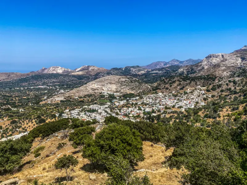
    Mountain Village Filoti Naxos Island Greece

    Halki is pleasant for a relaxed walk and local tastings, Filoti sits below Mount Zas, and Apiranthos has a distinctive stone-built character. Do not rush all three in one hour. Stop for coffee, walk the lanes and let lunch become part of the route.

    Mount Zas and hiking

    Mount Zas is the highest mountain in the Cyclades and attracts hikers who want more than beach scenery. Routes vary, and the exposed terrain can become very hot in summer. Start early, carry more water than you think you need and use proper footwear.

    If you are not a regular hiker, choose a shorter village walk rather than attempting a summit because it is famous. The interior offers plenty of rewarding scenery without turning the day into an endurance test.

    Naxos food

    The island is known for agricultural products including potatoes, cheeses and local meats, along with citrus liqueur from kitron. This makes Naxos particularly satisfying for travellers who care about food provenance rather than only seaside restaurants.

    Try one meal in a mountain village and another by the coast. Ask what is local and seasonal. Simple dishes often reveal more about the island than a long menu designed to serve every possible tourist preference.

    Getting around Naxos

    Buses are useful for popular beaches and some villages, especially in high season. A rental car is more flexible for the interior, remote beaches and early hiking starts. Scooters and ATVs are common, but they should not be treated as toys; wind, road surfaces and insurance conditions matter.

    If you only need a car for one or two days, rent it for those days rather than keeping it parked in Chora. That saves money and avoids unnecessary parking issues. For broader ferry and transport advice, use my getting around Greece guide.

    A five-day Naxos itinerary

    Day 1: Chora and Portara

    Settle in, explore the Kastro and waterfront, then walk to the Portara later in the day. Have dinner in town and keep the first day car-free.

    Day 2: beach day

    Choose Agios Prokopios, Agia Anna or Plaka according to your accommodation and wind. Make this a genuine beach day rather than squeezing in a long drive after lunch.

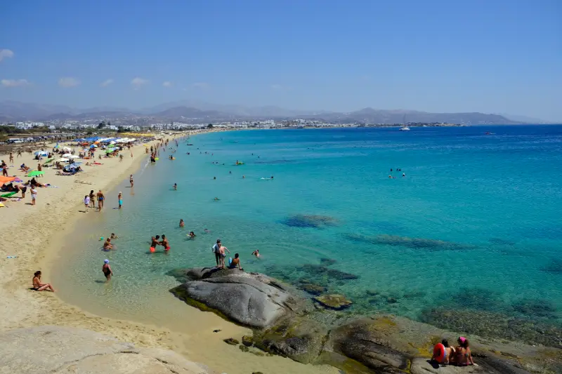
    Naxos Agios Georgios City Beach Saint George Beach Naxos Island Greece

    Day 3: village loop

    Rent a car or take a tour through Halki, Filoti and Apiranthos. Stop for a local meal and return by a different route if time allows.

    Day 4: hike or quieter coast

    Active travellers can hike part of Mount Zas early. Others can explore a less busy beach, a small archaeological site or another village. Keep the hottest hours slow.

    Day 5: flexible favourite

    Repeat the beach you loved, shop for local products and enjoy a final evening in Chora. A flexible day also protects against earlier strong winds.

    Naxos with children

    Naxos is one of the easiest Cyclades choices for families because of its long sandy beaches and practical town. Choose accommodation near a beach with gentle access and keep car journeys short. Children often enjoy the Portara and castle-like old town more than a long museum day.

    Naxos Portara

    A village outing works if you build in stops for snacks and shaded squares. Do not plan a serious mountain hike with young children in summer unless the route and temperatures are clearly appropriate.

    Naxos for couples

    Couples can combine relaxed beach days with village dinners and sunset walks in Chora. Naxos feels romantic without requiring a premium caldera-view budget. Renting a car for a day also makes it easy to find quieter corners.

    For a honeymoon centred on dramatic hotel views and famous sunsets, Santorini may fit better. For a balanced island holiday with more variety, Naxos is hard to beat.

    Naxos or Paros?

    Naxos is larger, more mountainous and especially strong for long beaches and inland villages. Paros has a polished harbour-town atmosphere and is easy to combine with nearby Antiparos. The choice depends on whether you want a more expansive road-trip feel or a compact social island. Read my Paros guide for the comparison.

    When to visit

    June and September are excellent for travellers who want beach weather with a slightly calmer pace than peak August. July and August have the most services but also higher demand and stronger summer crowds. May and October can be lovely for walking, though sea temperatures and seasonal operations vary.

    Cycladic wind is a normal part of summer. Do not treat a windy forecast as a ruined holiday; use it to choose a sheltered beach or an inland day.

    Common mistakes to avoid

    • Staying only in Chora and assuming you have seen the island.
    • Renting an ATV without considering wind, road exposure and insurance.
    • Planning a mountain hike in the hottest part of the day.
    • Moving hotels unnecessarily on a five-day stay.
    • Booking a ferry connection too close to an international flight.
    • Ignoring village food in favour of eating every meal on the waterfront.

    Frequently asked questions

    Is Naxos good for first-time visitors to Greece?

    Yes. It combines classic Cycladic scenery with easy beaches, a useful main town and more local variety than a very small island. It pairs naturally with Athens in a one-week or ten-day trip.

    Do I need a car?

    Not for Chora and popular beaches. A car greatly improves access to villages and remote areas. Renting for one or two days is often the best compromise.

    Can I combine Naxos and Paros?

    Yes, this is one of the most logical Cyclades combinations. Still, check the actual ferry schedule for your travel date. My Greek islands guide explains how to avoid overcomplicated island hopping.

    Why I would choose Naxos

    Naxos gives you enough variety to wake up and make a different kind of day: beach, mountain, village, old town or food-focused drive. That flexibility matters on an island holiday because weather and energy change. Stay long enough to leave the coast at least once, and Naxos becomes far more memorable than simply another beautiful beach destination.

  • Best Beaches in Skopelos: Stafylos, Velanio, Panormos, Milia, Kastani and More

    Best Beaches in Skopelos: Stafylos, Velanio, Panormos, Milia, Kastani and More

    Skopelos is one of the rare Greek islands where forest and sea feel inseparable. Visit Greece describes it as the greenest island in the Aegean, with around 80% of the land covered by forest, and many beaches sit directly below pine-covered slopes. The result is not a single “best beach” but a set of very different choices depending on wind, access, facilities and the kind of day you want.

    Woman Sunbathing Reading Book Beach By Sea Sunset St Skopelos Island Greece

    My approach is to choose a beach category rather than chase a ranking. Stafylos is practical near Chora, Panormos is easy for services, Milia is excellent for scenery, Kastani has the Mamma Mia connection, and Velanio gives a quieter continuation from Stafylos. The best plan changes with weather and transport.

    Stafylos: practical and close to Chora

    Stafylos is one of the easiest beaches to combine with Skopelos Town. Visit Greece highlights it as sheltered and well suited to families, with bus access followed by a short walk.

    Its convenience makes it busy in summer, so arrive earlier if you want a calmer start. The bay is a good first beach after arrival because you can reach it without committing to a cross-island drive.

    Velanio: a quieter continuation

    Velanio is reached from the Stafylos side via a short rocky path. The extra effort reduces casual foot traffic and changes the atmosphere noticeably.

    Wear footwear suitable for the path rather than beach sandals alone. Carry water and do not assume every section has the same services as Stafylos. The reward is a more natural-feeling beach close to the island’s main town.

    Panormos: services and easy beach living

    Panormos is a long pebbled bay with a strong range of services nearby. It is one of the easiest places to spend a complete day without moving the car again.

    The water can become deep relatively quickly, so families should supervise children closely. If you like the idea of walking from your room to the sea, Panormos is also one of the strongest accommodation areas outside Chora.

    Milia: classic Skopelos scenery

    Milia combines clear water, dramatic rock shapes and the green backdrop that many travellers imagine before arriving on Skopelos. Visit Greece also notes the view toward Dasia islet.

    Choose your section after walking the beach. Some visitors settle at the first convenient entrance, but a few extra minutes can lead to a quieter or more comfortable spot.

    Kastani: cinematic and lively

    Kastani is one of the best-known Mamma Mia locations on the island. In high season, its film fame and organised facilities can make it livelier than a remote cove.

    Come for the beach itself, not only the movie connection. The water and wooded slopes are the real reason to stay after the photo stops are finished.

    View Kastani Beach Skopelos Island Greece

    Adrines, Agnontas and quieter choices

    The Adrines are a sequence of smaller coves near Panormos, while Agnontas offers a harbour beach atmosphere and tavernas. Other small bays appear along the road network, and boat access opens still more options.

    Do not publish a rigid “top ten” in your own itinerary. Ask about wind, access and recent road conditions, then pick the beach that fits that day. Skopelos rewards flexibility more than beach collecting.

    Best time for beach days

    June and September are excellent if you want warm weather with less peak-season pressure. July and August bring the warmest sea and the broadest range of beach services, but parking and popular organised sections are busier.

    Wind matters as much as month. Check the conditions each morning and change coast if necessary rather than forcing a pre-booked mental itinerary.

    What to pack for Skopelos beaches

    Water shoes are useful on pebble shores, while a compact shade option helps on less organised beaches. Bring water, sunscreen and a dry bag if you plan to swim from boats or rocky access points.

    Do not leave valuables visible in a parked car. Take only what you need and keep electronics protected from saltwater and hot direct sun.

    Getting around Skopelos

    Skopelos is compact on a map but not flat. Roads curve through forested hills, and journey times are slower than straight-line distances suggest. A rental car gives the greatest flexibility for beaches and northern villages, while seasonal buses can work well for travellers based in Chora or along the main west-coast corridor.

    If you drive, allow extra time after dark and do not rush on narrow bends. If you rely on buses, check the current timetable after arrival because frequency changes through the season. Taxis are a useful backup for one-way trips, late dinners and locations away from the principal route.

    Where to stay and booking strategy

    For live availability, compare accommodation in Skopelos on Booking.com. Choose the map location before comparing room design: a hillside apartment may have a spectacular view but require steep walking, while a beach property may leave you dependent on transport for evening restaurants.

    For a first visit, Chora is the easiest all-round base. Panormos suits beach-first holidays, Glossa gives village character and north-island access, and Neo Klima offers a quieter west-coast compromise. A split stay becomes worthwhile at around six nights.

    Ferries and arrival planning

    Skopelos has no commercial airport, so most travellers arrive by ferry after flying to Skiathos or travelling overland to a mainland port. Visit Greece explains the common Skiathos-airport connection, while published 2026 ferry schedules show seasonal services from Mantoudi that can call at Skiathos, Glossa and Skopelos.

    Schedules change by date and weather, so treat any timetable in an article as a planning example rather than a permanent promise. Check the operator close to travel, confirm the exact Skopelos port on the ticket and leave buffer time when connecting a ferry with a flight.

    Common mistakes to avoid

    • Assuming every beach has sand, shallow water, shade and full services.
    • Booking a hillside room without checking stairs and luggage access.
    • Trying to see Chora, Glossa, Mamma Mia locations and several beaches in one day.
    • Using an old bus or ferry timetable instead of checking the current season.
    • Driving unfamiliar winding roads too quickly after dark.
    • Treating religious chapels as film props rather than active places of worship.

    Useful official information

    For destination background, use the Visit Greece beach guide. The Municipality of Skopelos is also useful for local notices. Recheck opening arrangements, transport, weather and any fire-related access restrictions shortly before the day you travel.

    Tours and activities

    Seasonal boat trips, transfers and guided experiences vary considerably by month. The widget below can help you see what is actually bookable for your dates. Compare meeting points, duration, cancellation rules and whether transport from your accommodation is included.

    Continue planning your Skopelos trip

    Final advice

    Skopelos works best when you leave enough empty space in the itinerary for the island itself. A road may be slower than expected, a beach may be perfect for another hour, or wind may make you change coast. Those changes are not failures; they are normal parts of travelling on a green, mountainous island.

    Check the next day’s weather and transport each evening, then choose one main experience and one secondary option. That simple habit prevents rushed driving and produces a trip that feels more like a holiday than a checklist.

    A realistic daily rhythm

    Start with the activity most sensitive to heat or crowds, whether that is a chapel climb, village walk or forest route. Use late morning and afternoon for the sea, lunch or a shaded harbour, then return to villages when temperatures fall. This rhythm reduces unnecessary driving and fits the way Skopelos is naturally experienced.

    View Sea Beach Mountains Skopelos Island Northern Sporades Greece

    Keeping one flexible block each day also protects the itinerary from wind and ferry changes. If the sea is rough, you can switch to Chora or Glossa; if the weather is calm, use the opportunity for a boat or beach day.

    Responsible travel on a green island

    Skopelos depends on healthy forest and clean coastal water. Respect fire restrictions, never leave rubbish at remote beaches and avoid parking where emergency or local access is blocked. On boats, follow protected-area rules and keep distance from wildlife.

    Support village shops, bakeries and family-run tavernas rather than treating the island only as scenery. Spending locally helps preserve the communities that make Skopelos different from a purpose-built resort.

    What to pack

    Bring shoes with grip for steps and short trails, water shoes for pebbled beaches, high-SPF sunscreen, a refillable bottle and a light layer for ferry decks or breezy evenings. An offline map is useful when mobile coverage becomes inconsistent in forested areas.

    A small dry bag protects phones and documents on boats, while a compact beach shade can be useful away from organised sections. Pack lightly enough that stairs in Chora or Glossa do not become a problem on arrival day.

  • Paros Travel Guide: Naoussa, Parikia, Beaches and Antiparos

    Paros has become one of the most popular Cyclades islands because it combines attractive towns, good beaches, nightlife, traditional villages and easy access to tiny Antiparos. It can feel stylish without being entirely defined by luxury, and it works for couples, groups of friends and families who choose the right base.

    The island is more compact than Naxos, which makes short stays easier. The risk is that visitors spend the whole trip moving between fashionable spots and never slow down. Five days is enough to see the main areas while still having real beach time.

    Parikia or Naoussa?

    Parikia is the main port and one of the most practical places to stay. You can walk from the ferry to many hotels, use bus connections easily and explore an old town with whitewashed lanes, churches and waterfront restaurants. It is especially convenient if your ferry arrives late or leaves early.

    Fishboats Yachts Moored Naoussa Port Paros Island Greece View Dock Boats Yachts Bright

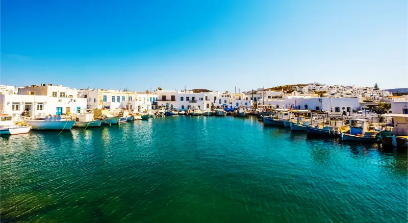
    Naoussa, on the north coast, is the island’s most photographed harbour town and has a strong evening scene with restaurants, bars and boutiques. It is beautiful but can become very busy in summer. Stay there if evening atmosphere is a priority; visit from elsewhere if you prefer quieter nights or better value.

    How many days do you need?

    Three days covers the two main towns and one beach day, but the schedule feels compressed. Five days allows a village day, Antiparos and flexibility for wind. A week is excellent if you want repeated beach days and slower evenings.

    If Paros is part of island hopping, limit the number of islands. Moving every two nights means repeated packing, port transfers and weather risk. My Greece itinerary guide shows why fewer bases usually create a better trip.

    Explore Parikia properly

    Many travellers treat Parikia as a port and immediately leave, which is a mistake. The old town lanes, Panagia Ekatontapiliani church complex and waterfront create a worthwhile half day or evening. Walk inland from the ferry and the atmosphere changes quickly.

    Sunset along the waterfront is easy and does not require a famous viewpoint. Have dinner away from the first line of port restaurants if you want a quieter meal, then return to the seafront for the evening atmosphere.

    Naoussa beyond the photos

    Naoussa’s small harbour, fishing boats and white lanes are undeniably attractive. Go early in the morning if you want quiet photographs, then return after dark when the town becomes social and lively. The two visits feel completely different.

    In peak season, dinner reservations can be useful for specific popular restaurants, but do not over-plan every evening. One of the pleasures of the Cyclades is walking until a terrace or small lane feels right.

    Lefkes and the interior

    Lefkes is one of Paros’s most appealing inland villages, with traditional architecture and hillside views. It is a good escape from the coast and can be combined with a short walk or village route. Visit in the morning or late afternoon when summer temperatures are easier.

    The old Byzantine path between villages is popular with walkers. If you hike, check the route, wear real shoes and carry water. A historic path is still an outdoor trail, not a shaded city promenade.

    Paros beaches

    Paros has a wide range of beaches, from organised areas with services to quieter coves. Kolymbithres is famous for smooth granite formations and small sandy sections. Golden Beach is known for water sports and wind conditions, while other bays around the island offer calmer swimming depending on the day.

    The Meltemi wind can be strong in summer. Ask locally which coast is more sheltered and treat beach choice as a daily decision. This approach works better than driving across the island because one saved beach is windy.

    A day in Antiparos

    Antiparos is reached by a short local ferry connection from the Paros side and makes an easy day trip. The main town is pleasant for walking and eating, while beaches and the island interior reward travellers with transport. The famous cave has many steps, so current access, weather and physical ability should be considered before visiting.

    Do not assume the last ferry runs as late as your dinner plans. Check the same-day timetable, especially outside high season. If you love Antiparos’s calmer feel, consider an overnight stay instead of turning it into a rushed checklist.

    Getting around Paros

    Public buses link the major towns and popular beaches, making Paros manageable without a car. Service frequency is best in the main season. A rental car gives freedom for villages, less-connected beaches and evening dining away from your base.

    Parking around Naoussa can be difficult at busy times. Use designated areas and walk into the centre rather than circling narrow streets. Renting a car only for one or two days often gives the best balance.

    A five-day Paros itinerary

    Day 1: Parikia

    Arrive, explore the old town and church, then enjoy sunset by the waterfront. Keep the first day simple, especially after a ferry journey.

    Day 2: Naoussa and north coast

    Visit Naoussa in the morning, continue to a nearby beach, rest in the afternoon and return to Naoussa for dinner if you enjoy a lively atmosphere.

    Day 3: Lefkes and villages

    Explore the interior, walk part of an old path if temperatures allow and have lunch in a village. Finish at a beach or viewpoint rather than adding another town.

    Day 4: Antiparos

    Take the local ferry, explore the town and choose one additional activity such as a beach or the cave. Confirm the return schedule before you wander too far.

    Day 5: flexible beach day

    Choose the coast according to wind and repeat your favourite area. A flexible final day protects the itinerary from earlier weather changes.

    Paros with children

    Families can use Parikia or a beach-oriented area as a simple base and take buses or a car for short excursions. Children often enjoy the Antiparos ferry because the journey itself feels like an activity. Choose beaches with facilities and easy water entry.

    Parikia City Beach Paros Island Greece

    Naoussa in the late evening can be very crowded in high season. Families who want calm nights may prefer to visit for an early dinner and sleep elsewhere.

    Paros for couples and friends

    Paros is excellent for couples who want attractive evenings without Santorini’s caldera focus. It also suits groups of friends because beaches, restaurants and nightlife are easy to combine. The island can be expensive in fashionable areas, so book accommodation early if value matters.

    For a more expansive island with mountain villages and long beaches, compare my Naxos travel guide. For volcanic landscapes and unusual coves, see the Milos guide.

    When to visit

    June and September are excellent for beach weather and active sightseeing. July and August bring the strongest demand and the liveliest atmosphere. May and October can be pleasant, but ferry frequency, beach services and evening life may be reduced.

    Wind is part of the Cyclades experience, particularly in summer. Build one inland day into the itinerary so a windy forecast becomes an opportunity rather than a problem.

    Common mistakes to avoid

    • Treating Parikia only as a ferry terminal.
    • Booking Naoussa accommodation without considering summer noise and prices.
    • Renting a vehicle for the entire trip when buses cover most planned days.
    • Ignoring the wind forecast when choosing beaches.
    • Doing Antiparos without checking the return ferry time.
    • Combining Paros with too many other islands in one week.

    Frequently asked questions

    Is Paros better than Mykonos?

    They suit different trips. Mykonos has a stronger international nightlife and luxury identity, while Paros offers a broader mix of villages, beaches and social evenings. Read my Mykonos guide if nightlife is central to your decision.

    Do I need a car?

    No. Paros is one of the easier Cyclades islands to enjoy with buses and taxis. A car is valuable for one or two exploration days but not mandatory.

    Can I combine Paros and Naxos?

    Yes. It is one of the most logical pairs for island hopping because the islands are close and commonly linked in season. Always confirm the actual sailing date before booking non-refundable hotels.

    A few extra planning tips for Paros

    If you are travelling in July or August, book accommodation earlier than you would for a less popular island and pay attention to the exact location, not only the hotel rating. A property outside Naoussa can look close on a map but still require a taxi or a dark roadside walk after dinner. If you plan to rely on buses, confirm the nearest stop and the seasonal timetable before arrival.

    Paros is also a good island for mixing active and slow days. A morning walk in Lefkes, a long swim after lunch and an unplanned evening in Parikia can be more satisfying than crossing the island three times to complete a list. Keep one day with no fixed reservations so you can respond to wind, heat and the places you discover after arrival.

    Parikia Paros Greece

    Why Paros works so well for a first Cyclades trip

    Paros is easy to understand without becoming boring. You have a practical port town, a glamorous harbour, inland villages, varied beaches and Antiparos next door. The best version of the trip is not the one with the most reservations; it is the one where you leave enough space for a windy-day change, a long lunch and an evening that lasts longer than expected.

  • Thassos Without a Car: Ferries, Buses, Taxis and the Best Bases for Easy Exploring

    Thassos Without a Car: Ferries, Buses, Taxis and the Best Bases for Easy Exploring

    Thassos without a car is possible, but it becomes a different holiday from the classic island road trip. You need to choose a base around the bus network and accept that remote beaches, mountain villages and trailheads will not all fit neatly into the same week. The reward is a simpler trip with fewer parking problems and no need to think about driving after dinner.

    The easiest approach is to arrive as a foot passenger, stay in Limenas, Golden Beach/Skala Potamia, Limenaria or Potos, and use buses plus occasional taxis or organised excursions. The busy Keramoti–Limenas ferry route is particularly useful because it puts foot passengers directly in the island capital. Published summer 2026 schedules showed very frequent daily sailings on that route, while Kavala–Prinos ran less frequently.

    Quick planning snapshot

    Best car-free baseLimenas for transport; Golden Beach for beach stay
    Other workable basesLimenaria and Potos
    Best ferry for simplicityKeramoti–Limenas for most foot passengers
    Use taxis forOne-off villages, awkward early/late transfers
    Main limitationRemote coves and mountain routes are harder

    Arriving by ferry as a foot passenger

    Thassos has no airport, so everyone arrives by sea. For most car-free travellers, Keramoti to Limenas is the simplest route because the crossing is short and Limenas is the main transport hub. The alternative Kavala–Prinos route can be useful depending on where you are coming from and the timetable.

    Thassos Capital Limenas Greece View With Church

    Ferry schedules change by season and sometimes during the month. Do not build an international flight connection around an old screenshot. Check the current operator timetable close to travel and leave buffer time on departure day.

    Limenas: the easiest base for transport

    Limenas gives you the strongest combination of ferry arrival, bus access, taxis, shops, restaurants and cultural sights. You can spend a day on the Archaeological Museum and ancient city without transport, then use buses for beaches or resort towns.

    The downside is that Limenas is not the island’s most relaxing beach base. If swimming is the priority, split the stay or choose Golden Beach and accept fewer route options.

    Golden Beach and Skala Potamia without a car

    This is the easiest choice if you want to walk to a long sandy beach every day. Seasonal buses connect the east coast, and taxis can cover Panagia or one special excursion. The main benefit is that your default day requires no transport at all.

    Choose the exact accommodation location carefully. A property far up a hill or away from the main road can turn a supposedly car-free holiday into a taxi-dependent one.

    Limenaria and Potos without a car

    The south works well for travellers who want evenings on foot and nearby beaches. Potos is compact; Limenaria has a longer waterfront and more town services. Seasonal buses allow some movement along the coast, but schedules may not support spontaneous late-night returns.

    Use one organised boat or road excursion for Alyki, Giola or other harder-to-reach places instead of trying to recreate a rental-car itinerary with multiple bus changes.

    What you should skip or outsource

    Mount Ipsarion, remote forest roads and difficult-access coves are the weakest fit for a fully car-free plan. You can still visit with a guide, taxi arrangement or organised excursion, but do not build the week around places that public transport is not designed to serve.

    A car-free trip works best when you value time at the base. If your personal goal is to photograph twenty beaches and six villages, rent a car for part of the stay instead.

    How to budget for a car-free stay

    Compare the cost of buses plus two or three strategic taxis with the cost of a rental car, fuel and parking. For one person, public transport often wins; for a family of four taking daily taxis, it may not. A hybrid strategy is often best: spend most of the week car-free in a walkable base and rent for one or two days of villages and remote beaches.

    Luggage and transfer strategy

    Pack so you can manage your own luggage at ferry ramps and bus stops. Wheeled suitcases are fine in towns but awkward on rough lanes or steep accommodation access. If you are changing base, ask the hotel to book a taxi in advance rather than hoping one appears exactly when the bus timetable requires it.

    Getting there and moving around

    Save the current bus timetable and ask your hotel which stop is actually active for your travel dates. Seasonal island buses are useful but not equivalent to a city metro. Carry enough flexibility for a taxi if the final service is missed.

    For airport connections on the mainland, plan the entire chain: airport or city to Keramoti/Kavala, ferry, then island transfer. The ferry itself is only one link.

    Keramoti Greece Port View Ferry Boat Thassos

    Best time to go

    Car-free travel is easiest from June through September when ferry and bus frequencies are strongest. Outside peak season, fewer connections make the same itinerary slower and less flexible.

    In shoulder season, staying in Limenas becomes more attractive because more year-round services remain around the capital.

    Who this plan works best for

    This approach suits solo travellers, couples, nervous drivers and visitors who want a simple beach base. It is less suitable for photographers chasing remote sunrise locations, serious hikers or travellers who dislike planning around timetables.

    A realistic way to plan the day

    A five-day plan from Limenas can include one ancient-city day, one Golden Beach day, one organised south-coast excursion, one north-west beach day and one flexible weather day.

    From Golden Beach, spend two or three days locally, take a bus or taxi to Limenas for culture, and use one organised excursion for the south. This is much calmer than changing buses every day.

    Common mistakes to avoid

    • Booking a remote villa without checking the bus stop.
    • Assuming buses run late enough for every dinner plan.
    • Using an old ferry timetable.
    • Trying to reach mountain trailheads by improvised public transport.
    • Spending more on daily taxis than a short rental would have cost.

    Useful official context

    The official Visit Greece Thassos page describes the island as the northernmost Greek island, green and mountainous, with a coastal road linking beaches and inland villages. For hiking, the Discover Greece hiking guide identifies Mount Ipsarion as the island’s highest peak at 1,204 metres and describes the popular route from Potamia. Because local access can change during periods of very high fire risk, especially on forest roads and trails, check municipal notices before setting out in summer.

    Tours and activities

    Boat trips, guided excursions and local experiences can be useful when they replace an awkward drive or help you reach coves and viewpoints more efficiently. Compare the exact departure point, duration, transport included and cancellation conditions before booking, because availability changes through the season.

    Frequently asked questions

    Can you visit Thassos without a car?

    Yes. Choose Limenas, Golden Beach, Limenaria or Potos and build the trip around buses, walking, taxis and organised excursions.

    Limenaria Thassos Greece

    Which ferry is easiest without a car?

    Keramoti–Limenas is usually the simplest because it is frequent in summer and arrives in the main town, but always check current schedules.

    What is the best base without a car?

    Limenas is best for transport flexibility; Golden Beach is best if your priority is walking to a good beach every day.

    Can I see Marble Beach without a car?

    It is harder by public transport. A taxi, excursion or organised transfer is more realistic than relying on a normal bus stop at the beach.

    Continue planning your Thassos trip

    For the overall island plan, start with the Thassos travel guide. The Alyki and Giola guide is the best companion for the south-east coast, while the new cluster links beaches, villages, hiking and archaeological sights into realistic day plans. Use the 7-day Thassos itinerary as a framework, then remove the remote-driving days and replace them with bus or excursion alternatives.

    Final practical advice

    A car-free Thassos holiday works when you design it around access rather than trying to imitate a road trip.

    Pick a walkable base, use buses for the obvious routes and spend money on one or two strategic taxis or excursions. That is usually easier than fighting the island’s geography every day.

    Extra planning notes

    A final planning detail is to keep the day flexible around local conditions. On Thassos, a short distance can still involve parking, a winding road or a seasonal access change. Check the weather before leaving, keep drinking water in the car, download the route while you have reliable signal and avoid building the schedule around a single irreplaceable stop. If a beach is crowded, the road is uncomfortable or a forest area is restricted because of fire risk, change the plan early rather than after losing an hour. The island has enough beaches, villages and cultural sights that a backup plan does not feel like a compromise. This is particularly valuable in July and August, when heat and traffic magnify small delays. In June and September, the same flexible approach lets you take advantage of quieter beaches and cooler inland walks. For any time-sensitive detail—bus departures, ferry times, museum hours, boat trips or road access—verify the information again close to the day you travel.

  • Kythira Hiking Guide: Best Kythera Trails, Gorges, Villages and Safety

    Kythira Hiking Guide: Best Kythera Trails, Gorges, Villages and Safety

    Kythira is much better for hiking than many first-time visitors expect. Signed routes connect villages, castles, ravines, coastlines and old agricultural landscapes, giving you a way to understand the island beyond beaches. The challenge is not extreme altitude but heat, rough ground and the temptation to underestimate time.

    Visit Greece describes the Kythera Trails network as dozens of routes of varying difficulty. I would choose one or two routes that match the rest of the holiday instead of turning every sightseeing day into a hike.

    Quick planning summary

    QuestionPractical answer
    Best forKythira Hiking travellers and first-time visitors
    Car needed?Very useful for broad island exploration; selected bases can work without one
    Best timingMorning and late afternoon for walking; beach or shade around midday in summer
    What to verifySeasonal hours, road access, wind and local transport close to the travel date

    Five routes that show the range of Kythira

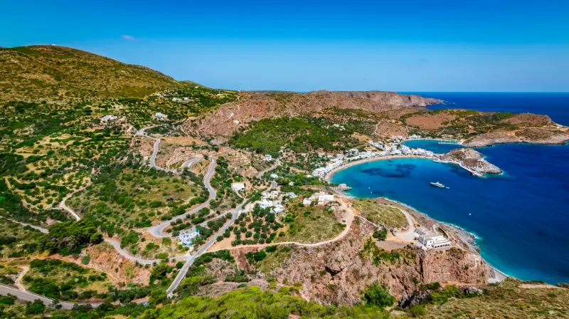
    The official destination material highlights several representative routes: M1 Chora and its Port at about two hours; M31 Pirate Raid around Paleochora at roughly 4.5 hours; M41 Valley of the Watermills at about 2.5 hours; M12 Round of Kapsali around two hours; and longer routes such as M11 Origins and M49 Nature in Contrasts at around five hours.

    Greece Kythira Island Empty Narrow Street Chora Town Traditional White Color Wall Building

    These times are useful for scale, not promises. Heat, photography, navigation and fitness change actual duration. Always use current trail information and allow a buffer if your day includes a ferry, cave opening or dinner reservation.

    M1 Chora–Kapsali: best first walk

    M1 connects the capital with its harbour and is a natural first route because you can combine it with the castle, churches and a swim. The official trail description lists Chora, the castle, churches of Mesa Vourgo, a British stone bridge and Kapsali among the features. It gives more context than simply driving between the two places.

    In summer, walk early or later in the afternoon and think about the return climb before committing. If you plan to finish with dinner in Kapsali, arrange your return transport rather than discovering after dark that the uphill walk feels much longer.

    M31 and Paleochora: history plus exposure

    The longer ‘Pirate Raid’ route around Paleochora links historical ruins with a more rugged landscape, including the Kakia Lagada gorge area. This is not the walk I would choose for a casual midday outing. It suits experienced walkers who have water, proper footwear and enough time to deal with route-finding or heat.

    Paleochora is evocative even without completing the entire route. If conditions are poor, shorten the day and focus on the historic site rather than forcing a long circuit.

    M41 Valley of the Watermills

    M41 is one of Kythira’s most distinctive walks because it follows the Mylopotamos water landscape. The route features Fonissa/Neraida waterfall, historic watermills, channels and stone bridges. Shaded sections can feel cooler than exposed coastal paths, but wet stone creates a different hazard.

    Do not assume the gorge is easy simply because there is water and vegetation. The path becomes more demanding farther down. Turn around when the route stops being comfortable for your group.

    Longer rural routes and cycling

    Visit Greece also mentions routes through forgotten rural landscapes and contrasting natural zones. These longer paths are ideal outside the hottest summer weeks, when you can actually enjoy olive groves, old settlements and open ridges rather than simply managing heat.

    Kythira also supports cycling and mountain-bike exploration, but road gradients and traffic awareness still matter. A route that looks gentle on a map can become demanding under sun and wind. For both walking and cycling, start with conservative distance estimates.

    Hiking safety and wildfire awareness

    Carry more water than you think you need, wear shoes with grip, protect yourself from sun and keep an offline route. Tell someone where you are going if the trail is remote. Avoid entering caves, ruins or military-looking structures that are not officially open.

    During periods of high fire danger, local authorities can restrict access to natural areas. That is not an inconvenience to work around; it is a safety measure. Check current notices and be ready to switch to a village walk or beach day.

    How Kythira changes the way you plan a Greek-island day

    Kythira is not a compact resort island where every attraction sits around one bay. Villages, beaches and historical sites are spread across a rugged landscape, so the best days normally focus on one side of the island rather than crossing from north to south several times. I plan mornings around one anchor place, add a nearby beach or village, and leave dinner close to wherever the afternoon naturally ends.

    The island also rewards flexibility. Wind can change which beach feels comfortable, a waterfall can be less dramatic after a dry period, and seasonal businesses do not all keep the same hours outside the busiest weeks. Treat the itinerary as a framework, not a contract. One unhurried village, one swim and one meaningful cultural stop often produce a better day than a long checklist.

    Driving, parking and realistic travel time

    Even when map distances look short, allow extra time for bends, village streets, parking and short walks from the road. Kythira is manageable by car, but it is not an island where I would schedule activities back-to-back. In popular places such as Chora, Kapsali, Kaladi or Mylopotamos, arriving earlier also makes parking and photography noticeably easier.

    If you rent a car, choose a vehicle you are comfortable using on narrow roads and never assume that every road to a remote beach has the same surface. Ask locally about the final approach before committing to an isolated cove, especially after unusual weather. For no-car travel, build the holiday around a strong base and use taxis or seasonal public transport selectively rather than trying to imitate a full road trip.

    Best season and daily rhythm

    Late spring and early autumn are especially attractive if walking, villages and archaeology matter as much as swimming. July and August deliver the warmest sea and the widest choice of seasonal services, but they also require earlier starts, more careful parking and a serious approach to shade and hydration. September is often a useful compromise for travellers who want warm water without the same daytime intensity.

    In summer, I keep exposed walks, castles and viewpoints for morning or late afternoon. Midday is better for a shaded lunch, a protected beach or a long break. Kythira’s most memorable places are often atmospheric rather than monumental, so giving them time is part of the experience rather than wasted schedule space.

    Food, water and what to carry

    Kythira is known for products such as thyme honey, local rusks and the aromatic Fatourada liqueur, but the practical food rule is simpler: eat where the day already takes you. A lunch in Mylopotamos, a waterfront meal in Kapsali or Avlemonas, and a village dinner in the north all make more sense than driving across the island for one saved restaurant pin.

    Bay Of Kapsali Kythira Island Greece

    For remote beaches and trails, carry water, sun protection and at least a small snack. Some coves have seasonal facilities while others have none. I also keep swim shoes, a light shoulder cover for churches and monasteries, and an offline map on my phone. Small preparations matter more here than on an island built around organised beaches.

    Accessibility and slower travel

    Historic settlements, castle approaches, waterfall paths and rocky coves can involve steps or uneven ground. Travellers with limited mobility should ask accommodation hosts very specific questions about stairs, parking distance and the route to the nearest restaurant or beach. A beautiful room can be inconvenient if every outing begins with a steep climb.

    Slow travel works exceptionally well on Kythira. Staying longer in one area reduces driving and makes room for repeat swims, village cafés and weather changes. If you have only three nights, do less. With a week, divide the island into south, east, west/inland and north rather than changing hotels repeatedly.

    Common mistakes to avoid

    The most common mistake is underestimating how spread out the island feels. The second is treating every beach recommendation as suitable in every wind direction. Other avoidable errors include wearing sandals on rough trails, arriving at a cave or museum without checking seasonal hours, and assuming a waterfall will look identical in late August and after spring rain.

    I would also avoid booking accommodation solely on a low map price. Location affects almost every day on Kythira. A base with dinner, a swim and a useful road connection nearby can save enough driving and taxi time to be worth a slightly higher room rate.

    How this fits into a complete Kythira trip

    Use this guide as one part of a regional plan. The existing Kythira Travel Guide gives the island-wide overview, while the dedicated guides below let you plan the areas and travel styles in more detail. I would normally combine one cultural or walking focus with one beach area each day rather than criss-crossing the island.

    Continue planning with Chora and Kapsali Kythira Guide: Castle, Twin Bays, Chytra and Where to Stay; Avlemonas and Paleopolis Kythira Guide: Coves, History, Beaches and Where to Stay; Agia Pelagia Kythira Guide: Beaches, North Coast, Food and Where to Stay; Mylopotamos Kythira Guide: Kato Chora, Watermills, Waterfall and Village Life; Kythira Waterfalls and Caves Guide: Fonissa, Watermills and Agia Sophia; Best Beaches in Kythira: 15 Beaches for Families, Snorkelling and Wild Scenery; Kythira Hiking Guide: Best Kythera Trails, Gorges, Villages and Safety; Kythira Without a Car: Taxis, Buses, Transfers and the Best Bases; Kythira with Kids: Family Beaches, Easy Days and Practical Tips; Where to Stay in Kythira: Chora, Kapsali, Avlemonas, Agia Pelagia or Mylopotamos?.

    View Whitewashed Buildings Ruins Venetian Castle Chora Kythira Island Greece

    Kythira Hiking Guide FAQ

    What is the best first hike in Kythira?

    M1 between Chora and Kapsali is a strong introduction because it combines history, views and practical endpoints.

    How long is the watermill route?

    Visit Greece describes M41 Valley of the Watermills at about 2.5 hours.

    Can I hike in July and August?

    Yes, but start very early or late and avoid long exposed routes during peak heat.

    Do I need hiking boots?

    Good trail shoes with grip are adequate for many routes; rougher routes justify more supportive footwear.

    Are routes well signed?

    Kythira has a recognised trail network, but always carry current route information and an offline map.

    Useful official information

    For route planning I check Visit Greece – Outdoor Activities on Kythira and current Kythera Trails information. Trail status and access can change after weather or maintenance.

    Opening times, local road conditions, public transport, boat trips and seasonal businesses can change. Recheck anything time-sensitive shortly before you use it, especially outside July and August or after unusual weather.

  • Corfu Without a Car: Buses, Boats, Taxis and the Best Bases for Easy Exploring

    Corfu Without a Car: Buses, Boats, Taxis and the Best Bases for Easy Exploring

    You can visit Corfu without renting a car, but the experience is much better if you choose your base around the bus network instead of booking an isolated villa and hoping transport will solve itself. Corfu Town is the easiest hub because city and intercity routes converge there, while a few resort areas work well if your priority is beach time rather than island-wide sightseeing.

    There are two main bus systems to understand. Corfu City Bus handles the urban area and nearby destinations such as Kanoni, Benitses, Dassia/Ipsos, Achilleion and Pelekas. Green Buses operate the intercity network to places including Kassiopi, Sidari, Paleokastritsa and other villages and beaches. Once you understand that division, a car-free itinerary becomes much simpler.

    Panoramic View Viewpoint Resort Town Paleokastritsa Corfu Greece

    This guide focuses on transport strategy rather than every timetable. For destination details, open the main Corfu guide and the individual guides linked below.

    Best car-free bases

    BaseWhy it works
    Corfu TownBest bus connections, airport/port access, culture and evening choice
    Dassia/IpsosFrequent urban corridor plus beaches
    BenitsesSouth-east coast with city-bus access
    PaleokastritsaGood if beach scenery matters more than crossing the whole island

    Understand the two bus networks first

    Corfu City Bus publishes routes including 2A to Kanoni, 6 to Benitses, 7 to Dassia/Ipsos, 10 to Achilleion, 11 to Pelekas and 15 linking airport, bus station, town and port. Check the official City Bus routes because seasonal changes and temporary detours are common.

    Green Buses handle longer island routes. Their 2026 network includes A4 to Kassiopi and A6 to Afionas/Arillas, as well as services to Sidari, Roda/Acharavi, Paleokastritsa and southern destinations. Use Green Buses for the current timetable rather than relying on a screenshot from an older blog.

    Panoramic View Ag Georgios Pagon Afionas Corfu Island Greece

    Why Corfu Town is the easiest base

    If you want culture plus several day trips, Corfu Town is hard to beat. You can walk the Old Town, reach Kanoni easily, connect to intercity buses and use taxis only for gaps. The airport and ferry port are also close enough that arrival and departure logistics are simpler.

    The trade-off is that you do not wake up on a resort beach. For many first-time visitors, that is a good exchange: beach days become deliberate excursions, while evenings give you far more dining and walking variety.

    Best day trips by bus

    Paleokastritsa is an obvious choice because the main bays, monastery area and boat trips are concentrated enough for a bus day. Kassiopi also works because the harbour, castle and coves are walkable after arrival; see my Kassiopi guide. Sidari is practical for Canal d’Amour, and Pelekas can be paired with a west-coast beach when schedules line up.

    Vlacherna Monastery Mediterranean Sea Corfu Island Greece

    Build each day around the final return bus, not the first outbound service. Screenshot or write down the return options and arrive at the stop early, especially in peak season when traffic can affect running times.

    When boats are more useful than buses

    Boat excursions are ideal for coastline experiences that road transport cannot reproduce: caves around Paleokastritsa, north-east coastal bays, Paxos/Antipaxos day trips and local beach transfers where offered. They are not a substitute for a general island network, because weather can cancel departures.

    Keep sea trips on flexible days. If wind cancels a boat, switch to a town, museum or bus-based beach day instead of losing the whole itinerary.

    Taxis and private transfers: use them strategically

    Taxis are most valuable for early flights, late returns, awkward hotel access and one-off cross-island gaps. They become expensive if you use them as a full replacement for a rental car every day. Ask for an estimated fare or use the official queue/booking channels rather than accepting an unclear arrangement.

    A smart car-free trip often uses buses for routine days and one taxi for a route that would otherwise require several changes. That keeps the budget predictable.

    Places that are harder without a car

    Old Perithia, Mount Pantokrator, remote south-west beaches and some inland villages require more planning. You can still reach them with a combination of bus, taxi or organised tour, but spontaneous hopping is harder. The Old Perithia guide and Pantokrator guide explain why these are better treated as dedicated days.

    If those remote places are your main reason for travelling, consider renting a car for only two or three days rather than the whole holiday. Partial rental is often the best compromise.

    A 5-day car-free Corfu outline

    This outline works because every day has a single transport logic. Do not schedule a Green Bus north-coast trip and an unrelated south-coast attraction for the same afternoon. Car-free travel is easiest when you accept that geography matters.

    DayPlan
    1Corfu Old Town and fortresses
    2Paleokastritsa by Green Bus + local boat if sea is calm
    3Kanoni, Vlacherna and Mon Repos by City Bus
    4Kassiopi or Sidari by Green Bus
    5Pelekas/Glyfada, Benitses or flexible boat day

    Small habits that make public transport easier

    • Stay within walking distance of a useful bus stop.
    • Check Sunday and holiday schedules separately.
    • Carry some cash even if cards are widely accepted.
    • Save your hotel pin and bus-station location offline.
    • Leave buffer time for airport or ferry connections.
    • Do not plan the final international departure around a same-day remote bus return.

    Airport and port logistics

    The airport is close to Corfu Town, so a car-free trip starts easily. City Bus line 15 connects airport, the intercity bus station, town and port corridor. For an early flight, however, check whether the first service is early enough; a pre-booked taxi may be worth the cost for peace of mind.

    At the ferry port, allow walking time from the bus stop to the correct terminal or gate. If you are connecting to an international ferry, arrive with more buffer than you would for a local bus.

    How to handle luggage on a split stay

    A two-base trip is still possible without a car if both hotels are near useful bus routes. Travel between bases in the late morning rather than during the busiest commuter or beach-return windows, and keep luggage compact enough that you can manage it yourself.

    If a second hotel sits up a steep road, use a taxi for the final kilometre. Saving money on every transfer is less important than arriving safely with your bags.

    One more practical planning note

    When planning Corfu Without a Car, keep the day deliberately flexible. Corfu rewards travellers who respond to wind, heat and traffic rather than following a fixed checklist. Confirm opening or transport information on the morning itself, carry water, save important locations offline and avoid adding a distant attraction just because there is an empty hour on paper. The island is most enjoyable when each day has one clear geographical focus, enough time for a meal and enough margin to change the plan if a beach is rough, a road is congested or a cultural site has temporary access restrictions.

    I also recommend building a deliberate pause into the middle of the day. In peak summer, a shaded lunch, swim or hotel break is not wasted time; it protects the part of the afternoon when you are more likely to enjoy a village, viewpoint or coastal walk. If you are driving, refill water before leaving a larger resort area and keep fuel comfortably above empty, because small mountain and coastal roads do not always have services exactly when you need them.

    Finally, check the return route before sunset. Corfu roads can be slower after dark, and bus frequencies often thin out in the evening. If a place is especially beautiful late in the day, consider staying nearby for dinner rather than immediately crossing the island. That simple decision often turns a rushed sightseeing day into a much more memorable travel experience.

    Timing, comfort and local conditions

    Corfu changes character through the day, so timing deserves as much attention as the list of places. Early morning is best for exposed walks, castles and viewpoints; the middle of the day is better for swimming, lunch and shade; late afternoon works well for villages and west-facing scenery. This rhythm is particularly useful in July and August, but it also makes shoulder-season days feel less rushed because you can spend longer where the conditions are best.

    If you are using a rental car, keep the route geographically compact and avoid relying on the fastest navigation estimate. Village traffic, scooters, narrow bends and summer parking can add time that does not appear on the map. If you are using buses, verify the current return service before leaving the main town and save the timetable offline in case mobile data becomes unreliable at a remote stop.

    A good Corfu day also needs a backup. Strong wind can change a beach, cloud can hide a mountain view and restoration work can affect access to a monument. Choose an alternative in the same part of the island so a change of plan costs twenty minutes rather than two hours. This is one of the easiest ways to travel more comfortably and still see a lot.

    Frequently asked questions

    Can I see Corfu properly without a car?

    Yes, especially if you stay in Corfu Town and focus on destinations connected by City Bus and Green Buses.

    Which bus goes to the airport?

    Corfu City Bus line 15 links the airport with the bus station, town and port corridor.

    Can I reach Paleokastritsa by bus?

    Yes. It is served by the intercity Green Bus network; check the current timetable.

    Is Kassiopi possible as a bus day trip?

    Yes. Green Buses list the A4 Corfu–Kassiopi route and the village is walkable once you arrive.

    Should I rent a car for just part of the trip?

    That is often ideal if you want remote villages or mountain routes but prefer not to drive every day.

    Final thoughts

    Corfu without a car is realistic when you build the holiday around transport instead of fighting it. Base yourself near useful routes, dedicate each day to one corridor and use boats or taxis as targeted tools. You will see less road and often enjoy the places you choose more slowly.

  • Skiathos Hiking Guide: Best Trails, Evangelistria, Kastro, Forests and Safety

    Skiathos Hiking Guide: Best Trails, Evangelistria, Kastro, Forests and Safety

    Skiathos is usually sold as a beach island, but the interior is crossed by one of the most interesting walking networks in the Sporades. Forest tracks, old cobbled paths, springs, chapels and viewpoints connect the town with Evangelistria, Kastro, remote beaches and the western pine forests. Hiking is the easiest way to see the island beyond the bus corridor.

    The Municipality of Skiathos describes a network of about 197 km of trails and says the routes range from short walks to outings of several hours. The island’s highest point is only around 433 metres, but distance, heat and repeated climbs can still make a route demanding. For the broad island overview, start with my Skiathos travel guide. For the capital, harbour and evening walks, use the Skiathos Town guide; and for the island’s best-known south-west beach, see the Koukounaries Beach guide.

    Sporades Skiathos Koukounaries

    Hiking Skiathos at a glance

    QuestionPractical answer
    Best monthsApril–May and September–October are especially comfortable
    Summer strategyStart early; avoid long exposed climbs in midday heat
    NavigationUse official route information plus offline maps
    Best cultural routeTown to Evangelistria
    Best historic objectiveKastro and the north-side routes

    The official Skiathos trail network

    The Municipality of Skiathos hiking page describes a broad network crossing forests, agricultural land, religious sites and coastal scenery. Routes have been reorganised with modern wayfinding principles and are intended for different ability levels, but signage should complement—not replace—basic navigation preparation.

    Download or save the route information before leaving. On a wooded junction it is much easier to make a good decision with an offline map than by trying to reload a website with weak signal.

    Route ST5: Town to Evangelistria

    The official network identifies ST5 as one of the main routes, connecting Skiathos Town with Evangelistria Monastery through olive groves, springs, chapels and old paths. It is an excellent first hike because the destination has cultural value and you can potentially use a bus or taxi for one direction.

    If you walk both ways, start early and allow time at the monastery. Do not count museum or church visiting time as a rest from the heat unless you are actually sitting in shade and drinking water.

    Kastro and the northern routes

    The northern network leads toward Kastro, with routes through chapels, broadleaf forest and historic landscapes. Kastro itself is an exposed rock, so save energy for the final approach and the return. A north-coast swim may be possible in good weather but should not be your only cooling strategy.

    Longer Kastro outings suit walkers who are comfortable with several hours on uneven terrain. If you mainly want to see the historic settlement, use a shorter land approach or boat trip instead of turning the day into an endurance test.

    Western forest and Mandraki-area walks

    Around Koukounaries and the western side, pine forest routes give access to quieter beaches such as Mandraki, Elias and Agkistros. These walks are appealing because you can combine forest shade with swimming, but the sand and heat can still be tiring after several kilometres.

    Use Koukounaries as a practical transport anchor if you are travelling by bus. Confirm the last return service before committing to a late-afternoon forest loop.

    Koukounaries Beach Skiathos Island Greece World Beach

    How difficult are Skiathos hikes?

    Low altitude does not automatically mean easy. Loose surfaces, steep short climbs, heat and cumulative distance matter. A route that feels effortless in April can be uncomfortable at 13:00 in August. Judge difficulty using time, elevation, surface and exposure together.

    If you are new to hiking, choose a 1–3 hour route with an obvious destination and simple return. Experienced walkers can link routes, but should still carry enough water and tell someone the plan.

    Hiking safety and fire awareness

    In dry summer conditions, wildfire risk can affect access to forests and trails. Follow official restrictions immediately and never enter a closed area because a route app still shows a line. Avoid smoking on trails and do not park vehicles where they block emergency access.

    Wear proper shoes, use sun protection, keep a charged phone and carry basic first aid. On hot days, turn around at the first sign that water or energy is running low; there is no reason to finish a recreational hike at all costs.

    A 3-hike progression for a first trip

    HikeWhy choose it
    Town/short local routeLearn the signs and terrain close to services
    Town–EvangelistriaCultural destination plus varied countryside
    Kastro or western forest routeLonger scenery-focused day once you know your pace

    Hiking with buses and taxis

    The 2026 bus network serves the south coast and Evangelistria area and was extended toward the Kastro junction. That creates useful one-way possibilities. Check Skiathos Transport on the morning of the hike rather than assuming the same service runs every month.

    A taxi can also turn a point-to-point trail into a manageable outing. Agree the pickup place clearly, especially if the trail ends at a junction rather than a named beach.

    When to go and how to use the weather

    For Skiathos Hiking Guide, I would treat the weather as part of the plan rather than background information. Skiathos is green, exposed to changing Aegean conditions and small enough that one coast can feel very different from another. In July and August the strongest sun usually falls in the middle of the day, so exposed walks and historic sites are more comfortable early or later. Spring and early autumn are particularly attractive for walking, while the sea remains the priority for most summer visitors.

    Wind matters even more than temperature. A calm morning can be ideal for the north coast, while a northerly wind can cancel small-boat departures or make open beaches uncomfortable. Check the marine forecast and ask local operators about the actual sea, not only the air temperature. If conditions are poor, switch to the south coast, town, a monastery or a forest walk and keep the exposed plan for another day.

    Food, water and a sensible pace

    Skiathos makes it easy to over-plan because distances look short. Leave time for a proper lunch, a swim and an unhurried return. On remote beaches and hiking routes, carry more water than you think you need; tavernas and beach bars are common on the developed south coast but not guaranteed on the north. A refillable bottle and a small snack are worth carrying even on a half-day outing.

    For meals, use the geography of the day. Eat near the beach or village you are already visiting instead of driving back to Skiathos Town for every lunch. In the evening, the town gives you the widest choice, but staying in Troulos, Agia Paraskevi or Koukounaries can be more relaxing if your hotel is on the west side of the bus corridor.

    Koukounaries Beach Skiathos Greece

    What to pack for this part of Skiathos

    • High-SPF sunscreen, a hat and enough drinking water for exposed stops.
    • Shoes with grip for paths, rocky viewpoints and historic sites; flip-flops are not hiking shoes.
    • A light layer for boat rides and breezy evenings, even in warm weather.
    • Offline maps or saved pins for remote beaches and trail junctions.
    • A small dry bag if the day includes a boat, tender transfer or swimming stop.
    • Cash as a backup for small seasonal businesses, although cards are widely used in tourist areas.

    A planning rule that saves time

    Group each day by geography. The south-coast bus corridor, the Koukounaries end of the island, the northern Kastro area and the town/monastery side each work best as separate clusters. Crossing the island several times in one day adds traffic and parking without adding much experience.

    Also keep the last day conservative if you have a flight or ferry connection. Boat trips can be delayed by weather, buses can run differently outside peak season and summer road traffic around town and the airport can slow unexpectedly. A relaxed final day near your departure point is a better insurance policy than squeezing in a remote north-coast beach.

    Local transport and timing checks before you leave

    For Skiathos Hiking Guide, check the official Skiathos Transport information on the same day you travel. The network changed several times during the 2026 season, including an extension from Evangelistria toward Profitis Ilias and the Kastro junction, and a revised timetable valid from 18 September. That is useful progress for visitors, but it also means an old screenshot can be wrong. Save the current timetable offline, note the last useful return and allow extra time at busy beach stops when buses can fill quickly.

    Boat schedules deserve the same treatment. North-coast trips depend on sea conditions, and responsible captains may change the order of stops or cancel a landing. Keep one flexible day in the itinerary so weather becomes a planning variable instead of a crisis. If you have a flight or ferry the next morning, spend the final afternoon somewhere easy to reach rather than on the most remote excursion of the holiday.

    Responsible travel on a small island

    Skiathos receives intense summer demand, yet many of its most attractive places are small beaches, forest paths and religious or historic sites. Use marked routes, take rubbish away from remote coves, respect private property and never remove stones or natural material from protected landscapes such as Lalaria. On organised beaches, use the bins provided and keep noise reasonable away from the main beach-bar areas.

    Wildfire risk is another reason to behave carefully in the dry season. Do not smoke on forest trails, do not park where vehicles block narrow access roads and follow any temporary closure immediately. These habits are simple, but they matter on a pine-covered island where a small mistake can have a large effect.

    Frequently asked questions

    Is Skiathos good for hiking?

    Yes. The island has an extensive official trail network through forests, chapels, historic sites and remote beaches.

    When is the best time to hike?

    Spring and early autumn are especially comfortable; in summer, start early and shorten exposed routes.

    Can I hike to Evangelistria Monastery?

    Yes. The official ST5 route connects Skiathos Town and the monastery.

    Can I hike to Kastro?

    Yes, with several possible approaches; choose the route according to your fitness and heat conditions.

    Do I need hiking boots?

    For longer routes, shoes with good grip and foot support are preferable. Avoid flip-flops on uneven paths.

    Final thoughts

    Walking is the best antidote to the idea that Skiathos is only a line of beaches. Start with a short official route, learn how the terrain feels and then build toward Evangelistria, Kastro or the western forest. In the right season, hiking can become one of the highlights of the island.