Author: Jessica

  • South Evia Road Trip: 6-Day Itinerary for Nea Styra, Marmari, Karystos, Mount Ochi and Cavo D’Oro

    South Evia Road Trip: 6-Day Itinerary for Nea Styra, Marmari, Karystos, Mount Ochi and Cavo D’Oro

    South Evia is ideal for a road trip because the region changes quickly from easy gulf-side resorts to mountain passes, wild Aegean coastline, gorges and remote villages. The mistake is trying to cover it from one Athens day trip. A six-day route gives enough time to use Nea Styra, Marmari and Karystos as real bases rather than fuel stops.

    This itinerary assumes a car and a flexible attitude to weather. Strong wind can affect ferries, beaches and high-ground hiking, while summer wildfire risk can close mountain access. Keep the order adaptable and use official information each morning before committing to remote routes.

    Quick planning summary

    • Region: Evia (Euboea), Central Greece.
    • Best for: independent travellers combining coast, villages, archaeology and nature.
    • Transport: a car gives the most flexibility; verify current ferries and buses if travelling without one.
    • Before leaving: check weather, wildfire risk, site opening, road access and sea conditions where relevant.
    • Pacing: Evia is much larger and more mountainous than it looks on a simple map.

    Day 1: Attica to Nea Styra

    If the current ferry timetable works, enter Evia via Agia Marina and Nea Styra; otherwise drive through Chalkida. Spend the first day lightly: old Styra, the Nea Styra waterfront and a nearby beach are enough after travel.

    Greece Chalkida City Evia Close Up View Port From Castle Building Cloudy Sky

    Stay in Nea Styra rather than pushing immediately to Karystos. This gives you a slower first evening and reduces the temptation to treat the western side of South Evia as scenery seen only through the windscreen.

    Day 2: Styra landscapes to Marmari

    Use the morning for the inland Styra area and selected archaeological or mountain viewpoints, then continue south toward Marmari. Do not attempt a long Dragon House hike unless you have a verified route and enough time; save the major mountain objectives for Karystos.

    In Marmari, walk the harbour and choose a nearby beach according to the wind. If seasonal boat trips to the Petali Islands are operating, decide whether they deserve a half day of their own rather than squeezing them into an arrival afternoon.

    Day 3: Marmari beaches and Karystos

    Spend the first part of the day around Marmari, then make the short transfer to Karystos. The town deserves a proper afternoon for the harbour, squares and Bourtzi rather than being used only as a sleeping base for hiking.

    Check mountain conditions, road access and any guide arrangements for the next day before dinner. Karystos is the practical logistics centre for Mount Ochi, Dimosari Gorge and Cavo D’Oro.

    Day 4: Mount Ochi, Dragon Houses or Dimosari Gorge

    Choose one major outdoor objective. The Dragon House on Mount Ochi and the Dimosari Gorge are both serious enough to anchor a day. Trying to do both in full, plus a beach and a long dinner stop, reduces safety margins and enjoyment.

    Carry offline navigation, water, sun protection and a light layer for wind. Turn back if weather closes in. If mountain access is restricted because of wildfire risk, use the day for coastal villages, beaches and Karystos history instead.

    Day 5: Cavo D’Oro and Cape Kafireas route

    Dedicate the day to the wild southeast. Start early from Karystos and choose priorities among Kastanologgos, Platanistos, Potami Beach, Antia and Cape Kafireas. The official Visit Greece route is about 60 kilometres from Karystos but should be treated as a full-day excursion because of terrain and stops.

    Return before you are exhausted. Remote roads, wind and darkness are a poor combination. If local advice indicates road damage or severe weather, do not force the cape day; South Evia has enough alternatives to postpone it.

    Day 6: Karystos coast and departure

    Keep the final day deliberately easy. Swim at a sheltered beach, have lunch in Karystos and depart either toward Marmari/Nea Styra for a ferry or north through Evia according to your broader trip.
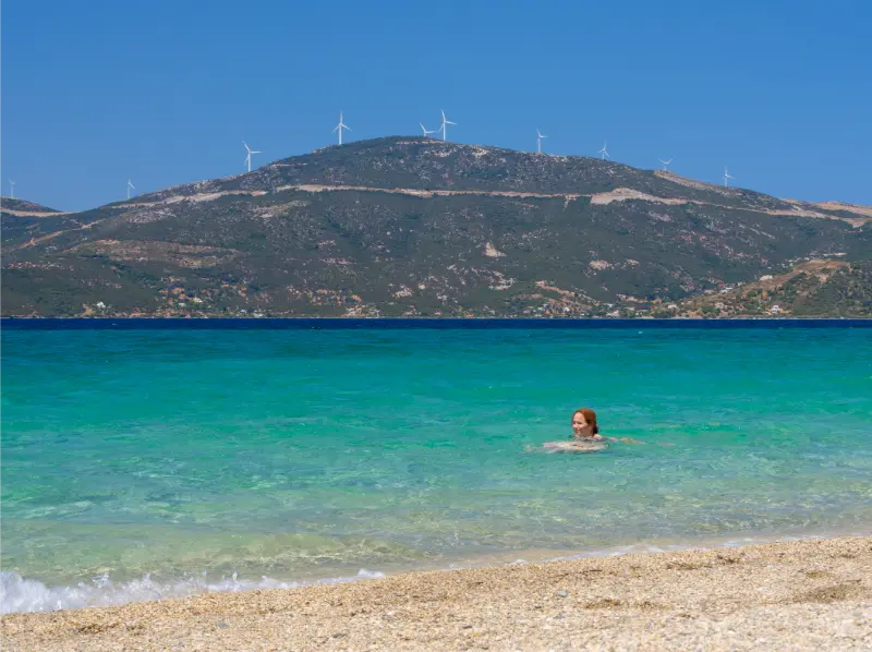
    Aegean Sea Leisure Women Near Town Marmari Greek Island Evia Greece

    If your ferry is weather-sensitive, avoid putting an onward flight or non-refundable commitment immediately after it. Build a buffer or use the road through Chalkida when certainty matters more than speed.

    Where to sleep on the route

    A practical split is one night Nea Styra, one night Marmari and three nights Karystos, with the final night adjusted to your departure. Travellers who dislike moving hotels can skip the Marmari overnight and use two bases: Nea Styra plus Karystos.

    Karystos deserves the longest stay because it is the gateway to the major outdoor objectives. Nea Styra is best for the arrival side, while Marmari works well for Petali Islands, beaches and a quieter harbour atmosphere.

    Driving and safety rules for South Evia

    Keep the fuel tank comfortably above reserve before remote drives, download offline maps and never accept an unpaved shortcut without checking vehicle suitability. Mountain roads can be narrow and slower than navigation apps predict.

    In summer, check wildfire restrictions daily and avoid parking on dry vegetation. On the coast, check wind before committing to exposed Aegean beaches or boat trips. Flexibility is not a compromise here; it is the correct way to travel South Evia.

    Road-trip rule that saves the most time

    Plan around geography rather than a list of famous names. Staying in the same part of the island for two or three nights usually creates more useful travel time than returning to one central hotel after every excursion.

    Keep one optional stop each day that can be removed without disappointment. Ferries, mountain roads, a long lunch or rough seas can easily absorb an hour, and that buffer keeps the itinerary enjoyable.

    Best time to visit

    Spring and autumn are ideal for combining archaeology, villages and driving without the strongest summer heat. Summer works best with early cultural visits and a slower afternoon by the water.

    Winter is excellent for towns and food-focused travel, but smaller beach resorts can be very quiet and museum schedules may be reduced.

    Food, water and breaks

    Evia is large enough that you should not assume a restaurant or petrol station appears exactly when you need one. Carry water, keep fuel above reserve and use larger towns as dependable service anchors.
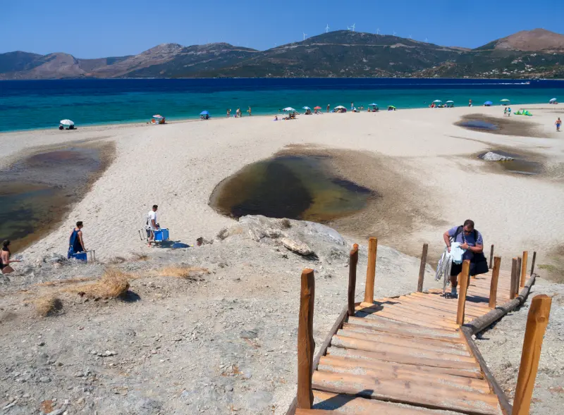
    Grand Sandy Beach Aegean Sea With Holidaymakers Tourists Greek Island Evia Greece

    Local meals can include grilled goat or lamb, seafood, cheeses, honey, figs, vegetables and pies. Choose places that are clearly open and active, and ask directly about ingredients if you have allergies or dietary restrictions.

    Where to stay nearby

    Choose accommodation according to the next morning’s route, not only the nightly rate. Evia’s driving times are long enough that the right base can save several hours across a multi-day trip.

    Useful internal planning links

    Continue planning with our Nea Styra and Styra.

    Continue planning with our Marmari and Petali Islands.

    Continue planning with our Cavo D’Oro and Cape Kafireas.

    Continue planning with our Karystos and Dimosari Gorge.

    Official information

    For details that may change, consult Visit Greece – Karystos and South Evia shortly before travel. Current archaeological, municipal, emergency, ferry or site-management instructions take priority over old reviews and cached map information.

    Frequently asked questions

    How many days do I need for South Evia?

    Five days is the minimum for a useful road trip; six or seven gives better weather flexibility.

    Where should I base myself?

    Nea Styra plus Karystos is the simplest two-base plan. Add Marmari if you want a slower trip.

    Do I need a 4×4?

    Not for the main road trip, but some mountain or remote tracks may be unsuitable for ordinary rental cars. Stay within your rental contract and current road advice.

    Can I do Cavo D’Oro and Dimosari Gorge in one day?

    It is better not to. Each deserves enough time and daylight to be enjoyed safely.

    Should I rely on ferries both ways?

    You can, but the Chalkida bridges give a useful road alternative when wind or timetable changes make ferry plans inconvenient.

    Final advice

    The best South Evia road trip is not the one with the most pins. Give Karystos and the wild southeast enough time, keep the ferry and weather plan flexible, and choose one major outdoor objective per day.

    Extra planning notes

    Before each departure, look at the entire day rather than only the next stop. A thirty-minute detour in the morning can become a two-hour problem once mountain roads, parking and a late meal are added together. Start with the non-negotiable experience and keep the rest flexible.

    If you are travelling as a family or group, agree on the priority for the day—swimming, hiking, archaeology or food. This reduces the pressure to satisfy everyone with too many stops and makes it easier to remove an optional detour.

    Before setting out, save the key address, accommodation contact and one official source offline. Evia has long mountain sections where a weak signal or missed junction can waste more time than expected. A simple offline note makes it easier to adapt without stress.

    Keep at least forty-five minutes of unscheduled time in the day. Parking, a longer meal, changing sea conditions or a cultural stop that deserves more attention can all absorb that margin. The buffer is especially valuable on Evia because distances are often slower than they look.

    For more detailed Evia planning, continue with Porto Buffalo and Zarakes.

  • Best Beaches in Kythira: 15 Beaches for Families, Snorkelling and Wild Scenery

    Best Beaches in Kythira: 15 Beaches for Families, Snorkelling and Wild Scenery

    The best beach in Kythira changes with wind, road conditions and the kind of day you want. Some beaches are easy and social, others are reached by steps or rougher roads, and several famous coves have little or no shade. I would therefore choose beaches by region and conditions rather than create a rigid ranking.

    This guide covers 15 useful options and explains what each one is actually good for. The goal is not to visit all of them. Three or four well-chosen beach days will show you more of Kythira than racing between coves for photographs.

    Quick planning summary

    QuestionPractical answer
    Best forBest Beaches In Kythira travellers and first-time visitors
    Car needed?Very useful for broad island exploration; selected bases can work without one
    Best timingMorning and late afternoon for walking; beach or shade around midday in summer
    What to verifySeasonal hours, road access, wind and local transport close to the travel date

    Quick beach chooser

    For an easy south-coast day, Kapsali combines swimming with food and a lively waterfront. For dramatic scenery, Kaladi is one of the island’s signature beaches but involves access that is less convenient than a resort shore. Chalkos and Melidoni are useful south-western choices, while Paleopolis gives you a long open east-coast beach.

    Families should prioritise access, shade and water entry over fame. Snorkellers may prefer rocky edges and smaller coves. On windy days, ask which coast is protected instead of driving toward the beach you chose the night before.

    1–5: Kapsali, Kaladi, Chalkos, Melidoni and Fyri Ammos

    1. Kapsali is practical: food, organised sections and a scenic setting below Chora. 2. Kaladi is visually dramatic and rewards an early start, but steps and limited convenience matter. 3. Chalkos offers clear water and a classic cove feel. 4. Melidoni is another beautiful south-west option. 5. Fyri Ammos provides a more open and natural beach landscape.

    Visit Kythera specifically highlights Kaladi as iconic and notes Chalkos and Melidoni as good choices in different wind conditions. I would still confirm local advice because comfort depends on exact daily weather, not only a general description.

    6–10: Komponada, Paleopolis, Avlemonas, Agia Pelagia and Lagkada

    6. Komponada is a quieter east/south-east option with a more natural feel. 7. Paleopolis is the island’s longest beach area and works well with Avlemonas. 8. Avlemonas is not a conventional sandy beach but has wonderful rocky swimming coves. 9. Agia Pelagia is convenient for food and accommodation. 10. Lagkada suits travellers exploring the north-east coast.

    This group shows why beach categories matter. A natural swimming platform in Avlemonas and a broad shore at Paleopolis provide completely different experiences even though they are close enough to combine on one east-coast day.

    11–15: Limnionas, Kalami, Sparagario, Fourni and Platia Ammos

    11. Limnionas is a small western cove that fits a Mylopotamos-area day. 12. Kalami appeals to travellers seeking a less developed setting but requires more effort. 13. Sparagario sits near Kapsali and can add variety to a south day. 14. Fourni gives another northern option. 15. Platia Ammos extends the north-coast choices for people already exploring that side of the island.

    For these quieter beaches, check the final access road, shade and services before committing. Conditions can change, and a remote cove is not automatically the best choice for every traveller.

    Best beaches for families

    Kapsali and the more serviced sections around Agia Pelagia are usually easier for families because food and practical facilities are close. Avlemonas can be delightful with older children who swim confidently, but rocky entries require attention. Paleopolis offers space, though wind and waves may be more important there.

    With toddlers, choose a beach after seeing the sea rather than from a permanent list. Depth, swell and wind change. A short drive to a calmer bay is more valuable than insisting on the beach that was supposed to be ‘best for kids.’

    Best beaches for snorkelling and scenery

    Rocky edges around Avlemonas, Chalkos and smaller coves can provide enjoyable snorkelling in calm water. Kaladi is one of the strongest scenery choices, while Kapsali combines a castle backdrop with accessible swimming. The most photogenic beach is not always the easiest place to spend six hours, so separate photography stops from full beach days.

    Bring your own mask if snorkelling matters; rental availability is not guaranteed at every cove. Never snorkel close to boat traffic or outside conditions you can comfortably manage.

    How Kythira changes the way you plan a Greek-island day

    Kythira is not a compact resort island where every attraction sits around one bay. Villages, beaches and historical sites are spread across a rugged landscape, so the best days normally focus on one side of the island rather than crossing from north to south several times. I plan mornings around one anchor place, add a nearby beach or village, and leave dinner close to wherever the afternoon naturally ends.

    The island also rewards flexibility. Wind can change which beach feels comfortable, a waterfall can be less dramatic after a dry period, and seasonal businesses do not all keep the same hours outside the busiest weeks. Treat the itinerary as a framework, not a contract. One unhurried village, one swim and one meaningful cultural stop often produce a better day than a long checklist.

    Driving, parking and realistic travel time

    Even when map distances look short, allow extra time for bends, village streets, parking and short walks from the road. Kythira is manageable by car, but it is not an island where I would schedule activities back-to-back. In popular places such as Chora, Kapsali, Kaladi or Mylopotamos, arriving earlier also makes parking and photography noticeably easier.

    If you rent a car, choose a vehicle you are comfortable using on narrow roads and never assume that every road to a remote beach has the same surface. Ask locally about the final approach before committing to an isolated cove, especially after unusual weather. For no-car travel, build the holiday around a strong base and use taxis or seasonal public transport selectively rather than trying to imitate a full road trip.

    Best season and daily rhythm

    Late spring and early autumn are especially attractive if walking, villages and archaeology matter as much as swimming. July and August deliver the warmest sea and the widest choice of seasonal services, but they also require earlier starts, more careful parking and a serious approach to shade and hydration. September is often a useful compromise for travellers who want warm water without the same daytime intensity.

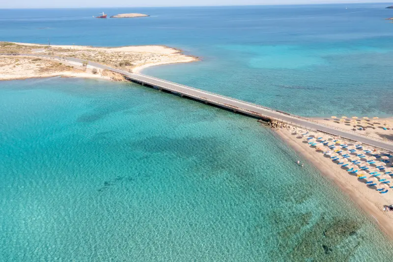
    Kythira Island Greece Aerial View Diakofti Sandy Beach Bridge Turquoise Blue Sea Water

    In summer, I keep exposed walks, castles and viewpoints for morning or late afternoon. Midday is better for a shaded lunch, a protected beach or a long break. Kythira’s most memorable places are often atmospheric rather than monumental, so giving them time is part of the experience rather than wasted schedule space.

    Food, water and what to carry

    Kythira is known for products such as thyme honey, local rusks and the aromatic Fatourada liqueur, but the practical food rule is simpler: eat where the day already takes you. A lunch in Mylopotamos, a waterfront meal in Kapsali or Avlemonas, and a village dinner in the north all make more sense than driving across the island for one saved restaurant pin.

    For remote beaches and trails, carry water, sun protection and at least a small snack. Some coves have seasonal facilities while others have none. I also keep swim shoes, a light shoulder cover for churches and monasteries, and an offline map on my phone. Small preparations matter more here than on an island built around organised beaches.

    Accessibility and slower travel

    Historic settlements, castle approaches, waterfall paths and rocky coves can involve steps or uneven ground. Travellers with limited mobility should ask accommodation hosts very specific questions about stairs, parking distance and the route to the nearest restaurant or beach. A beautiful room can be inconvenient if every outing begins with a steep climb.

    Slow travel works exceptionally well on Kythira. Staying longer in one area reduces driving and makes room for repeat swims, village cafés and weather changes. If you have only three nights, do less. With a week, divide the island into south, east, west/inland and north rather than changing hotels repeatedly.

    Common mistakes to avoid

    The most common mistake is underestimating how spread out the island feels. The second is treating every beach recommendation as suitable in every wind direction. Other avoidable errors include wearing sandals on rough trails, arriving at a cave or museum without checking seasonal hours, and assuming a waterfall will look identical in late August and after spring rain.

    I would also avoid booking accommodation solely on a low map price. Location affects almost every day on Kythira. A base with dinner, a swim and a useful road connection nearby can save enough driving and taxi time to be worth a slightly higher room rate.

    How this fits into a complete Kythira trip

    Use this guide as one part of a regional plan. The existing Kythira Travel Guide gives the island-wide overview, while the dedicated guides below let you plan the areas and travel styles in more detail. I would normally combine one cultural or walking focus with one beach area each day rather than criss-crossing the island.

    Continue planning with Chora and Kapsali Kythira Guide: Castle, Twin Bays, Chytra and Where to Stay; Avlemonas and Paleopolis Kythira Guide: Coves, History, Beaches and Where to Stay; Agia Pelagia Kythira Guide: Beaches, North Coast, Food and Where to Stay; Mylopotamos Kythira Guide: Kato Chora, Watermills, Waterfall and Village Life; Kythira Waterfalls and Caves Guide: Fonissa, Watermills and Agia Sophia; Best Beaches in Kythira: 15 Beaches for Families, Snorkelling and Wild Scenery; Kythira Hiking Guide: Best Kythera Trails, Gorges, Villages and Safety; Kythira Without a Car: Taxis, Buses, Transfers and the Best Bases; Kythira with Kids: Family Beaches, Easy Days and Practical Tips; Where to Stay in Kythira: Chora, Kapsali, Avlemonas, Agia Pelagia or Mylopotamos?.

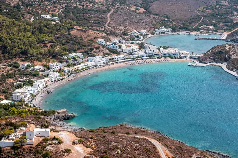
    Kythira Island Greece Aerial Drone View Kapsali Twin Bay Coast Beach Village

    Best Beaches In Kythira FAQ

    Which is the most famous beach in Kythira?

    Kaladi is one of the island’s most iconic beaches, but access is less effortless than at a resort beach.

    Which beach is easiest with restaurants nearby?

    Kapsali and Agia Pelagia are among the more practical choices.

    Is Avlemonas a beach?

    It is better described as a village with beautiful rocky swimming coves and natural-pool style water access.

    Do I need a car for Kythira beaches?

    For a varied beach holiday, a car is extremely useful because beaches are spread around the island.

    Should I choose beaches by wind?

    Yes. Daily wind direction can matter more than a fixed ranking.

    Useful official information

    The official Visit Kythera portal highlights Kaladi, Chalkos, Melidoni, Fyri Ammos, Komponada, Lagkada, Limnionas and Paleopolis among the island’s beaches. Check access and services locally because remote-beach conditions can change.

    Opening times, local road conditions, public transport, boat trips and seasonal businesses can change. Recheck anything time-sensitive shortly before you use it, especially outside July and August or after unusual weather.

  • Skopelos Boat Trips Guide: Coastline Cruises, Alonissos Marine Park and Sea Caves

    Skopelos Boat Trips Guide: Coastline Cruises, Alonissos Marine Park and Sea Caves

    A boat day changes the way Skopelos makes sense. From the road, the island feels mountainous and forested; from the water, you see how pine slopes drop into coves, cliffs and clear bays. Excursions may stay around Skopelos or continue toward Alonissos and the wider Northern Sporades marine environment, depending on season and operator.

    I would choose a trip based on the route and time on the water, not the number of advertised stops. A slower cruise with two good swimming stops can be more enjoyable than an itinerary that spends the whole day approaching, photographing and leaving places.

    Coastal cruises around Skopelos

    Coastal excursions focus on beaches, coves and viewpoints that are easier or more impressive from the sea. They are a good choice when you already have a land-based itinerary and want one day without driving.

    Ask whether the boat has shade, toilets and easy water access. These details matter more than the marketing name, especially for families or travellers who are not comfortable climbing ladders.

    Alonissos and the marine park

    Some excursions continue toward Alonissos and the protected marine environment of the Northern Sporades. The region is internationally important for marine life, including the Mediterranean monk seal.

    A wildlife trip should never promise a guaranteed seal sighting. Choose operators that keep responsible distances and explain protection rules instead of chasing animals for photographs.

    Sea caves, reefs and snorkelling

    Visit Greece highlights clear water, reefs, caves and wrecks as part of the broader Skopelos diving environment. Even without scuba equipment, boat stops can give excellent snorkelling when sea conditions are calm.

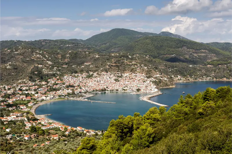
    Landscape Panoramic Views Mountains City Port Sea Height Skopelos Island Northern Sporades Greece

    Bring your own well-fitting mask if snorkelling matters to you. Never enter caves without the crew’s approval, and avoid touching marine life or standing on fragile underwater surfaces.

    Private boat versus organised cruise

    Private boats offer flexibility but require more responsibility. If you rent without a skipper, understand local licensing rules, insurance, fuel, weather limits and anchoring restrictions before departure.

    An organised cruise is easier for a first visit and often better value for solo travellers or couples. A skippered private trip makes most sense when several people share the cost or when you have a very specific route in mind.

    Weather and cancellations

    Wind can alter a route even when the sky looks clear from your hotel. A responsible captain may change swimming stops or cancel because conditions offshore differ from the harbour.

    Book with a flexible mindset and keep a land-based alternative ready. If a trip is cancelled for safety, use the day for Chora, Glossa or a sheltered beach rather than treating the change as lost holiday time.

    What to bring

    Pack high-SPF sunscreen, a hat that can be secured, water, a light layer for the return journey and a dry bag for electronics. Motion-sickness medication may help susceptible travellers, but follow medical advice and the product instructions.

    Carry only what you can keep organised in a small space. Large beach bags become awkward on crowded boats, and wet decks are not ideal places for loose phones and cameras.

    Choosing an operator

    Compare boat size, passenger numbers, shade, swimming access and cancellation policy. A smaller boat can reach different coves, while a larger vessel may be steadier and have more facilities.

    Passenger Plane Stands Runway Island Skopelos Greece

    Read the route carefully because “marine park”, “Alonissos” and “Skopelos cruise” can describe very different days. Choose according to the experience you want rather than the most stops.

    Responsible marine travel

    Do not feed wildlife, chase animals or ask the crew to approach protected species more closely. Use reef-safe practices, take litter back to port and avoid anchoring independently in restricted zones.

    The Northern Sporades are special partly because of their marine environment. A responsible trip leaves the sea exactly as it was found.

    Getting around Skopelos

    Skopelos is compact on a map but not flat. Roads curve through forested hills, and journey times are slower than straight-line distances suggest. A rental car gives the greatest flexibility for beaches and northern villages, while seasonal buses can work well for travellers based in Chora or along the main west-coast corridor.

    If you drive, allow extra time after dark and do not rush on narrow bends. If you rely on buses, check the current timetable after arrival because frequency changes through the season. Taxis are a useful backup for one-way trips, late dinners and locations away from the principal route.

    Where to stay and booking strategy

    For live availability, compare accommodation in Skopelos on Booking.com. Choose the map location before comparing room design: a hillside apartment may have a spectacular view but require steep walking, while a beach property may leave you dependent on transport for evening restaurants.

    For a first visit, Chora is the easiest all-round base. Panormos suits beach-first holidays, Glossa gives village character and north-island access, and Neo Klima offers a quieter west-coast compromise. A split stay becomes worthwhile at around six nights.

    Ferries and arrival planning

    Skopelos has no commercial airport, so most travellers arrive by ferry after flying to Skiathos or travelling overland to a mainland port. Visit Greece explains the common Skiathos-airport connection, while published 2026 ferry schedules show seasonal services from Mantoudi that can call at Skiathos, Glossa and Skopelos.

    Schedules change by date and weather, so treat any timetable in an article as a planning example rather than a permanent promise. Check the operator close to travel, confirm the exact Skopelos port on the ticket and leave buffer time when connecting a ferry with a flight.

    Common mistakes to avoid

    • Assuming every beach has sand, shallow water, shade and full services.
    • Booking a hillside room without checking stairs and luggage access.
    • Trying to see Chora, Glossa, Mamma Mia locations and several beaches in one day.
    • Using an old bus or ferry timetable instead of checking the current season.
    • Driving unfamiliar winding roads too quickly after dark.
    • Treating religious chapels as film props rather than active places of worship.

    Useful official information

    For destination background, use the Visit Greece diving guide. The Municipality of Skopelos is also useful for local notices. Recheck opening arrangements, transport, weather and any fire-related access restrictions shortly before the day you travel.

    Tours and activities

    Seasonal boat trips, transfers and guided experiences vary considerably by month. The widget below can help you see what is actually bookable for your dates. Compare meeting points, duration, cancellation rules and whether transport from your accommodation is included.

    Continue planning your Skopelos trip

    Final advice

    Skopelos works best when you leave enough empty space in the itinerary for the island itself. A road may be slower than expected, a beach may be perfect for another hour, or wind may make you change coast. Those changes are not failures; they are normal parts of travelling on a green, mountainous island.

    Check the next day’s weather and transport each evening, then choose one main experience and one secondary option. That simple habit prevents rushed driving and produces a trip that feels more like a holiday than a checklist.

    A realistic daily rhythm

    Start with the activity most sensitive to heat or crowds, whether that is a chapel climb, village walk or forest route. Use late morning and afternoon for the sea, lunch or a shaded harbour, then return to villages when temperatures fall. This rhythm reduces unnecessary driving and fits the way Skopelos is naturally experienced.

    Keeping one flexible block each day also protects the itinerary from wind and ferry changes. If the sea is rough, you can switch to Chora or Glossa; if the weather is calm, use the opportunity for a boat or beach day.

    Responsible travel on a green island

    Skopelos depends on healthy forest and clean coastal water. Respect fire restrictions, never leave rubbish at remote beaches and avoid parking where emergency or local access is blocked. On boats, follow protected-area rules and keep distance from wildlife.

    Support village shops, bakeries and family-run tavernas rather than treating the island only as scenery. Spending locally helps preserve the communities that make Skopelos different from a purpose-built resort.

    What to pack

    Bring shoes with grip for steps and short trails, water shoes for pebbled beaches, high-SPF sunscreen, a refillable bottle and a light layer for ferry decks or breezy evenings. An offline map is useful when mobile coverage becomes inconsistent in forested areas.

    A small dry bag protects phones and documents on boats, while a compact beach shade can be useful away from organised sections. Pack lightly enough that stairs in Chora or Glossa do not become a problem on arrival day.

  • Naxos Chora Guide: Portara, Kastro, Old Town and a Perfect 2-Day Stay

    Naxos Chora Guide: Portara, Kastro, Old Town and a Perfect 2-Day Stay

    Naxos Chora Guide is the focus of this guide. Naxos Chora is both the island capital and one of the most useful bases in the Cyclades. Ferries arrive almost in the centre, the Portara dominates the harbour entrance, the Kastro rises behind the waterfront, and Agios Georgios beach is close enough to reach on foot. This mix makes Chora much more than a place to sleep before driving inland.

    Give Chora at least one full day at the beginning or end of a Naxos trip. The town is at its best when you alternate between the harbour, steep old lanes, the Venetian Kastro and a beach break. Then use it as the launch point for mountain villages and the longer sandy beaches of the west coast.

    At a glance

    Best forFirst-time Naxos visitors, car-free stays, families and island hopping
    Ideal stay2 nights in Chora plus extra nights elsewhere if desired
    Main landmarksPortara, Kastro and the old market lanes
    Car needed?No for town; useful for inland villages and remote beaches

    Why this place deserves time in your Greece itinerary

    A good visit is less about collecting landmarks and more about understanding how the destination works. Naxos Chora is both the island capital and one of the most useful bases in the Cyclades. Ferries arrive almost in the centre, the Portara dominates the harbour entrance, the Kastro rises behind the waterfront, and Agios Georgios beach is close enough to reach on foot. This mix makes Chora much more than a place to sleep before driving inland.

    Naxos Agios Georgios City Beach Saint George Beach Naxos Island Greece

    My planning approach here is simple: build the day around the strongest local experiences, leave breathing room for weather and crowds, and use nearby destinations only when they add something genuinely different. Give Chora at least one full day at the beginning or end of a Naxos trip. The town is at its best when you alternate between the harbour, steep old lanes, the Venetian Kastro and a beach break. Then use it as the launch point for mountain villages and the longer sandy beaches of the west coast.

    What to see and do

    Portara

    The huge marble doorway of the unfinished Temple of Apollo stands on the islet of Palatia beside the harbour and has become the symbol of Naxos. It is especially popular around sunset, when the doorway frames the sea and town.

    Go once in daylight as well as near sunset if possible. Daylight makes the relationship between the monument, harbour and Kastro easier to understand, while sunset delivers the atmosphere.

    Kastro

    The fortified upper town preserves the Venetian layer of Naxos history. Climb slowly through the gates and narrow lanes, noticing how the architecture changes from the lower commercial streets. Museums and cultural spaces may add depth depending on current opening schedules.

    The Kastro is best explored without a rigid route. Wear shoes with grip because polished stone and steps can be slippery.

    Old Market lanes

    Between the waterfront and Kastro lies a maze of small shops, cafés, restaurants and passages. It can feel touristy in the busiest hours, but early morning reveals a quieter side and evenings are lively without being overwhelming.

    Use these lanes to move between major sights rather than treating shopping as a separate activity.

    Agios Georgios beach

    One of Chora’s greatest practical advantages is having a sandy beach close to the centre. It is easy to spend the morning sightseeing, swim in the afternoon and return on foot for dinner.

    The shallow water can suit families, but wind conditions change; Naxos is well known for breezy summer days that also attract wind- and kite-sports enthusiasts elsewhere on the coast.

    Harbour and evening promenade

    The waterfront is the town’s social spine. Ferries, fishing boats, cafés and restaurants create constant movement, especially around arrival times. Walk it after dark when the Portara and Kastro are illuminated.

    If ferry noise or nightlife bothers you, stay a few streets back rather than directly on the harbour.

    Where to stay

    Old Town/Kastro edge

    Best for atmosphere and historic lanes, but expect steps and difficult luggage access.

    Agios Georgios

    Excellent for families and beach-first travellers who still want to walk into town.

    Harbour/new town

    Most practical for ferries, buses and short stays, though potentially busier and noisier.

    When choosing accommodation, look beyond the marketing label and check the exact map position, stairs, parking or transfer access, and walking time to the places you will use most. On Greek islands in particular, two hotels described as being in the same village can offer very different daily experiences because of gradients, pedestrian lanes or spread-out coastal development.

    How to get there and get around

    Chora surrounds the main ferry arrival area, making it one of the easiest Greek island capitals for travellers without a car. Buses leave for popular beaches and villages, while rental cars are useful for a dedicated island-exploration day. If you rent, collect the car after your town days rather than paying to park it while you walk everywhere.

    For short stays, it is usually better to choose one transport strategy rather than mixing a rental car, taxis and tours every day. If the destination is walkable, keep car days for the places that genuinely need one. If you do rent, photograph the vehicle at collection, understand fuel and insurance conditions, and never assume an attractive coastal track is suitable for a standard rental car.

    A realistic itinerary

    Day 1

    Arrive, walk the harbour and old market, climb into the Kastro, then visit the Portara for late-afternoon light and sunset. Finish with dinner in the old lanes.

    Day 2

    Spend the morning at Agios Georgios or take a bus to a west-coast beach, return for a slow lunch, then revisit the Kastro and harbour after dark.

    Day 3 option

    Rent a car or join a tour for Halki, Filoti, Apiranthos and mountain Naxos. The Naxos travel guide covers the wider island in detail.

    Mountain Village Filoti Naxos Island Greece

    Best time to visit

    Chora is lively through the main travel season, with June and September offering an excellent balance of beach weather and manageable pressure. July and August bring the greatest ferry activity and accommodation demand. Spring is attractive for walking and inland villages even before the sea reaches peak warmth.

    Weather is only one part of timing. Ferry frequency, boat excursions, seasonal restaurants and opening hours can also change outside the main summer period. In peak season the opposite problem appears: almost everything is operating, but parking, restaurant reservations and popular viewpoints require more patience. Build flexibility into the plan rather than trying to optimise every hour.

    Food and evenings

    Naxos is one of the Cyclades’ strongest food islands. Chora is the easiest place to sample local cheeses, potatoes, meats and kitron-based drinks before seeking more traditional tavernas in mountain villages. Do not eat every meal on the harbour; the old lanes and inland day trips broaden the experience.

    A useful rule for a better Greece trip is to separate the places you choose for a view from the places you choose for food. Sometimes they are the same restaurant, but not always. Walk one or two streets away from the most obvious waterfront or viewpoint, read the menu before sitting down, and leave room for a bakery breakfast, a simple taverna lunch and one longer dinner rather than making every meal an event.

    Practical tips for different travellers

    Couples

    Couples can make the destination feel more relaxed by avoiding the most obvious sunset rush and booking one slower evening with no transport after dinner. A room with a view is worthwhile only if you will actually spend time there; otherwise put the budget into location, a boat trip or a special meal.

    Families

    Families should check gradients, shade, beach entry and transfer logistics before booking. A beautiful old-town room can become inconvenient with a stroller, while a resort outside the centre may require repeated taxis. Keep the hottest hours simple and build in a swim, playground or rest period rather than expecting children to follow an adult sightseeing pace.

    Solo travellers

    Solo travellers benefit from walkable bases and public transport, but should still plan the last connection of the day rather than assuming buses or boats run late. Joining a small-group excursion can be useful for remote sights, while self-guided mornings are ideal for photography and museums.

    Road-trip travellers

    If this stop is part of a larger road trip, resist the temptation to check out every morning. Two or three nights in one base often saves more time than it costs because packing, parking and check-in repeatedly can consume the best hours of the day.

    Common mistakes to avoid

    • Leaving Chora immediately after the ferry and never exploring the Kastro.
    • Renting a car for the entire stay even when the first two days are completely walkable.
    • Going to the Portara only at the busiest sunset moment.
    • Booking inside the steep old town without checking luggage access.
    • Treating Naxos only as a beach island and missing its food and mountain culture.

    How to combine it with the rest of Greece

    Use Chora as the gateway to the complete Naxos guide and connect onward with the Paros guide, Antiparos guide and island-hopping guide.

    Naxos Chora Skyline Greece Time

    The most efficient itinerary usually moves geographically rather than bouncing back and forth. Check ferry days, driving times and airport locations before fixing hotel dates. On an island trip, one extra night in a well-connected hub is often more valuable than adding another island simply to increase the destination count.

    FAQ

    Is Naxos Chora a good place to stay?

    Yes. It is one of the best all-round bases in the Cyclades because ferries, buses, restaurants, history and a beach are all close.

    How many days do you need in Chora?

    Two days are ideal before dedicating more time to beaches and mountain villages elsewhere on Naxos.

    Do I need a car in Chora?

    No. Walk and use buses, then rent a car only for the days you explore the interior.

    Is the Portara free to visit?

    The outdoor monument area is generally approached as an open landmark, but respect any current access rules and archaeological protections.

    Is Chora good for families?

    Yes, particularly around Agios Georgios where beach access and town facilities are easy to combine.

    Final advice

    Plan enough structure to protect the important parts of the trip, but leave room to change the order when weather, crowds or local advice suggest a better option. That flexibility is often what turns a busy Greece itinerary into a trip that actually feels like a holiday.

    More Naxos in-depth guides

    Continue planning Naxos with Temple of Demeter Naxos Guide; Apeiranthos Naxos Guide; Chalki Naxos Guide; Filoti Naxos Guide; Apollonas and Kouros Naxos Guide; Plaka Beach Naxos Guide; Mikri Vigla Naxos Guide; Alyko and Hawaii Beach Naxos Guide; Panagia Drosiani Naxos Guide; Naxos Road Trip.

  • Skiathos Town Guide: Bourtzi, Papadiamantis, Harbour Walks and a 2-Day Stay

    Skiathos Town Guide: Bourtzi, Papadiamantis, Harbour Walks and a 2-Day Stay

    Skiathos Town is more than the place where ferries arrive and buses begin. It is the island’s social and practical centre, built around a sheltered harbour where fishing boats, excursion vessels, ferries and evening promenades all share the same waterfront. Staying here gives you the easiest access to restaurants, nightlife, buses and boat trips while keeping the island’s beaches within reach.

    For a first visit, I would use the town as a base rather than treating it as a transit stop. It works especially well if you are travelling without a car, or if you want to combine beach days with evenings on foot. For the wider island, read the complete Skiathos travel guide.

    Why this place deserves more than a quick stop

    The town succeeds because its attractions fit naturally into everyday movement. You can walk from the ferry quay to Bourtzi, browse the narrow commercial lanes, stop at the home associated with Alexandros Papadiamantis, return to the waterfront for dinner and still be close to buses for the south-coast beaches the next morning.

    It also gives Skiathos a different personality after dark. Beach visitors return, boats come back into harbour and the lanes fill without requiring a taxi home. That makes the town one of the most convenient bases in the Sporades for a short trip.

    Koukounaries Beach Skiathos Island Greece World Beach

    At a glance

    Best forCar-free stays, nightlife, restaurants, boat trips and first-time visitors
    Ideal time2 nights for the town itself; longer if using it as an island base
    Main baseAround the harbour or the walkable streets behind it
    TransportOn foot in town; buses and boats for the rest of Skiathos
    Pair it withKoukounaries, Lalaria or Skopelos

    What to see and do

    The best way to understand Skiathos Town is on foot. Distances are short, but the experience changes quickly from ferry quay to quiet lanes and waterfront viewpoints.

    • Walk the old and new harbour edges at different times of day.
    • Cross onto Bourtzi, the green peninsula that separates the two harbour areas.
    • Visit the Papadiamantis House if you are interested in modern Greek literature and local history.
    • Explore the narrow lanes behind the waterfront rather than staying only on the restaurant strip.
    • Use the town as the departure point for boat excursions and evening walks.

    Bourtzi: the town’s easiest scenic pause

    Bourtzi is a small wooded peninsula immediately beside the harbour. In medieval times a Venetian fortification stood here; today the surviving walls, towers and the greenery make it a pleasant place to step away from the busier waterfront. The setting also helps you understand the geometry of the harbour, with views back toward Skiathos Town and out to sea.

    Visit once in daylight and, if you are staying nearby, return toward sunset or in the evening. It does not need a long sightseeing slot. The value is in the contrast: a few minutes from cafés and ferry traffic, you can sit among pines and look across the water.

    Papadiamantis, backstreets and local character

    Alexandros Papadiamantis is one of the best-known figures associated with Skiathos. The small house-museum gives cultural context to an island often marketed almost entirely through beaches. Even if literature is not your main interest, it adds depth to a town walk and helps explain why his name appears repeatedly around the island.

    Afterwards, wander without a strict route through the streets behind the harbour. The commercial lanes can be busy in summer, but short detours reveal quieter corners, small churches and residential details that are easy to miss when walking only from hotel to beach bus.

    A practical route that works

    A compact walking loop is more satisfying than trying to “tick off” isolated sights.

    1. Start at the ferry harbour early, before excursion traffic builds.
    2. Walk to Bourtzi and spend time on the peninsula.
    3. Continue into the central lanes and visit Papadiamantis House if open.
    4. Stop for lunch away from the busiest quay if you want a calmer meal.
    5. Return to the waterfront late afternoon and stay for the evening atmosphere.

    This route can be completed in half a day, but stretching it across a full day allows time for cafés, shopping and a swim or boat trip.

    Getting there

    Skiathos has an airport close to town, while ferries connect the island with mainland ports and other Sporades islands depending on season. The exact route network changes, so build the trip around the timetable for your travel dates rather than assuming every island pair operates daily.

    If you arrive by ferry, the town begins immediately around the port. If you arrive by air, transfers are short compared with many Greek islands, one reason Skiathos works well for travellers with limited time.

    Getting around

    Inside Skiathos Town, walking is the default. Streets are compact and parking can be more trouble than help. For south-coast beaches, the public bus corridor is extremely useful in season and reduces the need for a rental car.

    Boat excursions are the other important transport layer. They can reach coastal areas that are awkward or impossible by road, including trips toward the island’s north coast when sea conditions allow.

    Where to stay

    Stay near the harbour if evening walks, restaurants and early boat departures are priorities. This is the easiest choice for a short visit and for anyone travelling without a car.

    If you prefer quieter nights, look slightly uphill or on the edges of town rather than directly above nightlife streets. Always check the real walking route to the port because a short map distance can involve steps or slopes.

    Food and local rhythm

    Skiathos Town has the island’s widest concentration of dining choices. The best strategy is not to chase one famous restaurant but to mix simple tavernas, bakeries, seafood and one slower evening meal.

    At peak dinner time the obvious waterfront tables fill quickly. Walking a few streets back can change both atmosphere and price. Leave at least one evening unscheduled so you can choose based on what looks good that day.

    Best time to visit

    Late spring and early autumn are particularly comfortable for walking and still offer good island services. July and August bring the liveliest nightlife, hottest afternoons and greatest demand.

    Outside the main season Skiathos becomes quieter and transport frequencies can drop. If beach buses or boat excursions are central to your plan, confirm that they are operating on your dates.

    How long do you need?

    Two nights are enough to understand the town itself. A same-day visit from another base is possible, but you miss the evening atmosphere that is one of the reasons to stay here.

    Four or five nights work well if Skiathos Town is your base for the entire island, with separate days for beaches, a boat trip and inland exploration.

    A realistic mini-itinerary

    1. Day 1: harbour walk, Bourtzi, Papadiamantis House and an evening in the central lanes.
    2. Day 2: morning beach by bus, return for a late lunch, then sunset and dinner in town.
    3. Extra day: take a boat trip to the north coast or combine the town with Koukounaries.

    Mistakes to avoid

    • Renting a car only to use it inside the town.
    • Booking accommodation solely by straight-line distance without checking hills or steps.
    • Treating the harbour as only a transport terminal.
    • Planning a tight boat connection without allowing for weather changes.

    The simplest plan is often the best: stay walkable, use buses for beaches and reserve a car only if you have a specific inland route in mind.

    Responsible travel and practical etiquette

    Skiathos becomes intensely busy in high summer. Walking, buses and shared boat trips reduce traffic pressure, while carrying water and avoiding unnecessary single-use plastics makes beach days easier.

    In residential lanes, remember that the old town is not a theme park. Keep late-night noise reasonable away from the main entertainment streets and respect churches and private doorways when taking photographs.

    How to combine it with the rest of Greece

    Skiathos combines naturally with Skopelos because seasonal ferries link the Sporades. The two islands complement each other: Skiathos is easier for flights and nightlife, while Skopelos feels greener and more spread out.

    If nature is your priority, continue to Alonissos and its marine park. For a single-island stay, pair the town with the Koukounaries guide below once imported.

    Koukounaries Beach Skiathos Greece

    Useful official information

    For destination information, use the official Visit Greece Sporades page. It highlights Skiathos Town, Bourtzi, Papadiamantis and Koukounaries; always verify ferry and bus schedules separately for your exact dates.

    FAQ

    Is Skiathos Town worth staying in?

    Yes, especially without a car. It gives you restaurants, nightlife, the bus network, boat departures and a walkable evening base.

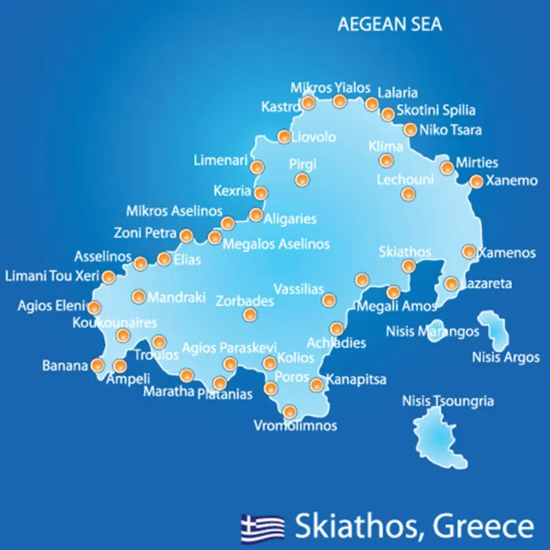
    Map Of Skiathos

    Can you walk around Skiathos Town?

    Yes. The central harbour and old-town streets are compact, although some accommodation areas involve slopes and steps.

    Do you need a car in Skiathos Town?

    No. A car is unnecessary for the centre and many popular beaches are served by seasonal buses.

    How many nights should I stay?

    Two nights cover the town, while four or five nights make it a practical base for the whole island.

    Is Bourtzi free to walk around?

    Access to the peninsula is generally part of a normal town walk, but museum or event arrangements can vary, so check locally if a specific venue matters to you.

    Final thoughts

    Skiathos Town works because it concentrates the practical side of an island holiday without feeling purely functional. The harbour, Bourtzi, lanes and evening life create enough character to justify staying rather than commuting in only for dinner.

    Use the town as your anchor, then let beaches and boat days radiate outward. That approach keeps transfers simple and gives a short Sporades trip far more rhythm.

  • Kea Hiking Guide: Historic Paths, Lion of Kea, Karthaia and the Best Walking Routes

    Kea Hiking Guide: Historic Paths, Lion of Kea, Karthaia and the Best Walking Routes

    Kea is one of the strongest hiking islands in the Cyclades, and that can surprise travellers who know it mainly as the quick ferry escape from Athens. Its old stone paths connect ancient city-states, farms, springs, chapels, oak woodland and the coast. Walking here is not an activity added on top of the island; it is one of the best ways to understand how Kea was organised before modern roads.

    Visit Greece currently describes twelve routes and more than 80 km of walking connections, while the Municipality of Kea has also promoted a signed cultural-interest trail network. Distances and route classifications can vary between mapping sources, so I treat official maps and current local information as more important than a single total-kilometre number.

    What makes hiking on Kea different

    Many paths follow kalderimia, old stone-paved routes that once connected the island’s settlements and ancient cities. You are therefore walking through a cultural landscape rather than on purpose-built recreational tracks. Dry-stone walls, springs, chapels and terraces matter as much as the final viewpoint.

    Kea also has oak woodland, which gives parts of the interior a greener character than the stereotypical bare Cycladic island. In spring, flowers and fresh growth can make the routes especially rewarding; in midsummer, the same paths become much hotter and more exposed.

    Ioulida to the Lion and toward Otzias

    One of the easiest ways to start is from Ioulida toward the Lion of Kea. The official Visit Greece route description continues in the direction of Otzias and measures about 5.1 km for that section. Even if you only walk to the Lion and back, it gives you a useful introduction to trail surfaces and the island’s terrain.

    If continuing farther, solve return transport before setting out. A route that looks straightforward on a map can become awkward if you finish at the coast late in the day and discover there is no convenient bus at that hour.

    Ioulida to Karthaia: the big cultural hike

    Visit Greece highlights a roughly 11.8 km route from Ioulida through Messaria and Agios Symeon toward Karthaia. This is a serious day compared with a village stroll. It combines interior landscapes with one of the island’s most important archaeological destinations.

    Do not use the quoted distance as your only planning metric. Heat, elevation, uneven stone and the logistics of returning from Karthaia matter just as much. For many visitors, a shorter Karthaia approach from a southern trailhead is the more realistic option.

    Korissia, Agia Irini and Vourkari

    The port-to-Vourkari side is useful for an easier walking day. Visit Greece lists a Korissia–Agia Irini–Vourkari route of about 3.5 km. It combines harbour scenery with a less demanding distance and works well for travellers who want activity without committing to a remote mountain route.

    Because this area is more developed, you can pair the walk with a swim at Gialiskari, lunch, or an evening in Vourkari. It is also a good first-day choice before deciding whether your group is ready for longer trails.

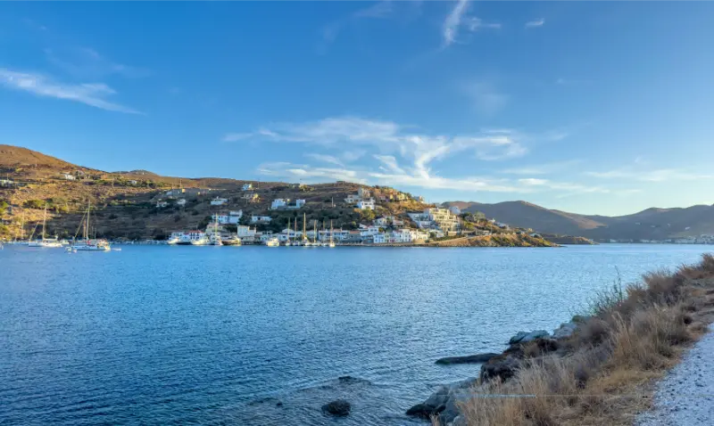
    Scenic View Coastal Village Marina Within Vourkari Kea Tzia Greece Captured Sunset Featuring Calm Blue Waters Moored Sailboats Hillside

    Karthaia routes

    Several traditional paths reach Ancient Karthaia. The Municipality of Kea identifies four approaches and notes that the shortest, route 6 from Stavroudaki, is roughly 1.9 km for the descent. The archaeological site and two beaches make this one of the island’s signature walking experiences.

    The return ascent is the part that catches people out. Start early, carry water for both directions and leave the beach with daylight to spare. If conditions are too hot, postpone the hike or use a boat rather than forcing the plan.

    How to choose a route by season

    SeasonBest approachMain concern
    March–MayLonger interior and archaeological routesWeather changes, some seasonal services limited
    JuneEarly starts with swimming finishRising heat
    July–AugustShorter routes at dawn or late dayHeat, strong sun and fire restrictions
    September–OctoberLonger walks plus warm seaShorter daylight later in autumn
    WinterLocal low-level walks when weather is stableRain, wind and reduced transport/services

    Footwear, navigation and water

    Use closed shoes with real grip. Historic paving can be polished, broken or covered with loose gravel. Download the route before leaving, carry a power bank and take a screenshot of key junctions. Signage helps, but it should not be your only navigation plan on a remote route.

    Water is the non-negotiable item. Even if an old spring appears on a map, do not depend on it being available or safe to drink. In warm weather, start with more water than a city walk of the same distance would require.

    Transport for point-to-point hikes

    A rental car is useful for reaching trailheads, but it can also trap you into returning to the same place. For linear hikes, taxis, buses and a second vehicle can solve the problem. Arrange this in advance rather than improvising after the hike.

    If you are staying in Ioulida without a car, you still have useful walking options from the town itself. This is one reason Ioulida is such a good hiking base: the trail network begins from a place where you can also eat and stay.

    When a guide is worth paying for

    A certified local guide makes sense for longer routes, archaeology-focused walks, complicated logistics or visitors who do not regularly hike in exposed Mediterranean terrain. The value is not only navigation; it is interpretation of the ancient road system, farming landscape and archaeological context.

    Independent walking is reasonable on well-understood routes in good conditions. The key is matching the route to your actual experience rather than to the best photo you saw online.

    Where to stay and how to book

    Ioulida is the strongest base for walkers because several routes connect naturally with the capital and you can return to restaurants without another long drive. Korissia works better if ferry convenience is the priority. For repeated Karthaia hikes or south-coast walking, a base around Pisses or Koundouros can reduce road time.

    For live availability and current rates, compare places to stay in Kea on Booking.com. I recommend checking the exact pin on the map before paying: on Kea, two properties described with the same village name can be separated by steep roads, long walks or a stretch that is much easier with a car.

    Official resources to check before your trip

    Start with Visit Greece’s hiking routes on Kea and cross-check local maps on the Municipality of Kea trail page.

    Opening hours, ferry times, bus routes and beach services can change by season. Recheck them close to your travel date rather than treating an old timetable or a social-media post as permanent.

    Tours and activities

    Kea has a smaller organised-tour market than Santorini or Mykonos, so availability is often seasonal. The widget below is useful for checking whether guided hikes, sailing, diving or other bookable experiences are operating on your dates. Verify meeting points and cancellation terms before paying.

    Continue planning your Kea trip

    How I would fit this into a first Kea itinerary

    For a first stay of four or five nights, I would not make Kea hiking guide the only purpose of the trip. Kea works best when one day is built around Ioulida and the historic interior, one around the coast, one around a substantial walk or archaeological experience, and at least one remains flexible for wind and weather. That structure lets you use this guide in context rather than forcing every attraction into consecutive hours. If you are arriving from Athens on a Friday and leaving Sunday, cut the plan further: choose one village experience, one beach area and one signature activity. The island is close enough to return to, so there is little value in turning a short break into a race.

    Kea also changes character between weekdays and summer weekends. Its proximity to Attica means Friday-evening and Sunday-return traffic can feel much busier than a midweek stay. If accommodation prices, restaurant reservations or ferry availability look tight, consider shifting the same itinerary by a day or travelling in June or September. Shoulder-season travel is particularly attractive for walking because the sun is less punishing and you can spend more of the day outdoors instead of organizing everything around midday heat.

    Keep one practical rule throughout the trip: verify the next day’s transport and opening information the evening before. Ferry operators, local buses, museums, restaurants and boat activities can all change seasonally. Ten minutes of checking is more useful than relying on a screenshot saved months earlier. It also gives you permission to change plans when the wind or temperature makes another part of the island more appealing.

    Small practical details that make the trip easier

    Another detail worth planning is the difference between map distance and real travel time. Kea’s roads are not long, but bends, village traffic, beach approaches and parking can slow a day considerably. Avoid stacking reservations back to back. Leaving thirty or forty minutes of slack between a beach, a museum, dinner or a ferry transfer makes the trip feel calmer and gives you room to stop when a viewpoint or village turns out to be more interesting than expected.

    Ferry Boat Leaving Kea Tzia Island Port Greece Aerial Drone View
  • Assos Kefalonia Guide: Venetian Castle, Harbour, Beach and a Perfect Half-Day Stop

    Assos Kefalonia Guide: Venetian Castle, Harbour, Beach and a Perfect Half-Day Stop

    Assos is one of Kefalonia’s most photographed villages, a small settlement wrapped around a sheltered bay beneath a green peninsula crowned by a Venetian fortress. The village is genuinely beautiful, but its small scale means summer traffic and parking can shape the experience. The right plan is not to “do Assos” as quickly as possible. Arrive early, walk the waterfront, choose whether the castle climb suits the weather, swim if conditions invite it, then leave enough time for lunch before continuing north or south.

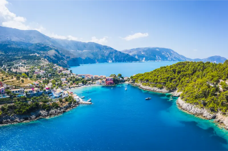
    View Assos Peninsula Greece Kefalonia

    This guide is built for travellers who want more than a quick photo stop. Keep Kefalonia Travel Guide, Myrtos Beach Guide, Fiskardo Guide open while planning so this place fits naturally into the wider trip instead of forcing unnecessary backtracking.

    Why this place deserves its own guide

    The difference between an average visit and a very good one is usually logistical rather than dramatic: arriving at the right time of day, understanding the terrain, leaving space for weather changes and knowing what not to combine. Greece rewards flexible planning. A destination can be world-famous and still feel disappointing if the day is overpacked, while a simple walk or village lunch can become a highlight when the schedule leaves room for it.

    What to see and do

    The harbour and waterfront

    The first view of Assos from the approach road is part of the experience. Once parked, walk the small waterfront without rushing for a restaurant table. Colourful houses, fishing boats and the enclosed bay create a gentler atmosphere than Kefalonia’s dramatic open beaches. Morning is especially pleasant before road-trip traffic peaks.

    The Venetian castle

    The fortress occupies the peninsula above the village and was built by the Venetians as part of their defensive strategy for Kefalonia. The walk up is longer and more exposed than it looks from below. Wear shoes, carry water and avoid the hottest part of the day. The route rewards you with changing views over the bay even if you do not explore every corner of the extensive ruins.

    Assos beach

    The small village beach is convenient for a swim but should not be compared with Myrtos as a major beach destination. Its strength is atmosphere: you can swim, dry off and walk directly to lunch. Space is limited in peak season, so travellers wanting a long beach day may be happier elsewhere after visiting the village.

    Parking strategy

    Parking is one of the practical challenges. Arrive early and use designated spaces rather than forcing a car down increasingly narrow streets. In high season, be prepared to walk from farther away. Do not block access for residents or emergency vehicles. A beautiful village loses its charm quickly when visitors treat every verge as a parking place.

    Combining Assos with Myrtos

    Myrtos lies relatively close by road and is a natural combination, but the two places deserve different rhythms. Use Assos for walking, lunch and perhaps a swim, then visit the Myrtos viewpoint or beach separately. Trying to climb the castle and spend hours at Myrtos before lunch can become exhausting in summer heat.

    Continuing to Fiskardo

    Northbound travellers often combine Assos with Fiskardo. This can work well as a full north-Kefalonia day: early Assos, scenic driving, a beach or viewpoint, then Fiskardo in the late afternoon. The road is winding, so build in time and avoid planning a dinner reservation so tight that every slow vehicle becomes stressful.

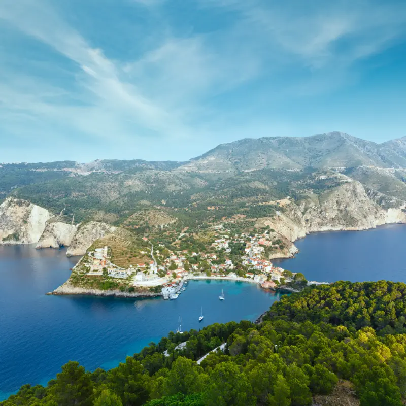
    Aerial Drone View Assos Village Kefalonia Island Greece

    Best time to visit

    May, June and September are excellent for walking and road trips. July and August bring the most visitors and make early arrival especially important. The castle path is exposed, so sunrise-to-midmorning is much more comfortable than early afternoon. Outside summer, check restaurant and café opening because the village becomes much quieter.

    Check conditions close to the day of your visit. Heat, wind, sea state, religious services, archaeological works or seasonal opening hours can matter more than the average weather for the month. When an official website publishes current access information, use that as the final reference instead of an old blog post or a saved social-media screenshot.

    How to get there and move around

    Assos is best reached by car. The road descends from the main north-western route through multiple bends, and the final approach can feel narrow when traffic is heavy. Drive defensively, expect buses or delivery vehicles and never assume a ten-kilometre island road will take ten minutes. Public transport is limited for this kind of multi-stop day.

    Build realistic transfer time into the day. Greek islands and historic city centres often look compact on a map, but narrow roads, parking searches, pedestrian zones and seasonal traffic slow everything down. If public transport is central to the plan, verify the latest timetable shortly before travel and keep a backup option for the final connection of the day.

    Where to stay

    Assos can be a romantic overnight base for travellers who prioritise peace and views, but it is less practical for covering the whole island quickly. Fiskardo offers more evening choice, while Argostoli is stronger for transport and central access. A split stay can make sense on a longer Kefalonia trip.

    Aerial Drone View Assos Village Kefalonia Island Greece

    For accommodation, zoom in on the exact property rather than relying on the neighbourhood label. Check stairs, parking, bus access, late-night noise and the walk back after dinner. A property that is geographically close can still be inconvenient if the route is steep or the last bus finishes earlier than expected.

    Food and local experience

    Lunch beside the bay is one of the pleasures of Assos. Menus often focus on Greek and Ionian dishes, seafood and grilled items. In peak season, arrive before the busiest lunch period or expect to wait. Do not choose a table solely for the closest water view; a slightly set-back taverna may offer better shade and a calmer meal.

    Give meals enough time. Greek travel is rarely improved by treating lunch as a twenty-minute gap between attractions. A slower meal also creates a useful buffer when the morning has taken longer than expected. In heavily visited places, moving one or two streets away from the most obvious viewpoint often changes both atmosphere and value.

    A realistic itinerary

    Arrive before 9:30 if you plan to climb the castle. Walk the waterfront, complete the climb while temperatures are manageable, then return for a swim and early lunch. Afterward, drive to the Myrtos viewpoint and decide whether to descend to the beach. Continue to Fiskardo only if you want a full northern road-trip day rather than a relaxed Assos afternoon.

    Use one priority and one secondary activity as the backbone of the day. If weather, traffic or a long lunch pushes the schedule back, drop the secondary stop instead of compressing everything. A good itinerary should survive a delay without turning the rest of the day into a race.

    Families, mobility and accessibility

    Families should plan around shade, toilets, meal timing and realistic walking stamina. Historic lanes, archaeological ground, fortress paths, beaches and mountain villages vary greatly in accessibility. Travellers who need step-free access should contact the site, transport provider or accommodation directly because general descriptions such as ‘easy walk’ are not precise enough for an important mobility decision.

    Safety and responsible travel

    Follow barriers, lifeguard instructions, religious-site rules and local signs even when other visitors ignore them. Do not climb unstable ruins, walk close to eroding cliffs, enter sea caves in rough water or drive onto protected sand for convenience. Responsible behaviour is not only about preserving the destination; it usually produces a calmer and safer trip for you as well.

    Common mistakes to avoid

    • Arriving around midday in August and expecting easy parking
    • Climbing the castle without water or proper shoes
    • Treating the tiny village beach as if it were a full resort beach
    • Blocking local access while searching for the closest parking space
    • Trying to rush Assos, Myrtos and Fiskardo into a very short half-day

    What to combine with it

    Use Kefalonia Travel Guide for the island, Myrtos Beach Guide for the famous nearby coast and Fiskardo Guide for a northern extension.

    Combine places that sit naturally on the same route. Crossing an island twice in one day or zigzagging through Athens wastes energy that could be spent walking, swimming or eating. If two excellent attractions pull you in opposite directions, separate them into different days and enjoy both properly.

    FAQ

    How much time should I allow?

    Protect at least half a day for a focused visit once transport, walking, breaks and a meal are included. If this is one of your main priorities, give it most of the day rather than squeezing it between two distant attractions.

    Do I need to book in advance?

    High-demand tours, tastings, organised beach services and timed archaeological visits can require or benefit from advance booking in peak season. Ordinary village walks and many beaches do not, but current access conditions should always be checked.

    Can I visit without a rental car?

    Often yes in central Athens and on well-served island routes. Rural villages, remote beaches and multi-stop road-trip days are easier by car. Rent only when it adds meaningful flexibility, and never treat a scooter or ATV as the default solution if you lack experience.

    Is it suitable for children?

    Usually, with an adjusted pace. Heat, stairs, exposed paths, long boat days and limited shade affect children more quickly than adults. Plan a shorter version of the day and keep swimming, food or playground time available as a reset.

    How reliable are old prices and timetables?

    Not very. Ticket prices, ferry schedules, museum hours, beach-service policies and bus frequency change. Use official or local sources close to the visit, particularly when one connection or opening window determines the entire day.

    Final advice

    Plan the logistics carefully, then leave space for the destination to change the plan. The most satisfying days in Greece usually have a clear structure but enough flexibility for a longer swim, an unexpected viewpoint, a village café or a sunset that makes the next scheduled stop suddenly unimportant.

    More Kefalonia in-depth guides

    Continue planning Kefalonia with Lassi and Makris Gialos Kefalonia Guide; Sami and Antisamos Kefalonia Guide; Skala Kefalonia Guide; Lixouri and Paliki Kefalonia Guide; Agia Efimia Kefalonia Guide; Fteri Beach Kefalonia Guide; Best Beaches in Kefalonia; Kefalonia Without a Car; Kefalonia with Kids; Where to Stay in Kefalonia.

  • Ioannina Island Guide: Monasteries, Ali Pasha History and a Half-Day on Lake Pamvotida

    Ioannina Island Guide: Monasteries, Ali Pasha History and a Half-Day on Lake Pamvotida

    Ioannina Island Guide is a useful way to experience a small inhabited island in Lake Pamvotida whose monasteries, village lanes and Ali Pasha associations add a quiet historical counterpoint to Ioannina city. This guide is designed for travellers who want more than a list of sights: it explains how to sequence the day, where driving or walking time is often underestimated, and which details matter when you are actually on the ground in Epirus.

    For wider context, start with the Zagori Travel Guide and the Ioannina Travel Guide. If hiking is central to your trip, also use the Hiking in Greece guide. Those pages cover the broader region; this article stays focused on the practical choices that make this specific stop work smoothly.

    Quick planning facts

    • The island sits in Lake Pamvotida directly beside Ioannina.
    • Small passenger boats connect the city waterfront with the island; schedules can vary seasonally.
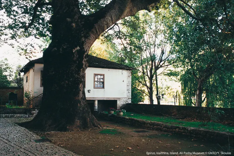
    • The island is associated with a group of historic monasteries and the final chapter of Ali Pasha’s life.
    • There are no cars in the visitor core, making walking the natural way to explore.
    • A half-day is usually enough, but a slow lunch can easily extend the visit.

    Why this place deserves its own stop

    The main reason to include this stop is that it reveals a different layer of Epirus from the famous headline sights. A small inhabited island in lake pamvotida whose monasteries, village lanes and ali pasha associations add a quiet historical counterpoint to ioannina city. The experience becomes much richer when you leave enough time for walking, food and the changing mountain light instead of treating the place as a roadside photograph.

    Zagori and the wider Pindus reward slow travel. Roads twist around valleys, parking in old settlements is limited, and weather can change the order of the day. I therefore plan by geographic clusters: one village group, one outdoor objective and one relaxed meal. That structure leaves room for an unexpected viewpoint, a local recommendation or a trail that takes longer than the sign suggests.

    The boat ride

    The crossing is short, but it changes the perspective on Ioannina. From the water, the castle, mountains and lake form one landscape rather than separate attractions. Check the current departure point and last return before leaving the city, especially outside summer. Do not build a tight onward connection around an assumed timetable.

    My approach here is to allow more time than the minimum. Even when the main sight takes less than an hour, the surrounding paths, views and village atmosphere are what make the stop memorable. If weather closes in, shorten the outdoor section rather than compensating by driving faster to the next place.

    Monasteries

    The island’s monasteries are among its most important cultural features. Dress and behave respectfully, keep voices low and follow any photography restrictions. Even if you are not travelling for religious tourism, the architecture, frescoes and lakeside setting help explain the long spiritual history of the island.

    My approach here is to allow more time than the minimum. Even when the main sight takes less than an hour, the surrounding paths, views and village atmosphere are what make the stop memorable. If weather closes in, shorten the outdoor section rather than compensating by driving faster to the next place.

    Ali Pasha history

    The island is strongly connected with Ali Pasha, the Ottoman-era ruler whose story is intertwined with Ioannina. Museums and local interpretation add context to the dramatic historical narrative. Treat the story as a doorway into the multicultural history of the city rather than only as a legend about one famous figure.

    Aerial View Ioannina Island Ioannina Lake Epirus Region Greece

    My approach here is to allow more time than the minimum. Even when the main sight takes less than an hour, the surrounding paths, views and village atmosphere are what make the stop memorable. If weather closes in, shorten the outdoor section rather than compensating by driving faster to the next place.

    Village and lake walk

    The settlement is small enough to explore without a rigid route. Walk beyond the first souvenir shops, follow the lakeside and allow time for quiet corners. The island works best at a slow pace. If the weather is clear, the changing views across Pamvotida toward the city and mountains are as memorable as any single monument.

    My approach here is to allow more time than the minimum. Even when the main sight takes less than an hour, the surrounding paths, views and village atmosphere are what make the stop memorable. If weather closes in, shorten the outdoor section rather than compensating by driving faster to the next place.

    How I would plan the visit

    Allow three to five hours including the boat, a museum or monastery visit, a full circuit or partial lakeside walk and lunch. Morning is ideal if you want quiet; late afternoon can produce beautiful light but requires more attention to the last return boat. Combine the island with the castle on the same day rather than driving elsewhere in Epirus.

    The key is to preserve a margin. In mountain Greece, a 30-minute delay can come from roadworks, livestock, a photo stop, a slow lunch or simply a narrow road behind another vehicle. Building slack into the itinerary means you can enjoy those moments rather than treating them as problems. I also avoid scheduling a long transfer immediately after the main hike or outdoor activity.

    Where to stay

    You do not need to sleep on the island to enjoy it. Staying in central Ioannina near the lake makes the boat trip simple and leaves the evening free for the city. If you are combining Ioannina with Zagori, use the island as a lower-intensity day between mountain drives or hikes.

    For booking, I pay more attention to parking instructions, heating, breakfast timing and road access than to a long amenities list. Historic villages often have pedestrian lanes and accommodation entrances that are not obvious from a map. A message to the property before arrival can save a stressful search with luggage on steep stone streets.

    Getting around and driving

    A car gives the greatest flexibility in this part of Epirus, but driving style matters. Mountain roads can be narrow, with blind bends, occasional animals and limited shoulders. Keep fuel comfortably above empty, download an offline map, and avoid relying on optimistic map-app journey times. After dark, familiarity with the route matters more than the number of kilometres.

    If you prefer not to drive, organised excursions, taxis and local transfers can cover some major sights, but they are not a complete substitute for a car when you want several small villages. For point-to-point hikes, pre-arranged transport is often more important than getting to the trailhead itself. Confirm the pickup plan before setting out.

    Food and local rhythm

    The island is known for lake-oriented local food as well as broader Epirote cuisine. Choose lunch based on what is fresh and clearly priced rather than chasing one supposedly mandatory dish. If you have dietary preferences, ask before ordering because traditional menus can be meat- and dairy-heavy.

    Opening patterns are seasonal. A village that feels busy on an autumn weekend can be extremely quiet on a weekday outside peak periods. I do not assume that a café, petrol station or taverna shown online will be open at a precise hour. Carrying water and a small snack gives you the freedom to keep the day relaxed.

    Best time to visit

    Late spring and early autumn are excellent for most road trips and walking because temperatures are usually more comfortable than midsummer. Summer offers long daylight, but exposed paths can still be hot. Autumn colours are particularly attractive around the Pindus. Winter creates a completely different atmosphere, with snow possible at altitude and a much greater need to check tyres, chains, forecasts and road conditions.

    There is no single best month for every traveller. Hikers should prioritise stable conditions; photographers may prefer changing weather; families often value long daylight and simpler roads. Whatever the season, recent local information is more important than a fixed annual rule when mountains, rivers or snow are involved.

    Travelling with children

    The boat ride and car-free lanes can be enjoyable for children, although old paving and monastery steps may challenge strollers. Keep children close to the waterfront. A half-day is usually the right length: enough variety without turning the island into a long museum programme.

    Ioannina Island Monastery Diliou

    A useful family rule in Zagori is one major objective per day. Children often enjoy the bridges, water, village squares and short paths more than a long checklist of viewpoints. Build in warm food, toilet stops and time to play. If a route has exposure, fast water or loose stone, adult supervision matters more than the route’s reputation for being easy.

    Photography without turning the trip into a photo shoot

    Photograph the city from the boat in both directions, not only the island. Reflections on Pamvotida can be excellent in calm weather. Respect restrictions inside religious buildings and avoid photographing residents at close range without permission. Misty winter conditions can be especially atmospheric.

    The best images often come when you stop looking for a single iconic frame. Stone walls, slate roofs, old paths, water and cloud layers tell the story of the region. Use safe pull-offs, never block a road or doorway, and remember that monasteries, churches and homes may have photography restrictions or deserve privacy even when no sign is posted.

    Responsible travel in the UNESCO landscape

    This part of Epirus is not a theme park: villages are lived-in communities and many trails cross a protected mountain landscape. Park only where you do not block residents or emergency access, keep noise low in village lanes, carry your rubbish out, and stay on established paths when the ground is fragile. In summer, fire restrictions can change quickly; in winter, snow and ice can turn an easy-looking road or path into a serious problem. Local advice on the day is more valuable than an old blog post when conditions are changing.

    UNESCO describes Zagori as a cultural landscape in which villages, stone bridges, paths, staircases, sacred forests and mountain terrain form one connected system. That is a useful way to travel here too: support local businesses, walk respectfully through settlements and avoid reducing the region to a collection of viewpoints. The character visitors come to see depends on villages remaining viable places to live.

    Common mistakes to avoid

    • Assuming boats run on the same timetable all year.
    • Rushing straight to lunch and skipping the monasteries.
    • Trying to combine the island with a distant Zagori excursion on the same half-day.
    • Ignoring respectful dress in religious sites.
    • Forgetting to check the last return boat.

    Most mistakes come from trying to make the day more efficient than the landscape allows. The cure is simple: fewer stops, earlier starts for outdoor activities, a clear parking plan and a willingness to change the route when weather or fatigue says so. In Epirus, a slower day often produces more memorable travel than a longer checklist.

    Official information and useful context

    For current destination information, consult the Visit Greece guide to Ioannina. For the wider heritage context, UNESCO’s Zagori Cultural Landscape page explains why the villages, stone infrastructure and surrounding landscape are protected as one cultural system. Recheck opening hours, trail conditions and activity schedules close to your travel date.

    Frequently asked questions

    How long do you need on Ioannina Island?

    Three to five hours is a comfortable range for the crossing, walking, one or two cultural stops and a meal.

    Ioannina Island Ag Panteleimon

    How do you get there?

    Small passenger boats operate from the Ioannina waterfront. Check the current timetable and departure point locally because schedules vary by season.

    Is the island worth visiting?

    Yes, especially if you are already staying in Ioannina. It adds monasteries, lake views and historical context in a compact, relaxed setting.

    Can families visit easily?

    Generally yes. The boat is short and the visitor area is walkable, though stone paving, steps and waterfront edges require normal care.

    What should you combine it with?

    The Ioannina Castle and lakeside promenade make the most logical same-day pairing. Save Zagori or Dodoni for a separate excursion.

    Final thoughts

    Ioannina Island Guide works best when it is given enough time to feel like part of a mountain journey rather than another pin on a map. Keep the day realistic, connect it with nearby villages instead of distant attractions, and let food, weather and walking pace shape the itinerary. That approach is exactly what makes Epirus different from a fast island-hopping schedule.

  • Serifos Hiking Guide: 46 km Trail Network, Miners Paths and Best Routes

    Serifos Hiking Guide: 46 km Trail Network, Miners Paths and Best Routes

    Serifos Hiking Guide is part of a larger Serifos trip rather than an isolated attraction. Serifos works best when you combine its hilltop Chora, port life, beaches, old villages, mining landscapes and footpaths instead of spending the entire holiday in one resort zone. This guide focuses on the decisions that matter on the ground: access, timing, swimming conditions, transport, where to eat and how to connect the experience with the rest of the island.

    Serifos is compact on a map but topography changes travel time. Roads climb and curve, old paths cross steep slopes and many beaches remain deliberately low-key. The result is an island that feels authentic and easy to understand once you stop trying to visit everything in one day. Build the trip around one main objective each morning and leave room for a second activity only if weather, transport and energy cooperate.

    Quick planning overview

    QuestionPractical answer
    Best forTravellers who want a quieter Cyclades experience with beaches, walking and traditional settlements
    Main transport choiceBus for Livadi–Chora, car or taxi for flexible island exploration, walking for selected old paths
    Best rhythmOne main area or beach per half-day rather than constant driving
    Biggest planning mistakeAssuming every beach has food, shade or frequent transport
    Useful baseLivadi/Livadakia for convenience; Chora for atmosphere

    The official 46.4 km network

    The Municipality of Serifos describes an official hiking network of 46.4 km, built on older routes used for farming, livestock and mining. This is important because the paths are not recreational inventions: they connect real settlements, water sources, mines, chapels and coastal areas.

    The network is branded around the island’s geology and history, often referred to through the idea of “iron and stone paths”. Hikers therefore get more from the routes when they understand the cultural landscape rather than focusing only on distance.

    Livadi to Chora

    Route 1A is about 2.3 km and follows the traditional ascent between the port area and Chora. It is the easiest route to fit into a normal holiday because you can combine it with dinner or sightseeing and use the bus one way.

    Serifos Island Greece Cyclades Aerial View Livadi Port Town

    Walk early or late in summer. The climb is exposed in places and stone can be slippery. Carry water even though the distance looks short.

    Chora to Kentarchos and northern routes

    Route 1 from Chora to Kallitsos/Kentarchos is listed at about 4.4 km and passes through traditional settlement and agricultural landscapes. Other northern routes link Panagia, Sykamia and Galani, adding watermills, old wash areas and mining traces.

    These routes are better for travellers who want a half-day hike rather than a quick fitness walk. Arrange the return before setting out, because bus or taxi options can be limited at the far end.

    Mining routes to Koutalas and Mega Livadi

    Several paths cross the old mining landscapes, including a roughly 5 km route from Aspros Pyrgos toward Koutalas and a 4.4 km route ending at Mega Livadi. These are among the most distinctive walks on the island because geology and industrial archaeology are present throughout.

    Do not enter old mine galleries or climb unstable industrial structures. The historical interest is visible from the paths and settlements without taking unnecessary risks.

    A useful cultural stop: the Archaeological Collection in Livadi

    The Archaeological Collection of Serifos is now housed in Livadi and gives useful historical context to the island beyond beaches and modern mining. The permanent display includes sculpture, architectural pieces, funerary reliefs and amphorae connected with sites such as Chora and Aspros Pyrgos, covering periods from Classical to Roman times.

    For the 2026 summer season the official museum portal lists general admission at €5, closure on Tuesday and opening from 08:30 to 15:30, with a later Friday schedule. Hours can change on holidays or operationally, so check again before building a ferry or beach day around the museum.

    How many days should you allow?

    A three-night stay is enough for a first taste of Serifos, but four or five nights creates a much better balance between Chora, beaches, villages and the mining landscapes. With only two nights, ferry times can dominate the trip and weather has too much power over your beach plans.

    Panoramic View Chora Serifos Island Greece

    If this article focuses on one district or activity, use it as one half-day or one full day inside a longer island stay. Avoid changing accommodation mid-trip unless you have a very specific reason; distances are short enough to explore from one sensible base.

    When to go

    June and September are excellent for travellers who want swimming without the most intense crowds. July and August have the fullest transport and beach-service network but also the strongest heat and accommodation demand. May and October can be superb for walking, although sea temperature and seasonal businesses become less predictable.

    Hikers should prioritise cooler hours in every season and avoid exposed routes in extreme heat or strong wind. Beach travellers should stay flexible because the Cycladic wind can make one coast uncomfortable while another remains calm.

    What to pack

    Serifos rewards practical packing: shoes with grip for Chora and trails, a hat, high-SPF sun protection, a refillable bottle and a light layer for ferry decks or windy evenings. A small daypack is more useful than a large beach bag on cobbled paths.

    View Island Serifos Greece

    For unorganised beaches add water, snacks, basic shade and swim shoes if you dislike mixed sand and pebbles. Do not assume every remote bay has a canteen, toilets or sunbeds just because it appears on a popular map.

    Practical tips that make the day easier

    • Check the current wind before committing to a beach; a protected coast can be dramatically better than the famous beach you planned the night before.
    • Confirm return transport before leaving Livadi or Chora, especially outside the peak July–August timetable.
    • Carry cash as a backup for small tavernas, buses or seasonal services even if cards are commonly accepted.
    • Do not enter abandoned mine galleries or climb industrial ruins; enjoy the mining heritage from safe paths and public areas.
    • Use the cooler first and last hours of the day for Chora steps and hiking routes.
    • Bring your own water to unorganised beaches and villages with limited services.
    • Keep one flexible half-day in the itinerary for wind, ferry changes or a beach you decide to revisit.
    • Respect churches and residential lanes: modest behaviour and low noise matter in small settlements.
    • If you are travelling with children or limited mobility, ask accommodation hosts about steps and road access before booking.
    • Download or photograph useful bus and trail information, but still verify locally because seasonal operations change.

    Continue planning your Serifos trip

    Use this page together with the rest of the new Serifos cluster: Chora Serifos Guide; Livadi and Livadakia Serifos Guide; Mega Livadi and Koutalas Serifos Guide; Psili Ammos and Agios Sostis Serifos Guide; Ganema, Vagia and Koutalas Beaches Serifos Guide; Serifos Villages Guide; Serifos Hiking Guide; Serifos Without a Car; Serifos with Kids; Where to Stay in Serifos. Start with the Serifos Travel Guide if this is your first visit, then choose the detailed guides that match your base and interests.

    Useful official sources before you go

    For details that can change, I cross-check the official Municipality of Serifos portal, the official transport page, the official hiking network and the Archaeological Collection of Serifos. Bus timetables, beach transfers, museum hours and seasonal services can change, so recheck the details that affect a specific travel day.

    Frequently asked questions

    Do I need a car in Serifos?

    Not always. Livadi, Livadakia and Chora can work very well with buses and walking, while a car becomes much more useful for multiple remote beaches, villages and the southwest mining coast.

    Is Serifos good for a short trip?

    Yes. Three nights can work well if ferry times are favourable, but four or five nights gives you enough flexibility for wind, hiking and a slower beach rhythm.

    Which area is best for a first visit?

    Livadi or Livadakia is the easiest base for transport and services. Chora is the most atmospheric choice if hills and luggage logistics do not bother you.

    Are the beaches organised?

    Some have food, umbrellas or nearby tavernas, but many are largely unorganised. Carry water and shade whenever you are unsure.

    Can I hike in summer?

    Yes, but start early or late, avoid extreme heat and carry more water than the route distance alone suggests.

    Final planning advice

    The best Serifos trips are built around contrast: an old stone path followed by a swim, a quiet village followed by Chora at sunset, or a mining-history stop followed by a relaxed taverna by the sea. Keep the schedule light enough to respond to wind and transport, and the island will feel far richer than a simple list of beaches.

    How to use one base efficiently

    Serifos is small enough that one good base is usually better than changing hotels. From Livadi or Livadakia you can solve ferry and bus logistics quickly; from Chora you gain atmosphere but accept more steps. Use taxis strategically for one-way hikes or a late dinner instead of paying for a rental vehicle every day if you only need it occasionally.

    the island is small enough that one good base is usually better than changing hotels. From the port area or Livadakia you can solve ferry and bus logistics quickly; from the hill town you gain atmosphere but accept more steps. Use taxis strategically for one-way hikes or a late dinner instead of paying for a rental vehicle every day if you only need it occasionally.

  • Best Beaches in Tinos: 15 Beaches for Families, Surfing, Calm Days and Scenery

    Best Beaches in Tinos: 15 Beaches for Families, Surfing, Calm Days and Scenery

    Tinos does not have one beach style. Near Chora you find long, convenient stretches such as Agios Fokas; on the south and east coast there are organised bays and family-friendly options; in the north, beaches such as Kolymbithra and Livada feel more exposed and dramatic. That variety is useful because the island can be windy, and the “best” beach changes with the day’s conditions.

    This guide compares fifteen beaches by access, exposure and travel style rather than ranking them from one to fifteen. The right choice for a family with a toddler is not necessarily the right choice for surfers or photographers. Check wind before driving across the island, especially if your plan depends on calm water. On Tinos, flexibility is often more valuable than choosing a famous beach weeks in advance.

    At a glance

    Beach/areaBest forWatch for
    Agios FokasChora, easy daysLess “remote island” feeling
    Agios Ioannis-PortoFamilies, accommodation nearbySeasonal crowds
    KolymbithraScenery, water sportsWind and waves
    LivadaWild landscape, photographyExposure, limited facilities
    Agios Romanos/KaliviaRelaxed west-coast swimRoad/parking at busy times
    Rochari/PanormosPyrgos day extensionNorth-coast conditions

    Agios Fokas

    Agios Fokas is the practical beach for Chora stays: long, easy to reach and useful when you want a swim without a full driving day. Different sections have different levels of organisation, so walk a little before choosing where to stop. It is especially good for arrival or departure days when a remote beach would create unnecessary ferry anxiety.

    Agios Sostis and Agios Ioannis-Porto

    These eastern beaches are popular with travellers staying in the coastal accommodation zone beyond Chora. They can work well for families because access and nearby services are simpler than at wild northern coves. Wind direction still matters, and individual sections vary in depth and protection, so parents should judge the water on the day rather than relying only on a label such as family-friendly.

    Pachia Ammos

    Pachia Ammos has a more natural dune-like setting and feels different from heavily organised resort beaches. Access and sand movement can change with weather, so it suits travellers who are comfortable with fewer facilities. Bring water and shade if you plan to stay. Avoid trampling vegetation simply to create a shorter route to the water.

    Kionia and Vourni

    Kionia is convenient from Chora and combines well with the archaeological area nearby. Vourni offers another close-to-town option for travellers who want a smaller bay atmosphere. These beaches are useful reminders that you do not need to cross Tinos every day to swim well; save the long drives for coastlines that offer a genuinely different experience.

    Tinos Kionia Beach Greece

    Agios Romanos and Kalivia

    The south-western coast around Agios Romanos and Kalivia is a strong choice for a relaxed beach day and can pair naturally with Kardiani or Isternia. The bays can feel more sheltered than exposed northern beaches depending on wind direction. Check the final road and parking before descending, especially in peak season when informal roadside parking can make narrow access more stressful.

    Ormos Giannaki

    Below Kardiani, Ormos Giannaki gives you a coastal stop after a steep-village day. It is best treated as part of a western route rather than a separate cross-island mission. The drive down and back takes longer than the map suggests, so build lunch or a proper swim into the visit to justify the detour.

    Kolymbithra

    Kolymbithra is one of Tinos’s best-known beach areas and contains more than one bay experience. The exposed setting makes it popular when conditions suit water sports, while calmer periods are better for ordinary swimming. If you are travelling with children, look at the sea before committing to a full day and choose the section whose facilities and wave conditions fit your group.

    Livada

    Livada is about scenery as much as swimming. The rocky landscape and exposed north-eastern position create a wild feel that is very different from Agios Fokas or Porto. It is not the beach to choose because you need guaranteed sunbeds, shade or a predictable lunch. Go for landscape, bring supplies and reconsider if wind or sea conditions are rough.

    Rochari, Panormos and Agia Thalassa

    The Panormos area gives you several ways to add swimming to a Pyrgos day. Rochari is relatively straightforward, while smaller coves can feel quieter and less serviced. Agia Thalassa and other northern options are best when you have checked road access and conditions locally. Do not force a remote-beach plan simply because an aerial photo looked calm.

    How to choose the beach each morning

    Start with three questions: what is the wind doing, how much driving does the group want, and which facilities are essential? Families may value toilets and food more than perfect scenery; strong swimmers may prefer a rocky cove; surfers actively want wind that ruins someone else’s beach day. Tinos is large enough that one flexible decision each morning improves the entire holiday.

    How this fits into a wider Tinos trip

    Use this page together with Tinos travel guide, Tinos Chora Guide, Pyrgos and Panormos Tinos Guide, Volax Tinos Guide, Kardiani and Isternia Tinos Guide, Panagia Evangelistria Tinos Guide. Keeping related places and practical topics connected makes it easier to build days by geography instead of repeatedly crossing the island.

    How to plan around wind and summer heat

    Tinos is famously exposed to Aegean wind, and the same breeze that makes a terrace comfortable can make a north-facing beach rough or an exposed ridge unpleasant. Check the day’s conditions before committing to a remote beach, boat outing or long hike. In July and August, use early morning for villages, churches and walking, reserve the hottest hours for lunch or swimming, and return to sightseeing later in the afternoon. A flexible itinerary is a practical advantage, not a failure to plan.

    Driving realistically on Tinos

    Distances on the map look short, but roads between villages are winding and often narrow. Add time for oncoming traffic, photo stops and finding sensible parking outside historic lanes. Do not follow a navigation app blindly onto a rough shortcut simply because it saves three minutes. If you are uncomfortable with steep bends, base in Chora and use buses, taxis or organised excursions for selected days rather than turning every transfer into stress.

    Food and daily rhythm

    Tinos is a destination where lunch can be part of the sightseeing rather than a break from it. Build time for village squares, bakeries, local cheeses, capers, artichokes, sausages and seasonal dishes instead of planning every meal at the waterfront. Opening patterns outside peak summer can be irregular in small villages, so carry water and a snack even when you expect to find a taverna. In August, reserve famous restaurants but leave ordinary meals spontaneous.

    Booking and time-sensitive information

    Ferry times, bus schedules, museum hours and road access can change. Recheck anything that would cause a serious problem if wrong: the last bus, the final ferry of the day, a museum you are crossing the island to visit, or access to a remote beach after strong weather. Save confirmations offline and keep enough margin before departure. Tinos rewards slow planning; it punishes itineraries where one ten-minute delay breaks the rest of the day.

    Tinos Vryokastro Beach

    Tours and activities

    A guided village day, food experience or private transfer can be useful when it reduces transport friction or adds local interpretation. Compare the actual time spent at each stop, pickup location, group size and cancellation policy rather than choosing the itinerary with the longest list of villages.

    Common planning mistakes

    • Choosing a beach only from photographs without checking wind.
    • Driving an hour for a beach that offers the same experience as one near your base.
    • Expecting shade and food at wild coves.
    • Parking carelessly on narrow access roads.
    • Leaving towels or rubbish in exposed windy areas where they can blow into the sea.

    Frequently asked questions

    Which Tinos beach is best near Chora?

    Agios Fokas is the easiest all-round answer for convenience.

    Which beach is best for surfing?

    Kolymbithra is the island’s best-known water-sports area when wind conditions suit.

    Which beaches are good for families?

    Agios Ioannis-Porto, Agios Sostis and organised sections near Chora are usually easier, but always judge the water on the day.

    Is Livada worth the drive?

    Yes for dramatic scenery and a wilder atmosphere, not for guaranteed facilities or calm swimming.

    Do you need a car for Tinos beaches?

    Not for every beach, but a car greatly expands your options and makes it easier to react to wind conditions.

    Final practical advice

    Tinos is most rewarding when you leave space between the famous stops. One village, one meaningful cultural visit and one swim often make a better day than six pins on a map. Choose a base that suits your transport style, group nearby experiences, check wind and heat each morning, and verify time-sensitive information shortly before you travel. The island’s villages, food and walking routes are not filler between beaches; together they are the reason Tinos feels different from many other Cycladic destinations.

    Photography without slowing everyone down

    The best photographs on Tinos usually come from side light, village details and wide landscapes rather than stopping a car in an unsafe place. In villages, park first and walk back to the viewpoint. Ask before photographing craftspeople at work and never treat worshippers as part of a travel portrait. Early morning and late afternoon also reduce harsh contrast on white walls and marble while making walking more comfortable.