Author: Jessica

  • Andros Hiking Guide: Andros Route, Best Day Hikes, Maps and Safety

    Andros Hiking Guide: Andros Route, Best Day Hikes, Maps and Safety

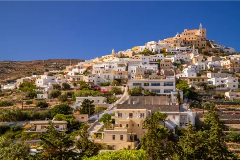
    Andros is one of the rare Greek islands where hiking can be the main reason for the trip rather than a side activity between beaches. Andros Routes has restored and signposted more than 240 km of paths within a historic network of over 500 km, including the certified 100 km Andros Route that crosses the island in ten stages. The trails link villages, monasteries, springs, valleys, archaeological sites and beaches.

    The quality of the network does not make every walk easy. Stone paving, steep descents, summer heat, vegetation and wind can turn a moderate distance into a demanding day. Choose by ascent and terrain, not only kilometres, and check current maintenance notes before setting out.

    Andros hiking at a glance

    RouteDistancePublished level / highlight
    Chora–Lamyra–Panachrados11.5 kmModerate; villages and monastery
    Chora–Livadia–Panachrados6.8 kmModerate; orchards and views
    Chora–Apikia–Vourkoti7 kmModerate; springs and Pythara area
    Chora–Syneti–Ormos Korthi10–12 kmModerate; Dipotamata and south
    Apikia–Gialia–Chora4–6 kmModerate; spring, ravine and beach
    Chora–Livadia circular4.5 kmLight; fertile valley

    The 100 km Andros Route

    The long-distance Andros Route is a continuous path across the island divided into ten practical daily sections. In 2015 it became the first island trail in Europe to receive the Leading Quality Trails – Best of Europe certification from the European hiking movement. That certification matters less as a badge than as evidence that signage and route continuity are taken seriously.

    A full thru-hike needs accommodation planning, luggage strategy and realistic daily stages. Do not assume the 100 km can be improvised after arrival. Some walkers use local transfers to move bags while others build a base-to-base itinerary. If you only have three or four days, select day hikes rather than racing through stages.

    Best hike near Chora: Apikia and Vourkoti

    The 7 km Chora–Apikia–Vourkoti route is a strong introduction to the green central landscape. It includes village environments, springs and a sense of the old transport network. Combine a shorter variant with Pythara if you are not ready for a full stage.

    Because the route changes elevation, do not treat 7 km as an urban 7 km. Start early, carry water and decide how you will return before leaving. The Menites, Apikia and Pythara guide helps build a lighter version.

    Panachrados Monastery routes

    Andros Routes lists two useful approaches from Chora: 11.5 km through Lamyra and 6.8 km through Livadia. Both are moderate and combine village landscapes with the monastery. The shorter distance is not automatically “easy” because ascent, stone and sun remain factors.

    Dress respectfully if entering the monastery and check access expectations. Carry a light layer or scarf rather than arriving in minimal beach clothing. Religious sites are active places, not just trail checkpoints.

    Chora to Korthi through Dipotamata

    The 10–12 km route toward Ormos Korthiou is one of the best walks for understanding the island’s watermill landscape. It passes through terrain where stone paths and old infrastructure are part of the attraction. Arrange a return transfer or bus before starting; a point-to-point hike becomes stressful if you discover at the end that transport has finished.
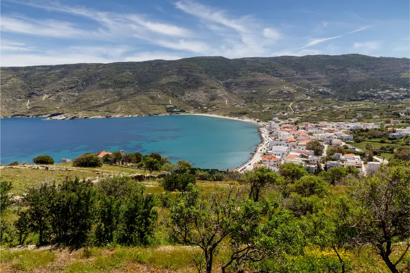
    Greek Islands View Korthiou Town From High Andros Island Cyclades Greece

    The Korthi guide explains how to turn the finish into an overnight stay or a relaxed meal rather than an immediate return.

    Gavrio and Agios Petros hikes

    Northern routes give a different experience: drier slopes, agricultural villages and west-coast views. A March 2026 Andros Routes maintenance hike used an 8 km medium circuit from Gavrio through Ano Agios Petros, the Hellenistic tower and beach. This is an attractive choice for travellers staying near the ferry port or Batsi.

    Greek Islands View Batsi Town From High Andros Island Cyclades Greece

    The ancient tower provides a clear objective, but do not climb on the structure. Use the path as a way to understand the surrounding landscape rather than turning the monument into a summit.

    Trail maintenance and 2026 conditions

    Andros Routes published maintenance work throughout 2026, including vegetation clearing, repaired signs and restored posts after winter damage. This is reassuring, but it also proves why checking current conditions matters. A route that was open last year may have a temporary obstruction after heavy rain, livestock damage or vegetation growth.

    Download route information before leaving Wi-Fi. A GPX track is useful, but it does not replace waymarks and judgement. If signs and the digital line disagree, stop and reassess rather than forcing a route through private land.

    Heat, wind and water

    Summer heat is the main hiking risk. Start at dawn or early morning, avoid exposed midday climbs and carry more water than you expect to drink. Andros has springs, but do not build a safety plan around a spring flowing or being potable unless the route information specifically confirms it.

    Wind can reduce heat stress but create balance problems on exposed ridges. In extreme fire-risk weather, access to certain forest or countryside zones may also be restricted. Follow Civil Protection and municipal announcements.

    Maps and navigation

    Andros Routes sells a dedicated hiking map and publishes route descriptions online. For serious walking, use both a physical or downloaded map and a GPX file. Keep your phone charged and carry a power bank. Tell someone your planned route if walking alone.

    The best hikers on Andros are not the people who collect the most kilometres; they are the people who choose a route appropriate to the day. A shorter 4.5 km circular walk can be the correct decision when heat or wind is strong.

    Best time to visit

    For a trip that mixes villages, walking and beaches, May, June, September and early October are the most balanced periods. The landscape is easier to enjoy on foot, roads and parking are less stressful than in peak August, and the sea is usually part of the day rather than the only reason to travel. July and August bring the strongest holiday atmosphere, more ferry capacity and fully active beach businesses, but they also demand earlier starts, stronger sun protection and more flexible planning around wind.

    Spring can be excellent for hikers because Andros is unusually green for the Cyclades, although winter and spring growth can temporarily obscure sections of old paths before maintenance teams clear them. In 2026 Andros Routes published repeated spring and summer maintenance updates, a useful reminder that even well-marked trails are living infrastructure rather than indoor attractions. Always check the latest route notes if walking is central to the trip.

    Who this part of Andros suits best

    Andros is ideal for experienced walkers, casual hikers who want one or two marked routes, and travellers visiting in spring or autumn. Families can use shorter village and valley walks, while the long-distance Andros Route is better for walkers comfortable with consecutive days on uneven terrain.

    What to carry

    Carry 1.5–2 litres of water per person for a moderate half-day, more in heat; sun protection; a hat; shoes with good grip; a small first-aid kit; charged phone and power bank; offline map/GPX; snacks; and a light wind layer. Trekking poles help on long stone descents.

    Common mistakes to avoid

    The biggest planning error on Andros is underestimating the island because it sits close to Athens. Roads cross steep terrain, villages are separated by valleys and a beach that looks near on a map may require a very different approach road. Build days around one part of the island instead of zigzagging from north to south. The second mistake is assuming the famous Cycladic wind affects every bay equally; conditions can differ sharply by coast, so keep a second beach or walking plan in mind.

    A third mistake is treating the ferry timetable as the only transport decision. The ferry arrives at Gavrio, while Chora is on the opposite side of the island. If you are travelling without a car, the timing of the onward bus or taxi matters. If you drive, check parking at your accommodation and do not assume narrow village lanes are appropriate for through traffic.

    Continue planning your Andros trip

    Use the guides together rather than as separate checklists. Start with the main Andros travel guide and then open the specialist pages that match your route: Andros Travel Guide; Chora Andros Guide; Batsi Andros Guide; Gavrio and Agios Petros Guide; Korthi Andros Guide; Menites, Apikia and Pythara Guide; Ancient Andros Guide. The remaining guides are linked throughout the cluster where they are most relevant, so you can move from a base or beach decision to transport and hiking without rebuilding the itinerary from scratch.

    Useful official sources before you go

    For current destination information I cross-check the Municipality of Andros visitor portal and the Andros Routes project. Trail conditions, museum schedules, ferry services and local transport can change seasonally, so verify time-sensitive details shortly before travel. Route distances and maintenance information are published by Andros Routes.

    Frequently asked questions

    How long is the Andros Route?

    The certified long-distance route is about 100 km and is divided into ten daily sections.
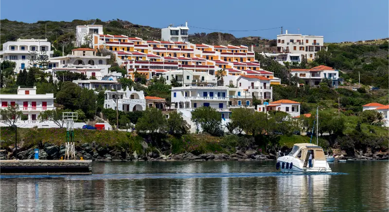
    Embankment City Batsi With Moored Fishing Ships Andros Island Cyclades Greece

    How much of the island trail network is restored?

    Andros Routes states that more than 240 km has been restored and signposted within a historic network of over 500 km.

    What is a good first hike?

    A light Chora–Livadia circular walk or a shorter Apikia/Pythara plan is a good introduction before a longer point-to-point route.

    Can I hike Andros in August?

    Yes, but start very early, choose shorter routes and avoid exposed midday walking.

    Do I need a guide?

    Not on every marked route, but a guide adds value for navigation, history and remote sections, especially if you are not an experienced independent hiker.

    Final planning advice

    Andros rewards a slower plan. Choose a base that makes your mornings easy, group nearby villages and beaches into the same day, and leave room for weather. The island is varied enough that a windy beach day can become a museum, village or hiking day without feeling like a compromise. That flexibility is one of the reasons Andros works so well for repeat visits as well as a first Cyclades trip.

  • Voulisma and Istro Beaches Guide: Swimming, Parking and Agios Nikolaos Day Trip

    Voulisma and Istro Beaches Guide: Swimming, Parking and Agios Nikolaos Day Trip

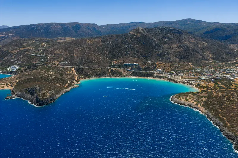
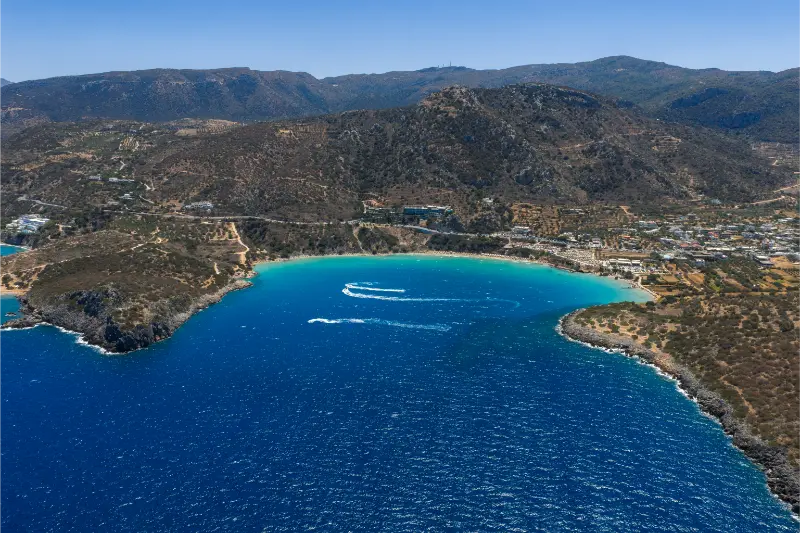
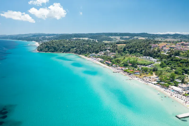
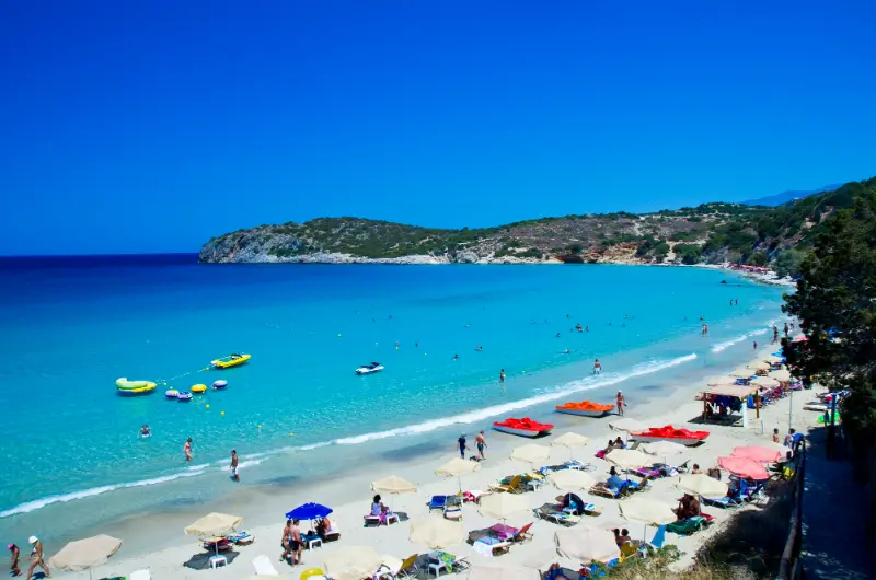
    Voulisma is one of the beaches most often shown in photographs of eastern Crete: bright water, pale sand and a curved bay near the village of Istro. The wider area has several beaches rather than one single strip, which is useful because wind, crowding and parking conditions can vary from cove to cove.

    Beach Of Voulisma At Crete Greece

    This is an easy half-day or full-day excursion from Agios Nikolaos. The key is not to arrive at noon expecting an empty beach. Start early, choose the cove that suits the day and leave enough time for lunch in Istro or Kalo Chorio.

    Quick planning notes

    • Eastern Crete rewards early starts because archaeological sites, gorges and remote beaches are more comfortable before peak afternoon heat.
    • A rental car is the most practical way to connect villages, trailheads and beaches; public transport is useful on selected routes but not for every remote stop.
    • Do not estimate driving time by kilometres alone. Coastal and mountain roads can be winding, narrow and slower than expected.
    • Carry water, sun protection and offline maps whenever you leave the main resort towns.
    • Check current monument hours, protected-area restrictions, fire-risk closures and boat conditions close to the day of travel.
    • Choose one major activity and one softer stop per day rather than trying to collect every beach and archaeological site.

    Why this place belongs in an East Crete itinerary

    East Crete feels different from the better-known route between Chania and Heraklion. Distances are not enormous, but the landscape is more open, services become thinner and the journey often matters as much as the destination. That is exactly why a focused stop here deserves its own article rather than a paragraph inside a generic Crete itinerary.

    The best way to use this guide is to connect it with nearby places instead of treating it as an isolated pin. A coastal village can be paired with archaeology, a gorge can finish with lunch beside the sea, and a beach day can include a monastery or mountain village. Keep the combinations logical and leave enough margin for heat, wind and slow roads.

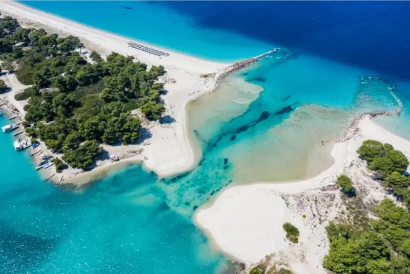
    Aerial View Voulisma Beach Surrounding Hills Crete Greece

    What to see and do

    Voulisma Beach

    Voulisma is the headline bay and usually the busiest. Organised sections provide sunbeds and basic services in season, while the water colour can be spectacular in calm conditions. Arrive early for easier parking and a better choice of space.

    Practical tip: for voulisma beach, check the exact access conditions on the day, especially in high summer. Park only where permitted, avoid blocking narrow roads, and carry enough water for the time you expect to spend away from the car. If conditions are poor, switch to a village, museum or easier beach rather than forcing the original plan.

    Golden Beach and nearby coves

    The Istro coastline includes several adjacent beaches with different levels of organisation and exposure. If Voulisma is crowded, a nearby cove may feel much more relaxed. Walk or drive carefully between them rather than assuming one famous beach is the only option.

    Aerial View Voulisma Beach Turquoise Waters Crete Greece

    Practical tip: for golden beach and nearby coves, check the exact access conditions on the day, especially in high summer. Park only where permitted, avoid blocking narrow roads, and carry enough water for the time you expect to spend away from the car. If conditions are poor, switch to a village, museum or easier beach rather than forcing the original plan.

    Wind and sea conditions

    A beach that looks calm online can change completely with wind direction. Families should judge the actual waves before settling in. If the sea is rough, use the day for Agios Nikolaos, Kritsa or an archaeological stop rather than forcing a swim because you planned it in advance.

    Practical tip: for wind and sea conditions, check the exact access conditions on the day, especially in high summer. Park only where permitted, avoid blocking narrow roads, and carry enough water for the time you expect to spend away from the car. If conditions are poor, switch to a village, museum or easier beach rather than forcing the original plan.

    Parking and access

    Roadside and designated parking can fill quickly in peak season. Do not block narrow access or park on vegetation. Bring only what you can comfortably carry down to the beach because some sections involve steps or slopes.

    Practical tip: for parking and access, check the exact access conditions on the day, especially in high summer. Park only where permitted, avoid blocking narrow roads, and carry enough water for the time you expect to spend away from the car. If conditions are poor, switch to a village, museum or easier beach rather than forcing the original plan.

    Lunch in Istro or Kalo Chorio

    Leaving the beach for lunch is often better than spending the entire day on a sunbed. The villages behind the coast have tavernas and a more local rhythm. A proper lunch also gives you a useful break from midday sun.

    Practical tip: for lunch in istro or kalo chorio, check the exact access conditions on the day, especially in high summer. Park only where permitted, avoid blocking narrow roads, and carry enough water for the time you expect to spend away from the car. If conditions are poor, switch to a village, museum or easier beach rather than forcing the original plan.

    Combine with Agios Nikolaos or Kritsa

    If you do not want a full beach day, swim in the morning and spend late afternoon around Lake Voulismeni in Agios Nikolaos or in Kritsa. This creates a better-balanced day than trying to visit several beaches in a row.

    Practical tip: for combine with agios nikolaos or kritsa, check the exact access conditions on the day, especially in high summer. Park only where permitted, avoid blocking narrow roads, and carry enough water for the time you expect to spend away from the car. If conditions are poor, switch to a village, museum or easier beach rather than forcing the original plan.

    A realistic way to structure the day

    1. Arrive at Voulisma before the main late-morning crowd.
    2. Swim for two or three hours and reassess wind conditions.
    3. Lunch in Istro or Kalo Chorio.
    4. Choose a second nearby cove or return to the same beach.
    5. Finish in Agios Nikolaos for an evening walk around the lake.

    This sequence deliberately leaves some flexibility. In eastern Crete, a strong north wind, a late-running lunch or an unexpected road closure can change a day quickly. Protect the one experience you care about most and treat the rest as optional. That produces a much better trip than driving aggressively between a list of saved map pins.

    Where to stay

    Istro works well for travellers who want a beach-focused stay close to Agios Nikolaos without sleeping in the town. Agios Nikolaos is better for nightlife, shopping and transport. A rental car gives the most flexibility for comparing beaches and adding inland stops.

    If you are comparing accommodation, check current places to stay in Istro on Booking.com. For this part of Crete I would prioritise a base that reduces evening driving and makes the next morning’s first stop easy.

    What to eat

    Beach bars are convenient but should not be your only plan. Istro and Kalo Chorio have tavernas for grilled meat, salads, fish, local cheese and Cretan dishes. Keep lunch light if you plan to swim again and drink more water than you think you need in midsummer.

    Across Lassithi, look for dishes that reflect local agriculture rather than only the pan-Greek classics: good olive oil, seasonal vegetables, local cheese, herbs, goat or lamb inland and seafood on the coast. Ask what is local and what was cooked that day. A long lunch is also a practical heat-management strategy on an active summer road trip.
    Getting there and getting around

    A car gives the most freedom in eastern Crete. Agios Nikolaos, Sitia and Ierapetra have bus connections, but trailheads, archaeological sites and remote beaches may require careful timetable planning or a taxi. If you are not driving, choose one of the larger towns as a base and build day trips around transport that is actually operating on your dates.

    Fuel before remote loops, especially toward Zakros and Xerokampos. Keep offline navigation available and avoid scheduling a long mountain drive immediately before a flight or ferry. Night driving on unfamiliar narrow roads is possible, but it is much less relaxing than reaching your base before dark.

    Best time to visit

    June and September are ideal for warm water and easier parking. July and August bring the fullest services and the biggest crowds. May and October can be lovely on warm days, though water temperatures and beach-bar opening vary.

    For hiking, archaeology and road trips, shoulder season is usually easier than peak summer. For swimming, June through September gives the most reliable warm-sea experience. Fire-risk restrictions can affect access to natural areas during very hot or windy periods, so official local announcements matter more than a fixed annual calendar.

    How to connect this stop with nearby East Crete

    Useful next reads are Agios Nikolaos guide; Kritsa village guide; Best beaches in East Crete. Build the route geographically so you are not repeatedly crossing the same mountain roads. A two- or three-night base usually creates more value than changing hotels every day.

    Common mistakes

    • Treating every remote beach as a quick roadside stop and spending more time parking than swimming.
    • Starting an exposed hike late in the morning during a heatwave.
    • Relying on an old blog post for archaeological opening hours or protected-area access rules.
    • Assuming a short map distance means a fast drive on the far-eastern road network.
    • Leaving groceries, fuel and water until after reaching a very small coastal settlement.
    • Trying to combine Vai, Zakros, Xerokampos and Sitia in a single rushed day.

    Frequently asked questions

    Do I need a rental car?

    For most of the places covered in this East Crete cluster, a car is the easiest option. If you do not drive, base yourself in Agios Nikolaos, Sitia or Ierapetra and use buses, taxis and organised excursions for selected days.

    How many nights should I allow?

    For a single stop, one or two nights may be enough. For the wider East Crete region, five to seven nights creates a much better pace because the far east is too spread out for repeated day trips from Heraklion.

    Is East Crete good with children?

    Yes, especially around sheltered beaches and the larger towns. Keep archaeological visits short, avoid long exposed hikes in midday heat and choose accommodation that makes dinner and swimming easy.

    Can I visit outside summer?

    Yes. Spring and autumn are excellent for walking, archaeology and road trips. Winter is much quieter and some beach businesses close, but larger towns remain active and the landscape can be very rewarding.

    What changes most from year to year?

    Boat services, archaeological hours, protected-area restrictions, road works and seasonal beach facilities are the details most likely to change. Recheck them shortly before travel.

    Useful official source

    For details that can change, use Visit Greece – Agios Nikolaos and recheck opening hours, tickets, access restrictions, weather and transport shortly before departure.

    Final advice

    Eastern Crete is at its best when you stop trying to see it like a checklist. Give the road time, choose fewer beaches, start important hikes early and let meals and villages slow the day down. The reward is a version of Crete that feels spacious, varied and far less compressed than the classic first-time route.

  • Rhodes Road Trip: A Realistic 7-Day Itinerary Around the Island

    Rhodes Road Trip: A Realistic 7-Day Itinerary Around the Island

    A Rhodes road trip works best when you stop trying to cross the island every day. The classic mistake is staying in the north and building daily out-and-back drives to Lindos, Prasonisi, Kamiros and Monolithos. A better plan groups the island into geographic zones: Rhodes Town and the north, the central east coast, Lindos and the south-east, the west coast, and the far south. This 7-day itinerary uses that logic.

    You can follow the route from one hotel, but a split stay makes it more relaxed. Three nights around Rhodes Town followed by four nights on the east or south-east coast reduces repeated driving and gives you different evenings. If you prefer not to change hotels, keep the same day order but accept longer return journeys.

    Day 1: Rhodes Town and the medieval city

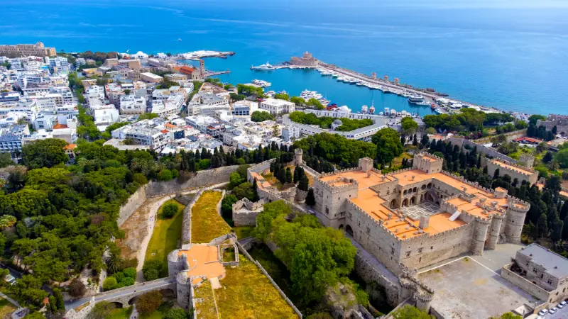
    Do not rent a car just to leave it parked on your first day. Walk the medieval city, the harbour and the modern centre. Use my Rhodes Old Town guide for the walls, Palace of the Grand Master and Street of the Knights. An evening in town is a much better introduction than landing and immediately driving south.

    Day 2: Kallithea, Faliraki and Anthony Quinn Bay

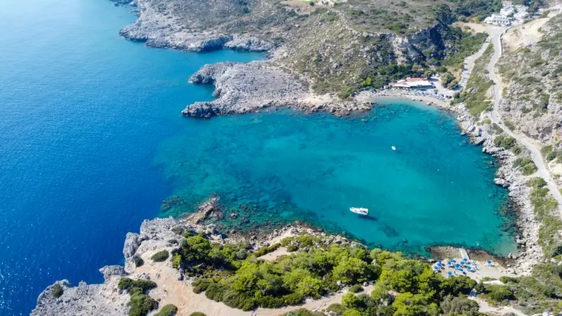
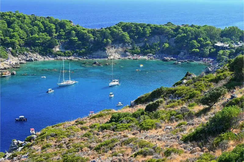
    Pick up the car and follow the north-east coast. Start at Kallithea Springs while the architecture is pleasant to walk, then continue to Faliraki. In the late morning or afternoon, use Anthony Quinn Bay and nearby Ladiko for swimming. The distances are short, so you spend more time outside the car.

    Ladiko Beach Anthony Quinn Bay Aerial Panoramic View Rhodes Island Greece Drone Photography

    Day 3: Tsambika, Stegna and Lindos

    Drive south early. If you want the Tsambika monastery viewpoint, tackle the climb before the hottest hours; otherwise go directly to Tsambika Beach. Have lunch or an afternoon swim in Stegna, then reach Lindos later when the village begins to cool. If the acropolis is your priority, reverse the order and enter as early as possible.

    Day 4: Filerimos, Ancient Kamiros and the west coast

    This is the history-and-landscape day. Start on Filerimos Hill, then continue south-west to Ancient Kamiros. Have lunch away from the major resort corridor and use the late afternoon for a west-coast viewpoint or village. The west feels very different from the beach resorts and deserves its own day.

    Day 5: Embonas, Siana and Monolithos

    Move into the interior and south-west. The road through mountain villages changes the scenery again. Leave time for Monolithos Castle when the light is softer. If you want wine or local products in Embonas, remember that the driver should not drink; tasting and driving are a poor combination.

    Day 6: the far south and Prasonisi

    Make this the longest driving day. Head toward the southern tip and Prasonisi. The objective is the landscape and the wind-sports atmosphere rather than ticking off another swimming beach. Read conditions carefully and keep enough daylight for the return journey. If you are staying in the south-east, this day becomes much easier.

    Peaceful Seaside Scenery Rhodes Island Greece Clear Water Relaxing Atmosphere

    Day 7: choose your own Rhodes

    Do not pre-book a frantic final circuit. Use the last day to repeat a favourite beach, visit Seven Springs, return to Rhodes Town for shopping, or spend a long lunch in a village. The flexible day absorbs weather changes and gives the trip breathing room. My Seven Springs guide and Rhodes beaches guide are useful for choosing based on conditions.

    Road-trip planning that makes a difference

    A good Rhodes itinerary depends more on logistics than on discovering secret places.

    Rent the right size of car

    A small car is usually easier in village streets and busy parking areas. Choose comfort and insurance clarity over unnecessary size.

    Do not change coasts twice a day

    The island is manageable, but repeated cross-island driving wastes the hours when you could be swimming or exploring. Keep each day geographically coherent.

    Start cultural sites early

    Lindos, Kamiros and other exposed places are easier before midday heat. Beaches can wait until later.

    Keep fuel and water in mind

    Services are widespread in populated areas, but south-west and far-south loops are easier when you refuel before you need to and carry drinking water.

    Treat wind as part of the itinerary

    A windy day is not automatically a lost beach day. Shift between coasts, use a cultural stop or choose a more sheltered bay.

    Where to stay for this route

    For a first trip, I like a split between Rhodes Town and the east coast. Rhodes Town gives you walkable evenings and culture; Faliraki or Stegna gives easy beach access; Lindos and the south-east shorten the long southern drives. The “best” split depends on whether you care more about nightlife, beaches or village atmosphere.

    Driving and safety

    Road quality varies from main coastal roads to narrower village approaches. Drive conservatively, avoid alcohol if you are behind the wheel and do not let navigation apps push you into tiny lanes simply because they look shorter. Park without blocking access, especially near beaches and villages. At viewpoints, use proper pull-offs rather than stopping in the carriageway.

    Frequently asked questions

    How many days do you need for a Rhodes road trip?

    Seven days gives a strong first overview without turning every day into a race. Five days can work if you skip either the far south or the west-coast loop.

    Rhodes Old Town With Palace Grand Master Aerial Panoramic View Rhodes Island Greece

    Do I need to change hotels?

    No, but a split stay reduces repeated driving. Rhodes Town plus an east- or south-east-coast base is a practical combination.

    Can I road-trip Rhodes without a car?

    You can see many major places using buses and excursions, but a true flexible loop is much easier with a rental car.

    What is the longest driving day?

    The far south to Prasonisi is the day most likely to feel long from Rhodes Town. Staying farther south changes the balance considerably.

    What should I skip if I only have five days?

    Keep Rhodes Town, Lindos/east coast and one west-coast day. Choose between the far south and a slower beach/nature day based on your interests.

    Final thoughts

    Rhodes is large enough to reward a road trip but compact enough that you do not need to change hotels every night. Group the island by coast, keep one flexible day and let beaches fill the spaces between the major historic sites. The result feels like a holiday rather than a driving challenge.

    Extra planning notes before you go

    Rhodes is easiest to enjoy when you separate fixed facts from decisions that should be made on the day. Opening hours, bus schedules, sea conditions, event closures and parking pressure can all change. Recheck the official source for any attraction that would ruin your day if it were closed, and keep one nearby alternative in mind. This is especially important in the shoulder season, when a place can be open while transport or beach services operate on a reduced timetable.

    If you are driving, save offline maps before leaving your accommodation but do not follow every shortcut blindly. Village lanes can narrow quickly, and the main signed road is often less stressful even if navigation software shows a slightly longer journey. In beach areas, park only where access remains clear for residents and emergency vehicles. A few extra minutes of walking is better than creating a problem at a crowded cove.

    Finally, give yourself permission to drop a stop. The most memorable days on Rhodes often come from staying longer at one beach, village or archaeological site because conditions are good. A travel guide should help you make choices, not force you to complete every line. Build the day around one priority, one natural companion stop and one optional extra; that structure works in almost every part of the island.

    Extra planning notes before you go

    Rhodes is easiest to enjoy when you separate fixed facts from decisions that should be made on the day. Opening hours, bus schedules, sea conditions, event closures and parking pressure can all change. Recheck the official source for any attraction that would ruin your day if it were closed, and keep one nearby alternative in mind. This is especially important in the shoulder season, when a place can be open while transport or beach services operate on a reduced timetable.

    If you are driving, save offline maps before leaving your accommodation but do not follow every shortcut blindly. Village lanes can narrow quickly, and the main signed road is often less stressful even if navigation software shows a slightly longer journey. In beach areas, park only where access remains clear for residents and emergency vehicles. A few extra minutes of walking is better than creating a problem at a crowded cove.

    Finally, give yourself permission to drop a stop. The most memorable days on Rhodes often come from staying longer at one beach, village or archaeological site because conditions are good. A travel guide should help you make choices, not force you to complete every line. Build the day around one priority, one natural companion stop and one optional extra; that structure works in almost every part of the island.

    Extra planning notes before you go

    Rhodes is easiest to enjoy when you separate fixed facts from decisions that should be made on the day. Opening hours, bus schedules, sea conditions, event closures and parking pressure can all change. Recheck the official source for any attraction that would ruin your day if it were closed, and keep one nearby alternative in mind. This is especially important in the shoulder season, when a place can be open while transport or beach services operate on a reduced timetable.

    If you are driving, save offline maps before leaving your accommodation but do not follow every shortcut blindly. Village lanes can narrow quickly, and the main signed road is often less stressful even if navigation software shows a slightly longer journey. In beach areas, park only where access remains clear for residents and emergency vehicles. A few extra minutes of walking is better than creating a problem at a crowded cove.

    Finally, give yourself permission to drop a stop. The most memorable days on Rhodes often come from staying longer at one beach, village or archaeological site because conditions are good. A travel guide should help you make choices, not force you to complete every line. Build the day around one priority, one natural companion stop and one optional extra; that structure works in almost every part of the island.

  • Patmos Travel Guide: Chora, Monastery, Beaches and a 4-Day Itinerary

    Patmos Travel Guide: Chora, Monastery, Beaches and a 4-Day Itinerary

    Patmos is one of the most culturally distinctive islands in the Dodecanese. Its spiritual importance is internationally recognised: UNESCO lists the historic centre of Chora together with the Monastery of Saint John the Theologian and the Cave of the Apocalypse as a World Heritage property. Yet Patmos is not only a pilgrimage destination. It also has elegant villages, quiet coves and a relaxed summer atmosphere.

    The island works best when you allow religious heritage and ordinary holiday time to coexist. Spend a morning in Chora and the monastery, then swim in the afternoon and eat by the harbour in Skala. That balance prevents the trip from becoming either a rushed church tour or a beach holiday that ignores what makes Patmos unique. For a wider Dodecanese route, see my Kos guide and Symi guide.

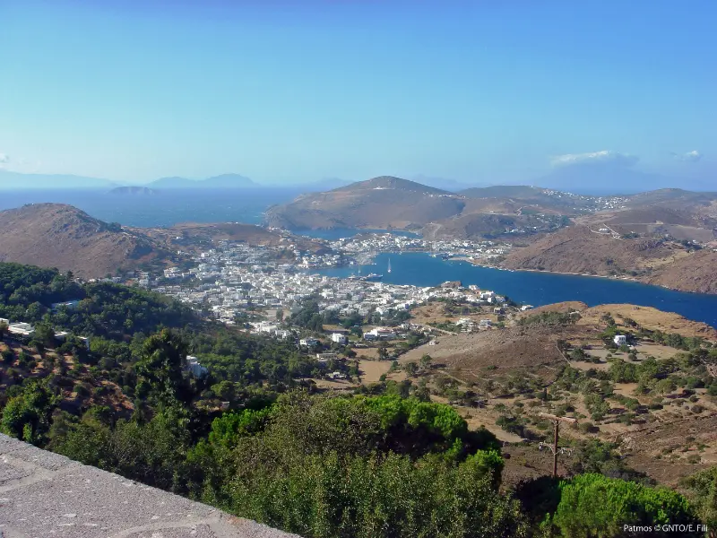
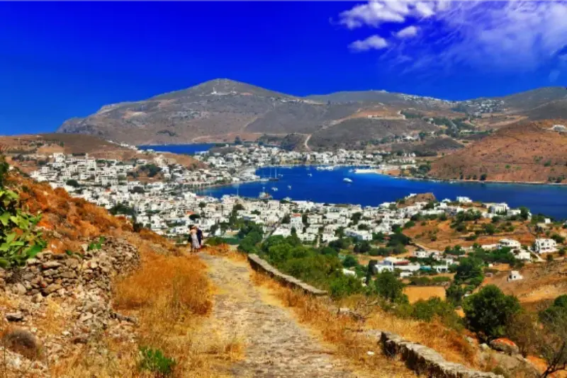
    Patmos

    Understanding the UNESCO-listed landscape

    UNESCO’s property brings together Chora, the monastery and the Cave of the Apocalypse because their historical and spiritual relationship matters as much as each individual building. The monastery was founded in the late eleventh century and dominates the island visually from its hilltop position.

    Approach the area with time and respectful clothing. This is a living religious environment. Opening hours, access and dress expectations can change, so verify official information shortly before your visit rather than relying on an old itinerary.

    Chora

    Patmos Chora is one of the most atmospheric settlements in the Dodecanese, with whitewashed houses, small squares and lanes wrapped around the monastery. It is beautiful during the day but especially compelling in the evening when temperatures fall and the stone streets quiet down.

    Some historic houses and cultural spaces have limited opening periods. I treat them as bonuses rather than structuring the entire day around a single interior. The village itself is the main experience.

    The Cave of the Apocalypse

    Tradition identifies the cave as the place where Saint John received the visions recorded in the Book of Revelation. Whether you visit as a believer, historian or curious traveller, the space deserves quiet behaviour.

    Combine the cave with Chora because they form one cultural route. The road between Skala and Chora makes logistics straightforward by bus, taxi or car, but walking in midday heat is not something I recommend casually.

    Skala as a base

    Skala is the main port and the island’s practical centre. It has restaurants, shops, transport and ferry connections, which makes it a convenient first base. The atmosphere is busier than Chora but never on the scale of major resort islands.

    Staying in Chora gives more beauty and evening atmosphere, while Skala makes luggage and transport easier. Couples often prefer Chora; first-time island hoppers may find Skala simpler.

    Best beaches

    Patmos beaches are generally smaller and more understated than the huge sandy bays of islands such as Naxos. Psili Ammos is among the best known, while Agriolivado, Kambos, Lambi and Grikos offer different combinations of access and facilities.

    Patmos Greece

    Wind and sea conditions should guide the day. Ask locally which coast is most sheltered. If reaching a beach requires a walk, carry water and do not assume shade will be available.

    A four-day Patmos itinerary

    Day one: arrive in Skala and settle in with a waterfront walk. Day two: visit the Cave of the Apocalypse and spend several hours in Chora and the monastery, returning for sunset or dinner. Day three: choose two beaches or one long beach day. Day four: explore Grikos, another coastal village or take a short boat trip depending on conditions.

    With six days, add a completely slow day and revisit Chora after dark. Patmos improves when religious sites are not squeezed between ferry arrival and departure.

    Getting around

    Buses connect Skala with Chora and several beach areas in season. Taxis are useful for evening returns. A rental car or scooter adds flexibility but is not essential for a four-day stay.

    Patmos has no commercial airport, so most visitors arrive by ferry. That makes schedule planning important, especially if you are connecting to an international flight. Build buffer time into the end of the trip.

    Religious etiquette

    Carry clothing that covers shoulders and knees when visiting major religious sites and follow posted rules on photography. Silence phones and avoid blocking worshippers while taking pictures. These small gestures matter.

    Patmos attracts pilgrims from many countries. A respectful visitor does not need to share the religious beliefs of the site, only to recognise that other people may be there for prayer rather than tourism.

    Patmos Greece

    Best time to visit

    May, June and September are particularly attractive for combining sightseeing, walking and swimming. July and August are warmer and busier, with stronger ferry services. Easter has deep religious significance but requires very early accommodation planning.

    For quiet travel, October can be beautiful if weather and ferry schedules cooperate. Some seasonal businesses will already be reducing hours, so verify practical details.

    Who Patmos suits

    Patmos is excellent for travellers interested in culture, religion, architecture and slower island life. Couples and solo travellers often appreciate the evening atmosphere of Chora, while families can build easy days around beaches and short transfers.

    If your priority is nightlife or enormous sandy beaches, Patmos may feel too restrained. If you want a place where history is still present in daily life, it is one of the strongest choices in the Aegean.

    Frequently asked questions

    How many days do I need in Patmos?

    Four days is a good first visit. Five or six days lets you balance heritage sites with beaches at a much slower pace.

    Does Patmos have an airport?

    No commercial airport. Most visitors arrive by ferry, often via another Dodecanese island or Piraeus depending on the route.

    Is Patmos only for religious travellers?

    No. Its religious heritage is central, but the island also offers beaches, walking, architecture, food and relaxed coastal villages.

    Is Patmos UNESCO listed?

    Yes. UNESCO lists the historic centre of Chora with the Monastery of Saint John the Theologian and the Cave of the Apocalypse.

    Planning Patmos in practice

    Because Patmos has no commercial airport, ferry planning comes first. Check which route fits your wider trip before choosing non-refundable hotel dates. Connections through Kos, Leros, Rhodes or Piraeus vary by season, and the fastest option on one date may not exist on another.

    Keep religious visits to cooler morning hours when possible. Chora’s lanes and monastery areas involve slopes, and respectful clothing can feel warm in summer. Carry a light layer or scarf that meets dress rules without forcing you to wear heavy clothing all day.

    The island’s spiritual importance can make some visitors feel they need to see every monastery. You do not. Choose the UNESCO core sites, then allow time for beaches and ordinary village life. This balance gives a more honest impression of modern Patmos.

    For departure day, avoid scheduling a remote beach immediately before the ferry. Stay within easy reach of Skala, have a relaxed meal and arrive at the port with margin. Island travel becomes much less stressful when the final hours are simple.

    Patmos is particularly rewarding for readers and history lovers because the landscape is tied to texts and long religious traditions. Reading a short history before arrival makes the monastery and cave far more intelligible.

    Travel days also deserve their own space in the itinerary. Leave time for breakfast, packing, transfers and delays instead of counting a ferry or drive as invisible time. This simple adjustment makes the entire Greece trip feel calmer and more realistic.

    Patmos is particularly rewarding for readers and history lovers because the landscape is tied to texts and long religious traditions. Reading a short history before arrival makes the monastery and cave far more intelligible.

    Travel days also deserve their own space in the itinerary. Leave time for breakfast, packing, transfers and delays instead of counting a ferry or drive as invisible time. This simple adjustment makes the entire Greece trip feel calmer and more realistic.

    Patmos is particularly rewarding for readers and history lovers because the landscape is tied to texts and long religious traditions. Reading a short history before arrival makes the monastery and cave far more intelligible.

    Travel days also deserve their own space in the itinerary. Leave time for breakfast, packing, transfers and delays instead of counting a ferry or drive as invisible time. This simple adjustment makes the entire Greece trip feel calmer and more realistic.

    Patmos is particularly rewarding for readers and history lovers because the landscape is tied to texts and long religious traditions. Reading a short history before arrival makes the monastery and cave far more intelligible.

    Travel days also deserve their own space in the itinerary. Leave time for breakfast, packing, transfers and delays instead of counting a ferry or drive as invisible time. This simple adjustment makes the entire Greece trip feel calmer and more realistic.

    Patmos is particularly rewarding for readers and history lovers because the landscape is tied to texts and long religious traditions. Reading a short history before arrival makes the monastery and cave far more intelligible.

    Patmos is particularly rewarding for readers and history lovers because the landscape is tied to texts and long religious traditions. Reading a short history before arrival makes the monastery and cave far more intelligible.

    More detailed Dodecanese guides

    Continue with Lipsi; Leros for more detailed planning.

    More in-depth Patmos guides

    Continue planning with Skala Patmos Guide; Chora Patmos Guide; Monastery of Saint John Patmos Guide; Cave of the Apocalypse Patmos Guide; Grikos and Petra Patmos Guide; Best Beaches in Patmos; Patmos Hiking Guide; Patmos Without a Car; Patmos with Kids; Where to Stay in Patmos.

  • Kalymnos Climbing Guide: Best Areas, Seasons, Grades, Safety and Beginner Tips

    Kalymnos Climbing Guide: Best Areas, Seasons, Grades, Safety and Beginner Tips

    Kalymnos is one of the rare places where climbing is not a niche activity hidden from the rest of the destination. The cliffs rise directly behind villages, climbers eat breakfast beside beach holidaymakers, and rest days can mean swimming in clear water or taking a small boat to Telendos. That combination is why the island works as a climbing holiday rather than only a climbing area.

    Greece Kalymnos Island Charming Vlichadia Village Beach With Crystal Sea

    The Municipality of Kalymnos describes almost 2,500 well-equipped sport routes for a wide range of levels, while Visit Greece highlights 77 organised climbing areas. Numbers change as routes are developed, rebolted or retired, so the important point is scale rather than memorising a total. You can build a week around different styles without spending half the trip in a car.

    Kalymnos climbing at a glance

    Planning pointPractical approach
    StyleMostly sport climbing, from easier slabs and technical walls to steep tufa and cave climbing; some multipitch exists.
    Main baseMassouri, Myrties and Armeos give the easiest access to many sectors and climber services.
    Best seasonSpring and autumn are generally most comfortable; Visit Greece specifically highlights September.
    BeginnersUse a qualified local instructor rather than treating bolts as a substitute for experience.
    SafetyCheck current route information, equipment, bolt condition, weather, approach and descent before every session.

    Why the limestone is special

    Kalymnos limestone offers unusual variety: slabs, vertical faces, pockets, tufas, stalactites and huge overhanging caves. Grande Grotta is the visual icon, but reducing the island to one cave misses the point. The best week mixes styles and aspects so you can adapt to weather and avoid repeatedly loading the same muscles.

    Route grades are not a promise of identical difficulty from sector to sector. Rock polish, length, exposure and style can change how a route feels. Warm up below your limit on the first day, especially if you have travelled, and learn the local feel before chasing a grade.

    Where to base yourself

    Massouri and nearby Armeos are the obvious climbing base because many sectors sit above the west-coast road and climbing services are concentrated there. Myrties works well if you also want Telendos access. A scooter or car expands the number of sectors you can reach, but a surprising amount of climbing is possible from a west-coast base without driving every day.

    If you are travelling with a non-climbing partner, this area is also the easiest compromise: beaches, restaurants, sunset and Telendos provide independent activities. Read Massouri and Myrties before choosing accommodation based only on distance to a crag.

    Best time for a climbing trip

    Visit Greece identifies September as an ideal month because climbing weather can be excellent while the sea remains pleasant for swimming. October and parts of spring are also popular because active days are more comfortable than in peak summer. Winter climbing can be possible, but accommodation, transport and restaurant choices may be quieter.

    In hot weather, aspect is everything. Climb early, seek shade, or switch the session to a different part of the island rather than pushing through direct sun. Heat affects judgment, hydration and skin as much as performance. Wind can be helpful on a hot wall but dangerous on exposed approaches or descents.

    Beginners: how to start safely

    If you have never sport climbed outdoors, Kalymnos is a wonderful place to learn precisely because qualified local instructors and established infrastructure exist. Book instruction rather than asking a more experienced holiday friend to improvise. Outdoor belaying, clipping, lowering, route finding and rockfall management are skills, not automatic extensions of indoor climbing.

    A good beginner day should feel conservative. Expect instruction, an equipment check, a short approach and routes chosen for learning rather than ego. Ask what is included, what qualification the guide holds, and how the group handles rescue or weather changes.

    Equipment and route information

    Bring personal equipment you trust, but verify rope length and number of quickdraws against current route information. Long sport routes can require more rope than a home crag, and lowering accidents happen when climbers assume every pitch fits their setup. Tie a stopper knot in the free end of the rope and communicate before lowering.

    Use current guidebooks or reliable updated resources, because routes can be rebolted, damaged or temporarily discouraged. Do not rely on an old screenshot. Inspect fixed hardware as you climb and retreat if something is uncertain. Salt air and exposure are reasons to respect maintenance, even on a famous crag.

    Rockfall, goats and people below

    A well-bolted sport route is not the same as an indoor wall. Loose rock can exist, goats can dislodge stones, and climbers above you can drop equipment. Helmets are a sensible default for climber and belayer, and bags should be organised away from the fall line.

    If a sector is busy, do not spread ropes and gear across every flat space. Keep access paths clear and avoid shouting unnecessarily near homes, chapels or quiet valleys. The island’s climbing future depends partly on visitors behaving like guests rather than owners of the cliff.

    Rescue and emergency planning

    The municipality notes a local rescue team able to assist in climbing and rough-terrain incidents. That is reassuring infrastructure, not permission to take bigger risks. Save emergency contacts, know the name of your sector, and make sure someone can explain how to reach you.

    Travel insurance should explicitly cover outdoor climbing at the grade and style you plan to do, including rescue and medical treatment. European health cover or ordinary travel insurance may not replace specialist activity cover. Carry identification and enough battery to communicate.

    Rest days that actually help

    The advantage of Kalymnos is that rest does not have to mean boredom. Swim on the west coast, visit the Archaeological and Maritime museums in Pothia, take the boat to Telendos, or explore Vathy. A genuine rest day often improves the second half of a climbing week more than another “easy” session that becomes five pitches.

    Kalymnos Pothia Greece

    If fingers or elbows are painful rather than simply tired, stop. The island will still be there tomorrow. Build the trip around memorable days, not the maximum possible route count.

    A balanced five-day climbing rhythm

    • Day 1: easy sector, technique, conservative grades and equipment check.
    • Day 2: fuller climbing day on a style that suits the conditions.
    • Day 3: rest day with Telendos, Pothia or a beach.
    • Day 4: different sector or guided skill-building day.
    • Day 5: favourite style, but finish before fatigue turns into poor decisions.

    When to go and how to use the day

    Kalymnos works in more than one season, but the ideal timing depends on what you want to do. Summer is straightforward for swimming and long evenings, yet exposed walks and limestone cliffs can become very hot in the middle of the day. Spring and autumn are better for active itineraries, and Visit Greece specifically highlights September as an excellent climbing month because the rock conditions and sea temperatures can work well together. Wind can change swimming, boating and climbing comfort from one coast to another, so keep at least one day flexible.

    In July and August I would front-load anything strenuous: walk, climb or explore archaeological sites early, take a long lunch or swim around midday, and return outside later in the afternoon. In the shoulder season the same itinerary can be more continuous, but daylight and boat frequency may be reduced. The practical habit that improves almost every Kalymnos trip is to check wind and sea conditions before committing to a remote beach or a boat-based day.

    What to pack for this part of Kalymnos

    • Shoes with grip rather than relying only on beach sandals; limestone paths and village steps can be polished or loose.
    • A refillable water bottle and more water than you expect for exposed walks, beaches without services and climbing approaches.
    • Sun protection that works while moving: hat, high-SPF sunscreen and a light layer for shoulders.
    • Swim shoes if you dislike pebbles or rocky entries; many of the island’s most attractive coves are not soft-sand beaches.
    • A small dry bag or waterproof phone pouch for caiques, sea taxis and beach days.
    • A light layer for breezy evenings, especially outside peak summer or after sunset on the west coast.

    A realistic planning rule

    For a climbing holiday, avoid building a day that depends on every connection, meal and swim happening at an exact minute. Kalymnos is compact, but its mountain spine, indented coast and seasonal transport mean that a short distance can still require a deliberate route. Two strong experiences plus an unhurried meal usually create a better day than five photo stops. This is especially true if one element depends on wind, a boat, a museum timetable or a trail that you have not walked before.

    It is also worth separating “possible” from “comfortable.” You may be able to combine a morning in Pothia, a west-coast swim, Telendos and a sunset dinner, but that does not mean every traveller will enjoy the transfers. Families, slower walkers and anyone visiting in extreme heat should reduce the number of moves. Climbers should treat approach walks and recovery time as part of the schedule rather than invisible minutes between sightseeing stops.

    Continue planning Kalymnos

    Build the rest of the trip with Pothia Kalymnos Guide; Massouri and Myrties Kalymnos Guide; Telendos Island Guide; Vathy and Rina Kalymnos Guide; Best Beaches in Kalymnos; Kalymnos Hiking Guide; Kalymnos Diving and Sponge Heritage Guide; Kalymnos Without a Car; Where to Stay in Kalymnos. Start with the Kalymnos Travel Guide if you want the broader five-day overview before choosing detailed day plans.

    Kalymnos climbing FAQ

    How many climbing routes are on Kalymnos?

    The Municipality of Kalymnos describes almost 2,500 equipped sport routes, while route totals evolve as development and maintenance continue. Use current local information rather than treating any number as permanent.

    Is Kalymnos good for beginner climbers?

    Yes, if you learn with a qualified local instructor. The island has routes across a wide range of levels, but outdoor sport climbing still requires proper skills and judgment.

    What is the best month for climbing?

    Visit Greece specifically highlights September. Spring and autumn are generally preferred to the hottest summer period, but conditions vary by aspect, wind and year.

    Do I need a car for climbing?

    Not for every day if you stay around Massouri, Myrties or Armeos. A vehicle makes it easier to reach more distant sectors and adapt to weather.

    Is Grande Grotta suitable for everyone?

    It is an iconic steep sector, but not every route or condition suits every climber. Choose sectors based on your actual grade, style and experience rather than fame.

    Useful official information

    For current destination information I check the Municipality of Kalymnos and Visit Greece – Kalymnos. Transport, museum opening hours, boat services, climbing access and seasonal businesses can change, so recheck the details that matter to your day shortly before travel. The municipality’s climbing page also explains local route scale, instructor availability and rescue infrastructure.

  • Cape Lefkatas Lefkada Guide: Lighthouse, Sappho Legend, Scenic Drive and Sunset

    Cape Lefkatas Lefkada Guide: Lighthouse, Sappho Legend, Scenic Drive and Sunset

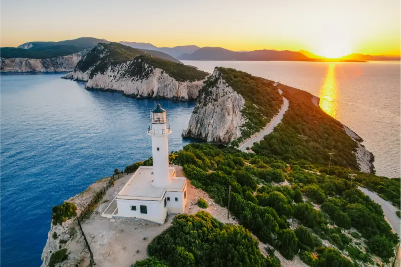
    Cape Lefkatas is the raw southern end of Lefkada: white cliffs, open Ionian water and a stone lighthouse standing where ancient tradition placed an important sanctuary of Apollo. The drive is longer and more isolated than many first-time visitors expect, which is exactly why the cape should be planned as a destination rather than squeezed between two beaches.

    The municipality of Lefkada describes the cape as the site of the ancient sanctuary of Apollo Lefkatas and notes that the modern lighthouse occupies the area associated with the temple. It also explains the long literary tradition linking the cliffs with the legend of Sappho. Treat the story as legend, the ancient sanctuary as historical context and the present-day cliffs as a serious natural environment that requires distance from edges.

    Lighthouse Cliff Seascape Cape Lefkatas With Old Lighthouse Lefkada Island Greece Views Azure Sea Water Nature With Cliffs View 3

    Quick planning snapshot

    Best forLandscape, history, photography, road trips
    Time needed2–4 hours from Vasiliki/Athani depending on stops
    Car needed?Yes for most independent visitors
    Main cautionRemote roads, exposed cliffs, limited services
    Best lightLate afternoon, but do not rely on darkness for the return

    The cape is impressive because it feels exposed. That also means you should arrive with water, fuel, sun protection and a realistic plan for the drive back. There is no reason to stand close to an unstable edge to get a good photograph.

    The lighthouse and the southern headland

    The lighthouse is the visual anchor at the end of the road. The landscape around it is more important than the building itself: steep white rock drops toward deep blue water and the horizon feels unusually open. Access rules around the lighthouse structure can vary, so plan for an exterior visit and viewpoint rather than assuming the tower interior is open.

    The final section of the route feels remote compared with resort Lefkada. Mobile signal, road surface and traffic conditions can change, and there are far fewer services than around Nydri or Kathisma. Bring what you need before leaving the settled south-coast villages.

    Resort Of Nydri On Coast Eastern Of Lefkada Island In Greece

    Apollo Lefkatas: the ancient story beneath the landscape

    Ancient sources associate the cape with a sanctuary of Apollo. The municipality notes that only limited traces remain and that the modern lighthouse occupies the area of the sanctuary. This is not an archaeological site with extensive labelled ruins; the value is understanding why such a dramatic headland held religious meaning in antiquity.

    Read a little history before arriving. Without context, visitors may see only a lighthouse and cliffs; with context, the cape becomes part of Lefkada’s ancient geography and its connection to the wider story of Actium and Apollo.

    The Sappho legend: what to say and what not to claim

    Stories connect the poet Sappho with a fatal leap from Lefkatas because of unrequited love, but this belongs to literary legend rather than a securely documented biographical event. The municipality itself presents the tradition as legend. Keep that distinction clear when reading travel blogs that state the story as simple historical fact.

    Combining the cape with Athani and the south-west coast

    Athani is a logical stop before or after the cape, and the wider south-west route can connect with Porto Katsiki or other beaches if you start early. Do not force all of them into a late-afternoon loop. Beach access, winding roads and sunset traffic can make the timetable much slower than the map suggests.

    How to plan the visit without wasting half the day

    A car is the practical choice. Start with enough fuel and download the route before you lose confidence in signal. Drive slowly, especially on blind bends, and give way where the road narrows. If weather is poor or strong wind makes the exposed headland uncomfortable, the cape can wait for another day.

    For sunset, arrive well before the sun is low so you can choose a safe viewpoint without rushing. The return after dark is the part many itineraries ignore. If you are not comfortable with mountain driving at night, leave before full darkness and enjoy sunset from a less remote west-coast viewpoint instead.

    When to go and how weather changes the experience

    Late spring, summer and early autumn offer the most reliable road-trip conditions. Midday summer heat is intense because shade is limited, while late afternoon gives better light and cooler temperatures.

    Winter storms and strong winds can make the headland feel severe rather than romantic. Never climb barriers or approach cliff edges for a photo, regardless of season.

    Who this plan works best for

    Cape Lefkatas suits independent road-trippers, photographers, history-minded visitors and couples looking for a scenic excursion. It is less suitable as a casual stop for very young children unless adults are prepared for constant supervision around exposed terrain.

    A realistic way to fit it into your Lefkada trip

    From Vasiliki, drive toward Athani and the southern peninsula after a relaxed lunch, allowing time for viewpoints rather than racing to the lighthouse. If you want Porto Katsiki the same day, visit the beach earlier and treat the cape as a separate late-afternoon objective.

    Spend enough time at the headland to walk safely and appreciate the landscape, then begin the return before you are tired. A slow dinner back in Vasiliki is a better ending than adding another remote stop in darkness.

    Common mistakes to avoid

    • Treating the Sappho story as proven history.
    • Arriving with almost no fuel or water.
    • Standing close to cliff edges for photos.
    • Underestimating the return drive after sunset.
    • Combining the cape with too many west-coast beaches in one afternoon.

    The cape rewards restraint. Its power comes from the landscape and history, not from how close you can get to an edge or how many nearby pins you can collect.

    Tours and activities around Lefkada

    Boat trips, sailing days and guided activities can be useful when you want to see coves or nearby islands without building the entire day around driving and parking. Availability changes through the season, so compare the exact departure point, duration and cancellation conditions before booking.

    Frequently asked questions

    Where is Cape Lefkatas?

    It is at the southern end of Lefkada, beyond the south-west villages and the peninsula that extends past Vasiliki.

    Can you enter the lighthouse?

    Do not assume interior access. Plan the visit for the exterior, landscape and historical setting unless current local information specifically confirms entry.

    Did Sappho really jump from Lefkada?

    The connection is a famous literary legend, not a securely established biographical fact. It should be presented as tradition rather than certainty.

    Is Cape Lefkatas good for sunset?

    The open horizon can be beautiful in late light, but the isolated return drive is the practical issue. Leave before dark if you are uncomfortable driving winding roads at night.

    Continue planning your Lefkada trip

    Start with the main Lefkada travel guide if you are still choosing your base and trip length. For the island’s most famous west-coast scenery, use the Porto Katsiki and Egremni guide. The Lefkada Town guide, Nydri guide and Vasiliki guide help you compare very different bases rather than booking only by hotel price. For the closest major resort base, use the Vasiliki guide.

    Nydri Or Nidri On Coast Eastern Of Island Of Lefkada In Greece

    Final practical advice

    Cape Lefkatas is one of Lefkada’s best examples of landscape and history occupying the same place. Go for the headland, understand the Apollo context and keep the Sappho story in the realm of legend.

    A safe, unhurried visit is more memorable than a rushed sunset photo. Build the day around the drive rather than pretending the cape is a ten-minute detour.

    Extra planning notes for a smoother day

    For a longer stay, remember that Cape Lefkatas Lefkada should be one part of a broader Lefkada plan rather than the only objective. Build in time for meals, parking, short walks and weather changes. Distances on the island are manageable, but the roads frequently bend around mountains and bays, so a schedule that looks sparse on a flat map can already be full in practice. Travelling earlier in the morning usually improves parking, temperatures and photography, while late afternoon is better for slower village walks and harbour dinners. If a beach or boat day is uncomfortable because of wind, switch to an inland village, the capital or a sheltered bay instead of forcing the original plan. This flexible approach is especially useful in July and August, when traffic and heat magnify every small delay. Keep drinking water in the car, download the route before leaving your accommodation, and confirm seasonal transport or boat information close to the day of travel.

    Extra planning notes for a smoother day

    For a longer stay, remember that Cape Lefkatas Lefkada should be one part of a broader Lefkada plan rather than the only objective. Build in time for meals, parking, short walks and weather changes. Distances on the island are manageable, but the roads frequently bend around mountains and bays, so a schedule that looks sparse on a flat map can already be full in practice. Travelling earlier in the morning usually improves parking, temperatures and photography, while late afternoon is better for slower village walks and harbour dinners. If a beach or boat day is uncomfortable because of wind, switch to an inland village, the capital or a sheltered bay instead of forcing the original plan. This flexible approach is especially useful in July and August, when traffic and heat magnify every small delay. Keep drinking water in the car, download the route before leaving your accommodation, and confirm seasonal transport or boat information close to the day of travel.

  • Fira to Oia Hike Guide: Route, Distance, Difficulty and Best Time

    Fira to Oia Hike Guide: Route, Distance, Difficulty and Best Time

    The walk from Fira to Oia is the best way to experience Santorini as a landscape rather than a sequence of viewpoints reached by road. The path follows the caldera rim north from Fira through Firostefani and Imerovigli before becoming rougher and more exposed on the long approach to Oia. Instead of seeing the cliffs through a bus window, you watch the volcanic islands, villages and sea change slowly for several hours. It is a real hike, though, not a flat promenade.

    Fira Donkey Path Santorini Greece

    If this is your first trip to the area, use this article together with Santorini Travel Guide, Fira Santorini Guide and Oia Santorini Guide. Those guides cover the wider destination, while this page focuses on the practical decisions that make a visit to Fira to Oia Hike Guide work smoothly.

    Why Fira to Oia Hike Guide is worth your time

    This route connects Santorini’s most famous settlements while revealing stretches that many visitors never see. Discover Greece currently describes the Fira-Oia route as about 10.5 km with a typical walking time of three to five hours. The first urban sections are straightforward, but later parts cross volcanic ground with little shade. That combination makes preparation more important than the modest distance suggests.

    The most satisfying way to use a focused guide like this is to decide what you actually want from the stop before building the timetable. Some travellers care most about history, others about landscape, walking, swimming or photography. Once the priority is clear, it becomes much easier to choose the right time of day, avoid unnecessary transfers and leave enough space for the experience rather than simply collecting another pin on a map.

    Main highlights

    • Fira and Firostefani caldera views
    • Imerovigli and the optional Skaros Rock detour
    • the exposed volcanic trail north of Imerovigli
    • chapels and ridgeline views on the approach to Oia
    • arriving in Oia on foot
    • the flexibility to return by bus or taxi

    Fira and Firostefani caldera views

    The first section is the easiest part of the hike and can be enjoyed even by travellers who do not want to complete the full route. Streets and paved lanes connect Fira with Firostefani, with frequent places to stop for water or coffee. Do not rush this opening hour: the caldera view changes continuously as you gain height and move away from Fira’s busiest streets.

    Ristorante Affacciato On Caldera At Fira Santorini

    Imerovigli and the optional Skaros Rock detour

    Imerovigli is the last major settlement before the route becomes noticeably more exposed. Skaros Rock is a worthwhile detour for experienced walkers with time, but it adds effort and should not be treated as mandatory. If the main goal is reaching Oia comfortably, save energy, refill water in Imerovigli and continue north without adding every side path.

    the exposed volcanic trail north of Imerovigli

    This is the section that turns the outing into a hike. Expect loose gravel, sun, wind and repeated small climbs and descents. There is little dependable shade. Proper trainers or light hiking shoes are much safer than smooth sandals, and in warm weather you should carry more water than you think you will need.

    chapels and ridgeline views on the approach to Oia

    chapels and ridgeline views on the approach to Oia is one of the elements that gives Fira to Oia Hike Guide its identity. Spend enough time to understand how it connects with the surrounding landscape, streets or historical context rather than approaching it only as a photo stop.

    Best time to visit

    April, May, October and mild days in late September are ideal. In July and August, start very early. Discover Greece recommends early morning or a later start timed toward sunset in the hottest months, but a late-afternoon hike still requires enough daylight and water. Strong wind also changes the experience on exposed sections, so check the forecast rather than planning solely around the temperature.

    Time of day matters almost as much as the month. Early mornings are usually best for exposed walks, archaeological sites and popular viewpoints, while late afternoon works well for villages, waterfronts and softer photography light. If access depends on weather, boats, trail conditions or opening hours, check official information shortly before leaving your accommodation rather than relying on a screenshot saved months earlier.

    How to get there and get around

    The route is one-way. Start from central Fira and follow the caldera path north through Firostefani and Imerovigli. Do not rely on driving directions in navigation apps because the hiking line differs from roads. Once in Oia, most walkers return to Fira by KTEL bus or taxi. Check the same-day bus timetable before starting and avoid the mistake of assuming frequent service late at night outside peak season.

    Fira Santorini Island Greece Panoramic Banner View With Donkey Path Cable Car From Old Port High

    Transport should be planned around the whole day, not just the headline attraction. A rental car gives freedom in rural areas but creates parking problems in old villages and cities. Buses can be excellent when the route is direct, yet seasonal frequency may make multi-stop itineraries awkward. Taxis are most valuable when they remove one difficult gap rather than replacing every transfer. Always protect enough time for the return journey.

    How much time do you need?

    For Fira to Oia Hike Guide, a focused visit usually needs at least half a day once transport, walking and breaks are included. Travellers who enjoy hiking, photography or long lunches should protect more time. The mistake is not staying too long; it is scheduling another major attraction so close afterwards that every small delay becomes stressful. One well-planned experience is better than three rushed stops.

    A realistic itinerary

    For a summer morning, leave Fira shortly after sunrise, walk slowly through Firostefani, take a short break in Imerovigli and continue before the day heats up. Skip Skaros Rock unless conditions are comfortable and you have extra water. Reach Oia around late morning or midday, have lunch, explore the village and return by bus. In shoulder season, a later start can work, but finish before darkness if you are unfamiliar with the trail.

    Build a buffer into the schedule. That margin absorbs parking, a bus delay, an unexpected queue, stronger wind, a slower walking pace or the discovery of a place where you simply want to stay. Greece rarely rewards itineraries planned in thirty-minute blocks. Protect the essential logistics, then leave enough flexibility for the day to develop naturally.

    Where to stay

    You do not necessarily need accommodation beside Fira to Oia Hike Guide. Choose the base that makes the wider trip simpler. On islands, a central town can be better if you plan several day trips, while staying locally makes sense when sunrise, sunset or early trail access is important. In cities, proximity to useful public transport often saves more time than a room with a slightly better view. Always check parking if you are renting a car.

    Food and breaks

    Plan at least one proper break rather than relying on snacks all day. In villages, move a street or two away from the most photographed corner before choosing a taverna. Around beaches and natural attractions, opening hours can be seasonal, so carry water and do not assume a café will be open exactly when you need it. A slower lunch during the hottest part of the day is often smarter than forcing another exposed walk.

    What to bring

    • comfortable shoes with good grip
    • refillable water bottle
    • sun protection and a hat
    • a light layer for wind or cooler conditions
    • offline map or downloaded route
    • charged phone or small power bank
    • a little cash for small purchases

    Pack for the terrain rather than the photograph. Volcanic paths, polished village paving, cave stairs and mountain roads all create different practical needs. Good shoes, water and sun protection make a bigger difference than carrying extra clothing you never use. If the day includes a swim, keep dry footwear available for the return walk or drive.

    Common mistakes to avoid

    • arriving at the same peak hour as every excursion group
    • trying to combine too many distant stops
    • ignoring heat, wind, sea or trail conditions
    • using outdated opening hours or access information
    • forgetting to plan the return transport
    • treating residential, religious or protected places as photo sets

    The most common mistake at Fira to Oia Hike Guide is overestimating how much fits comfortably into one day. Maps hide steep lanes, parking searches, queues and the time you will naturally spend taking photos or sitting down for coffee. Prioritise the two or three elements that matter most and make everything else optional.

    Is it suitable for families?

    Usually yes with the right expectations, but adapt the day to heat, walking distance and attention span. Families often do better with an early start, one main experience and a predictable meal break. At viewpoints, caves, mountain paths and archaeological sites, uneven surfaces require active supervision. A shorter successful visit is better than forcing children through an adult sightseeing schedule.

    Accessibility and mobility

    Accessibility varies significantly. Modern transport and some organised attractions may be straightforward, while historic villages, natural trails, caves and archaeological terrain can include steps, steep gradients and rough ground. Check the latest accessibility information for the exact place. When mobility is limited, a taxi or private transfer can sometimes remove the hardest approach even if the final attraction still requires some walking.

    What to combine with it

    Treat the hike as one of the day’s main activities. It combines naturally with a relaxed meal and short exploration of Oia, but not with a second major archaeological visit. If you want to see Ammoudi Bay as well, remember the steep steps add significant climbing after a long walk.

    For more context, continue with Santorini Travel Guide, then use Fira Santorini Guide and Oia Santorini Guide to build the surrounding itinerary. This keeps Fira to Oia Hike Guide connected to the rest of the trip instead of turning it into an isolated detour.

    FAQ

    Do I need to book in advance?

    For major archaeological sites, organised tours, water-sport lessons and time-sensitive transport, advance booking can be sensible. Ordinary village walks and viewpoints usually do not require reservations.

    What is the best time of day?

    Early morning is generally best for cooler temperatures and fewer people. Late afternoon can be excellent for atmosphere and photography, provided access hours and the return journey still work.

    Can I visit without a car?

    City and major resort attractions are often possible by bus or taxi. Rural, mountain and multi-stop days are easier with a car, but organised excursions can be a good alternative.

    Is it worth visiting outside peak summer?

    Yes. May, June, September and October are often excellent, though seasonal buses, boats, tavernas and activity centres may run less frequently.

    Should I trust old prices and timetables?

    No. Tickets, opening hours, access rules and transport schedules change. Recheck official or local information shortly before the visit, especially for sites affected by heat, weather or conservation rules.

    Final advice

    Treat Fira to Oia Hike Guide as an experience rather than a task to complete. Arrive with the essential logistics under control, then give yourself enough time to notice the details that make the place distinctive. That balance between preparation and flexibility is what turns a technically correct itinerary into a day that genuinely feels like Greece.

  • Ermoupoli Syros Guide: Miaouli Square, Apollo Theatre, Vaporia, Museums and Where to Stay

    Ermoupoli Syros Guide: Miaouli Square, Apollo Theatre, Vaporia, Museums and Where to Stay

    Ermoupoli is not a typical whitewashed Cycladic village. It grew as a major nineteenth-century port and commercial centre, and that history is visible in its monumental town hall, pastel neoclassical mansions, marble-paved squares, theatres and waterfront warehouses. For a first visit, the pleasure comes from moving slowly between these layers rather than treating the town as a ferry terminal on the way to a beach.

    The compact centre is walkable, but the streets rise quickly toward Vaporia and Ano Syros. A sensible day combines the flat waterfront and Miaouli Square with one or two museums, then climbs toward the mansion district when the light is softer. Asteria gives you the unusual option of swimming directly below the neoclassical quarter, so culture and sea can fit naturally into the same day.

    This guide focuses on what is genuinely useful: how to organise the town on foot, which cultural stops add context, where the steep sections begin, how to combine Ermoupoli with the rest of Syros, and which part of town is most practical for your accommodation.

    At a glance

    Best forArchitecture, museums, restaurants, ferry convenience
    AllowOne full day; two nights if you enjoy towns
    TransportExcellent on foot in the centre; buses for beaches
    Best swimAsteria platform below Vaporia
    Good base without a carYes – the easiest on Syros

    Miaouli Square and the Town Hall

    Miaouli Square is the natural starting point because it immediately explains the scale and confidence of Ermoupoli. The Town Hall dominates the square and was designed by Ernst Ziller, one of the architects most closely associated with nineteenth-century neoclassical Greece. Sit for a few minutes before walking on: the proportions, arcades and surrounding façades are easier to appreciate when you are not treating the square as a waypoint.

    The Archaeological Museum of Syros is housed in the Town Hall complex. Its collection is particularly useful if you plan to explore the prehistoric sites of Kastri and Chalandriani, because objects from those areas turn abstract place names into a clearer story. In 2026 the official museum information lists a general ticket of €5 and a Tuesday closure in the summer season; verify current hours before your visit.

    Apollo Theatre

    The Apollo Theatre is one of the city’s signature interiors and a reminder that Ermoupoli was a wealthy cultural centre, not simply a port. Its horseshoe auditorium, boxes and painted decoration make even a short visit worthwhile. The theatre also remains a working performance venue, so access can change around rehearsals and events.

    The official theatre site currently publishes daily visiting periods in the morning and early evening, with afternoon access dependent on performances and rehearsals. If seeing the interior is important, check the schedule before building the rest of the day around it. Evening performances can be an excellent way to experience the building as intended rather than as a static monument.

    Vaporia and the church of Agios Nikolaos

    From the centre, walk uphill toward Vaporia, the district where shipowners and merchants built some of Ermoupoli’s most impressive mansions. Balconies project toward the Aegean, façades stack above the water and narrow lanes open suddenly onto sea views. The climb is part of the experience, but in summer it is much more comfortable before late morning or after the strongest heat.

    Agios Nikolaos is the architectural landmark of this side of town. Treat it as an active church rather than a photo set: dress appropriately, keep voices low and avoid interrupting services. From the surrounding streets continue down toward Asteria, where the view back to the mansions is one of the clearest visual summaries of Ermoupoli.

    Swimming at Asteria

    Asteria is not a broad sandy beach. It is an urban swimming platform and small rocky shoreline directly below Vaporia, reached by steps. That distinction matters: choose it when you want a refreshing swim without leaving town, not when you want sunbeds, shallow sand and a full resort day. The water can be wonderfully clear, and the setting beneath the mansions is unique on Syros.

    Wear footwear with grip on wet surfaces, watch sea conditions and do not assume every entry point is equally easy. Families with small children may prefer a sandy beach such as Galissas, Kini or Agathopes. For confident swimmers staying in Ermoupoli, however, Asteria is one of the easiest ways to add the sea to a culture-focused day.

    Industrial Museum and the port story

    The Industrial Museum gives a different perspective from the neoclassical centre. It explains how shipbuilding, textiles, machinery and manufacturing helped shape Hermoupolis into one of the most important industrial and commercial centres of modern Greece. The collections make the old factories and warehouses around the port much easier to understand afterward.

    The museum is around a ten-minute walk from the port area. Current official visitor information lists Tuesday to Saturday opening in the morning and early afternoon, with Monday and Sunday closed, and a low general admission fee. Because these details can change, confirm before setting out. The museum is especially useful on a hot day when a long uphill walk is less appealing.

    Where to eat and what to notice

    Ermoupoli has the island’s broadest dining choice, from simple bakeries and coffee shops to seafood, modern Greek cooking and late dinners on the waterfront. Look beyond generic “Greek menu” dishes for Syros specialities such as louza, fennel-scented sausages, local cheeses including San Michali, capers, loukoumi and halvadopita.

    Syros Ermoupoli Greece

    The waterfront is atmospheric, but you do not need to eat directly beside the harbour at every meal. Side streets around the centre often feel less exposed to traffic and ferry activity. For dessert, trying local loukoumi in Ermoupoli makes sense because the sweet is strongly associated with the island’s commercial history and remains one of its best-known edible souvenirs.

    Where to stay in Ermoupoli

    Stay close to the waterfront or Miaouli Square if you want the simplest luggage transfer from the ferry, easy buses and a large restaurant choice. Vaporia is more romantic and visually distinctive, but check how many steps separate the property from the water and bus stops. “Five minutes from the centre” can mean a steep five minutes on Syros.

    For a no-car trip, Ermoupoli is the strongest base on the island. You can walk to the main cultural sights and use buses for organised beaches and villages. Travellers focused almost entirely on swimming may prefer Galissas or Kini, but a two-base trip is rarely necessary unless you are staying a week or longer.

    How much time to allow

    Allow at least a full day if architecture and museums matter, and consider two nights if you want an evening performance or relaxed dinners. Syros is compact on a map, but steep streets, beach stops and meal times make a rushed schedule less enjoyable than it looks. Build the day around two or three meaningful anchors rather than a list of ten pins. That gives you room for a swim, a museum that takes longer than expected, or a bus connection that is less frequent outside the busiest summer weeks.

    If you are visiting on a day trip, identify the one experience that matters most and protect time for the return to the port. If you are staying several nights, group places by coast: Ermoupoli and Ano Syros together, Galissas with the south-west, and Kini with the west. This simple geographic approach cuts backtracking and gives every stop a more relaxed rhythm.

    Ermoupoli City Capital Town Cyclades Syros Island Greece

    Getting around and transport reality

    The centre, port, Miaouli Square and waterfront are straightforward on foot, while Vaporia and Ano Syros involve sustained uphill walking. The public bus network is useful for the main settlements and beaches, but timetables are seasonal. Check the official KTEL Syros schedule shortly before travelling rather than planning from an old screenshot. Taxis are valuable for early ferries, late dinners and combinations that do not line up neatly with buses.

    A rental car gives more flexibility for remote coves and village combinations, but it is not automatically the best choice in Ermoupoli. Central streets can be steep, narrow and busy, and parking may be some distance from your accommodation. Travellers who stay centrally can often combine walking, buses and an occasional taxi and avoid driving every day.

    Best time of day

    Start with the centre and museums in the morning, swim at Asteria or rest after lunch, then return to Vaporia for softer late-afternoon light. In July and August, the middle of the day can feel much hotter on stone streets and exposed beaches than the air temperature suggests. Use morning for uphill walking, museums or uncrowded swimming, keep lunch unhurried, and save sunset-facing beaches or waterfront walks for later.

    Wind matters as much as temperature in the Cyclades. A beach that looks perfect in a photograph may feel very different on a strong northerly day. Keep at least one flexible beach afternoon and ask locally which coast is calmer that day; this is more useful than locking every swim into the itinerary weeks in advance.

    What to bring

    Comfortable walking shoes matter because polished marble, steps and steep lanes are part of the experience. Add a refillable bottle, strong sun protection, a light layer for evening wind and offline maps. Shoes with grip are much more useful than smooth sandals in Ano Syros, on polished marble steps and on rough paths to quieter coves.

    For beaches, pack a small dry bag or waterproof pouch for phones and ferry tickets. For churches and cultural sites, carry something that lets you dress respectfully without returning to your room. Families should add water shoes when children dislike pebbles and a compact shade solution for beaches with limited natural cover.

    Costs and reservations

    Ermoupoli itself rewards walking, so daily sightseeing costs can remain modest; museum tickets and performances are the main paid cultural extras. Accommodation prices rise sharply around popular summer weekends, so lodging and ferry tickets deserve priority. Ordinary beach days and village walks do not need to be over-planned, and leaving some free time makes it easier to react to wind, heat and local events.

    For paid museums and attractions, confirm opening hours on the official site on the day before your visit. Small Cycladic museums sometimes close one weekday or change seasonal hours. For restaurants with a specific sunset table in mind, reserving ahead is sensible in July and August; otherwise, eating a little earlier or later usually provides more flexibility.

    How this fits into a wider Syros trip

    Start with the Syros Travel Guide for the island overview, then use Ano Syros Guide, Vaporia & Asteria, Galissas & Kini, Posidonia & Agathopes, Syros Food Guide for the parts of the trip that need more detail. Linking the guides by geography and travel style makes it easier to plan realistic days instead of zig-zagging across the island.

    Tours and activities

    If you want a guided experience, boat trip or organised activity, compare what is available for your exact dates. Check the meeting point, cancellation terms, language, duration and what is included before booking; on an island, wind can also affect marine activities.

    Common mistakes to avoid

    • Treating Ermoupoli only as an arrival port.
    • Underestimating the climb to Vaporia and Ano Syros.
    • Assuming Asteria is a conventional sandy family beach.
    • Relying on old museum or theatre opening hours.
    • Booking a hilltop room without checking luggage access.

    Frequently asked questions

    Is Ermoupoli worth a full day?

    Yes. Architecture, museums, Vaporia, food and an Asteria swim can easily fill a day without rushing.

    Can you stay in Ermoupoli without a car?

    Yes. It is the best base on Syros for a car-free trip because buses, taxis, ferries and services converge here.

    Is Asteria a beach?

    It is primarily an urban swimming platform and rocky access point rather than a broad sandy beach.

    What museum should I prioritise?

    Choose the Archaeological Museum for ancient Syros and the Industrial Museum for the city’s nineteenth- and twentieth-century economic story.

    Is Ermoupoli good in the evening?

    Very. The waterfront, squares and restaurants stay lively, and the Apollo Theatre may offer performances depending on the programme.

    Final practical advice

    Give Ermoupoli more time than its size suggests. The best visit is not a checklist of buildings but a sequence: coffee in the square, a museum that explains the island, a slow climb through Vaporia, a swim below the mansions and dinner after the ferry traffic eases. That rhythm reveals why Syros feels different from many other Cycladic islands.

    Useful official information

    For time-sensitive planning, check the official Apollo Theatre website for visits and performances and the Greek Ministry of Culture museum information shortly before your trip. Museum hours and access can change around public holidays and seasonal schedules.

  • Folegandros Travel Guide: Chora, Beaches, Hiking and a 4-Day Itinerary

    Folegandros Travel Guide: Chora, Beaches, Hiking and a 4-Day Itinerary

    Folegandros is small enough to understand quickly but dramatic enough to remember for years. Its cliff-top Chora, compact villages and wild coast create a very different rhythm from nearby Santorini. There are fewer headline attractions, which is exactly the point: you come here to walk, swim, eat and enjoy long views over the Aegean.

    The official Greek tourism site highlights Chora at roughly 200 metres above the sea, the Church of Panagia above it and a network of paths connecting villages, chapels and beaches. That description captures the island well. Folegandros is not built around quantity. If you are planning a quieter Cyclades route, pair this guide with Milos or Sifnos.

    Where to stay: Chora or Karavostasis

    Chora is the obvious choice for most first-time visitors. Its connected squares, restaurants and evening atmosphere make it easy to enjoy the island without planning transport after dinner. The Kastro quarter adds historical character, and the sunset walk toward Panagia begins directly above town.

    Karavostasis is the port and works well if you prioritise quick access to ferries and nearby beaches. Ano Meria is quieter and more rural. Because the island is small, none of these bases isolates you completely, but Chora gives the most satisfying all-round experience for a short stay.

    Exploring Chora

    Folegandros Chora is made for wandering. Cars stay out of much of the centre, and the village unfolds through small squares shaded by trees, whitewashed lanes and simple houses. The Kastro section preserves the older fortified core on the cliff edge.

    The best time is late afternoon into evening. Day-trippers and beachgoers return, restaurants begin to fill and the light softens across the buildings. Do not rush through in thirty minutes; the village is the island’s main living space, not just an attraction.

    Folegandros Greece Evening

    Walking to the Church of Panagia

    The zigzag path above Chora is short but exposed. The reward is a broad view over the settlement and sea, especially near sunset. Wear shoes with grip and carry water in warm weather.

    Sunset is popular, so arrive before the final minutes if you want space. I also like the walk earlier in the morning when the path is quiet. If wind is strong, keep a safe distance from exposed edges rather than prioritising photographs.

    Best beaches

    Katergo is one of the island’s most famous beaches and is commonly reached by boat or on foot. Agali is easier and serves as a useful hub for walking or boat connections to nearby coves. Livadi and beaches near Karavostasis are simpler options when you want less logistics.

    Folegandros beaches can be exposed and services are limited compared with large islands. Carry water, check boat returns and remember that a beautiful remote cove may have no shade. Your “best” beach should match the wind and your tolerance for hiking.

    Hiking and old paths

    The island’s trail network connects Chora, Ano Meria, chapels and coastal areas. Even short walks reveal terraces, dry-stone walls and the agricultural landscape behind the postcard image. Spring is especially good when wildflowers soften the hills.

    In July and August, start early or walk late. A route that feels easy on a cool map can become uncomfortable under strong sun. Use proper shoes, take water and do not assume every coastal path has mobile coverage.

    Ano Meria and rural Folegandros

    Ano Meria stretches along the northern part of the island and shows a more agricultural side of Folegandros. Houses, fields and stone walls are spread out rather than clustered into one compact village. The Folklore/Ecological Museum, when open, helps explain traditional rural life.

    Combine Ano Meria with a walk rather than visiting only for a quick drive-through. The contrast with Chora is important: one is concentrated and social, the other dispersed and tied closely to land use.

    Getting around

    Local buses connect the port, Chora and Ano Meria, with seasonal services adapted to visitor demand. This makes a car unnecessary for many short stays. Taxis and boat services fill some gaps.

    A rental car or scooter can be useful, but parking near Chora is outside the pedestrian core and the island is small enough that transport rarely needs to dominate your planning. As always, scooters only make sense for experienced riders.

    A four-day itinerary

    Day one: arrive, settle in Chora and walk to Panagia for the evening light. Day two: take a boat or hike to a beach such as Katergo, then return for dinner in Chora. Day three: explore Ano Meria and walk part of the old path network. Day four: choose Agali or another accessible beach and keep the afternoon relaxed before departure.

    Agali Beach Folegandros Greece

    If you have a fifth day, do not automatically add another island. Use it to repeat the experience you liked most. Folegandros is a place where repetition can feel luxurious rather than wasteful.

    Best time to visit

    June and September are excellent because sea temperatures are pleasant and walking is easier than in peak heat. July and August bring more visitors and stronger demand for rooms, but Chora remains charming if you accept that the central squares will be busy.

    May and early October suit walkers and travellers who value quiet, although transport and beach services can be reduced. Check ferries carefully in shoulder season.

    Folegandros or Santorini?

    They solve different travel problems. Santorini has volcanic scenery, major archaeological sites, wineries and far more accommodation and dining options. Folegandros is smaller, quieter and more focused on village life, walking and uncrowded moments.

    If your itinerary permits, the islands can complement each other. Do not choose Folegandros because you expect a cheaper copy of Santorini; choose it because you want a different experience.

    Frequently asked questions

    How many days do I need?

    Three nights can work, but four days gives enough time for Chora, one or two beaches and a walk without rushing.

    Do I need a car?

    Usually no. Buses connect the main settlements and boat services help with some beaches.

    Is Folegandros good for nightlife?

    It has lively evenings in Chora, but the atmosphere is based more on restaurants, wine bars and conversation than large clubs.

    Chora Folegandros Island Greece

    Can I combine Folegandros with Milos?

    Yes, subject to the seasonal ferry schedule. The two islands make a strong combination because Milos adds geological beaches and Folegandros adds cliff-top village atmosphere.

    Planning Folegandros in practice

    Accommodation sells quickly in high season because the island is small. If your dates are fixed in July or August, book earlier than you might for a larger island. In June or September you usually have more breathing room and better walking temperatures.

    Boat access to beaches is weather-dependent. Never assume the last boat will run exactly as it did yesterday. Ask the operator when you board and keep enough water, sun protection and cash for a longer wait if conditions change.

    The island is ideal for travellers who can accept a little repetition. You may eat in the same square twice or return to the same beach because wind is perfect there. That is not poor planning; it is how a small island holiday becomes relaxing.

    If connecting onward, verify ferry departure from Karavostasis and arrange transport from Chora with margin. The drive is short, but summer buses, luggage loading and busy port moments can consume more time than expected.

    Folegandros is also an excellent place to travel with fewer possessions. Distances are short, evenings are informal and the island rewards walking. A lighter bag makes ferry transfers and Chora accommodation much easier.

    Travel days also deserve their own space in the itinerary. Leave time for breakfast, packing, transfers and delays instead of counting a ferry or drive as invisible time. This simple adjustment makes the entire Greece trip feel calmer and more realistic.

    Folegandros is also an excellent place to travel with fewer possessions. Distances are short, evenings are informal and the island rewards walking. A lighter bag makes ferry transfers and Chora accommodation much easier.

    Travel days also deserve their own space in the itinerary. Leave time for breakfast, packing, transfers and delays instead of counting a ferry or drive as invisible time. This simple adjustment makes the entire Greece trip feel calmer and more realistic.

    Folegandros is also an excellent place to travel with fewer possessions. Distances are short, evenings are informal and the island rewards walking. A lighter bag makes ferry transfers and Chora accommodation much easier.

    Travel days also deserve their own space in the itinerary. Leave time for breakfast, packing, transfers and delays instead of counting a ferry or drive as invisible time. This simple adjustment makes the entire Greece trip feel calmer and more realistic.

    Folegandros is also an excellent place to travel with fewer possessions. Distances are short, evenings are informal and the island rewards walking. A lighter bag makes ferry transfers and Chora accommodation much easier.

    Folegandros is also an excellent place to travel with fewer possessions. Distances are short, evenings are informal and the island rewards walking. A lighter bag makes ferry transfers and Chora accommodation much easier.

    Folegandros is also an excellent place to travel with fewer possessions. Distances are short, evenings are informal and the island rewards walking. A lighter bag makes ferry transfers and Chora accommodation much easier.

    More in-depth Folegandros guides

    Continue planning with Chora Folegandros Guide; Karavostasis Folegandros Guide; Ano Meria Folegandros Guide; Agali Folegandros Guide; Katergo Beach Folegandros Guide; Livadaki Beach Folegandros Guide; Best Beaches in Folegandros; Folegandros Hiking Guide; Folegandros Without a Car; Where to Stay in Folegandros.

    If you are island hopping east, our new Sikinos ferry guide and Sikinos travel guide explain how to add the quieter neighboring island to this route.

    Related itinerary: Ios, Folegandros and Santorini in 10 Days: Southern Cyclades Island-Hopping Itinerary.

  • Halkidiki with Kids: Best Bases, Family Beaches, Easy Trips and Practical Tips

    Halkidiki with Kids: Best Bases, Family Beaches, Easy Trips and Practical Tips

    Halkidiki is one of mainland Greece’s easiest beach regions for families because it combines road access from Thessaloniki with a very large choice of sandy beaches, apartments and resort hotels. The official tourism portal emphasises the contrast between developed Kassandra, natural Sithonia and the Mount Athos area, which means families can choose a style rather than accept one fixed type of holiday.

    Kassandra Coastline Near Lagoon Beach Chalkidiki Greece

    The key is to reduce driving. A family trip works better with one or two bases and repeat visits to nearby beaches than with a daily mission to photograph every famous cove. Shallow water, shade, parking and a supermarket often matter more with children than a beach’s social-media reputation.

    Why this Halkidiki stop is worth your time

    Choose Halkidiki for a family holiday if you want beaches without ferry logistics, access to apartments and kitchens, and enough cultural or nature excursions to break up swimming days.

    Quick planning summary

    • Best season: late May to June and September for warm weather with easier parking and sightseeing.
    • Peak season: July and August bring the widest services but also the heaviest beach and road pressure.
    • Transport: a car is the easiest way to combine villages and beaches, while KTEL buses work best between larger settlements.
    • Trip style: choose one peninsula or one local cluster per day instead of trying to cross the whole region.
    • Safety: wind, heat, currents, roadside parking and forest-fire restrictions can change the best plan for a given day.
    • Variable information: recheck beach access, archaeological hours, boat departures and bus timetables shortly before travel.

    What to see and do

    Best base for first-time families: Nikiti

    Nikiti combines a long organised beach, supermarkets, restaurants and easy access to both sides of north Sithonia. It is practical without feeling like a giant resort complex.

    Build time around this stop rather than squeezing it between several distant beaches. Halkidiki looks compact on a map, but summer traffic, parking and winding peninsula roads make a slower schedule far more enjoyable.

    Best for calm-water scenery: Vourvourou

    Vourvourou is excellent for shallow bays and apartment stays. Choose exact accommodation location carefully because the area is spread out.

    Build time around this stop rather than squeezing it between several distant beaches. Halkidiki looks compact on a map, but summer traffic, parking and winding peninsula roads make a slower schedule far more enjoyable.

    Best for resort convenience: Sani

    Sani offers organised shallow beaches, lifeguards and high-end facilities. It can be expensive, but the convenience level is high.

    Build time around this stop rather than squeezing it between several distant beaches. Halkidiki looks compact on a map, but summer traffic, parking and winding peninsula roads make a slower schedule far more enjoyable.

    Best for a lively beach town: Sarti

    Sarti’s long sandy beach gives children space, while parents have easy access to restaurants and shops. Avoid the busiest nightlife streets if sleep matters.

    Build time around this stop rather than squeezing it between several distant beaches. Halkidiki looks compact on a map, but summer traffic, parking and winding peninsula roads make a slower schedule far more enjoyable.

    Beach Town Pefkohori Resort Cassandra Chalkidiki Peninsula Greece

    Easy cultural stop: Aristotle Park

    The interactive instruments make Aristotle Park more engaging for school-age children than a conventional museum. Pair it with a short visit to Ancient Stagira or a beach, not an overloaded history day.

    Build time around this stop rather than squeezing it between several distant beaches. Halkidiki looks compact on a map, but summer traffic, parking and winding peninsula roads make a slower schedule far more enjoyable.

    Boat days

    Short cruises around Diaporos or Ammouliani can be memorable, but choose boats with shade, toilets and realistic swimming stops. Life-jacket policy matters more than the number of bays on the brochure.

    Build time around this stop rather than squeezing it between several distant beaches. Halkidiki looks compact on a map, but summer traffic, parking and winding peninsula roads make a slower schedule far more enjoyable.

    A realistic itinerary

    • For 5 nights: base in Nikiti or Vourvourou and alternate local beach days with one boat trip and one short cultural outing.
    • For 7 nights: add two or three nights in Kassandra or Sarti instead of making long return drives every day.
    • Keep at least one completely unscheduled beach day for weather changes, naps and slower family rhythm.

    This itinerary is intentionally conservative. If you have an extra day, repeat the beach or village you liked most rather than adding another two-hour return drive. A holiday here becomes much better once you stop treating every famous cove as mandatory.

    Where to stay

    Apartments with kitchens are useful for breakfast and child meal routines. Hotels or resorts work well when you value pool, kids facilities and zero driving. Confirm cot availability, parking, stairs and real distance to the beach before booking.

    Check the exact map position before booking. In Halkidiki, the same resort name can cover a surprisingly long stretch of coast. Also confirm parking, road gradient, air conditioning and whether restaurants are realistically walkable after dark.

    For accommodation, compare current options on Booking.com. Use map view and recent reviews, especially for noise, parking and beach access.

    Getting there and getting around

    A rental car is the easiest family solution, especially with beach gear. Choose a vehicle large enough for luggage but small enough for village parking. Bring approved child seats or confirm rental equipment in writing.

    Thessaloniki Airport is the main gateway for most international visitors. Visit Greece notes regular intercity KTEL connections to principal Halkidiki towns, but buses are easier for staying in one base than for visiting remote coves. If you drive, avoid illegal verge parking and never block forest or emergency access.

    Best time to visit

    June and September are the easiest all-round months for many travellers: the sea is usable, restaurants and excursions are active, and the most famous beaches are less pressured than in August. July and August are excellent for a classic summer holiday but require early starts for parking. May can be beautiful for walking and villages, while October becomes more weather-dependent.

    Wind direction matters. A beach that is perfect one day may be choppy the next, while a cove on the opposite side of a peninsula can be comfortable. Check a local marine forecast in the morning and be willing to change beaches.

    Food and local products

    Greek tavernas are generally family-friendly. Keep children’s meals simple: grilled meat or fish, potatoes, pasta, yoghurt, fruit, bread, cheese and salads are widely available. Eat earlier than peak dinner time if waiting with small children is difficult.

    Across Halkidiki, look for olives and olive oil, honey, local wine, seafood and simple grilled dishes. Inland villages add meat, pies and mountain produce. Ask what is local and seasonal rather than ordering the same tourist menu at every beach.

    Travelling with children

    For babies and toddlers, prioritise shade and short transfers. For school-age children, add snorkelling, kayaking, archaeology or a small boat day. Teenagers may prefer Sarti, Kallithea or larger resort areas with more evening activity.

    For children, shade and access matter more than fame. Bring water shoes where rock entries are common, use reef-safe sun protection, and avoid the strongest midday sun. On long beach days, a nearby supermarket or taverna can be more valuable than one extra viewpoint.

    Costs and practical details

    The biggest cost differences come from accommodation style, beach clubs and car rental. Many beaches remain free to access, but organised sunbeds, parking, boat trips and resort facilities add up quickly. Carry some cash for small businesses and keep a little flexibility in the budget for a boat or activity that looks worthwhile once you arrive.

    How to connect this article with the rest of Halkidiki

    Continue planning with Best beaches in Halkidiki; Nikiti guide; Vourvourou guide; Sani and Possidi guide. These pages are designed to work as one Halkidiki cluster rather than isolated guides.

    Common mistakes

    • Changing hotels every two nights.
    • Planning beach arrival at midday in August.
    • Choosing tiny coves for toddlers when an organised shallow beach would be easier.
    • Forgetting that car seats take luggage space.
    • Booking an all-day boat without shade or child-friendly facilities.

    Frequently asked questions

    How many nights should I stay?

    Three or four nights is a useful minimum for one peninsula or local cluster. A full week lets you split the trip between Kassandra and Sithonia or add the Mount Athos area without rushing.

    Port Glarokavos And Beach Lagunare In Peninsula Of Kassandra Halkidiki Greece

    Do I need a rental car?

    Not for every trip, but a car is the most flexible choice for beaches. Without one, choose a larger base such as Nikiti, Sarti or Neos Marmaras and use buses, taxis and organised excursions selectively.

    Is August too crowded?

    August is busy, but it is manageable if you start early, stay near the beaches you actually want and avoid driving across the region at peak times.

    Are beaches good for children?

    Many are excellent, especially shallow sandy options in Sani, Nikiti, Sarti and Paliouri. Tiny rock coves are beautiful but often less convenient for toddlers.

    What should I verify before the trip?

    Current KTEL schedules, boat departures, archaeological opening hours, beach or resort access, fire-risk restrictions and marine weather for the days you plan to swim or sail.

    Useful official source

    For information that may change, use Visit Greece – Halkidiki and recheck local access, opening hours and transport close to your travel date.

    Final advice

    The best Halkidiki trips are local rather than exhaustive. Pick a base that matches your style, arrive at famous beaches early, keep a second option for wind or parking, and leave enough time for a long lunch or sunset. The region becomes much more rewarding when you stop racing between the three peninsulas.