Author: Jessica

  • Sifnos Without a Car: Buses, Walking, Taxis and the Best No-Car Bases

    Sifnos Without a Car: Buses, Walking, Taxis and the Best No-Car Bases

    Sifnos is one of the smaller Greek islands where a car is useful but not automatically necessary. The central villages form a strong transport hub, seasonal buses reach the main beach settlements and the old path network lets you turn some transfers into walks. A successful no-car trip depends less on distance than on choosing the right base and respecting the current timetable.

    This guide is for travellers who prefer buses, walking and occasional taxis. It explains which areas are easiest, where the system becomes inconvenient and how to avoid the common mistake of booking a beautiful remote room that quietly creates a taxi-dependent holiday.

    Can you visit Sifnos without a car?

    Yes, particularly from late spring through the main summer season when buses are more frequent. Apollonia and Artemonas are the strongest bases because routes radiate through the centre. Kamares is also practical thanks to the port, beach and direct connection inland.
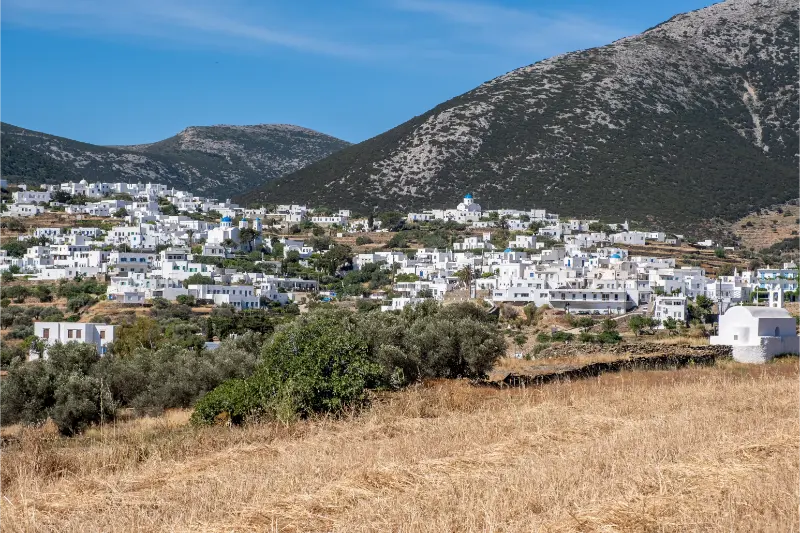
    Greece Sifnos Island Artemonas Town Traditional Architecture Blue Sky

    The answer becomes more conditional in shoulder season. Municipal timetables change several times a year, and a route that runs frequently in July may be limited in April or October. Check the schedule for your exact dates before making accommodation decisions.

    Best no-car bases

    ApolloniaBest overall for buses, restaurants and evening life
    ArtemonasExcellent central access with quieter atmosphere
    KamaresBest for ferry convenience + beach
    Platis GialosGood beach base when bus frequency is strong
    FarosPossible but quieter and more timetable-dependent
    Remote villasOften poor without pre-arranged transport

    How the bus network works in practice

    The municipality publishes seasonal routes linking Artemonas and Apollonia with Kamares, Platis Gialos, Faros, Vathi, Kastro and Herronissos at different times of year. The exact pattern changes, so think in corridors rather than memorising a permanent timetable.

    Photograph the current timetable at your accommodation or bus stop and keep the official online notice bookmarked. Build dinner plans around the last return service before you sit down, not after. On an island, “I will just take the next bus” may mean waiting much longer than in a city.

    Arrival at Kamares without a car

    If you stay in Kamares, arrival is simple once you know the walking distance to the hotel. If you continue inland, look for the bus or taxi connection after disembarking. Ferries unload quickly and the port can feel chaotic for ten minutes; do not let that pressure you into an unnecessary rental.

    For early departures, either sleep in Kamares or pre-arrange a taxi from the central villages. The convenience can be worth one final night near the port.

    Walking between the central villages

    Apollonia, Artemonas and the neighbouring settlements are made for walking. You can move through old paved lanes instead of treating every village as a bus stop. This is one reason the centre is so strong without a car: restaurants, bakeries, pharmacies and atmosphere are all available on foot.

    Use the central-villages guide for a route that makes the walk part of the sightseeing rather than simply transport.

    Using hiking trails as transport

    Some of Sifnos’s best paths connect places you might otherwise visit separately: central villages to Kastro, Faros to Chrysopigi, Platis Gialos toward Fikiada and Vathi. A one-way hike plus bus return can create a full day without a vehicle.

    This only works when you plan the logistics first. Check the Sifnos Hiking Guide, carry water and confirm the last practical bus. Taxis are the safety valve, not the primary schedule.

    Beaches without a car

    Kamares is the easiest because the beach sits beside the port settlement. Platis Gialos, Faros and Vathi are good targets when buses operate at useful frequencies. Remote beaches such as Fikiada require hiking or boat access and should be treated as excursions rather than casual transport stops.

    See Best Beaches in Sifnos to choose beaches by access as well as scenery.

    When a taxi makes sense

    Use taxis strategically: late dinners, early ferries, luggage transfers and route combinations that would require long waits. Booking one taxi can be cheaper and easier than renting a car for a week simply to solve two awkward journeys.

    In peak summer, pre-book important transfers. Do not assume a taxi will be waiting in a small beach village at midnight.

    When you should rent a car instead

    A car becomes more attractive if you are staying in a remote property, travelling with mobility constraints, carrying substantial child equipment, planning several far-flung beaches each day or visiting when bus service is thin. It also helps photographers and hikers who want very early starts outside normal transport hours.

    Even then, parking and pedestrian access in central villages should be checked with the hotel. A rental car is not useful if it spends the week far from your room while you walk the same lanes anyway.

    A five-day no-car outline

    • Day 1: arrive in Kamares, bus to Apollonia/Artemonas, central village evening.
    • Day 2: bus to Platis Gialos for beach and pottery.
    • Day 3: bus or one-way walk to Kastro, return according to timetable.
    • Day 4: Faros–Chrysopigi coastal walk and swim.
    • Day 5: Kamares beach before ferry, or a Vathi day if connections fit.

    Luggage, heat and accessibility

    No-car does not mean no walking. Some accommodation sits up steep lanes, and bus stops may be on a road below the property. Ask the hotel for the exact luggage route. Travellers with mobility limitations should prioritise flatter Kamares or carefully chosen central accommodation near road access.

    In summer, a ten-minute uphill walk with luggage at 14:00 feels very different from the same distance on a map. Arrange transfers when they materially improve the trip.

    Official transport information

    The Municipality of Sifnos publishes updated bus notices through its official sites. Use sifnos.gr or the municipality pages close to your travel date rather than relying on an old third-party schedule.

    Tours and activities

    If you want a guided walk, food experience, boat trip or another organised activity, compare what is available for your exact dates. On a small Cycladic island the choice can change by season, so check the meeting point, duration, language, cancellation terms and whether transport is included before booking.

    Frequently asked questions

    Do I need a car in Sifnos?

    No. A central base, buses, walking and occasional taxis can cover a very good first trip.

    Where should I stay without a car?

    Apollonia and Artemonas are best for overall flexibility; Kamares is best for port and beach convenience.

    Can buses reach the main beaches?

    Seasonal services connect several main beaches, including Platis Gialos, Faros and Vathi, but frequency changes.

    Can I visit Kastro without a car?

    Yes by seasonal bus, taxi or walking route from the central area.

    Are buses frequent at night?

    Not necessarily. Always check the last return before planning dinner away from your base.

    Should families rent a car?

    Not automatically. Families staying near central transport or Kamares can manage well without one, but a car helps with lots of equipment and remote accommodation.
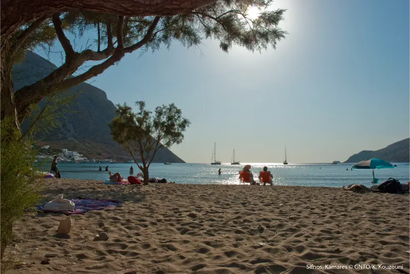
    Sifnos Kamares

    Final practical advice

    The secret to Sifnos without a car is not squeezing the car itinerary onto buses. Build a different trip: stay centrally, walk where the old paths make sense, use the bus for main beach corridors and spend taxi money only on the journeys that genuinely need it. Done this way, no-car travel can feel simpler rather than restrictive.

    Planning details that are easy to overlook

    Build each day around geography rather than a list of saved pins. Sifnos is compact, but repeated returns through the central road network can still waste time. Group central villages together, south-coast beaches together and Kastro with the eastern side. This leaves more time for meals and swimming, which are not empty gaps in a Sifnos itinerary but part of the experience.

    In July and August, heat changes the order of the day. Walk early, swim through the hottest hours and return to villages in late afternoon. In May, June, September and October, longer daytime walks become more realistic, but ferry and bus frequency may be lower. Always verify the transport that operates on your exact dates before making a non-refundable plan around it.

    Carry a refillable bottle, sun protection and shoes with grip even on days that are not labelled “hiking”. Stone lanes can be polished, coastal paths can be dusty and a five-minute viewpoint detour can become uncomfortable in smooth sandals. A light layer is useful for wind on evening terraces and ferry decks.

    For churches and monasteries, dress respectfully and avoid entering during services simply to take photographs. For pottery workshops, ask before photographing artisans at work. For beaches, leave stones, plants and shells where they are and take rubbish back to a serviced settlement if there are no bins.

    Finally, keep one flexible half-day in the itinerary. Wind, a changed bus timetable, a festival or a restaurant recommendation may give you a better plan than the one you made months earlier. Sifnos rewards travellers who organise the essentials but leave enough room for the island to change the schedule.

    A realistic pace for the day

    Avoid planning Sifnos as a sequence of ten-minute stops. Roads are short, but parking, bus waits, stone lanes, meals and beach access all add time. A realistic day normally has one main village or walk, one swim and one unhurried meal. This rhythm also makes it easier to adapt when wind changes the beach choice or when a small museum has different seasonal hours than expected.

    If you are combining this area with another part of the island, choose the nearest logical neighbour rather than crossing Sifnos repeatedly. Keep Kastro with the eastern side, Faros and Chrysopigi with the south-east, Platis Gialos with the south and Kamares with ferry-day logistics. This simple approach reduces unnecessary transfers and creates more time for the experiences that make the island distinctive.

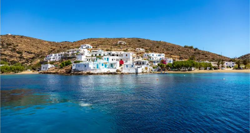
    Sifnos Island Faros Traditional Village Greece Cyclades
  • Kastro Sifnos Guide: Medieval Village, Eptamartyres, Museum and Seralia

    Kastro Sifnos Guide: Medieval Village, Eptamartyres, Museum and Seralia

    Kastro is one of the places that makes Sifnos feel deeper than a beach island. It was the old capital, preserves a defensive medieval layout and sits on a site inhabited since prehistoric times. Ancient columns, Roman sarcophagi, narrow gateways, chapels and white houses appear inside the same compact settlement, while the small church of Eptamartyres stands dramatically below the village above the Aegean.

    The temptation is to arrive for one famous photograph and leave. I would do the opposite: give Kastro enough time to read the settlement slowly, add the Archaeological Museum if open, walk toward Eptamartyres and decide whether conditions suit the descent to Seralia or a longer route toward Panagia Poulati.

    Kastro at a glance

    CharacterHistoric fortified village and former capital
    Main sightsMedieval lanes, Eptamartyres, Archaeological Museum
    Swimming nearbySeralia; rocky swimming around Poulati for experienced swimmers
    Best timeMorning or late afternoon
    Good with a car?Yes, but park outside the pedestrian core

    Why Kastro matters

    The Municipality of Sifnos describes Kastro as the ancient city mentioned by Herodotus and notes continuous occupation from the third millennium BC to the present. The village flourished in the sixth century BC and later developed the fortified form that gives it its modern name. This continuity is visible rather than abstract: old stone elements are embedded in newer buildings, and the settlement still follows the hilltop defensive logic.

    Two rings of buildings helped create protection, with wealthier houses historically concentrated further inside. Six gateways, known as lodges, controlled the entrances. Once you know this, the lanes stop looking like a random maze and start reading like a defensive urban plan.

    How to walk the village

    Enter without trying to follow the fastest line through the centre. Look for marble details, old coats of arms, reused ancient fragments and the changing sea views between houses. Because Kastro is still inhabited, keep voices down in residential lanes and do not treat doorways or terraces as photo props.

    The highest parts reveal the compact geometry of the settlement. The real pleasure comes from the contrast between enclosed lanes and sudden openings toward the sea. Allow at least an hour for the village itself before adding the museum or coastal paths.

    Eptamartyres: the famous chapel below Kastro

    East of Kastro, the chapel of the Seven Martyrs—Eptamartyres—sits on a rocky outcrop below the village. The descent gives one of the most recognisable views on Sifnos. It is not a beach promenade: steps and exposed rock can be slippery, hot and windy, so use proper footwear and avoid treating the railings or cliff edge casually for photographs.

    The return is uphill. In strong summer heat, do this section early or late rather than immediately after lunch. If the wind is rough, the visual experience is still excellent even if you decide not to spend time close to the water.

    Archaeological Museum of Sifnos

    The Archaeological Museum is in Kastro and holds material from prehistoric through Roman periods, including sculpture and coins. Small island museums can have seasonal hours or a weekly closing day, so verify the current Ministry of Culture information shortly before travelling rather than relying on an old blog timetable.

    The museum is most rewarding after you have walked the village because it gives context to the ancient city hidden inside the later settlement. It also provides a useful indoor break from midday heat.

    Seralia and Panagia Poulati

    At the foot of Kastro hill, Seralia is the small historic harbour area. It is a pleasant extension if you want a waterside meal or swim, but the climb back should be included in your plan. North of Kastro, the old path leads toward Panagia Poulati, one of the island’s striking church-and-coast landscapes.

    Poulati is better understood as a rocky coastal swimming area than a conventional sandy beach. Sea conditions matter. Do not enter rough water simply because other people are doing so; the safest beach choice on a windy day may be elsewhere on the island.

    Getting to Kastro

    Kastro can be reached by road and is also linked to the central villages by the old path network. Seasonal buses serve Kastro at selected times, but the number of services changes through the year. If you are travelling without a car, build the day around the current municipal timetable and keep a taxi number as backup for dinner or a missed connection.

    Walkers can connect Kastro with central settlements and other routes described in the Sifnos Hiking Guide. In hot weather, do not underestimate the lack of shade on exposed sections.

    Sifnos Kastro Eftamartyros

    Kastro with children

    School-age children who enjoy castles and exploration may love the gateways and winding streets. Families with toddlers should be more cautious around steep steps, exposed viewpoints and the descent toward Eptamartyres. A carrier is usually more practical than a stroller inside the historic core.

    Food and evening atmosphere

    Kastro has a small selection of tavernas and cafés rather than the breadth of Apollonia. That makes it a good place for a slower meal if you value setting over choice. For a wider evening scene, return to Apollonia and Artemonas.

    A realistic half-day plan

    • Arrive early or in late afternoon.
    • Walk the fortified settlement and its gateways slowly.
    • Visit the Archaeological Museum if its current hours fit.
    • Descend toward Eptamartyres only if heat, wind and footwear are suitable.
    • Add Seralia for a swim or meal, or save your energy for a longer hike toward Poulati.

    Official background

    The official Kastro page provides detailed historical context, while the municipality’s archaeological sites page explains the island’s ancient mining, towers and acropoleis.

    Tours and activities

    If you want a guided walk, food experience, boat trip or another organised activity, compare what is available for your exact dates. On a small Cycladic island the choice can change by season, so check the meeting point, duration, language, cancellation terms and whether transport is included before booking.

    Frequently asked questions

    Is Kastro worth visiting?

    Yes. It combines archaeology, medieval urban form, sea views and one of the island’s most recognisable chapels in a compact area.

    How long do I need?

    Allow two to three hours for the village, museum and Eptamartyres; longer if you add Seralia or a hike.

    Can I swim at Kastro?

    Seralia is the easiest nearby option. Poulati and other rocky spots require more caution and suitable sea conditions.

    Can I reach Kastro by bus?

    Seasonal buses serve the village, but frequencies change, so check the current municipal timetable.

    Is Kastro stroller-friendly?

    No. Steps, narrow lanes and uneven surfaces make a carrier more practical for small children.

    When is the best time to visit?

    Morning or late afternoon gives cooler walking conditions and better light; midday can be very hot in summer.

    Final practical advice

    Kastro rewards curiosity more than speed. Read the lanes as part of a fortified town, give the archaeology context and let the sea views appear naturally rather than racing from one photo point to another. Combined with Faros and Chrysopigi or a central-village walk, it becomes one of the strongest culture days on Sifnos.

    Planning details that are easy to overlook

    Build each day around geography rather than a list of saved pins. Sifnos is compact, but repeated returns through the central road network can still waste time. Group central villages together, south-coast beaches together and Kastro with the eastern side. This leaves more time for meals and swimming, which are not empty gaps in a Sifnos itinerary but part of the experience.

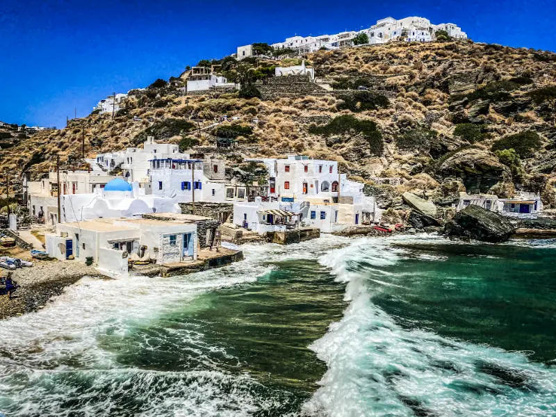
    Kastro Its Small Harbor Waves Sifnos Greece

    In July and August, heat changes the order of the day. Walk early, swim through the hottest hours and return to villages in late afternoon. In May, June, September and October, longer daytime walks become more realistic, but ferry and bus frequency may be lower. Always verify the transport that operates on your exact dates before making a non-refundable plan around it.

    Carry a refillable bottle, sun protection and shoes with grip even on days that are not labelled “hiking”. Stone lanes can be polished, coastal paths can be dusty and a five-minute viewpoint detour can become uncomfortable in smooth sandals. A light layer is useful for wind on evening terraces and ferry decks.

    For churches and monasteries, dress respectfully and avoid entering during services simply to take photographs. For pottery workshops, ask before photographing artisans at work. For beaches, leave stones, plants and shells where they are and take rubbish back to a serviced settlement if there are no bins.

    Finally, keep one flexible half-day in the itinerary. Wind, a changed bus timetable, a festival or a restaurant recommendation may give you a better plan than the one you made months earlier. Sifnos rewards travellers who organise the essentials but leave enough room for the island to change the schedule.

    A realistic pace for the day

    Avoid planning Sifnos as a sequence of ten-minute stops. Roads are short, but parking, bus waits, stone lanes, meals and beach access all add time. A realistic day normally has one main village or walk, one swim and one unhurried meal. This rhythm also makes it easier to adapt when wind changes the beach choice or when a small museum has different seasonal hours than expected.

    If you are combining this area with another part of the island, choose the nearest logical neighbour rather than crossing Sifnos repeatedly. Keep Kastro with the eastern side, Faros and Chrysopigi with the south-east, Platis Gialos with the south and Kamares with ferry-day logistics. This simple approach reduces unnecessary transfers and creates more time for the experiences that make the island distinctive.

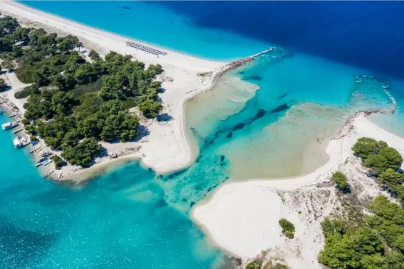
    Sifnos Island Faros Village Cyclades Greece Blue Sky Turquoise Sea Sandy Beach
  • Best Beaches in Halkidiki: Kassandra, Sithonia and Mount Athos Coast Compared

    Best Beaches in Halkidiki: Kassandra, Sithonia and Mount Athos Coast Compared

    Halkidiki has one of the most varied coastlines in northern Greece. The official regional tourism portal describes roughly 550 kilometres of coast, ranging from long organised sandy beaches to rocky coves backed by pine forest. The challenge is not finding a beautiful beach; it is choosing one that matches your base, wind, parking tolerance and travel style.

    Kassandra is generally easier for resort facilities and nightlife, Sithonia has the highest concentration of dramatic coves and road-trip beaches, while the Mount Athos side combines sandy coast with quieter eastern settlements and views toward the monastic peninsula. A good beach plan is regional: choose a base and explore nearby rather than driving the full trident every day.

    Port Glarokavos And Beach Lagunare In Peninsula Of Kassandra Halkidiki Greece

    Why this Halkidiki stop is worth your time

    Use this guide to match beaches to your trip rather than to rank them as if one shoreline can satisfy every traveller. Families, snorkellers, couples, beach-bar fans and photographers often need different things.

    Quick planning summary

    • Best season: late May to June and September for warm weather with easier parking and sightseeing.
    • Peak season: July and August bring the widest services but also the heaviest beach and road pressure.
    • Transport: a car is the easiest way to combine villages and beaches, while KTEL buses work best between larger settlements.
    • Trip style: choose one peninsula or one local cluster per day instead of trying to cross the whole region.
    • Safety: wind, heat, currents, roadside parking and forest-fire restrictions can change the best plan for a given day.
    • Variable information: recheck beach access, archaeological hours, boat departures and bus timetables shortly before travel.

    What to see and do

    Karidi, Vourvourou

    Best for shallow turquoise water and a postcard setting. It is small and crowded, so early arrival matters.

    Build time around this stop rather than squeezing it between several distant beaches. Halkidiki looks compact on a map, but summer traffic, parking and winding peninsula roads make a slower schedule far more enjoyable.

    Kavourotrypes / Orange Beach

    Best for white-rock coves and photography. Access and parking are harder than the photos suggest.

    Build time around this stop rather than squeezing it between several distant beaches. Halkidiki looks compact on a map, but summer traffic, parking and winding peninsula roads make a slower schedule far more enjoyable.

    Sarti

    Best for a long sandy beach with services and Mount Athos views. It is easier for families than many tiny east-coast coves.

    Build time around this stop rather than squeezing it between several distant beaches. Halkidiki looks compact on a map, but summer traffic, parking and winding peninsula roads make a slower schedule far more enjoyable.

    Sani

    Best for organised facilities, shallow water and a polished resort environment. Public/resort access varies by section.

    Build time around this stop rather than squeezing it between several distant beaches. Halkidiki looks compact on a map, but summer traffic, parking and winding peninsula roads make a slower schedule far more enjoyable.

    Possidi / Aegeopelagitika

    Best for open west-coast scenery, long sand and sunset. Watch wind and currents around the cape.

    Build time around this stop rather than squeezing it between several distant beaches. Halkidiki looks compact on a map, but summer traffic, parking and winding peninsula roads make a slower schedule far more enjoyable.

    Kalogria and west Sithonia

    Best for clear water and combining several beaches from Nikiti or Neos Marmaras. Parking is the main issue in peak season.

    Build time around this stop rather than squeezing it between several distant beaches. Halkidiki looks compact on a map, but summer traffic, parking and winding peninsula roads make a slower schedule far more enjoyable.

    Paliouri / Chrousso

    Best for shallow sandy water in southern Kassandra and a family-oriented bay, though beach bars can be lively on weekends.

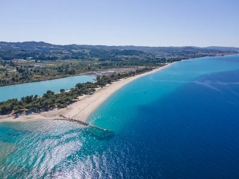
    Kassandra Coastline Near Lagoon Beach Chalkidiki Greece

    Build time around this stop rather than squeezing it between several distant beaches. Halkidiki looks compact on a map, but summer traffic, parking and winding peninsula roads make a slower schedule far more enjoyable.

    Ouranoupoli and Kampoudi coast

    Best for combining beach time with Ammouliani or Mount Athos-area excursions. The coast has organised options and easy access from Ouranoupoli.

    Build time around this stop rather than squeezing it between several distant beaches. Halkidiki looks compact on a map, but summer traffic, parking and winding peninsula roads make a slower schedule far more enjoyable.

    A realistic itinerary

    • If based in Kassandra: Afitos/Kallithea day, Sani day, Possidi or Paliouri day.
    • If based in north Sithonia: Nikiti/Kalogria day, Vourvourou/Karidi day, optional boat day.
    • If based in south/east Sithonia: Sarti, Kavourotrypes early, then Toroni or Kalamitsi on another day.

    This itinerary is intentionally conservative. If you have an extra day, repeat the beach or village you liked most rather than adding another two-hour return drive. A holiday here becomes much better once you stop treating every famous cove as mandatory.

    Where to stay

    Choose accommodation by beach cluster. Afitos or Kallithea works for Kassandra, Nikiti or Vourvourou for north Sithonia, Sarti for east Sithonia and Neos Marmaras for the west. Ouranoupoli is best for the Mount Athos/Ammouliani side.

    Check the exact map position before booking. In Halkidiki, the same resort name can cover a surprisingly long stretch of coast. Also confirm parking, road gradient, air conditioning and whether restaurants are realistically walkable after dark.

    For accommodation, compare current options on Booking.com. Use map view and recent reviews, especially for noise, parking and beach access.

    Getting there and getting around

    A car offers the most flexibility. KTEL buses connect major settlements, but they are not designed for hopping between remote coves. In July and August, leave early because parking often becomes the limiting factor.

    Thessaloniki Airport is the main gateway for most international visitors. Visit Greece notes regular intercity KTEL connections to principal Halkidiki towns, but buses are easier for staying in one base than for visiting remote coves. If you drive, avoid illegal verge parking and never block forest or emergency access.

    Best time to visit

    June and September are the easiest all-round months for many travellers: the sea is usable, restaurants and excursions are active, and the most famous beaches are less pressured than in August. July and August are excellent for a classic summer holiday but require early starts for parking. May can be beautiful for walking and villages, while October becomes more weather-dependent.

    Wind direction matters. A beach that is perfect one day may be choppy the next, while a cove on the opposite side of a peninsula can be comfortable. Check a local marine forecast in the morning and be willing to change beaches.

    Food and local products

    Do not drive an hour just for a famous beach-bar lunch if your base has good tavernas. Beach days are easier when you keep lunch local and save destination dining for evenings.

    Across Halkidiki, look for olives and olive oil, honey, local wine, seafood and simple grilled dishes. Inland villages add meat, pies and mountain produce. Ask what is local and seasonal rather than ordering the same tourist menu at every beach.

    Travelling with children

    For younger children, prioritise shallow water, toilets, shade and easy access over Instagram scenery. Sani, Nikiti, Sarti and Paliouri are generally simpler than tiny rocky coves.

    For children, shade and access matter more than fame. Bring water shoes where rock entries are common, use reef-safe sun protection, and avoid the strongest midday sun. On long beach days, a nearby supermarket or taverna can be more valuable than one extra viewpoint.

    Costs and practical details

    The biggest cost differences come from accommodation style, beach clubs and car rental. Many beaches remain free to access, but organised sunbeds, parking, boat trips and resort facilities add up quickly. Carry some cash for small businesses and keep a little flexibility in the budget for a boat or activity that looks worthwhile once you arrive.

    How to connect this article with the rest of Halkidiki

    Continue planning with Halkidiki travel guide; Kassandra guide; Sithonia guide; Ouranoupoli guide. These pages are designed to work as one Halkidiki cluster rather than isolated guides.

    Sithonia Coastline Near Agios Ioannis Beach Chalkidiki Greece

    Common mistakes

    • Trying to see beaches on all three peninsulas in one day.
    • Parking illegally near forest or emergency access.
    • Assuming shallow water means no currents.
    • Bringing no shade to unorganised coves.
    • Choosing only famous beaches and ignoring quieter alternatives near your base.

    Frequently asked questions

    How many nights should I stay?

    Three or four nights is a useful minimum for one peninsula or local cluster. A full week lets you split the trip between Kassandra and Sithonia or add the Mount Athos area without rushing.

    Do I need a rental car?

    Not for every trip, but a car is the most flexible choice for beaches. Without one, choose a larger base such as Nikiti, Sarti or Neos Marmaras and use buses, taxis and organised excursions selectively.

    Is August too crowded?

    August is busy, but it is manageable if you start early, stay near the beaches you actually want and avoid driving across the region at peak times.

    Are beaches good for children?

    Many are excellent, especially shallow sandy options in Sani, Nikiti, Sarti and Paliouri. Tiny rock coves are beautiful but often less convenient for toddlers.

    What should I verify before the trip?

    Current KTEL schedules, boat departures, archaeological opening hours, beach or resort access, fire-risk restrictions and marine weather for the days you plan to swim or sail.

    Useful official source

    For information that may change, use Visit Halkidiki – Beaches and recheck local access, opening hours and transport close to your travel date.

    Final advice

    The best Halkidiki trips are local rather than exhaustive. Pick a base that matches your style, arrive at famous beaches early, keep a second option for wind or parking, and leave enough time for a long lunch or sunset. The region becomes much more rewarding when you stop racing between the three peninsulas.

  • Andros Travel Guide: Chora, Beaches, Hiking and a 5-Day Itinerary

    Andros Travel Guide: Chora, Beaches, Hiking and a 5-Day Itinerary

    Andros is one of the easiest Cycladic islands to underestimate. It has the whitewashed villages and clear Aegean water people expect from the Cyclades, but it is also greener, more mountainous and more varied than the classic postcard stereotype. Water springs, stone bridges, old mule paths and fertile valleys give the island a character that feels distinctly its own.

    I would choose Andros when I wanted an island holiday with more than beaches. It works especially well for travellers who enjoy walking, road trips and small villages. It also pairs naturally with other Cyclades destinations such as Tinos while feeling much less focused on nightlife than Mykonos.

    Why visit Andros?

    The strongest reason to visit is variety. In a single day you can walk through elegant Chora, swim below a rugged headland, stop in a village shaded by plane trees and follow an old path across a green valley. The western coast around Gavrio and Batsi is practical for beaches and transport, while the eastern side around Chora feels more cultural and refined.

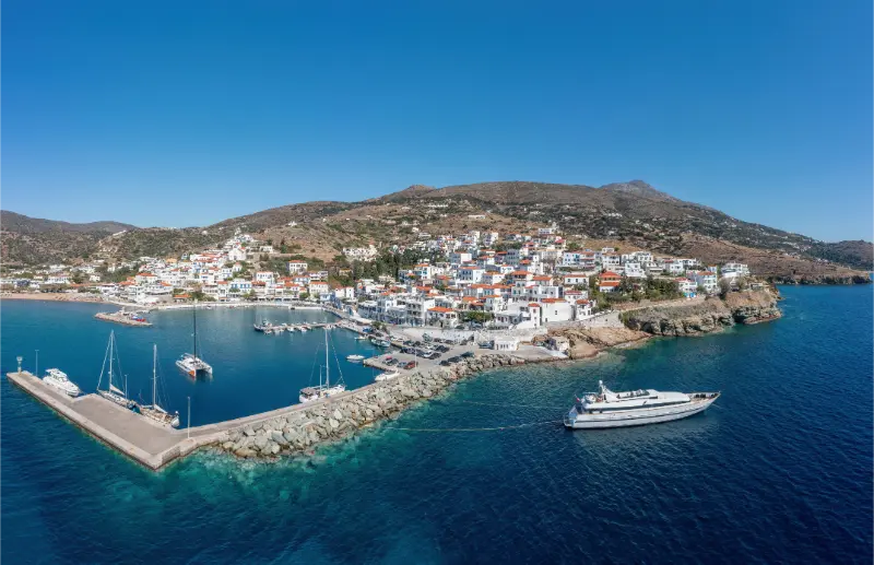
    Andros Island Batsi Village Cyclades Greece Aerial Drone View Port Breakwater Yacht Sea Sky

    Andros is also one of the best Greek islands for hikers. The marked trail network links villages, monasteries, valleys and coastlines, so walking can become part of the trip rather than a single organised excursion. That makes the island attractive in spring and autumn, not only during peak beach season.

    Where to stay

    There is no single perfect base because Andros is relatively large and its main areas serve different styles of trip. If you have a car, splitting your stay can reduce driving and make the island feel more varied.

    Gavrio

    Gavrio is the ferry port and the most practical arrival base. It is useful for late arrivals, early departures and access to north-western beaches. I would choose it for convenience rather than atmosphere.

    Port Of Gavrio On Island Of Andros In Greece

    Batsi

    Batsi combines a protected bay, restaurants, accommodation and an easy holiday rhythm. It is one of the simplest bases for couples and families who want evenings on foot and beaches close by.

    Chora

    Chora is the most visually distinctive base, with neoclassical houses, museums, sea views and access to eastern beaches. Choose it if culture, architecture and walking matter more than being close to the ferry.

    Korthi

    Korthi in the south is quieter and well placed for Grias to Pidima beach, inland villages and walking routes. It suits travellers who prefer a slower base away from the busier western coast.

    Best things to do

    Walk through Chora

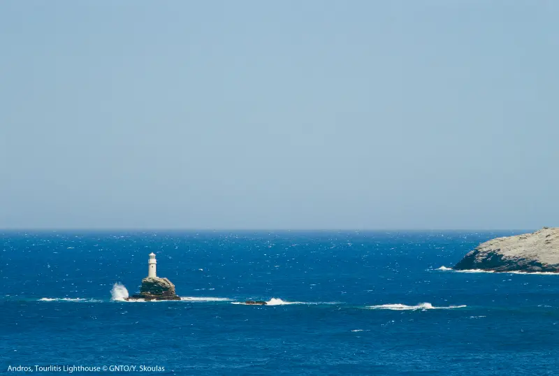
    Explore the long pedestrian centre, the old mansions and the viewpoints toward the sea. The setting around the Tourlitis lighthouse is one of the island’s signature images, but the pleasure of Chora is also in its cafés, small museums and unhurried streets.

    Andros Tourlitis Lighthouse

    Hike part of the Andros Routes network

    The island has an unusually extensive network of marked historic paths. Choose a route that matches your fitness and the weather rather than treating every trail as an easy coastal walk. Spring and autumn are particularly rewarding.

    Visit Apikia and Menites

    These green villages show a different side of the Cyclades, with springs, shaded lanes and vegetation that feels surprising after drier islands. They are easy to combine with Chora on a road-trip day.

    See Grias to Pidima

    This beach near Korthi is known for its dramatic sea stack and wild setting. Access and sea conditions can vary, so arrive with sensible footwear and do not assume it will feel like an organised resort beach.

    Explore the western beaches

    Agios Petros, Kypri and Chrysi Ammos are among the easier beach choices for a relaxed day, with straightforward access compared with some of the island’s remote coves.

    Discover the mining and maritime story

    Andros has a long seafaring identity, while different parts of the island also reveal agricultural and industrial history. Museums and old routes give useful context beyond the beach experience.

    Beaches and nature

    Andros has more than forty beaches and a long coastline with very different access conditions. The western side generally offers the easiest family-friendly options, while beaches such as Achla or Vitali can require more planning. Wind direction matters: a beach that looks perfect on a photo may feel exposed on a strong meltemi day.

    The interior is just as important. Valleys, springs and old stone paths make Andros unusually rewarding for travellers who normally get restless after several beach days. If hiking is central to your trip, build the itinerary around one or two specific routes and keep a weather alternative ready.

    Food and local character

    Andros is a good island for long taverna lunches. Look for local cheeses, vegetable dishes, pies, fresh fish and regional sweets rather than chasing only famous names. Mountain and village tavernas can feel very different from seafront restaurants.

    I would plan at least one meal away from the main tourist waterfronts. The island’s character becomes clearer in inland villages, especially when food is connected to local produce and family-run kitchens.

    How to get there

    Andros has no commercial airport. Most visitors arrive by ferry from Rafina, the port east of Athens that serves several northern Cyclades islands. The crossing pattern changes by season, so check current timetables before fixing onward flights or hotel nights.

    Because Rafina is not central Athens, allow realistic transfer time between Athens International Airport, the city and the port. If Andros is the first island of a longer trip, it can be efficient to sleep near Rafina after a late flight rather than force a tight connection.

    Getting around

    A car gives the most freedom, particularly for remote beaches, villages and trailheads. Roads can be winding and some beach approaches may be unpaved. Drive conservatively and never assume a rental vehicle is permitted on rough tracks.

    Buses connect important settlements, but they are less useful for a detailed beach-and-hiking itinerary. If you do not drive, base yourself in Batsi or Chora and build the trip around places reachable by bus, taxi and organised transfers.

    How many days do you need?

    Four nights is a useful minimum; five days gives the island room to breathe. With only two days, choose one coast and accept that you are sampling Andros rather than seeing it. Hikers can easily justify a week.

    A practical 5-day Andros itinerary

    Day 1 – Gavrio and Batsi

    Arrive, collect your car if needed and settle around Batsi. Keep the first day light: a nearby swim, waterfront walk and dinner are enough after ferry travel.

    Day 2 – Chora and the east

    Spend the morning in Chora, then combine it with a nearby beach and one inland village. Stay for the late-afternoon light rather than rushing back across the island.

    Day 3 – Hiking and green villages

    Choose a marked trail around Apikia, Menites or another section of the network. Make this a walking day rather than adding multiple distant beaches afterward.

    Day 4 – South Andros

    Drive toward Korthi, explore the village and visit Grias to Pidima if conditions and access suit you. Stop at viewpoints and small villages along the way.

    Day 5 – Western beaches

    Finish with an easy beach day around Agios Petros, Kypri or Chrysi Ammos before returning toward Gavrio for your ferry.

    Best time to visit

    May, June, September and early October are excellent for a mixed hiking-and-beach trip. Summer has the warmest sea and the fullest services, but July and August can be hot and windy.

    For serious walking, spring and autumn are usually more comfortable. In winter the island becomes much quieter and greener, but travellers should expect reduced tourism services and more weather dependence.

    Is it a good choice for families?

    Andros can work very well for families who choose an easy base and do not overplan driving. Western beaches with gentler access are usually simpler than remote coves reached by rough tracks or long descents.

    Older children who enjoy nature may love short hiking sections, springs and village walks. Check route difficulty carefully and avoid exposed midday hikes in hot weather.

    Budget and booking tips

    Accommodation prices change sharply with season, location and room type. I prefer to compare a few bases before booking rather than choosing the first hotel that looks inexpensive. A cheaper room far from the places you actually want to see can cost more once transport, parking and lost time are included.

    For ferries, flights, rental cars, boat trips and guided activities, treat schedules and prices as dynamic. Check the operator again shortly before travel, especially outside July and August. Weather can affect sea transport, while seasonal businesses may open later in spring or close earlier in autumn.

    Mistakes to avoid

    The biggest mistake is assuming every beach is ten minutes from the main road. Some of the most famous places require slower driving, walking or local knowledge. Build in extra time and be willing to change plans if wind or road conditions are poor.

    Another mistake is staying only near the port and concluding that you have seen Andros. The eastern side, inland villages and trail network are central to the island’s identity.

    Who Andros suits best

    Andros works best for travellers who are comfortable giving a destination enough time to reveal its character. If your priority is to collect as many islands or regions as possible in a single week, this may feel slower than expected. If instead you enjoy mixing beaches or landscapes with local food, village walks, cultural stops and unplanned pauses, the trip becomes much more rewarding. Couples can build quiet evenings around scenic towns, solo travellers gain flexibility to follow weather and transport conditions, and repeat visitors to Greece will appreciate seeing a side of the country that is less dominated by the most internationally famous stops.

    It is also a strong choice for independent travellers who like making decisions day by day. A rental vehicle can open up more options, but it should not turn the holiday into a driving challenge. Pick one main objective for each day, then add nearby stops only if time and energy allow. That approach keeps the itinerary useful for different ages and budgets and reduces the temptation to race from viewpoint to viewpoint.

    Planning the pace of your trip

    My preferred way to plan this kind of Greece trip is to separate transfer days from sightseeing days. Arrival and departure always take longer than the timetable suggests once luggage, check-in, parking, meals and possible delays are included. Treating those hours as real travel time makes the itinerary far more realistic. On full days, start early for exposed archaeological sites, long drives or hikes, then reserve the hottest part of the afternoon for lunch, swimming or rest.

    Keep at least one half-day flexible. Wind, heat, ferry changes or a beach you unexpectedly love can easily change priorities. A flexible block prevents one cancelled boat trip or poor-weather morning from becoming a problem. It also leaves space for the experiences that are difficult to schedule in advance: a village festival, a recommendation from a hotel owner, a quiet cove discovered on the road or simply the decision to stay longer over lunch.

    How to combine Andros with the rest of Greece

    Andros combines naturally with Tinos, and seasonal ferry routes can make further Cyclades connections possible. If this is your first Greece trip, also compare the island with Naxos for a different balance of beaches, villages and archaeology.

    If you want a broader overview before choosing, use the best Greek islands guide and keep transfers realistic. Two well-chosen islands usually make a better week than four rushed ferry stops.

    Frequently asked questions

    Is Andros worth visiting?

    Yes, especially if you want beaches, villages and hiking in one trip rather than a resort-only island.

    Do I need a car on Andros?

    A car is highly useful for a broad itinerary, although Batsi and Chora can work for shorter car-free stays.

    How long should I stay?

    Four to five days is a strong first visit. A week is ideal if hiking is important.

    Is Andros very windy?

    Like other Cyclades islands, it can be affected by strong summer winds. Beach choice should adapt to the daily forecast.

    Can I combine Andros with Athens?

    Yes. Ferries use Rafina, making Andros a practical island extension before or after time in Athens.

    Practical final advice

    Build your days around geography rather than a checklist. Group nearby beaches, villages and sights together, leave room for a long lunch or an unexpected swim, and avoid crossing the same area repeatedly. This matters even more on islands and mountain roads, where short distances can take longer than they appear on a map.

    Carry water, sun protection and shoes suitable for uneven ground. Download an offline map before remote drives or hikes, and do not rely on mobile coverage in every cove or mountain village. If a route uses an unpaved road, confirm the conditions locally and check whether your rental agreement permits it.

    Most importantly, allow the destination to feel different from the headline islands. The value of this trip is not in reproducing Santorini or Mykonos somewhere else, but in experiencing its own landscapes, food, architecture and daily rhythm. A slower itinerary usually produces a better trip than adding another island simply because it fits on the map.

    Useful official information

    For destination updates and inspiration, consult the Greek National Tourism Organisation: Visit Greece – Andros. Always recheck transport timetables and seasonal opening details close to your travel dates.

    More Attica guides for your trip

    Continue with Rafina Port for more detailed planning.

    More in-depth Andros guides

    Continue planning with Chora Andros Guide; Batsi Andros Guide; Gavrio and Agios Petros Andros Guide; Korthi Andros Guide; Menites, Apikia and Pythara Waterfalls Andros Guide; Ancient Andros Guide; Best Beaches in Andros; Andros Hiking Guide; Andros Without a Car; Where to Stay in Andros.

    Related itinerary: Andros and Tinos in 7 Days: Hiking, Villages and Beaches Itinerary.

  • Chora Andros Guide: Neoclassical Mansions, Museums, Tourlitis Lighthouse and Where to Stay

    Chora Andros Guide: Neoclassical Mansions, Museums, Tourlitis Lighthouse and Where to Stay

    Chora is the side of Andros that surprises travellers who expect every Cycladic capital to look the same. Instead of a dense maze of identical white cubes, the town mixes neoclassical mansions, maritime history, pedestrian lanes, two beaches and a dramatic rocky end point facing the Tourlitis lighthouse. It feels elegant rather than resort-like, and it makes a strong base for travellers who care about architecture, museums, cafés and walking as much as swimming.

    I would stay in Chora for at least two nights if culture is a priority. A rushed day trip can cover the main pedestrian street and a museum, but the town is better early in the morning and again after sunset, when day visitors leave and the long spine of shops and cafés becomes part of local evening life. For the island-wide picture, start with the Andros Travel Guide.

    Chora at a glance

    QuestionBest answer
    Best forCulture, architecture, couples, walkers and travellers who enjoy evenings on foot
    Nearest beachesNimborio and Paraporti
    Car needed?No for Chora itself; useful for wider island exploration
    How longOne full day for highlights, two or more nights for a relaxed stay
    Main trade-offFarther from Gavrio ferry port than Batsi or Gavrio

    Walk the pedestrian centre slowly

    The centre of Chora is built for walking. Start before the heat becomes intense and follow the main pedestrian street past cafés, bakeries, small shops and neoclassical façades. The architecture reflects the island’s long maritime wealth: Andros produced important ship-owning families, and Chora’s houses often feel more urban and formal than the village homes on smaller Cycladic islands. Do not rush directly to the final viewpoint; the pleasure is in side lanes, courtyards, shaded steps and the contrast between stone, plaster and sea.

    If you are photographing the town, morning light is useful on one side of the peninsula while late afternoon creates a softer atmosphere around the squares. Comfortable shoes matter because polished paving and steps can be slippery. Chora is compact, but it is not completely flat, and museum visits add more standing than the map suggests.

    Riva Square, the Unknown Sailor and Tourlitis Lighthouse

    At the seaward end of town, Riva Square and the statue of the Unknown Sailor open toward one of the most recognisable views on Andros. Offshore, Tourlitis lighthouse rises from a narrow rock, giving the harbour entrance a theatrical quality. The current lighthouse dates to the modern era but the site has become a visual symbol of the island. You do not need a tour to appreciate it: the best experience is simply to walk to the end of Chora when the light is good and the wind is comfortable.

    Andros Tourlitis Lighthouse

    The ruined Venetian-era lower castle on the islet is part of the same view. Access conditions around exposed rocks can be affected by sea and weather, so treat the viewpoint rather than the ruin itself as the core experience. This is also a good place to understand Chora geographically: Nimborio lies to one side, Paraporti to the other, and the town occupies a narrow ridge between them.

    Archaeological Museum of Andros

    The Archaeological Museum is one of the easiest cultural stops to add to a Chora day. The Cyclades Ephorate of Antiquities publishes 2026 summer hours of 09:00–16:00 with Tuesday closed and a general ticket of €5. Collections help place Andros in a much longer timeline than its neoclassical appearance suggests, with material from ancient settlements and important finds from the island.

    I would visit the museum before an archaeology-focused road trip because the objects give context to Paleopolis, Ypsili and other sites. Opening patterns can change outside the published season, so check the official schedule rather than planning an entire day around an old blog post. Our Ancient Andros Guide explains how to connect Chora’s museum with the archaeological landscape.

    Museum of Contemporary Art and maritime culture

    Chora also has a strong modern cultural identity. The Museum of Contemporary Art of the Basil and Elise Goulandris Foundation is one of the island’s best-known institutions, while maritime collections and local exhibitions reflect the ship-owning history that shaped the town. Temporary exhibitions change, so the most useful planning approach is to decide how much indoor time you want, then check what is actually running during your stay.

    On a very windy afternoon, museums are not a consolation prize; they are one of the reasons Chora works better than a pure beach resort. Build a flexible day in which you can swap swimming and culture according to conditions.

    Nimborio and Paraporti beaches

    Nimborio is the more convenient choice for a quick swim from town, especially when you want to return to a café or hotel without moving the car. Paraporti is broader and more exposed, with a wilder feel. Neither should be chosen from photos alone: wind direction and sea state can make one side of Chora much more comfortable than the other on the same day.

    For a dedicated beach holiday I would usually base farther west, but for a culture-led trip the ability to walk from a museum to the sea is a major advantage. The Best Beaches in Andros guide compares organised and wild options across the island.

    Where to eat and spend the evening

    Chora has enough restaurants, bakeries, cafés and bars to make evenings easy without driving. Look for local Andriot dishes rather than treating dinner as generic island food: froutalia, local cheeses, preserved products and seasonal vegetables help distinguish the island. Reservations are sensible for sought-after restaurants in August, but the broader lesson is to avoid driving across the island only for dinner if you already have a pleasant pedestrian centre outside your door.

    After dinner, repeat part of the morning walk. The town feels different after shops quieten, and the illuminated waterfront gives Chora a more residential atmosphere than many famous Cycladic capitals.

    Day trips from Chora

    Chora is well positioned for the green central valleys. Menites, Lamyra and Apikia can be combined with springs and short walks, while Pythara waterfall is a natural add-on when conditions are suitable. Hikers can use marked routes toward Panachrados Monastery, Vourkoti or Korthi. If you have a car, keep these as east-and-central days rather than adding Batsi or remote northern beaches to the same schedule.

    Andros Island Batsi Village Cyclades Greece Aerial Drone View Port Breakwater Yacht Sea Sky

    For a realistic village-and-water day, read the Menites, Apikia and Pythara guide. For longer walking, the Andros Hiking Guide explains route choices and difficulty.

    Where to stay in Chora

    Choose the centre if you want restaurants and museums within minutes, but ask about luggage access because pedestrian lanes can turn a short map distance into several flights of steps. Accommodation near Nimborio can make swimming and parking easier, while properties farther inland may be quieter. Do not book solely for a sea-view balcony without checking the walking route from the nearest vehicle access point.

    If your flight or ferry day is early, remember that Gavrio is the ferry port. Chora is a destination base, not the transport hub. The Where to Stay in Andros guide compares Chora with Batsi, Gavrio and Korthi in detail.

    Best time to visit

    For a trip that mixes villages, walking and beaches, May, June, September and early October are the most balanced periods. The landscape is easier to enjoy on foot, roads and parking are less stressful than in peak August, and the sea is usually part of the day rather than the only reason to travel. July and August bring the strongest holiday atmosphere, more ferry capacity and fully active beach businesses, but they also demand earlier starts, stronger sun protection and more flexible planning around wind.

    Spring can be excellent for hikers because Andros is unusually green for the Cyclades, although winter and spring growth can temporarily obscure sections of old paths before maintenance teams clear them. In 2026 Andros Routes published repeated spring and summer maintenance updates, a useful reminder that even well-marked trails are living infrastructure rather than indoor attractions. Always check the latest route notes if walking is central to the trip.

    Who this part of Andros suits best

    Chora is strongest for couples, solo travellers, culture-focused visitors and hikers who want cafés and museums at the end of the day. Families can enjoy it too, particularly with older children, but a beachfront base such as Batsi may be easier for a trip centred on daily swimming. Travellers with limited mobility should ask hotels precise questions about steps and vehicle access.

    Andros Island Batsi Village Cyclades Greece Aerial Drone View Sandy Beach Sea Water Blue Sky

    What to carry

    Carry water, sun protection and shoes with grip. Add swimwear if you plan to use Nimborio or Paraporti, and a light layer for evenings because wind can make the seafront cooler than inland streets. Museum visitors should keep the current opening schedule saved on their phone rather than relying on memory.

    Common mistakes to avoid

    The biggest planning error on Andros is underestimating the island because it sits close to Athens. Roads cross steep terrain, villages are separated by valleys and a beach that looks near on a map may require a very different approach road. Build days around one part of the island instead of zigzagging from north to south. The second mistake is assuming the famous Cycladic wind affects every bay equally; conditions can differ sharply by coast, so keep a second beach or walking plan in mind.

    A third mistake is treating the ferry timetable as the only transport decision. The ferry arrives at Gavrio, while Chora is on the opposite side of the island. If you are travelling without a car, the timing of the onward bus or taxi matters. If you drive, check parking at your accommodation and do not assume narrow village lanes are appropriate for through traffic.

    Continue planning your Andros trip

    Use the guides together rather than as separate checklists. Start with the main Andros travel guide and then open the specialist pages that match your route: Andros Travel Guide; Batsi Andros Guide; Gavrio and Agios Petros Guide; Korthi Andros Guide; Menites, Apikia and Pythara Guide; Ancient Andros Guide; Best Beaches in Andros. The remaining guides are linked throughout the cluster where they are most relevant, so you can move from a base or beach decision to transport and hiking without rebuilding the itinerary from scratch.

    Useful official sources before you go

    For current destination information I cross-check the Municipality of Andros visitor portal and the Andros Routes project. Trail conditions, museum schedules, ferry services and local transport can change seasonally, so verify time-sensitive details shortly before travel. The Cyclades Ephorate of Antiquities publishes current museum and archaeological-site hours.

    Frequently asked questions

    Is Chora the same as Andros Town?

    Yes. Chora, often called Andros Town, is the island capital on the east coast.

    Can I stay in Chora without a car?

    Yes. The centre is fully walkable and buses/taxis connect with other main areas, but a car makes remote beaches and villages easier.

    How many nights should I stay?

    Two to four nights works well if culture, walking and eastern Andros are priorities.

    Which beach is easiest from Chora?

    Nimborio is generally the simplest town beach; Paraporti is broader and more exposed.

    Is Chora good for nightlife?

    It has bars and a pleasant evening scene, but it is not a large club destination like Mykonos.

    Final planning advice

    Andros rewards a slower plan. Choose a base that makes your mornings easy, group nearby villages and beaches into the same day, and leave room for weather. The island is varied enough that a windy beach day can become a museum, village or hiking day without feeling like a compromise. That flexibility is one of the reasons Andros works so well for repeat visits as well as a first Cyclades trip.

  • Larissa Travel Guide: Ancient Theatre, Pinios River, Museums, Food and Day Trips

    Larissa Travel Guide: Ancient Theatre, Pinios River, Museums, Food and Day Trips

    Larissa is one of Greece’s largest regional cities, but it rarely appears on first-time itineraries. That is precisely why it can be rewarding. An ancient theatre sits beside busy pedestrian streets, cafés fill the modern centre, the Pinios River creates a green edge to the city, and Thessaly’s agricultural plain shapes the food and markets around you.

    Larissa works best for travellers who want an urban base without a heavy tourist layer. Give it one full day for the city and a second if you want Tempe, Ambelakia, Mount Ossa or a wider Thessaly road trip. It also makes sense as a stop between Athens, Meteora, Mount Olympus and the Aegean coast.

    Quick planning notes

    • Best for city-break travellers, food lovers and road trippers crossing Thessaly.
    • Allow one full day for the centre, theatre, museums and river; add nights for regional excursions.
    • The central pedestrian area is easy on foot and cycling is common on the flat terrain.
    • Summer afternoons can be very hot on the Thessalian plain, so move outdoor sightseeing to morning and evening.
    • A car is not necessary inside Larissa but becomes useful for Ambelakia, Mount Ossa and smaller villages.
    • Check museum and archaeological-site opening times separately; they may close earlier than city attractions.

    Why visit

    Larissa Travel Guide fills an important gap in a mainland Greece itinerary because it combines a strong sense of place with practical connections to better-known destinations. Instead of treating it as a box to tick, build the visit around the landscape, local rhythm and one or two experiences that are genuinely specific to the area.

    The biggest planning mistake is trying to compress too many nearby places into one day. Distances on the map can look modest, but mountain roads, museum hours, summer heat and long Greek lunches all slow a trip down. A realistic schedule usually produces better photographs, better meals and much more time actually inside the places you travelled to see.

    What to see and do

    Ancient Theatre of Larissa

    The First Ancient Theatre sits directly beside the modern centre, creating one of Larissa’s most striking contrasts. Built into the slope of Frourio Hill, it reminds you that the city has occupied the same strategic landscape for centuries. Even when full access to the monument changes because of conservation or events, viewing it from the surrounding streets is worthwhile. Use it as the starting point for understanding the historic core.

    Frourio district

    The Frourio area layers ancient, Byzantine and Ottoman history above the commercial centre. Walk slowly around the hill, looking for surviving monuments and the way old routes connect with modern squares. The district is compact enough to explore on foot and works especially well in the late afternoon when cafés and pedestrian streets become livelier.

    Diachronic Museum of Larissa

    The Diachronic Museum provides the deeper historical framework that the open-air theatre cannot. Collections span prehistoric, classical, Roman, Byzantine and later periods from Thessaly, helping visitors understand the scale of settlement across the fertile plain. It deserves real time rather than being treated as a rainy-day backup.

    Pinios River and riverside walking

    The Pinios is central to Thessaly’s geography and gives Larissa a greener, more relaxed edge. Riverside areas are useful for walking, cycling and taking a break from the dense centre. Conditions vary by season and river level, so stay on maintained paths and respect any temporary closures after heavy weather.

    Markets, pedestrian streets and café culture

    Larissa is a city to experience at street level. The pedestrian centre is busy with shops, bakeries, coffee bars and restaurants, especially in the evening. Rather than chasing a long monument list, allow time to observe how a major inland Greek city functions. This everyday energy is one of the main reasons to stay overnight.

    Alcazar Park and green spaces

    The Alcazar area offers additional green space near the river and helps balance museum-heavy sightseeing. It is particularly useful for families or anyone travelling in shoulder season when you can spend longer outdoors. Pair it with the riverside rather than crossing the city repeatedly.

    A realistic itinerary

    1. Begin at the Ancient Theatre and Frourio district before the centre becomes busy.
    2. Walk through the pedestrian commercial streets and stop for coffee or a bakery breakfast.
    3. Spend late morning in the Diachronic Museum, allowing enough time for the regional collections.
    4. After lunch, head toward the Pinios River and Alcazar for a slower outdoor afternoon.
    5. Stay for dinner in the centre; on day two, drive to Tempe and Ambelakia or continue toward Mount Olympus or Meteora.

    Where to stay

    Stay in the central pedestrian-zone area if you want to walk to restaurants, the theatre and cafés. Drivers may prefer a hotel with dedicated parking just outside the tightest core. Larissa offers more conventional city hotels than mountain guesthouses, making it a practical base for work-and-leisure trips or road travellers who need dependable services.

    For current accommodation availability, compare options on Booking.com. I prefer to choose location first and only then compare room score, cancellation terms and parking, because a cheaper hotel can cost time if it is on the wrong side of your daily route.

    Getting there and getting around

    Larissa is a major rail and road hub, although railway operations in Greece can change and should always be checked close to travel. Intercity buses connect the city widely. The centre is flat and walkable; bicycles are common. For Tempe, Ambelakia, Mount Ossa and rural Thessaly, driving gives far more flexibility.

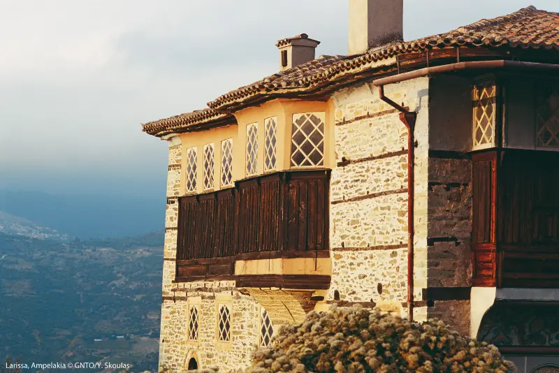
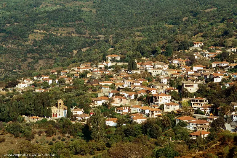
    Larissa Ambelakia

    If you are driving, download an offline map before leaving the main road and avoid building the day around the fastest route suggested by navigation. In mainland Greece the most interesting roads are often slower, and weather, roadworks or seasonal traffic can change travel times. If you are using buses, verify the exact KTEL operator and timetable for your date rather than relying on a generic journey planner.

    Best time to visit

    Spring and autumn are the easiest times for city walking and regional drives. Summer can be intensely hot, but evenings remain lively and the Aegean coast is within excursion range. Winter is good for museums, food and links to mountain destinations, though fog and weather can affect longer drives.

    Whatever the season, check the conditions that matter for your main activity on the morning of travel: museum opening, trail access, fire risk, snow, lift operation or bus departures. That small habit is more useful than memorising a timetable months in advance.

    What to eat

    Thessaly is one of Greece’s great agricultural regions, and Larissa’s food reflects that abundance. Look for pies, grilled meats, local cheeses, seasonal vegetables, legumes, tsipouro and wines from the wider region. The city’s advantage is choice: you can move from traditional tavernas to contemporary restaurants without leaving the centre.

    For a more local meal, move one or two streets away from the most obvious sightseeing point and look for places serving a short menu to Greek families and workers. Opening days can be unpredictable outside the busiest season, so keep a second option in mind instead of driving a long distance for one restaurant.

    Good day trips and onward routes

    Vale of Tempe and Ambelakia

    The easiest history-and-landscape day trip from Larissa. Read our Vale of Tempe and Ambelakia guide.

    Mount Olympus

    Continue north toward Litochoro for Greece’s most famous mountain. Read our Mount Olympus guide.

    Meteora

    Travel west for monasteries and a radically different Thessalian landscape. Read our Meteora guide.

    Volos

    Head south-east for the Pagasetic Gulf, tsipouradika and Pelion. Read our Volos guide.

    How to plan the day well

    • Choose one anchor experience for the morning and one for the afternoon; everything else should be optional.
    • Keep museums and archaeological interiors for the hotter or wetter part of the day when possible.
    • Carry water, sun protection and a light layer. Mainland weather can change quickly between plains, gorges and mountains.
    • Do not schedule a long mountain drive after a heavy lunch or alcohol; Greek regional roads often demand more concentration than the distance suggests.
    • Carry some cash for small villages, parking areas and family businesses even when cards are widely accepted in larger towns.
    • For religious sites, cover shoulders and knees and follow local photography rules. For protected nature areas, conservation and fire-safety restrictions always override an online itinerary.

    Internal planning links

    This new Central Greece and Thessaly cluster is designed to work as a connected route. Depending on your direction of travel, continue with Lamia, Thermopylae, Livadeia, Amfissa and Itea, Hosios Loukas. These links are most useful when you build two- or three-night bases instead of changing hotels every day.

    Frequently asked questions

    Is Larissa worth visiting?

    Yes if you enjoy living cities, archaeology and food without heavy tourism. It is especially useful as a Thessaly transport and road-trip base.

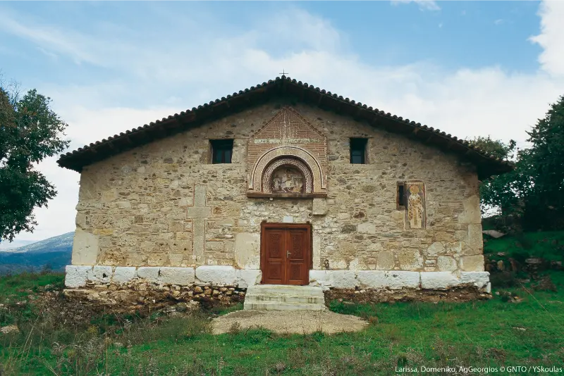
    Larissa Domeniko Ag Georgios

    How many days do you need?

    One day covers the main city sights; two nights are better if you want an excursion to Tempe, Ambelakia or Mount Ossa.

    Can you explore Larissa on foot?

    Yes. The central area is flat and pedestrian-friendly, though the Diachronic Museum and some outer areas may require a taxi, bus or bicycle.

    What is the best day trip?

    Tempe and Ambelakia combine landscape and history. Mount Olympus, Meteora and Volos are bigger onward destinations rather than casual half-day trips.

    Should I book everything in advance?

    Book accommodation in advance for weekends, festivals and winter mountain periods, but keep the daily sightseeing plan flexible. Museums, weather-dependent activities and local transport are better reconfirmed close to the date. A flexible structure usually works better than prepaid timing for every hour.

    Useful official sources

    For details that can change, use the official sources before travelling: Visit Greece – Larissa Municipality of Larissa – City Tour. Recheck opening hours, ticket arrangements, road access, weather restrictions and public transport shortly before departure.

    Final advice

    The best way to use this Larissa travel guide is to choose a pace that matches the place. Mainland Greece rewards travellers who leave room for riverside walks, village squares, museum conversations and unplanned food stops. If you only move between headline sights, you miss the character that makes these destinations different from the islands and from Athens.

    Plan the route logically, sleep where evenings are enjoyable, and use the quieter towns as real bases rather than emergency stops. That approach reduces driving, strengthens internal links across the site and, most importantly, produces a trip that feels coherent instead of like a sequence of pins on a map.

  • Fira to Oia Hike Logistics: Best Direction, Bus Return, Heat, Sunrise and Sunset Planning

    Fira to Oia Hike Logistics: Best Direction, Bus Return, Heat, Sunrise and Sunset Planning

    Scope of this page: this is the logistics companion to the broader Fira to Oia hike guide. Use it when your main questions are direction, start time, heat, water, the return bus and how sunrise or sunset changes the plan, rather than for a second general description of the trail.

    The Fira to Oia hike is the Santorini experience I recommend most strongly to travellers who want to understand the caldera rather than only photograph it. The trail follows the rim north from Fira through Firostefani and Imerovigli before crossing a more exposed volcanic landscape toward Oia. You move from busy villages to quiet ridges, with the caldera on one side and the eastern Aegean on the other, so the scenery changes constantly even though the island is compact.

    It is not a technical mountain hike, but it is also not a flat promenade. Heat, wind, loose volcanic surfaces and the lack of shade make the route more demanding than its distance suggests. I would plan it as a proper half-day activity, start early, carry more water than you think you need and keep enough energy for the final descent or bus journey after reaching Oia.

    For the wider island picture, keep the Santorini travel guide open alongside this page. The Oia guide, Fira guide, Akrotiri guide, Imerovigli guide and Santorini wine guide cover the main places and experiences in more depth, so you can build a route without repeating the same stops.

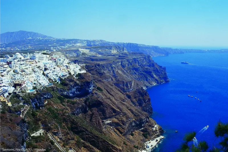
    Santorini Fira

    Fira to Oia hike at a glance

    QuestionPractical answer
    DistanceRoughly 10 km, depending on your exact start and finish points.
    Walking timeAbout 2.5–4 hours for most travellers, longer with photo stops or heat.
    Best directionFira to Oia is the classic direction; Oia to Fira can work better for logistics or afternoon light.
    DifficultyModerate rather than technical: uneven surfaces, exposed sun and several climbs.
    Best timeEarly morning in warm months; shoulder season is much more comfortable.
    WaterCarry your own, especially beyond Imerovigli where services become sparse.

    Where the trail actually starts

    There is no single ceremonial trailhead. Most walkers begin in central Fira and simply follow the caldera-side lanes north. The first section to Firostefani feels more like a scenic village walk than a hike, which is useful because it lets you settle into the route without immediately dealing with loose ground. If you are staying in Firostefani or Imerovigli, you can start from your hotel and shorten the total distance.

    Do not rely on one continuous set of painted trail markers. In the built-up sections, you are moving through lanes, stairways and pedestrian paths used by residents and hotel guests. A downloaded offline map is useful at junctions, but the general principle is simple: keep progressing north while staying reasonably close to the caldera rim without entering private hotel terraces or residential courtyards.

    Section 1: Fira to Firostefani

    This is the easiest part of the route and a good place to decide whether the day is already too hot. The path climbs gently out of Fira, passing churches, hotels, cafés and repeated viewpoints over Nea Kameni and the flooded caldera. Firostefani is close enough to Fira that many visitors walk between the two without thinking of it as part of the famous hike, but the transition matters: the crowds usually thin and the view opens wider.

    If you have not eaten, this is still a sensible place to stop. Once you leave Imerovigli later, food and shade are much less predictable. I prefer a light breakfast or snack rather than a heavy meal, because the exposed climbs beyond the villages feel noticeably harder in summer.

    Section 2: Firostefani to Imerovigli

    The route continues north with some of the most polished caldera scenery on Santorini. Imerovigli sits higher and gives a superb perspective over Skaros Rock. If you are hiking only part of the trail, Fira to Imerovigli is an excellent short alternative: you still get dramatic views without committing to the long exposed section toward Oia.

    Fira Town Aerial Panoramic View Santorini Sunset Fira Modern Capital Santorini Island Cyclades Greece

    Skaros Rock is a separate detour involving a steep descent and return climb. I would not automatically combine it with the full Fira–Oia hike in hot weather. If Skaros is a priority, consider visiting it on another morning using the Imerovigli guide so you can enjoy both experiences instead of turning the day into an endurance test.

    Section 3: Imerovigli to the exposed ridge

    North of Imerovigli the character changes. Buildings become less continuous, the ground becomes rougher and there is far less shade. This is the section where people who began too late often realise that Santorini sun is the main difficulty. A hat, sunscreen, water and shoes with real grip matter more here than stylish resort footwear.

    The route rises and falls over volcanic terrain and passes small chapels and viewpoints. Wind can be welcome when the temperature is high, but strong gusts can also make exposed stretches uncomfortable. I would avoid standing close to cliff edges for photographs, particularly where the surface is loose. The best views do not require leaving the established walking line.

    Section 4: the final approach to Oia

    The last section gives you the psychological reward of seeing Oia grow larger ahead, but do not assume it is all downhill. There are still undulations and road-adjacent stretches before you enter the village. Once inside Oia, the lanes become busier and the route dissolves into the pedestrian network around shops, churches and hotels.

    If you start early, arriving before the peak afternoon crowd is one of the biggest benefits of hiking. Have lunch, explore the quieter lanes and descend toward Ammoudi Bay only if your legs still have enough reserve for the steps back up. The Oia guide explains the sunset areas, Ammoudi and where to spend extra time.

    Which direction is better?

    Fira to Oia is popular because the route feels like a journey toward the island’s most famous village. It also works well with the bus back to Fira. The reverse direction can be smart if you are based in Oia, want to finish near Fira restaurants or need to avoid a crowded Oia evening. I would choose based on accommodation and transport rather than assuming one direction has dramatically better scenery; the panorama changes in both directions.

    Heat, wind and footwear

    On a calm spring morning, the hike can feel straightforward. On an August midday, the same route can become punishing. There is little shade after Imerovigli and the pale volcanic ground reflects heat. Start near sunrise or shortly after in summer, and do not treat a forecasted sea breeze as guaranteed cooling. If winds are unusually strong, exposed sections may be unpleasant enough to postpone the walk.

    Trainers or light hiking shoes are ideal. Sandals with smooth soles, flip-flops and fashion footwear are poor choices because parts of the trail are dusty and uneven. You do not need heavy mountain boots unless you prefer them, but you do need stable footing.

    How to return from Oia

    The public bus is the simplest return for most independent walkers. Santorini’s official KTEL network is organised around Fira, and the operator publishes current Oia services on KTEL Santorini. Seasonal schedules change, so check the timetable the same day rather than relying on an old screenshot. At busy times, allow extra time for queues and do not plan an immediate ferry or flight connection after the hike.

    Village Of Fira Noto Come Thira Capital Of Island Of Santorini Nelle Cyclades In Greece

    A shorter version if you do not want 10 km

    • Fira to Firostefani: easy scenic walk with cafés and frequent exits.
    • Fira to Imerovigli: the best short version for caldera views and Skaros Rock panoramas.
    • Imerovigli to a nearby ridge and back: good for experienced walkers who want a quieter section without reaching Oia.
    • Oia local walking loop: combine the village with Ammoudi only if you are comfortable with many steps.

    Tours and guided options

    You do not need a guide to complete the route, but a guided walk can add geology, village history and transport organisation. It is most useful if you are uncomfortable navigating independently or want the hike combined with another activity without arranging transfers yourself.

    Detailed planning checklist before you start

    Check sunrise, temperature, wind speed and the current Oia bus timetable the evening before. Download an offline map, charge your phone, pack at least one substantial water bottle per person and tell anyone in your group that the route has very little shade after Imerovigli. If somebody is already tired after reaching Imerovigli, turn the outing into a shorter caldera walk rather than using pride as the reason to continue.

    Frequently asked questions

    How long does the Fira to Oia hike take?

    Most travellers should allow three to four hours including photo and water stops. Strong hikers can be faster, while heat, wind or long breaks can push the outing beyond four hours.

    Can children do the hike?

    Older children who are used to walking may enjoy it, but the full route is long, exposed and largely unshaded. With younger children I would choose the Fira–Firostefani–Imerovigli section instead.

    Is the trail suitable for strollers?

    No. The village sections include steps and the open sections have uneven volcanic surfaces.

    Do I need hiking boots?

    No heavy boots are required for most people, but closed shoes or supportive trainers with good grip are much safer than smooth sandals.

    Can I hike at sunset?

    You can walk a section in late afternoon, but finishing the full route near or after dark adds navigation risk on uneven ground. For a first attempt, morning is easier and cooler.

    Final thoughts

    The Fira to Oia hike earns its reputation because it connects the famous villages into one continuous landscape. The key is not speed. Start early, keep the plan flexible, respect private property and save enough energy to enjoy Oia when you arrive. If conditions are too hot or windy, shorten the route rather than forcing the full distance simply because it appears on a bucket list.

  • Mykonos 4-Day Itinerary: Town, Delos, Beaches, Ano Mera and Sunset

    Mykonos 4-Day Itinerary: Town, Delos, Beaches, Ano Mera and Sunset

    Four days is enough to experience the essential Mykonos mix without spending the whole trip in transit: one full day for Chora, one for Delos, one for the south-coast beaches and one for Ano Mera plus a more rural or scenic part of the island. The key is not to add every famous beach. Mykonos is more enjoyable when each day has a clear geographic focus.

    Mykonos Island Aerial Panoramic View Night Mykonos Island Part Cyclades Greece

    Who this 4-day itinerary is for

    This plan suits first-time visitors staying in Chora, Ornos, Platis Gialos or another well-connected area. It assumes you want culture, beaches and a little nightlife rather than four consecutive party days. You can complete most of it without a car, using public buses and one taxi, tour or rental day for the lighthouse or remote north coast.

    Day 1: Mykonos Town without rushing

    Morning: Chora before the crowds

    Start with the Mykonos Town walking guide: windmills, Little Venice, Matogianni and the waterfront. The old town is most enjoyable before the lanes become crowded and hot. Do not chase every church; choose a few landmarks and leave time to wander.

    Quartiere Of Little Venice At Mykonos Greece

    Late morning: Archaeological Museum

    Add the Archaeological Museum of Mykonos for an hour. The museum gives context to Rineia, Delos and the island’s ancient history, which improves the next day’s excursion.

    Evening: sunset and dinner

    Return to Little Venice or the windmills before sunset, but do not stand on unsafe walls or block narrow lanes for photographs. Have dinner after the main sunset surge if you prefer a less frantic table.

    Mykonos Island Greece Little Venice Area Mykonos Town

    Day 2: Delos and a relaxed beach

    Use the Delos day-trip guide and check official site/museum information before departure. The archaeological island is exposed, so water, sun protection and secure shoes matter. Give Delos the morning rather than trying to add another major cultural stop immediately afterward.

    In late afternoon, choose an easy beach near your base—Ornos, Agios Ioannis or Platis Gialos are ideal—then keep the evening flexible. This is deliberately a lighter second half of the day because Delos walking in summer heat can be tiring.

    Day 3: South-coast beach day

    Choose the coast according to your travel style. Families and relaxed swimmers can use Ornos or Agios Ioannis; party-focused travellers can choose Paradise or Super Paradise; those wanting a long organised beach can use Elia. Do not attempt all three zones.

    If you want beach hopping, use seasonal public buses or a south-coast boat service rather than driving from bay to bay and searching for parking. The objective is time in the water, not collecting beach names.

    Day 4: Ano Mera, east coast and Armenistis or north coast

    Start at Ano Mera and Panagia Tourliani, then continue to an east-coast beach such as Kalafatis, Kalo Livadi or Elia. If you have a rental car or tour and conditions are good, finish with Armenistis Lighthouse. Alternatively use Panormos or Agios Sostis for a quieter north-coast afternoon when the wind is light.

    Where to stay for this itinerary

    Chora maximises walking and transport flexibility. Ornos and Platis Gialos trade immediate old-town access for easier beach mornings. If nightlife is a major priority, Chora usually wins; if children or early swims are the priority, a beach base can make the four days smoother. Read accommodation maps together with bus routes, not in isolation.

    Do you need a rental car?

    No. Days 1–3 can be done comfortably without one if you are near public transport. For Day 4, either rent a car for a single day, use taxis or join an island tour. The Mykonos without a car guide explains the bus hubs and SeaBus connection in detail.

    How to change the itinerary for wind

    If the meltemi is strong on your planned north-coast day, swap it with Chora, the museum or a sheltered south-coast beach. Do not treat daily order as sacred. The itinerary is designed as four modules that can be rearranged according to weather and ferry conditions.

    How to change it for families

    Use the Mykonos with kids guide to shorten Delos, skip late-night beach clubs and favour Ornos, Agios Ioannis or Platis Gialos. Keep one afternoon completely unscheduled so children can rest instead of forcing a sightseeing target.

    Getting around Mykonos in practice

    Mykonos looks small on a map, but summer traffic, limited parking and the shape of the road network can make short distances take longer than expected. Public buses are genuinely useful when your route matches the network. The operator currently publishes seasonal services from Fabrika and the Old Port/New Peripheral toward Ornos, Agios Ioannis, Platis Gialos, Paradise, Super Paradise, Ano Mera, Elia, Kalafatis, Panormos, the airport and the ports. Check the official Mykonos Bus timetable shortly before every journey because schedules change during the season rather than staying fixed for the whole year.

    For ferry arrivals at Tourlos, the Mykonos SeaBus is often simpler than joining road traffic: its published service connects the New Port with the Old Port/Mykonos Town area and is designed to carry luggage and pushchairs. If you rent a car, treat it as a tool for selected days—Ano Mera, remote beaches, lighthouse viewpoints—rather than assuming you need it every day. Staying near a bus corridor can save money and reduce the stress of parking close to Chora.

    Wind, swimming conditions and the meltemi

    Mykonos is known as the Island of the Winds for good reason. During summer, the meltemi often blows from the north and can transform the character of a beach. South-facing bays are usually the safer default for a calm swimming day, while north-coast beaches can be magnificent when the wind is light and uncomfortable when it is strong. Do not decide purely from photographs or a general island forecast: look at the water, ask locally and keep a second beach in mind.

    Wind matters even when you are not swimming. It increases dehydration, can make an exposed viewpoint feel much cooler than town and can turn an umbrella into a hazard. For families, older travellers and anyone who wants a relaxed sea day, flexibility is more useful than a rigid itinerary. One of the easiest ways to enjoy Mykonos is to treat the wind as a planning variable instead of trying to force the same beach plan in every condition.

    How to plan the day without rushing

    A common mistake on Mykonos is to schedule too many famous places in a single day. The island is compact, but parking, buses, lunch reservations, beach access and slow pedestrian streets add hidden time. A better formula is one major objective in the morning, one nearby beach or village in the afternoon and one evening area. That leaves space for a swim, a long meal and the delays that are normal in peak season.

    In July and August, start cultural visits and scenic drives earlier than you think. Use the hottest hours for lunch, shade or the beach rather than exposed walking. In June and September the same itinerary feels much easier, and May or October can be excellent for sightseeing if you accept that some seasonal beach businesses and late services operate at reduced levels.

    Budget and booking strategy

    Mykonos can be expensive, but the biggest costs are usually accommodation, private transport, premium beach seating and nightlife—not the act of walking through Chora, visiting a monastery or laying a towel on public beach space. Decide which experiences matter enough to pay for and keep the rest simple. A hotel on a useful bus route can be better value than a cheaper room that forces several taxis every day.

    During the busiest weeks, reserve accommodation, high-demand restaurants and any tour with limited capacity in advance. For ordinary beach time, keep some flexibility so you can change coast when the wind changes. Prices, minimum spends and sunbed policies at commercial venues change quickly, so verify them directly rather than building a budget around an old screenshot or social-media post.

    Responsible travel and local etiquette

    Mykonos is both an international resort and a lived-in Cycladic island. Dress respectfully in churches and monasteries, keep voices low around worshippers, avoid blocking narrow lanes for photographs and never enter private courtyards because they look photogenic. On unorganised beaches, take rubbish away with you and avoid driving or parking on dunes, vegetation and informal coastal paths.

    At archaeological sites and museums, follow barriers and photography rules. Around crowded viewpoints, do not step onto unstable walls or road edges for a better angle. These small choices matter on an island that receives very heavy visitor pressure in summer, and they usually make the experience calmer for you as well as for residents.

    Tours and activities

    Guided Delos tours, island overviews and boat trips can replace individual pieces of this itinerary. The best choice is the one that removes a transport problem without duplicating places you already plan to visit independently.

    Frequently asked questions

    Are 4 days enough for Mykonos?

    Yes. Four days allow Chora, Delos, one full beach day and one inland/scenic day without excessive rushing.

    Should I rent a car for all four days?

    Usually no. One rental day or organised tour is enough for remote areas if you stay near the bus network.

    Which day should I book Delos?

    Choose a day with a suitable forecast and confirmed boat operation, then keep the other days flexible around it.

    Can I include nightlife?

    Yes. Day 1 or Day 3 are the easiest evenings for nightlife, but avoid scheduling an early Delos departure after a very late night.

    What if the meltemi is strong?

    Move cultural and town activities to the windy day and save sheltered south-coast swimming for the best sea conditions.

    More Mykonos guides for the same trip

    Continue planning with Ano Mera, Armenistis Lighthouse, Ornos and Agios Ioannis, Paradise and Super Paradise, Elia and Agrari, plus the main Mykonos travel guide, the Mykonos Town guide and the Mykonos beaches guide.

    Final thoughts

    The strength of a four-day Mykonos itinerary is balance. Chora shows the postcard island, Delos gives it historical depth, the beaches provide the holiday rhythm and Ano Mera plus the rural coast reveal a less commercial side. Keep the order flexible and the trip feels full without becoming exhausting.

  • Mykonos Travel Guide: Beaches, Nightlife, Where to Stay and Practical Tips

    Mykonos Travel Guide: Beaches, Nightlife, Where to Stay and Practical Tips

    Mykonos is famous enough that travellers often arrive with a version of the island already in their head: white lanes, windmills, Little Venice, luxury hotels, beach clubs and late nights. All of that exists, but the quality of the trip depends on matching your base and transport plan to the experience you want. Mykonos can be glamorous, relaxed, loud, beautiful, expensive and simple—sometimes on the same day.

    Little Venice Neighbourhood Town Chora Mykonos Island Greece

    For a first visit, three nights is a useful minimum if you are combining Mykonos with Athens and another island. Four or five nights works better if beaches and nightlife are major priorities. If you do not care about the social scene, visit in shoulder season or compare Mykonos with Naxos and Paros before committing.

    Where to stay on Mykonos

    Mykonos Town (Chora) is the best base for walking to restaurants, bars, Little Venice and the windmills. It is especially convenient if you want nightlife without relying on a late taxi. Beach areas can be better for travellers who want to wake up by the sea and spend afternoons at a beach club, but evening transport becomes a bigger part of the plan.

    Before booking, look at the actual walking route rather than the straight-line distance. Hills, narrow roads and heat can turn a “15-minute walk” into something you do not want twice a day. Also check whether your hotel offers transfers and whether there is safe pedestrian access.

    Mykonos Town: what to see

    The pleasure of Chora is wandering. Little Venice and the windmills are the best-known landmarks, but the narrow lanes, small churches, white houses and flashes of sea between buildings create the atmosphere. Visit early in the morning if you want calmer streets, then return after dark when restaurants and bars take over.

    Panoramic View Little Venice With Walking Tourists Mykonos Greece

    Do not over-plan the route. The town is made for getting slightly lost. Save cafés, shops and dinner options on a map, but let the walk between them remain flexible.

    Beaches: organised, social or relaxed?

    Mykonos beaches differ more by atmosphere than by distance. Some are strongly linked to beach clubs and music; others are better for a traditional beach day. Before choosing a base, decide whether you want to spend money on reserved loungers and lunch, or whether a simpler beach with public space matters more. Peak-season pricing can be high at the most famous venues.

    Wind also matters. Mykonos is known as the “island of the winds,” and conditions can change the best beach choice on a given day. Ask locally which coast is more sheltered rather than forcing a pre-booked plan regardless of weather.

    Nightlife: what to expect

    Mykonos nightlife ranges from sunset drinks and cocktail bars to clubs that run very late. You do not need to party every night to enjoy the island, but travellers who actively dislike nightlife should choose their accommodation carefully. Staying directly above a busy lane can be a bad bargain even if the room looks charming in daytime photos.

    If nightlife is your main goal, staying near Chora or arranging reliable return transport from beach venues is worth paying for. Do not assume taxis will appear instantly at peak closing times.

    Delos: the cultural day trip

    A trip to the archaeological island of Delos adds a completely different dimension to a Mykonos stay. It is one of the most important ancient sites in the Cyclades and a useful reminder that the region’s history is far older than its modern resort reputation. Boat schedules and site access are seasonal, so check current operating information before building the day around it.

    How to get around Mykonos

    Buses connect Mykonos Town with several major beaches and visitor areas, and they can be the best option if you do not want to drive. Taxis and private transfers are useful but demand is high in summer. Rental cars, ATVs and scooters provide flexibility, but narrow roads, parking and inexperienced tourist traffic can make driving stressful.

    For a short trip, I would choose accommodation and daily plans to minimise transport rather than renting a vehicle automatically. If you are island hopping, see Getting Around Greece for ferry planning and buffer-time advice.

    Mykonos on a budget

    Mykonos is not the easiest Greek island for a low-cost holiday, but you can control spending. Travel in shoulder season, stay outside the most prestigious zones, use buses, skip daily beach-club reservations and mix restaurant meals with bakeries, gyros and simple tavernas. The most important budget decision is accommodation timing: last-minute summer rooms can erase savings elsewhere.

    Mykonos for couples

    Couples can make Mykonos feel romantic by separating the island from its party stereotype. Early morning in Chora, a quieter beach day, sunset drinks and a hotel with a terrace can create a very different trip. The key is choosing a base that gives you the amount of nightlife you want, not the amount Instagram suggests you should want.

    Mykonos for families

    Families can enjoy Mykonos, particularly in beach areas, but it is not automatically the easiest family island. Summer prices, busy roads and nightlife can add friction. If you choose it, prioritise a family-friendly beach base, pool, easy transfers and a room away from late-night noise. For a broader range of family options, compare Mykonos with Crete, Rhodes and Naxos in the Greek islands guide.

    How many days do you need?

    NightsBest use
    2 nightsFast taste of Chora + one beach; rushed
    3 nightsGood minimum in a multi-island trip
    4–5 nightsBetter for beaches, nightlife and Delos
    6+ nightsBest for travellers making Mykonos the main holiday destination

    A 3-day Mykonos plan

    1. Day 1: check in, Chora, windmills, Little Venice, sunset and dinner.
    2. Day 2: beach day; choose the atmosphere based on your style and wind conditions; nightlife if desired.
    3. Day 3: Delos excursion or second beach, then a slower evening in town.

    Mykonos and Santorini: should you visit both?

    Yes, if you have enough time and want two very famous but different Cycladic experiences. Mykonos is more social and beach-club oriented; Santorini is dominated by the caldera landscape and romantic views. With ten days in Greece, Athens + Mykonos + Santorini can work. With seven days, it may feel too compressed. Use the Greece itinerary guide to judge the pacing.

    When to visit Mykonos

    June through September is the core summer season, with July and August delivering the busiest nightlife and strongest demand. May and early October can be calmer and better for travellers interested in scenery and town life rather than peak club energy. Weather and seasonal opening dates vary, so check specific venues if they are a major reason for the trip.

    Common mistakes

    • Booking a remote hotel without understanding transport costs.
    • Assuming every famous beach offers the same atmosphere.
    • Depending on last-minute taxis after late-night venues close.
    • Renting a scooter without appropriate experience or licence.
    • Paying for a premium beach club every day when that is not actually your travel style.
    • Trying to combine Mykonos and Santorini in a four- or five-night Greece trip.

    Is Mykonos worth it?

    Mykonos is worth it when you want what Mykonos does well: beautiful Cycladic streets, stylish hospitality, beaches and a strong social scene. It is less convincing if you are forcing it into the itinerary simply because it is famous. Greece has many alternatives. Compare your priorities honestly and choose the island that fits the holiday you want.

    The official Visit Greece portal describes Mykonos as a mix of cosmopolitan life, Cycladic architecture and beaches. Always check seasonal transport and venue opening dates for your exact trip.

    Mykonos FAQ

    Is Mykonos only for partying?

    No, but nightlife is an important part of its identity. Early mornings in Chora, quieter beaches, Delos and shoulder-season stays can feel very different from the late-night image. The island is most rewarding when you choose accommodation that puts you close to the version of Mykonos you actually want.

    How expensive is Mykonos?

    It can be one of the more expensive Greek islands in peak season, especially for central accommodation, taxis, premium restaurants and organised beach venues. Costs are much easier to control in shoulder season, with buses, simple food and accommodation booked early. The difference between a moderate and luxury Mykonos trip can be enormous.

    Do you need to reserve beach clubs?

    If a particular famous venue is central to your trip in peak season, booking can be sensible. If you simply want a beach day, do not assume you need a premium reservation. Research public areas, standard sunbed options and less-hyped beaches before committing your daily budget to clubs.

    Is Mykonos good without a car?

    Yes, particularly if you stay in Chora and use buses for selected beaches. A car is more useful for flexibility than necessity. The main limitation is late-night transport and peak-season demand, so plan the return from dinner or clubs instead of assuming a taxi will be easy.

    What should you pair with Mykonos?

    Santorini creates a famous contrast of nightlife versus caldera romance, while Naxos or Paros can add a more relaxed Cycladic chapter. The best pair is one with a direct seasonal connection and a different reason to visit, not merely another famous name.

    How to keep Mykonos enjoyable in high season

    Start town walks early, avoid scheduling every meal at the most photographed waterfront, use buses outside the tightest peak times when possible, and leave one beach day flexible for wind. A little structure around transport lets the rest of the island feel spontaneous.

    Little Venice District With Old Houses By Sea Mykonos Island Sunset Greece
  • Therma Beach Kos Guide: Hot Springs, Access, Swimming and Practical Tips

    Therma Beach Kos Guide: Hot Springs, Access, Swimming and Practical Tips

    Therma Beach is one of the most unusual stops on Kos: a dark-pebble cove where naturally hot spring water flows into the Aegean and mixes inside a rough stone pool. It is not a polished spa and that is exactly why many travellers remember it. You reach a dramatic southeastern coastline, walk down from the road, smell the sulphur and step between very warm spring water and cooler sea.

    The experience is simple but deserves planning. The access path, heat of the water, crowded stone pool and lack of the smooth infrastructure of a hotel spa mean Therma is not equally comfortable for everyone. Go with realistic expectations and it can be one of the island’s best short excursions.

    Where Therma is and how the hot pool forms

    The Municipality of Kos places Therma roughly 13 km southeast of Kos Town, beyond Agios Fokas. The official Therma page explains that hot spring water reaches the coast and mixes with seawater inside a stone-bordered pool. The municipal information gives spring temperatures in the range of roughly 42–50°C near the source, so temperature varies significantly depending on exactly where you sit.

    Dodecanese Kos Empros Therma

    Do not position yourself at the hottest inflow because other visitors are doing it. Move gradually between sea and pool and leave immediately if you feel dizzy, faint or unwell. People with medical concerns related to heat exposure should seek appropriate professional advice rather than treating a natural spring as automatically safe.

    The walk down to the beach

    Public transport and road access take you to the upper area, but the official island information notes an additional walk of around ten minutes down a dusty track. That descent is manageable for many travellers but matters for anyone with limited mobility, a stroller or unsuitable shoes. The return is uphill and feels hotter than the way down.

    Wear shoes with grip rather than smooth flip-flops. Carry water even though the excursion looks short on a map. After a long soak in hot water, climbing an exposed track in summer sun can feel much more demanding than expected.

    What the beach itself is like

    Therma is a dark-sand-and-pebble setting shaped by the island’s volcanic context. The sea can become deep away from shore, and the coastline is far more rugged than Tigaki or Paradise Beach. This is not the place I would choose for a classic all-day family sandcastle beach.

    Instead, pair the thermal pool with a swim, a short rest and perhaps another stop around Psalidi or Agios Fokas. Water shoes are useful because the stones can be uncomfortable and hot surfaces around the pool are not pleasant barefoot.

    Best time of day to visit

    Early morning reduces heat and crowd pressure. Evening can be atmospheric because the spring feels especially distinctive after the sun drops, but darkness makes the track and uneven shore harder to navigate. If you plan a late visit, bring a proper light rather than relying on a phone battery.

    Midday in July or August is the least appealing combination: hot air, hot spring water and an exposed walk. If that is your only available time, shorten the soak and prioritise hydration.

    Bus, car or taxi?

    The official island guide states that Therma is accessible by public transport. For travellers based in Kos Town, that can make it a car-free half-day, but route details and seasonal frequency should be checked on the day. A taxi is useful if several people are travelling together or if the last bus does not fit the evening you want.

    Dodecanese Kos Empros Therma

    Drivers should expect the final approach to feel more remote than the city. Park only where permitted and do not block turning space or bus access. Coastal roads can also be affected by maintenance or severe weather, so local advice outranks an old itinerary.

    Can children visit Therma?

    Families can visit, but the attraction is hot water rather than a purpose-built children’s pool. Closely supervise children around rocks and temperature changes, keep hot-water exposure conservative and consider whether the walk back up suits your family. For a straightforward shallow beach day, Tigaki, Marmari or Paradise Beach are easier.

    The strongest family plan is often a short Therma stop for older children followed by a conventional beach elsewhere, rather than spending the entire day here.

    What to bring

    • Water and extra drinking water for the uphill return
    • Shoes with grip plus optional water shoes
    • Swimsuit and quick-drying towel
    • Sun protection; shade is limited
    • A small light if you plan to leave after sunset
    • A bag for all rubbish—leave the natural pool as you found it

    How Therma Beach fits into a wider Kos trip

    Use this guide together with the main Kos travel guide, Kos Town guide and Asklepieion guide. The newer in-depth pages on Tigaki and Marmari, Kefalos and Kamari, Kardamena, Zia and Mount Dikeos, Therma, cycling, the best beaches, Kos without a car, Kos with kids and where to stay in Kos make it easier to build a trip around one area instead of crossing the island repeatedly.

    Therma is best treated as a distinctive two- or three-hour experience rather than a conventional full-day resort beach. The most useful rule is to group places geographically. Kos is compact compared with many Greek islands, but a holiday still feels much better when a beach, village and archaeological stop naturally belong to the same side of the island.

    Getting around and checking transport

    Public transport is possible according to the Municipality of Kos, but seasonal operating details should be checked locally. Taxis simplify a late return, while a rental car lets you combine Therma with Agios Fokas or another eastern stop.

    Kos Town and Psalidi are the easiest bases for reaching Therma without dedicating an entire driving day to the southeastern coast. Public transport is useful, but seasonal frequency matters. The official KTEL Kos general routes page currently lists services for Kefalos, Kardamena, Marmari, Zia, Antimachia, Tigaki, Pyli and Mastichari. KTEL also announced timetable changes taking effect from 29 June 2026, so always open the live timetable again shortly before the day you travel rather than saving an old screenshot.

    Kardamena Kos Greece

    Booking excursions and activities

    Boat trips, island excursions and guided experiences are highly seasonal on Kos. Before booking, compare the actual time spent at each stop, whether transfers are included, the size of the boat or group, shade, swimming opportunities and cancellation conditions. Do not choose an excursion simply because it has the longest list of stops.

    Mistakes that make the day harder

    • Staying too close to the hottest spring inflow because other visitors are doing it.
    • Walking down in slippery footwear and forgetting that the return is uphill.
    • Visiting at midday in extreme heat and then soaking for a long time.
    • Expecting a formal spa with changing rooms and controlled water temperature.
    • Leaving rubbish in a natural coastal site.

    Frequently asked questions

    How hot is the water at Therma?

    Official Kos tourism information gives the spring temperature at roughly 42–50°C near the source, but it cools as it mixes with seawater.

    Can you get to Therma by bus?

    The Municipality of Kos states that the area is accessible by public transport. Check the current route and return times for your travel date.

    Is Therma free to visit?

    The natural coastal spring itself is an open natural attraction; ancillary services can change. Check local conditions rather than assuming facilities are always operating.

    Is Therma a good beach for young children?

    It is more rugged than the island’s shallow sandy beaches. Families can visit, but the hot water, rocks and uphill access require closer supervision.

    How long should you spend at Therma?

    For most visitors, a couple of hours is enough for the walk, thermal pool and a sea swim. Extend the outing by combining it with nearby southeastern beaches rather than staying in the hottest water for a long period.

    Final planning advice

    Kos is at its best when you leave some space between the headline attractions. The island is easy enough to explore that there is little benefit in forcing four distant stops into one day. Pick one anchor experience, add one or two nearby places, and keep time for a swim, a long lunch or an evening walk. That slower structure usually produces a better holiday and makes delays, wind or summer heat much easier to handle.

    How to plan around wind and summer heat

    Wind and heat should be treated as planning variables, not annoyances that have ruined the schedule. Kos has enough coastline and enough non-beach alternatives that you can move a swimming day, shorten an exposed walk or swap a western drive for a museum and town afternoon. Check conditions each morning, especially before a boat trip, long cycle ride or remote-beach drive.

    In July and August, schedule archaeological sites, village walks and cycling early. Keep the middle of the day for swimming, shade or a long lunch, then use late afternoon for another short outing. This is more comfortable and usually produces better photographs than forcing outdoor sightseeing under the harshest sun.

    How much should you plan in advance?

    Reserve the things with real capacity constraints—specific hotels, popular boat excursions and important airport transfers—then leave ordinary beach days flexible. A rigid seven-day schedule is vulnerable to one windy day; a flexible plan can move the boat trip and still protect the experiences that matter most.

    Keep addresses, bus information and booking confirmations available offline. Mobile coverage is generally good in populated areas, but a dead battery or weak signal is a poor reason to miss the last bus. For driving days, download an offline map and verify that navigation is not sending a standard rental car onto an unnecessary rough track.