Author: Jessica

  • Where to Stay in Samos: Best Areas for Beaches, Couples, Families, Hiking and No-Car Trips

    Where to Stay in Samos: Best Areas for Beaches, Couples, Families, Hiking and No-Car Trips

    Choosing where to stay in Samos matters more than choosing the “best hotel.” The island is large enough and mountainous enough that a beautiful property in the wrong area can turn every day into a long drive. The right base should make your most frequent activity easy: Kokkari for north-coast beaches and atmosphere, Pythagoreio for archaeology and evenings, Vathy for public transport, Votsalakia for a slow south-west beach stay, or Karlovasi for western exploration.
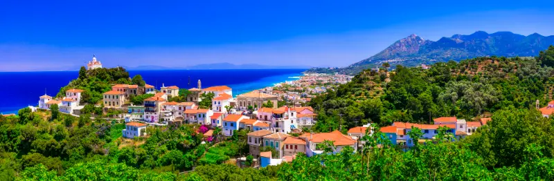
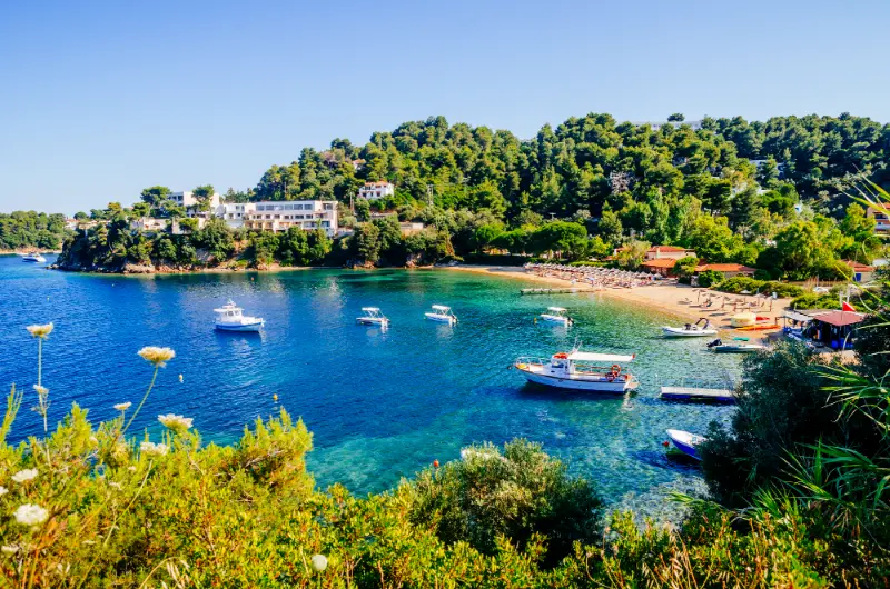
    Karlovasi Samos Greece

    For stays longer than a week, splitting the trip between east/north and west can make sense. For four or five nights, one base is usually better. Packing, checking out and moving luggage costs more holiday time than most people expect.

    Kokkari: best for couples and north-coast atmosphere

    Choose Kokkari if you want a compact village, waterfront dinner, attractive nearby beaches and easy access to Manolates/Vourliotes. It feels polished enough for a romantic trip without becoming a large resort.

    Main trade-off: north-coast wind and pebble beaches. Families should check whether that beach style suits young children.

    Pythagoreio: best first-time all-round base

    Pythagoreio combines a beautiful harbour, restaurants, archaeology, airport convenience and access to Heraion and south-east beaches. It is one of the strongest first choices for travellers who want history and evenings without staying in the capital.

    Main trade-off: the west side of the island is far enough away that repeated Karlovasi or Kerkis days become tiring.

    Vathy / Samos Town: best without a car

    Vathy wins on logistics: main bus hub, museums, services, shopping, taxis and port connections. It suits travellers who want to use public transport and see several areas rather than stay next to one beach.

    Main trade-off: you will travel for the classic beach experience. Choose it because you value transport and culture, not because you expect a resort outside the hotel door.

    Votsalakia / Kampos: best for relaxed beach weeks

    The south-west is excellent for apartments, long beach days, families and access to Mount Kerkis. It works especially well for travellers who are happy to spend several days locally rather than crossing the island constantly.

    Main trade-off: distance from the airport, Vathy and Pythagoreio. A car is strongly recommended for a broad sightseeing trip.

    Karlovasi: best for western Samos and repeat visitors

    Karlovasi is practical for western hiking, Potami, ferries and local life. It is a good choice for travellers who prefer a working town to a resort and for split stays that reduce driving.

    Main trade-off: it lacks the immediate holiday atmosphere of Kokkari or Pythagoreio.
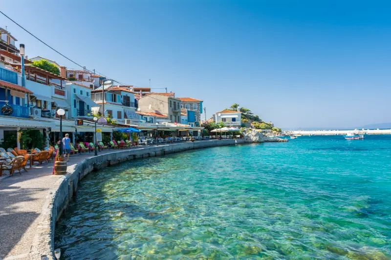
    Kokkari Samos Greece

    South-east coast: best for quiet coves and car-based exploring

    Areas around Mykali, Psili Ammos, Posidonio and Klima can be excellent if you want sea views and quieter nights. They are best with a car because restaurants, shops and beaches are distributed rather than concentrated in one walkable centre.

    Best areas by traveller type

    TravellerBest first choicesWhy
    CouplesKokkari, PythagoreioAtmosphere, dinners, attractive setting
    FamiliesVotsalakia, Pythagoreio, south-eastPractical beaches and apartments
    Without a carVathy, Pythagoreio, KokkariBuses, taxis, walkable evenings
    HikersMarathokampos/Votsalakia, KarlovasiKerkis and western trail access
    History loversPythagoreio, VathyUNESCO sites and museums
    Wine/food travellersVathy, Kokkari + mountain villagesWine museum and Ambelos access

    One base or two?

    With five nights, stay in one place and accept one or two longer days. With eight to ten nights, splitting between Pythagoreio/Kokkari and the west or south-west can reduce driving enough to justify the hotel move. Do not split simply because a map makes the island look large; split because your priority list genuinely belongs to two different regions.

    What to check before booking accommodation

    • Exact walking distance to restaurants and bus stop.
    • Parking availability if renting a car.
    • Slope or stairs between property and waterfront.
    • Air-conditioning policy and room location.
    • Recent comments about road noise or evening noise.
    • Whether “sea view” is direct or partial.
    • Cancellation terms for shoulder-season travel.

    How where to stay in Samos fits into a wider Samos trip

    Use this page together with the Samos travel guide, Pythagoreion and Heraion UNESCO guide, Kokkari, Samos Town and Vathy, Karlovasi and Potami, Manolates and Vourliotes, Marathokampos and Votsalakia, Samos wine, best beaches, hiking, Samos without a car and where to stay. The strongest Samos itineraries are built by geography: combine the north coast with mountain villages, the west with Karlovasi or Marathokampos, and the south-east with Pythagoreio and Heraion. That avoids spending the best part of the day repeatedly crossing an island whose roads are far more winding than its map distances suggest.

    The best base depends on what you want to do repeatedly. Choose geography first, then hotel. A cheaper room can become expensive if it creates daily taxi rides or long fuel-heavy drives.

    Getting around and checking transport

    No-car travellers should prioritise Vathy, Pythagoreio or Kokkari. Drivers have far more freedom and can consider Votsalakia, south-east coves or countryside properties. Always check the exact map location rather than relying on the resort name.

    For buses, use the official KTEL Samos website close to the day you travel. KTEL Samos operates from Vathy and publishes routes and online ticketing; seasonal frequency changes, so an old screenshot should never be treated as a permanent timetable. If one specific connection matters—for example a last bus after a beach day—verify it the same morning and have a taxi number as backup.

    Heat, wind and realistic daily pacing

    Samos rewards early starts. In July and August, use the cooler morning for village walks, archaeological sites or hiking, keep the hottest hours for swimming or shade, and return to sightseeing in late afternoon. The north coast can be breezy, while inland roads and trails may feel much hotter than the waterfront. A flexible plan works better than forcing a fixed beach or mountain day in poor conditions.

    Tours and activities

    Boat trips, wine experiences and guided excursions can be useful when they solve a transport problem or add local interpretation. Compare the real time spent at each stop, boat size, shade, swimming access, transfer arrangements and cancellation rules rather than choosing the excursion with the longest list of place names.

    Common planning mistakes

    • Booking a remote property without checking evening food options.
    • Choosing west Samos for a trip centred on Pythagoreio.
    • Assuming every Kokkari property is flat and steps-free.
    • Splitting a short trip between too many hotels.
    • Paying for a sea view while ignoring road noise or parking difficulty.

    Frequently asked questions

    What is the best area for a first visit?

    Pythagoreio is the strongest all-round choice; Kokkari is better if beach atmosphere matters more than archaeology.

    Where should you stay without a car?

    Vathy for the widest bus network, Pythagoreio for a balanced trip, or Kokkari for a beach-focused stay.

    Where is best for families?

    Votsalakia and selected south/east beaches work well for a slower family routine, while Pythagoreio is convenient for mixed sightseeing.

    Where should hikers stay?

    Votsalakia/Marathokampos for Mount Kerkis and Karlovasi for western routes. Ambelos walkers can use Kokkari as a comfortable base.

    Is a split stay worth it?

    Usually for eight nights or more when you genuinely want both east/north and west Samos. For a short trip, one base is easier.

    Final practical advice

    Samos feels most rewarding when you leave room for one unplanned stop each day: a roadside viewpoint, a village square, a swim at a smaller cove or a long lunch. The island has enough variety that you do not need to “complete” it. Pick a strong base, cluster nearby experiences, check time-sensitive transport and opening information again shortly before departure, and let weather decide which day becomes the beach day and which becomes the mountain day.

    Booking by map, not marketing name

    Accommodation platforms sometimes use the nearest well-known resort name for properties that are several kilometres away. Open the exact map, inspect road access, calculate the walk to dinner and look at elevation. “Near Kokkari” can mean very different things depending on whether you have a car.

    Season and atmosphere

    The same base can feel completely different in May, August and October. Peak summer gives maximum restaurant choice and transport frequency but more demand. Shoulder season is calmer and often better for walking, while some seasonal businesses reduce hours. Match the base not only to activities but also to the month you travel.

    Extra planning notes

    A useful final planning rule is to make the day geographically coherent. Samos looks compact on a map, but mountain roads, village traffic and beach access can turn a short distance into a meaningful part of the day. Keep one main objective, add one or two nearby stops and leave room for weather. In peak summer, carry water in the car, download the map before leaving strong signal and avoid arriving at remote beaches or trailheads just before sunset unless you already understand the return route. In spring and autumn, check seasonal opening hours because beach bars, excursion schedules and some services may be reduced even when the weather is excellent. For any detail that can change—bus times, museum hours, ferry ports, tasting reservations or trail access—verify it again shortly before departure instead of relying on an old blog screenshot.
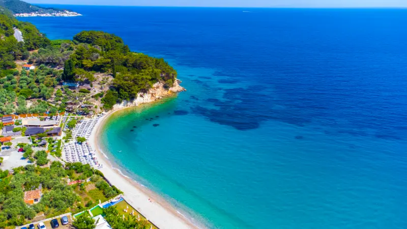
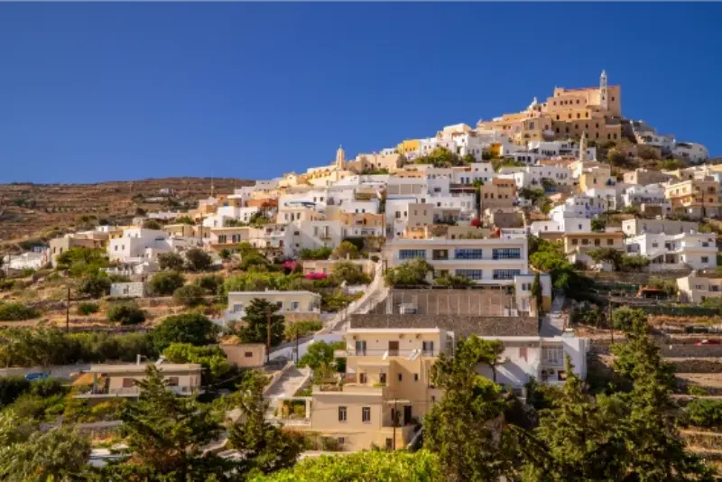
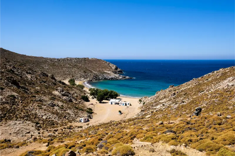
    Beaches Samos Island Greece Tsambou Beach
  • Syros Travel Guide: Ermoupoli, Ano Syros, Beaches and a 4-Day Itinerary

    Syros Travel Guide: Ermoupoli, Ano Syros, Beaches and a 4-Day Itinerary

    Syros feels different from the postcard stereotype of the Cyclades. The island still has whitewashed lanes and clear Aegean water, but its capital, Ermoupoli, is a genuine small city with grand neoclassical façades, theatres, public squares and an urban rhythm that continues beyond the summer season. That contrast is exactly why I think Syros works so well for travellers who want an island holiday without spending every day moving between beaches.

    The island is also unusually practical for a first independent trip. Ferries arrive directly in the centre of Ermoupoli, buses connect the main beach villages, and the compact scale means you can combine architecture, food and sea time without a rental car every day. If you are comparing islands, read my guide to choosing the best Greek island and the Tinos travel guide, because Syros and Tinos pair naturally on a Cyclades itinerary.

    Why Syros is different from other Cyclades islands

    Ermoupoli grew as a major commercial and industrial centre in the nineteenth century, and that history is visible everywhere around Miaouli Square, the harbour and the Vaporia district. Instead of a small white village wrapped around a church, you find mansions, municipal buildings, marble-paved streets and a waterfront that feels lively in a way many seasonal islands do not.

    Above the modern town, Ano Syros has a completely different personality. Its medieval lanes climb around the hill beneath the Catholic Cathedral of Saint George. The steep stairways, arches and close-set houses feel far more intimate than the formal lower town. Seeing both areas in the same day explains the island better than any single beach.

    Where to stay in Syros

    For a first visit, Ermoupoli is the easiest base. You can walk from the ferry, eat well without driving and use buses or taxis for beach days. Staying near the harbour is convenient with luggage, while Vaporia is prettier and quieter once the day-trippers disappear. Ano Syros is atmospheric, but the stairs make it less practical for anyone with heavy bags or limited mobility.

    If your priority is swimming, Galissas, Kini or Finikas can be better choices. They give you a classic beach-holiday rhythm and still allow an evening trip into Ermoupoli. Families often appreciate the simpler logistics of a coastal base, while couples who enjoy restaurants and architecture usually get more from staying in town.

    What to see in Ermoupoli

    Start at Miaouli Square and look at the Town Hall before wandering toward the Apollo Theatre and the surrounding streets. Continue toward the waterfront, then walk into Vaporia where elegant houses face the sea. The Church of Saint Nicholas and the nearby lanes are especially attractive in late-afternoon light.

    Do not reduce Ermoupoli to a checklist. One of the best experiences is simply sitting for coffee in the centre and watching a functioning island capital go about its day. Syros rewards travellers who notice bakeries, small shops, markets and neighbourhood churches as much as the formal monuments.

    Ano Syros and the two-hill view

    Ano Syros is best explored on foot with shoes that handle polished stone. The lanes are steep and confusing in a pleasant way, and the reward is a sequence of views over Ermoupoli and the Aegean. The Catholic heritage is an important part of the island’s identity, and it gives Syros a cultural texture you do not find everywhere in Greece.

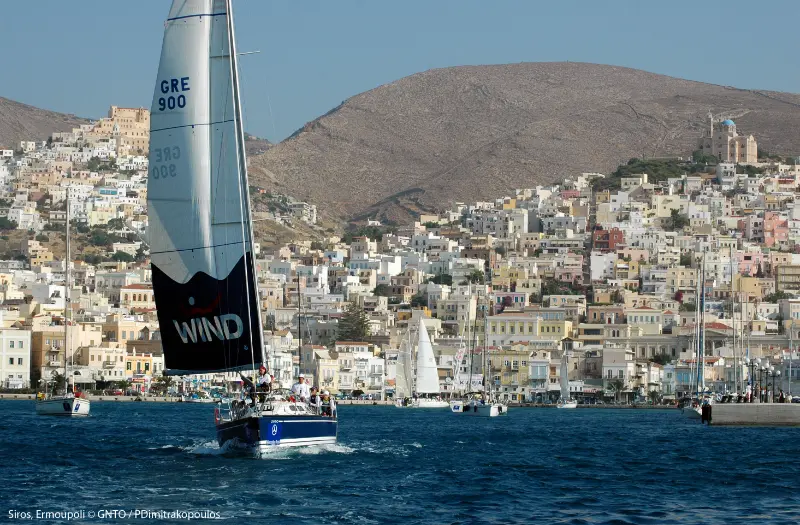
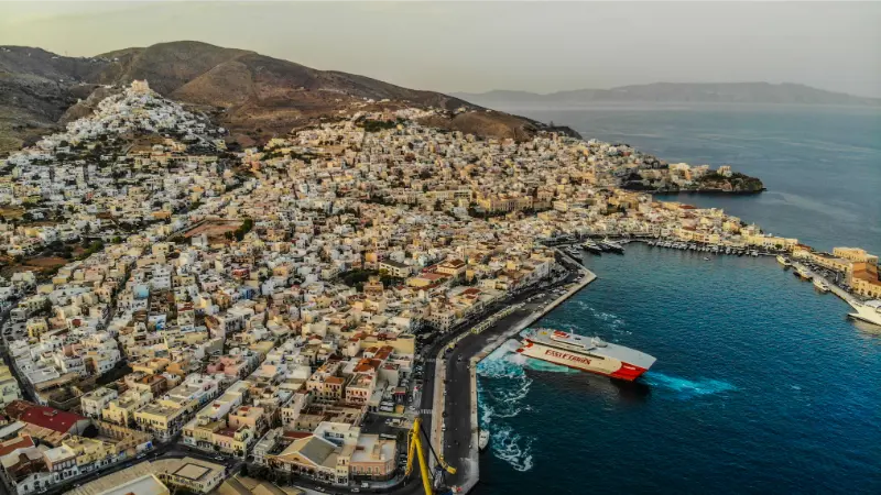
    Syros Ermoupoli Greece

    I prefer to visit in the late afternoon, when the temperature drops and the lower city begins to glow. You can walk down toward Ermoupoli for dinner, but check your energy before committing to every staircase. A taxi for one direction is a sensible choice rather than a failure of adventurous travel.

    Best beaches in Syros

    Galissas is one of the easiest all-round choices, with a broad bay and useful facilities. Kini has a relaxed seaside feel and a beautiful evening atmosphere. Finikas and nearby Agathopes work well if you are exploring the southwest coast. Vari is another convenient option, particularly for families.

    The northern part of Syros is rougher and less developed. Some coves require walking or a boat, so they suit travellers who already have the main logistics under control. I would not chase a remote beach just because it is described online as “secret”; choose according to wind, access and how much of the day you want to spend in transit.

    Food to try

    Syros has a strong food identity. Look for local cheeses, loukoumi, halvadopita, sausages and dishes built around seasonal vegetables and island produce. The best meal is not automatically the restaurant with the most elaborate sea view. Small neighbourhood tavernas and bakeries often give a clearer sense of local life.

    If food is one of your priorities, Syros combines well with Sifnos, another island with a serious culinary reputation. The difference is that Syros adds a stronger urban café and restaurant culture, while Sifnos feels more village-based.

    Getting around without a car

    One of Syros’s advantages is that you can build a satisfying trip around buses, taxis and walking. Seasonal bus routes connect Ermoupoli with several main beach settlements, and distances are short. Always check current schedules, especially outside July and August, because frequency changes by season.

    A rental car becomes useful if you want to combine multiple beaches and villages in one day or explore less accessible northern areas. Even then, I would not keep it for every day if you are staying in Ermoupoli. Parking and narrow streets can remove much of the convenience you thought you were buying.

    A realistic four-day Syros itinerary

    Day one: arrive, settle into Ermoupoli, walk the harbour, Miaouli Square and Vaporia, then have dinner in town. Day two: explore Ano Syros in the morning or late afternoon and leave the hottest hours for museums, cafés or a swim. Day three: choose Galissas or Kini for a relaxed beach day. Day four: rent a car or use buses to see two coastal villages before returning for a final evening in Ermoupoli.

    Ermoupoli City Capital Town Cyclades Syros Island Greece

    If you have a fifth day, keep it unscheduled until you see the wind and ferry situation. Repeat your favourite beach, take a boat trip or spend more time in town. Greek island trips become better when every day does not need a new headline attraction.

    Best time to visit

    Late May, June and September are excellent for travellers who want warm weather with a calmer atmosphere. July and August have the fullest transport schedules and liveliest evenings, but also more heat and higher accommodation demand. Spring is appealing for walking and culture even when the sea is still cool.

    Syros is also more viable outside the classic summer window than many resort-focused islands because Ermoupoli functions year-round. That does not mean every beach business stays open, but it does mean you are visiting a real town rather than a summer set that closes completely.

    Who will enjoy Syros most

    Syros is ideal for travellers who want architecture, culture and food alongside swimming. It is particularly good for couples, solo travellers and repeat visitors to Greece who want a Cycladic island that feels less dependent on the beach-club formula.

    If your dream is a tiny village, total silence and no urban environment, another island may fit better. But if you like the idea of watching a theatre performance, eating in a city square and swimming the next morning, Syros is one of the most balanced islands in the Aegean.

    Frequently asked questions

    How many days do I need in Syros?

    Four days is enough for Ermoupoli, Ano Syros and two beach areas without rushing. Five or six days gives you more flexibility for wind and slower meals.

    Do I need a car?

    No for a first visit based in Ermoupoli. Buses and taxis cover the main beach areas, although a car is useful for one exploratory day.

    Is Syros good for island hopping?

    Yes. Its central position and ferry connections make it easy to combine with islands such as Tinos, Mykonos, Paros and other Cyclades, depending on the seasonal timetable.

    Syros Island Greece

    Is Syros good for families?

    Yes, especially if you choose a beach base such as Galissas or Vari and keep city sightseeing to cooler parts of the day.

    Planning Syros in practice

    If you arrive by ferry, keep the first day deliberately light. Ermoupoli starts directly at the port, so there is no need to schedule a transfer, museum and beach before dinner. Drop bags, learn the shape of the waterfront and identify the bus stop you will use later. This small amount of orientation makes the following days much easier.

    For beach days, check wind before leaving town. Syros has coastlines facing different directions, and a ten-minute conversation with hotel staff can save you from choosing the most exposed bay. In peak summer, leave for popular beaches before late morning if you want an easier bus ride and more choice of umbrellas.

    If you are island hopping, do not book a same-day international flight after the ferry unless you have a very large buffer. Weather and port schedules can change. An overnight in Athens or another secure connection point is often worth the extra hotel cost.

    Syros is also a good place to slow down your spending. You do not need a paid activity every day. Architecture walks, village streets, public beaches and sunset views can fill much of the trip, leaving the budget for meals and comfortable accommodation.

    More in-depth Syros guides

    Continue planning the island with Ermoupoli Guide; Ano Syros Guide; Vaporia & Asteria; Galissas & Kini; Posidonia & Agathopes; Syros Food Guide; Best Beaches in Syros; Syros Without a Car; Syros with Kids; Where to Stay in Syros. These focused guides cover the places and travel styles that need more detail than the general Syros overview.

    Related itinerary: Syros, Tinos and Mykonos in 10 Days: Northern Cyclades Island-Hopping Itinerary.

    Syros sweet traditions are covered in detail in Loukoumi in Greece and Regional Greek Sweets.

  • Lefkada Without a Car: Buses, Boats, Taxis and the Best Bases

    Lefkada Without a Car: Buses, Boats, Taxis and the Best Bases

    You can visit Lefkada without renting a car, but you should choose your base around transport rather than booking a remote villa and hoping taxis will solve everything. Lefkada Town and Nydri are the easiest car-free bases; Agios Nikitas can work for a west-coast beach stay; Vasiliki is useful for the south but has fewer bus departures than Nydri on the current local timetable.

    As of September 2026, KTEL Lefkada publishes local services linking Lefkada Town with Nydri, Vasiliki, Agios Nikitas and Kathisma. Frequencies are not equal: Nydri has many more departures than Vasiliki, and beach routes are limited enough that you must check the return. This guide shows what a realistic car-free holiday looks like rather than pretending every village is easy by bus.

    Quick planning snapshot

    Easiest baseLefkada Town for buses; Nydri for buses + boats
    Good west-coast baseAgios Nikitas
    South-coast optionVasiliki, with more timetable planning
    Best day-trip toolBoat excursions from Nydri
    Biggest limitationRemote beaches and mountain villages

    A car-free Lefkada trip is strongest when you accept that you will not see every remote cove. In exchange, you avoid parking stress, can use boat days for inaccessible coastlines and spend more time in walkable towns.

    Lefkada Town: the transport-first base

    Lefkada Town is the best choice if bus flexibility matters most. You can walk the old centre, lagoon and waterfront, then use buses for Nydri, Agios Nikitas, Kathisma and other routes according to the seasonal schedule. Aktion/Preveza Airport is on the mainland, so plan the airport transfer separately rather than assuming the local island bus network starts at the terminal.

    The town also gives you more fallback options when weather cancels a boat trip. Museums, cafés, the lagoon and nearby beaches can fill a day without expensive taxi rides.

    Nydri: the best base for boats

    Nydri is the most practical place for travellers who want to use boat excursions instead of a rental car. Day cruises, sailing trips and connections toward Meganisi turn the sea into your transport network. Bus service to Lefkada Town is also comparatively frequent.

    Many Sailing Vessels Bay Hazy Lefkada Coast Panorama Nydri Greece Ionian Sea

    The trade-off is that Nydri is busy and commercial in summer. If you want a quiet traditional village, choose elsewhere; if you want to step outside and compare five boat options, it is hard to beat.

    Agios Nikitas and Kathisma by bus

    The current KTEL timetable lists direct services from Lefkada Town to Agios Nikitas and Kathisma. This makes the west coast possible without a car, but the limited number of daily departures means you should plan the return before swimming. Missing the final bus can mean an expensive taxi or an awkward evening.

    Agios Nikitas Lefkada Greece

    Vasiliki and the limits of the network

    Vasiliki is reachable by bus, but the current timetable shows far fewer departures than the Nydri corridor. It works best if you stay there for several nights rather than commute from Lefkada Town every day. Mountain villages and remote beaches remain difficult without a car, so use one planned taxi day if those are essential.

    How to plan the visit without wasting half the day

    Save the KTEL timetable on your phone and check for notices close to travel because public-holiday and seasonal changes are common. Arrive at stops early, carry small-value payment options and confirm the departure point locally when using a route for the first time.

    Use taxis strategically rather than constantly. One taxi to a mountain village or remote beach can be reasonable; relying on taxis for every dinner and beach usually costs more than a short rental. Boat trips are often the better substitute for a car because they provide both transport and an activity.

    When to go and how weather changes the experience

    Car-free travel is easiest in high season when buses and boat excursions operate most frequently. In May, October and winter, schedules can be thinner and some tourist boats stop entirely.

    Weather affects boat plans more than buses. Always keep a land-based backup day, especially if you have pre-booked several sea excursions.

    Who this plan works best for

    This approach suits solo travellers, couples, nervous drivers and anyone who wants a simple base-and-day-trip holiday. It is less suitable for travellers whose priority is remote beaches at sunrise, mountain villages at sunset or a different rural taverna every night.

    A realistic way to fit it into your Lefkada trip

    A strong five-day car-free structure is: one Lefkada Town day, one Nydri boat day, one Agios Nikitas/Kathisma beach day, one Nydri or Meganisi day, and one flexible weather day. Add Vasiliki only if the timetable and your accommodation plan make it comfortable.

    Seaport City Vasiliki With Its Turquoise Sea Island Lefkada Greece

    If you have seven days, split the stay between Lefkada Town and Nydri or Agios Nikitas. Changing base once can remove several repetitive bus journeys and gives the holiday two distinct moods.

    Common mistakes to avoid

    • Booking a remote villa because it looks close to the sea on a map.
    • Assuming buses run hourly to every beach.
    • Leaving the return timetable until the end of the day.
    • Planning all boat trips on consecutive days with no weather backup.
    • Using taxis for every small journey without estimating the total cost.

    The car-free strategy is not about reproducing a road trip without a car. It is about designing a different holiday around places that are naturally connected by bus and boat.

    Tours and activities around Lefkada

    Boat trips, sailing days and guided activities can be useful when you want to see coves or nearby islands without building the entire day around driving and parking. Availability changes through the season, so compare the exact departure point, duration and cancellation conditions before booking.

    Frequently asked questions

    Can you enjoy Lefkada without a car?

    Yes, especially from Lefkada Town or Nydri. You will need to be selective about remote beaches and inland villages.

    Which base is best without a car?

    Lefkada Town is best for the bus network; Nydri is excellent for boat trips; Agios Nikitas works for a west-coast beach stay.

    Can I reach Kathisma by bus?

    The current KTEL local timetable lists direct Lefkada Town–Kathisma services, but departures are limited and seasonal. Check the same-day schedule.

    How do I get to Meganisi without a car?

    Travel to Nydri and use a scheduled ferry or excursion boat. Foot-passenger day trips are practical when you build the day around the return sailing.

    Continue planning your Lefkada trip

    Start with the main Lefkada travel guide if you are still choosing your base and trip length. For the island’s most famous west-coast scenery, use the Porto Katsiki and Egremni guide. The Lefkada Town guide, Nydri guide and Vasiliki guide help you compare very different bases rather than booking only by hotel price. Use the Meganisi day-trip guide and Agios Nikitas guide to turn the transport plan into actual days.

    Final practical advice

    Lefkada without a car is completely realistic if you choose the right base and accept the shape of the transport network. Nydri, Lefkada Town and Agios Nikitas are much easier than isolated hillside accommodation.

    Build each day from the return journey backwards. Once you know how you are getting home, the beach, boat trip or dinner becomes much more relaxed.

    Extra planning notes for a smoother day

    For a longer stay, remember that Lefkada without a car should be one part of a broader Lefkada plan rather than the only objective. Build in time for meals, parking, short walks and weather changes. Distances on the island are manageable, but the roads frequently bend around mountains and bays, so a schedule that looks sparse on a flat map can already be full in practice. Travelling earlier in the morning usually improves parking, temperatures and photography, while late afternoon is better for slower village walks and harbour dinners. If a beach or boat day is uncomfortable because of wind, switch to an inland village, the capital or a sheltered bay instead of forcing the original plan. This flexible approach is especially useful in July and August, when traffic and heat magnify every small delay. Keep drinking water in the car, download the route before leaving your accommodation, and confirm seasonal transport or boat information close to the day of travel.

    Extra planning notes for a smoother day

    For a longer stay, remember that Lefkada without a car should be one part of a broader Lefkada plan rather than the only objective. Build in time for meals, parking, short walks and weather changes. Distances on the island are manageable, but the roads frequently bend around mountains and bays, so a schedule that looks sparse on a flat map can already be full in practice. Travelling earlier in the morning usually improves parking, temperatures and photography, while late afternoon is better for slower village walks and harbour dinners. If a beach or boat day is uncomfortable because of wind, switch to an inland village, the capital or a sheltered bay instead of forcing the original plan. This flexible approach is especially useful in July and August, when traffic and heat magnify every small delay. Keep drinking water in the car, download the route before leaving your accommodation, and confirm seasonal transport or boat information close to the day of travel.

  • Kavala Travel Guide: Old Town, Philippi, Beaches and a 4-Day Itinerary

    Kavala Travel Guide: Old Town, Philippi, Beaches and a 4-Day Itinerary

    Kavala is one of northern Greece’s most visually distinctive cities, climbing amphitheatrically above the Aegean with an old quarter, a fortress, the great Kamares aqueduct and layers of Ottoman, tobacco-trade and ancient Macedonian history.

    I would combine it with Thessaloniki and the new Thassos guide. Kavala gives the itinerary a real city base, while nearby Philippi and the coast turn it into much more than an overnight stop.

    Why visit Kavala?

    The city’s setting is the first reason: houses and historic buildings rise above a working port with views toward the northern Aegean. The Panagia district preserves the old-town atmosphere, while neoclassical buildings and tobacco warehouses show the prosperity of a later commercial era.

    Kavala is also the natural base for visiting ancient Philippi, one of the most important archaeological sites in northern Greece. That combination of city, archaeology and beach time makes four days surprisingly easy to fill.

    Where to stay

    City centre / waterfront

    The most practical base for restaurants, transport and evening walks. Expect some uphill walking if you visit Panagia on foot.

    Panagia old town

    More atmospheric and historic, but steep lanes and limited parking make it less convenient for every traveller.

    Coastal base outside the centre

    A good choice in summer if beach access matters more than walking to city restaurants each night.

    Best things to do

    Walk the Panagia district

    Take time with the lanes, old houses and viewpoints rather than simply climbing straight to the fortress.

    Visit Kavala Fortress

    The hilltop fortifications provide one of the city’s defining views. Go early or late in hot weather because the climb is exposed.

    See the Kamares aqueduct

    The great stone arches are one of Kavala’s visual landmarks and a useful orientation point between the old city and modern neighbourhoods.

    Learn about the tobacco era

    Kavala was once a major tobacco-trade centre. Warehouses and the Tobacco Museum help explain why the city developed such a distinctive early-20th-century urban character.

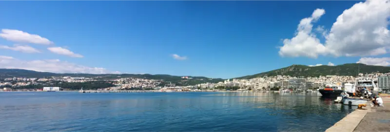
    Thasos Island Greece Kavala City Cityscape Panorama

    Take a day trip to Philippi

    Ancient Philippi combines Macedonian, Roman and early Christian history. Give the archaeological site and museum several hours and protect yourself from sun because much of the visit is outdoors.

    Add a beach afternoon

    The wider Kavala coast has sandy beaches that make an easy counterpoint to archaeology and city walking. Use a beach close to your route rather than spending the day chasing a single famous name.

    Food

    Northern Greek cuisine gives the city a strong food identity, with seafood, small plates, meat dishes and influences from population movements across Macedonia and Thrace. The waterfront is convenient, but I would also eat in neighbourhood tavernas away from the most obvious view tables.

    How to get there

    Kavala is served by Kavala International Airport “Alexander the Great”, about 30 km from the centre according to Visit Greece. Thessaloniki is another major gateway and is roughly 150 km away by road.

    Getting around

    Central Kavala is walkable for fit travellers, but hills are unavoidable. A car is useful for Philippi, beaches and onward travel to ferry ports, while city parking can make it preferable to leave the vehicle at your accommodation when sightseeing downtown.

    A realistic 4-day itinerary

    Day 1 – Old Kavala

    Walk Panagia, the fortress, Kamares and the waterfront.

    Day 2 – Philippi

    Devote the day to the archaeological site and museum, adding a nearby food stop rather than another major attraction.

    Day 3 – Beaches and modern city

    Use the morning for the coast and return for the Tobacco Museum or city neighbourhoods later.

    Day 4 – Flexible northern Greece day

    Choose another beach, a slower city day or continue toward Thassos depending on ferry plans.

    How I would plan the trip

    I would build a trip to Kavala around geography rather than a list of attractions. Choose one main area for each day, add only nearby stops, and keep at least one half-day flexible. On a Greek region, the distance on the map rarely tells the full story: narrow roads, parking, ferry schedules, heat and the temptation to stop at an unexpected beach can all stretch a simple transfer.

    Transfer days deserve their own space in the itinerary. A morning ferry, a rental-car pickup or a mountain drive can consume more time than the timetable suggests once luggage, check-in and meals are included. Treating those hours as real travel time is one of the easiest ways to make the holiday feel relaxed rather than rushed.

    Best time to visit

    For a first trip to Kavala, late spring and early autumn are usually the easiest seasons to balance warm weather with a calmer pace. July and August bring the most reliable beach conditions but also the highest demand, stronger midday heat and more pressure on parking and accommodation. In shoulder season, some seasonal services may run less frequently, so transport and opening times should be checked close to the trip.

    If walking, archaeological sites or road trips are central to the plan, I would avoid putting the most exposed activities in the middle of the day. Start early, leave the hottest hours for lunch or swimming, and return to villages and viewpoints later in the afternoon.

    Budget and booking strategy

    Accommodation prices can change dramatically by month and by exact location. I compare the total cost of the stay rather than the room rate alone: a cheaper property can become less attractive if it requires daily taxis, long drives or paid parking. On small islands and in mountain regions, location is often worth more than an extra category of hotel.

    Ferry timetables, domestic flights, rental-car prices and boat excursions are dynamic. I would book the fixed parts of the trip first, then leave weather-dependent activities flexible where possible. Always recheck schedules a few days before travel and again on the day when sea conditions are relevant.

    Practical mistakes to avoid

    The most common mistake in Kavala is trying to see too much in too little time. A better trip usually comes from choosing fewer bases, driving the same roads less often and leaving space for a beach, village or meal that turns out to be better than expected.

    Do not assume every attractive cove has easy access, shade, facilities or reliable phone coverage. Carry water, sun protection and shoes suitable for uneven ground. Download an offline map before remote drives or hikes, and ask locally before taking a rental car onto rough roads that may not be covered by the rental agreement.

    Who this destination suits

    Kavala works especially well for independent travellers who enjoy combining landscapes with local food and small-scale sightseeing. Couples can build days around beaches, sunset walks and slow dinners, while solo travellers gain flexibility to follow weather and transport conditions. Families can also enjoy the destination, but the most comfortable plan usually uses fewer bases and avoids very long transfer days.

    Travellers with limited mobility should check accommodation access carefully. Historic villages can have steep lanes, steps and parking outside the centre, while some beaches require rough paths or stairways. A beautiful location on a map is not always the most practical base for every traveller.

    How to combine it with the rest of Greece

    Kavala combines easily with Thessaloniki and the new Thassos article. For a wider northern itinerary, the Halkidiki guide, Mount Olympus guide and Meteora guide show very different landscapes within mainland Greece.

    Frequently asked questions

    How many days do I need in Kavala?

    For a first visit, four to seven days usually gives enough time to understand the destination without turning every day into a transfer. A shorter stay can work if you focus on one area and accept that you will leave some places for another trip.

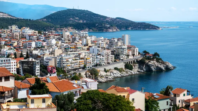
    Multiple Buildings Located Kavala Greece

    Do I need a car?

    It depends on the destination and your base, but a car is often the easiest way to reach beaches, villages and archaeological sites away from the main town. If you prefer not to drive, choose accommodation around the strongest public-transport hub and build the itinerary around available buses, boats and organised excursions.

    Is it suitable for a first trip to Greece?

    Yes, provided you match the destination to your travel style. It is particularly rewarding for travellers who want to go beyond the most famous Greek islands while still having enough infrastructure for an independent holiday.

    Should I book everything in advance?

    Book the parts that can sell out or determine the structure of the trip, such as peak-season accommodation, flights and important ferry connections. Keep beach days and weather-sensitive excursions more flexible whenever cancellation terms allow.

    What should I pack?

    Bring sun protection, a reusable water bottle, comfortable walking shoes and a light layer for windy evenings or mountain areas. For beach-heavy itineraries, water shoes can be useful on pebbled or rocky shores.

    Final advice

    The best way to experience Kavala is to resist the temptation to turn it into a checklist. Spend enough time in one area to notice the rhythm of the place, eat where the day naturally takes you, and leave room for local recommendations. That slower approach is what makes a second-tier destination in the guidebooks feel like a first-rate travel experience.

    Useful official information

    For destination information and current travel inspiration, consult the Greek National Tourism Organisation: Visit Greece. Transport timetables, seasonal opening hours and excursion schedules should always be checked again close to your travel dates.

    Why Philippi matters

    Philippi began as an ancient city in eastern Macedonia and later became a major Roman and early Christian centre. The archaeological landscape includes a theatre, forum areas, basilicas and traces of the Via Egnatia corridor.

    It is the sort of site where a guide or a little reading before arrival greatly improves the experience. Without context, the scale can be hard to interpret; with context, it becomes one of the most important historical day trips in northern Greece.

    Continue east through Thrace

    After Kavala, continue the mainland route with the Xanthi guide for old-town architecture and the Nestos River, then the Alexandroupoli guide for the Evros Delta and Samothrace connections.

    More detailed northern Greece guides

    Continue with Philippi Archaeological Site for more detailed planning.

    For a deeper Eastern Macedonia route, add our guides to Drama, Amphipolis and Alistrati and Aggitis.

    Related itinerary: Kavala, Philippi and Thassos in 7 Days: Northern Aegean Coast and Island Itinerary.

  • Tinos Travel Guide: Villages, Beaches, Food, Hiking and a 5-Day Itinerary

    Tinos Travel Guide: Villages, Beaches, Food, Hiking and a 5-Day Itinerary

    Tinos is one of the best Cycladic islands for travellers who want more than beaches and nightlife. It has a major pilgrimage tradition, dozens of distinctive villages, an exceptional marble-working heritage, terraced hills, hundreds of ornate dovecotes, walking paths and a food culture that rewards slow exploration. The island can look austere from the ferry, but inland Tinos is full of detail.

    Because nearby Mykonos is much more famous internationally, Tinos is sometimes treated as a side trip. I would do the opposite: give Tinos several days and let the villages shape the itinerary. If you are comparing islands, read the best Greek islands guide and the guides to Naxos and Paros.

    What makes Tinos different

    Visit Greece calls Tinos the “hand-crafted” island, and the phrase fits. The island’s identity is shaped by marble architecture, artists, stone walls, terraces and elaborate dovecotes as much as by sea and sun. It is also one of Greece’s most important Orthodox pilgrimage destinations because of the Church of Panagia Evangelistria in Chora.

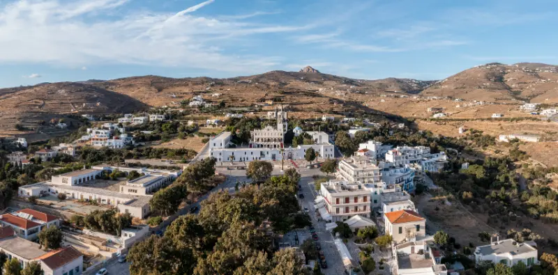
    Greece Aerial Drone View Tinos Island Cyclades Church Panagia Megalohari Chora Building

    The result is an island with several parallel identities: religious, artistic, agricultural, gastronomic and beach-oriented. A good Tinos trip samples all of them rather than spending five days on one coast.

    Tinos Chora

    Chora is the ferry port and main town. The broad route leading toward Panagia Evangelistria is central to the pilgrimage experience, while side streets hold cafes, restaurants and everyday island life.

    Staying in Chora is practical if you do not have a car because ferries and many buses are close. It is also convenient for evening meals after day trips inland.

    Pyrgos and marble tradition

    Pyrgos is one of the essential villages, known for marble craftsmanship, elegant architectural details and a strong artistic tradition. Spend time looking at doorways, fountains, lintels and the surfaces of the village rather than treating it as a twenty-minute photo stop.

    Nearby Panormos adds a coastal contrast and can turn the village visit into a relaxed half-day. Museums and workshops related to marble art deepen the experience for travellers interested in craft and design.

    Volax and the interior villages

    Volax is famous for the rounded granite boulders scattered through the landscape. The village itself is compact, but the surrounding terrain makes it one of the most distinctive places on Tinos.

    Other villages reward wandering for dovecotes, Catholic and Orthodox churches, squares and traditional houses. Instead of trying to “complete” a list of forty villages, choose a cluster each day and travel slowly between them.

    Hiking on Tinos

    Tinos is unusually strong for walking. Visit Greece reports more than 150 kilometres of stone-paved roads and paths connecting villages, valleys, dovecotes, monasteries and beaches. Routes range from easy village walks to more demanding terrain.

    A popular approach is to combine a walk with a village meal so you are not dependent on a circular hiking route. In warm weather, start early and carry more water than the distance alone suggests because shade can be limited.

    Best beaches

    Tinos has beaches on several coasts, from organised stretches near Chora to more exposed coves. Kolymbithra is among the better-known choices and can feel very different depending on wind. Agios Ioannis and Agios Sostis are convenient for visitors who want easier access and services.

    Wind is a major planning factor in the Cyclades. Ask locally which beach is most sheltered on the day rather than insisting on one famous name when conditions are poor.

    Food to try

    Tinos has an excellent food reputation built on local cheeses, sausages, capers, artichokes, honey and produce from a rugged agricultural landscape. Look for dishes that use what grows on the island rather than only standard Greek-menu classics.

    Village tavernas are part of the travel experience. I often plan the day around lunch in the interior, then choose a beach for late afternoon when the light softens and temperatures drop.

    Getting around

    A car gives the most flexibility because the villages are spread across mountainous terrain. Buses serve key settlements and beaches, especially in season, but a vehicle makes it easier to link small villages and trailheads.

    Roads can be narrow and winding. Drive slowly, expect local traffic in both directions and do not stop in the road for photographs. Parking outside small villages is often better than trying to squeeze into the historic centre.

    Where to stay

    Chora is best for ferry convenience, restaurants and travellers without a car. A village stay offers a quieter atmosphere and immediate access to the interior landscape, while beach areas suit visitors who want swimming to dominate the trip.

    For a first five-night visit, I prefer one base near Chora or centrally located with a car. Tinos is compact enough that changing hotels is rarely necessary.

    A five-day Tinos itinerary

    Day 1: Arrive in Chora, visit the main church respectfully, explore town and have a slow dinner.

    Day 2: Drive to Pyrgos and Panormos, visit marble-related sights and spend the late afternoon by the sea.

    Day 3: Explore Volax and a cluster of nearby villages, including time for a short hike or village-to-village walk.

    Day 4: Beach day chosen according to wind, with a long lunch and no major sightseeing target.

    Village Of Isternia Island Of Tinos Greece

    Day 5: Choose a longer hike, more villages or a food-focused loop, then return to Chora early enough to pack without rushing.

    Pilgrimage and respectful visiting

    Panagia Evangelistria is not merely a tourist landmark; it is a place of deep devotion. Dress appropriately, keep voices low and do not obstruct worshippers for photographs. Around major religious dates, Chora can become extremely busy and accommodation should be booked well in advance.

    If you are not religious, the pilgrimage culture is still an important part of understanding Tinos. Observe it with the same respect you would bring to an active mosque, synagogue, cathedral or monastery elsewhere.

    Tinos versus Mykonos, Paros and Naxos

    Tinos is less oriented toward nightlife and international luxury than Mykonos, more village-and-hiking focused than Paros, and smaller in scale than Naxos. It suits travellers who enjoy food, walking, craft and quiet exploration.

    Island choice is about matching personality, not ranking beauty. If your ideal day is beach club followed by late-night clubs, Tinos may feel too quiet. If your ideal day is a village walk, long lunch, swim and sunset, it can be one of the most rewarding Cycladic choices.

    Frequently asked questions

    How many days do I need in Tinos?

    Four to five days is ideal for a first visit because the best experiences are spread across villages, beaches and walking routes rather than concentrated in one town.

    Do I need a car?

    A car is very useful for exploring the interior efficiently, but travellers based in Chora can use seasonal buses for key villages and beaches.

    Is Tinos only a religious destination?

    No. Pilgrimage is central to its identity, but Tinos is equally compelling for marble art, architecture, food, villages, beaches and hiking.

    Is Tinos windy?

    It can be, like much of the Cyclades. Wind direction should influence beach choice and ferry-day expectations, especially in midsummer.

    How to slow down on Tinos

    Tinos rewards travellers who choose one geographic area each day. A village that looks tiny on the map can absorb an hour once you notice marble doorways, dovecotes, churches and small workshops. Add a coffee and a long lunch and the schedule naturally becomes slower than an itinerary designed around beach hopping.

    Walking is another way to reduce the urge to collect sights. A village-to-village path reveals terraces, dry-stone walls and agricultural land that disappear when you drive between parking areas. Even a short section can change your understanding of how communities are connected across the island.

    Tinos Kardiani Village

    Leave one day partly unplanned. Use the morning wind and local advice to decide whether it becomes a beach day, a hiking day or another village loop. That flexibility is especially valuable in the Cyclades, where weather can make one coast uncomfortable while another remains calm.

    Additional practical notes

    Tinos has both Orthodox and Catholic traditions, visible in churches and villages. Respect local services and religious events, and ask before photographing people at worship.

    For ferry planning, leave enough time between Tinos and a flight from Athens. Meltemi winds can disrupt schedules in the Cyclades, so a same-day tight connection is unnecessary risk.

    Planning around villages and wind

    Each morning on Tinos, check wind direction before choosing the coast. This small habit prevents the common mistake of driving across the island to a famous beach only to find it uncomfortable. Local hotel staff and taverna owners are often excellent sources because they know which coves are sheltered under the day’s conditions.

    For village days, I group places geographically. Pyrgos and Panormos belong naturally together, while Volax can be combined with nearby interior villages and a short walking route. This approach leaves time for coffee, museums and lunch instead of turning every village into a ten-minute parking stop.

    If you enjoy photography, morning and late afternoon are especially good for marble details, dovecotes and narrow streets. Midday light can be harsh, but it is perfect for a long shaded meal. Tinos becomes much easier when the itinerary follows the light and temperature instead of fighting them.

    A final practical point is footwear. Even travellers who are not planning formal hikes spend a surprising amount of time on stone lanes, steps and uneven village paths. Comfortable shoes will be used far more than elegant sandals, especially if you want to explore beyond Chora.

    More Attica guides for your trip

    Continue with Rafina Port for more detailed planning.

    More in-depth Tinos guides

    Continue planning Tinos with Tinos Chora Guide; Pyrgos and Panormos Tinos Guide; Volax Tinos Guide; Kardiani and Isternia Tinos Guide; Panagia Evangelistria Tinos Guide; Best Beaches in Tinos; Tinos Hiking Guide; Tinos Without a Car; Tinos with Kids; Where to Stay in Tinos.

    Related itinerary: Andros and Tinos in 7 Days: Hiking, Villages and Beaches Itinerary.

    Related itinerary: Syros, Tinos and Mykonos in 10 Days: Northern Cyclades Island-Hopping Itinerary.

    Related festival or event guide: August 15 in Greece: Dormition, Island Festivals, Pilgrimages, Crowds and Travel Tips.

  • Best Beaches in Skiathos: 15 Beaches for Families, Scenery, Sunset and Quiet Days

    Best Beaches in Skiathos: 15 Beaches for Families, Scenery, Sunset and Quiet Days

    Skiathos has enough beaches that the useful question is not ‘Which one is best?’ but ‘Which beach is best today?’ Wind, transport, age of your group and the kind of day you want matter more than a universal ranking. The famous north coast is spectacular but exposed; the south coast is easier for buses, facilities and family routines.

    This guide compares 15 beaches by purpose rather than pretending they offer the same experience. Use it with the island weather and your location. For the broad island overview, start with my Skiathos travel guide. For the capital, harbour and evening walks, use the Skiathos Town guide; and for the island’s best-known south-west beach, see the Koukounaries Beach guide.

    Fast beach chooser

    If you want…Start with…
    Iconic sceneryLalaria
    Easy family dayTroulos or Agia Paraskevi
    Pine forest + famous sandKoukounaries
    SunsetAgia Eleni or Banana
    Lively organised beachBanana or Vromolimnos
    Quieter natural settingMandraki, Elias or Aselinos depending on conditions

    1. Koukounaries

    Koukounaries combines golden sand with pine forest and wetland scenery, which is why it remains the island’s signature south-coast beach. It is organised and easy to reach by bus, making it a strong first choice without a car. My detailed Koukounaries guide covers the beach, lagoon and practical timing.

    Go early if you want a calmer atmosphere in high season. Late afternoon can be beautiful, but check your return transport if you are not staying nearby.

    2. Lalaria

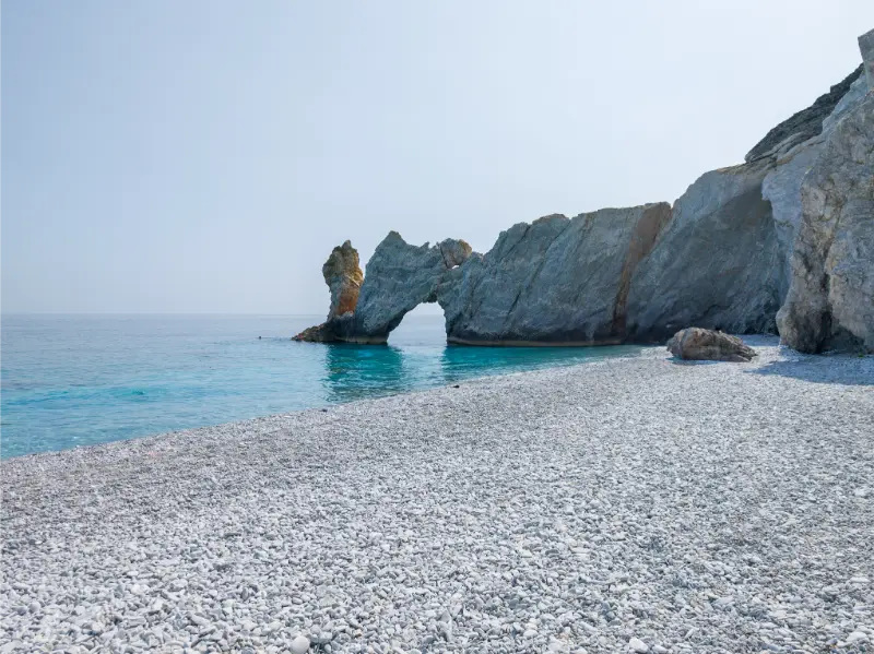
    Lalaria is the dramatic white-pebble beach beneath pale cliffs on the north-east coast. It is boat-only and should be attempted only in suitable sea conditions. Read the Lalaria guide before booking because the practical details matter more here than at any road-access beach.

    There are no normal beach facilities and taking pebbles is prohibited. Choose it for scenery, not convenience.

    3–4. Banana and Agia Eleni

    Banana brings an organised, social atmosphere with watersports, while Agia Eleni is the calmer west-facing alternative. Both work well with Koukounaries in a south-west day. The Banana and Agia Eleni guide compares them in detail.

    If sunset is important, plan the return before it gets dark. In peak season a taxi or bus strategy is more relaxing than improvising after the last light.

    5–7. Troulos, Agia Paraskevi and Kolios

    These beaches sit along the practical south-coast corridor. Troulos is particularly family-friendly, and Agia Paraskevi works well as a holiday base. See the Troulos and Agia Paraskevi guide if accommodation choice matters as much as the sand.

    Kolios is another convenient option between the town and Koukounaries. These are the beaches I would prioritise for an uncomplicated day with lunch, toilets and straightforward transport.

    8–10. Vromolimnos, Kanapitsa and Achladies

    Vromolimnos is known for a livelier organised beach scene and is popular with younger visitors. Kanapitsa and Achladies are closer to town and can be useful when you want a beach without spending much of the day in transit.

    Beach Of Kanapitsa Skiathos Greece

    The exact character of beach bars and watersports changes by season, so choose these areas for location and swimming first. If a particular venue matters, check its current opening rather than assuming last year’s setup is unchanged.

    11–13. Mandraki, Elias and Agkistros

    The western/north-western forest beaches feel more natural than the main south-coast strip. Reaching them may involve walking through pine forest or driving on less-developed roads. They are rewarding when the weather is settled and you want space rather than facilities.

    These beaches pair especially well with a walk; see my Skiathos hiking guide. Carry water and do not assume every beach bar or seasonal facility is operating outside peak summer.

    14. Aselinos

    Aselinos is a broader north-west beach with a more open feeling than the sheltered southern bays. That openness can mean waves and wind. On a calm day it is a satisfying escape; on a rough day, move back toward the south coast.

    It works best for travellers with a vehicle or a planned walking route rather than people who want effortless bus hopping.

    15. Megali Ammos

    Megali Ammos is not the island’s wildest beach, but it is one of the most useful if you stay in Skiathos Town. You can walk or make a short transfer, swim for a few hours and still have the harbour and restaurants for the evening.

    For a short trip, convenience can be more valuable than chasing a remote cove. Megali Ammos is a good reminder that the best beach is sometimes the one you can enjoy without turning the day into logistics.

    Beach choice by traveller type

    TravellerBest starting choices
    Families with young childrenTroulos, Agia Paraskevi, Koukounaries
    CouplesAgia Eleni, Koukounaries, quieter forest beaches
    Friends/nightlifeBanana, Vromolimnos, town-side beaches
    PhotographersLalaria, Kastro coast, Koukounaries wetland
    HikersMandraki/Elias/Agkistros, Kastro-side coast

    How wind should change your plan

    North wind is the key variable. It can make Lalaria and the exposed northern beaches unsuitable while the south coast remains comfortable. Do not treat a cancelled boat as a lost day: switch coasts and use the calm window later in the trip.

    The opposite can also happen with local swell or crowded conditions. Look at the sea in front of you and be willing to move. Skiathos gives you enough alternatives that there is little reason to force a bad beach day.

    When to go and how to use the weather

    For Best Beaches in Skiathos, I would treat the weather as part of the plan rather than background information. Skiathos is green, exposed to changing Aegean conditions and small enough that one coast can feel very different from another. In July and August the strongest sun usually falls in the middle of the day, so exposed walks and historic sites are more comfortable early or later. Spring and early autumn are particularly attractive for walking, while the sea remains the priority for most summer visitors.

    Wind matters even more than temperature. A calm morning can be ideal for the north coast, while a northerly wind can cancel small-boat departures or make open beaches uncomfortable. Check the marine forecast and ask local operators about the actual sea, not only the air temperature. If conditions are poor, switch to the south coast, town, a monastery or a forest walk and keep the exposed plan for another day.

    Food, water and a sensible pace

    Skiathos makes it easy to over-plan because distances look short. Leave time for a proper lunch, a swim and an unhurried return. On remote beaches and hiking routes, carry more water than you think you need; tavernas and beach bars are common on the developed south coast but not guaranteed on the north. A refillable bottle and a small snack are worth carrying even on a half-day outing.

    For meals, use the geography of the day. Eat near the beach or village you are already visiting instead of driving back to Skiathos Town for every lunch. In the evening, the town gives you the widest choice, but staying in Troulos, Agia Paraskevi or Koukounaries can be more relaxing if your hotel is on the west side of the bus corridor.

    Beach Of Troulos Skiathos Island Greece

    What to pack for this part of Skiathos

    • High-SPF sunscreen, a hat and enough drinking water for exposed stops.
    • Shoes with grip for paths, rocky viewpoints and historic sites; flip-flops are not hiking shoes.
    • A light layer for boat rides and breezy evenings, even in warm weather.
    • Offline maps or saved pins for remote beaches and trail junctions.
    • A small dry bag if the day includes a boat, tender transfer or swimming stop.
    • Cash as a backup for small seasonal businesses, although cards are widely used in tourist areas.

    A planning rule that saves time

    Group each day by geography. The south-coast bus corridor, the Koukounaries end of the island, the northern Kastro area and the town/monastery side each work best as separate clusters. Crossing the island several times in one day adds traffic and parking without adding much experience.

    Also keep the last day conservative if you have a flight or ferry connection. Boat trips can be delayed by weather, buses can run differently outside peak season and summer road traffic around town and the airport can slow unexpectedly. A relaxed final day near your departure point is a better insurance policy than squeezing in a remote north-coast beach.

    Frequently asked questions

    What is the most famous beach in Skiathos?

    Koukounaries is the classic organised beach, while Lalaria is the island’s most iconic wild coastal image.

    Skiathos Island Near Lalaria Beach Sporades Thessaly Greece

    Which beach is best for families?

    Troulos, Agia Paraskevi and Koukounaries are practical starting points, but always judge the actual sea conditions.

    Which beach is best for sunset?

    Agia Eleni and Banana are convenient west-facing options.

    Can I visit the best beaches without a car?

    Many south-coast beaches are easy by bus; Lalaria requires a boat, while some northern and forest beaches are easier with a vehicle or hike.

    How many beaches should I visit in one day?

    Usually one main beach plus one second stop is enough. More than that often turns the day into transport.

    Final thoughts

    Skiathos does not need a single beach winner. Build your choice around wind, access and the people travelling with you. Keep Lalaria for a calm sea, use the south coast for easy days, and save the forest beaches for when you want the island to feel quieter and wilder.

  • Where to Stay in Ikaria: Agios Kirykos, Armenistis, Raches, Evdilos or Faros?

    Where to Stay in Ikaria: Agios Kirykos, Armenistis, Raches, Evdilos or Faros?

    Choosing where to stay in Ikaria is more important than on many Greek islands because the island is long, mountainous and slow to cross. A hotel that looks “central” on a small map can still be a winding drive from the beach, port or village you want every day. The right base therefore starts with your priorities: north-coast sand, thermal baths, ferry logistics, mountain nightlife, airport convenience or a quieter village stay.

    Agios Kirykos: best for services, south-east sights and Therma

    Agios Kirykos is the capital, a main port and the strongest practical base on the south-eastern side. It suits ferry arrivals, travellers using the airport, visitors who want Therma nearby and anyone who values pharmacies, shops and year-round services.

    The downside is distance from Mesakti, Livadi, Nas and Raches. Read the Agios Kirykos guide if you are considering the capital for more than a transit night.

    Mesakti Sandy Beach Calm Turquoise Bay Ikaria Island Greece Swimmers Hillside Homes

    Armenistis and Gialiskari: best for a beach-first holiday

    This is the obvious choice if your ideal day begins with sand at Livadi or Mesakti and ends with dinner near the water. The area has the strongest concentration of visitor accommodation on the north coast and easy access to Nas and Raches.

    High-season demand is higher, parking can be tighter and the airport or Agios Kirykos are far away by Ikarian standards. If you arrive late in the south, a split stay may be more comfortable than driving across the island at night.

    Raches: best for village atmosphere and late nights

    Stay in or near Christos Raches if mountain scenery, hiking and panigiria matter more than stepping directly onto a beach. Evenings are cooler, village life runs late and the north-west trail network is close.

    This is not the best choice for travellers who dislike driving. Every beach day requires a descent and return climb, and festival nights make a sober-driver plan essential.

    Evdilos: best compromise for a central north-coast base

    Evdilos works well for travellers arriving at the north port and for anyone who wants to explore both Armenistis/Raches and the middle of the island. It has shops, food and a real-town atmosphere without the tourism concentration of Armenistis.

    The beach directly outside your accommodation may not be the island’s most famous, so expect short drives for dedicated beach days.

    Faros: best for airport convenience and a simple beach stay

    Faros is close to Ikaria’s airport and offers a straightforward coastal holiday with beach, tavernas and accommodation. It is particularly good for a short stay at the start or end of the trip and for travellers who prefer the south-east but do not want to sleep in the capital.

    For repeated evenings in Raches or visits to Nas, Faros is too far away. Build the trip around the side of the island where you actually want to spend time.

    Therma: best for a wellness-focused stay

    Therma makes sense if the thermal springs are a primary reason for travel. The village is close to Agios Kirykos but feels smaller and more seasonal. Read the Therma Ikaria guide before deciding whether to stay there or commute from the capital.

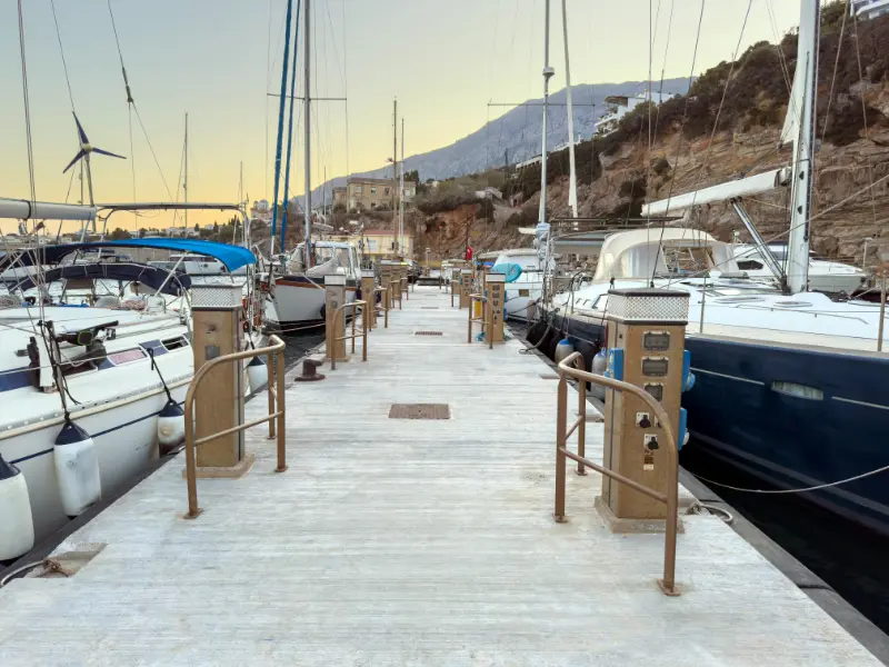
    Floating Marine Platform Sailboats Agios Kirikos Marina Warm Evening Light Ikaria Island Greece

    Outside peak months, confirm which restaurants and accommodation services remain open. A quiet spa village can be wonderful if that is what you want and frustrating if you expected a full resort.

    Should you split your stay?

    For a week or longer, a north/south split can dramatically reduce driving. Three nights around Agios Kirykos or Faros followed by four nights in Armenistis or Raches lets you experience both halves without turning every day into a road trip.

    The cost is one hotel change. If you travel light, that is often a good trade. If you are staying only four nights, choose one side and accept that you will not see everything.

    Best area by traveller type

    TravellerBest starting area
    First-time visitor with carArmenistis or split north/south
    No car / practical servicesAgios Kirykos or Evdilos depending arrival port
    Beach-first familyArmenistis / Gialiskari
    Panigiria and hikingRaches
    Thermal springsTherma or Agios Kirykos
    Airport overnightFaros or Agios Kirykos
    North-port ferry arrivalEvdilos

    Accommodation details to verify before booking

    • Exact road access and whether the final approach is paved.
    • Dedicated parking versus informal roadside parking.
    • Number of stairs between room, road and beach.
    • Air conditioning in the actual sleeping area.
    • Walking distance measured on safe roads, not straight-line distance.
    • Nearby food options in your travel month.
    • Late check-in procedure if arriving by ferry or flight.

    The most common booking mistake

    The biggest mistake is choosing a property for the view while ignoring daily logistics. A spectacular hillside room can require two steep drives for every meal and beach visit. Conversely, a simple room in the right village can make the whole trip feel easier.

    Choose the location first, then the property. Ikaria’s geography matters more than having a private pool, and time saved on the road is time you can spend at a beach, village square or long dinner.

    Booking accommodation and activities

    For accommodation, compare places to stay in Ikaria on Booking.com. Always check the exact village and road access before booking. A property described simply as “Ikaria” can be an hour or more from the beach, port or village you expect to use most.

    For organised activities and excursions, use the widget below as a starting point. Ikaria has a smaller organised-tour market than Santorini, Rhodes or Crete, so availability can be seasonal. Verify the meeting point, transfer arrangements and cancellation terms before paying.

    Official resources to recheck before you go

    For a broad official destination overview, use Visit Ikaria and the Municipality of Ikaria. Both are useful for checking local notices, villages, beaches, museums and seasonal information close to your trip.

    For village geography, the official Visit Ikaria village directory is especially useful because Ikaria is not organised around one resort strip: the island has many scattered settlements and travel times are longer than the map first suggests.

    Continue planning your Ikaria trip

    Drone Panorama Gialiskari Armenistis Coast Turquoise Water Ikaria Island Greece

    One base versus two

    A single base is simplest for unpacking, but Ikaria’s road geometry means a week in one corner can create hours of unnecessary driving. Splitting seven or eight nights between north and south often gives more usable holiday time despite one check-out and check-in.

    If you hate moving hotels, choose a central compromise such as Evdilos and accept that some beach or spa days will involve longer drives.

    Noise expectations

    Harbour rooms can hear ferry activity, village-square rooms can hear late music and beach rooms can hear summer traffic. Read reviews for the specific season because August noise tells you little about May.

    Bring earplugs if you are sensitive. The most beautiful location in a Greek village is often also the place where community life happens.

    Planning by season

    May and early June favour walking, green landscapes and quieter villages, but some seasonal beach businesses operate shorter hours. July and August bring the widest choice of accommodation, food and festival activity along with stronger heat, wind, traffic and booking pressure. September often offers the best balance of warm sea, active villages and easier roads. October can be rewarding for slow travel, but ferry frequency and seasonal restaurants require more checking.

    Whatever the month, build each day around the actual wind and temperature. Ikaria is large enough that a fixed itinerary can create unnecessary driving when the north coast is rough or the mountains are hot. Keeping one flexible half-day is more useful than adding another attraction to a crowded schedule.
    Common planning mistakes

    The most common mistake is treating map distance as travel time. Mountain bends, village traffic, ferry arrivals and spontaneous stops slow every journey. Choose one main part of the island per day and resist adding a distant beach simply because it appears only thirty kilometres away.

    Another mistake is relying on a single old timetable or social-media post. Ferries, buses, museum hours and festival confirmations change. Recheck anything time-critical close to travel and ask locally when conditions matter more than a published schedule.

    How to keep the day realistic

    Ikaria works best when you choose one main purpose for each day and let secondary stops remain optional. A beach day can include one village and dinner; a hiking day can finish with a swim; a port day can include a museum and nearby meal. Trying to combine the north coast, Raches, Therma and a sunset stop in one circuit creates more road time than experience.

    Leave enough time to stop when a bakery, viewpoint or village square looks inviting. The island rewards curiosity more than speed. If the wind, heat or ferry schedule changes, shorten the plan rather than moving every stop later into the evening. That flexibility is one of the simplest ways to make an Ikaria trip feel genuinely relaxed.

  • Chora Patmos Guide: UNESCO Lanes, Windmills, Mansions and Sunset

    Chora Patmos Guide: UNESCO Lanes, Windmills, Mansions and Sunset

    Chora is the image of Patmos that stays with most visitors: white cubic houses climbing beneath the dark fortified walls of the Monastery of Saint John, narrow stone lanes, hidden courtyards, small churches and sudden views over the Aegean. It is also a living settlement and part of a UNESCO World Heritage property, not a stage set. The best way to experience it is slowly and with respect for the people who live behind the whitewashed walls.

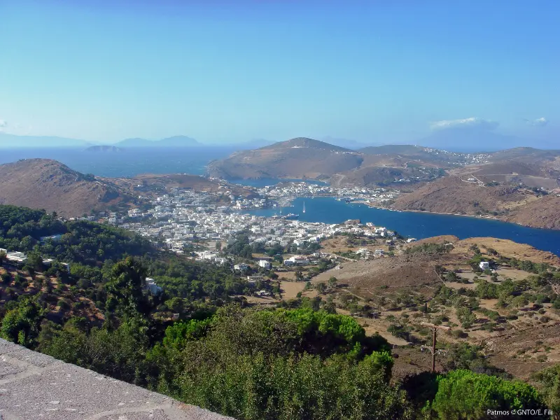
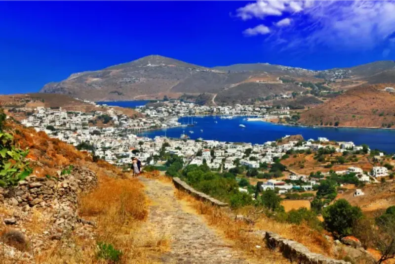
    Patmos Greece

    This guide focuses on Chora itself rather than repeating the monastery and cave in detail. You will find a walking strategy, viewpoints, the windmills, historic mansions, Nikolaidis Mansion, evening atmosphere, transport and where to stay. For the religious monuments, use the dedicated Monastery of Saint John and Cave of the Apocalypse guides.

    Why Chora is UNESCO-listed

    UNESCO inscribed the Historic Centre of Chora together with the Monastery of Saint John the Theologian and the Cave of the Apocalypse in 1999. The organisation describes Chora as one of the few Greek settlements that has evolved continuously since the 12th century, with medieval fabric, later merchant houses and a religious life closely tied to the monastery.

    That context changes the way I would visit. Do not think of Chora as “the pretty old town above Skala.” The lanes, houses and churches form part of the heritage value. Keep voices low around churches and residential alleys, dress appropriately if you intend to enter religious spaces, and avoid blocking narrow passages for photographs.

    A walking route through Chora

    1. Begin near the main approach before the heat builds.
    2. Climb through the white lanes rather than heading straight to the monastery door.
    3. Detour to the windmills for open views and a clearer sense of the hilltop setting.
    4. Visit one cultural interior, such as Nikolaidis Mansion when open.
    5. Return through a different set of lanes and save the main square or a terrace for late afternoon.

    Distances are short but the route is not flat. Smooth stone, steps and summer heat make supportive footwear worthwhile. The reward comes from wandering slowly enough to notice carved doorways, small chapels and changes in view between the houses.

    The windmills and viewpoints

    The restored windmills on the ridge are an easy visual landmark and one of the best places to understand why Chora feels so dramatic. From here you can see the relationship between the fortified monastery, the settlement and the sea. Go early for softer light and fewer people, or near sunset if you are comfortable walking back through the lanes after dark.

    Wind is part of the experience. A breezy evening can feel much cooler than the port, while a still midday climb can be punishing. Carry a light layer outside high summer and do not underestimate sun exposure just because the air feels fresh.

    Nikolaidis Mansion: a useful cultural stop

    The Nikolaidis Mansion is a 17th–18th-century example of Patmian urban architecture and now hosts archaeological material and photographic archives. The Directorate of Archaeological Museums lists a €5 ticket, summer opening from 1 April to 31 October at 08:30–15:30 with Tuesday closed, and a shorter winter schedule. Check again before your visit because museum hours can change.

    This is a good stop when you want to understand domestic architecture rather than only religious monuments. It also works well in the hotter middle part of the day, letting you alternate exterior walking with an interior visit.

    Chora after sunset

    Chora becomes especially atmospheric after day visitors drift away. The municipality’s 2026 brochure describes its evening character as a blend of serenity, spirituality and elegance, which is accurate: dinner feels more intimate than in Skala, and the absence of a loud party scene is part of the appeal.

    Do not confuse quiet with empty. Popular restaurants still benefit from reservations in July and August, and transport back to Skala should be planned if you are not staying in Chora. If you want more late-night choice, Skala remains the practical option.

    Walking from Skala to Chora

    Visit Greece describes the old Skala–Chora–Skala trail as roughly 40 minutes uphill and 30 minutes downhill, passing the Cave of the Apocalypse and the historic Patmian School. It is one of the most satisfying ways to connect the port and the old town because the climb explains the island’s geography better than a quick taxi ride.

    In summer, start early. The walk is not technically difficult, but exposed heat changes the effort. If you plan to visit the monastery immediately afterward, carry modest clothing and enough water. The Patmos Hiking Guide includes this route in a broader walking plan.

    Patmos

    Where to stay in Chora

    Choose Chora if you value atmosphere, architecture and calm evenings more than immediate access to the ferry. It suits couples, photographers, repeat visitors and anyone who wants to step into the historic lanes before excursion traffic arrives. The compromise is practical: luggage transfers, stairs and the need to use bus or taxi for many beach days.

    Ask accommodation hosts exactly how luggage reaches the property. A room that looks close on a map can involve steps or a lane inaccessible to vehicles. For a direct comparison with Skala, Grikos and Kampos, see Where to Stay in Patmos.

    Combine Chora with the monastery and cave without rushing

    A common mistake is trying to visit Chora, the monastery and the Cave of the Apocalypse in one compressed hour between bus services. Give the heritage zone at least half a day. Visit the monastery early, walk the lanes, pause for coffee or lunch, then descend to the cave if its opening period fits. The spiritual sites have specific visiting hours and should not be treated like shops that are open continuously.

    The official monastery site currently lists morning opening every day and afternoon opening on Tuesday, Thursday and Saturday only, with slightly different afternoon closing times. Because religious schedules can change, verify the day before you go.

    Tours and guided experiences

    A knowledgeable guide can add real value in Chora because the architectural details and religious history are easy to walk past without context. If you book a tour, check whether it actually enters the monastery and cave or only views them externally.

    Official sources and what to recheck

    For current destination information, use Visit Greece – Patmos and the 2026 Municipality of Patmos visitor brochure. Bus schedules are seasonal, so verify them on Patmos Bus shortly before travelling. For UNESCO context, consult UNESCO World Heritage Centre. For Nikolaidis Mansion, use the Greek Ministry of Culture museum page.

    Continue planning your Patmos trip

    Start with the main Patmos travel guide, then use specialist pages according to the trip you are building. Useful next reads are Skala; Monastery of Saint John; Cave of the Apocalypse; Grikos and Petra; Best Beaches. Keeping the guides connected helps you plan one coherent holiday rather than treating every sight as a separate day trip.

    Patmos Greece

    Frequently asked questions

    Is Chora the same as Patmos Town?

    Yes. Chora (Hora) is the historic hilltop capital of Patmos.

    Is Chora better than Skala for a first stay?

    Choose Chora for atmosphere and heritage; choose Skala for ferries, buses and broader evening convenience.

    Can I walk from Skala?

    Yes. Visit Greece describes the old path as about 40 minutes uphill and 30 minutes down.

    Do I need a ticket just to walk around Chora?

    No. The settlement is lived-in public space; individual museums and attractions may charge admission.

    What should I wear?

    Normal summer clothing is fine for the streets, but modest dress is required when entering churches, the monastery and the cave.

    Final planning advice

    Give Chora two different moments if your itinerary allows: one morning for heritage and one evening for atmosphere. The town is small enough that you do not need a checklist, but layered enough that a rushed single pass misses much of what makes Patmos distinctive.

    Photography without disturbing residents

    Chora is exceptionally photogenic, but many doors, terraces and courtyards belong to private homes. Photograph architecture from public lanes, avoid leaning equipment against walls or blocking entrances, and do not follow residents through gates for a better angle. Sunrise and early morning naturally give you quieter streets without needing to push into private space.

    A cooler midday plan

    If you reach Chora near midday in summer, slow the schedule. Choose an indoor museum when open, take a long lunch, then return to exterior viewpoints as the light softens. This is safer and produces better photographs than spending the hottest two hours climbing between exposed viewpoints.

    Practical packing checklist

    For a Patmos day out, carry water, sun protection, supportive shoes, a light layer for wind, swimwear when relevant, modest clothing for sacred sites, a charged phone and a small amount of cash. Keep ferry and bus information saved offline. The island is compact, but small practical choices make the difference between a relaxed day and repeatedly returning to your room for something you forgot.

    Seasonal planning

    May, June, September and early October are especially comfortable for mixed sightseeing and walking, while July and August offer the strongest holiday atmosphere but require earlier starts and more attention to heat. Outside peak season, verify ferry frequency, buses, restaurant openings and beach services rather than assuming the summer pattern applies. Religious sites remain important throughout the year, but their schedules can change around services and feast days.

  • Nisyros Volcano Guide: Stefanos Crater, Caldera, Geology, Safety and Visiting Tips

    Nisyros Volcano Guide: Stefanos Crater, Caldera, Geology, Safety and Visiting Tips

    The volcano is the reason many people first hear about Nisyros, but the experience is more interesting when you understand that you are not visiting a single cone. The island is a volcanic system with a broad caldera, several hydrothermal craters and visible geothermal activity. Stefanos is the easiest crater for most visitors to recognise, yet the surrounding landscape, villages on the rim and Volcanological Museum in Nikia are what turn a quick stop into a meaningful day.

    If this is your first visit, use this article together with my Nisyros travel guide. Nisyros is compact, but the combination of steep terrain, summer heat, seasonal buses and a volcanic interior means that realistic timing matters more than raw distance.

    Why this experience belongs in a Nisyros itinerary

    Nisyros rewards travellers who look beyond a quick crater visit. The island combines an active volcanic landscape with four historic settlements, ancient fortifications, monasteries, thermal heritage, a small network of distinctive beaches and walking routes. Many visitors arrive from Kos for only a few hours, so staying overnight or planning one theme at a time immediately creates a calmer and more local experience.

    Nisyros Kos Greece

    The best days here usually have one main objective before lunch and one lighter activity later. That rhythm keeps you out of the strongest sun, leaves room for transport changes and makes space for the long meals and village walks that are central to a small-island trip.

    What you are actually visiting

    Nisyros belongs to the active South Aegean volcanic arc. Inside the island is a caldera roughly four kilometres across, with volcanic domes, hydrothermal craters and areas where heat, steam and gases reach the surface. The Municipality’s Volcanological Museum describes the island as a complex stratovolcano whose geological structures are unusually easy to read in the landscape.

    This matters because the visit should not be reduced to ‘walking inside a volcano’. The most visible features around Stefanos are hydrothermal rather than a classic lava-filled crater. Look at the colour changes in the ground, mineral deposits, steam vents and the scale of the caldera walls. The setting becomes much easier to understand if you later view it from Nikia or Emporios.

    Stefanos crater

    Stefanos is the crater most visitors descend into because access is straightforward compared with more rugged parts of the volcanic field. The floor can feel surreal: pale earth, yellowish mineral staining and the smell of sulphur make the geothermal activity obvious. Stay on the accepted visitor route and do not touch vents, crystals or wet-looking patches simply for a photograph.

    Heat can be intense because the crater floor is exposed and reflects sunlight. Closed shoes with a solid sole are a much better choice than thin sandals. Carry water, use sun protection and avoid treating the descent as a race. If you have respiratory sensitivity, mobility limitations or feel uncomfortable with strong sulphur smells, enjoying the crater from safer viewpoints may be the better option.

    Polyvotis and the wider volcanic field

    Stefanos is only one part of the system. The Municipality also identifies Polyvotis and other craters within the volcanic field. Some areas are less suitable for casual visitors, and conditions can change, so do not improvise off-trail exploration because a map shows another crater nearby.

    The wider view is best appreciated from the caldera rim. Nikia and Emporios both provide perspectives that reveal how villages sit around the volcanic basin. If you are interested in geology, take photographs from several elevations rather than only from the crater floor; the island’s structure is much clearer when you compare those viewpoints later.

    Volcanological Museum in Nikia

    The Volcanological Museum in Nikia is the best companion to the crater. It explains volcanic processes, the volcanoes of Greece, Nisyros specifically and the relationship between volcanoes, environment and people. Displays include rocks, maps, models and educational material, making the museum useful even if you are not a geology specialist.

    I would visit the museum either before the crater, if you want context, or immediately after, when the features you have just seen are still fresh. Opening hours are seasonal and can change, so verify them with the municipality shortly before your visit rather than relying on an old screenshot or blog post.

    Safety, heat and what to bring

    The volcanic field is a natural environment, not a theme-park attraction. Wear closed shoes, carry water, protect your head and skin from sun, and follow current instructions from staff. Do not step over barriers or approach active vents for a closer photograph. Strong wind can also carry dust and gases in different directions.

    In July and August, the practical enemy is often heat rather than the difficulty of the path. An earlier visit is usually more comfortable. If you arrive on a Kos excursion, your timing may be fixed; in that case pace yourself, spend less time in full sun and use the village stops to recover.

    How to get around for this part of the trip

    Mandraki is the transport hub. Seasonal municipal buses connect the port area with Pali and, on selected services, the mountain villages. Taxis and organised excursions are useful for the volcanic field, especially when you want to avoid waiting around a limited bus timetable. The Municipality of Nisyros publishes current public-transport information, so check the latest schedule rather than copying times from an older travel blog.

    Nisyros Dodecanese Panorama Of Mandraki

    A rental car or scooter adds flexibility, but it is not essential for every traveller. If you do drive, remember that roads climb quickly and parking inside traditional settlements can be limited. Do not take a standard rental vehicle onto rough tracks simply because an online map shows a road continuing.

    Where to stay

    You do not need to sleep beside the caldera to experience the volcano. Mandraki is the most practical general base, Nikia is ideal for atmosphere and caldera views if you find suitable accommodation, and Pali suits travellers who want quieter evenings by the sea. A rental vehicle adds flexibility, but municipal buses and tours make a volcano visit possible without one.

    A realistic way to plan the day

    • Reach the volcanic field as early as your transport allows.
    • Walk into Stefanos only if conditions and your mobility make it comfortable.
    • Pause at a caldera viewpoint rather than leaving immediately after the crater.
    • Continue to Nikia for the Volcanological Museum and Porta square.
    • Add Emporios for a second perspective and the natural steam feature if time allows.

    Use the sequence above as a framework rather than a timetable. Wind, ferry arrivals, heat and seasonal opening hours can change the best order. If a museum is closed or a bus is full, Nisyros is small enough to swap the day around without losing the trip.

    Nisyros Island Greece

    Best time to visit

    Late spring and September are excellent for travellers who want to combine sightseeing and walking with warm weather. July and August offer the fullest summer atmosphere but bring stronger heat and more day-trip traffic from Kos. For hiking, archaeology and village exploration, the shoulder seasons are easier; for swimming, mid-summer provides warmer sea temperatures but demands more attention to shade and hydration.

    Outside the main season, ferry frequency, bus services, museums and tavernas may operate on reduced schedules. Nisyros can still be rewarding, but you should confirm the services that matter to your trip before booking a tightly connected itinerary.

    What to pack

    • Closed or grippy shoes for volcanic ground, cobbled lanes and paths.
    • A refillable water bottle and extra water for beaches or exposed walks.
    • High-SPF sunscreen, sunglasses and a hat that stays secure in wind.
    • A light layer for ferry crossings and breezy evenings.
    • Offline maps and a charged power bank for routes away from the villages.
    • A small amount of cash as backup for small businesses and transport.

    Common mistakes to avoid

    • Wearing thin flip-flops on hot, uneven ground.
    • Leaving the marked visitor area to chase a photograph.
    • Visiting only Stefanos and skipping the caldera-rim villages.
    • Assuming museum hours remain identical every season.
    • Underestimating sun exposure because the crater walk looks short.

    More Nisyros guides

    Mandraki Nisyros Guide: Panagia Spiliani, Paleokastro, Museums and Where to Stay; Nisyros Volcano Guide: Stefanos Crater, Caldera, Geology, Safety and Visiting Tips; Nikia and Emporios Nisyros Guide: Caldera Views, Porta Square, Museum and Natural Sauna; Pali Nisyros Guide: Harbour, Beaches, Thermal Heritage, Food and Where to Stay; Best Beaches in Nisyros: Hohlaki, Pali, Lies, Pachia Ammos and Volcanic Swimming Spots; Nisyros Hiking Guide: Caldera Trails, Villages, Paleokastro, Beaches and Safety; Nisyros Day Trip from Kos: Kardamena Boats, Volcano, Villages and a Realistic Itinerary; Nisyros Without a Car: Buses, Taxis, Walking, Volcano Transport and the Best Base; Where to Stay in Nisyros: Mandraki, Pali, Nikia or Emporios? Best Areas Compared; Nisyros Food Guide: Pithia, Kapamas, Local Cheese, Capers, Sweets and What to Eat; Nisyros Travel Guide.

    Frequently asked questions

    Is the Nisyros volcano active?

    Nisyros is part of the active South Aegean volcanic arc and shows strong geothermal and hydrothermal activity. Visitors should follow the current local safety instructions.

    Can you walk inside Stefanos crater?

    Visitor access is normally possible, but conditions and rules can change. Stay on the accepted route and follow staff guidance.

    Do you need hiking boots?

    Full hiking boots are not essential for most visitors, but closed shoes with a grippy sole are far better than beach sandals.

    Is the volcano suitable for children?

    Many families visit, but adults should judge heat, sulphur smells, uneven ground and the child’s ability to follow safety rules. The Volcanological Museum is a good educational addition.

    Official information to check before you go

    For current island information, settlements, museums, transport announcements and activities, consult the Municipality of Nisyros visitor information. For broader destination information and sea access, see the official Visit Greece Nisyros page. Always recheck ferry, bus, museum and excursion details for your exact travel dates.

    Final planning advice

    Nisyros is at its best when you resist the urge to treat it as one volcanic attraction. Give the villages, coastline and food the same attention as the crater, plan around the hottest hours, and keep enough flexibility to follow local transport and weather conditions. Even on a short stay, that approach produces a much richer trip than racing through a checklist.

  • Karpathos Hiking Guide: Best Trails, Lastos, Olympos, Diafani and Saria

    Karpathos Hiking Guide: Best Trails, Lastos, Olympos, Diafani and Saria

    Karpathos is one of the strongest hiking islands in the Dodecanese because the landscape is genuinely mountainous rather than gently rolling. The municipality describes a network of about 60 mapped trails, concentrated especially in the north, while Mount Lastos rises to about 1,215 m. Hiking here can mean pine forest, exposed ridges, old cobbled paths, remote beaches and villages in the same day.

    This article complements the Karpathos Travel Guide rather than repeating it. Karpathos is long, mountainous and more spread out than its map can suggest, so the useful question is not simply what is beautiful, but what fits together in one realistic day. I also link to the Olympos Karpathos Guide where the northern traditions need more detail.

    Quick planning summary

    • The municipality describes roughly 60 mapped hiking trails, many in the northern half of the island.
    • Official route examples range from an easy one-hour Spoa–Mesochori walk to a demanding 7.5-hour Avlona–Tristomo–Vananda–Diafani route.
    • Mount Lastos reaches about 1,215 m and is the highest mountain in the Dodecanese according to municipal information.
    • Saria adds gorge and archaeological scenery but requires boat logistics.
    • Heat, wind, limited shade and sparse water sources make preparation essential.
    • Spring and autumn are the easiest seasons for longer routes; summer hiking should start very early.
    Planning pointPractical approach
    BaseChoose the area that matches your main priority instead of changing hotels every night.
    TransportA car gives the widest freedom; buses, taxis and summer boats work best with a narrower plan.
    WindUse daily wind and sea conditions to decide between exposed and sheltered coasts.
    PaceTwo or three well-chosen stops usually work better than a long checklist.

    Why Karpathos is a serious hiking destination

    Karpathos has steep terrain, long north-south distances and historic paths that linked villages long before the modern road network. The official trail page highlights pine forests, sea views, churches, springs and routes that end at beaches or caves.

    Beaches Greek Islands Apella Karpathos Island Dodecanese Greece

    Treat the island like a small mountain destination, not a beach resort with a few casual walks. Route length, ascent, heat and transport back to the starting point matter.

    A short coastal walk and a seven-hour mountain traverse belong to completely different categories even if both appear on the same trail map.

    Kato Lastos to Spoa

    The municipality lists Kato Lastos–Spoa as an easy route taking roughly 3 hours and 10 minutes, combining mountain and sea scenery. It is a strong introduction for travellers who want a substantial walk without committing to the longest northern traverses.

    Start early and confirm the practical return transport before setting out. A point-to-point hike is only easy if you know how you will get back.

    The route also gives context to the island’s central mountain spine, which is easy to underestimate from the coast.

    Spoa to Mesochori

    Spoa–Mesochori is listed as an easy route of about one hour, with pine and sea scenery. This makes it useful for travellers who want a village-to-village experience without a full-day expedition.

    Combine it with a village visit and meal rather than treating the walk as the only objective. If using public transport or a taxi, confirm pickup arrangements first.

    Short routes are still exposed to heat; carry water and sun protection even when the distance looks modest.

    Avlona, Vananda and Diafani

    The northern routes around Avlona and Diafani are among the island’s most distinctive. The municipality lists Avlona–Vananda–Diafani at around 4.5 hours and the longer Avlona–Tristomo–Vananda–Diafani at roughly 7.5 hours, described as relatively difficult.

    These are not casual flip-flop walks. Take proper footwear, navigation, more water than you expect to need and a firm plan for transport at the finish.

    The reward is a remote landscape where mountain paths, pine, sea and old settlements feel far removed from resort Karpathos.

    Olympos and the northern paths

    Many traditional paths begin around Olympos, where isolation preserved both culture and the old walking network. A hike can extend the village visit into surrounding agricultural landscapes and remote coast.

    Use the dedicated Olympos guide for village etiquette and cultural context. On trail days, start before tour groups arrive and avoid assuming that every path from the village is clearly signed.

    Offline mapping is valuable because mobile coverage can be inconsistent in rugged terrain.

    Saria island hiking

    Saria, immediately north of Karpathos, is part of the protected northern area and combines a gorge, archaeological remains and remote coves. Access is normally by boat from Diafani or organised excursions.

    Bay Greece Holiday Karpathos

    Because transport depends on sea conditions, Saria hiking should never be the only plan for a fixed day. Confirm how much walking time the boat schedule actually allows and whether a guide is included.

    Carry all essentials and follow conservation rules carefully; the landscape is more sensitive than a serviced beach excursion.

    Achata cave and shorter adventure walks

    Municipal trail information mentions a route toward a cave with stalactites above Achata, passing churches and springs. This kind of walk can be a good alternative to a full mountain traverse.

    Caves add hazards beyond ordinary hiking: loose rock, darkness and uncertain footing. Do not enter deep or technically difficult sections without local guidance and appropriate equipment.

    A hike ending with a swim is appealing, but keep dry footwear and enough water for the return.

    Heat, water and equipment

    The municipality specifically recommends water, snacks or fruit, a hat, glasses, walking stick and suitable shoes. In practice, summer hikers should also carry sunscreen, offline navigation and a charged phone or power bank.

    Start earlier than feels necessary. A route that is pleasant at 07:00 can become exhausting by midday, especially when there is no shade.

    Tell someone where you are going on remote routes and avoid hiking alone if your navigation or heat tolerance is uncertain.

    Transport for point-to-point hikes

    The hardest part of a Karpathos hike can be logistics. Buses serve villages, taxis are available and boats reach Diafani and Saria seasonally, but these systems do not always align perfectly with trail times.

    Plan the return before leaving the start. A taxi booked in advance can be worth the cost for a long traverse, while a circular route is safer when transport information is uncertain.

    Do not rely on hitchhiking as the only way back from a remote trailhead.

    Best season and route selection

    April, May, late September and October are usually easier for longer walking than the hottest part of summer, though exact weather varies. Winter can bring wind, rain and limited tourist services.

    Choose routes by total time, elevation and exposure rather than distance alone. A short steep path can be harder than a longer village road.

    Build at least one rest or beach day after the longest hike, especially if you are also driving mountain roads.

    Aerial Shot Houses Beach By Calm Ocean Captured Karpathos Greece

    Tours and activities

    Availability changes through the season, especially for boat trips and outdoor activities. Compare departure points, cancellation terms and the exact beaches or villages included before booking. The widget below is useful for seeing what is actually running for your dates rather than assuming that every summer excursion operates every day.

    Useful official sources

    Continue planning Karpathos

    For the rest of the island, continue with these dedicated guides: Pigadia Karpathos Guide: Harbour, Beach, Museum, Food and Where to Stay; Arkasa and Finiki Karpathos Guide: Paleokastro, Beaches, Sunset and Where to Stay; Lefkos and Mesochori Karpathos Guide: Beaches, Village Walks, Sokastro and Where to Stay; Karpathos Mountain Villages Guide: Aperi, Othos, Volada, Pyles and Menetes; Apella, Kyra Panagia and Achata Karpathos Guide: Access, Swimming and Boat Trips; Best Beaches in Karpathos: 15 Beaches for Families, Snorkelling, Wind and Scenery; Karpathos Hiking Guide: Best Trails, Lastos, Olympos, Diafani and Saria; Karpathos Windsurfing Guide: Afiartis, Chicken Bay, Wind, Lessons and Where to Stay; Karpathos Without a Car: Buses, Boats, Taxis and the Best Bases; Where to Stay in Karpathos: Pigadia, Ammoopi, Arkasa, Lefkos or Diafani?. The two existing cornerstone articles remain the Karpathos Travel Guide and the Olympos Karpathos Guide.

    Frequently asked questions

    How many hiking trails are there in Karpathos?

    The municipality describes a network of about 60 mapped trails, particularly strong in the northern part of the island.

    What is the highest mountain in Karpathos?

    Municipal information gives Mount Lastos at about 1,215 m, making it the highest mountain in the Dodecanese.

    Can I hike in July and August?

    Yes, but long routes should start very early and require serious heat management. Spring and autumn are more comfortable for sustained hiking.

    Do I need a guide?

    Not for every signed route, but a guide is valuable for remote northern trails, Saria, complex navigation or anyone without mountain experience.

    Final planning advice

    Karpathos rewards travellers who leave room for the island to set the pace. Distances, mountain roads, wind and boat conditions can change the value of a plan from one day to the next. A flexible itinerary makes it easier to move a beach day, stay longer in a village or choose a sheltered coast when the Aegean is rough.

    For a first trip, I would prioritise one strong base, one mountain-village day, one east-coast beach day, one west-coast day and at least one experience that reflects the island’s character beyond the sea. That might be a hike, a windsurf lesson, a slow meal in a fishing village or an overnight in the north. The result feels much more like Karpathos than racing from viewpoint to viewpoint.